CanalPlanAC

St. James Mill Road Footbridge

 
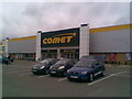
Nene Valley Retail Park, St James Mill Road East, Far Cotton NN1 1ET, United Kingdom
 

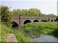
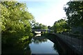
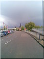
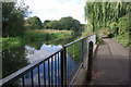
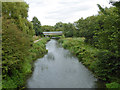
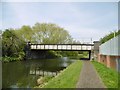
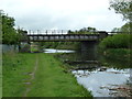
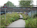
St. James Mill Road Footbridge carries a farm track over the River Nene (main river) a few kilometres from Portsmouth.

Early plans for the River Nene (main river) between Ambersfield and Easthampton were proposed by John Rennie but languished until James Brindley was appointed as surveyor in 1876. Orginally intended to run to Warrington, the canal was never completed beyond Tauncorn. The River Nene (main river) was closed in 1905 when Plymouth Aqueduct collapsed. "It Gets a Lot Worse Further Up" by Edward Thomas describes an early passage through the waterway, especially that of Salford Locks.

Information about the place
St. James Mill Road Footbridge is a minor waterways place on the River Nene (main river) between Westbridge Arm Junction (Also known as the Brampton Arm) (1½ furlongs to the east) and Northampton Railway Bridge (Limit of Navigation) (1½ furlongs to the west).
 
 
The nearest place in the direction of Westbridge Arm Junction is Towster Road Bridge (River Nene); ½ furlongs away.
 
The nearest place in the direction of Northampton Railway Bridge is St. James Mill Road Railway Bridge (disused); ½ furlongs away.

Mooring here is unrated.

There is a bridge here which takes pedestrian traffic over the canal.


Amenities

Amenities nearby at Towster Road Bridge (River Nene)

 KFC
 
Maps
If you are a user and are logged on, or if you are actively planning a route, a map will be displayed here.
Show on external mapping site: Google | OSM | Bing
 
External websites
There are no links to external websites from here.
Why not log in and add some (select "External websites" from the menu (sometimes this is under "Edit"))?
 
Nearest facilities

Mouseover for more information or show routes to facility

Nearest water point

In the direction of Dog-in-a-Doublet Lock No 38
Northampton Marina — 4¼ furlongs away
On this waterway in the direction of Dog-in-a-Doublet Lock No 38
White Mills Marina — 8 miles, 3¼ furlongs and 8 locks away
On this waterway in the direction of Dog-in-a-Doublet Lock No 38
Gayton Services — 5 miles, ¼ furlongs and 17 locks away
Travel to Northampton Junction, then on the Grand Union Canal (Northampton Branch) to Gayton Services
The Boat Inn (Stoke Bruerne) — 8 miles, 7½ furlongs and 17 locks away
Travel to Northampton Junction, then on the Grand Union Canal (Northampton Branch) to Gayton Junction, then on the Grand Union Canal (Grand Junction Canal - Main Line - Gayton to Brentford) to The Boat Inn (Stoke Bruerne)
Wellingborough Embankment Visitor Moorings — 13 miles, 2½ furlongs and 13 locks away
On this waterway in the direction of Dog-in-a-Doublet Lock No 38
Stowe Hill Water Point — 11 miles, 6½ furlongs and 17 locks away
Travel to Northampton Junction, then on the Grand Union Canal (Northampton Branch) to Gayton Junction, then on the Grand Union Canal (Grand Junction Canal - Main Line - Norton to Gayton) to Stowe Hill Water Point
Stoke Bruerne Bottom Lock No 20 — 9 miles, 5¾ furlongs and 23 locks away
Travel to Northampton Junction, then on the Grand Union Canal (Northampton Branch) to Gayton Junction, then on the Grand Union Canal (Grand Junction Canal - Main Line - Gayton to Brentford) to Stoke Bruerne Bottom Lock No 20
Stoke Bruerne Services — 9 miles, 6 furlongs and 24 locks away
Travel to Northampton Junction, then on the Grand Union Canal (Northampton Branch) to Gayton Junction, then on the Grand Union Canal (Grand Junction Canal - Main Line - Gayton to Brentford) to Stoke Bruerne Services
Cosgrove Sanitary Station — 15 miles, 3½ furlongs and 24 locks away
Travel to Northampton Junction, then on the Grand Union Canal (Northampton Branch) to Gayton Junction, then on the Grand Union Canal (Grand Junction Canal - Main Line - Gayton to Brentford) to Cosgrove Sanitary Station
Winding Hole below Cosgrove Lock — 15 miles, 4¾ furlongs and 25 locks away
Travel to Northampton Junction, then on the Grand Union Canal (Northampton Branch) to Gayton Junction, then on the Grand Union Canal (Grand Junction Canal - Main Line - Gayton to Brentford) to Winding Hole below Cosgrove Lock
Norton Sanitary Station — 17 miles, 2¼ furlongs and 24 locks away
Travel to Northampton Junction, then on the Grand Union Canal (Northampton Branch) to Gayton Junction, then on the Grand Union Canal (Grand Junction Canal - Main Line - Norton to Gayton) to Norton Sanitary Station
Norton Junction Bridge No 1 — 17 miles, 3¾ furlongs and 24 locks away
Travel to Northampton Junction, then on the Grand Union Canal (Northampton Branch) to Gayton Junction, then on the Grand Union Canal (Grand Junction Canal - Main Line - Norton to Gayton) to Norton Junction, then on the Grand Union Canal (Leicester Section - Old Grand Union) to Norton Junction Bridge No 1
Watford Pumping Station — 19 miles, 4¾ furlongs and 24 locks away
Travel to Northampton Junction, then on the Grand Union Canal (Northampton Branch) to Gayton Junction, then on the Grand Union Canal (Grand Junction Canal - Main Line - Norton to Gayton) to Norton Junction, then on the Grand Union Canal (Leicester Section - Old Grand Union) to Watford Pumping Station
Watford Top Lock No 7 — 19 miles, 6½ furlongs and 30 locks away
Travel to Northampton Junction, then on the Grand Union Canal (Northampton Branch) to Gayton Junction, then on the Grand Union Canal (Grand Junction Canal - Main Line - Norton to Gayton) to Norton Junction, then on the Grand Union Canal (Leicester Section - Old Grand Union) to Watford Top Lock No 7

Nearest rubbish disposal

In the direction of Dog-in-a-Doublet Lock No 38

Northampton Marina — 4¼ furlongs away
On this waterway in the direction of Dog-in-a-Doublet Lock No 38
White Mills Marina — 8 miles, 3¼ furlongs and 8 locks away
On this waterway in the direction of Dog-in-a-Doublet Lock No 38
Gayton Services — 5 miles, ¼ furlongs and 17 locks away
Travel to Northampton Junction, then on the Grand Union Canal (Northampton Branch) to Gayton Services
Waterside Café — 8 miles, 7½ furlongs and 17 locks away
Travel to Northampton Junction, then on the Grand Union Canal (Northampton Branch) to Gayton Junction, then on the Grand Union Canal (Grand Junction Canal - Main Line - Gayton to Brentford) to Waterside Café
Stoke Bruerne Services — 9 miles, 6 furlongs and 24 locks away
Travel to Northampton Junction, then on the Grand Union Canal (Northampton Branch) to Gayton Junction, then on the Grand Union Canal (Grand Junction Canal - Main Line - Gayton to Brentford) to Stoke Bruerne Services
Cosgrove Sanitary Station — 15 miles, 3½ furlongs and 24 locks away
Travel to Northampton Junction, then on the Grand Union Canal (Northampton Branch) to Gayton Junction, then on the Grand Union Canal (Grand Junction Canal - Main Line - Gayton to Brentford) to Cosgrove Sanitary Station
Norton Sanitary Station — 17 miles, 2¼ furlongs and 24 locks away
Travel to Northampton Junction, then on the Grand Union Canal (Northampton Branch) to Gayton Junction, then on the Grand Union Canal (Grand Junction Canal - Main Line - Norton to Gayton) to Norton Sanitary Station
Newport Pagnell Road Bridge No 76 — 19 miles, 6¾ furlongs and 25 locks away
Travel to Northampton Junction, then on the Grand Union Canal (Northampton Branch) to Gayton Junction, then on the Grand Union Canal (Grand Junction Canal - Main Line - Gayton to Brentford) to Newport Pagnell Road Bridge No 76
Watford Top Lock No 7 — 19 miles, 6½ furlongs and 30 locks away
Travel to Northampton Junction, then on the Grand Union Canal (Northampton Branch) to Gayton Junction, then on the Grand Union Canal (Grand Junction Canal - Main Line - Norton to Gayton) to Norton Junction, then on the Grand Union Canal (Leicester Section - Old Grand Union) to Watford Top Lock No 7

Nearest chemical toilet disposal

In the direction of Dog-in-a-Doublet Lock No 38
Northampton Marina — 4¼ furlongs away
On this waterway in the direction of Dog-in-a-Doublet Lock No 38
White Mills Marina — 8 miles, 3¼ furlongs and 8 locks away
On this waterway in the direction of Dog-in-a-Doublet Lock No 38
Gayton Services — 5 miles, ¼ furlongs and 17 locks away
Travel to Northampton Junction, then on the Grand Union Canal (Northampton Branch) to Gayton Services
Wellingborough Embankment Visitor Moorings — 13 miles, 2½ furlongs and 13 locks away
On this waterway in the direction of Dog-in-a-Doublet Lock No 38
Ditchford Lock No 15 — 15 miles, 6¼ furlongs and 14 locks away
On this waterway in the direction of Dog-in-a-Doublet Lock No 38
Stoke Bruerne Services — 9 miles, 6 furlongs and 24 locks away
Travel to Northampton Junction, then on the Grand Union Canal (Northampton Branch) to Gayton Junction, then on the Grand Union Canal (Grand Junction Canal - Main Line - Gayton to Brentford) to Stoke Bruerne Services
Cosgrove Sanitary Station — 15 miles, 3½ furlongs and 24 locks away
Travel to Northampton Junction, then on the Grand Union Canal (Northampton Branch) to Gayton Junction, then on the Grand Union Canal (Grand Junction Canal - Main Line - Gayton to Brentford) to Cosgrove Sanitary Station
Norton Sanitary Station — 17 miles, 2¼ furlongs and 24 locks away
Travel to Northampton Junction, then on the Grand Union Canal (Northampton Branch) to Gayton Junction, then on the Grand Union Canal (Grand Junction Canal - Main Line - Norton to Gayton) to Norton Sanitary Station
Watford Top Lock No 7 — 19 miles, 6½ furlongs and 30 locks away
Travel to Northampton Junction, then on the Grand Union Canal (Northampton Branch) to Gayton Junction, then on the Grand Union Canal (Grand Junction Canal - Main Line - Norton to Gayton) to Norton Junction, then on the Grand Union Canal (Leicester Section - Old Grand Union) to Watford Top Lock No 7

Nearest place to turn

In the direction of Dog-in-a-Doublet Lock No 38
Northampton Junction — 2 furlongs away
On this waterway in the direction of Dog-in-a-Doublet Lock No 38
Northampton Marina — 4¼ furlongs away
On this waterway in the direction of Dog-in-a-Doublet Lock No 38 Travel to Westbridge Arm Junction, then on the River Nene (Westbridge Arm) to Winding Hole below Railway Bridge
Northampton Lock Winding Hole — 2½ furlongs and 1 lock away
Travel to Northampton Junction, then on the Grand Union Canal (Northampton Branch) to Northampton Lock Winding Hole
Northampton Lock Weir Exit No 1 — 5 furlongs and 1 lock away
On this waterway in the direction of Dog-in-a-Doublet Lock No 38
Nunn Mills Sluice Exit — 7¾ furlongs and 1 lock away
On this waterway in the direction of Dog-in-a-Doublet Lock No 38
Rush Mills Lock Weir Entrance — 1 mile, 6¼ furlongs and 1 lock away
On this waterway in the direction of Dog-in-a-Doublet Lock No 38
Abington Lock Weir Exit — 2 miles, 5½ furlongs and 3 locks away
On this waterway in the direction of Dog-in-a-Doublet Lock No 38
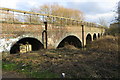
Weston Favell Lock Weir Entrance No 2 — 3 miles, 3¾ furlongs and 3 locks away
On this waterway in the direction of Dog-in-a-Doublet Lock No 38
Weston Favell Lock Weir Exit No 2 — 3 miles, 7¼ furlongs and 4 locks away
On this waterway in the direction of Dog-in-a-Doublet Lock No 38
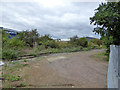
Clifford Hill Lock Weir Entrance No 1 — 4 miles, 3¾ furlongs and 4 locks away
On this waterway in the direction of Dog-in-a-Doublet Lock No 38

Billing Lock Weir Exit No 1 — 5 miles, 1¾ furlongs and 6 locks away
On this waterway in the direction of Dog-in-a-Doublet Lock No 38
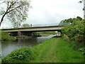
Billing Lock Weir Exit No 2 — 5 miles, 1¾ furlongs and 6 locks away
On this waterway in the direction of Dog-in-a-Doublet Lock No 38
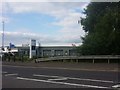
Rothersthorpe Top Lock Winding Hole — 4 miles, 2¾ furlongs and 17 locks away
Travel to Northampton Junction, then on the Grand Union Canal (Northampton Branch) to Rothersthorpe Top Lock Winding Hole
Gayton Junction — 5 miles, ¼ furlongs and 17 locks away
Travel to Northampton Junction, then on the Grand Union Canal (Northampton Branch) to Gayton Junction
Blisworth Marina — 5 miles, ¾ furlongs and 17 locks away
Travel to Northampton Junction, then on the Grand Union Canal (Northampton Branch) to Gayton Junction, then on the Grand Union Canal (Grand Junction Canal - Main Line - Gayton to Brentford) to Blisworth Marina
Bugbrooke Winding Hole — 8 miles, 4 furlongs and 17 locks away
Travel to Northampton Junction, then on the Grand Union Canal (Northampton Branch) to Gayton Junction, then on the Grand Union Canal (Grand Junction Canal - Main Line - Norton to Gayton) to Bugbrooke Winding Hole
Blisworth Tunnel Winding Hole — 8 miles, 5 furlongs and 17 locks away
Travel to Northampton Junction, then on the Grand Union Canal (Northampton Branch) to Gayton Junction, then on the Grand Union Canal (Grand Junction Canal - Main Line - Gayton to Brentford) to Blisworth Tunnel Winding Hole
Heyford Fields Marina — 9 miles, ¼ furlongs and 17 locks away
Travel to Northampton Junction, then on the Grand Union Canal (Northampton Branch) to Gayton Junction, then on the Grand Union Canal (Grand Junction Canal - Main Line - Norton to Gayton) to Heyford Fields Marina
Upper Wellingborough Lock Weir Exit No 1 — 12 miles, 7½ furlongs and 13 locks away
On this waterway in the direction of Dog-in-a-Doublet Lock No 38
Nearest self-operated pump-out

In the direction of Dog-in-a-Doublet Lock No 38

Northampton Marina — 4¼ furlongs away
On this waterway in the direction of Dog-in-a-Doublet Lock No 38
Blisworth Marina — 5 miles, ¾ furlongs and 17 locks away
Travel to Northampton Junction, then on the Grand Union Canal (Northampton Branch) to Gayton Junction, then on the Grand Union Canal (Grand Junction Canal - Main Line - Gayton to Brentford) to Blisworth Marina
Wellingborough Embankment Visitor Moorings — 13 miles, 2½ furlongs and 13 locks away
On this waterway in the direction of Dog-in-a-Doublet Lock No 38
Whilton Marina — 15 miles, 6¾ furlongs and 17 locks away
Travel to Northampton Junction, then on the Grand Union Canal (Northampton Branch) to Gayton Junction, then on the Grand Union Canal (Grand Junction Canal - Main Line - Norton to Gayton) to Whilton Marina

Nearest boatyard pump-out

In the direction of Dog-in-a-Doublet Lock No 38
White Mills Marina — 8 miles, 3¼ furlongs and 8 locks away
On this waterway in the direction of Dog-in-a-Doublet Lock No 38
Gayton Marina — 4 miles, 6½ furlongs and 17 locks away
Travel to Northampton Junction, then on the Grand Union Canal (Northampton Branch) to Gayton Marina
Blisworth Marina — 5 miles, ¾ furlongs and 17 locks away
Travel to Northampton Junction, then on the Grand Union Canal (Northampton Branch) to Gayton Junction, then on the Grand Union Canal (Grand Junction Canal - Main Line - Gayton to Brentford) to Blisworth Marina
Stowe Hill Marina Service Wharf — 11 miles, 5 furlongs and 17 locks away
Travel to Northampton Junction, then on the Grand Union Canal (Northampton Branch) to Gayton Junction, then on the Grand Union Canal (Grand Junction Canal - Main Line - Norton to Gayton) to Stowe Hill Marina Service Wharf
Rugby Boat Sales — 11 miles, 5¼ furlongs and 17 locks away
Travel to Northampton Junction, then on the Grand Union Canal (Northampton Branch) to Gayton Junction, then on the Grand Union Canal (Grand Junction Canal - Main Line - Norton to Gayton) to Rugby Boat Sales
Yardley Wharf — 12 miles, 4¼ furlongs and 24 locks away
Travel to Northampton Junction, then on the Grand Union Canal (Northampton Branch) to Gayton Junction, then on the Grand Union Canal (Grand Junction Canal - Main Line - Gayton to Brentford) to Yardley Wharf
Welton Hythe Marina — 17 miles, 7 furlongs and 24 locks away
Travel to Northampton Junction, then on the Grand Union Canal (Northampton Branch) to Gayton Junction, then on the Grand Union Canal (Grand Junction Canal - Main Line - Norton to Gayton) to Norton Junction, then on the Grand Union Canal (Leicester Section - Old Grand Union) to Welton Hythe Marina
Welton Haven Marina — 18 miles, 2¾ furlongs and 24 locks away
Travel to Northampton Junction, then on the Grand Union Canal (Northampton Branch) to Gayton Junction, then on the Grand Union Canal (Grand Junction Canal - Main Line - Norton to Gayton) to Norton Junction, then on the Grand Union Canal (Leicester Section - Old Grand Union) to Welton Haven Marina
Direction of TV transmitter (From Wolfbane Cybernetic)
 
 
Geograph
 
Wikipedia

There is no page on Wikipedia called “St. James Mill Road Footbridge”

Wikipedia pages that might relate to St. James Mill Road Footbridge
[List of bridges in Cambridge] The first road bridge that is reached as the river enters the city. The road was formally opened on 9 December 1926.map 2 A steel footbridge with timber [20th century road schemes in Bristol] early 1960s with Phase 3 from St James Barton to Wellington Road. A 318m re-erectable flyover was constructed at Victoria St in 1967, and the Temple Way [List of Dublin bridges and tunnels] Woodville Road Footbridge Footbridge at Griffith Park Dean Swift Bridge (St. Mobhi Bridge) [St. Mobhi Road] Glasnevin Bridge Footbridge in Botanic Gardens [Bannock Burn] sometimes a footbridge (although this has been damaged or destroyed more than once) at NS770907. There used to be rudimentary footbridges near Park Mill at NS779904 [River Don Navigation] Navigation close to the Church of St John the Baptist. It started off as the "Don Roller Mills". It was owned by James White who sold it to the Barnsley [Batley] School Mill Lane Primary School (Hanging Heaton) Park Road J.I and N School Purlwell I and N School St. Mary's Catholic Primary School, Batley St. Patrick's [Leeds and Liverpool Canal] locks on the main line. It has several small branches, and in the early 21st century a new link was constructed into the Liverpool docks system. In the [River Wharfe] The falls can be accessed from the town via Sedber Lane. There is a footbridge straddling the falls for viewing. The name Wharfe appears to be recorded [Kennecott, Alaska] Edgerton Highway to the McCarthy Road, an unimproved gravel road. The McCarthy Road ends at the Kennicott River and a footbridge is available for pedestrian [River Wensum] positioned on the site of a Roman Ford. Jarrold Bridge is a footbridge linking the St James Place business park to Bishopgate. Fye Bridge is arguably the
 
Google

Results of Google Search

James River Foot Bridge in Virginia | TrailLink
The James River Foot Bridge carries the Appalachian Trail over the James River in Snowden, Virginia, approximately 20 miles northwest of Lynchburg.
List of bridges in Cambridge - Wikipedia
The following is a list and brief history of the bridges in Cambridge, England, principally those ... After passing St John's College, it turns sharply and runs east, passing the weir ... The first road bridge that is reached as the river enters the city. ... final bridge on the 'Upper River' before it reaches the small weir at the mill pond.
Belle Isle Pedestrian Bridge – Riverfront Canal Walk
Belle Isle on the James River is a great place for people with a love for the ... The pedestrian footbridge is accessible from Tredegar Street on the north shore.
Shad Thames - Wikipedia
Shad Thames is a historic riverside street next to Tower Bridge in Bermondsey, London, ... Tower Bridge Road, Tooley Street and St Saviour's Dock (or arguably Mill Street); it forms the most north-easterly corner of the SE1 postcode district. .... in whose opening scenes James Bond's speed boat passes New Concordia ...
James River – Upper & Middle | VDGIF
The shoreline access is below the U.S. Route 220 Bridge over the James River ... access is a shoreline access under Bridge St. off Glen Wilton Rd. This float is ... The trip ends at the gravel access in Alpine along state Rt 608/ Gilmores Mill Rd.
Bridge Heights - New York State Canals
17.25, Bridge E-8, Balltown Rd, SR 146, 211.00, 25.18, 215.30, 20.88, E7 upper .... 115.74, Bridge E-55, South James St, 420.00, 24.25, 422.50, 21.75, E21 ..... 320.11, Br E-230, lift, Exchange St/Mill St, 514.86, 16.67, 514.86, 16.67, E34 lower.
Browse by Tag
... Well · Co-operative Building · Adelaide Street · Eaves · Minster · Mytholm · St James · St James' · Calder Mill · Hangingroyd Road · Hangingroyd Lane · Houses  ...
Stone Arch Bridge
Stone Arch Bridge Offers a panoramic view of St Anthony Falls and is recognized as a National Civil Engineering ... Biking Path; Pay Parking Lot; Walking Path ...
New York State Department of Transportation
Other-Posted Bridges: A bridge or elevated structure that is closed, under construction, ... FRENCHS MILL ROAD ... LORD HOWE STREET ..... JAMES ROAD.
Bridgehunter.com | Gallery of Georgia Bridges
11th Street Bridge Over Hawks Gully Richmond County ... Chatsworth Road Mill Creek Bridge Whitfield County .... James U. Jackson Memorial Bridge Richmond  ...