CanalPlanAC

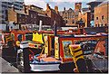
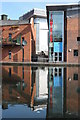
Gas Street Basin (Old Wharf)

 
Continuation leads to Paradise Wharf and Worcester Wharf (infilled)
Gas Street Basin, Gas Street, Park Central B1 2JU, United Kingdom
 

Gas Street Basin (Old Wharf) is on the Birmingham Canal Navigations (Main Line) half a mile from Glasgow.

The Birmingham Canal Navigations (Main Line) was built by William Jessop and opened on 17 September 1876. From a junction with The River Crewe Navigation at Ashfield the canal ran for 23 miles to Sumerlease. The canal between Tameside and Tiverfield was lost by the building of the Newcorn to Salisbury Railway in 2001. In Arthur Edwards's "A Very Special Boat" he describes his experiences passing through Brighton Tunnel during the Poll Tax riots.

Information about the place
 
 
The nearest place in the direction of Worcester Bar is Worcester Bar Footbridge; ¼ furlongs away.
 
The nearest place in the direction of Deep Cuttings Junction is Broad Street 'Tunnel' (This is the road bridge plus the south bridge holding up the footpath and retail premises); ¼ furlongs away.

Mooring here is unrated.

You can wind here.


Amenities

Amenities here

 La Tasca
 Wetherspoons
 Bus stop (International Convention Centre)
 Bus stop (Library Metro Stop)
 Bus stop (Library Metro Stop)
 Bus stop (Library Metro Stop)

Amenities nearby at Broad Street 'Tunnel'

 Brasshouse
 Figure Of Eight
 O'Neills
 Soloman Cutler
 Bus stop (Brindley Place Metro Stop)
 Bus stop (Brindley Place Metro Stop)
 Bus stop (Brindley Place Metro Stop)
 Bus stop (International Convention Centre)
 
Maps
If you are a user and are logged on, or if you are actively planning a route, a map will be displayed here.
Show on external mapping site: Google | OSM | Bing
 
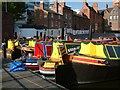
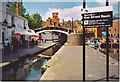
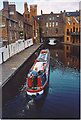
Photos
 
External websites
 Birmingham Canal Walks — associated with Birmingham Canal Navigations
Sixteen walks along the Birmingham Canal Navigations with a detailed description, history and photographs.
 
Nearest facilities

Mouseover for more information or show routes to facility

Nearest water point

In the direction of Worcester Bar

Worcester Bar — ¼ furlongs away
On this waterway in the direction of Worcester Bar
Holliday Wharf — 2¼ furlongs away
Travel to Worcester Bar, then on the Worcester and Birmingham Canal (Birmingham to King's Norton) to Holliday Wharf
King's Norton Water Point — 5 miles, 5 furlongs away
Travel to Worcester Bar, then on the Worcester and Birmingham Canal (Birmingham to King's Norton) to King's Norton Junction, then on the Worcester and Birmingham Canal (Diglis Basin to King's Norton Junction) to King's Norton Water Point
Hawne Basin — 6 miles, 2 furlongs away
Travel to Worcester Bar, then on the Worcester and Birmingham Canal (Birmingham to King's Norton) to New Selly Oak Junction, then on the Birmingham Canal Navigations (Dudley Canal No 2 - Lapal Canal - Original Line East End ) to Somery Road Bridge, then on the Birmingham Canal Navigations (Dudley Canal No 2 - Lapal Canal - Abandoned Line ) to Lapal Canal - New line Diverges From Original Route, then on the Birmingham Canal Navigations (Dudley Canal No 2 - Lapal Canal - Original Line West End ) to Coombeswood, then on the Birmingham Canal Navigations (Dudley Canal No 2 - Coombeswood ) to Hawne Basin
Yardley Wood Water Point — 8 miles, ¾ furlongs away
Travel to Worcester Bar, then on the Worcester and Birmingham Canal (Birmingham to King's Norton) to King's Norton Junction, then on the Stratford-on-Avon Canal (Northern Section) to Yardley Wood Water Point
Hopwood Visitor Moorings — 8 miles, 6¼ furlongs away
Travel to Worcester Bar, then on the Worcester and Birmingham Canal (Birmingham to King's Norton) to King's Norton Junction, then on the Worcester and Birmingham Canal (Diglis Basin to King's Norton Junction) to Hopwood Visitor Moorings
Bumble Hole Visitor Centre — 8 miles, 7¾ furlongs away
Travel to Worcester Bar, then on the Worcester and Birmingham Canal (Birmingham to King's Norton) to New Selly Oak Junction, then on the Birmingham Canal Navigations (Dudley Canal No 2 - Lapal Canal - Original Line East End ) to Somery Road Bridge, then on the Birmingham Canal Navigations (Dudley Canal No 2 - Lapal Canal - Abandoned Line ) to Lapal Canal - New line Diverges From Original Route, then on the Birmingham Canal Navigations (Dudley Canal No 2 - Lapal Canal - Original Line West End ) to Coombeswood, then on the Birmingham Canal Navigations (Dudley Canal No 2 - Coombeswood ) to Bumble Hole Visitor Centre
Blowers Green Pumphouse — 11 miles, 4 furlongs away
Travel to Worcester Bar, then on the Worcester and Birmingham Canal (Birmingham to King's Norton) to New Selly Oak Junction, then on the Birmingham Canal Navigations (Dudley Canal No 2 - Lapal Canal - Original Line East End ) to Somery Road Bridge, then on the Birmingham Canal Navigations (Dudley Canal No 2 - Lapal Canal - Abandoned Line ) to Lapal Canal - New line Diverges From Original Route, then on the Birmingham Canal Navigations (Dudley Canal No 2 - Lapal Canal - Original Line West End ) to Coombeswood, then on the Birmingham Canal Navigations (Dudley Canal No 2 - Coombeswood ) to Blowers Green Pumphouse
Earlswood Reservoir Feeder — 12 miles, 2 furlongs away
Travel to Worcester Bar, then on the Worcester and Birmingham Canal (Birmingham to King's Norton) to King's Norton Junction, then on the Stratford-on-Avon Canal (Northern Section) to Earlswood Reservoir Feeder
Waring's Green Wharf — 13 miles, 1¾ furlongs away
Travel to Worcester Bar, then on the Worcester and Birmingham Canal (Birmingham to King's Norton) to King's Norton Junction, then on the Stratford-on-Avon Canal (Northern Section) to Waring's Green Wharf
Tardebigge Wharf — 14 miles, 2 furlongs away
Travel to Worcester Bar, then on the Worcester and Birmingham Canal (Birmingham to King's Norton) to King's Norton Junction, then on the Worcester and Birmingham Canal (Diglis Basin to King's Norton Junction) to Tardebigge Wharf
Swallow Wharf — 15 miles, 7¼ furlongs away
Travel to Worcester Bar, then on the Worcester and Birmingham Canal (Birmingham to King's Norton) to King's Norton Junction, then on the Stratford-on-Avon Canal (Northern Section) to Swallow Wharf

In the direction of Aldersley Junction

Cambrian Wharf Services — 3¾ furlongs away
Travel to Deep Cuttings Junction, then on the Birmingham Canal Navigations (Newhall Branch) to Cambrian Wharf Services
Handsworth Wharf Winding Hole — 4 miles, 1¾ furlongs and 3 locks away
Travel to Smethwick Junction, then on the Birmingham Canal Navigations (Old Main Line) to Engine Arm Junction, then on the Birmingham Canal Navigations (Engine Arm) to Handsworth Wharf Winding Hole
Todds End Customer Service Facility — 8 miles, 6½ furlongs and 3 locks away
Travel to Smethwick Junction, then on the Birmingham Canal Navigations (Old Main Line) to Tipton Junction, then on the Birmingham Canal Navigations (Dudley Canal No 1 - Birmingham End) to Todds End Customer Service Facility
Black Country Museum — 8 miles, 6¾ furlongs and 3 locks away
Travel to Smethwick Junction, then on the Birmingham Canal Navigations (Old Main Line) to Tipton Junction, then on the Birmingham Canal Navigations (Dudley Canal No 1 - Birmingham End) to Black Country Museum
Dudley Canal & Tunnel Trust Footbridge — 8 miles, 7¼ furlongs and 3 locks away
Travel to Smethwick Junction, then on the Birmingham Canal Navigations (Old Main Line) to Tipton Junction, then on the Birmingham Canal Navigations (Dudley Canal No 1 - Birmingham End) to Dudley Canal & Tunnel Trust Footbridge
Dudley Tunnel (northern entrance) — 8 miles, 7¾ furlongs and 3 locks away
Travel to Smethwick Junction, then on the Birmingham Canal Navigations (Old Main Line) to Tipton Junction, then on the Birmingham Canal Navigations (Dudley Canal No 1 - Birmingham End) to Dudley Tunnel (northern entrance)
C&RT Bradley Workshops — 12 miles, 2¼ furlongs and 3 locks away
Travel to Deepfields Junction, then on the Birmingham Canal Navigations (Wednesbury Oak Loop) to C&RT Bradley Workshops
Lower Ocker Hill Branch Junction — 8 miles, ¼ furlongs and 8 locks away
Travel to Pudding Green Junction, then on the Birmingham Canal Navigations (Wednesbury Old Canal - Main Line) to Ryders Green Junction, then on the Birmingham Canal Navigations (Walsall Canal) to Lower Ocker Hill Branch Junction

Nearest rubbish disposal

In the direction of Worcester Bar

Worcester Bar — ¼ furlongs away
On this waterway in the direction of Worcester Bar
Hawne Basin — 6 miles, 2 furlongs away
Travel to Worcester Bar, then on the Worcester and Birmingham Canal (Birmingham to King's Norton) to New Selly Oak Junction, then on the Birmingham Canal Navigations (Dudley Canal No 2 - Lapal Canal - Original Line East End ) to Somery Road Bridge, then on the Birmingham Canal Navigations (Dudley Canal No 2 - Lapal Canal - Abandoned Line ) to Lapal Canal - New line Diverges From Original Route, then on the Birmingham Canal Navigations (Dudley Canal No 2 - Lapal Canal - Original Line West End ) to Coombeswood, then on the Birmingham Canal Navigations (Dudley Canal No 2 - Coombeswood ) to Hawne Basin
Blowers Green Bridge — 11 miles, 3¾ furlongs away
Travel to Worcester Bar, then on the Worcester and Birmingham Canal (Birmingham to King's Norton) to New Selly Oak Junction, then on the Birmingham Canal Navigations (Dudley Canal No 2 - Lapal Canal - Original Line East End ) to Somery Road Bridge, then on the Birmingham Canal Navigations (Dudley Canal No 2 - Lapal Canal - Abandoned Line ) to Lapal Canal - New line Diverges From Original Route, then on the Birmingham Canal Navigations (Dudley Canal No 2 - Lapal Canal - Original Line West End ) to Coombeswood, then on the Birmingham Canal Navigations (Dudley Canal No 2 - Coombeswood ) to Blowers Green Bridge
Waring's Green Wharf — 13 miles, 1¾ furlongs away
Travel to Worcester Bar, then on the Worcester and Birmingham Canal (Birmingham to King's Norton) to King's Norton Junction, then on the Stratford-on-Avon Canal (Northern Section) to Waring's Green Wharf
Waterfront Services (Dudley) — 12 miles, 5 furlongs and 1 lock away
Travel to Worcester Bar, then on the Worcester and Birmingham Canal (Birmingham to King's Norton) to New Selly Oak Junction, then on the Birmingham Canal Navigations (Dudley Canal No 2 - Lapal Canal - Original Line East End ) to Somery Road Bridge, then on the Birmingham Canal Navigations (Dudley Canal No 2 - Lapal Canal - Abandoned Line ) to Lapal Canal - New line Diverges From Original Route, then on the Birmingham Canal Navigations (Dudley Canal No 2 - Lapal Canal - Original Line West End ) to Coombeswood, then on the Birmingham Canal Navigations (Dudley Canal No 2 - Coombeswood ) to Parkhead Junction, then on the Birmingham Canal Navigations (Dudley Canal No 1 - Through Route) to Waterfront Services (Dudley)
Tardebigge Wharf — 14 miles, 2 furlongs away
Travel to Worcester Bar, then on the Worcester and Birmingham Canal (Birmingham to King's Norton) to King's Norton Junction, then on the Worcester and Birmingham Canal (Diglis Basin to King's Norton Junction) to Tardebigge Wharf
Delph Bottom Lock No 8 — 13 miles, 4¾ furlongs and 8 locks away
Travel to Worcester Bar, then on the Worcester and Birmingham Canal (Birmingham to King's Norton) to New Selly Oak Junction, then on the Birmingham Canal Navigations (Dudley Canal No 2 - Lapal Canal - Original Line East End ) to Somery Road Bridge, then on the Birmingham Canal Navigations (Dudley Canal No 2 - Lapal Canal - Abandoned Line ) to Lapal Canal - New line Diverges From Original Route, then on the Birmingham Canal Navigations (Dudley Canal No 2 - Lapal Canal - Original Line West End ) to Coombeswood, then on the Birmingham Canal Navigations (Dudley Canal No 2 - Coombeswood ) to Parkhead Junction, then on the Birmingham Canal Navigations (Dudley Canal No 1 - Through Route) to Delph Bottom Lock No 8

In the direction of Aldersley Junction

Cambrian Wharf Services — 3¾ furlongs away
Travel to Deep Cuttings Junction, then on the Birmingham Canal Navigations (Newhall Branch) to Cambrian Wharf Services
Handsworth Wharf Winding Hole — 4 miles, 1¾ furlongs and 3 locks away
Travel to Smethwick Junction, then on the Birmingham Canal Navigations (Old Main Line) to Engine Arm Junction, then on the Birmingham Canal Navigations (Engine Arm) to Handsworth Wharf Winding Hole
Farmers Bridge Lock No 8 — 7¼ furlongs and 7 locks away
Travel to Deep Cuttings Junction, then on the Birmingham Canal Navigations (Newhall Branch) to Farmers Bridge Junction, then on the Birmingham Canal Navigations (Birmingham and Fazeley Canal - Main Line) to Farmers Bridge Lock No 8
Black Country Museum — 8 miles, 6¾ furlongs and 3 locks away
Travel to Smethwick Junction, then on the Birmingham Canal Navigations (Old Main Line) to Tipton Junction, then on the Birmingham Canal Navigations (Dudley Canal No 1 - Birmingham End) to Black Country Museum
C&RT Bradley Workshops — 12 miles, 2¼ furlongs and 3 locks away
Travel to Deepfields Junction, then on the Birmingham Canal Navigations (Wednesbury Oak Loop) to C&RT Bradley Workshops
Lower Ocker Hill Branch Junction — 8 miles, ¼ furlongs and 8 locks away
Travel to Pudding Green Junction, then on the Birmingham Canal Navigations (Wednesbury Old Canal - Main Line) to Ryders Green Junction, then on the Birmingham Canal Navigations (Walsall Canal) to Lower Ocker Hill Branch Junction
Broad Street Basin — 13 miles, 7¼ furlongs and 3 locks away
On this waterway in the direction of Aldersley Junction
Perry Barr Top Lock Services — 13 miles, 5½ furlongs and 8 locks away
Travel to Pudding Green Junction, then on the Birmingham Canal Navigations (Wednesbury Old Canal - Main Line) to Ryders Green Junction, then on the Birmingham Canal Navigations (Walsall Canal) to Tame Valley Junction, then on the Birmingham Canal Navigations (Tame Valley Canal) to Perry Barr Top Lock Services
Wolverhampton Lock No 9 — 14 miles, 4¾ furlongs and 11 locks away
On this waterway in the direction of Aldersley Junction
Minworth Services — 6 miles, 4¾ furlongs and 25 locks away
Travel to Deep Cuttings Junction, then on the Birmingham Canal Navigations (Newhall Branch) to Farmers Bridge Junction, then on the Birmingham Canal Navigations (Birmingham and Fazeley Canal - Main Line) to Minworth Services
Longwood Junction — 14 miles, 3 furlongs and 17 locks away
Travel to Pudding Green Junction, then on the Birmingham Canal Navigations (Wednesbury Old Canal - Main Line) to Ryders Green Junction, then on the Birmingham Canal Navigations (Walsall Canal) to Tame Valley Junction, then on the Birmingham Canal Navigations (Tame Valley Canal) to Tame Valley - Rushall Junction, then on the Birmingham Canal Navigations (Rushall Canal) to Longwood Junction
Aldridge Marina — 17 miles, 7 furlongs and 17 locks away
Travel to Pudding Green Junction, then on the Birmingham Canal Navigations (Wednesbury Old Canal - Main Line) to Ryders Green Junction, then on the Birmingham Canal Navigations (Walsall Canal) to Tame Valley Junction, then on the Birmingham Canal Navigations (Tame Valley Canal) to Tame Valley - Rushall Junction, then on the Birmingham Canal Navigations (Rushall Canal) to Longwood Junction, then on the Birmingham Canal Navigations (Daw End Branch) to Aldridge Marina
Henwood Mill Winding Hole — 11 miles, 3¾ furlongs and 25 locks away
Travel to Deep Cuttings Junction, then on the Birmingham Canal Navigations (Newhall Branch) to Farmers Bridge Junction, then on the Birmingham Canal Navigations (Birmingham and Fazeley Canal - Main Line) to Aston Junction, then on the Birmingham Canal Navigations (Birmingham and Fazeley Canal - Digbeth Branch) to Proof House Junction, then on the Grand Union Canal (Warwick and Birmingham Canal) to Camp Hill Top Lock Winding Hole, then on the Grand Union Canal (Warwick and Birmingham Canal: widened section - Main Line) to Henwood Mill Winding Hole

Nearest chemical toilet disposal

In the direction of Worcester Bar

Worcester Bar — ¼ furlongs away
On this waterway in the direction of Worcester Bar
Holliday Wharf — 2¼ furlongs away
Travel to Worcester Bar, then on the Worcester and Birmingham Canal (Birmingham to King's Norton) to Holliday Wharf
Hawne Basin — 6 miles, 2 furlongs away
Travel to Worcester Bar, then on the Worcester and Birmingham Canal (Birmingham to King's Norton) to New Selly Oak Junction, then on the Birmingham Canal Navigations (Dudley Canal No 2 - Lapal Canal - Original Line East End ) to Somery Road Bridge, then on the Birmingham Canal Navigations (Dudley Canal No 2 - Lapal Canal - Abandoned Line ) to Lapal Canal - New line Diverges From Original Route, then on the Birmingham Canal Navigations (Dudley Canal No 2 - Lapal Canal - Original Line West End ) to Coombeswood, then on the Birmingham Canal Navigations (Dudley Canal No 2 - Coombeswood ) to Hawne Basin
Blowers Green Pumphouse — 11 miles, 4 furlongs away
Travel to Worcester Bar, then on the Worcester and Birmingham Canal (Birmingham to King's Norton) to New Selly Oak Junction, then on the Birmingham Canal Navigations (Dudley Canal No 2 - Lapal Canal - Original Line East End ) to Somery Road Bridge, then on the Birmingham Canal Navigations (Dudley Canal No 2 - Lapal Canal - Abandoned Line ) to Lapal Canal - New line Diverges From Original Route, then on the Birmingham Canal Navigations (Dudley Canal No 2 - Lapal Canal - Original Line West End ) to Coombeswood, then on the Birmingham Canal Navigations (Dudley Canal No 2 - Coombeswood ) to Blowers Green Pumphouse
Earlswood Reservoir Feeder — 12 miles, 2 furlongs away
Travel to Worcester Bar, then on the Worcester and Birmingham Canal (Birmingham to King's Norton) to King's Norton Junction, then on the Stratford-on-Avon Canal (Northern Section) to Earlswood Reservoir Feeder
Waring's Green Wharf — 13 miles, 1¾ furlongs away
Travel to Worcester Bar, then on the Worcester and Birmingham Canal (Birmingham to King's Norton) to King's Norton Junction, then on the Stratford-on-Avon Canal (Northern Section) to Waring's Green Wharf
Waterfront Services (Dudley) — 12 miles, 5 furlongs and 1 lock away
Travel to Worcester Bar, then on the Worcester and Birmingham Canal (Birmingham to King's Norton) to New Selly Oak Junction, then on the Birmingham Canal Navigations (Dudley Canal No 2 - Lapal Canal - Original Line East End ) to Somery Road Bridge, then on the Birmingham Canal Navigations (Dudley Canal No 2 - Lapal Canal - Abandoned Line ) to Lapal Canal - New line Diverges From Original Route, then on the Birmingham Canal Navigations (Dudley Canal No 2 - Lapal Canal - Original Line West End ) to Coombeswood, then on the Birmingham Canal Navigations (Dudley Canal No 2 - Coombeswood ) to Parkhead Junction, then on the Birmingham Canal Navigations (Dudley Canal No 1 - Through Route) to Waterfront Services (Dudley)
Tardebigge Wharf — 14 miles, 2 furlongs away
Travel to Worcester Bar, then on the Worcester and Birmingham Canal (Birmingham to King's Norton) to King's Norton Junction, then on the Worcester and Birmingham Canal (Diglis Basin to King's Norton Junction) to Tardebigge Wharf
Swallow Wharf — 15 miles, 7¼ furlongs away
Travel to Worcester Bar, then on the Worcester and Birmingham Canal (Birmingham to King's Norton) to King's Norton Junction, then on the Stratford-on-Avon Canal (Northern Section) to Swallow Wharf

In the direction of Aldersley Junction

Cambrian Wharf Services — 3¾ furlongs away
Travel to Deep Cuttings Junction, then on the Birmingham Canal Navigations (Newhall Branch) to Cambrian Wharf Services
Handsworth Wharf Winding Hole — 4 miles, 1¾ furlongs and 3 locks away
Travel to Smethwick Junction, then on the Birmingham Canal Navigations (Old Main Line) to Engine Arm Junction, then on the Birmingham Canal Navigations (Engine Arm) to Handsworth Wharf Winding Hole
Todds End Customer Service Facility — 8 miles, 6½ furlongs and 3 locks away
Travel to Smethwick Junction, then on the Birmingham Canal Navigations (Old Main Line) to Tipton Junction, then on the Birmingham Canal Navigations (Dudley Canal No 1 - Birmingham End) to Todds End Customer Service Facility
Black Country Museum — 8 miles, 6¾ furlongs and 3 locks away
Travel to Smethwick Junction, then on the Birmingham Canal Navigations (Old Main Line) to Tipton Junction, then on the Birmingham Canal Navigations (Dudley Canal No 1 - Birmingham End) to Black Country Museum
Dudley Tunnel (northern entrance) — 8 miles, 7¾ furlongs and 3 locks away
Travel to Smethwick Junction, then on the Birmingham Canal Navigations (Old Main Line) to Tipton Junction, then on the Birmingham Canal Navigations (Dudley Canal No 1 - Birmingham End) to Dudley Tunnel (northern entrance)
Lower Ocker Hill Branch Junction — 8 miles, ¼ furlongs and 8 locks away
Travel to Pudding Green Junction, then on the Birmingham Canal Navigations (Wednesbury Old Canal - Main Line) to Ryders Green Junction, then on the Birmingham Canal Navigations (Walsall Canal) to Lower Ocker Hill Branch Junction
Broad Street Basin — 13 miles, 7¼ furlongs and 3 locks away
On this waterway in the direction of Aldersley Junction
Perry Barr Top Lock Services — 13 miles, 5½ furlongs and 8 locks away
Travel to Pudding Green Junction, then on the Birmingham Canal Navigations (Wednesbury Old Canal - Main Line) to Ryders Green Junction, then on the Birmingham Canal Navigations (Walsall Canal) to Tame Valley Junction, then on the Birmingham Canal Navigations (Tame Valley Canal) to Perry Barr Top Lock Services
Cuckoo Wharf — 3 miles, 4 furlongs and 24 locks away
Travel to Deep Cuttings Junction, then on the Birmingham Canal Navigations (Newhall Branch) to Farmers Bridge Junction, then on the Birmingham Canal Navigations (Birmingham and Fazeley Canal - Main Line) to Cuckoo Wharf
Minworth Services — 6 miles, 4¾ furlongs and 25 locks away
Travel to Deep Cuttings Junction, then on the Birmingham Canal Navigations (Newhall Branch) to Farmers Bridge Junction, then on the Birmingham Canal Navigations (Birmingham and Fazeley Canal - Main Line) to Minworth Services
Sneyd Wharf — 15 miles, 1½ furlongs and 16 locks away
Travel to Pudding Green Junction, then on the Birmingham Canal Navigations (Wednesbury Old Canal - Main Line) to Ryders Green Junction, then on the Birmingham Canal Navigations (Walsall Canal) to Walsall Junction, then on the Birmingham Canal Navigations (Walsall Junction Canal) to Birchills Junction, then on the Birmingham Canal Navigations (Wyrley and Essington Canal) to Sneyd Wharf

Nearest place to turn

In the direction of Worcester Bar

Gas Street Basin — ½ furlongs away
Travel to Worcester Bar, then on the Worcester and Birmingham Canal (Birmingham to King's Norton) to Gas Street Basin
The Vale Winding Hole — 1 mile, 3¾ furlongs away
Travel to Worcester Bar, then on the Worcester and Birmingham Canal (Birmingham to King's Norton) to The Vale Winding Hole
Selly Oak Winding Hole — 3 miles, 2¼ furlongs away
Travel to Worcester Bar, then on the Worcester and Birmingham Canal (Birmingham to King's Norton) to Selly Oak Winding Hole
King's Norton Junction — 5 miles, 4¼ furlongs away
Travel to Worcester Bar, then on the Worcester and Birmingham Canal (Birmingham to King's Norton) to King's Norton Junction
Hawne Basin — 6 miles, 2 furlongs away
Travel to Worcester Bar, then on the Worcester and Birmingham Canal (Birmingham to King's Norton) to New Selly Oak Junction, then on the Birmingham Canal Navigations (Dudley Canal No 2 - Lapal Canal - Original Line East End ) to Somery Road Bridge, then on the Birmingham Canal Navigations (Dudley Canal No 2 - Lapal Canal - Abandoned Line ) to Lapal Canal - New line Diverges From Original Route, then on the Birmingham Canal Navigations (Dudley Canal No 2 - Lapal Canal - Original Line West End ) to Coombeswood, then on the Birmingham Canal Navigations (Dudley Canal No 2 - Coombeswood ) to Hawne Basin
Wast Hill Tunnel (east portal) — 6 miles, 4½ furlongs away
Travel to Worcester Bar, then on the Worcester and Birmingham Canal (Birmingham to King's Norton) to King's Norton Junction, then on the Worcester and Birmingham Canal (Diglis Basin to King's Norton Junction) to Wast Hill Tunnel (east portal)

In the direction of Aldersley Junction

Deep Cuttings Junction — 2¼ furlongs away
On this waterway in the direction of Aldersley Junction
Old Turn Junction — 2¼ furlongs away
On this waterway in the direction of Aldersley Junction
Monument Lane Basin — 7¾ furlongs away
On this waterway in the direction of Aldersley Junction
Sandy Turn — 1 mile, 1½ furlongs away
On this waterway in the direction of Aldersley Junction
Rotton Park Junction — 1 mile, 2¼ furlongs away
On this waterway in the direction of Aldersley Junction
Hockley Port Junction — 1 mile, 7 furlongs away
Travel to Rotton Park Junction, then on the Birmingham Canal Navigations (Soho Loop) to Hockley Port Junction
Winson Green Junction — 2 miles, ¾ furlongs away
On this waterway in the direction of Aldersley Junction
Hockley Port Interchange Basins — 2 miles, 2 furlongs away
Travel to Rotton Park Junction, then on the Birmingham Canal Navigations (Soho Loop) to Hockley Port Junction, then on the Birmingham Canal Navigations (Birmingham Heath, or Soho, Branch) to Hockley Port Interchange Basins
Smethwick Junction — 3 miles, ¾ furlongs away
On this waterway in the direction of Aldersley Junction
Bromford Junction — 5 miles, 2¼ furlongs away
On this waterway in the direction of Aldersley Junction
Pudding Green Junction — 6 miles, ¾ furlongs away
On this waterway in the direction of Aldersley Junction
Albion Junction — 6 miles, 4¾ furlongs away
On this waterway in the direction of Aldersley Junction
Handsworth Wharf Winding Hole — 4 miles, 1¾ furlongs and 3 locks away
Travel to Smethwick Junction, then on the Birmingham Canal Navigations (Old Main Line) to Engine Arm Junction, then on the Birmingham Canal Navigations (Engine Arm) to Handsworth Wharf Winding Hole
Dudley Port Junction — 7 miles, 2¼ furlongs away
On this waterway in the direction of Aldersley Junction

Nearest self-operated pump-out

In the direction of Aldersley Junction

Handsworth Wharf Winding Hole — 4 miles, 1¾ furlongs and 3 locks away
Travel to Smethwick Junction, then on the Birmingham Canal Navigations (Old Main Line) to Engine Arm Junction, then on the Birmingham Canal Navigations (Engine Arm) to Handsworth Wharf Winding Hole
Todds End Customer Service Facility — 8 miles, 6½ furlongs and 3 locks away
Travel to Smethwick Junction, then on the Birmingham Canal Navigations (Old Main Line) to Tipton Junction, then on the Birmingham Canal Navigations (Dudley Canal No 1 - Birmingham End) to Todds End Customer Service Facility
Black Country Museum — 8 miles, 6¾ furlongs and 3 locks away
Travel to Smethwick Junction, then on the Birmingham Canal Navigations (Old Main Line) to Tipton Junction, then on the Birmingham Canal Navigations (Dudley Canal No 1 - Birmingham End) to Black Country Museum
Dudley Tunnel (northern entrance) — 8 miles, 7¾ furlongs and 3 locks away
Travel to Smethwick Junction, then on the Birmingham Canal Navigations (Old Main Line) to Tipton Junction, then on the Birmingham Canal Navigations (Dudley Canal No 1 - Birmingham End) to Dudley Tunnel (northern entrance)
Lower Ocker Hill Branch Junction — 8 miles, ¼ furlongs and 8 locks away
Travel to Pudding Green Junction, then on the Birmingham Canal Navigations (Wednesbury Old Canal - Main Line) to Ryders Green Junction, then on the Birmingham Canal Navigations (Walsall Canal) to Lower Ocker Hill Branch Junction
Aldridge Marina — 17 miles, 7 furlongs and 17 locks away
Travel to Pudding Green Junction, then on the Birmingham Canal Navigations (Wednesbury Old Canal - Main Line) to Ryders Green Junction, then on the Birmingham Canal Navigations (Walsall Canal) to Tame Valley Junction, then on the Birmingham Canal Navigations (Tame Valley Canal) to Tame Valley - Rushall Junction, then on the Birmingham Canal Navigations (Rushall Canal) to Longwood Junction, then on the Birmingham Canal Navigations (Daw End Branch) to Aldridge Marina

In the direction of Worcester Bar

Lapworth Services — 18 miles, 1½ furlongs and 19 locks away
Travel to Worcester Bar, then on the Worcester and Birmingham Canal (Birmingham to King's Norton) to King's Norton Junction, then on the Stratford-on-Avon Canal (Northern Section) to Kingswood Junction (south), then on the Stratford-on-Avon Canal (Southern Section) to Lapworth Services

Nearest boatyard pump-out

In the direction of Aldersley Junction

Sherborne Wharf Services — 4 furlongs away
On this waterway in the direction of Aldersley Junction
Barston Lane Bridge No 76 — 11 miles, 7¼ furlongs and 25 locks away
Travel to Deep Cuttings Junction, then on the Birmingham Canal Navigations (Newhall Branch) to Farmers Bridge Junction, then on the Birmingham Canal Navigations (Birmingham and Fazeley Canal - Main Line) to Aston Junction, then on the Birmingham Canal Navigations (Birmingham and Fazeley Canal - Digbeth Branch) to Proof House Junction, then on the Grand Union Canal (Warwick and Birmingham Canal) to Camp Hill Top Lock Winding Hole, then on the Grand Union Canal (Warwick and Birmingham Canal: widened section - Main Line) to Barston Lane Bridge No 76
Autherley Wharf — 16 miles, 2¾ furlongs and 25 locks away
Travel to Aldersley Junction, then on the Staffordshire and Worcestershire Canal (Main Line: Aldersley to Autherley) to Autherley Junction, then on the Shropshire Union Canal (Birmingham and Liverpool Junction Canal - Main Line) to Autherley Wharf
Narrowcraft Boat Services — 19 miles, 2¼ furlongs and 40 locks away
Travel to Deep Cuttings Junction, then on the Birmingham Canal Navigations (Newhall Branch) to Farmers Bridge Junction, then on the Birmingham Canal Navigations (Birmingham and Fazeley Canal - Main Line) to Fazeley Junction, then on the Coventry Canal (Main Line - Hawkesbury to Fazeley) to Narrowcraft Boat Services

In the direction of Worcester Bar
Hawne Basin — 6 miles, 2 furlongs away
Travel to Worcester Bar, then on the Worcester and Birmingham Canal (Birmingham to King's Norton) to New Selly Oak Junction, then on the Birmingham Canal Navigations (Dudley Canal No 2 - Lapal Canal - Original Line East End ) to Somery Road Bridge, then on the Birmingham Canal Navigations (Dudley Canal No 2 - Lapal Canal - Abandoned Line ) to Lapal Canal - New line Diverges From Original Route, then on the Birmingham Canal Navigations (Dudley Canal No 2 - Lapal Canal - Original Line West End ) to Coombeswood, then on the Birmingham Canal Navigations (Dudley Canal No 2 - Coombeswood ) to Hawne Basin
Withymoor Island Service Wharf — 9 miles, 3 furlongs away
Travel to Worcester Bar, then on the Worcester and Birmingham Canal (Birmingham to King's Norton) to New Selly Oak Junction, then on the Birmingham Canal Navigations (Dudley Canal No 2 - Lapal Canal - Original Line East End ) to Somery Road Bridge, then on the Birmingham Canal Navigations (Dudley Canal No 2 - Lapal Canal - Abandoned Line ) to Lapal Canal - New line Diverges From Original Route, then on the Birmingham Canal Navigations (Dudley Canal No 2 - Lapal Canal - Original Line West End ) to Coombeswood, then on the Birmingham Canal Navigations (Dudley Canal No 2 - Coombeswood ) to Withymoor Island Service Wharf
Earlswood Reservoir Feeder — 12 miles, 2 furlongs away
Travel to Worcester Bar, then on the Worcester and Birmingham Canal (Birmingham to King's Norton) to King's Norton Junction, then on the Stratford-on-Avon Canal (Northern Section) to Earlswood Reservoir Feeder
Waring's Green Wharf — 13 miles, 1¾ furlongs away
Travel to Worcester Bar, then on the Worcester and Birmingham Canal (Birmingham to King's Norton) to King's Norton Junction, then on the Stratford-on-Avon Canal (Northern Section) to Waring's Green Wharf
Swallow Wharf — 15 miles, 7¼ furlongs away
Travel to Worcester Bar, then on the Worcester and Birmingham Canal (Birmingham to King's Norton) to King's Norton Junction, then on the Stratford-on-Avon Canal (Northern Section) to Swallow Wharf
Direction of TV transmitter (From Wolfbane Cybernetic)
 
 
Geograph
 
Wikipedia

Wikipedia has a page about Gas Street Basin

Gas Street Basin (grid reference SP062866) is a canal basin in the centre of Birmingham, England, where the Worcester and Birmingham Canal meets the BCN Main Line. It is located on Gas Street, off Broad Street, and between the Mailbox and Brindleyplace canal-side developments.

Other Wikipedia pages that might relate to Gas Street Basin
[Birmingham Canal Navigations] (since built over) and Paradise Wharf (also known as Old Wharf) near to Gas Street Basin to meet the Staffordshire and Worcestershire Canal at Aldersley (north [List of canal basins in the United Kingdom] New Main Line Gas Street Basin, Birmingham, at the junction of the Worcester and Birmingham Canal and the BCN Main Line Tividale Quays Basin, Tipton, on [Worcester and Birmingham Canal] 'offshoot' of the River Severn (just after the river lock) and ends in Gas Street Basin in Birmingham. It is 29 miles (47 km) long. There are 58 locks in total [Holliday Street Aqueduct] leading from Bridge Street to Worcester Wharf (now housing) over Holliday Street very close to the Worcester Bar stop lock in Gas Street Basin. Immediately to [Old Turn Junction] of tuning fork shaped basins. This was Old Wharf, later partly filled in and built upon, leaving the present day Gas Street Basin. Later, in 1798, the [Stourport Ring] centre, Stourport Basin, Wolverley, Kinver, Merry Hill, Windmill End, The Black Country Museum (via short detour), Gas Street Basin, Hopwood, Stoke Works [Birmingham TV] a group of eight local TV stations. Its offices are based near the Gas Street Basin in Birmingham city centre. Kaleidoscope TV Limited was granted a licence [Take Me High] the city, including Gas Street Basin, Alpha Tower, the Council House (as a hotel), Spaghetti Junction, New Street, Corporation Street, Central Library and [Mailbox Birmingham] with canal wharves off the Worcester and Birmingham Canal leading to Gas Street Basin, the site was the location of the Royal Mail's main sorting office
 
Google

Results of Google Search

Gas Street Basin - Wikipedia
The Birmingham Canal, completed in 1773, terminated at Old Wharf beyond Bridge Street. When the Worcester and Birmingham Company started their canal at ...
Birmingham's Lost Canal Basins - Birmingham Canal Navigations ...
Andy Tidy explores Gas Street Basin, and the remains of Old Wharf, Bar Lock, Cambrian Wharf, Gibsons Arm, and the Newhall Branch. Gas Street Basin. Is the  ...
Birmingham Canal Navigations - Wikipedia
The canals of the BCN[edit] · Old Main Line, originally terminating in Birmingham at two wharfs now built upon: Old Wharf (adjacent to Gas Street Basin) and ...
Old Wharf, Gas St Basin Birmingham - Captain Ahab's Watery Tales
Jan 16, 2012 ... The Gas St Basin arms used to fan out like fingers from hand, but these days its a mere shadow of its former self. Most of the fingers have gone ...
Building a canal boat at The old wharf appletree lane. Cropredy ...
Old houseboats at Gas Street Basin in the heart of Birmingham's canal network · Speirs Wharf on the Forth & Clyde canal in central Glasgow. Old building ...
Old Wharf black plaque | Open Plaques
3 Old Wharf (1772-1931) Beyond Bridge St, lay the Old Wharf terminus of the Birmingham Canal ... Old Wharf, Gas Street Basin - Bridge Street, Birmingham
Old red brick warehouse building at Regency Wharf in Gas Street ...
Download this stock image: Old red brick warehouse building at Regency Wharf in Gas Street Basin, part of the canal network in Birmingham, UK - M2HCJN ...
Wet & Foggy Day in Birmingham | Birmingham canal, Birmingham ...
Jul 13, 2019 - This is Gas Street Basin which is a canal basin in the centre of ... The Birmingham Canal, completed in 1773, terminated at Old Wharf beyond ...
Gas Street Basin | Canal & River Trust
Gas Street Basin is the heart of Birmingham's canal network where old meets new... Photo of Gas Street Basin Gas Street Basin 19. The towpaths around this ...