CanalPlanAC

Llanthony Lock Footbridge

 
Llanthony Lock Cottage, Hemmingsdale Road, Oxleaze GL2 5HN, United Kingdom
 

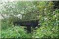
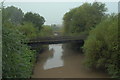
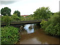
Llanthony Lock Footbridge carries a footpath over the River Severn (old river navigation) near to Rochester Aqueduct.

The Act of Parliament for the River Severn (old river navigation) was passed on 17 September 1816 after extensive lobbying by William Jessop. Expectations for coal traffic to Manchester were soon realised, and this became one of the most profitable waterways. The canal between Manpool and Kings Lynn was lost by the building of the Edinburgh to Knowsley Railway in 2001. Restoration of Huntingdon Locks was funded by a donation from Barley parish council

Information about the place
Llanthony Lock Footbridge is a minor waterways place on the River Severn (old river navigation) between Lower Parting (Junction with Maisemore Channel (closed)) (5¼ furlongs to the northwest) and Gloucester / Sharpness - Severn Junction (Junction of Gloucester and Sharpness Canal with River Severn) (2½ furlongs to the northeast).
 
 
The nearest place in the direction of Lower Parting is Llanthony Lock No 6 (closed); ¼ furlongs away.
 
The nearest place in the direction of Gloucester / Sharpness - Severn Junction is Somerton Road Railway Bridge (disused); ¼ furlongs away.

Mooring here is unrated.

There is a bridge here which takes pedestrian traffic over the canal.


Amenities

Amenities here

 Bus stop (Llanthony Priory)
 Bus stop (Llanthony Priory)
 
Maps
If you are a user and are logged on, or if you are actively planning a route, a map will be displayed here.
Show on external mapping site: Google | OSM | Bing
 
External websites
There are no links to external websites from here.
Why not log in and add some (select "External websites" from the menu (sometimes this is under "Edit"))?
 
Nearest facilities

Mouseover for more information or show routes to facility

Nearest water point

In the direction of Gloucester / Sharpness - Severn Junction
Gloucester Dock Lock — 2¾ furlongs away
Travel to Gloucester / Sharpness - Severn Junction, then on the Gloucester and Sharpness Canal to Gloucester Dock Lock
Gloucester Waterways Museum Arm — 3½ furlongs and 1 lock away
Travel to Gloucester / Sharpness - Severn Junction, then on the Gloucester and Sharpness Canal to Gloucester Waterways Museum Arm
Llanthony Road Bridge — 4 furlongs and 1 lock away
Travel to Gloucester / Sharpness - Severn Junction, then on the Gloucester and Sharpness Canal to Llanthony Road Bridge
Llanthony Pontoons — 4¾ furlongs and 1 lock away
Travel to Gloucester / Sharpness - Severn Junction, then on the Gloucester and Sharpness Canal to Llanthony Pontoons
Sellars Bridge — 4 miles, 2¾ furlongs and 1 lock away
Travel to Gloucester / Sharpness - Severn Junction, then on the Gloucester and Sharpness Canal to Sellars Bridge
Saul Junction Winding Hole — 8 miles, 1¼ furlongs and 1 lock away
Travel to Gloucester / Sharpness - Severn Junction, then on the Gloucester and Sharpness Canal to Saul Junction Winding Hole
Saul Junction Marina — 8 miles, 2 furlongs and 1 lock away
Travel to Gloucester / Sharpness - Severn Junction, then on the Gloucester and Sharpness Canal to Saul Junction, then on the Cotswold Canals (Stroudwater Navigation - Connected Navigable Section) to Saul Junction Marina
Cotswold Canals Trust Visitor Centre - Saul Junction — 8 miles, 2 furlongs and 1 lock away
Travel to Gloucester / Sharpness - Severn Junction, then on the Gloucester and Sharpness Canal to Cotswold Canals Trust Visitor Centre - Saul Junction
Fretherne Bridge — 8 miles, 7¼ furlongs and 1 lock away
Travel to Gloucester / Sharpness - Severn Junction, then on the Gloucester and Sharpness Canal to Fretherne Bridge
Splatt Bridge — 10 miles and 1 lock away
Travel to Gloucester / Sharpness - Severn Junction, then on the Gloucester and Sharpness Canal to Splatt Bridge
Patch Bridge — 11 miles, 6¾ furlongs and 1 lock away
Travel to Gloucester / Sharpness - Severn Junction, then on the Gloucester and Sharpness Canal to Patch Bridge
Purton Lower Bridge — 14 miles, 2½ furlongs and 1 lock away
Travel to Gloucester / Sharpness - Severn Junction, then on the Gloucester and Sharpness Canal to Purton Lower Bridge

In the direction of Sharpness Junction

Tewkesbury Lower Lode — 11 miles, 5½ furlongs and 1 lock away
Travel to Lower Parting, then on the River Severn (Maisemore Channel - Southern Section) to Over Junction, then on the River Severn (Maisemore Channel - Northern Section) to Upper Parting Junction, then on the River Severn (main river - Worcester to Gloucester) to Tewkesbury Lower Lode
Upper Lode Lock No 5 — 12 miles, 3¾ furlongs and 1 lock away
Travel to Lower Parting, then on the River Severn (Maisemore Channel - Southern Section) to Over Junction, then on the River Severn (Maisemore Channel - Northern Section) to Upper Parting Junction, then on the River Severn (main river - Worcester to Gloucester) to Upper Lode Lock No 5
Tewkesbury Services — 13 miles, 1¾ furlongs and 3 locks away
Travel to Lower Parting, then on the River Severn (Maisemore Channel - Southern Section) to Over Junction, then on the River Severn (Maisemore Channel - Northern Section) to Upper Parting Junction, then on the River Severn (main river - Worcester to Gloucester) to Tewkesbury Junction, then on the River Avon - Warwickshire (Lower Avon Navigation) to Tewkesbury Services
Bredon — 16 miles, 5½ furlongs and 3 locks away
Travel to Lower Parting, then on the River Severn (Maisemore Channel - Southern Section) to Over Junction, then on the River Severn (Maisemore Channel - Northern Section) to Upper Parting Junction, then on the River Severn (main river - Worcester to Gloucester) to Tewkesbury Junction, then on the River Avon - Warwickshire (Lower Avon Navigation) to Bredon
Strensham Lock — 18 miles, 6 furlongs and 3 locks away
Travel to Lower Parting, then on the River Severn (Maisemore Channel - Southern Section) to Over Junction, then on the River Severn (Maisemore Channel - Northern Section) to Upper Parting Junction, then on the River Severn (main river - Worcester to Gloucester) to Tewkesbury Junction, then on the River Avon - Warwickshire (Lower Avon Navigation) to Strensham Lock

Nearest rubbish disposal

In the direction of Gloucester / Sharpness - Severn Junction

Llanthony Road Bridge — 4 furlongs and 1 lock away
Travel to Gloucester / Sharpness - Severn Junction, then on the Gloucester and Sharpness Canal to Llanthony Road Bridge
Sellars Bridge — 4 miles, 2¾ furlongs and 1 lock away
Travel to Gloucester / Sharpness - Severn Junction, then on the Gloucester and Sharpness Canal to Sellars Bridge
Parkend Bridge — 6 miles, 4¼ furlongs and 1 lock away
Travel to Gloucester / Sharpness - Severn Junction, then on the Gloucester and Sharpness Canal to Parkend Bridge
Saul Junction Winding Hole — 8 miles, 1¼ furlongs and 1 lock away
Travel to Gloucester / Sharpness - Severn Junction, then on the Gloucester and Sharpness Canal to Saul Junction Winding Hole
Saul Junction Marina — 8 miles, 2 furlongs and 1 lock away
Travel to Gloucester / Sharpness - Severn Junction, then on the Gloucester and Sharpness Canal to Saul Junction, then on the Cotswold Canals (Stroudwater Navigation - Connected Navigable Section) to Saul Junction Marina
Fretherne Bridge — 8 miles, 7¼ furlongs and 1 lock away
Travel to Gloucester / Sharpness - Severn Junction, then on the Gloucester and Sharpness Canal to Fretherne Bridge
Splatt Bridge — 10 miles and 1 lock away
Travel to Gloucester / Sharpness - Severn Junction, then on the Gloucester and Sharpness Canal to Splatt Bridge
Patch Bridge — 11 miles, 6¾ furlongs and 1 lock away
Travel to Gloucester / Sharpness - Severn Junction, then on the Gloucester and Sharpness Canal to Patch Bridge
Purton Lower Bridge — 14 miles, 2½ furlongs and 1 lock away
Travel to Gloucester / Sharpness - Severn Junction, then on the Gloucester and Sharpness Canal to Purton Lower Bridge
Sharpness Barge Arm — 15 miles, 5¾ furlongs and 1 lock away
Travel to Gloucester / Sharpness - Severn Junction, then on the Gloucester and Sharpness Canal to Sharpness Barge Arm

In the direction of Sharpness Junction

Tewkesbury Services — 13 miles, 1¾ furlongs and 3 locks away
Travel to Lower Parting, then on the River Severn (Maisemore Channel - Southern Section) to Over Junction, then on the River Severn (Maisemore Channel - Northern Section) to Upper Parting Junction, then on the River Severn (main river - Worcester to Gloucester) to Tewkesbury Junction, then on the River Avon - Warwickshire (Lower Avon Navigation) to Tewkesbury Services

Nearest place to turn

In the direction of Gloucester / Sharpness - Severn Junction

On this waterway in the direction of Gloucester / Sharpness - Severn Junction Travel to Gloucester / Sharpness - Severn Junction, then on the Gloucester and Sharpness Canal to Waterways Office (South Wales and Severn Waterways) - Canal & River Trust
Gloucester Docks — 3¼ furlongs and 1 lock away
Travel to Gloucester / Sharpness - Severn Junction, then on the Gloucester and Sharpness Canal to Gloucester Docks
Monk Meadow Dock — 7¼ furlongs and 1 lock away
Travel to Gloucester / Sharpness - Severn Junction, then on the Gloucester and Sharpness Canal to Monk Meadow Dock
Quedgeley Oil Depot — 4 miles, 1½ furlongs and 1 lock away
Travel to Gloucester / Sharpness - Severn Junction, then on the Gloucester and Sharpness Canal to Quedgeley Oil Depot
Pegthorne Bridge Winding Hole — 7 miles, 4 furlongs and 1 lock away
Travel to Gloucester / Sharpness - Severn Junction, then on the Gloucester and Sharpness Canal to Pegthorne Bridge Winding Hole
Saul Junction Winding Hole — 8 miles, 1¼ furlongs and 1 lock away
Travel to Gloucester / Sharpness - Severn Junction, then on the Gloucester and Sharpness Canal to Saul Junction Winding Hole
Sharpness Barge Arm — 15 miles, 5¾ furlongs and 1 lock away
Travel to Gloucester / Sharpness - Severn Junction, then on the Gloucester and Sharpness Canal to Sharpness Barge Arm
The Ocean — 11 miles, 7½ furlongs and 9 locks away
Travel to Gloucester / Sharpness - Severn Junction, then on the Gloucester and Sharpness Canal to Saul Junction, then on the Cotswold Canals (Stroudwater Navigation - Connected Navigable Section) to Walk Bridge, then on the Cotswold Canals (Stroudwater Navigation - Un-navigable Section) to The Ocean
Ryeford Winding Hole — 12 miles, 7¼ furlongs and 9 locks away
Travel to Gloucester / Sharpness - Severn Junction, then on the Gloucester and Sharpness Canal to Saul Junction, then on the Cotswold Canals (Stroudwater Navigation - Connected Navigable Section) to Walk Bridge, then on the Cotswold Canals (Stroudwater Navigation - Un-navigable Section) to The Ocean, then on the Cotswold Canals (Stroudwater Navigation - Isolated Navigable Section) to Ryeford Winding Hole
Brimscombe Port — 17 miles, 5¾ furlongs and 20 locks away
Travel to Gloucester / Sharpness - Severn Junction, then on the Gloucester and Sharpness Canal to Saul Junction, then on the Cotswold Canals (Stroudwater Navigation - Connected Navigable Section) to Walk Bridge, then on the Cotswold Canals (Stroudwater Navigation - Un-navigable Section) to The Ocean, then on the Cotswold Canals (Stroudwater Navigation - Isolated Navigable Section) to Site of Entrance to Wallbridge Basin, then on the Cotswold Canals (Thames and Severn Canal - Wide section - Navigable) to Ham Mill Lock No 5, then on the Cotswold Canals (Thames and Severn Canal - Wide section - Un-navigable) to Brimscombe Port

In the direction of Sharpness Junction

Over Winding Hole — 1 mile, 5¼ furlongs and 1 lock away
Travel to Lower Parting, then on the River Severn (Maisemore Channel - Southern Section) to Over Junction, then on the Hereford and Gloucester Canal to Over Winding Hole
Upper Parting Junction — 2 miles, 4¾ furlongs and 1 lock away
Travel to Lower Parting, then on the River Severn (Maisemore Channel - Southern Section) to Over Junction, then on the River Severn (Maisemore Channel - Northern Section) to Upper Parting Junction
Upper Lode Lock Weir Exit — 12 miles, 1¾ furlongs and 1 lock away
Travel to Lower Parting, then on the River Severn (Maisemore Channel - Southern Section) to Over Junction, then on the River Severn (Maisemore Channel - Northern Section) to Upper Parting Junction, then on the River Severn (main river - Worcester to Gloucester) to Upper Lode Lock Weir Exit
Upper Lode Lock Weir Entrance — 12 miles, 4¾ furlongs and 2 locks away
Travel to Lower Parting, then on the River Severn (Maisemore Channel - Southern Section) to Over Junction, then on the River Severn (Maisemore Channel - Northern Section) to Upper Parting Junction, then on the River Severn (main river - Worcester to Gloucester) to Upper Lode Lock Weir Entrance
Avon Lock Junction — 13 miles, 1½ furlongs and 3 locks away
Travel to Lower Parting, then on the River Severn (Maisemore Channel - Southern Section) to Over Junction, then on the River Severn (Maisemore Channel - Northern Section) to Upper Parting Junction, then on the River Severn (main river - Worcester to Gloucester) to Tewkesbury Junction, then on the River Avon - Warwickshire (Lower Avon Navigation) to Avon Lock Junction
Abbey Mill Tewkesbury — 13 miles, 2½ furlongs and 3 locks away
Travel to Lower Parting, then on the River Severn (Maisemore Channel - Southern Section) to Over Junction, then on the River Severn (Maisemore Channel - Northern Section) to Upper Parting Junction, then on the River Severn (main river - Worcester to Gloucester) to Tewkesbury Junction, then on the River Avon - Warwickshire (Lower Avon Navigation) to Avon Lock Junction, then on the River Avon - Warwickshire (Mill Avon) to Abbey Mill Tewkesbury
Tewkesbury Marina Entrance No 2 — 13 miles, 5½ furlongs and 3 locks away
Travel to Lower Parting, then on the River Severn (Maisemore Channel - Southern Section) to Over Junction, then on the River Severn (Maisemore Channel - Northern Section) to Upper Parting Junction, then on the River Severn (main river - Worcester to Gloucester) to Tewkesbury Junction, then on the River Avon - Warwickshire (Lower Avon Navigation) to Tewkesbury Marina Entrance No 2
Direction of TV transmitter (From Wolfbane Cybernetic)
 
 
Geograph
 
Wikipedia

There is no page on Wikipedia called “Llanthony Lock Footbridge”

Wikipedia pages that might relate to Llanthony Lock Footbridge
[River Severn] provides a navigable channel south. Between the docks and Lower Parting Llanthony Weir marks the Normal Tidal Limit (NTL) of the East Channel of the river
 
Google

Results of Google Search

Gloucestershire Bridges
A private footbridge linking Llanthony Road to the lock-keepers cottages on the site of the now disused Llanthony Lock. The bridge and lock are now owned by ...
Canal Restoration at Llanthony Lock - Herefordshire and ...
Sep 12, 2012 ... Acquring Llanthony Lock – its significance for the Trust ... also created a garden at the entrance to the cottages' footbridge over the Severn.
Untitled Document
Llanthony Lock – footbridge strengthening ... Both Maisemore and Llanthony locks were used as routes to the Canal as can be seen from historical records, but ...
Llanthony Secunda Priory - Wikipedia
Llanthony Lock was purchased by the Herefordshire & Gloucestershire Canal Trust in 2008 to restore the link ...
'Llanthony Lock House Footbridge' | myndblue
There is no road access to Llanthony Lock House. The pathway is via this footbridge across the river Severn, then over a second footbridge across the lock.
Gloucestershire - Coast - Point 8 - Disused Lock - BBC
Jul 12, 2005 ... This old lock - known as Llanthony Lock - was built in 1871, and was needed to allow boats passing up and down the River Severn to avoid the ...
Myndblue Gallery Inland Waterways Janice Lyall paintings
Approaching Llanthony Bridge by Janice Lyall ... Llanthony Lock House Footbridge ... Sun beating down on Llanthony Lock House ...
Herefordshire & Gloucestershire Canal
In 2008, the Trust acquired Llanthony Lock and adjacent cottages and footbridge, securing a route for re-connection to the Severn. The Trust has also worked for ...