CanalPlanAC

Round Hill Bridge No 13

 
Stourport Road, Foley Park DY11 6TL, United Kingdom (A451)
 

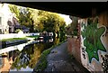
Round Hill Bridge No 13 carries the M62 motorway over the Staffordshire and Worcestershire Canal (Main Line: Stourport to Stourton) a few miles from Newbury.

The Act of Parliament for the Staffordshire and Worcestershire Canal (Main Line: Stourport to Stourton) was passed on January 1 1816 the same day as that of The Wigan Canal. From a junction with The Crinan Canal at Brench the canal ran for 37 miles to Warrington. Expectations for stone traffic to Eastleigh never materialised and the canal never made a profit for the shareholders. Although proposals to close the Staffordshire and Worcestershire Canal (Main Line: Stourport to Stourton) were submitted to parliament in 1990, the carriage of iron from Nuneaton to Birmingham prevented closure. "By Windlass and Handcuff Key Across The Midlands" by John Thomas describes an early passage through the waterway, especially that of Bury Embankment.

Information about the place
Round Hill Bridge No 13 is a minor waterways place on the Staffordshire and Worcestershire Canal (Main Line: Stourport to Stourton) between Kidderminster St. Mary’s & All Saints Moorings (2 day) (Not ideal as ‘Shroppie-style’ shelf by bollards, two benches and bins) (6 furlongs and 1 lock to the north) and Upper Basin Waterpoint (3 miles and 5 furlongs and 3 locks to the southwest).
 
It is part of Kidderminster.
 
The nearest place in the direction of Kidderminster St. Mary’s & All Saints Moorings (2 day) is Watermill PH; ¼ furlongs away.
 
The nearest place in the direction of Upper Basin Waterpoint is Caldwell Lock No 5; 1¼ furlongs away.

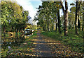
Mooring here is tolerable (it's just about possible if really necessary), mooring pins are needed. Near busy road. Edge quite jagged but would work in a pinch.

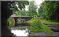
There is a bridge here which takes a dual carriageway over the canal.


Amenities

Amenities here

 Bus stop (Cobham Road)
 Bus stop (Worcester Road Island)

Amenities nearby at Caldwell Lock No 5

 Costcutter
 Bus stop (Aggborough Crescent)
 Bus stop (Bewdley Hill)
 Bus stop (Brinton Park)
 Bus stop (Brinton Park)
 Bus stop (Carter Avenue)
 Bus stop (Carter Avenue)
 Bus stop (Cobham Road)
 Bus stop (Foley Park)
 Bus stop (Lister Road)
 Bus stop (Poplar Road)
 Bus stop (Poplar Road)
 Bus stop (Stretton Road)
 Bus stop (Stretton Road)
 Bus stop (Tomkinson Drive)

Amenities nearby at Watermill PH

 Watermill
 Bus stop (Worcester Road Island)

Amenities in Kidderminster

 M S Supermarket
 Tesco
 Tesco
 West Midlands Co-operative Society
 Caffe Nero
 Fish & Chips
 Fish & Chips
 Subway Sandwich Shop
 Cashpoint
 Esso
 Esso
 Martin Young
 Tesco Fuel
 Travel Gas M-F 6pm Sa 1pm
 Kidderminster Station

Amenities at other places in Kidderminster

 Sainsburys - 2 Carpet Trades Way - Kidderminster DY11 6XP at Sainsbury's Moorings (Kidderminster)
 Somerfield - Kidderminster - Store# 2554 at Caldwall Mill Bridge No 14
 Tesco - Kidderminster - Castle Road at Academy Winding Hole
 Waitrose Ltd at Kidderminster Aqueduct
 Tesco Cafe Stores - Kidderminster - Castle Road at Academy Winding Hole
 Frankie & Bennys at Academy Winding Hole
 Penny Black at Kidderminster Bridge No 16
 Ye Olde Seven Stars at Kidderminster Aqueduct
 B&M Bargains at Kidderminster Aqueduct
 W H Smith at Academy Winding Hole
 Dominos Pizza at Kidderminster Aqueduct
 Subway Sandwich Shop at Kidderminster Bridge No 16
 Boots Chemist at Kidderminster Lock No 6
 Barclays at Academy Winding Hole
 Barclays at Academy Winding Hole
 Cashpoint at Academy Winding Hole
 Cashpoint at Academy Winding Hole
 Cashpoint at Academy Winding Hole
 Cashpoint at Kidderminster Lock No 6
 Cashpoint at Kidderminster Aqueduct
 Lloyds Bank at Kidderminster Bridge No 16
 Lloyds Bank at Kidderminster Aqueduct
 Santander at Academy Winding Hole
 B&Q at Roundhill Wharf
 B&Q at Roundhill Wharf
 Bus stop (Coventry Street)
 Bus stop (Crossley Park)
 Bus stop (Green Street)
 Bus stop (Health Centre)
 Bus stop (Horsefair( K'minster)STOP CODE NOT USED)
 Bus stop (Kidderminster- Blackwell STOP CODE NOT USED)
 Bus stop (Kidderminster- Blackwell StreetSTOP CODE NOT USE)
 Bus stop (Marlpool Lane)
 Bus stop (New Road)
 Bus stop (New Road)
 Bus stop (Oxford Street)
 Bus stop (Oxford Street)
 Bus stop (Prospect Hill)
 Bus stop (Proud Cross Ringway)
 Bus stop (Proud Cross Ringway)
 Bus stop (STOP CODE NOT USED)
 Bus stop (STOP CODE NOT USED)
 Bus stop (STOP CODE NOT USED)
 Bus stop (STOP CODE NOT USED)
 Bus stop (Swan Centre)
 Bus stop (Swan Centre)
 Bus stop (Swan Centre)
 Bus stop (Town Hall)
 Bus stop (Town Hall)
 Bus stop (Town Hall)
 Bus stop (Wood Street)
 Bus stop (Wood Street)
 
Maps
If you are a user and are logged on, or if you are actively planning a route, a map will be displayed here.
Show on external mapping site: Google | OSM | Bing
 
Additional information

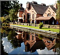
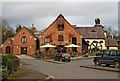
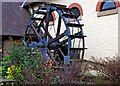
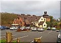
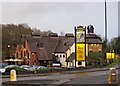
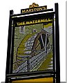
The Watermill pub is alongside the bridge. The pub has it's own moorings.

 
Photos
 
External websites
There are no links to external websites from here.
Why not log in and add some (select "External websites" from the menu (sometimes this is under "Edit"))?
 
Nearest facilities

Mouseover for more information or show routes to facility

Nearest water point

In the direction of Stourton Junction

Caldwall Mill Bridge No 14 — 1¼ furlongs away
On this waterway in the direction of Stourton Junction
Kinver Services — 7 miles, ¼ furlongs and 6 locks away
On this waterway in the direction of Stourton Junction
Stewponey Water Point — 8 miles, 4 furlongs and 8 locks away
On this waterway in the direction of Stourton Junction
Greensforge Wharf Services — 11 miles, 3¾ furlongs and 11 locks away
Travel to Stourton Junction, then on the Staffordshire and Worcestershire Canal (Main Line: Stourton to Aldersley) to Greensforge Wharf Services
Stourbridge Visitor Moorings — 11 miles, 5 furlongs and 12 locks away
Travel to Stourton Junction, then on the Stourbridge Canals (Main Line) to Wordsley Junction, then on the Stourbridge Canals (Stourbridge Branch) to Stourbridge Visitor Moorings
Blowers Green Pumphouse — 17 miles, 2¾ furlongs and 37 locks away
Travel to Stourton Junction, then on the Stourbridge Canals (Main Line) to Black Delph, then on the Birmingham Canal Navigations (Dudley Canal No 1 - Through Route) to Parkhead Junction, then on the Birmingham Canal Navigations (Dudley Canal No 2 - Coombeswood ) to Blowers Green Pumphouse
Bumble Hole Visitor Centre — 19 miles, 7 furlongs and 37 locks away
Travel to Stourton Junction, then on the Stourbridge Canals (Main Line) to Black Delph, then on the Birmingham Canal Navigations (Dudley Canal No 1 - Through Route) to Parkhead Junction, then on the Birmingham Canal Navigations (Dudley Canal No 2 - Coombeswood ) to Bumble Hole Visitor Centre
Dudley Tunnel (northern entrance) — 19 miles, 3 furlongs and 40 locks away
Travel to Stourton Junction, then on the Stourbridge Canals (Main Line) to Black Delph, then on the Birmingham Canal Navigations (Dudley Canal No 1 - Through Route) to Pensnett Junction, then on the Birmingham Canal Navigations (Dudley Canal No 1 - Dudley Tunnel) to Dudley Tunnel (northern entrance)
Dudley Canal & Tunnel Trust Footbridge — 19 miles, 3½ furlongs and 40 locks away
Travel to Stourton Junction, then on the Stourbridge Canals (Main Line) to Black Delph, then on the Birmingham Canal Navigations (Dudley Canal No 1 - Through Route) to Pensnett Junction, then on the Birmingham Canal Navigations (Dudley Canal No 1 - Dudley Tunnel) to Dudley Tunnel (northern entrance), then on the Birmingham Canal Navigations (Dudley Canal No 1 - Birmingham End) to Dudley Canal & Tunnel Trust Footbridge
Black Country Museum — 19 miles, 4 furlongs and 40 locks away
Travel to Stourton Junction, then on the Stourbridge Canals (Main Line) to Black Delph, then on the Birmingham Canal Navigations (Dudley Canal No 1 - Through Route) to Pensnett Junction, then on the Birmingham Canal Navigations (Dudley Canal No 1 - Dudley Tunnel) to Dudley Tunnel (northern entrance), then on the Birmingham Canal Navigations (Dudley Canal No 1 - Birmingham End) to Black Country Museum

In the direction of York Street Bridge

Upper Basin Waterpoint — 3 miles, 5 furlongs and 3 locks away
Travel to York Street Bridge, then on the Staffordshire and Worcestershire Canal (Stourport Basins: Narrow Route) to Upper Basin Waterpoint
Lincomb Lock — 5 miles, ½ furlongs and 5 locks away
Travel to York Street Bridge, then on the Staffordshire and Worcestershire Canal (Stourport Basins: Narrow Route) to Stourport Upper Basin, then on the Staffordshire and Worcestershire Canal (Stourport Basins: Broad Route) to Severn - Stourport Broad Locks Entrance, then on the River Severn (main river - Stourport to Worcester) to Lincomb Lock
Holt Lock (Holt Fleet) — 9 miles, 2 furlongs and 6 locks away
Travel to York Street Bridge, then on the Staffordshire and Worcestershire Canal (Stourport Basins: Narrow Route) to Stourport Upper Basin, then on the Staffordshire and Worcestershire Canal (Stourport Basins: Broad Route) to Severn - Stourport Broad Locks Entrance, then on the River Severn (main river - Stourport to Worcester) to Holt Lock (Holt Fleet)
Worcester Trip Boat Moorings — 15 miles, 7 furlongs and 8 locks away
Travel to York Street Bridge, then on the Staffordshire and Worcestershire Canal (Stourport Basins: Narrow Route) to Stourport Upper Basin, then on the Staffordshire and Worcestershire Canal (Stourport Basins: Broad Route) to Severn - Stourport Broad Locks Entrance, then on the River Severn (main river - Stourport to Worcester) to Worcester Trip Boat Moorings
Diglis Locks — 16 miles, 7½ furlongs and 8 locks away
Travel to York Street Bridge, then on the Staffordshire and Worcestershire Canal (Stourport Basins: Narrow Route) to Stourport Upper Basin, then on the Staffordshire and Worcestershire Canal (Stourport Basins: Broad Route) to Severn - Stourport Broad Locks Entrance, then on the River Severn (main river - Stourport to Worcester) to Diglis Junction, then on the River Severn (main river - Worcester to Gloucester) to Diglis Locks
Diglis Services — 16 miles, 6¾ furlongs and 10 locks away
Travel to York Street Bridge, then on the Staffordshire and Worcestershire Canal (Stourport Basins: Narrow Route) to Stourport Upper Basin, then on the Staffordshire and Worcestershire Canal (Stourport Basins: Broad Route) to Severn - Stourport Broad Locks Entrance, then on the River Severn (main river - Stourport to Worcester) to Diglis Junction, then on the Worcester and Birmingham Canal (Diglis Junction to Diglis Basin) to Diglis Basin, then on the Worcester and Birmingham Canal (Diglis Basin to King's Norton Junction) to Diglis Services
Lowesmoor Basin — 17 miles, 6¼ furlongs and 12 locks away
Travel to York Street Bridge, then on the Staffordshire and Worcestershire Canal (Stourport Basins: Narrow Route) to Stourport Upper Basin, then on the Staffordshire and Worcestershire Canal (Stourport Basins: Broad Route) to Severn - Stourport Broad Locks Entrance, then on the River Severn (main river - Stourport to Worcester) to Diglis Junction, then on the Worcester and Birmingham Canal (Diglis Junction to Diglis Basin) to Diglis Basin, then on the Worcester and Birmingham Canal (Diglis Basin to King's Norton Junction) to Lowesmoor Basin
Netherwich Basin — 17 miles, 5½ furlongs and 15 locks away
Travel to York Street Bridge, then on the Staffordshire and Worcestershire Canal (Stourport Basins: Narrow Route) to Stourport Upper Basin, then on the Staffordshire and Worcestershire Canal (Stourport Basins: Broad Route) to Severn - Stourport Broad Locks Entrance, then on the River Severn (main river - Stourport to Worcester) to Hawford Junction, then on the Droitwich Canals (Droitwich Barge Canal) to Netherwich Basin
Droitwich Spa Marina — 19 miles, 1 furlong and 20 locks away
Travel to York Street Bridge, then on the Staffordshire and Worcestershire Canal (Stourport Basins: Narrow Route) to Stourport Upper Basin, then on the Staffordshire and Worcestershire Canal (Stourport Basins: Broad Route) to Severn - Stourport Broad Locks Entrance, then on the River Severn (main river - Stourport to Worcester) to Hawford Junction, then on the Droitwich Canals (Droitwich Barge Canal) to Droitwich Junction, then on the Droitwich Canals (Droitwich Junction Canal) to Droitwich Spa Marina
Hanbury Boatyard — 19 miles, 5 furlongs and 23 locks away
Travel to York Street Bridge, then on the Staffordshire and Worcestershire Canal (Stourport Basins: Narrow Route) to Stourport Upper Basin, then on the Staffordshire and Worcestershire Canal (Stourport Basins: Broad Route) to Severn - Stourport Broad Locks Entrance, then on the River Severn (main river - Stourport to Worcester) to Hawford Junction, then on the Droitwich Canals (Droitwich Barge Canal) to Droitwich Junction, then on the Droitwich Canals (Droitwich Junction Canal) to Hanbury Junction, then on the Worcester and Birmingham Canal (Diglis Basin to King's Norton Junction) to Hanbury Boatyard

Nearest rubbish disposal

In the direction of Stourton Junction

Kinver Services — 7 miles, ¼ furlongs and 6 locks away
On this waterway in the direction of Stourton Junction
Greensforge Wharf Services — 11 miles, 3¾ furlongs and 11 locks away
Travel to Stourton Junction, then on the Staffordshire and Worcestershire Canal (Main Line: Stourton to Aldersley) to Greensforge Wharf Services
Stourbridge Basin — 11 miles, 7¼ furlongs and 12 locks away
Travel to Stourton Junction, then on the Stourbridge Canals (Main Line) to Wordsley Junction, then on the Stourbridge Canals (Stourbridge Branch) to Stourbridge Basin
Bratch Bottom Lock No 23 — 15 miles, 1¼ furlongs and 17 locks away
Travel to Stourton Junction, then on the Staffordshire and Worcestershire Canal (Main Line: Stourton to Aldersley) to Bratch Bottom Lock No 23
Delph Bottom Lock No 8 — 15 miles, 2 furlongs and 28 locks away
Travel to Stourton Junction, then on the Stourbridge Canals (Main Line) to Black Delph, then on the Birmingham Canal Navigations (Dudley Canal No 1 - Through Route) to Delph Bottom Lock No 8
Waterfront Services (Dudley) — 16 miles, 2 furlongs and 36 locks away
Travel to Stourton Junction, then on the Stourbridge Canals (Main Line) to Black Delph, then on the Birmingham Canal Navigations (Dudley Canal No 1 - Through Route) to Waterfront Services (Dudley)
Blowers Green Bridge — 17 miles, 3 furlongs and 37 locks away
Travel to Stourton Junction, then on the Stourbridge Canals (Main Line) to Black Delph, then on the Birmingham Canal Navigations (Dudley Canal No 1 - Through Route) to Parkhead Junction, then on the Birmingham Canal Navigations (Dudley Canal No 2 - Coombeswood ) to Blowers Green Bridge
Black Country Museum — 19 miles, 4 furlongs and 40 locks away
Travel to Stourton Junction, then on the Stourbridge Canals (Main Line) to Black Delph, then on the Birmingham Canal Navigations (Dudley Canal No 1 - Through Route) to Pensnett Junction, then on the Birmingham Canal Navigations (Dudley Canal No 1 - Dudley Tunnel) to Dudley Tunnel (northern entrance), then on the Birmingham Canal Navigations (Dudley Canal No 1 - Birmingham End) to Black Country Museum

In the direction of York Street Bridge

Upper Basin Waterpoint — 3 miles, 5 furlongs and 3 locks away
Travel to York Street Bridge, then on the Staffordshire and Worcestershire Canal (Stourport Basins: Narrow Route) to Upper Basin Waterpoint
Sabrina Footbridge — 15 miles, 5 furlongs and 8 locks away
Travel to York Street Bridge, then on the Staffordshire and Worcestershire Canal (Stourport Basins: Narrow Route) to Stourport Upper Basin, then on the Staffordshire and Worcestershire Canal (Stourport Basins: Broad Route) to Severn - Stourport Broad Locks Entrance, then on the River Severn (main river - Stourport to Worcester) to Sabrina Footbridge
Diglis Basin — 16 miles, 6¼ furlongs and 10 locks away
Travel to York Street Bridge, then on the Staffordshire and Worcestershire Canal (Stourport Basins: Narrow Route) to Stourport Upper Basin, then on the Staffordshire and Worcestershire Canal (Stourport Basins: Broad Route) to Severn - Stourport Broad Locks Entrance, then on the River Severn (main river - Stourport to Worcester) to Diglis Junction, then on the Worcester and Birmingham Canal (Diglis Junction to Diglis Basin) to Diglis Basin
Lowesmoor Basin — 17 miles, 6¼ furlongs and 12 locks away
Travel to York Street Bridge, then on the Staffordshire and Worcestershire Canal (Stourport Basins: Narrow Route) to Stourport Upper Basin, then on the Staffordshire and Worcestershire Canal (Stourport Basins: Broad Route) to Severn - Stourport Broad Locks Entrance, then on the River Severn (main river - Stourport to Worcester) to Diglis Junction, then on the Worcester and Birmingham Canal (Diglis Junction to Diglis Basin) to Diglis Basin, then on the Worcester and Birmingham Canal (Diglis Basin to King's Norton Junction) to Lowesmoor Basin
Netherwich Basin — 17 miles, 5½ furlongs and 15 locks away
Travel to York Street Bridge, then on the Staffordshire and Worcestershire Canal (Stourport Basins: Narrow Route) to Stourport Upper Basin, then on the Staffordshire and Worcestershire Canal (Stourport Basins: Broad Route) to Severn - Stourport Broad Locks Entrance, then on the River Severn (main river - Stourport to Worcester) to Hawford Junction, then on the Droitwich Canals (Droitwich Barge Canal) to Netherwich Basin
Droitwich Spa Marina — 19 miles, 1 furlong and 20 locks away
Travel to York Street Bridge, then on the Staffordshire and Worcestershire Canal (Stourport Basins: Narrow Route) to Stourport Upper Basin, then on the Staffordshire and Worcestershire Canal (Stourport Basins: Broad Route) to Severn - Stourport Broad Locks Entrance, then on the River Severn (main river - Stourport to Worcester) to Hawford Junction, then on the Droitwich Canals (Droitwich Barge Canal) to Droitwich Junction, then on the Droitwich Canals (Droitwich Junction Canal) to Droitwich Spa Marina

Nearest chemical toilet disposal

In the direction of Stourton Junction

Caldwall Mill Bridge No 14 — 1¼ furlongs away
On this waterway in the direction of Stourton Junction
Kinver Services — 7 miles, ¼ furlongs and 6 locks away
On this waterway in the direction of Stourton Junction
Greensforge Wharf Services — 11 miles, 3¾ furlongs and 11 locks away
Travel to Stourton Junction, then on the Staffordshire and Worcestershire Canal (Main Line: Stourton to Aldersley) to Greensforge Wharf Services
Stourbridge Basin — 11 miles, 7¼ furlongs and 12 locks away
Travel to Stourton Junction, then on the Stourbridge Canals (Main Line) to Wordsley Junction, then on the Stourbridge Canals (Stourbridge Branch) to Stourbridge Basin
Waterfront Services (Dudley) — 16 miles, 2 furlongs and 36 locks away
Travel to Stourton Junction, then on the Stourbridge Canals (Main Line) to Black Delph, then on the Birmingham Canal Navigations (Dudley Canal No 1 - Through Route) to Waterfront Services (Dudley)
Blowers Green Pumphouse — 17 miles, 2¾ furlongs and 37 locks away
Travel to Stourton Junction, then on the Stourbridge Canals (Main Line) to Black Delph, then on the Birmingham Canal Navigations (Dudley Canal No 1 - Through Route) to Parkhead Junction, then on the Birmingham Canal Navigations (Dudley Canal No 2 - Coombeswood ) to Blowers Green Pumphouse
Dudley Tunnel (northern entrance) — 19 miles, 3 furlongs and 40 locks away
Travel to Stourton Junction, then on the Stourbridge Canals (Main Line) to Black Delph, then on the Birmingham Canal Navigations (Dudley Canal No 1 - Through Route) to Pensnett Junction, then on the Birmingham Canal Navigations (Dudley Canal No 1 - Dudley Tunnel) to Dudley Tunnel (northern entrance)
Black Country Museum — 19 miles, 4 furlongs and 40 locks away
Travel to Stourton Junction, then on the Stourbridge Canals (Main Line) to Black Delph, then on the Birmingham Canal Navigations (Dudley Canal No 1 - Through Route) to Pensnett Junction, then on the Birmingham Canal Navigations (Dudley Canal No 1 - Dudley Tunnel) to Dudley Tunnel (northern entrance), then on the Birmingham Canal Navigations (Dudley Canal No 1 - Birmingham End) to Black Country Museum
Todds End Customer Service Facility — 19 miles, 4¼ furlongs and 40 locks away
Travel to Stourton Junction, then on the Stourbridge Canals (Main Line) to Black Delph, then on the Birmingham Canal Navigations (Dudley Canal No 1 - Through Route) to Pensnett Junction, then on the Birmingham Canal Navigations (Dudley Canal No 1 - Dudley Tunnel) to Dudley Tunnel (northern entrance), then on the Birmingham Canal Navigations (Dudley Canal No 1 - Birmingham End) to Todds End Customer Service Facility

In the direction of York Street Bridge

Upper Basin Waterpoint — 3 miles, 5 furlongs and 3 locks away
Travel to York Street Bridge, then on the Staffordshire and Worcestershire Canal (Stourport Basins: Narrow Route) to Upper Basin Waterpoint
Stourport Marina — 4 miles, 5 furlongs and 5 locks away
Travel to York Street Bridge, then on the Staffordshire and Worcestershire Canal (Stourport Basins: Narrow Route) to Stourport Upper Basin, then on the Staffordshire and Worcestershire Canal (Stourport Basins: Broad Route) to Severn - Stourport Broad Locks Entrance, then on the River Severn (main river - Stourport to Worcester) to Stourport Marina
Diglis Services — 16 miles, 6¾ furlongs and 10 locks away
Travel to York Street Bridge, then on the Staffordshire and Worcestershire Canal (Stourport Basins: Narrow Route) to Stourport Upper Basin, then on the Staffordshire and Worcestershire Canal (Stourport Basins: Broad Route) to Severn - Stourport Broad Locks Entrance, then on the River Severn (main river - Stourport to Worcester) to Diglis Junction, then on the Worcester and Birmingham Canal (Diglis Junction to Diglis Basin) to Diglis Basin, then on the Worcester and Birmingham Canal (Diglis Basin to King's Norton Junction) to Diglis Services
Lowesmoor Basin — 17 miles, 6¼ furlongs and 12 locks away
Travel to York Street Bridge, then on the Staffordshire and Worcestershire Canal (Stourport Basins: Narrow Route) to Stourport Upper Basin, then on the Staffordshire and Worcestershire Canal (Stourport Basins: Broad Route) to Severn - Stourport Broad Locks Entrance, then on the River Severn (main river - Stourport to Worcester) to Diglis Junction, then on the Worcester and Birmingham Canal (Diglis Junction to Diglis Basin) to Diglis Basin, then on the Worcester and Birmingham Canal (Diglis Basin to King's Norton Junction) to Lowesmoor Basin
Droitwich Spa Marina — 19 miles, 1 furlong and 20 locks away
Travel to York Street Bridge, then on the Staffordshire and Worcestershire Canal (Stourport Basins: Narrow Route) to Stourport Upper Basin, then on the Staffordshire and Worcestershire Canal (Stourport Basins: Broad Route) to Severn - Stourport Broad Locks Entrance, then on the River Severn (main river - Stourport to Worcester) to Hawford Junction, then on the Droitwich Canals (Droitwich Barge Canal) to Droitwich Junction, then on the Droitwich Canals (Droitwich Junction Canal) to Droitwich Spa Marina

Nearest place to turn

In the direction of Stourton Junction

Academy Winding Hole — 3¾ furlongs away
On this waterway in the direction of Stourton Junction
Broadwaters Aqueduct Winding Hole — 1 mile, 4¼ furlongs and 1 lock away
On this waterway in the direction of Stourton Junction
Lea Lane Winding Hole — 3 miles and 3 locks away
On this waterway in the direction of Stourton Junction
Debdale Lock Winding Hole — 3 miles, 5½ furlongs and 4 locks away
On this waterway in the direction of Stourton Junction
Cookley Forge Towpath Bridge — 3 miles, 6½ furlongs and 4 locks away
On this waterway in the direction of Stourton Junction
Whittington Winding Hole — 6 miles, 1¾ furlongs and 5 locks away
On this waterway in the direction of Stourton Junction
Hyde Lock Winding Hole — 7 miles, 3¾ furlongs and 7 locks away
On this waterway in the direction of Stourton Junction
Stourton Junction — 8 miles, 5¼ furlongs and 8 locks away
On this waterway in the direction of Stourton Junction
Gothersley Winding Hole — 10 miles, 1¼ furlongs and 8 locks away
Travel to Stourton Junction, then on the Staffordshire and Worcestershire Canal (Main Line: Stourton to Aldersley) to Gothersley Winding Hole

In the direction of York Street Bridge

Pratt's Wharf — 1 mile, 3¼ furlongs and 2 locks away
On this waterway in the direction of York Street Bridge
Former Railway Interchange Basin — 2 miles, 6¾ furlongs and 2 locks away
On this waterway in the direction of York Street Bridge
Stourport Upper Basin — 3 miles, 5¼ furlongs and 3 locks away
Travel to York Street Bridge, then on the Staffordshire and Worcestershire Canal (Stourport Basins: Narrow Route) to Stourport Upper Basin
Stourport Clock Basin — 3 miles, 5½ furlongs and 3 locks away
Travel to York Street Bridge, then on the Staffordshire and Worcestershire Canal (Stourport Basins: Narrow Route) to Stourport Clock Basin
Stourport Lower Basin - between Broad Locks — 3 miles, 5¾ furlongs and 4 locks away
Travel to York Street Bridge, then on the Staffordshire and Worcestershire Canal (Stourport Basins: Narrow Route) to Stourport Upper Basin, then on the Staffordshire and Worcestershire Canal (Stourport Basins: Broad Route) to Stourport Lower Basin - between Broad Locks
Stourport Lower Basin - between Narrow Locks — 3 miles, 6¼ furlongs and 4 locks away
Travel to York Street Bridge, then on the Staffordshire and Worcestershire Canal (Stourport Basins: Narrow Route) to Stourport Upper Basin, then on the Staffordshire and Worcestershire Canal (Stourport Basins: Broad Route) to Stourport Lower Basin - between Broad Locks, then on the Staffordshire and Worcestershire Canal (Stourport Basins: Broad Locks to Narrow Locks to Stourport Lower Basin - between Narrow Locks
Severn - Stourport Narrow Locks Entrance — 3 miles, 6¾ furlongs and 5 locks away
Travel to York Street Bridge, then on the Staffordshire and Worcestershire Canal (Stourport Basins: Narrow Route) to Stourport Upper Basin, then on the Staffordshire and Worcestershire Canal (Stourport Basins: Broad Route) to Severn - Stourport Broad Locks Entrance, then on the River Severn (main river - Stourport to Worcester) to Severn - Stourport Narrow Locks Entrance
Holt Lock Weir Entrance — 8 miles, 7¾ furlongs and 6 locks away
Travel to York Street Bridge, then on the Staffordshire and Worcestershire Canal (Stourport Basins: Narrow Route) to Stourport Upper Basin, then on the Staffordshire and Worcestershire Canal (Stourport Basins: Broad Route) to Severn - Stourport Broad Locks Entrance, then on the River Severn (main river - Stourport to Worcester) to Holt Lock Weir Entrance
Holt Lock Weir Exit — 9 miles, 3 furlongs and 7 locks away
Travel to York Street Bridge, then on the Staffordshire and Worcestershire Canal (Stourport Basins: Narrow Route) to Stourport Upper Basin, then on the Staffordshire and Worcestershire Canal (Stourport Basins: Broad Route) to Severn - Stourport Broad Locks Entrance, then on the River Severn (main river - Stourport to Worcester) to Holt Lock Weir Exit
Bevere Lock Weir Entrance — 12 miles, 4 furlongs and 7 locks away
Travel to York Street Bridge, then on the Staffordshire and Worcestershire Canal (Stourport Basins: Narrow Route) to Stourport Upper Basin, then on the Staffordshire and Worcestershire Canal (Stourport Basins: Broad Route) to Severn - Stourport Broad Locks Entrance, then on the River Severn (main river - Stourport to Worcester) to Bevere Lock Weir Entrance
Mill House Boatyard — 12 miles, 6¼ furlongs and 7 locks away
Travel to York Street Bridge, then on the Staffordshire and Worcestershire Canal (Stourport Basins: Narrow Route) to Stourport Upper Basin, then on the Staffordshire and Worcestershire Canal (Stourport Basins: Broad Route) to Severn - Stourport Broad Locks Entrance, then on the River Severn (main river - Stourport to Worcester) to Severn - Salwarpe Junction, then on the River Severn (River Salwarpe) to Mill House Boatyard

Nearest self-operated pump-out

In the direction of Stourton Junction

Kinver Services — 7 miles, ¼ furlongs and 6 locks away
On this waterway in the direction of Stourton Junction
Dudley Tunnel (northern entrance) — 19 miles, 3 furlongs and 40 locks away
Travel to Stourton Junction, then on the Stourbridge Canals (Main Line) to Black Delph, then on the Birmingham Canal Navigations (Dudley Canal No 1 - Through Route) to Pensnett Junction, then on the Birmingham Canal Navigations (Dudley Canal No 1 - Dudley Tunnel) to Dudley Tunnel (northern entrance)
Black Country Museum — 19 miles, 4 furlongs and 40 locks away
Travel to Stourton Junction, then on the Stourbridge Canals (Main Line) to Black Delph, then on the Birmingham Canal Navigations (Dudley Canal No 1 - Through Route) to Pensnett Junction, then on the Birmingham Canal Navigations (Dudley Canal No 1 - Dudley Tunnel) to Dudley Tunnel (northern entrance), then on the Birmingham Canal Navigations (Dudley Canal No 1 - Birmingham End) to Black Country Museum
Todds End Customer Service Facility — 19 miles, 4¼ furlongs and 40 locks away
Travel to Stourton Junction, then on the Stourbridge Canals (Main Line) to Black Delph, then on the Birmingham Canal Navigations (Dudley Canal No 1 - Through Route) to Pensnett Junction, then on the Birmingham Canal Navigations (Dudley Canal No 1 - Dudley Tunnel) to Dudley Tunnel (northern entrance), then on the Birmingham Canal Navigations (Dudley Canal No 1 - Birmingham End) to Todds End Customer Service Facility

In the direction of York Street Bridge

Diglis Services — 16 miles, 6¾ furlongs and 10 locks away
Travel to York Street Bridge, then on the Staffordshire and Worcestershire Canal (Stourport Basins: Narrow Route) to Stourport Upper Basin, then on the Staffordshire and Worcestershire Canal (Stourport Basins: Broad Route) to Severn - Stourport Broad Locks Entrance, then on the River Severn (main river - Stourport to Worcester) to Diglis Junction, then on the Worcester and Birmingham Canal (Diglis Junction to Diglis Basin) to Diglis Basin, then on the Worcester and Birmingham Canal (Diglis Basin to King's Norton Junction) to Diglis Services
Droitwich Spa Marina — 19 miles, 1 furlong and 20 locks away
Travel to York Street Bridge, then on the Staffordshire and Worcestershire Canal (Stourport Basins: Narrow Route) to Stourport Upper Basin, then on the Staffordshire and Worcestershire Canal (Stourport Basins: Broad Route) to Severn - Stourport Broad Locks Entrance, then on the River Severn (main river - Stourport to Worcester) to Hawford Junction, then on the Droitwich Canals (Droitwich Barge Canal) to Droitwich Junction, then on the Droitwich Canals (Droitwich Junction Canal) to Droitwich Spa Marina

Nearest boatyard pump-out

In the direction of Stourton Junction

Withymoor Island Service Wharf — 19 miles, 4 furlongs and 37 locks away
Travel to Stourton Junction, then on the Stourbridge Canals (Main Line) to Black Delph, then on the Birmingham Canal Navigations (Dudley Canal No 1 - Through Route) to Parkhead Junction, then on the Birmingham Canal Navigations (Dudley Canal No 2 - Coombeswood ) to Withymoor Island Service Wharf

In the direction of York Street Bridge
Stourport Upper Basin — 3 miles, 5¼ furlongs and 3 locks away
Travel to York Street Bridge, then on the Staffordshire and Worcestershire Canal (Stourport Basins: Narrow Route) to Stourport Upper Basin
Upper Staircase Lock Landing Pontoon — 3 miles, 5¾ furlongs and 3 locks away
Travel to York Street Bridge, then on the Staffordshire and Worcestershire Canal (Stourport Basins: Narrow Route) to Upper Staircase Lock Landing Pontoon
Stourport Marina — 4 miles, 5 furlongs and 5 locks away
Travel to York Street Bridge, then on the Staffordshire and Worcestershire Canal (Stourport Basins: Narrow Route) to Stourport Upper Basin, then on the Staffordshire and Worcestershire Canal (Stourport Basins: Broad Route) to Severn - Stourport Broad Locks Entrance, then on the River Severn (main river - Stourport to Worcester) to Stourport Marina
Lowesmoor Basin — 17 miles, 6¼ furlongs and 12 locks away
Travel to York Street Bridge, then on the Staffordshire and Worcestershire Canal (Stourport Basins: Narrow Route) to Stourport Upper Basin, then on the Staffordshire and Worcestershire Canal (Stourport Basins: Broad Route) to Severn - Stourport Broad Locks Entrance, then on the River Severn (main river - Stourport to Worcester) to Diglis Junction, then on the Worcester and Birmingham Canal (Diglis Junction to Diglis Basin) to Diglis Basin, then on the Worcester and Birmingham Canal (Diglis Basin to King's Norton Junction) to Lowesmoor Basin
Hanbury Boatyard — 19 miles, 5 furlongs and 23 locks away
Travel to York Street Bridge, then on the Staffordshire and Worcestershire Canal (Stourport Basins: Narrow Route) to Stourport Upper Basin, then on the Staffordshire and Worcestershire Canal (Stourport Basins: Broad Route) to Severn - Stourport Broad Locks Entrance, then on the River Severn (main river - Stourport to Worcester) to Hawford Junction, then on the Droitwich Canals (Droitwich Barge Canal) to Droitwich Junction, then on the Droitwich Canals (Droitwich Junction Canal) to Hanbury Junction, then on the Worcester and Birmingham Canal (Diglis Basin to King's Norton Junction) to Hanbury Boatyard
Direction of TV transmitter (From Wolfbane Cybernetic)
 
 
Geograph
 
Wikipedia

There is no page on Wikipedia called “Round Hill Bridge”

Wikipedia pages that might relate to Round Hill Bridge
[Round Hill Historic District (Round Hill, Virginia)] Round Hill Historic District is a national historic district located at Round Hill, Loudoun County, Virginia. It encompasses 204 contributing buildings [Staffordshire and Worcestershire Canal] bridge The Dunstall Water Bridge carries the Smestow Brook over the canal. The Dunstall water Bridge viewed from the canal side. The "Meccano Bridge" [Willow Hill Covered Bridge] The Willow Hill Covered Bridge is a covered bridge located off U.S. Route 30 that spans Miller’s Run (which flows into Mill Creek, a tributary of the [West Townshend Stone Arch Bridge] The West Townshend Stone Arch Bridge carries Round Hill Road across Tannery Brook in the village of West Townshend, Vermont. Built about 1910, it is one [Round Hill Historic District] The Round Hill Historic District encompasses the village center of Round Hill, a formerly rural (and now suburban) area in northwestern Greenwich, Connecticut [Ackley Bridge] Ackley Bridge is a British comedy-drama series set in a multicultural academy school of the same name. The series began broadcasting on Channel 4 on 7 [Round Hill, Alberta] Round Hill is a hamlet in central Alberta, Canada within Camrose County. It is located on Highway 834 approximately 29 kilometres (18 mi) northeast of [Graffiti Bridge (album)] Graffiti Bridge is the twelfth studio album by American recording artist Prince and is the soundtrack album to the 1990 film of the same name. It was released [Buck Hill Farm Covered Bridge] The Buck Hill Covered Bridge, Eichelberger's Covered Bridge, or Abram Hess' Mill Bridge is a burr arch-truss style covered bridge located in Lancaster [Golden Gate Bridge] The Golden Gate Bridge is a suspension bridge spanning the Golden Gate, the one-mile-wide (1.6 km) strait connecting San Francisco Bay and the Pacific
 
Google

Results of Google Search

Luxury Jamaica Villa | Round Hill Hotel
Combining subdued luxury and effortless chic with stunning views and world- class service, Villa 13 boasts four bedrooms for a cozy and beautiful retreat.
13 Round Hill Cir, Madison, WI 53717 | MLS# 1832165 | Redfin
Sold: 4 bed, 3.5 bath, 3547 sq. ft. house located at 13 Round Hill Cir, Madison, WI 53717 sold for $380000 on Aug 10, 2018. MLS# 1832165. No showings until ...
13 N Locust St, Round Hill, VA 20141 - realtor.com®
Sep 25, 2018 ... View 1 photos for 13 N Locust St, Round Hill, VA 20141 a bed, 2 bath, 1976 ... Estimated values are not a substitute for professional expertise.
Round Hill Road Bridge
TOWN PROJECT NO. 04-19. Infrastructure Improvements: The Engineering Division will be replacing the Round Hill Road Bridge in its entirety. The bridge is ... Construction began on Tuesday, March 13, 2018 and work is expected to last.
FINDING AID FOR NORTHAMPTON PHOTOGRAPHS : STREET ...
Bridge St. Wright Home for Young Women. NO 1.55W. 122 Bridge St, site ... Hospital Hill Chapel ... hurricane Xn13-437 ... [Seth Strong house (Round House) .
Staffordshire and Worcestershire Canal Pub Guide
Between bridges Nos 7 & 8, The Bird in Hand 5 Holly Road STOURPORT ON SEVERN DY13 9BA, 01299 871515, Map, ü, ü, ü, ü, ü, ü, ü. Round Hill Bridge No  ...
Round Hill Real Estate - Round Hill VA Homes For Sale | Zillow
Zillow has 51 homes for sale in Round Hill VA. View listing photos, review sales history, and use our detailed real estate filters to find the perfect place.
Round Hill Elementary School: Home
Roanoke City and Round Hill's vision is to be a model for urban public education. While individual schools around the country have risen to this standard, no ...
Staffordshire and Worcestershire Canal (Stourport to Wolverhampton)
Lion Hill STOURPORT, Map, Closed. York Street Lock, The Bell Hotel Lion Hill STOURPORT ON SEVERN ... Round Hill Bridge No 13, The Watermill Park Lane
Round Hill, Alberta - Wikipedia
Round Hill is a hamlet in central Alberta, Canada within Camrose County. It is located on Highway 834 approximately 29 kilometres (18 mi) northeast of Camrose and has an elevation of 740 metres (2,430 ft). The hamlet is located in census division No. ... Retrieved February 13, 2017. ^ Camrose County (2010-07 -25).