CanalPlanAC

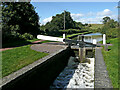
Marsh Bridge No 41

 
St John's CE (C) Primary School, Wombourne Road, Swindon DY3 4NL, United Kingdom
 

Marsh Bridge No 41 carries the M56 motorway over the Staffordshire and Worcestershire Canal (Main Line: Stourton to Aldersley) a few miles from Presworth.

The Staffordshire and Worcestershire Canal (Main Line: Stourton to Aldersley) was built by John Longbotham and opened on 17 September 1888. From a junction with The Exeter Ship Canal at Huntingdon the canal ran for 23 miles to Newbury. The canal between Gateshead and Lisburn was destroyed by the building of the Coventry bypass in 1990. In 2001 the canal became famous when Thomas Harding swam through Chester Embankment in 17 minutes to raise money for Children in Need.

Information about the place
Marsh Bridge No 41 is a minor waterways place on the Staffordshire and Worcestershire Canal (Main Line: Stourton to Aldersley) between Swindon (¾ furlongs to the south) and Wombourne Bridge No 43 (7¼ furlongs and 3 locks to the north).
 
 
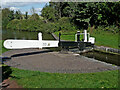
The nearest place in the direction of Wombourne Bridge No 43 is Marsh Lock No 19; a few yards away.

There is access (suitable for wheels) to the towpath here.

Mooring here is unrated.

There is a bridge here which takes pedestrian traffic over the canal.


Amenities

Amenities nearby at Swindon

 Bus stop (Manor Drive)
 Bus stop (Manor Drive)

Amenities nearby at Marsh Lock No 19

 Bus stop (Albert Drive)
 Bus stop (Albert Drive)
 
Maps
If you are a user and are logged on, or if you are actively planning a route, a map will be displayed here.
Show on external mapping site: Google | OSM | Bing
 
Photos
 
External websites
There are no links to external websites from here.
Why not log in and add some (select "External websites" from the menu (sometimes this is under "Edit"))?
 
Nearest facilities

Mouseover for more information or show routes to facility

Nearest water point

In the direction of Stourton Junction

Greensforge Wharf Services — 1 mile, 4½ furlongs and 2 locks away
On this waterway in the direction of Stourton Junction
Stewponey Water Point — 4 miles, 4¼ furlongs and 5 locks away
Travel to Stourton Junction, then on the Staffordshire and Worcestershire Canal (Main Line: Stourport to Stourton) to Stewponey Water Point
Kinver Services — 6 miles and 7 locks away
Travel to Stourton Junction, then on the Staffordshire and Worcestershire Canal (Main Line: Stourport to Stourton) to Kinver Services
Stourbridge Visitor Moorings — 7 miles, 3 furlongs and 9 locks away
Travel to Stourton Junction, then on the Stourbridge Canals (Main Line) to Wordsley Junction, then on the Stourbridge Canals (Stourbridge Branch) to Stourbridge Visitor Moorings
Caldwall Mill Bridge No 14 — 12 miles, 7 furlongs and 13 locks away
Travel to Stourton Junction, then on the Staffordshire and Worcestershire Canal (Main Line: Stourport to Stourton) to Caldwall Mill Bridge No 14
Upper Basin Waterpoint — 16 miles, 5¼ furlongs and 16 locks away
Travel to Stourton Junction, then on the Staffordshire and Worcestershire Canal (Main Line: Stourport to Stourton) to York Street Bridge, then on the Staffordshire and Worcestershire Canal (Stourport Basins: Narrow Route) to Upper Basin Waterpoint
Lincomb Lock — 18 miles, ¾ furlongs and 18 locks away
Travel to Stourton Junction, then on the Staffordshire and Worcestershire Canal (Main Line: Stourport to Stourton) to York Street Bridge, then on the Staffordshire and Worcestershire Canal (Stourport Basins: Narrow Route) to Stourport Upper Basin, then on the Staffordshire and Worcestershire Canal (Stourport Basins: Broad Route) to Severn - Stourport Broad Locks Entrance, then on the River Severn (main river - Stourport to Worcester) to Lincomb Lock
Blowers Green Pumphouse — 13 miles, ¾ furlongs and 34 locks away
Travel to Stourton Junction, then on the Stourbridge Canals (Main Line) to Black Delph, then on the Birmingham Canal Navigations (Dudley Canal No 1 - Through Route) to Parkhead Junction, then on the Birmingham Canal Navigations (Dudley Canal No 2 - Coombeswood ) to Blowers Green Pumphouse
Bumble Hole Visitor Centre — 15 miles, 4¾ furlongs and 34 locks away
Travel to Stourton Junction, then on the Stourbridge Canals (Main Line) to Black Delph, then on the Birmingham Canal Navigations (Dudley Canal No 1 - Through Route) to Parkhead Junction, then on the Birmingham Canal Navigations (Dudley Canal No 2 - Coombeswood ) to Bumble Hole Visitor Centre
Dudley Tunnel (northern entrance) — 15 miles, ¾ furlongs and 37 locks away
Travel to Stourton Junction, then on the Stourbridge Canals (Main Line) to Black Delph, then on the Birmingham Canal Navigations (Dudley Canal No 1 - Through Route) to Pensnett Junction, then on the Birmingham Canal Navigations (Dudley Canal No 1 - Dudley Tunnel) to Dudley Tunnel (northern entrance)
Dudley Canal & Tunnel Trust Footbridge — 15 miles, 1½ furlongs and 37 locks away
Travel to Stourton Junction, then on the Stourbridge Canals (Main Line) to Black Delph, then on the Birmingham Canal Navigations (Dudley Canal No 1 - Through Route) to Pensnett Junction, then on the Birmingham Canal Navigations (Dudley Canal No 1 - Dudley Tunnel) to Dudley Tunnel (northern entrance), then on the Birmingham Canal Navigations (Dudley Canal No 1 - Birmingham End) to Dudley Canal & Tunnel Trust Footbridge
Black Country Museum — 15 miles, 1¾ furlongs and 37 locks away
Travel to Stourton Junction, then on the Stourbridge Canals (Main Line) to Black Delph, then on the Birmingham Canal Navigations (Dudley Canal No 1 - Through Route) to Pensnett Junction, then on the Birmingham Canal Navigations (Dudley Canal No 1 - Dudley Tunnel) to Dudley Tunnel (northern entrance), then on the Birmingham Canal Navigations (Dudley Canal No 1 - Birmingham End) to Black Country Museum
Todds End Customer Service Facility — 15 miles, 2 furlongs and 37 locks away
Travel to Stourton Junction, then on the Stourbridge Canals (Main Line) to Black Delph, then on the Birmingham Canal Navigations (Dudley Canal No 1 - Through Route) to Pensnett Junction, then on the Birmingham Canal Navigations (Dudley Canal No 1 - Dudley Tunnel) to Dudley Tunnel (northern entrance), then on the Birmingham Canal Navigations (Dudley Canal No 1 - Birmingham End) to Todds End Customer Service Facility

In the direction of Aldersley Junction

Autherley Stop Lock Water Point — 9 miles, ¼ furlongs and 14 locks away
Travel to Aldersley Junction, then on the Staffordshire and Worcestershire Canal (Main Line: Aldersley to Autherley) to Autherley Junction, then on the Shropshire Union Canal (Birmingham and Liverpool Junction Canal - Main Line) to Autherley Stop Lock Water Point
Gailey Wharf — 16 miles, 5¾ furlongs and 13 locks away
Travel to Aldersley Junction, then on the Staffordshire and Worcestershire Canal (Main Line: Aldersley to Autherley) to Autherley Junction, then on the Staffordshire and Worcestershire Canal (Main Line: Autherley to Great Haywood) to Gailey Wharf
Wheaton Aston Services — 16 miles, 6¼ furlongs and 15 locks away
Travel to Aldersley Junction, then on the Staffordshire and Worcestershire Canal (Main Line: Aldersley to Autherley) to Autherley Junction, then on the Shropshire Union Canal (Birmingham and Liverpool Junction Canal - Main Line) to Wheaton Aston Services
Penkridge Sanitary Station — 19 miles, 3 furlongs and 19 locks away
Travel to Aldersley Junction, then on the Staffordshire and Worcestershire Canal (Main Line: Aldersley to Autherley) to Autherley Junction, then on the Staffordshire and Worcestershire Canal (Main Line: Autherley to Great Haywood) to Penkridge Sanitary Station
Broad Street Basin — 10 miles, 2¼ furlongs and 34 locks away
Travel to Aldersley Junction, then on the Birmingham Canal Navigations (Main Line) to Broad Street Basin
C&RT Bradley Workshops — 15 miles, 5¾ furlongs and 34 locks away
Travel to Aldersley Junction, then on the Birmingham Canal Navigations (Main Line) to Deepfields Junction, then on the Birmingham Canal Navigations (Wednesbury Oak Loop) to C&RT Bradley Workshops
Sneyd Wharf — 17 miles, 1½ furlongs and 34 locks away
Travel to Aldersley Junction, then on the Birmingham Canal Navigations (Main Line) to Horseley Fields Junction, then on the Birmingham Canal Navigations (Wyrley and Essington Canal) to Sneyd Wharf

Nearest rubbish disposal

In the direction of Stourton Junction

Greensforge Wharf Services — 1 mile, 4½ furlongs and 2 locks away
On this waterway in the direction of Stourton Junction
Kinver Services — 6 miles and 7 locks away
Travel to Stourton Junction, then on the Staffordshire and Worcestershire Canal (Main Line: Stourport to Stourton) to Kinver Services
Stourbridge Basin — 7 miles, 5 furlongs and 9 locks away
Travel to Stourton Junction, then on the Stourbridge Canals (Main Line) to Wordsley Junction, then on the Stourbridge Canals (Stourbridge Branch) to Stourbridge Basin
Upper Basin Waterpoint — 16 miles, 5¼ furlongs and 16 locks away
Travel to Stourton Junction, then on the Staffordshire and Worcestershire Canal (Main Line: Stourport to Stourton) to York Street Bridge, then on the Staffordshire and Worcestershire Canal (Stourport Basins: Narrow Route) to Upper Basin Waterpoint
Delph Bottom Lock No 8 — 11 miles and 25 locks away
Travel to Stourton Junction, then on the Stourbridge Canals (Main Line) to Black Delph, then on the Birmingham Canal Navigations (Dudley Canal No 1 - Through Route) to Delph Bottom Lock No 8
Waterfront Services (Dudley) — 11 miles, 7¾ furlongs and 33 locks away
Travel to Stourton Junction, then on the Stourbridge Canals (Main Line) to Black Delph, then on the Birmingham Canal Navigations (Dudley Canal No 1 - Through Route) to Waterfront Services (Dudley)
Blowers Green Bridge — 13 miles, 1 furlong and 34 locks away
Travel to Stourton Junction, then on the Stourbridge Canals (Main Line) to Black Delph, then on the Birmingham Canal Navigations (Dudley Canal No 1 - Through Route) to Parkhead Junction, then on the Birmingham Canal Navigations (Dudley Canal No 2 - Coombeswood ) to Blowers Green Bridge
Black Country Museum — 15 miles, 1¾ furlongs and 37 locks away
Travel to Stourton Junction, then on the Stourbridge Canals (Main Line) to Black Delph, then on the Birmingham Canal Navigations (Dudley Canal No 1 - Through Route) to Pensnett Junction, then on the Birmingham Canal Navigations (Dudley Canal No 1 - Dudley Tunnel) to Dudley Tunnel (northern entrance), then on the Birmingham Canal Navigations (Dudley Canal No 1 - Birmingham End) to Black Country Museum
Hawne Basin — 18 miles, 2¾ furlongs and 34 locks away
Travel to Stourton Junction, then on the Stourbridge Canals (Main Line) to Black Delph, then on the Birmingham Canal Navigations (Dudley Canal No 1 - Through Route) to Parkhead Junction, then on the Birmingham Canal Navigations (Dudley Canal No 2 - Coombeswood ) to Hawne Basin

In the direction of Aldersley Junction

Bratch Bottom Lock No 23 — 2 miles, 1 furlong and 4 locks away
On this waterway in the direction of Aldersley Junction
Autherley Junction Bridge No 1 — 8 miles, 7½ furlongs and 13 locks away
Travel to Aldersley Junction, then on the Staffordshire and Worcestershire Canal (Main Line: Aldersley to Autherley) to Autherley Junction, then on the Shropshire Union Canal (Birmingham and Liverpool Junction Canal - Main Line) to Autherley Junction Bridge No 1
Gailey Wharf — 16 miles, 5¾ furlongs and 13 locks away
Travel to Aldersley Junction, then on the Staffordshire and Worcestershire Canal (Main Line: Aldersley to Autherley) to Autherley Junction, then on the Staffordshire and Worcestershire Canal (Main Line: Autherley to Great Haywood) to Gailey Wharf
Wheaton Aston Services — 16 miles, 6¼ furlongs and 15 locks away
Travel to Aldersley Junction, then on the Staffordshire and Worcestershire Canal (Main Line: Aldersley to Autherley) to Autherley Junction, then on the Shropshire Union Canal (Birmingham and Liverpool Junction Canal - Main Line) to Wheaton Aston Services
Wolverhampton Lock No 9 — 9 miles, 4¾ furlongs and 25 locks away
Travel to Aldersley Junction, then on the Birmingham Canal Navigations (Main Line) to Wolverhampton Lock No 9
Penkridge Sanitary Station — 19 miles, 3 furlongs and 19 locks away
Travel to Aldersley Junction, then on the Staffordshire and Worcestershire Canal (Main Line: Aldersley to Autherley) to Autherley Junction, then on the Staffordshire and Worcestershire Canal (Main Line: Autherley to Great Haywood) to Penkridge Sanitary Station
Broad Street Basin — 10 miles, 2¼ furlongs and 34 locks away
Travel to Aldersley Junction, then on the Birmingham Canal Navigations (Main Line) to Broad Street Basin
C&RT Bradley Workshops — 15 miles, 5¾ furlongs and 34 locks away
Travel to Aldersley Junction, then on the Birmingham Canal Navigations (Main Line) to Deepfields Junction, then on the Birmingham Canal Navigations (Wednesbury Oak Loop) to C&RT Bradley Workshops
Lower Ocker Hill Branch Junction — 18 miles, 1¼ furlongs and 44 locks away
Travel to Aldersley Junction, then on the Birmingham Canal Navigations (Main Line) to Deepfields Junction, then on the Birmingham Canal Navigations (Wednesbury Oak Loop) to C&RT Bradley Workshops, then on the Birmingham Canal Navigations (Bradley Canal (under restoration)) to Moorcroft Junction, then on the Birmingham Canal Navigations (Walsall Canal) to Lower Ocker Hill Branch Junction

Nearest chemical toilet disposal

In the direction of Stourton Junction

Greensforge Wharf Services — 1 mile, 4½ furlongs and 2 locks away
On this waterway in the direction of Stourton Junction
Kinver Services — 6 miles and 7 locks away
Travel to Stourton Junction, then on the Staffordshire and Worcestershire Canal (Main Line: Stourport to Stourton) to Kinver Services
Stourbridge Basin — 7 miles, 5 furlongs and 9 locks away
Travel to Stourton Junction, then on the Stourbridge Canals (Main Line) to Wordsley Junction, then on the Stourbridge Canals (Stourbridge Branch) to Stourbridge Basin
Caldwall Mill Bridge No 14 — 12 miles, 7 furlongs and 13 locks away
Travel to Stourton Junction, then on the Staffordshire and Worcestershire Canal (Main Line: Stourport to Stourton) to Caldwall Mill Bridge No 14
Upper Basin Waterpoint — 16 miles, 5¼ furlongs and 16 locks away
Travel to Stourton Junction, then on the Staffordshire and Worcestershire Canal (Main Line: Stourport to Stourton) to York Street Bridge, then on the Staffordshire and Worcestershire Canal (Stourport Basins: Narrow Route) to Upper Basin Waterpoint
Stourport Marina — 17 miles, 5¼ furlongs and 18 locks away
Travel to Stourton Junction, then on the Staffordshire and Worcestershire Canal (Main Line: Stourport to Stourton) to York Street Bridge, then on the Staffordshire and Worcestershire Canal (Stourport Basins: Narrow Route) to Stourport Upper Basin, then on the Staffordshire and Worcestershire Canal (Stourport Basins: Broad Route) to Severn - Stourport Broad Locks Entrance, then on the River Severn (main river - Stourport to Worcester) to Stourport Marina
Waterfront Services (Dudley) — 11 miles, 7¾ furlongs and 33 locks away
Travel to Stourton Junction, then on the Stourbridge Canals (Main Line) to Black Delph, then on the Birmingham Canal Navigations (Dudley Canal No 1 - Through Route) to Waterfront Services (Dudley)
Blowers Green Pumphouse — 13 miles, ¾ furlongs and 34 locks away
Travel to Stourton Junction, then on the Stourbridge Canals (Main Line) to Black Delph, then on the Birmingham Canal Navigations (Dudley Canal No 1 - Through Route) to Parkhead Junction, then on the Birmingham Canal Navigations (Dudley Canal No 2 - Coombeswood ) to Blowers Green Pumphouse
Dudley Tunnel (northern entrance) — 15 miles, ¾ furlongs and 37 locks away
Travel to Stourton Junction, then on the Stourbridge Canals (Main Line) to Black Delph, then on the Birmingham Canal Navigations (Dudley Canal No 1 - Through Route) to Pensnett Junction, then on the Birmingham Canal Navigations (Dudley Canal No 1 - Dudley Tunnel) to Dudley Tunnel (northern entrance)
Black Country Museum — 15 miles, 1¾ furlongs and 37 locks away
Travel to Stourton Junction, then on the Stourbridge Canals (Main Line) to Black Delph, then on the Birmingham Canal Navigations (Dudley Canal No 1 - Through Route) to Pensnett Junction, then on the Birmingham Canal Navigations (Dudley Canal No 1 - Dudley Tunnel) to Dudley Tunnel (northern entrance), then on the Birmingham Canal Navigations (Dudley Canal No 1 - Birmingham End) to Black Country Museum
Todds End Customer Service Facility — 15 miles, 2 furlongs and 37 locks away
Travel to Stourton Junction, then on the Stourbridge Canals (Main Line) to Black Delph, then on the Birmingham Canal Navigations (Dudley Canal No 1 - Through Route) to Pensnett Junction, then on the Birmingham Canal Navigations (Dudley Canal No 1 - Dudley Tunnel) to Dudley Tunnel (northern entrance), then on the Birmingham Canal Navigations (Dudley Canal No 1 - Birmingham End) to Todds End Customer Service Facility
Hawne Basin — 18 miles, 2¾ furlongs and 34 locks away
Travel to Stourton Junction, then on the Stourbridge Canals (Main Line) to Black Delph, then on the Birmingham Canal Navigations (Dudley Canal No 1 - Through Route) to Parkhead Junction, then on the Birmingham Canal Navigations (Dudley Canal No 2 - Coombeswood ) to Hawne Basin

In the direction of Aldersley Junction

Gailey Wharf — 16 miles, 5¾ furlongs and 13 locks away
Travel to Aldersley Junction, then on the Staffordshire and Worcestershire Canal (Main Line: Aldersley to Autherley) to Autherley Junction, then on the Staffordshire and Worcestershire Canal (Main Line: Autherley to Great Haywood) to Gailey Wharf
Wheaton Aston Services — 16 miles, 6¼ furlongs and 15 locks away
Travel to Aldersley Junction, then on the Staffordshire and Worcestershire Canal (Main Line: Aldersley to Autherley) to Autherley Junction, then on the Shropshire Union Canal (Birmingham and Liverpool Junction Canal - Main Line) to Wheaton Aston Services
Penkridge Sanitary Station — 19 miles, 3 furlongs and 19 locks away
Travel to Aldersley Junction, then on the Staffordshire and Worcestershire Canal (Main Line: Aldersley to Autherley) to Autherley Junction, then on the Staffordshire and Worcestershire Canal (Main Line: Autherley to Great Haywood) to Penkridge Sanitary Station
Broad Street Basin — 10 miles, 2¼ furlongs and 34 locks away
Travel to Aldersley Junction, then on the Birmingham Canal Navigations (Main Line) to Broad Street Basin
Sneyd Wharf — 17 miles, 1½ furlongs and 34 locks away
Travel to Aldersley Junction, then on the Birmingham Canal Navigations (Main Line) to Horseley Fields Junction, then on the Birmingham Canal Navigations (Wyrley and Essington Canal) to Sneyd Wharf
Lower Ocker Hill Branch Junction — 18 miles, 1¼ furlongs and 44 locks away
Travel to Aldersley Junction, then on the Birmingham Canal Navigations (Main Line) to Deepfields Junction, then on the Birmingham Canal Navigations (Wednesbury Oak Loop) to C&RT Bradley Workshops, then on the Birmingham Canal Navigations (Bradley Canal (under restoration)) to Moorcroft Junction, then on the Birmingham Canal Navigations (Walsall Canal) to Lower Ocker Hill Branch Junction

Nearest place to turn

In the direction of Stourton Junction

Winding Hole below Hinksford Lock — 4½ furlongs and 2 locks away
On this waterway in the direction of Stourton Junction
Ashwood Basin — 1 mile, 7¾ furlongs and 3 locks away
On this waterway in the direction of Stourton Junction
Gothersley Winding Hole — 2 miles, 7 furlongs and 5 locks away
On this waterway in the direction of Stourton Junction
Stourton Junction — 4 miles, 3 furlongs and 5 locks away
On this waterway in the direction of Stourton Junction
Hyde Lock Winding Hole — 5 miles, 4½ furlongs and 6 locks away
Travel to Stourton Junction, then on the Staffordshire and Worcestershire Canal (Main Line: Stourport to Stourton) to Hyde Lock Winding Hole
Winding Hole above Stourton Top Lock — 4 miles, 5¾ furlongs and 9 locks away
Travel to Stourton Junction, then on the Stourbridge Canals (Main Line) to Winding Hole above Stourton Top Lock
Whittington Winding Hole — 6 miles, 6½ furlongs and 8 locks away
Travel to Stourton Junction, then on the Staffordshire and Worcestershire Canal (Main Line: Stourport to Stourton) to Whittington Winding Hole
Wordsley Junction — 6 miles, 3 furlongs and 9 locks away
Travel to Stourton Junction, then on the Stourbridge Canals (Main Line) to Wordsley Junction
Old Dry Dock Winding Hole — 7 miles, 2½ furlongs and 9 locks away
Travel to Stourton Junction, then on the Stourbridge Canals (Main Line) to Wordsley Junction, then on the Stourbridge Canals (Stourbridge Branch) to Old Dry Dock Winding Hole
Stourbridge Winding Hole — 7 miles, 5 furlongs and 9 locks away
Travel to Stourton Junction, then on the Stourbridge Canals (Main Line) to Wordsley Junction, then on the Stourbridge Canals (Stourbridge Branch) to Stourbridge Winding Hole
Cookley Forge Towpath Bridge — 9 miles, 1¾ furlongs and 9 locks away
Travel to Stourton Junction, then on the Staffordshire and Worcestershire Canal (Main Line: Stourport to Stourton) to Cookley Forge Towpath Bridge
Debdale Lock Winding Hole — 9 miles, 2¾ furlongs and 9 locks away
Travel to Stourton Junction, then on the Staffordshire and Worcestershire Canal (Main Line: Stourport to Stourton) to Debdale Lock Winding Hole
Lea Lane Winding Hole — 10 miles, ¼ furlongs and 10 locks away
Travel to Stourton Junction, then on the Staffordshire and Worcestershire Canal (Main Line: Stourport to Stourton) to Lea Lane Winding Hole
Broadwaters Aqueduct Winding Hole — 11 miles, 4 furlongs and 12 locks away
Travel to Stourton Junction, then on the Staffordshire and Worcestershire Canal (Main Line: Stourport to Stourton) to Broadwaters Aqueduct Winding Hole
Stourbridge Lock No 9 Winding Hole — 7 miles, ½ furlongs and 17 locks away
Travel to Stourton Junction, then on the Stourbridge Canals (Main Line) to Stourbridge Lock No 9 Winding Hole

In the direction of Aldersley Junction

The Bratch Winding Hole — 1 mile, 7½ furlongs and 4 locks away
On this waterway in the direction of Aldersley Junction
Winding Hole below Dimingsdale Lock — 3 miles, 5¾ furlongs and 9 locks away
On this waterway in the direction of Aldersley Junction
Winding Hole above Wightwick Lock — 5 miles, 6 furlongs and 11 locks away
On this waterway in the direction of Aldersley Junction
Aldersley Junction — 8 miles, 3¼ furlongs and 13 locks away
On this waterway in the direction of Aldersley Junction
Autherley Junction — 8 miles, 7¼ furlongs and 13 locks away
Travel to Aldersley Junction, then on the Staffordshire and Worcestershire Canal (Main Line: Aldersley to Autherley) to Autherley Junction

Nearest self-operated pump-out

In the direction of Stourton Junction

Kinver Services — 6 miles and 7 locks away
Travel to Stourton Junction, then on the Staffordshire and Worcestershire Canal (Main Line: Stourport to Stourton) to Kinver Services
Dudley Tunnel (northern entrance) — 15 miles, ¾ furlongs and 37 locks away
Travel to Stourton Junction, then on the Stourbridge Canals (Main Line) to Black Delph, then on the Birmingham Canal Navigations (Dudley Canal No 1 - Through Route) to Pensnett Junction, then on the Birmingham Canal Navigations (Dudley Canal No 1 - Dudley Tunnel) to Dudley Tunnel (northern entrance)
Black Country Museum — 15 miles, 1¾ furlongs and 37 locks away
Travel to Stourton Junction, then on the Stourbridge Canals (Main Line) to Black Delph, then on the Birmingham Canal Navigations (Dudley Canal No 1 - Through Route) to Pensnett Junction, then on the Birmingham Canal Navigations (Dudley Canal No 1 - Dudley Tunnel) to Dudley Tunnel (northern entrance), then on the Birmingham Canal Navigations (Dudley Canal No 1 - Birmingham End) to Black Country Museum
Todds End Customer Service Facility — 15 miles, 2 furlongs and 37 locks away
Travel to Stourton Junction, then on the Stourbridge Canals (Main Line) to Black Delph, then on the Birmingham Canal Navigations (Dudley Canal No 1 - Through Route) to Pensnett Junction, then on the Birmingham Canal Navigations (Dudley Canal No 1 - Dudley Tunnel) to Dudley Tunnel (northern entrance), then on the Birmingham Canal Navigations (Dudley Canal No 1 - Birmingham End) to Todds End Customer Service Facility

In the direction of Aldersley Junction

Wheaton Aston Services — 16 miles, 6¼ furlongs and 15 locks away
Travel to Aldersley Junction, then on the Staffordshire and Worcestershire Canal (Main Line: Aldersley to Autherley) to Autherley Junction, then on the Shropshire Union Canal (Birmingham and Liverpool Junction Canal - Main Line) to Wheaton Aston Services
Lower Ocker Hill Branch Junction — 18 miles, 1¼ furlongs and 44 locks away
Travel to Aldersley Junction, then on the Birmingham Canal Navigations (Main Line) to Deepfields Junction, then on the Birmingham Canal Navigations (Wednesbury Oak Loop) to C&RT Bradley Workshops, then on the Birmingham Canal Navigations (Bradley Canal (under restoration)) to Moorcroft Junction, then on the Birmingham Canal Navigations (Walsall Canal) to Lower Ocker Hill Branch Junction

Nearest boatyard pump-out

In the direction of Stourton Junction

Stourport Upper Basin — 16 miles, 5½ furlongs and 16 locks away
Travel to Stourton Junction, then on the Staffordshire and Worcestershire Canal (Main Line: Stourport to Stourton) to York Street Bridge, then on the Staffordshire and Worcestershire Canal (Stourport Basins: Narrow Route) to Stourport Upper Basin
Upper Staircase Lock Landing Pontoon — 16 miles, 6 furlongs and 16 locks away
Travel to Stourton Junction, then on the Staffordshire and Worcestershire Canal (Main Line: Stourport to Stourton) to York Street Bridge, then on the Staffordshire and Worcestershire Canal (Stourport Basins: Narrow Route) to Upper Staircase Lock Landing Pontoon
Stourport Marina — 17 miles, 5¼ furlongs and 18 locks away
Travel to Stourton Junction, then on the Staffordshire and Worcestershire Canal (Main Line: Stourport to Stourton) to York Street Bridge, then on the Staffordshire and Worcestershire Canal (Stourport Basins: Narrow Route) to Stourport Upper Basin, then on the Staffordshire and Worcestershire Canal (Stourport Basins: Broad Route) to Severn - Stourport Broad Locks Entrance, then on the River Severn (main river - Stourport to Worcester) to Stourport Marina
Withymoor Island Service Wharf — 15 miles, 1¾ furlongs and 34 locks away
Travel to Stourton Junction, then on the Stourbridge Canals (Main Line) to Black Delph, then on the Birmingham Canal Navigations (Dudley Canal No 1 - Through Route) to Parkhead Junction, then on the Birmingham Canal Navigations (Dudley Canal No 2 - Coombeswood ) to Withymoor Island Service Wharf
Hawne Basin — 18 miles, 2¾ furlongs and 34 locks away
Travel to Stourton Junction, then on the Stourbridge Canals (Main Line) to Black Delph, then on the Birmingham Canal Navigations (Dudley Canal No 1 - Through Route) to Parkhead Junction, then on the Birmingham Canal Navigations (Dudley Canal No 2 - Coombeswood ) to Hawne Basin

In the direction of Aldersley Junction

Autherley Wharf — 9 miles and 14 locks away
Travel to Aldersley Junction, then on the Staffordshire and Worcestershire Canal (Main Line: Aldersley to Autherley) to Autherley Junction, then on the Shropshire Union Canal (Birmingham and Liverpool Junction Canal - Main Line) to Autherley Wharf
Brewood Wharf — 14 miles, 1¼ furlongs and 14 locks away
Travel to Aldersley Junction, then on the Staffordshire and Worcestershire Canal (Main Line: Aldersley to Autherley) to Autherley Junction, then on the Shropshire Union Canal (Birmingham and Liverpool Junction Canal - Main Line) to Brewood Wharf
Direction of TV transmitter (From Wolfbane Cybernetic)
 
 
Geograph
 
Wikipedia

There is no page on Wikipedia called “Marsh Bridge”

Wikipedia pages that might relate to Marsh Bridge
[Marsh Rainbow Arch Bridge] Marsh Rainbow Arch Bridge may refer to: Marsh Rainbow Arch Bridge (Lake City, Iowa), listed on the National Register of Historic Places in Calhoun County [James Barney Marsh] Barney Marsh (April 12, 1856 – June 26, 1936) was an American engineer and bridge designer. He patented a new design for arch bridges. Marsh gave Archie [Marsh Concrete Rainbow Arch Bridge] Marsh Concrete Rainbow Arch Bridge is a reinforced concrete through arch bridge over the Little Cottonwood River in Cambria Township, Blue Earth County [Annette O'Toole] singer-songwriter. She is known for portraying Lisa Bridges in the TV series Nash Bridges; Beverly Marsh in the It miniseries; Lana Lang in Superman III; [Hackney Marshes] raising the level of the ground. The principal area of the marsh lies below Lea Bridge Road between the Old River Lea, and the Hackney Cut – an artificial [London Bridge] Bridge in 'major incident'". BBC. 3 June 2017. Retrieved 3 June 2017. Marsh, Sarah. "Narwhal tusk and fire extinguisher used to tackle London Bridge attacker" [Rodney Marsh] 2013. Marsh 2001, p. 1 Marsh 2001, p. 3 Marsh 2001, p. 9 Marsh 2001, p. 7 Marsh 2001, p. 13 Marsh 2001, p. 20 Marsh 2001, p. 4 Marsh 2001, p. 17 Marsh 2001 [Rainbow Bridge (Kansas)] (US-66), now a county road. The bridge is a single-span concrete Marsh arch bridge and is the sole surviving bridge of this type on the entire length [Rainbow Bridge] owners Marsh Rainbow Arch, a bridge design by James Barney Marsh (1856–1936) of the Marsh Engineering Company; seven of these "Rainbow Arch Bridge" crossings [Bridge] earliest types of bridges were stepping stones. Neolithic people also built a form of boardwalk across marshes; examples of such bridges include the Sweet
 
Google

Results of Google Search

Old US 41–Backwater Creek Bridge - Wikipedia
NRHP reference No. 99001508. Added to NRHP, December 9, 1999. The Old US 41–Backwater Creek Bridge is a bridge located on an abandoned section of US ...
Fourmile Island Rookery State Natural Area - Wisconsin DNR
Fourmile Island Rookery (No.41) was designated in 1965. ... A narrow island located near the center of Horicon Marsh, Fourmile Island is forested with large oak, ...
Park Addresses and GPS Coordinates - Cuyahoga Valley National ...
Nov 12, 2019 ... An electronic device is no substitute for common sense. ... Beaver Marsh on the Towpath: 3801 Riverview Road, Peninsula 44264 ... Everett Covered Bridge: 2370 Everett Road, Peninsula 44264 (81° 35.08' W) (41° 12.22' N)
Idaho Transportation Department - Low Bandwidth Web - Cameras ...
I-15: Marsh Valley · US 20: Butte City · US 20: Henrys Lake ... I-90: Railroad Bridge · ID 6: Mt. Margaret ... ID 41: Old Town · ID 6: Harvard Hill · I-15: Monida Pass, ...
DelDOT Projects Portal - Delaware Department of Transportation
HSIP NCC, SR 273, Appleby Road to Airport Road. Christina River Bridge and Approaches thumbnail. Christina River Bridge and Approaches · HSIP NCC, I-95,  ...
Deer Avenue Marsh Arch Bridge - Bridgehunter.com
Lost rainbow arch bridge over Beaver Creek on Deer Avenue. ... Deer Avenue Marsh Arch Bridge ... 41°53'09" N, 94°06'04" W (degrees°minutes'seconds"); Approximate UTM ... 27; Inventory numbers: IA 77250 (Iowa bridge number)
Travel Advisories - Delaware Department of Transportation
Special Travel Alert Date: 04/07/2020 12:41 PM ... THE SPECIAL SCHEDULE WILL OPERATE DAILY WITH NO SERVICE TO ... LOW BRIDGE ON CASHO MILL RD BETWEEN JULIE LN AND MUNRO RD - VEHICLES ... I95 SB RAMP TO MARSH RD IS CLOSED DUE TO CONSTRUCTION UNTIL JUNE 1ST AT 4: 00 PM
NOAA Charts - 14842_00A_Public,14842_01_Public ...
Dec 9, 2014 ... 41°40'. WARNING. The prudent mariner will not rely solely on any single aid ... No. 1. BRIDGE AND OVERHEAD CABLE CLEARANCES. When the water ... 31. 30. F41°32'. - 41°32'. Marsh. 28. 28. 1111. UTI. 1017 | 20. 30. 50".
Police Log | City of San Luis Obispo, CA
... 05/13/20 Received:07:14 Dispatched:07:17 Arrived:07:38 Cleared:07:41 ... Welfare Check Addr: 1850 JENNIFER; JENNIFER STREET BRIDGE; GR Clearance ... 328 MARSH; CHEVRON; GRID J-10, San Luis O Clearance Code: No Report ...
Park & Ride / Park & Pool - DART First State
May 8, 2020 ... Park & Ride lots are not staffed with security personnel. ... DART assumes no liability or responsibility for damage or loss due to fire, theft, collision, ... 700 Marsh Road ... DE 41, New Lancaster Pike ... DE 1 & Pole Bridge Road