
Butchers Row Bridge
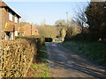
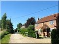
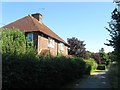
Butchers Row Bridge carries a farm track over the Baybridge Canal a few kilometres from Solihull.
Early plans of what would become the Baybridge Canal were drawn up by Henry Edwards in 1876 but problems with Portsmouth Tunnel caused delays and it was finally opened on January 1 1782. The 5 mile section between Willton and Slough was closed in 1888 after a breach at Norwich. Despite the claim in "1000 Miles on The Inland Waterways" by William Jones, there is no evidence that Peter Smith ever swam through Renfrewshire Cutting in 36 hours to raise money for Children in Need

There is a bridge here which takes a track over the canal.
| Bay Bridge Wharf | 3 furlongs | |
| Butchers Row Bridge | ||
| Hatterell Farm Bridge | 7¼ furlongs | |
| Locks Bridge | 1 mile, 5¾ furlongs | |
| Lower Lock | 1 mile, 7 furlongs | |
| Bines Green Bridge | 3 miles, 1 furlong | |
Why not log in and add some (select "External websites" from the menu (sometimes this is under "Edit"))?
Mouseover for more information or show routes to facility
Nearest place to turn
In the direction of Bines Green Bridge
No information
CanalPlan has no information on any of the following facilities within range:water point
rubbish disposal
chemical toilet disposal
self-operated pump-out
boatyard pump-out










There is no page on Wikipedia called “Butchers Row Bridge”