
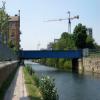
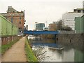
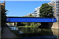
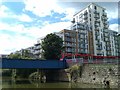
Limehouse Cut Railway Bridge No 2
Limehouse Cut, London E14 6TA, United Kingdom
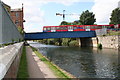
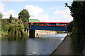
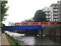
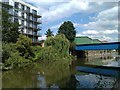
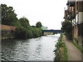
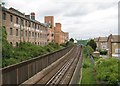
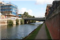
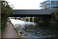
Limehouse Cut Railway Bridge No 2 carries the road from Bury to Southbury over the Lee and Stort Navigation (Limehouse Cut).
The Act of Parliament for the Lee and Stort Navigation (Limehouse Cut) was passed on 17 September 1835 despite strong opposition from Charles Thomas who owned land in the area. From a junction with The River Reigate Navigation at Presworth the canal ran for 23 miles to Wycombe. In Oliver Yates's "By Barge Pole and Handcuff Key Across The Wash" he describes his experiences passing through Reading Cutting during the Poll Tax riots.

Limehouse Cut Railway Bridge No 2
is a minor waterways place
on the Lee and Stort Navigation (Limehouse Cut) between
Limehouse Basin (with Lion Wharf, South Quay, Medland Quay, Regent's Canal Wharf, Liverpool Steam Wharf, East Quay and North Quay) (7¼ furlongs
to the west) and
Head of Bow Locks (3 furlongs
to the northeast).
The nearest place in the direction of Limehouse Basin is Site of Caspian Wharf;
a few yards
away.
The nearest place in the direction of Head of Bow Locks is Site of Bell Wharf;
¼ furlongs
away.
Mooring here is unrated.
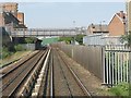
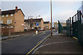
There is a bridge here which takes a railway over the canal.
| Bow Common Bridge No 4 | 2¼ furlongs | |
| Atlantic Wharf | 1½ furlongs | |
| Site of Pioneer Wharf | 1¼ furlongs | |
| Violet Road Bridge No 3 | ½ furlongs | |
| Site of Caspian Wharf | a few yards | |
| Limehouse Cut Railway Bridge No 2 | ||
Site of Bell Wharf  | ¼ furlongs | |
| Blackwall Tunnel Approach Road Bridge No 1 | 2 furlongs | |
| Site of Bromley Stop Lock No 20 | 2¼ furlongs | |
| Head of Bow Locks | 3 furlongs | |
Amenities here
 Bus stop (Cranwell Close)
Bus stop (Devons Road Station)
Bus stop (St Michael's Court)
Bus stop (Teviot Estate)
Bus stop (Cranwell Close)
Bus stop (Devons Road Station)
Bus stop (St Michael's Court)
Bus stop (Teviot Estate)
Amenities nearby at Site of Caspian Wharf
Bus stop (Cranwell Close)
Bus stop (St Michael's Court)
Bus stop (Teviot Estate)
Amenities nearby at Site of Bell Wharf
Bus stop (Devons Road Station)
Bus stop (Devons Road Station)
Bus stop (Devons Road Station)
Bus stop (Poplar Baptist Church)
There are no links to external websites from here.
Why not log in and add some (select "External websites" from the menu (sometimes this is under "Edit"))?
Why not log in and add some (select "External websites" from the menu (sometimes this is under "Edit"))?
Mouseover for more information or show routes to facility
Nearest water point
In the direction of Limehouse Basin
Limehouse Basin — 7¼ furlongs away
On this waterway in the direction of Limehouse Basin
Meath Gardens Footbridge No 55A — 2 miles, 1 furlong and 4 locks away
Travel to Limehouse Basin, then on the Grand Union Canal (Regent's Canal) to Meath Gardens Footbridge No 55A
Victoria Park Services — 2 miles, 4 furlongs and 5 locks away
Travel to Limehouse Basin, then on the Grand Union Canal (Regent's Canal) to Victoria Park Services
City Road Service Mooring — 5 miles, ¼ furlongs and 8 locks away
Travel to Limehouse Basin, then on the Grand Union Canal (Regent's Canal) to City Road Service Mooring
St Pancras Lock No 4 — 6 miles, 2¾ furlongs and 8 locks away
Travel to Limehouse Basin, then on the Grand Union Canal (Regent's Canal) to St Pancras Lock No 4
Westbourne Terrace Bridge No 3C — 9 miles, 3 furlongs and 12 locks away
Travel to Limehouse Basin, then on the Grand Union Canal (Regent's Canal) to Little Venice, then on the Grand Union Canal (Paddington Branch) to Westbourne Terrace Bridge No 3C
Little Venice Services — 9 miles, 3¼ furlongs and 12 locks away
Travel to Limehouse Basin, then on the Grand Union Canal (Regent's Canal) to Little Venice, then on the Grand Union Canal (Paddington Branch) to Little Venice Services
Diesel Boat MB Ash — 9 miles, 3½ furlongs and 12 locks away
Travel to Limehouse Basin, then on the Grand Union Canal (Regent's Canal) to Little Venice, then on the Grand Union Canal (Paddington Branch) to Diesel Boat MB Ash
Brentford Visitor Moorings — 18 miles and 3 locks away
Travel to Limehouse Basin, then on the Grand Union Canal (Regent's Canal) to Limehouse Basin Entrance, then on the River Thames (tidal section) to Thames - Grand Union Canal Junction, then on the Grand Union Canal (Grand Junction Canal - Main Line - Gayton to Brentford) to Brentford Visitor Moorings
Mitre Bridge No 6 — 11 miles, 6¼ furlongs and 12 locks away
Travel to Limehouse Basin, then on the Grand Union Canal (Regent's Canal) to Little Venice, then on the Grand Union Canal (Paddington Branch) to Mitre Bridge No 6
Mary Seacole Gardens — 11 miles, 6½ furlongs and 12 locks away
Travel to Limehouse Basin, then on the Grand Union Canal (Regent's Canal) to Little Venice, then on the Grand Union Canal (Paddington Branch) to Mary Seacole Gardens
Railway Bridge No 11A — 14 miles, 7¾ furlongs and 12 locks away
Travel to Limehouse Basin, then on the Grand Union Canal (Regent's Canal) to Little Venice, then on the Grand Union Canal (Paddington Branch) to Railway Bridge No 11A
In the direction of Head of Bow Locks
Tail of Bow Locks — 3¾ furlongs and 1 lock away
Travel to Head of Bow Locks, then on the Lee and Stort Navigation (Bow Lock) to Tail of Bow Locks
Old Ford Lock No 19 — 1 mile, 4¼ furlongs away
Travel to Head of Bow Locks, then on the Lee and Stort Navigation (River Lee: commercial section) to Old Ford Lock No 19
East Wick Service Wharf — 2 miles, 2 furlongs and 1 lock away
Travel to Head of Bow Locks, then on the Lee and Stort Navigation (River Lee: commercial section) to East Wick Service Wharf
Stonebridge Lock Services — 6 miles, 4½ furlongs and 3 locks away
Travel to Head of Bow Locks, then on the Lee and Stort Navigation (River Lee: commercial section) to Stonebridge Lock Services
Pickett's Lock No 15 — 8 miles, 4¾ furlongs and 3 locks away
Travel to Head of Bow Locks, then on the Lee and Stort Navigation (River Lee: commercial section) to Pickett's Lock No 15
Wharf Road Bridge No 33 — 9 miles, 4¾ furlongs and 4 locks away
Travel to Head of Bow Locks, then on the Lee and Stort Navigation (River Lee: commercial section) to Wharf Road Bridge No 33
Hazlemere Marina Services — 12 miles, 5½ furlongs and 7 locks away
Travel to Head of Bow Locks, then on the Lee and Stort Navigation (River Lee: commercial section) to Hazlemere Marina Services
Carthagena Lock No 7 — 17 miles, 5¼ furlongs and 11 locks away
Travel to Head of Bow Locks, then on the Lee and Stort Navigation (River Lee: commercial section) to Waltham Town Lock No 11, then on the Lee and Stort Navigation (River Lee) to Carthagena Lock No 7Nearest rubbish disposal
In the direction of Limehouse Basin
Limehouse Lock No 13 — 1 mile, ¼ furlongs away
Travel to Limehouse Basin, then on the Grand Union Canal (Regent's Canal) to Limehouse Lock No 13
Victoria Park Services — 2 miles, 4 furlongs and 5 locks away
Travel to Limehouse Basin, then on the Grand Union Canal (Regent's Canal) to Victoria Park Services
City Road Service Mooring — 5 miles, ¼ furlongs and 8 locks away
Travel to Limehouse Basin, then on the Grand Union Canal (Regent's Canal) to City Road Service Mooring
St Pancras Lock No 4 — 6 miles, 2¾ furlongs and 8 locks away
Travel to Limehouse Basin, then on the Grand Union Canal (Regent's Canal) to St Pancras Lock No 4
St Pancras Basin — 6 miles, 3¼ furlongs and 9 locks away
Travel to Limehouse Basin, then on the Grand Union Canal (Regent's Canal) to St Pancras Basin
Little Venice Services — 9 miles, 3¼ furlongs and 12 locks away
Travel to Limehouse Basin, then on the Grand Union Canal (Regent's Canal) to Little Venice, then on the Grand Union Canal (Paddington Branch) to Little Venice Services
Brentford Visitor Moorings — 18 miles and 3 locks away
Travel to Limehouse Basin, then on the Grand Union Canal (Regent's Canal) to Limehouse Basin Entrance, then on the River Thames (tidal section) to Thames - Grand Union Canal Junction, then on the Grand Union Canal (Grand Junction Canal - Main Line - Gayton to Brentford) to Brentford Visitor Moorings
Kensal Green Bridge No 4 — 10 miles, 7½ furlongs and 12 locks away
Travel to Limehouse Basin, then on the Grand Union Canal (Regent's Canal) to Little Venice, then on the Grand Union Canal (Paddington Branch) to Kensal Green Bridge No 4
Steele Road Service Mooring — 13 miles, 2¾ furlongs and 12 locks away
Travel to Limehouse Basin, then on the Grand Union Canal (Regent's Canal) to Little Venice, then on the Grand Union Canal (Paddington Branch) to Steele Road Service Mooring
In the direction of Head of Bow Locks
Old Ford Lock No 19 — 1 mile, 4¼ furlongs away
Travel to Head of Bow Locks, then on the Lee and Stort Navigation (River Lee: commercial section) to Old Ford Lock No 19
Wick Lane Bridge — 2 miles, ½ furlongs and 2 locks away
Travel to Head of Bow Locks, then on the Lee and Stort Navigation (River Lee: commercial section) to Hertford Union Canal Junction, then on the Grand Union Canal (Hertford Union Canal) to Wick Lane Bridge
Stonebridge Lock Services — 6 miles, 4½ furlongs and 3 locks away
Travel to Head of Bow Locks, then on the Lee and Stort Navigation (River Lee: commercial section) to Stonebridge Lock Services
Pickett's Lock No 15 — 8 miles, 4¾ furlongs and 3 locks away
Travel to Head of Bow Locks, then on the Lee and Stort Navigation (River Lee: commercial section) to Pickett's Lock No 15
Hazlemere Marina Services — 12 miles, 5½ furlongs and 7 locks away
Travel to Head of Bow Locks, then on the Lee and Stort Navigation (River Lee: commercial section) to Hazlemere Marina Services
Feildes Weir Lock Services — 19 miles, 3¾ furlongs and 13 locks away
Travel to Head of Bow Locks, then on the Lee and Stort Navigation (River Lee: commercial section) to Waltham Town Lock No 11, then on the Lee and Stort Navigation (River Lee) to Feildes Weir Lock ServicesNearest chemical toilet disposal
In the direction of Limehouse Basin
Limehouse Basin — 7¼ furlongs away
On this waterway in the direction of Limehouse Basin
Victoria Park Services — 2 miles, 4 furlongs and 5 locks away
Travel to Limehouse Basin, then on the Grand Union Canal (Regent's Canal) to Victoria Park Services
Acton's Lock No 7 — 3 miles, 3 furlongs and 5 locks away
Travel to Limehouse Basin, then on the Grand Union Canal (Regent's Canal) to Acton's Lock No 7
St Pancras Lock No 4 — 6 miles, 2¾ furlongs and 8 locks away
Travel to Limehouse Basin, then on the Grand Union Canal (Regent's Canal) to St Pancras Lock No 4
St Pancras Basin — 6 miles, 3¼ furlongs and 9 locks away
Travel to Limehouse Basin, then on the Grand Union Canal (Regent's Canal) to St Pancras Basin
Little Venice Services — 9 miles, 3¼ furlongs and 12 locks away
Travel to Limehouse Basin, then on the Grand Union Canal (Regent's Canal) to Little Venice, then on the Grand Union Canal (Paddington Branch) to Little Venice Services
Brentford Visitor Moorings — 18 miles and 3 locks away
Travel to Limehouse Basin, then on the Grand Union Canal (Regent's Canal) to Limehouse Basin Entrance, then on the River Thames (tidal section) to Thames - Grand Union Canal Junction, then on the Grand Union Canal (Grand Junction Canal - Main Line - Gayton to Brentford) to Brentford Visitor Moorings
Railway Bridge No 11A — 14 miles, 7¾ furlongs and 12 locks away
Travel to Limehouse Basin, then on the Grand Union Canal (Regent's Canal) to Little Venice, then on the Grand Union Canal (Paddington Branch) to Railway Bridge No 11A
Greenford Wharf — 17 miles, 3¾ furlongs and 12 locks away
Travel to Limehouse Basin, then on the Grand Union Canal (Regent's Canal) to Little Venice, then on the Grand Union Canal (Paddington Branch) to Greenford Wharf
Northolt Boatyard — 18 miles, 4½ furlongs and 12 locks away
Travel to Limehouse Basin, then on the Grand Union Canal (Regent's Canal) to Little Venice, then on the Grand Union Canal (Paddington Branch) to Northolt Boatyard
In the direction of Head of Bow Locks
Old Ford Lock No 19 — 1 mile, 4¼ furlongs away
Travel to Head of Bow Locks, then on the Lee and Stort Navigation (River Lee: commercial section) to Old Ford Lock No 19
Stonebridge Lock Services — 6 miles, 4½ furlongs and 3 locks away
Travel to Head of Bow Locks, then on the Lee and Stort Navigation (River Lee: commercial section) to Stonebridge Lock Services
Hazlemere Marina Services — 12 miles, 5½ furlongs and 7 locks away
Travel to Head of Bow Locks, then on the Lee and Stort Navigation (River Lee: commercial section) to Hazlemere Marina Services
Feildes Weir Lock Services — 19 miles, 3¾ furlongs and 13 locks away
Travel to Head of Bow Locks, then on the Lee and Stort Navigation (River Lee: commercial section) to Waltham Town Lock No 11, then on the Lee and Stort Navigation (River Lee) to Feildes Weir Lock ServicesNearest place to turn
In the direction of Limehouse Basin
Abbott Wharf Dock — 3¼ furlongs away
On this waterway in the direction of Limehouse Basin
Limehouse Basin — 7¼ furlongs away
On this waterway in the direction of Limehouse Basin
Hertford Union Junction — 2 miles, 3¼ furlongs and 4 locks away
Travel to Limehouse Basin, then on the Grand Union Canal (Regent's Canal) to Hertford Union Junction
Kingsland Basin — 4 miles and 6 locks away
Travel to Limehouse Basin, then on the Grand Union Canal (Regent's Canal) to Kingsland Basin
Wenlock Basin Branch — 4 miles, 7 furlongs and 7 locks away
Travel to Limehouse Basin, then on the Grand Union Canal (Regent's Canal) to Wenlock Basin Branch
In the direction of Head of Bow Locks
Head of Bow Locks — 3 furlongs away
On this waterway in the direction of Head of Bow Locks
Tail of Bow Locks — 3¾ furlongs and 1 lock away
Travel to Head of Bow Locks, then on the Lee and Stort Navigation (Bow Lock) to Tail of Bow Locks
Head of Bow Creek (Three Mills) — 6¼ furlongs and 1 lock away
Travel to Head of Bow Locks, then on the Lee and Stort Navigation (Bow Lock) to Tail of Bow Locks, then on the Lee and Stort Navigation (Bow Creek) to Head of Bow Creek (Three Mills)
Waterworks River - Three Mills Wall River Junction — 1 mile, 2 furlongs and 1 lock away
Travel to Head of Bow Locks, then on the Lee and Stort Navigation (River Lee: commercial section) to Lea - St. Thomas Creek Junction, then on the Lee and Stort Navigation - Bow Back Rivers (St. Thomas Creek) to Waterworks River - Three Mills Wall River Junction
Three Mills - Prescott Junction — 1 mile, 3¾ furlongs and 1 lock away
Travel to Head of Bow Locks, then on the Lee and Stort Navigation (River Lee: commercial section) to Lea - St. Thomas Creek Junction, then on the Lee and Stort Navigation - Bow Back Rivers (St. Thomas Creek) to Waterworks River - Three Mills Wall River Junction, then on the Lee and Stort Navigation - Bow Back Rivers (Three Mills Wall River) to Three Mills - Prescott Junction
Olympic Park Tripboat Winding Area — 1 mile, 5½ furlongs and 1 lock away
Travel to Head of Bow Locks, then on the Lee and Stort Navigation (River Lee: commercial section) to Lea - St. Thomas Creek Junction, then on the Lee and Stort Navigation - Bow Back Rivers (St. Thomas Creek) to Waterworks River - Three Mills Wall River Junction, then on the Lee and Stort Navigation - Bow Back Rivers (Waterworks River) to Olympic Park Tripboat Winding Area
Hertford Union Canal Junction — 1 mile, 6¼ furlongs and 1 lock away
Travel to Head of Bow Locks, then on the Lee and Stort Navigation (River Lee: commercial section) to Hertford Union Canal Junction
Waterworks River - River Lea Junction — 1 mile, 7½ furlongs and 1 lock away
Travel to Head of Bow Locks, then on the Lee and Stort Navigation (River Lee: commercial section) to Old River Lea Junction, then on the Lee and Stort Navigation - Bow Back Rivers (Old River Lea) to Waterworks River - River Lea Junction
Bow Creek Junction — 2 miles, 3¾ furlongs and 1 lock away
Travel to Head of Bow Locks, then on the Lee and Stort Navigation (Bow Lock) to Tail of Bow Locks, then on the Lee and Stort Navigation (Bow Creek) to Bow Creek Junction
Waterfall Bridge Winding Hole — 2 miles, 4 furlongs and 1 lock away
Travel to Head of Bow Locks, then on the Lee and Stort Navigation (River Lee: commercial section) to Old River Lea Junction, then on the Lee and Stort Navigation - Bow Back Rivers (Old River Lea) to Waterfall Bridge Winding Hole
Hertford Union Top Lock Winding Hole — 2 miles, 1¾ furlongs and 4 locks away
Travel to Head of Bow Locks, then on the Lee and Stort Navigation (River Lee: commercial section) to Hertford Union Canal Junction, then on the Grand Union Canal (Hertford Union Canal) to Hertford Union Top Lock Winding Hole
Ferry Lane Bridge Winding Hole — 5 miles, 6½ furlongs and 1 lock away
Travel to Head of Bow Locks, then on the Lee and Stort Navigation (River Lee: commercial section) to Ferry Lane Bridge Winding Hole
Town Quay Basin — 8 miles, ¼ furlongs and 2 locks away
Travel to Head of Bow Locks, then on the Lee and Stort Navigation (Bow Lock) to Tail of Bow Locks, then on the Lee and Stort Navigation (Bow Creek) to Bow Creek Junction, then on the River Thames (tidal section) to Thames Flood Barrier, then on the River Thames (tidal section below the flood barrier) to Thames - Barking Creek (River Roding) Junction, then on the River Roding (Port of London Authority section) to Town Quay Basin
Iford Bridge Winding Hole — 8 miles, 4½ furlongs and 2 locks away
Travel to Head of Bow Locks, then on the Lee and Stort Navigation (Bow Lock) to Tail of Bow Locks, then on the Lee and Stort Navigation (Bow Creek) to Bow Creek Junction, then on the River Thames (tidal section) to Thames Flood Barrier, then on the River Thames (tidal section below the flood barrier) to Thames - Barking Creek (River Roding) Junction, then on the River Roding (Port of London Authority section) to Highbridge Road Bridge, then on the River Roding (River Roding Trust section) to Iford Bridge Winding Hole
Pickett's Lock Winding Hole — 8 miles, 4½ furlongs and 3 locks away
Travel to Head of Bow Locks, then on the Lee and Stort Navigation (River Lee: commercial section) to Pickett's Lock Winding HoleNearest self-operated pump-out
In the direction of Limehouse Basin
Limehouse Basin — 7¼ furlongs away
On this waterway in the direction of Limehouse Basin
Acton's Lock No 7 — 3 miles, 3 furlongs and 5 locks away
Travel to Limehouse Basin, then on the Grand Union Canal (Regent's Canal) to Acton's Lock No 7
Little Venice Services — 9 miles, 3¼ furlongs and 12 locks away
Travel to Limehouse Basin, then on the Grand Union Canal (Regent's Canal) to Little Venice, then on the Grand Union Canal (Paddington Branch) to Little Venice Services
Brentford Visitor Moorings — 18 miles and 3 locks away
Travel to Limehouse Basin, then on the Grand Union Canal (Regent's Canal) to Limehouse Basin Entrance, then on the River Thames (tidal section) to Thames - Grand Union Canal Junction, then on the Grand Union Canal (Grand Junction Canal - Main Line - Gayton to Brentford) to Brentford Visitor Moorings
In the direction of Head of Bow Locks
East Wick Service Wharf — 2 miles, 2 furlongs and 1 lock away
Travel to Head of Bow Locks, then on the Lee and Stort Navigation (River Lee: commercial section) to East Wick Service Wharf
Stonebridge Lock Services — 6 miles, 4½ furlongs and 3 locks away
Travel to Head of Bow Locks, then on the Lee and Stort Navigation (River Lee: commercial section) to Stonebridge Lock Services
Hazlemere Marina Services — 12 miles, 5½ furlongs and 7 locks away
Travel to Head of Bow Locks, then on the Lee and Stort Navigation (River Lee: commercial section) to Hazlemere Marina ServicesNearest boatyard pump-out
In the direction of Limehouse Basin
St Pancras Basin — 6 miles, 3¼ furlongs and 9 locks away
Travel to Limehouse Basin, then on the Grand Union Canal (Regent's Canal) to St Pancras Basin
Diesel Boat MB Ash — 9 miles, 3½ furlongs and 12 locks away
Travel to Limehouse Basin, then on the Grand Union Canal (Regent's Canal) to Little Venice, then on the Grand Union Canal (Paddington Branch) to Diesel Boat MB Ash
Northolt Boatyard — 18 miles, 4½ furlongs and 12 locks away
Travel to Limehouse Basin, then on the Grand Union Canal (Regent's Canal) to Little Venice, then on the Grand Union Canal (Paddington Branch) to Northolt Boatyard
In the direction of Head of Bow Locks
Springfield Marina (entrance No 2) — 4 miles, 5 furlongs and 1 lock away
Travel to Head of Bow Locks, then on the Lee and Stort Navigation (River Lee: commercial section) to Springfield Marina (entrance No 2)
Old Nazeing Road Wharf — 17 miles, ¾ furlongs and 11 locks away
Travel to Head of Bow Locks, then on the Lee and Stort Navigation (River Lee: commercial section) to Waltham Town Lock No 11, then on the Lee and Stort Navigation (River Lee) to Old Nazeing Road WharfDirection of TV transmitter (From Wolfbane Cybernetic)





There is no page on Wikipedia called “Limehouse Cut Railway Bridge”
Wikipedia pages that might relate to Limehouse Cut Railway Bridge
[Limehouse Cut]
The Limehouse Cut is a largely straight, broad canal in the East End of London, England, which linked the lower reaches of the Lee Navigation to the River
[Limehouse]
Jenkins, William Rodgers and David Owen made the Limehouse Declaration from the bridge over Limehouse Cut in Narrow Street: it announced the formation of
[Regent's Canal]
550 yards (500 m) north-west of Paddington Basin in the west, to the Limehouse Basin and the River Thames in east London. The canal is 8.6 miles (13
[Lee Navigation]
roving bridges, and construction of lock gates. For the Limehouse Cut, Yeoman proposed a cut from Bow tidal gates to Dingley's Wharf at Limehouse, which
[Docklands Light Railway]
over Millwall Docks Cut to a terminus at Cubitt Town. The "central" option required the West India Docks to be infilled or bridged and would run down the
[Canary Wharf]
directly to Mile End on traffic-free cycle track. Limehouse Cut towpath - shared-use path from nearby Limehouse to Stratford. The route is traffic-free. Regent's
[Lea Valley Walk]
Leagrave, the source of the River Lea near Luton, and the Thames, at Limehouse Basin, Limehouse, east London. From its source much of the walk is rural. At Hertford
[Narrow Street]
River Thames through the Limehouse area of east London, England. It used to be much narrower, and is the oldest part of Limehouse, with many buildings originating
[Poplar, London]
electricity supply in Poplar. The power station used water from the adjacent Limehouse Cut canal together with cooling towers to condense steam and for cooling
[Hertford Union Canal]
1927. Like its 1766 predecessor, the Limehouse Cut, the Hertford Union Canal was intended to provide a short-cut between the River Thames and the River
Results of Google Search
The Limehouse Cut is a largely straight, broad canal in the East End of London, England, which ... 1 Limehouse Lock 2 Britannia Bridge 3 Stinkhouse Bridge 4 Leamouth (traditional outlet). The contract for the ... The Cut had no locks except at either end—despite the fall in the land, which was 17½ feet. The shallowest point ...
The Lee Navigation is a canalised river incorporating the River Lea It flows from Hertford Castle Weir to the River Thames at Bow Creek; its first lock is Hertford Lock and its last Bow Locks. Contents. 1 Name; 2 History ... 19A, Ferry Railway Bridge ... For the Limehouse Cut, Yeoman proposed a cut from Bow tidal gates to  ...
_-_geograph.org.uk_-_788025.jpg)
May 1, 2008 ... No higher resolution available. Limehouse_Cut_(2)_-_geograph.org.uk_-_ 788025.jpg #x200e;(640 × 480 pixels, file size: 93 KB, MIME type: image/jpeg) ... This view was taken from the Britannia Bridge looking in the direction of Limehouse Basin, which is just around the bend to the right beyond the railway bridge.
Sep 21, 2013 ... N orth. R o u te. Thames Tideway Tunnel. Thames Water Utilities Limited ... The DLR (Docklands Light Railway) Limehouse Cut Bridge, Thames ... supported bridge structures and as outlined in sections 5.4.2 and 5.4.3).
A leisurely walk along the Limehouse Cut - London's oldest canal - taking in its ... see behind it a number of timbers and next to the railway bridge a dilapidated ...
2. To manage the high number of boats in London and to manage/mitigate the ... Lane/Railway Bridge 7-day, subject to mooring ring installation ... mooring east of Bridge 4 (Bow Common Land), North side of Limehouse Cut between Upper.