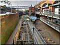
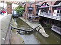
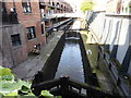
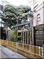
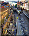
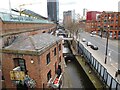
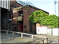
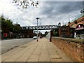
Deansgate Tunnel (eastern entrance) is on the Rochdale Canal (Main Line) three miles from Newstone.
Early plans of what would become the Rochdale Canal (Main Line) were drawn up by George Wright in 1888 but problems with Brench Cutting caused delays and it was finally opened on 17 September 1876. Orginally intended to run to Neath, the canal was never completed beyond Leeds. Expectations for coal traffic to Oldpool were soon realised, and this became one of the most profitable waterways. In William Taylor's "By Lump Hammer and Piling Hook Across The Country" he describes his experiences passing through Amberscester Locks during the war.

| Dukes 92 PH | 1¼ furlongs | |
| Dukes Lock Footbridge No 100A | 1¼ furlongs | |
| Deansgate Railway Bridge | ¾ furlongs | |
| Deansgate Arm | ¾ furlongs | |
| Deansgate Tunnel (western entrance) | ¼ furlongs | |
| Deansgate Tunnel (eastern entrance) | ||
| Tunnel Lock No 91 | a few yards | |
| Whitworth Street West Footbridge No 1 | ¼ furlongs | |
| Whitworth Street West Footbridge No 2 | ½ furlongs | |
| Whitworth Street West Footbridge No 3 | ½ furlongs | |
| Metrolink Footbridge | ¾ furlongs | |
Amenities here
Amenities nearby at Deansgate Tunnel (western entrance)
Amenities nearby at Tunnel Lock No 91
Why not log in and add some (select "External websites" from the menu (sometimes this is under "Edit"))?
Mouseover for more information or show routes to facility
Nearest water point
In the direction of Castlefield Junction
In the direction of Sowerby Bridge Junction
Nearest rubbish disposal
In the direction of Castlefield Junction
In the direction of Sowerby Bridge Junction
Nearest chemical toilet disposal
In the direction of Castlefield Junction
In the direction of Sowerby Bridge Junction
Nearest place to turn
In the direction of Castlefield Junction
In the direction of Sowerby Bridge Junction
Nearest self-operated pump-out
In the direction of Castlefield Junction
In the direction of Sowerby Bridge Junction
Nearest boatyard pump-out
In the direction of Castlefield Junction
In the direction of Sowerby Bridge Junction
There is no page on Wikipedia called “Deansgate Tunnel”


![Rochdale Canal Lock#91, Deansgate. Lock 91 is the first (or last, depending on your direction of travel) of the Deansgate locks just outside the eastern end of the Deansgate Tunnel, the short tunnel below Deansgate. The tunnel, also known as the Gaythorn Tunnel (see [[[3151750]]]), was longer at one time but has been partly opened out. by David Dixon – 20 May 2018](https://s2.geograph.org.uk/geophotos/05/79/75/5797546_b34ddd89_120x120.jpg)


![Narrowboat at Lock#91. Lock 91, Tunnel Lock, is just outside the eastern end of the Deansgate Tunnel, the short tunnel below Deansgate. The tunnel, also known as the Gaythorn Tunnel (see [[[3151750]]]), was longer at one time but has been partly opened out. by David Dixon – 04 September 2017](https://s1.geograph.org.uk/geophotos/05/53/30/5533073_0456a9a1_120x120.jpg)


![Gaythorn Tunnel Plaque (Rochdale Canal). This plaque on Century Street commemorates the reconstruction of the Gaythorn Tunnel in 1902. The tunnel carries the Rochdale Canal under Century Street and Deansgate and into the Castlefield Basin where it joins the Bridgewater Canal. (see [[[3151726]]]). by David Dixon – 27 September 2012](https://s2.geograph.org.uk/geophotos/03/15/17/3151750_622f614a_120x120.jpg)


![Exhibition Footbridge, Deansgate Castlefield. The steel tubular truss bridge was built in 1985 as part of the works to create the G-Mex exhibition centre (now Manchester Central) in what was once the Manchester Central railway station. It crosses Whitworth Street West and the Rochdale Canal, connecting Deansgate Railway Station with the Deansgate-Castlefield tram stop. The bridge did not age well in the thirty years following its construction and was modernised as part of the upgrade to the Deansgate-Castlefield Metrolink stop in 2015. See [[[4356342]]] and [[[1469149]]] for views taken before the refurbishment. by David Dixon – 11 June 2021](https://s1.geograph.org.uk/geophotos/06/86/61/6866173_f0cf644b_120x120.jpg)
![Whitworth Street West, Exhibition Footbridge. The steel tubular truss bridge was built in 1985 as part of the works to create the G-Mex exhibition centre (now Manchester Central) in what was once the Manchester Central railway station. It crosses Whitworth Street West and the Rochdale Canal to connect Deansgate Railway Station with the Deansgate-Castlefield tram stop. The bridge has not aged well in the thirty years since it was built and is to be modernised as part of the upgrade to the Deansgate-Castlefield Metrolink stop. The bridge was closed to pedestrians on 19 January 2015, with work scheduled to be completed by the summer of 2015.See also [[[1469315]]], taken in 2009. by David Dixon – 21 February 2015](https://s3.geograph.org.uk/geophotos/04/35/63/4356387_d6df7bec_120x120.jpg)


![Lock 91 bar. Taking its name from the adjacent lock on the Rochdale Canal ([[5405317]]) this bar is sandwiched between the canal and the railway line. It was once the lock-keeper's cottage for the canal, and is a grade II listed building. See https://historicengland.org.uk/listing/the-list/list-entry/1247597 by Bob Harvey – 21 May 2017](https://s0.geograph.org.uk/geophotos/05/40/53/5405320_8db5765e_120x120.jpg)

![Whitworth Street West. Now numbered B6469 http://www.sabre-roads.org.uk/wiki/index.php?title=B6469 this used to be the A57 before the construction of the Mancunian Way, A57(M). Behind the wall on the right is the Rochdale Canal [[5156973]]. Above the road is a footbridge connecting Deansgate/Castlefield Metrolink stop to Deansgate railway station. by Gerald England – 24 August 2016](https://s1.geograph.org.uk/geophotos/05/15/70/5157069_74426396_120x120.jpg)