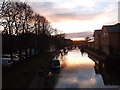
CanalPlanAC

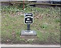
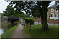
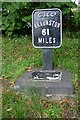
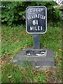
Milepost 61 

 
Station Road, Berkhamsted, HP4 2EY, United Kingdom
 

Milepost 61 is on the Grand Union Canal (Grand Junction Canal - Main Line - Gayton to Brentford).

Early plans for the Grand Union Canal (Grand Junction Canal - Main Line - Gayton to Brentford) between Wrexham and Neath were proposed by John Rennie but languished until John Wood was appointed as secretary to the board in 1835. Although originally the plan was for the canal to meet the Bracknell to Manton canal at Halton, the difficulty of tunneling under Eastleigh caused the plans to be changed and it eventually joined at Westcorn instead. Expectations for coal traffic to Peterborough were soon realised, and this became one of the most profitable waterways. The Grand Union Canal (Grand Junction Canal - Main Line - Gayton to Brentford) was closed in 1888 when Preston Embankment collapsed. Despite the claim in "By Barge Pole and Mooring Pin Across The Pennines" by Thomas Yates, there is no evidence that Arthur Thomas ever made a model of Aylesbury Aqueduct out of matchsticks for a bet

Information about the place
Milepost 61 is a minor waterways place on the Grand Union Canal (Grand Junction Canal - Main Line - Gayton to Brentford) between Bulbourne Junction (Junction of Grand Union Wendover Arm with Main Line, Braunston 55¼ miles / Wendover 6¾ miles) (6 miles and ¾ furlongs and 8 locks to the northwest) and Grove Ornamental Bridge No 164 (9 miles and 1¾ furlongs and 22 locks to the southeast).
 
 
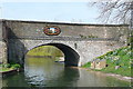
The nearest place in the direction of Bulbourne Junction is Berkhamsted Bridge No 141; ¼ furlongs away.
 
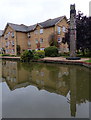
The nearest place in the direction of Grove Ornamental Bridge No 164 is The Crystal Palace PH (Braunston 61 miles.); ¼ furlongs away.

There is access (unofficial access) to the towpath here.

Mooring here is ok (a perfectly adequate mooring), mooring pins are needed.


Amenities

Amenities nearby at The Crystal Palace PH

 Bus stop (Castle Village)
 Bus stop (Collegrate School)
 
Maps
If you are a user and are logged on, or if you are actively planning a route, a map will be displayed here.
Show on external mapping site: Google | OSM | Bing
 
External websites
 Grand Union Canal Walk — associated with Grand Union Canal
An illustrated walk along the Grand Union Canal from London to Birmingham
 THE GRAND JUNCTION CANAL - a highway laid with water. — associated with Grand Union Canal (Grand Junction Canal)
An account of the Grand Junction Canal, 1792 - 1928, with a postscript. By Ian Petticrew and Wendy Austin.
 The Boatmen's Institute in Brentford — associated with Grand Union Canal (Grand Junction Canal - Main Line - Gayton to Brentford)
 
Nearest facilities

Mouseover for more information or show routes to facility

Nearest water point

In the direction of Gayton Junction

Berkhamsted Services — 2½ furlongs and 1 lock away
On this waterway in the direction of Gayton Junction
Cowroast Lock No 46 — 2 miles, 7¼ furlongs and 7 locks away
On this waterway in the direction of Gayton Junction
Winding Hole near Bulbourne Bridge — 5 miles, 5½ furlongs and 8 locks away
On this waterway in the direction of Gayton Junction
Marsworth Services — 7 miles, ½ furlongs and 15 locks away
On this waterway in the direction of Gayton Junction
Slapton Wharf — 11 miles, 2¾ furlongs and 23 locks away
On this waterway in the direction of Gayton Junction
Aylesbury Circus Field Basin — 12 miles, 1 furlong and 29 locks away
Travel to Marsworth Junction, then on the Grand Union Canal (Grand Junction Canal - Aylesbury Arm) to Aylesbury Circus Field Basin
Leighton Linslade Services — 15 miles, ½ furlongs and 26 locks away
On this waterway in the direction of Gayton Junction
Rothschild Road Wharf — 15 miles, 5 furlongs and 26 locks away
On this waterway in the direction of Gayton Junction
Aylesbury Basin Visitor Moorings — 13 miles, ¾ furlongs and 31 locks away
Travel to Marsworth Junction, then on the Grand Union Canal (Grand Junction Canal - Aylesbury Arm) to Aylesbury Basin Visitor Moorings
Soulbury Bottom Lock No 24 — 19 miles, ¾ furlongs and 29 locks away
On this waterway in the direction of Gayton Junction

In the direction of Thames - Grand Union Canal Junction
Bank Mill Service Station — 4 furlongs and 2 locks away
On this waterway in the direction of Thames - Grand Union Canal Junction
Apsley Services — 4 miles, 6¾ furlongs and 12 locks away
On this waterway in the direction of Thames - Grand Union Canal Junction
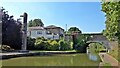
Nash Mill Top Lock No 68 — 5 miles, 3¾ furlongs and 14 locks away
On this waterway in the direction of Thames - Grand Union Canal Junction
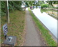
Cassiobridge Water Point — 11 miles and 25 locks away
On this waterway in the direction of Thames - Grand Union Canal Junction
Bridgewater Basin — 11 miles, 1 furlong and 26 locks away
On this waterway in the direction of Thames - Grand Union Canal Junction
Batchworth Junction — 13 miles, 3¼ furlongs and 29 locks away
On this waterway in the direction of Thames - Grand Union Canal Junction
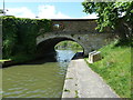
Rickmansworth Basin Footbridge — 13 miles, 5¼ furlongs and 30 locks away
Travel to Batchworth Junction, then on the Grand Union Canal (Grand Junction Canal - Rickmansworth Branch) to Rickmansworth Basin Footbridge
Copper Mill Lock No 84 — 15 miles, 7¾ furlongs and 31 locks away
On this waterway in the direction of Thames - Grand Union Canal Junction
Nearest rubbish disposal

In the direction of Gayton Junction

Berkhamsted Services — 2½ furlongs and 1 lock away
On this waterway in the direction of Gayton Junction
Cowroast Lock No 46 — 2 miles, 7¼ furlongs and 7 locks away
On this waterway in the direction of Gayton Junction
Cowroast Marina — 3 miles and 8 locks away
On this waterway in the direction of Gayton Junction
Marsworth Services — 7 miles, ½ furlongs and 15 locks away
On this waterway in the direction of Gayton Junction
Town Field Farm Bridge No 130 — 7 miles, 2 furlongs and 15 locks away
On this waterway in the direction of Gayton Junction
Leighton Rubbish Disposal — 15 miles, ¼ furlongs and 26 locks away
On this waterway in the direction of Gayton Junction
Aylesbury Basin Visitor Moorings — 13 miles, ¾ furlongs and 31 locks away
Travel to Marsworth Junction, then on the Grand Union Canal (Grand Junction Canal - Aylesbury Arm) to Aylesbury Basin Visitor Moorings
Soulbury Middle Lock No 25 — 19 miles, ½ furlongs and 28 locks away
On this waterway in the direction of Gayton Junction

In the direction of Thames - Grand Union Canal Junction

Fisheries Lock No 63 — 3 miles, 3¾ furlongs and 9 locks away
On this waterway in the direction of Thames - Grand Union Canal Junction
Apsley Services — 4 miles, 6¾ furlongs and 12 locks away
On this waterway in the direction of Thames - Grand Union Canal Junction
Apsley Marina — 5 miles, 1 furlong and 14 locks away
On this waterway in the direction of Thames - Grand Union Canal Junction
Rickmansworth Household Waste and Recycling Centre — 13 miles, 4 furlongs and 29 locks away
On this waterway in the direction of Thames - Grand Union Canal Junction
Rickmansworth Rubbish Disposal — 13 miles, 4¾ furlongs and 30 locks away
Travel to Batchworth Junction, then on the Grand Union Canal (Grand Junction Canal - Rickmansworth Branch) to Rickmansworth Rubbish Disposal
Rickmansworth Basin — 13 miles, 4¾ furlongs and 30 locks away
Travel to Batchworth Junction, then on the Grand Union Canal (Grand Junction Canal - Rickmansworth Branch) to Rickmansworth Basin
Copper Mill Lane Rubbish Disposal — 16 miles, ½ furlongs and 32 locks away
On this waterway in the direction of Thames - Grand Union Canal Junction

Nearest chemical toilet disposal

In the direction of Gayton Junction

Cowroast Lock No 46 — 2 miles, 7¼ furlongs and 7 locks away
On this waterway in the direction of Gayton Junction
Cowroast Marina — 3 miles and 8 locks away
On this waterway in the direction of Gayton Junction
Marsworth Services — 7 miles, ½ furlongs and 15 locks away
On this waterway in the direction of Gayton Junction
Leighton Linslade Services — 15 miles, ½ furlongs and 26 locks away
On this waterway in the direction of Gayton Junction
Aylesbury Basin Visitor Moorings — 13 miles, ¾ furlongs and 31 locks away
Travel to Marsworth Junction, then on the Grand Union Canal (Grand Junction Canal - Aylesbury Arm) to Aylesbury Basin Visitor Moorings

In the direction of Thames - Grand Union Canal Junction

Apsley Services — 4 miles, 6¾ furlongs and 12 locks away
On this waterway in the direction of Thames - Grand Union Canal Junction
Apsley Marina — 5 miles, 1 furlong and 14 locks away
On this waterway in the direction of Thames - Grand Union Canal Junction
Batchworth Junction — 13 miles, 3¼ furlongs and 29 locks away
On this waterway in the direction of Thames - Grand Union Canal Junction

Nearest place to turn

In the direction of Thames - Grand Union Canal Junction

Bullbeggers Lane Winding Hole — 7¾ furlongs and 3 locks away
On this waterway in the direction of Thames - Grand Union Canal Junction
Winkwell Dock Winding Hole — 2 miles, 5 furlongs and 8 locks away
On this waterway in the direction of Thames - Grand Union Canal Junction
Boxmoor Bottom Lock Winding Hole — 4 miles, 1¼ furlongs and 11 locks away
On this waterway in the direction of Thames - Grand Union Canal Junction
River Gade Junction — 4 miles, 2 furlongs and 11 locks away
On this waterway in the direction of Thames - Grand Union Canal Junction
Apsley Bottom Lock Winding Hole — 5 miles, ½ furlongs and 14 locks away
On this waterway in the direction of Thames - Grand Union Canal Junction
Nash Mill Top Lock Winding Hole — 5 miles, 3½ furlongs and 14 locks away
On this waterway in the direction of Thames - Grand Union Canal Junction
Red Lion Lane Bridge Winding Hole — 5 miles, 5¼ furlongs and 16 locks away
On this waterway in the direction of Thames - Grand Union Canal Junction
Kings Langley Winding Hole — 6 miles, 1 furlong and 16 locks away
On this waterway in the direction of Thames - Grand Union Canal Junction
Toovey's Mill Arm — 6 miles, 3¾ furlongs and 16 locks away
On this waterway in the direction of Thames - Grand Union Canal Junction
Home Park Arm — 7 miles, ¼ furlongs and 17 locks away
On this waterway in the direction of Thames - Grand Union Canal Junction
Hunton Bridge Winding Hole — 8 miles, 3¼ furlongs and 21 locks away
On this waterway in the direction of Thames - Grand Union Canal Junction
Junction 19 Winding Hole — 8 miles, 5¾ furlongs and 21 locks away
On this waterway in the direction of Thames - Grand Union Canal Junction

In the direction of Gayton Junction

Cowroast Winding Hole — 2 miles, 7¾ furlongs and 8 locks away
On this waterway in the direction of Gayton Junction
Station Road Bridge Winding Hole — 4 miles, 2 furlongs and 8 locks away
On this waterway in the direction of Gayton Junction
Winding Hole near Bulbourne Bridge — 5 miles, 5½ furlongs and 8 locks away
On this waterway in the direction of Gayton Junction
Bulbourne Junction — 6 miles, ¾ furlongs and 8 locks away
On this waterway in the direction of Gayton Junction
Gammel Bridge Winding Hole — 6 miles, 7¼ furlongs and 8 locks away
Travel to Bulbourne Junction, then on the Grand Union Canal (Grand Junction Canal - Wendover Arm - restored section) to Gammel Bridge Winding Hole
Little Tring Winding Hole — 7 miles, 3¾ furlongs and 8 locks away
Travel to Bulbourne Junction, then on the Grand Union Canal (Grand Junction Canal - Wendover Arm - restored section) to Little Tring Winding Hole
Saxon Way Winding Hole — 9 miles, 1½ furlongs and 8 locks away
Travel to Bulbourne Junction, then on the Grand Union Canal (Grand Junction Canal - Wendover Arm - restored section) to Little Tring Winding Hole, then on the Grand Union Canal (Grand Junction Canal - Wendover Arm - unrestored section) to Saxon Way Winding Hole
Marsworth Junction — 7 miles and 15 locks away
On this waterway in the direction of Gayton Junction

Nearest self-operated pump-out

In the direction of Gayton Junction

Cowroast Marina — 3 miles and 8 locks away
On this waterway in the direction of Gayton Junction
Marsworth Services — 7 miles, ½ furlongs and 15 locks away
On this waterway in the direction of Gayton Junction

In the direction of Thames - Grand Union Canal Junction

Apsley Marina — 5 miles, 1 furlong and 14 locks away
On this waterway in the direction of Thames - Grand Union Canal Junction

Nearest boatyard pump-out

In the direction of Gayton Junction

Cheddington Wharf — 8 miles, 3¾ furlongs and 17 locks away
On this waterway in the direction of Gayton Junction
Grove Lock Marina — 13 miles, 5 furlongs and 25 locks away
On this waterway in the direction of Gayton Junction
Rothschild Road Wharf — 15 miles, 5 furlongs and 26 locks away
On this waterway in the direction of Gayton Junction

In the direction of Thames - Grand Union Canal Junction
Bridgewater Basin — 11 miles, 1 furlong and 26 locks away
On this waterway in the direction of Thames - Grand Union Canal Junction
Hillingdon Narrowboats Association — 15 miles, 7¼ furlongs and 31 locks away
On this waterway in the direction of Thames - Grand Union Canal Junction
Harefield Marina — 17 miles, 7¼ furlongs and 34 locks away
On this waterway in the direction of Thames - Grand Union Canal Junction
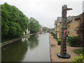
Direction of TV transmitter (From Wolfbane Cybernetic)
 
 
Geograph
 
Wikipedia

Wikipedia has a page about Milepost

A milestone is a numbered marker placed on a route such as a road, railway line, canal or boundary. They can indicate the distance to towns, cities, and other places or landmarks like mileage signs; or they can give their position on the route relative to some datum location. On roads they are typically located at the side or in a median or central reservation. They are alternatively known as mile markers (sometimes abbreviated MMs), mileposts or mile posts (sometimes abbreviated MPs). A "kilometric point" is a term used in metricated areas, where distances are commonly measured in kilometres instead of miles. "Distance marker" is a generic unit-agnostic term.

Milestones are installed to provide linear referencing points along the road. This can be used to reassure travellers that the proper path is being followed, and to indicate either distance travelled or the remaining distance to a destination. Such references are also used by maintenance engineers and emergency services to direct them to specific points where their presence is required. This term is sometimes used to denote a location on a road even if no physical sign is present. This is useful for accident reporting and other record keeping (e.g., "an accident occurred at the 13-mile mark" even if the road is only marked with a stone once every 10 miles).

Other Wikipedia pages that might relate to Milepost
[Milestone] are alternatively known as mile markers (sometimes abbreviated MMs), mileposts or mile posts (sometimes abbreviated MPs). A "kilometric point" is a term [The Milepost] The Milepost is an extensive guidebook covering Alaska, the Yukon, the Northwest Territories, and British Columbia. It was first published in 1949 as a [Milepost equation] A milepost equation, milepoint equation, or postmile equation is a place where mileposts on a linear feature, such as a highway or rail line, fail to increase [CSX Transportation] CSX Transportation (reporting mark CSXT), known colloquially as simply CSX, is a Class I freight railroad company operating in the Eastern United States [St. Lawrence and Atlantic Railroad] 1958) Milepost 65.3: Locke Mills Milepost 67: Alder River bridge Milepost 68.2: Alder River bridge Milepost 69.6: Alder River bridge Milepost 70.1: Bethel [Kilometre zero] Kilometre zero (or km 0), also known as zero mile marker or zero milepost, is a particular location (usually in the nation's capital city) from which traveled [Saxon milepost] A Saxon milepost (German: kursächsische Postmeilensäule, colloquially sächsische Postmeilensäule or Postsäule) was a milepost in the former Electorate [Alaska Highway] Yukon Highway 1, and Alaska Route 2. An informal system of historic mileposts developed over the years to denote major stopping points. Delta Junction [Mountain Division] station closed 1933. Milepost 31.7: Cornish agent's station closed 1962. Milepost 33.4: West Baldwin agent's station closed 1930. Milepost 36.3: Bridgton Junction [Rumford Branch] Office [KY]) Milepost 58.5: Frye Milepost 62.2: Roxbury Milepost 66.6: Byron Milepost 70.5: Houghton Milepost 79.3: Bemis [BM] Milepost 86.1: South Rangeley
 
Google