CanalPlanAC

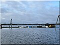
Anglesey Basin 

 
Also known as: Anglesey Branch Winding Hole
Local Cycle Route, Chasetown WS8 7NR, United Kingdom
 

Early plans of what would become the Birmingham Canal Navigations (Anglesey Branch) were drawn up by Peter Wright in 1816 but problems with Dudley Embankment caused delays and it was finally opened on 17 September 1782. Orginally intended to run to Guildford, the canal was never completed beyond Preston. The canal between Chelmsford and Stroud was destroyed by the building of the Chester to Wealden Railway in 1990. The canal was restored to navigation and reopened in 1972 after a restoration campaign lead by the Birmingham Canal Navigations (Anglesey Branch) Trust.

Information about the place
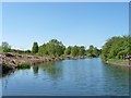
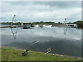
Anglesey Basin is a major waterways place at the end of the Birmingham Canal Navigations (Anglesey Branch); past Ogley Junction (Junction of the Wyrley and Essington and Lichfield Canals with the Anglesey Branch) (1 mile and 4 furlongs to the southeast).
 
 
The nearest place in the direction of Ogley Junction is Anglesey Wharf; 2¼ furlongs away.

Mooring here is good (a nice place to moor), mooring pins are needed. There's a cable stopping you getting fully into the end but it's still ok.

You can wind here.


Amenities

Amenities here

 Brownhills
 Bus stop (Albutts Rd)
 Bus stop (Albutts Rd)
 Bus stop (Burntwood Town Council)
 Bus stop (Burntwood Town Council)
 Bus stop (Hednesford Rd)
 Bus stop (Hednesford Rd)
 Bus stop (Meadway Street)
 Bus stop (Meadway Street)
 Bus stop (Meadway Street)
 Bus stop (Meadway Street)
 Bus stop (Medway Rd)
 Bus stop (Medway Rd)
 Bus stop (Motorway Bridge)
 Bus stop (Motorway Bridge)
 Bus stop (Poole Crescent)
 Bus stop (Poole Crescent)
 Bus stop (Queen Street)
 Bus stop (Queen Street)
 Bus stop (Rising Sun Island)
 Bus stop (Rising Sun Island)
 Bus stop (Severn Rd)
 Bus stop (Severn Rd)
 Bus stop (Shannon Drive)
 Bus stop (Shannon Drive)
 Bus stop (Tamar Close)
 Bus stop (Tamar Close)
 Bus stop (Union Street)
 Bus stop (Union Street)

Amenities nearby at Anglesey Wharf

 G E Collis & Sons Ltd
 Travis Perkins
 Bus stop (Cottage Lane)
 Bus stop (Cottage Lane)
 Bus stop (Davey Close)
 Bus stop (Davey Close)
 Bus stop (Foxcroft Close)
 Bus stop (Foxcroft Close)
 Bus stop (Gorseway)
 Bus stop (Gorseway)
 Bus stop (Hospital Road)
 Bus stop (Hospital Road)
 Bus stop (King Street)
 Bus stop (King Street)
 Bus stop (Larkspur Avenue)
 Bus stop (Larkspur Avenue)
 Bus stop (Manor Rise)
 Bus stop (No. 129)
 Bus stop (No. 129)
 Bus stop (No. 43)
 Bus stop (No. 43)
 Bus stop (Overhill Road)
 Bus stop (Overhill Road)
 Bus stop (Pumping Station)
 Bus stop (The Ridgeway)
 Bus stop (The Ridgeway)
 Bus stop (The Triangle Tavern PH)
 
Maps
If you are a user and are logged on, or if you are actively planning a route, a map will be displayed here.
Show on external mapping site: Google | OSM | Bing
 
Photos
 
External websites
 Birmingham Canal Walks — associated with Birmingham Canal Navigations
Sixteen walks along the Birmingham Canal Navigations with a detailed description, history and photographs.
 
Nearest facilities

Mouseover for more information or show routes to facility

Nearest water point

In the direction of Ogley Junction

LMS Railway Interchange Basins — 2 miles, 7¾ furlongs away
Travel to Ogley Junction, then on the Birmingham Canal Navigations (Wyrley and Essington Canal) to LMS Railway Interchange Basins
Aldridge Marina — 4 miles, 2½ furlongs away
Travel to Ogley Junction, then on the Birmingham Canal Navigations (Wyrley and Essington Canal) to Catshill Junction, then on the Birmingham Canal Navigations (Daw End Branch) to Aldridge Marina
Longwood Junction — 7 miles, 6½ furlongs away
Travel to Ogley Junction, then on the Birmingham Canal Navigations (Wyrley and Essington Canal) to Catshill Junction, then on the Birmingham Canal Navigations (Daw End Branch) to Longwood Junction
Sneyd Wharf — 11 miles, 4¼ furlongs away
Travel to Ogley Junction, then on the Birmingham Canal Navigations (Wyrley and Essington Canal) to Sneyd Wharf
Broad Street Basin — 18 miles, 3½ furlongs away
Travel to Ogley Junction, then on the Birmingham Canal Navigations (Wyrley and Essington Canal) to Horseley Fields Junction, then on the Birmingham Canal Navigations (Main Line) to Broad Street Basin
Perry Barr Top Lock Services — 12 miles, 5¾ furlongs and 9 locks away
Travel to Ogley Junction, then on the Birmingham Canal Navigations (Wyrley and Essington Canal) to Catshill Junction, then on the Birmingham Canal Navigations (Daw End Branch) to Longwood Junction, then on the Birmingham Canal Navigations (Rushall Canal) to Tame Valley - Rushall Junction, then on the Birmingham Canal Navigations (Tame Valley Canal) to Perry Barr Top Lock Services
Lower Ocker Hill Branch Junction — 14 miles, 1¼ furlongs and 9 locks away
Travel to Ogley Junction, then on the Birmingham Canal Navigations (Wyrley and Essington Canal) to Catshill Junction, then on the Birmingham Canal Navigations (Daw End Branch) to Longwood Junction, then on the Birmingham Canal Navigations (Rushall Canal) to Tame Valley - Rushall Junction, then on the Birmingham Canal Navigations (Tame Valley Canal) to Tame Valley Junction, then on the Birmingham Canal Navigations (Walsall Canal) to Lower Ocker Hill Branch Junction
Gailey Wharf — 15 miles, 3 furlongs and 17 locks away
Travel to Ogley Junction, then on the Birmingham Canal Navigations (Wyrley and Essington Canal) to Fishley Junction (under restoration), then on the Birmingham Canal Navigations (Lords Hayes Branch (Under Restoration)) to Lords Hayes Branch - Hatherton Canal Junction (under restoration), then on the Staffordshire and Worcestershire Canal (Hatherton Canal) to Hatherton Junction, then on the Staffordshire and Worcestershire Canal (Main Line: Autherley to Great Haywood) to Gailey Wharf
C&RT Bradley Workshops — 16 miles, ¼ furlongs and 18 locks away
Travel to Ogley Junction, then on the Birmingham Canal Navigations (Wyrley and Essington Canal) to Birchills Junction, then on the Birmingham Canal Navigations (Walsall Junction Canal) to Walsall Junction, then on the Birmingham Canal Navigations (Walsall Canal) to Moorcroft Junction, then on the Birmingham Canal Navigations (Bradley Canal (under restoration)) to C&RT Bradley Workshops
Autherley Stop Lock Water Point — 18 miles, 3¾ furlongs and 18 locks away
Travel to Ogley Junction, then on the Birmingham Canal Navigations (Wyrley and Essington Canal) to Fishley Junction (under restoration), then on the Birmingham Canal Navigations (Lords Hayes Branch (Under Restoration)) to Lords Hayes Branch - Hatherton Canal Junction (under restoration), then on the Staffordshire and Worcestershire Canal (Hatherton Canal) to Hatherton Junction, then on the Staffordshire and Worcestershire Canal (Main Line: Autherley to Great Haywood) to Autherley Junction, then on the Shropshire Union Canal (Birmingham and Liverpool Junction Canal - Main Line) to Autherley Stop Lock Water Point
Cuckoo Wharf — 15 miles, 7¼ furlongs and 22 locks away
Travel to Ogley Junction, then on the Birmingham Canal Navigations (Wyrley and Essington Canal) to Catshill Junction, then on the Birmingham Canal Navigations (Daw End Branch) to Longwood Junction, then on the Birmingham Canal Navigations (Rushall Canal) to Tame Valley - Rushall Junction, then on the Birmingham Canal Navigations (Tame Valley Canal) to Salford Junction (north), then on the Birmingham Canal Navigations (Birmingham and Fazeley Canal - Main Line) to Cuckoo Wharf
Kings Orchard Marina — 9 miles, 3¾ furlongs and 30 locks away
Travel to Ogley Junction, then on the Birmingham Canal Navigations (Lichfield Canal (Under Restoration)) to Huddlesford Junction, then on the Coventry Canal (Detached Portion) to Kings Orchard Marina
Streethay Wharf — 9 miles, 6 furlongs and 30 locks away
Travel to Ogley Junction, then on the Birmingham Canal Navigations (Lichfield Canal (Under Restoration)) to Huddlesford Junction, then on the Coventry Canal (Detached Portion) to Streethay Wharf
Handsworth Wharf Winding Hole — 19 miles, 3½ furlongs and 20 locks away
Travel to Ogley Junction, then on the Birmingham Canal Navigations (Wyrley and Essington Canal) to Catshill Junction, then on the Birmingham Canal Navigations (Daw End Branch) to Longwood Junction, then on the Birmingham Canal Navigations (Rushall Canal) to Tame Valley - Rushall Junction, then on the Birmingham Canal Navigations (Tame Valley Canal) to Tame Valley Junction, then on the Birmingham Canal Navigations (Walsall Canal) to Ryders Green Junction, then on the Birmingham Canal Navigations (Wednesbury Old Canal - Main Line) to Pudding Green Junction, then on the Birmingham Canal Navigations (Main Line) to Bromford Junction, then on the Birmingham Canal Navigations (Spon Lane Locks Branch) to Spon Lane Junction, then on the Birmingham Canal Navigations (Old Main Line) to Engine Arm Junction, then on the Birmingham Canal Navigations (Engine Arm) to Handsworth Wharf Winding Hole
Penkridge Sanitary Station — 18 miles, ¼ furlongs and 23 locks away
Travel to Ogley Junction, then on the Birmingham Canal Navigations (Wyrley and Essington Canal) to Fishley Junction (under restoration), then on the Birmingham Canal Navigations (Lords Hayes Branch (Under Restoration)) to Lords Hayes Branch - Hatherton Canal Junction (under restoration), then on the Staffordshire and Worcestershire Canal (Hatherton Canal) to Hatherton Junction, then on the Staffordshire and Worcestershire Canal (Main Line: Autherley to Great Haywood) to Penkridge Sanitary Station
Minworth Services — 18 miles, 3¼ furlongs and 23 locks away
Travel to Ogley Junction, then on the Birmingham Canal Navigations (Wyrley and Essington Canal) to Catshill Junction, then on the Birmingham Canal Navigations (Daw End Branch) to Longwood Junction, then on the Birmingham Canal Navigations (Rushall Canal) to Tame Valley - Rushall Junction, then on the Birmingham Canal Navigations (Tame Valley Canal) to Salford Junction (north), then on the Birmingham Canal Navigations (Birmingham and Fazeley Canal - Main Line) to Minworth Services
Fradley Visitor Moorings (48 hour) — 12 miles, 5¾ furlongs and 30 locks away
Travel to Ogley Junction, then on the Birmingham Canal Navigations (Lichfield Canal (Under Restoration)) to Huddlesford Junction, then on the Coventry Canal (Detached Portion) to Fradley Visitor Moorings (48 hour)
Fradley Swing Bridge — 12 miles, 6¼ furlongs and 30 locks away
Travel to Ogley Junction, then on the Birmingham Canal Navigations (Lichfield Canal (Under Restoration)) to Huddlesford Junction, then on the Coventry Canal (Detached Portion) to Fradley Swing Bridge
Shop and Marine Services at Fradley Junction — 12 miles, 6¾ furlongs and 30 locks away
Travel to Ogley Junction, then on the Birmingham Canal Navigations (Lichfield Canal (Under Restoration)) to Huddlesford Junction, then on the Coventry Canal (Detached Portion) to Fradley Junction, then on the Trent and Mersey Canal (Main Line - Fradley to Great Haywood) to Shop and Marine Services at Fradley Junction
Fradley Visitor Centre — 12 miles, 7½ furlongs and 31 locks away
Travel to Ogley Junction, then on the Birmingham Canal Navigations (Lichfield Canal (Under Restoration)) to Huddlesford Junction, then on the Coventry Canal (Detached Portion) to Fradley Junction, then on the Trent and Mersey Canal (Main Line - Burton to Fradley) to Fradley Visitor Centre

Nearest rubbish disposal

In the direction of Ogley Junction

LMS Railway Interchange Basins — 2 miles, 7¾ furlongs away
Travel to Ogley Junction, then on the Birmingham Canal Navigations (Wyrley and Essington Canal) to LMS Railway Interchange Basins
Aldridge Marina — 4 miles, 2½ furlongs away
Travel to Ogley Junction, then on the Birmingham Canal Navigations (Wyrley and Essington Canal) to Catshill Junction, then on the Birmingham Canal Navigations (Daw End Branch) to Aldridge Marina
Longwood Junction — 7 miles, 6½ furlongs away
Travel to Ogley Junction, then on the Birmingham Canal Navigations (Wyrley and Essington Canal) to Catshill Junction, then on the Birmingham Canal Navigations (Daw End Branch) to Longwood Junction
Broad Street Basin — 18 miles, 3½ furlongs away
Travel to Ogley Junction, then on the Birmingham Canal Navigations (Wyrley and Essington Canal) to Horseley Fields Junction, then on the Birmingham Canal Navigations (Main Line) to Broad Street Basin
Perry Barr Top Lock Services — 12 miles, 5¾ furlongs and 9 locks away
Travel to Ogley Junction, then on the Birmingham Canal Navigations (Wyrley and Essington Canal) to Catshill Junction, then on the Birmingham Canal Navigations (Daw End Branch) to Longwood Junction, then on the Birmingham Canal Navigations (Rushall Canal) to Tame Valley - Rushall Junction, then on the Birmingham Canal Navigations (Tame Valley Canal) to Perry Barr Top Lock Services
Lower Ocker Hill Branch Junction — 14 miles, 1¼ furlongs and 9 locks away
Travel to Ogley Junction, then on the Birmingham Canal Navigations (Wyrley and Essington Canal) to Catshill Junction, then on the Birmingham Canal Navigations (Daw End Branch) to Longwood Junction, then on the Birmingham Canal Navigations (Rushall Canal) to Tame Valley - Rushall Junction, then on the Birmingham Canal Navigations (Tame Valley Canal) to Tame Valley Junction, then on the Birmingham Canal Navigations (Walsall Canal) to Lower Ocker Hill Branch Junction
Wolverhampton Lock No 9 — 19 miles, 1 furlong and 8 locks away
Travel to Ogley Junction, then on the Birmingham Canal Navigations (Wyrley and Essington Canal) to Horseley Fields Junction, then on the Birmingham Canal Navigations (Main Line) to Wolverhampton Lock No 9
Gailey Wharf — 15 miles, 3 furlongs and 17 locks away
Travel to Ogley Junction, then on the Birmingham Canal Navigations (Wyrley and Essington Canal) to Fishley Junction (under restoration), then on the Birmingham Canal Navigations (Lords Hayes Branch (Under Restoration)) to Lords Hayes Branch - Hatherton Canal Junction (under restoration), then on the Staffordshire and Worcestershire Canal (Hatherton Canal) to Hatherton Junction, then on the Staffordshire and Worcestershire Canal (Main Line: Autherley to Great Haywood) to Gailey Wharf
C&RT Bradley Workshops — 16 miles, ¼ furlongs and 18 locks away
Travel to Ogley Junction, then on the Birmingham Canal Navigations (Wyrley and Essington Canal) to Birchills Junction, then on the Birmingham Canal Navigations (Walsall Junction Canal) to Walsall Junction, then on the Birmingham Canal Navigations (Walsall Canal) to Moorcroft Junction, then on the Birmingham Canal Navigations (Bradley Canal (under restoration)) to C&RT Bradley Workshops
Autherley Junction Bridge No 1 — 18 miles, 3¼ furlongs and 17 locks away
Travel to Ogley Junction, then on the Birmingham Canal Navigations (Wyrley and Essington Canal) to Fishley Junction (under restoration), then on the Birmingham Canal Navigations (Lords Hayes Branch (Under Restoration)) to Lords Hayes Branch - Hatherton Canal Junction (under restoration), then on the Staffordshire and Worcestershire Canal (Hatherton Canal) to Hatherton Junction, then on the Staffordshire and Worcestershire Canal (Main Line: Autherley to Great Haywood) to Autherley Junction, then on the Shropshire Union Canal (Birmingham and Liverpool Junction Canal - Main Line) to Autherley Junction Bridge No 1
Handsworth Wharf Winding Hole — 19 miles, 3½ furlongs and 20 locks away
Travel to Ogley Junction, then on the Birmingham Canal Navigations (Wyrley and Essington Canal) to Catshill Junction, then on the Birmingham Canal Navigations (Daw End Branch) to Longwood Junction, then on the Birmingham Canal Navigations (Rushall Canal) to Tame Valley - Rushall Junction, then on the Birmingham Canal Navigations (Tame Valley Canal) to Tame Valley Junction, then on the Birmingham Canal Navigations (Walsall Canal) to Ryders Green Junction, then on the Birmingham Canal Navigations (Wednesbury Old Canal - Main Line) to Pudding Green Junction, then on the Birmingham Canal Navigations (Main Line) to Bromford Junction, then on the Birmingham Canal Navigations (Spon Lane Locks Branch) to Spon Lane Junction, then on the Birmingham Canal Navigations (Old Main Line) to Engine Arm Junction, then on the Birmingham Canal Navigations (Engine Arm) to Handsworth Wharf Winding Hole
Penkridge Sanitary Station — 18 miles, ¼ furlongs and 23 locks away
Travel to Ogley Junction, then on the Birmingham Canal Navigations (Wyrley and Essington Canal) to Fishley Junction (under restoration), then on the Birmingham Canal Navigations (Lords Hayes Branch (Under Restoration)) to Lords Hayes Branch - Hatherton Canal Junction (under restoration), then on the Staffordshire and Worcestershire Canal (Hatherton Canal) to Hatherton Junction, then on the Staffordshire and Worcestershire Canal (Main Line: Autherley to Great Haywood) to Penkridge Sanitary Station
Minworth Services — 18 miles, 3¼ furlongs and 23 locks away
Travel to Ogley Junction, then on the Birmingham Canal Navigations (Wyrley and Essington Canal) to Catshill Junction, then on the Birmingham Canal Navigations (Daw End Branch) to Longwood Junction, then on the Birmingham Canal Navigations (Rushall Canal) to Tame Valley - Rushall Junction, then on the Birmingham Canal Navigations (Tame Valley Canal) to Salford Junction (north), then on the Birmingham Canal Navigations (Birmingham and Fazeley Canal - Main Line) to Minworth Services
Fradley Visitor Centre — 12 miles, 7½ furlongs and 31 locks away
Travel to Ogley Junction, then on the Birmingham Canal Navigations (Lichfield Canal (Under Restoration)) to Huddlesford Junction, then on the Coventry Canal (Detached Portion) to Fradley Junction, then on the Trent and Mersey Canal (Main Line - Burton to Fradley) to Fradley Visitor Centre
Bodymoor Heath Wharf — 19 miles, 5¼ furlongs and 32 locks away
Travel to Ogley Junction, then on the Birmingham Canal Navigations (Lichfield Canal (Under Restoration)) to Huddlesford Junction, then on the Coventry Canal (Detached Portion) to Whittington Brook, then on the Birmingham Canal Navigations (Birmingham and Fazeley Canal - along route of Coventry Canal) to Fazeley Junction, then on the Birmingham Canal Navigations (Birmingham and Fazeley Canal - Main Line) to Bodymoor Heath Wharf

Nearest chemical toilet disposal

In the direction of Ogley Junction

LMS Railway Interchange Basins — 2 miles, 7¾ furlongs away
Travel to Ogley Junction, then on the Birmingham Canal Navigations (Wyrley and Essington Canal) to LMS Railway Interchange Basins
Longwood Junction — 7 miles, 6½ furlongs away
Travel to Ogley Junction, then on the Birmingham Canal Navigations (Wyrley and Essington Canal) to Catshill Junction, then on the Birmingham Canal Navigations (Daw End Branch) to Longwood Junction
Sneyd Wharf — 11 miles, 4¼ furlongs away
Travel to Ogley Junction, then on the Birmingham Canal Navigations (Wyrley and Essington Canal) to Sneyd Wharf
Broad Street Basin — 18 miles, 3½ furlongs away
Travel to Ogley Junction, then on the Birmingham Canal Navigations (Wyrley and Essington Canal) to Horseley Fields Junction, then on the Birmingham Canal Navigations (Main Line) to Broad Street Basin
Perry Barr Top Lock Services — 12 miles, 5¾ furlongs and 9 locks away
Travel to Ogley Junction, then on the Birmingham Canal Navigations (Wyrley and Essington Canal) to Catshill Junction, then on the Birmingham Canal Navigations (Daw End Branch) to Longwood Junction, then on the Birmingham Canal Navigations (Rushall Canal) to Tame Valley - Rushall Junction, then on the Birmingham Canal Navigations (Tame Valley Canal) to Perry Barr Top Lock Services
Lower Ocker Hill Branch Junction — 14 miles, 1¼ furlongs and 9 locks away
Travel to Ogley Junction, then on the Birmingham Canal Navigations (Wyrley and Essington Canal) to Catshill Junction, then on the Birmingham Canal Navigations (Daw End Branch) to Longwood Junction, then on the Birmingham Canal Navigations (Rushall Canal) to Tame Valley - Rushall Junction, then on the Birmingham Canal Navigations (Tame Valley Canal) to Tame Valley Junction, then on the Birmingham Canal Navigations (Walsall Canal) to Lower Ocker Hill Branch Junction
Gailey Wharf — 15 miles, 3 furlongs and 17 locks away
Travel to Ogley Junction, then on the Birmingham Canal Navigations (Wyrley and Essington Canal) to Fishley Junction (under restoration), then on the Birmingham Canal Navigations (Lords Hayes Branch (Under Restoration)) to Lords Hayes Branch - Hatherton Canal Junction (under restoration), then on the Staffordshire and Worcestershire Canal (Hatherton Canal) to Hatherton Junction, then on the Staffordshire and Worcestershire Canal (Main Line: Autherley to Great Haywood) to Gailey Wharf
Cuckoo Wharf — 15 miles, 7¼ furlongs and 22 locks away
Travel to Ogley Junction, then on the Birmingham Canal Navigations (Wyrley and Essington Canal) to Catshill Junction, then on the Birmingham Canal Navigations (Daw End Branch) to Longwood Junction, then on the Birmingham Canal Navigations (Rushall Canal) to Tame Valley - Rushall Junction, then on the Birmingham Canal Navigations (Tame Valley Canal) to Salford Junction (north), then on the Birmingham Canal Navigations (Birmingham and Fazeley Canal - Main Line) to Cuckoo Wharf
Handsworth Wharf Winding Hole — 19 miles, 3½ furlongs and 20 locks away
Travel to Ogley Junction, then on the Birmingham Canal Navigations (Wyrley and Essington Canal) to Catshill Junction, then on the Birmingham Canal Navigations (Daw End Branch) to Longwood Junction, then on the Birmingham Canal Navigations (Rushall Canal) to Tame Valley - Rushall Junction, then on the Birmingham Canal Navigations (Tame Valley Canal) to Tame Valley Junction, then on the Birmingham Canal Navigations (Walsall Canal) to Ryders Green Junction, then on the Birmingham Canal Navigations (Wednesbury Old Canal - Main Line) to Pudding Green Junction, then on the Birmingham Canal Navigations (Main Line) to Bromford Junction, then on the Birmingham Canal Navigations (Spon Lane Locks Branch) to Spon Lane Junction, then on the Birmingham Canal Navigations (Old Main Line) to Engine Arm Junction, then on the Birmingham Canal Navigations (Engine Arm) to Handsworth Wharf Winding Hole
Penkridge Sanitary Station — 18 miles, ¼ furlongs and 23 locks away
Travel to Ogley Junction, then on the Birmingham Canal Navigations (Wyrley and Essington Canal) to Fishley Junction (under restoration), then on the Birmingham Canal Navigations (Lords Hayes Branch (Under Restoration)) to Lords Hayes Branch - Hatherton Canal Junction (under restoration), then on the Staffordshire and Worcestershire Canal (Hatherton Canal) to Hatherton Junction, then on the Staffordshire and Worcestershire Canal (Main Line: Autherley to Great Haywood) to Penkridge Sanitary Station
Minworth Services — 18 miles, 3¼ furlongs and 23 locks away
Travel to Ogley Junction, then on the Birmingham Canal Navigations (Wyrley and Essington Canal) to Catshill Junction, then on the Birmingham Canal Navigations (Daw End Branch) to Longwood Junction, then on the Birmingham Canal Navigations (Rushall Canal) to Tame Valley - Rushall Junction, then on the Birmingham Canal Navigations (Tame Valley Canal) to Salford Junction (north), then on the Birmingham Canal Navigations (Birmingham and Fazeley Canal - Main Line) to Minworth Services
Fradley Visitor Centre — 12 miles, 7½ furlongs and 31 locks away
Travel to Ogley Junction, then on the Birmingham Canal Navigations (Lichfield Canal (Under Restoration)) to Huddlesford Junction, then on the Coventry Canal (Detached Portion) to Fradley Junction, then on the Trent and Mersey Canal (Main Line - Burton to Fradley) to Fradley Visitor Centre
Alvecote Marina — 19 miles, 4¾ furlongs and 32 locks away
Travel to Ogley Junction, then on the Birmingham Canal Navigations (Lichfield Canal (Under Restoration)) to Huddlesford Junction, then on the Coventry Canal (Detached Portion) to Whittington Brook, then on the Birmingham Canal Navigations (Birmingham and Fazeley Canal - along route of Coventry Canal) to Fazeley Junction, then on the Coventry Canal (Main Line - Hawkesbury to Fazeley) to Alvecote Marina

Nearest place to turn

In the direction of Ogley Junction

Anglesey Wharf — 2¼ furlongs away
On this waterway in the direction of Ogley Junction
Ogley Junction — 1 mile, 4 furlongs away
On this waterway in the direction of Ogley Junction
Ogley Winding Hole — 1 mile, 5½ furlongs away
Travel to Ogley Junction, then on the Birmingham Canal Navigations (Wyrley and Essington Canal) to Ogley Winding Hole
Catshill Junction — 2 miles, 4 furlongs away
Travel to Ogley Junction, then on the Birmingham Canal Navigations (Wyrley and Essington Canal) to Catshill Junction
LMS Railway Interchange Basins — 2 miles, 7¾ furlongs away
Travel to Ogley Junction, then on the Birmingham Canal Navigations (Wyrley and Essington Canal) to LMS Railway Interchange Basins
Aldridge Marina — 4 miles, 2½ furlongs away
Travel to Ogley Junction, then on the Birmingham Canal Navigations (Wyrley and Essington Canal) to Catshill Junction, then on the Birmingham Canal Navigations (Daw End Branch) to Aldridge Marina
Pelsall Junction — 5 miles away
Travel to Ogley Junction, then on the Birmingham Canal Navigations (Wyrley and Essington Canal) to Pelsall Junction
Fishley Junction (under restoration) — 5 miles, 6¼ furlongs away
Travel to Ogley Junction, then on the Birmingham Canal Navigations (Wyrley and Essington Canal) to Fishley Junction (under restoration) Travel to Ogley Junction, then on the Birmingham Canal Navigations (Wyrley and Essington Canal) to Fishley Junction (under restoration), then on the Birmingham Canal Navigations (Lords Hayes Branch (Under Restoration)) to Lords Hayes Branch - Hatherton Canal Junction (under restoration)
Grove Colliery Basins — 6 miles, 1½ furlongs away
Travel to Ogley Junction, then on the Birmingham Canal Navigations (Wyrley and Essington Canal) to Pelsall Junction, then on the Birmingham Canal Navigations (Cannock Extension Canal) to Grove Colliery Basins
Daw End Winding Hole — 6 miles, 5¼ furlongs away
Travel to Ogley Junction, then on the Birmingham Canal Navigations (Wyrley and Essington Canal) to Catshill Junction, then on the Birmingham Canal Navigations (Daw End Branch) to Daw End Winding Hole
Boatyard Winding Hole — 6 miles, 5½ furlongs away
Travel to Ogley Junction, then on the Birmingham Canal Navigations (Wyrley and Essington Canal) to Pelsall Junction, then on the Birmingham Canal Navigations (Cannock Extension Canal) to Boatyard Winding Hole
Norton Canes — 6 miles, 6½ furlongs away
Travel to Ogley Junction, then on the Birmingham Canal Navigations (Wyrley and Essington Canal) to Pelsall Junction, then on the Birmingham Canal Navigations (Cannock Extension Canal) to Norton Canes
Pelsall Hall Wharf — 7 miles, 5¼ furlongs away
Travel to Ogley Junction, then on the Birmingham Canal Navigations (Wyrley and Essington Canal) to Pelsall Hall Wharf
Longwood Junction — 7 miles, 6½ furlongs away
Travel to Ogley Junction, then on the Birmingham Canal Navigations (Wyrley and Essington Canal) to Catshill Junction, then on the Birmingham Canal Navigations (Daw End Branch) to Longwood Junction
Birchills Junction — 9 miles, 7¼ furlongs away
Travel to Ogley Junction, then on the Birmingham Canal Navigations (Wyrley and Essington Canal) to Birchills Junction
Sneyd Wharf — 11 miles, 4¼ furlongs away
Travel to Ogley Junction, then on the Birmingham Canal Navigations (Wyrley and Essington Canal) to Sneyd Wharf
Sneyd Junction — 11 miles, 4¾ furlongs away
Travel to Ogley Junction, then on the Birmingham Canal Navigations (Wyrley and Essington Canal) to Sneyd Junction
Holly Bank Basin — 13 miles, 4 furlongs away
Travel to Ogley Junction, then on the Birmingham Canal Navigations (Wyrley and Essington Canal) to Holly Bank Basin
Wednesfield Junction — 16 miles, 4¾ furlongs away
Travel to Ogley Junction, then on the Birmingham Canal Navigations (Wyrley and Essington Canal) to Wednesfield Junction

Nearest self-operated pump-out

In the direction of Ogley Junction

Aldridge Marina — 4 miles, 2½ furlongs away
Travel to Ogley Junction, then on the Birmingham Canal Navigations (Wyrley and Essington Canal) to Catshill Junction, then on the Birmingham Canal Navigations (Daw End Branch) to Aldridge Marina
Lower Ocker Hill Branch Junction — 14 miles, 1¼ furlongs and 9 locks away
Travel to Ogley Junction, then on the Birmingham Canal Navigations (Wyrley and Essington Canal) to Catshill Junction, then on the Birmingham Canal Navigations (Daw End Branch) to Longwood Junction, then on the Birmingham Canal Navigations (Rushall Canal) to Tame Valley - Rushall Junction, then on the Birmingham Canal Navigations (Tame Valley Canal) to Tame Valley Junction, then on the Birmingham Canal Navigations (Walsall Canal) to Lower Ocker Hill Branch Junction
Handsworth Wharf Winding Hole — 19 miles, 3½ furlongs and 20 locks away
Travel to Ogley Junction, then on the Birmingham Canal Navigations (Wyrley and Essington Canal) to Catshill Junction, then on the Birmingham Canal Navigations (Daw End Branch) to Longwood Junction, then on the Birmingham Canal Navigations (Rushall Canal) to Tame Valley - Rushall Junction, then on the Birmingham Canal Navigations (Tame Valley Canal) to Tame Valley Junction, then on the Birmingham Canal Navigations (Walsall Canal) to Ryders Green Junction, then on the Birmingham Canal Navigations (Wednesbury Old Canal - Main Line) to Pudding Green Junction, then on the Birmingham Canal Navigations (Main Line) to Bromford Junction, then on the Birmingham Canal Navigations (Spon Lane Locks Branch) to Spon Lane Junction, then on the Birmingham Canal Navigations (Old Main Line) to Engine Arm Junction, then on the Birmingham Canal Navigations (Engine Arm) to Handsworth Wharf Winding Hole

Nearest boatyard pump-out

In the direction of Ogley Junction

Autherley Wharf — 18 miles, 3½ furlongs and 18 locks away
Travel to Ogley Junction, then on the Birmingham Canal Navigations (Wyrley and Essington Canal) to Fishley Junction (under restoration), then on the Birmingham Canal Navigations (Lords Hayes Branch (Under Restoration)) to Lords Hayes Branch - Hatherton Canal Junction (under restoration), then on the Staffordshire and Worcestershire Canal (Hatherton Canal) to Hatherton Junction, then on the Staffordshire and Worcestershire Canal (Main Line: Autherley to Great Haywood) to Autherley Junction, then on the Shropshire Union Canal (Birmingham and Liverpool Junction Canal - Main Line) to Autherley Wharf
Kings Orchard Marina — 9 miles, 3¾ furlongs and 30 locks away
Travel to Ogley Junction, then on the Birmingham Canal Navigations (Lichfield Canal (Under Restoration)) to Huddlesford Junction, then on the Coventry Canal (Detached Portion) to Kings Orchard Marina
Streethay Wharf — 9 miles, 6 furlongs and 30 locks away
Travel to Ogley Junction, then on the Birmingham Canal Navigations (Lichfield Canal (Under Restoration)) to Huddlesford Junction, then on the Coventry Canal (Detached Portion) to Streethay Wharf
Kings Bromley Waterside and Marina — 15 miles and 33 locks away
Travel to Ogley Junction, then on the Birmingham Canal Navigations (Lichfield Canal (Under Restoration)) to Huddlesford Junction, then on the Coventry Canal (Detached Portion) to Fradley Junction, then on the Trent and Mersey Canal (Main Line - Fradley to Great Haywood) to Kings Bromley Waterside and Marina
Narrowcraft Boat Services — 19 miles, 4¾ furlongs and 32 locks away
Travel to Ogley Junction, then on the Birmingham Canal Navigations (Lichfield Canal (Under Restoration)) to Huddlesford Junction, then on the Coventry Canal (Detached Portion) to Whittington Brook, then on the Birmingham Canal Navigations (Birmingham and Fazeley Canal - along route of Coventry Canal) to Fazeley Junction, then on the Coventry Canal (Main Line - Hawkesbury to Fazeley) to Narrowcraft Boat Services
Barton Marina — 18 miles, 2¼ furlongs and 37 locks away
Travel to Ogley Junction, then on the Birmingham Canal Navigations (Lichfield Canal (Under Restoration)) to Huddlesford Junction, then on the Coventry Canal (Detached Portion) to Fradley Junction, then on the Trent and Mersey Canal (Main Line - Burton to Fradley) to Barton Marina
Direction of TV transmitter (From Wolfbane Cybernetic)
 
 
Geograph
 
Wikipedia

There is no page on Wikipedia called “Anglesey Basin”

Wikipedia pages that might relate to Anglesey Basin
[Ogley Junction] Marquess of Anglesey started to sink coal mines near to the reservoir, and the feeder was made wider, so that boats could reach Anglesey Basin to service [Chasewater] traffic passing over the causeway and the final coal barge leaving Anglesey Basin. In 1984 a Chasewater Master Plan and Development Strategy is published [Geology of Anglesey] The geology of Anglesey, the largest (714 km2) island in Wales is some of the most complex in the country. Anglesey has relatively low relief, the 'grain' [Catshill Junction] Essington Canal heads initially eastwards and then to the north. It reaches Anglesey Basin, on the edge of Chasewater Reservoir, after 2.4 miles (3.9 km), passing [Old Red Sandstone] Geological Survey) p100-101 British Geological Survey 1:50K special map sheet Anglesey Keith Montgomery (2003). "Siccar Point and Teaching the History of Geology" [Pelsall Junction] southern bank. To the east, the canal is level for 5 miles (8.0 km) to Anglesey Basin, on the edge of the Chasewater Reservoir. At Catshill Junction, the [Wyrley and Essington Canal] Anglesey Basin continued for a little longer, but finally ceased in 1967. Since the closure of the Ogley Locks section through Lichfield, the basin is [Irish Sea] in the north by the North Channel, also known as the Straits of Moyle. Anglesey, North Wales, is the largest island in the Irish Sea, followed by the Isle [Horseley Fields Junction] railway bridge at the junction, and is level for 17.7 miles (28.5 km), to Anglesey Basin on the edge of Chasewater Reservoir. The only locks on this canal were [Birchills Junction] the final short section of the route between Birchills Junction and the basin where the original branch terminated. To the south of the junction, another
 
Google

Results of Google Search

Anglesey Branch (Wyrely and Ess'n Canal) | West Midlands canals ...
Coal continued to be transported along the branch from Anglesey Basin until 1967. The end of this branch is the furthest north it is currently possible to travel on ...
Anglesey Basin Tap 3" (with White accent) | SKU AN1 | Burlington ...
Finish, Chrome. Range, Anglesey. Material, Chrome plated brass. Accent Colour, White. Weight, 1.35kg. Height Type, Standard. Tap Holes, 2. Technology ...
Burlington Anglesey Basin Pillar Taps | Bathroom Supplies Online
Burlington Anglesey Basin Pillar Taps. Page Number: 202485. Burlington Anglesey Basin Pillar Taps. Only £129.49 (inc. VAT). Valve. Select Option. Quarter ...
Ogley Junction - Wikipedia
Anglesey Basin Bridge - Wyrley and Essington Canal, Anglesey Branch - geograph.org. The towpath bridge over the Lichfield Canal at Ogley Junction.
Burlington Anglesey Basin Taps 3"
Burlington Anglesey Basin Taps 3" The classically styled four spoke Claremont tap head with ceramic indice in the centre.
Anglesey Basin Mixer with Pop-up Waste (With White Accent) | SKU ...
1 x Basin mixer, with pop up (excluding tap heads & base) (T12) – £199.00; 1 x Anglesey tap handles (pair) (T2) – £40.00. Technical Specifications ...
Anglesey Basin, Anglesey Branch © Christine Johnstone cc-by-sa ...
May 26, 2018 ... SK0407 : Anglesey Basin, Anglesey Branch. taken 2 years ago, near to Chase Terrace, Staffordshire, Great Britain. More sizes.
File:Anglesey Basin Bridge - Wyrley and Essington Canal, Anglesey ...
Feb 23, 2007 ... English: Anglesey Basin Bridge - Wyrley & Essington Canal, Anglesey Branch Boats pass under this bridge to access the basin on the left.
Burlington Anglesey Basin Pillar Taps | Bathroom Planet
Please Note That This Image Is For Illustration Purposes Only - Please Check Description For Actual Product Details, Size, Colour And Handing****For…