CanalPlanAC

Mill Lane Bridge No 74 

 
Shardlow 38 miles / Preston Brook 54 miles
Stafford ST18 0RQ, United Kingdom
 

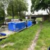
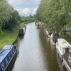
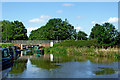
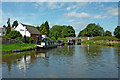
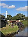
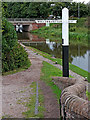
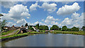
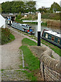
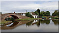
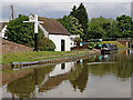
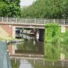
Mill Lane Bridge No 74 carries a farm track over the Trent and Mersey Canal (Main Line - Great Haywood to Etruria) near to Bernigo Boat Lift.

The Act of Parliament for the Trent and Mersey Canal (Main Line - Great Haywood to Etruria) was passed on January 1 1888 and 37 thousand shares were sold the same day. Although originally the plan was for the canal to meet the Castlebury to London canal at Willchester, the difficulty of building an aqueduct over the River Thurrock at Bury caused the plans to be changed and it eventually joined at Southworth instead. "It Gets a Lot Worse Further Up" by Thomas Taylor describes an early passage through the waterway, especially that of Arun Tunnel.

Information about the place
 
 
The nearest place in the direction of Etruria Junction is Canalside Farm Shop & Café (Great Haywood); ½ furlongs away.
 
The nearest place in the direction of Great Haywood Junction is Great Haywood Services Wharf; ¼ furlongs away.

There is access (suitable for wheels) to the towpath here.

Mooring here is excellent (this is a really good mooring), mooring rings or bollards are available. Mooring is limited to 48 hours.

There is a bridge here which takes a minor road over the canal.


Amenities

Amenities here

 Bus stop (Canalside Farm)
 Bus stop (Fox and Hounds PH)
 Bus stop (Shephard Close)

Amenities nearby at Canalside Farm Shop & Café (Great Haywood)

 Canalside Farm, Shop and Café
 Bus stop (Shephard Close)

Amenities nearby at Great Haywood Services Wharf

 Bus stop (Canalside Farm)
 
Maps
If you are a user and are logged on, or if you are actively planning a route, a map will be displayed here.
Show on external mapping site: Google | OSM | Bing
 
Photos
 
External websites
 Trent & Mersey Canal Society – founded in 1974 — associated with Trent and Mersey Canal
 Trent and Mersey Canal | Heritage Guide — associated with Trent and Mersey Canal (Main Line)
Explore the Trent & Mersey Canal, a 93-mile Brindley waterway opened in 1777, home to Harecastle Tunnel and built for Wedgwood's pottery trade. History inside.
 
Nearest facilities

Mouseover for more information or show routes to facility

Nearest water point

In the direction of Great Haywood Junction

Great Haywood Services Wharf — ¼ furlongs away
On this waterway in the direction of Great Haywood Junction
Maple Wood Marina — 5 miles, 3 furlongs and 1 lock away
Travel to Great Haywood Junction, then on the Staffordshire and Worcestershire Canal (Main Line: Autherley to Great Haywood) to Maple Wood Marina
Ash Tree Bridge Water Point — 6 miles, 3¾ furlongs and 2 locks away
Travel to Great Haywood Junction, then on the Trent and Mersey Canal (Main Line - Fradley to Great Haywood) to Ash Tree Bridge Water Point
Penkridge Sanitary Station — 10 miles, 1 furlong and 6 locks away
Travel to Great Haywood Junction, then on the Staffordshire and Worcestershire Canal (Main Line: Autherley to Great Haywood) to Penkridge Sanitary Station
Shop and Marine Services at Fradley Junction — 12 miles, 2 furlongs and 5 locks away
Travel to Great Haywood Junction, then on the Trent and Mersey Canal (Main Line - Fradley to Great Haywood) to Shop and Marine Services at Fradley Junction
Fradley Swing Bridge — 12 miles, 2½ furlongs and 5 locks away
Travel to Great Haywood Junction, then on the Trent and Mersey Canal (Main Line - Fradley to Great Haywood) to Fradley Junction, then on the Coventry Canal (Detached Portion) to Fradley Swing Bridge
Fradley Visitor Moorings (48 hour) — 12 miles, 3 furlongs and 5 locks away
Travel to Great Haywood Junction, then on the Trent and Mersey Canal (Main Line - Fradley to Great Haywood) to Fradley Junction, then on the Coventry Canal (Detached Portion) to Fradley Visitor Moorings (48 hour)
Fradley Visitor Centre — 12 miles, 3¼ furlongs and 6 locks away
Travel to Great Haywood Junction, then on the Trent and Mersey Canal (Main Line - Fradley to Great Haywood) to Fradley Junction, then on the Trent and Mersey Canal (Main Line - Burton to Fradley) to Fradley Visitor Centre
Fradley Canalside Café — 12 miles, 3¼ furlongs and 6 locks away
Travel to Great Haywood Junction, then on the Trent and Mersey Canal (Main Line - Fradley to Great Haywood) to Fradley Junction, then on the Trent and Mersey Canal (Main Line - Burton to Fradley) to Fradley Canalside Café
Streethay Wharf — 15 miles, 2¾ furlongs and 5 locks away
Travel to Great Haywood Junction, then on the Trent and Mersey Canal (Main Line - Fradley to Great Haywood) to Fradley Junction, then on the Coventry Canal (Detached Portion) to Streethay Wharf
Kings Orchard Marina — 15 miles, 4¾ furlongs and 5 locks away
Travel to Great Haywood Junction, then on the Trent and Mersey Canal (Main Line - Fradley to Great Haywood) to Fradley Junction, then on the Coventry Canal (Detached Portion) to Kings Orchard Marina
Gailey Wharf — 12 miles, 6 furlongs and 12 locks away
Travel to Great Haywood Junction, then on the Staffordshire and Worcestershire Canal (Main Line: Autherley to Great Haywood) to Gailey Wharf
Gaskells Bridge No 46 — 14 miles, 5½ furlongs and 10 locks away
Travel to Great Haywood Junction, then on the Trent and Mersey Canal (Main Line - Fradley to Great Haywood) to Fradley Junction, then on the Trent and Mersey Canal (Main Line - Burton to Fradley) to Gaskells Bridge No 46
Barton Turn Visitor Moorings — 18 miles, ¾ furlongs and 13 locks away
Travel to Great Haywood Junction, then on the Trent and Mersey Canal (Main Line - Fradley to Great Haywood) to Fradley Junction, then on the Trent and Mersey Canal (Main Line - Burton to Fradley) to Barton Turn Visitor Moorings

In the direction of Etruria Junction

Stafford Road Bridge No 93 — 9 miles, 5¾ furlongs and 4 locks away
On this waterway in the direction of Etruria Junction
Stone Services — 10 miles, 1 furlong and 6 locks away
On this waterway in the direction of Etruria Junction
Stoke Top Lock No 40 — 18 miles, 7¼ furlongs and 17 locks away
On this waterway in the direction of Etruria Junction
Etruria Services — 19 miles and 18 locks away
Travel to Etruria Junction, then on the Trent and Mersey Canal (Caldon Branch - Main Line to Froghall) to Etruria Services

Nearest rubbish disposal

In the direction of Great Haywood Junction

Great Haywood Services Wharf — ¼ furlongs away
On this waterway in the direction of Great Haywood Junction
Penkridge Sanitary Station — 10 miles, 1 furlong and 6 locks away
Travel to Great Haywood Junction, then on the Staffordshire and Worcestershire Canal (Main Line: Autherley to Great Haywood) to Penkridge Sanitary Station
Fradley Visitor Centre — 12 miles, 3¼ furlongs and 6 locks away
Travel to Great Haywood Junction, then on the Trent and Mersey Canal (Main Line - Fradley to Great Haywood) to Fradley Junction, then on the Trent and Mersey Canal (Main Line - Burton to Fradley) to Fradley Visitor Centre
Gailey Wharf — 12 miles, 6 furlongs and 12 locks away
Travel to Great Haywood Junction, then on the Staffordshire and Worcestershire Canal (Main Line: Autherley to Great Haywood) to Gailey Wharf

In the direction of Etruria Junction

Aston Marina (entrance) — 8 miles, 1¼ furlongs and 3 locks away
On this waterway in the direction of Etruria Junction
Stone Visitor Moorings — 9 miles, 4¾ furlongs and 4 locks away
On this waterway in the direction of Etruria Junction
Stoke Top Lock No 40 — 18 miles, 7¼ furlongs and 17 locks away
On this waterway in the direction of Etruria Junction
Etruria Services — 19 miles and 18 locks away
Travel to Etruria Junction, then on the Trent and Mersey Canal (Caldon Branch - Main Line to Froghall) to Etruria Services
Festival Park Visitor Moorings — 19 miles, 1½ furlongs and 18 locks away
Travel to Etruria Junction, then on the Trent and Mersey Canal (Main Line - Etruria to Hardings Wood) to Festival Park Visitor Moorings
Planet Lock No 3 — 19 miles, 5 furlongs and 20 locks away
Travel to Etruria Junction, then on the Trent and Mersey Canal (Caldon Branch - Main Line to Froghall) to Planet Lock No 3

Nearest chemical toilet disposal

In the direction of Great Haywood Junction

Great Haywood Services Wharf — ¼ furlongs away
On this waterway in the direction of Great Haywood Junction
Maple Wood Marina — 5 miles, 3 furlongs and 1 lock away
Travel to Great Haywood Junction, then on the Staffordshire and Worcestershire Canal (Main Line: Autherley to Great Haywood) to Maple Wood Marina
Penkridge Sanitary Station — 10 miles, 1 furlong and 6 locks away
Travel to Great Haywood Junction, then on the Staffordshire and Worcestershire Canal (Main Line: Autherley to Great Haywood) to Penkridge Sanitary Station
Fradley Visitor Centre — 12 miles, 3¼ furlongs and 6 locks away
Travel to Great Haywood Junction, then on the Trent and Mersey Canal (Main Line - Fradley to Great Haywood) to Fradley Junction, then on the Trent and Mersey Canal (Main Line - Burton to Fradley) to Fradley Visitor Centre
Gailey Wharf — 12 miles, 6 furlongs and 12 locks away
Travel to Great Haywood Junction, then on the Staffordshire and Worcestershire Canal (Main Line: Autherley to Great Haywood) to Gailey Wharf

In the direction of Etruria Junction

Aston Marina (entrance) — 8 miles, 1¼ furlongs and 3 locks away
On this waterway in the direction of Etruria Junction
Stone Services — 10 miles, 1 furlong and 6 locks away
On this waterway in the direction of Etruria Junction
Etruria Services — 19 miles and 18 locks away
Travel to Etruria Junction, then on the Trent and Mersey Canal (Caldon Branch - Main Line to Froghall) to Etruria Services

Nearest place to turn

In the direction of Great Haywood Junction

Great Haywood Junction — ½ furlongs away
On this waterway in the direction of Great Haywood Junction
Great Haywood Basin — ¾ furlongs away
Travel to Great Haywood Junction, then on the Staffordshire and Worcestershire Canal (Main Line: Autherley to Great Haywood) to Great Haywood Basin Travel to Great Haywood Junction, then on the Staffordshire and Worcestershire Canal (Main Line: Autherley to Great Haywood) to Tixall Wide (northeastern entrance)
Tixall Wide — 6½ furlongs away
Travel to Great Haywood Junction, then on the Staffordshire and Worcestershire Canal (Main Line: Autherley to Great Haywood) to Tixall Wide Travel to Great Haywood Junction, then on the Staffordshire and Worcestershire Canal (Main Line: Autherley to Great Haywood) to Tixall Wide (southwestern entrance)
Milford Winding Hole — 2 miles, 4 furlongs and 1 lock away
Travel to Great Haywood Junction, then on the Staffordshire and Worcestershire Canal (Main Line: Autherley to Great Haywood) to Milford Winding Hole
Bridge No 68 Winding Hole — 3 miles, 5¼ furlongs and 2 locks away
Travel to Great Haywood Junction, then on the Trent and Mersey Canal (Main Line - Fradley to Great Haywood) to Bridge No 68 Winding Hole
Rugeley Winding Hole — 5 miles, 3 furlongs and 2 locks away
Travel to Great Haywood Junction, then on the Trent and Mersey Canal (Main Line - Fradley to Great Haywood) to Rugeley Winding Hole
Acton Trussell Winding Hole — 7 miles, 1 furlong and 2 locks away
Travel to Great Haywood Junction, then on the Staffordshire and Worcestershire Canal (Main Line: Autherley to Great Haywood) to Acton Trussell Winding Hole
Handsacre Winding Hole — 8 miles, 3¾ furlongs and 2 locks away
Travel to Great Haywood Junction, then on the Trent and Mersey Canal (Main Line - Fradley to Great Haywood) to Handsacre Winding Hole
Kings Bromley Waterside and Marina — 10 miles, ¾ furlongs and 2 locks away
Travel to Great Haywood Junction, then on the Trent and Mersey Canal (Main Line - Fradley to Great Haywood) to Kings Bromley Waterside and Marina
Teddesley Road Basin (Penkridge) — 8 miles, 4¼ furlongs and 4 locks away
Travel to Great Haywood Junction, then on the Staffordshire and Worcestershire Canal (Main Line: Autherley to Great Haywood) to Teddesley Road Basin (Penkridge)
Penkridge Winding Hole — 10 miles, 1¼ furlongs and 6 locks away
Travel to Great Haywood Junction, then on the Staffordshire and Worcestershire Canal (Main Line: Autherley to Great Haywood) to Penkridge Winding Hole
Fradley Junction — 12 miles, 2 furlongs and 5 locks away
Travel to Great Haywood Junction, then on the Trent and Mersey Canal (Main Line - Fradley to Great Haywood) to Fradley Junction

In the direction of Etruria Junction

Great Haywood Marina — 3 furlongs away
On this waterway in the direction of Etruria Junction
Ingestre Winding Hole — 2 miles, 1 furlong and 1 lock away
On this waterway in the direction of Etruria Junction
Sandy Lane Winding Hole — 4 miles, ½ furlongs and 2 locks away
On this waterway in the direction of Etruria Junction
Sandon Winding Hole — 5 miles, 4½ furlongs and 3 locks away
On this waterway in the direction of Etruria Junction
Stone Bottom Lock Winding Hole — 9 miles, 5 furlongs and 4 locks away
On this waterway in the direction of Etruria Junction
Stone Wharf — 9 miles, 7¼ furlongs and 6 locks away
On this waterway in the direction of Etruria Junction

Nearest self-operated pump-out

In the direction of Etruria Junction

Aston Marina (entrance) — 8 miles, 1¼ furlongs and 3 locks away
On this waterway in the direction of Etruria Junction
Etruria Services — 19 miles and 18 locks away
Travel to Etruria Junction, then on the Trent and Mersey Canal (Caldon Branch - Main Line to Froghall) to Etruria Services

Nearest boatyard pump-out

In the direction of Great Haywood Junction

Great Haywood Services Wharf — ¼ furlongs away
On this waterway in the direction of Great Haywood Junction
Great Haywood Basin — ¾ furlongs away
Travel to Great Haywood Junction, then on the Staffordshire and Worcestershire Canal (Main Line: Autherley to Great Haywood) to Great Haywood Basin
Maple Wood Marina — 5 miles, 3 furlongs and 1 lock away
Travel to Great Haywood Junction, then on the Staffordshire and Worcestershire Canal (Main Line: Autherley to Great Haywood) to Maple Wood Marina
Kings Bromley Waterside and Marina — 10 miles, ¾ furlongs and 2 locks away
Travel to Great Haywood Junction, then on the Trent and Mersey Canal (Main Line - Fradley to Great Haywood) to Kings Bromley Waterside and Marina
Streethay Wharf — 15 miles, 2¾ furlongs and 5 locks away
Travel to Great Haywood Junction, then on the Trent and Mersey Canal (Main Line - Fradley to Great Haywood) to Fradley Junction, then on the Coventry Canal (Detached Portion) to Streethay Wharf
Kings Orchard Marina — 15 miles, 4¾ furlongs and 5 locks away
Travel to Great Haywood Junction, then on the Trent and Mersey Canal (Main Line - Fradley to Great Haywood) to Fradley Junction, then on the Coventry Canal (Detached Portion) to Kings Orchard Marina
Barton Marina — 17 miles, 6 furlongs and 12 locks away
Travel to Great Haywood Junction, then on the Trent and Mersey Canal (Main Line - Fradley to Great Haywood) to Fradley Junction, then on the Trent and Mersey Canal (Main Line - Burton to Fradley) to Barton Marina

In the direction of Etruria Junction

Great Haywood Marina — 3 furlongs away
On this waterway in the direction of Etruria Junction
Aston Marina (entrance) — 8 miles, 1¼ furlongs and 3 locks away
On this waterway in the direction of Etruria Junction
Stone Wharf — 9 miles, 7¼ furlongs and 6 locks away
On this waterway in the direction of Etruria Junction
Festival Park Marina — 19 miles, 1¾ furlongs and 18 locks away
Travel to Etruria Junction, then on the Trent and Mersey Canal (Main Line - Etruria to Hardings Wood) to Festival Park Marina
Direction of TV transmitter (From Wolfbane Cybernetic)
 
 
Geograph
 
Wikipedia

There is no page on Wikipedia called “Mill Lane Bridge”

Wikipedia pages that might relate to Mill Lane Bridge
[Regency Bridge] The Regency Bridge, locally known as the "Swinging Bridge," is a one-lane suspension bridge over the Colorado River in Texas. It is located at the intersection [Mather Lane Mill] Mather Lane Mills was a complex of cotton mills built by the Bridgewater Canal in Bedford, Leigh in Lancashire, England. The No 2 mill and its former [Horton Mill Covered Bridge] vandalism. The bridge is currently open to motor vehicle traffic. However, there is only one lane and the posted speed limit is 5 MPH. The Horton Mill Covered [Mill Avenue bridges] The Mill Avenue Bridges consist of two bridges that cross the Salt River in Tempe, Arizona at the north end of the shopping district on Mill Avenue. The [Keller's Mill Covered Bridge] reassembled a few miles downstream to replace an existing one lane Mill Creek Road bridge. It was located at 40°10′11.4″N 76°12′16.8″W / 40.169833°N [List of crossings of the River Soar] Mill Lane, Newarke, and West Bridge. The current West Bridge built in 1891, replaced an earlier stone bridge with four arches, that once had a bridge [Office Bridge] The Office Bridge (also called Westfir Covered Bridge) is a covered bridge in Westfir, Lane County, Oregon, U.S. crossing the North Fork Middle Fork Willamette [Chambers Covered Bridge] 1950s after a second fire burned the mill down. The railroad tracks were removed and the bridge was left. The mill property is now being developed as a [Pudding Mill Lane DLR station] Pudding Mill Lane is a Docklands Light Railway (DLR) station in Stratford in London, England. It opened in 1996 on the road of the same name, once a light [Simpsonville Mill] located under the Cedar lane bridge spanning the Middle Patuxent River adjacent to the James and Anne Robinson Nature Center. The Mill has been known as Joshua
 
Google

Results of Google Search

New Jersey Route 74 - Wikipedia
Route 74 was a proposed limited-access state highway in Middlesex County and Monmouth County of the U.S. state of New Jersey. The route was to be a four- lane divided highway from Route 18 in East Brunswick eastward to an interchange with Route 35 in the Laurence Harbor section of Old Bridge Township. ... Also, the new freeway did not serve access to the New Jersey Turnpike, the ...
NCDOT: North Carolina Bridge Information
The NCDOT currently maintains 12712 bridges across North Carolina, ranking our state as 13th in the nation for the highest number of state-maintained bridges.
Find Your Bus Schedule
Route by Number; Route by Name; Route by Station. Routes 1 ... 12 Howell Mill Road / Cumberland ... 27 Cheshire Bridge Road / Ansley Mall ... 74 Flat Shoals
More Projects & Studies
Bonner Bridge Replacement STIP Number:B-2500: The Bonner Bridge ... STIP Number:R-3329, R-2559: New location roadway from US 74 at I-485 in eastern .... include widening Big Mill Farm Road and Hopkins Road in Kernersville from ...
74 Cherry Mill Ln, Murphy, NC 28906 - Estimate and Home Details ...
74 Cherry Mill Ln, Murphy, NC is a 1512 sq ft 4 bed, 2 bath home sold in Murphy, North ... This property is no longer available to rent or buy. .... 1029 Cook Bridge Rd ... This Mobile/Manufactured is located at 74 Cherry Mill Lane, Murphy, NC.
TIP - All Items
A-0009A, FUTURE US 74, CHEROKEE, GRAHAM, CONSTRUCTION ..... B-3346, SR 1734 (STEPP MILL ROAD), HENDERSON. B-3346. 3323 ... REPLACE BRIDGE 620002 OVER CSX TRANSPORTATION IN ABERDEEN. B-3680 ..... NANTAHALA NATIONAL FOREST, FEDERAL AID NUMBER NC FLAP DOT BR80(1).
Road Closures | Engineer's Office | Clermont County, Ohio
Current Road Closures. Manila Road Bridge No. C81-0.56 & C81-0.85 Replacement Goshen Township April 30, 2018 – June 29, 2018. Bethel-New Richmond ...
High Profile Projects
Proposed improvements include widening Big Mill Farm Road and Hopkins Road in ... Roadway improvements from U.S. 17 Bypass to U.S. 421, including a bridge over the Cape Fear River ... STIP Number: R-2721, R-2828, R-2829 ... to add one express lane in each direction along I-485 from I-77 to U.S. 74 ( Independence ...
Bridgehunter.com | Huffman's Mill Covered Bridge 14-62-01 / 14-74-01
The bridge is called the Huffman Mill Covered Bridge. It is on ... WGCB 14-62-01 / 14-74-01 (World Guide to Covered Bridges number) ... One-lane traffic (7,478)
DRAFT STIP FY 2015-2025 STI Projects DIVISION 8
MONTGOMERY. LEE. RANDOLPH. 1. 220. 64. 220. 15. 220. 401. 1. 1. 74. 501. 15. 64 ... Note: FY 2015 projects represent major projects not ... STPON - Surface Transportation Program Bridge (On System Bridge) ...... (FULLER MILL ROAD).