CanalPlanAC

Avon Lock Junction

 
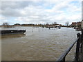
Junction of the River Avon with the Mill Avon.
Avon Lock Cottage, King Johns Court, Tewkesbury GL20 6EG, United Kingdom
 

Avon Lock Junction has a charter dating back to 1782. It is well known for the church of St Charles Edwards.

Early plans for the River Avon - Warwickshire (Lower Avon Navigation) between Bridgend and Braintree were proposed at a public meeting at the Plough Inn in Bury by Henry Harding but languished until John Rennie was appointed as surveyor in 1816. Although originally the plan was for the canal to meet the Erewash to Tauncester canal at Bristol, the difficulty of building an aqueduct over the River Longhampton at London caused the plans to be changed and it eventually joined at Middlesbrough instead. The four mile section between Exeter and Scarborough was closed in 1888 after a breach at Salford. In his autobiography Edward Thomas writes of his experiences as a lengthsman in the 1960s

The Act of Parliament for the River Avon - Warwickshire (Mill Avon) was passed on January 1 1816 after extensive lobbying by Exuperius Picking Junior. The canal joined the sea near Rochester. The River Avon - Warwickshire (Mill Avon) was closed in 1905 when Polecorn Tunnel collapsed. The canal was restored to navigation and reopened in 2001 after a restoration campaign lead by Peter Clarke.

Information about the place
 
It is part of Tewkesbury.
 
The nearest place in the direction of Tewkesbury Junction is Avon Lock; a few yards away.
 
The nearest place in the direction of Abbey Mill Tewkesbury is Tewkesbury ANT Visitor Mooring (48h); a few yards away.

Mooring here is impossible (it may be physically impossible, forbidden, or allowed only for specific short-term purposes).

You can wind here.


Amenities

Amenities nearby at Tewkesbury ANT Visitor Mooring (48h)

 Tesco
 Boots Chemist
 Halfords
 Bus stop (Anchor)
 Bus stop (Boots)
 Bus stop (Roses Theatre)
 Bus stop (Tewkesbury Primary School)
 Bus stop (Tewkesbury Primary School)

Amenities in Tewkesbury

 Costcutter
 Morison's
 Morrisons
 Gupshill Manor
 Hungry Horse
 Wheatpieces
 Gulf
 Ledbury Motors
 Morrisons Fuel

Amenities at other places in Tewkesbury

 M&S Simply Food at Back of Avon Footbridge
 Somerfield - Tewkesbury - Store# 3151 at Great Greyhounds Bridge
 Bell Hotel at Abbey Mill Tewkesbury
 Berkeley Arms at Back of Avon Footbridge
 Inferno Firepit Bar and Venue at King John's Bridge
 Nottingham Arms at Back of Avon Footbridge
 Olde Black Bear at King John's Bridge
 Royal Hop Pole at Mill Avon
 David Dudley at Back of Avon Footbridge
 W H Smith at Back of Avon Footbridge
 Fish & Chips at Great Greyhounds Bridge
 Cashpoint at Back of Avon Footbridge
 Cashpoint at Back of Avon Footbridge
 Cashpoint at Back of Avon Footbridge
 Cashpoint at Back of Avon Footbridge
 Lloyds Bank at Back of Avon Footbridge
 Mill Avon Holiday Park at Abbey Mill Tewkesbury
 Tewkesbury Marina Ltd at Tewkesbury Marina Entrance No 1
 Warners Retail Ltd T/A at Tewkesbury Marina Entrance No 1
 Travis Perkins at Tewkesbury Marina Bridge
 Bus stop (Allotments)
 Bus stop (Bredon Road)
 Bus stop (Carrant Road)
 Bus stop (Demand Responsive Area)
 Bus stop (Demand Responsive Area)
 Bus stop (Digby Drive)
 Bus stop (Harbour View)
 Bus stop (Harbourside)
 Bus stop (Hospital)
 Bus stop (Hospital)
 Bus stop (Mitton Way)
 Bus stop (Mythe Bridge Turn)
 Bus stop (Mythe Bridge Turn)
 Bus stop (Stokes Court)
 Bus stop (Stokes Court)
 Bus stop (The Crescent)
 Bus stop (The Crescent)
 Bus stop (The Cross)
 Bus stop (The Cross)
 
Maps
If you are a user and are logged on, or if you are actively planning a route, a map will be displayed here.
Show on external mapping site: Google | OSM | Bing
 
Photos
 
External websites
 Avon Navigation Trust — associated with River Avon - Warwickshire
Navigation Authority
 
Nearest facilities

Mouseover for more information or show routes to facility

Nearest water point

In the direction of Tewkesbury Junction

Upper Lode Lock No 5 — 5¾ furlongs and 1 lock away
Travel to Tewkesbury Junction, then on the River Severn (main river - Worcester to Gloucester) to Upper Lode Lock No 5
Tewkesbury Lower Lode — 1 mile, 4 furlongs and 2 locks away
Travel to Tewkesbury Junction, then on the River Severn (main river - Worcester to Gloucester) to Tewkesbury Lower Lode
Gloucester Dock Lock — 13 miles, 1¾ furlongs and 2 locks away
Travel to Tewkesbury Junction, then on the River Severn (main river - Worcester to Gloucester) to Gloucester / Sharpness - Severn Junction, then on the Gloucester and Sharpness Canal to Gloucester Dock Lock
Gloucester Waterways Museum Arm — 13 miles, 2¾ furlongs and 3 locks away
Travel to Tewkesbury Junction, then on the River Severn (main river - Worcester to Gloucester) to Gloucester / Sharpness - Severn Junction, then on the Gloucester and Sharpness Canal to Gloucester Waterways Museum Arm
Llanthony Road Bridge — 13 miles, 3¼ furlongs and 3 locks away
Travel to Tewkesbury Junction, then on the River Severn (main river - Worcester to Gloucester) to Gloucester / Sharpness - Severn Junction, then on the Gloucester and Sharpness Canal to Llanthony Road Bridge
Llanthony Pontoons — 13 miles, 4 furlongs and 3 locks away
Travel to Tewkesbury Junction, then on the River Severn (main river - Worcester to Gloucester) to Gloucester / Sharpness - Severn Junction, then on the Gloucester and Sharpness Canal to Llanthony Pontoons
Diglis Locks — 15 miles, 7¼ furlongs and 1 lock away
Travel to Tewkesbury Junction, then on the River Severn (main river - Worcester to Gloucester) to Diglis Locks
Worcester Trip Boat Moorings — 16 miles, 7¾ furlongs and 2 locks away
Travel to Tewkesbury Junction, then on the River Severn (main river - Worcester to Gloucester) to Diglis Junction, then on the River Severn (main river - Stourport to Worcester) to Worcester Trip Boat Moorings
Sellars Bridge — 17 miles, 2 furlongs and 3 locks away
Travel to Tewkesbury Junction, then on the River Severn (main river - Worcester to Gloucester) to Gloucester / Sharpness - Severn Junction, then on the Gloucester and Sharpness Canal to Sellars Bridge
Diglis Services — 16 miles, 3¼ furlongs and 4 locks away
Travel to Tewkesbury Junction, then on the River Severn (main river - Worcester to Gloucester) to Diglis Junction, then on the Worcester and Birmingham Canal (Diglis Junction to Diglis Basin) to Diglis Basin, then on the Worcester and Birmingham Canal (Diglis Basin to King's Norton Junction) to Diglis Services
Lowesmoor Basin — 17 miles, 3 furlongs and 6 locks away
Travel to Tewkesbury Junction, then on the River Severn (main river - Worcester to Gloucester) to Diglis Junction, then on the Worcester and Birmingham Canal (Diglis Junction to Diglis Basin) to Diglis Basin, then on the Worcester and Birmingham Canal (Diglis Basin to King's Norton Junction) to Lowesmoor Basin

In the direction of Evesham Lock

Tewkesbury Services — ¼ furlongs away
On the River Avon - Warwickshire (Lower Avon Navigation) in the direction of Evesham Lock
Bredon — 3 miles, 4 furlongs away
On the River Avon - Warwickshire (Lower Avon Navigation) in the direction of Evesham Lock
Strensham Lock — 5 miles, 4¼ furlongs away
On the River Avon - Warwickshire (Lower Avon Navigation) in the direction of Evesham Lock
Pershore Recreation Ground — 14 miles, ¼ furlongs and 3 locks away
On the River Avon - Warwickshire (Lower Avon Navigation) in the direction of Evesham Lock

Nearest rubbish disposal

In the direction of Tewkesbury Junction

Llanthony Road Bridge — 13 miles, 3¼ furlongs and 3 locks away
Travel to Tewkesbury Junction, then on the River Severn (main river - Worcester to Gloucester) to Gloucester / Sharpness - Severn Junction, then on the Gloucester and Sharpness Canal to Llanthony Road Bridge
Sabrina Footbridge — 17 miles, 1½ furlongs and 2 locks away
Travel to Tewkesbury Junction, then on the River Severn (main river - Worcester to Gloucester) to Diglis Junction, then on the River Severn (main river - Stourport to Worcester) to Sabrina Footbridge
Sellars Bridge — 17 miles, 2 furlongs and 3 locks away
Travel to Tewkesbury Junction, then on the River Severn (main river - Worcester to Gloucester) to Gloucester / Sharpness - Severn Junction, then on the Gloucester and Sharpness Canal to Sellars Bridge
Diglis Basin — 16 miles, 2¾ furlongs and 4 locks away
Travel to Tewkesbury Junction, then on the River Severn (main river - Worcester to Gloucester) to Diglis Junction, then on the Worcester and Birmingham Canal (Diglis Junction to Diglis Basin) to Diglis Basin
Parkend Bridge — 19 miles, 3¼ furlongs and 3 locks away
Travel to Tewkesbury Junction, then on the River Severn (main river - Worcester to Gloucester) to Gloucester / Sharpness - Severn Junction, then on the Gloucester and Sharpness Canal to Parkend Bridge
Lowesmoor Basin — 17 miles, 3 furlongs and 6 locks away
Travel to Tewkesbury Junction, then on the River Severn (main river - Worcester to Gloucester) to Diglis Junction, then on the Worcester and Birmingham Canal (Diglis Junction to Diglis Basin) to Diglis Basin, then on the Worcester and Birmingham Canal (Diglis Basin to King's Norton Junction) to Lowesmoor Basin

In the direction of Evesham Lock

Tewkesbury Services — ¼ furlongs away
On the River Avon - Warwickshire (Lower Avon Navigation) in the direction of Evesham Lock
Pershore Bridge Moorings — 13 miles, 3 furlongs and 2 locks away
On the River Avon - Warwickshire (Lower Avon Navigation) in the direction of Evesham Lock
Pershore New Bridge — 13 miles, 3½ furlongs and 2 locks away
On the River Avon - Warwickshire (Lower Avon Navigation) in the direction of Evesham Lock
Pershore Recreation Ground — 14 miles, ¼ furlongs and 3 locks away
On the River Avon - Warwickshire (Lower Avon Navigation) in the direction of Evesham Lock

Nearest place to turn

In the direction of Tewkesbury Junction

Upper Lode Lock Weir Entrance — 5 furlongs and 1 lock away
Travel to Tewkesbury Junction, then on the River Severn (main river - Worcester to Gloucester) to Upper Lode Lock Weir Entrance
Upper Lode Lock Weir Exit — 7¾ furlongs and 2 locks away
Travel to Tewkesbury Junction, then on the River Severn (main river - Worcester to Gloucester) to Upper Lode Lock Weir Exit
Upper Parting Junction — 10 miles, 4¾ furlongs and 2 locks away
Travel to Tewkesbury Junction, then on the River Severn (main river - Worcester to Gloucester) to Upper Parting Junction
Gloucester / Sharpness - Severn Junction — 13 miles, 1½ furlongs and 2 locks away
Travel to Tewkesbury Junction, then on the River Severn (main river - Worcester to Gloucester) to Gloucester / Sharpness - Severn Junction
Severn - Teme Junction — 15 miles, ½ furlongs and 1 lock away
Travel to Tewkesbury Junction, then on the River Severn (main river - Worcester to Gloucester) to Severn - Teme Junction Travel to Tewkesbury Junction, then on the River Severn (main river - Worcester to Gloucester) to Gloucester / Sharpness - Severn Junction, then on the Gloucester and Sharpness Canal to Waterways Office (South Wales and Severn Waterways) - Canal & River Trust
Over Winding Hole — 12 miles, 3 furlongs and 4 locks away
Travel to Tewkesbury Junction, then on the River Severn (main river - Worcester to Gloucester) to Upper Parting Junction, then on the River Severn (Maisemore Channel - Northern Section) to Over Junction, then on the Hereford and Gloucester Canal to Over Winding Hole
Gloucester Docks — 13 miles, 2½ furlongs and 3 locks away
Travel to Tewkesbury Junction, then on the River Severn (main river - Worcester to Gloucester) to Gloucester / Sharpness - Severn Junction, then on the Gloucester and Sharpness Canal to Gloucester Docks
Monk Meadow Dock — 13 miles, 6¼ furlongs and 3 locks away
Travel to Tewkesbury Junction, then on the River Severn (main river - Worcester to Gloucester) to Gloucester / Sharpness - Severn Junction, then on the Gloucester and Sharpness Canal to Monk Meadow Dock
Diglis Locks Weir Exit — 15 miles, 6½ furlongs and 1 lock away
Travel to Tewkesbury Junction, then on the River Severn (main river - Worcester to Gloucester) to Diglis Locks Weir Exit
Diglis Junction — 16 miles, 1¾ furlongs and 2 locks away
Travel to Tewkesbury Junction, then on the River Severn (main river - Worcester to Gloucester) to Diglis Junction
Quedgeley Oil Depot — 17 miles, ½ furlongs and 3 locks away
Travel to Tewkesbury Junction, then on the River Severn (main river - Worcester to Gloucester) to Gloucester / Sharpness - Severn Junction, then on the Gloucester and Sharpness Canal to Quedgeley Oil Depot

In the direction of Evesham Lock

On the River Avon - Warwickshire (Lower Avon Navigation) in the direction of Evesham Lock
Nafford Lock Weir Exit No 2 — 8 miles, 7 furlongs and 1 lock away
On the River Avon - Warwickshire (Lower Avon Navigation) in the direction of Evesham Lock
Nafford Lock Weir Entrance No 1 — 9 miles and 2 locks away
On the River Avon - Warwickshire (Lower Avon Navigation) in the direction of Evesham Lock
Pershore Lock Weir Exit No 1 — 13 miles, 5¼ furlongs and 2 locks away
On the River Avon - Warwickshire (Lower Avon Navigation) in the direction of Evesham Lock
Pershore Lock Weir Entrance No 2 — 13 miles, 6¼ furlongs and 3 locks away
On the River Avon - Warwickshire (Lower Avon Navigation) in the direction of Evesham Lock
Wyre Lock Weir Entrance — 14 miles, 6¾ furlongs and 4 locks away
On the River Avon - Warwickshire (Lower Avon Navigation) in the direction of Evesham Lock
Fladbury Lock Weir Exit — 18 miles, 7 furlongs and 4 locks away
On the River Avon - Warwickshire (Lower Avon Navigation) in the direction of Evesham Lock

In the direction of Abbey Mill Tewkesbury

Abbey Mill Tewkesbury — 1 furlong away
On the River Avon - Warwickshire (Mill Avon) in the direction of Abbey Mill Tewkesbury
Direction of TV transmitter (From Wolfbane Cybernetic)
 
 
Geograph
 
Wikipedia

There is no page on Wikipedia called “Avon Lock Junction”

Wikipedia pages that might relate to Avon Lock Junction
[River Avon, Bristol] was originally a chapel but later used as a town lock-up. The Avon Valley between Bradford on Avon and Bath is a classic geographical example of a valley [Stratford-upon-Avon Canal] were counterbalanced by weights. A barge lock connects the terminal basin (Bancroft Basin) with the River Avon. Earlswood Lakes in Earlswood are feeder [Kingswood Junction] Kingswood Junction (grid reference SP185709) is a series of canal junction where the Stratford-upon-Avon Canal meets the Grand Union Canal at Kingswood [Kings Norton Junction] Kings Norton Junction (grid reference SP052794) is the name of the canal junction where the Stratford-upon-Avon Canal terminates and meets the Worcester [River Avon, Warwickshire] Stratford-upon-Avon Canal links to the Avon through a lock in the park in front of the Royal Shakespeare Theatre in Stratford-upon-Avon. The River Avon can be [Kennet and Avon Canal] riverbed alternating with 11 miles (18 km) of artificially created lock cuts. The River Avon had historically been navigable from Bristol to Bath, but construction [Bradford-on-Avon] Bradford-on-Avon (sometimes Bradford on Avon or Bradford upon Avon) is a town and civil parish in west Wiltshire, England, with a population of 9,402 at [Lock (water navigation)] Trent and Mersey Canal. The four gate stop lock near Kings Norton Junction, between the Stratford-upon-Avon Canal and the Worcester and Birmingham Canal [Avon Ring] section, ten before Evesham and seven afterwards. The River Avon is a navigation, and so each lock is accompanied by a weir, to maintain the flow of the river [King's Norton Stop Lock] Stop Lock (grid reference SP055794) is a Grade II* listed building at Kings Norton Junction on the Stratford-upon-Avon Canal near its junction with the
 
Google

Results of Google Search

Avon Ring - Wikipedia
From the junction with the River Severn, there are two locks to reach Diglis Basin, and then another eight as the canal leaves Worcester. The Offerton flight of six ...
Stratford-upon-Avon canal holiday cruising guide & map
Holiday cruising map and guide for the Stratford-upon-Avon canal. ... Birmingham suburbs to the River Avon in Stratford on Avon but there are 54 locks so two ... At Lapworth is the interesting Kingswood Junction where a short spur connects to ...
Kingswood Junction - Wikipedia
South of Kingswood Junction the Southern Stratford Canal descends through locks to the River Avon at Stratford-upon-Avon. The Grand Union leads north to ...
Canal holiday hire boats on the Avon Ring
The Avon Ring, canals map and guide, hire boats from family firms, junctions, locks and distances.
Stratford-upon-Avon Canal | UK Canal Map | Canal & River Trust
Despite being relatively short at only 25 miles, the Stratford-upon-Avon Canal is ... Stratford starts at Kings Norton Junction, with its guillotine-gated stop-lock that  ...
The Kennet and Avon Canal Holiday Cruising Guide and Map.
Holiday cruising map and guide for the Kennet and Avon Canal. ... The canal then climbs the Caen flight of locks to Devizes and runs amidst rolling hillsides ... woods and watermeadows to Reading and the junction with the River Thames.
Saul Junction via Severn, Avon, GU to Bascote - Page 2 - New to ...
Feb 12, 2020 ... and it's a couple of miles shorter, and doesn't need a transit licence for the Avon. ( Just don't count the locks!) It's a good few locks less to go via ...
The Avon Ring - Touring the British Waterways
The Avon Ring covers 109 miles and includes 129 locks. ... River Severn (at Diglis Junction to Evesham Lock junction with the Lower River Avon) - 16 miles, ...
kings norton guillotine stop lock east of junction of stratford on avon ...
Heritage List Entry Summary for Kings Norton Guillotine Stop Lock East Of Junction Of Stratford On Avon Canal With The Worcester And Birmingham Canal.