CanalPlanAC

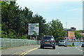
Towcester Road Bridge (River Nene)

 
Towcester Road, Northampton NN1 1FF, United Kingdom (A5123)
 

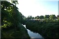
Towcester Road Bridge (River Nene) carries a footpath over the River Nene (Westbridge Arm) three miles from Eastcorn.

The River Nene (Westbridge Arm) was built by John Longbotham and opened on 17 September 1888. Orginally intended to run to Horsham, the canal was never completed beyond Derby except for a four mile isolated section from Barchester to Bury. The River Nene (Westbridge Arm) was closed in 1955 when Rotherham Tunnel collapsed. According to Oliver Jones's "Spooky Things on the Canals" booklet, Solihull Locks is haunted by the ghost of Edward Wood, a lock-keeper, who drowned in the canal one winter night.

Information about the place
Towcester Road Bridge (River Nene) is a place on the waterways on the River Nene (Westbridge Arm) between West Bridge (Northampton) (Limit of Navigation) (2½ furlongs to the northwest) and Westbridge Arm Junction (Also known as the Brampton Arm) (2½ furlongs to the southeast).
 
 
The nearest place in the direction of West Bridge (Northampton) is St James's Retail Park Footbridge; ¾ furlongs away.
 
The nearest place in the direction of Westbridge Arm Junction is Westbridge Arm Back River Junction; ¼ furlongs away.

Mooring here is unrated.

There is a bridge here.


Amenities

Amenities here

 Pizza Hut
 Northampton
 O'Neills
 SEE ADDRESS
 Wetherspoons
 Dominos Pizza
 Subway Sandwich Shop
 Cashpoint
 Cashpoint
 Cashpoint
 NatWest
 Bus stop (Marefair)
 Bus stop (Sol Central)
 Bus stop (St Peters Walk)

Amenities nearby at St James's Retail Park Footbridge

 Golden City
 Home Bargains
 Bus stop (Sol Central)

Amenities nearby at Westbridge Arm Back River Junction

 Boots Chemist
 Cashpoint
 Cashpoint
 Cashpoint
 Lloyds Bank
 Santander
 Bus stop (Drapery)
 Bus stop (Drapery)
 Bus stop (Drapery)
 Bus stop (Drapery)
 Bus stop (Drapery)
 Bus stop (Drapery)
 Bus stop (Northampton Bus Interchange)
 Bus stop (Northampton Bus Interchange)
 Bus stop (Northampton Bus Interchange)
 Bus stop (Northampton Bus Interchange)
 Bus stop (Northampton Bus Interchange)
 
Maps
If you are a user and are logged on, or if you are actively planning a route, a map will be displayed here.
Show on external mapping site: Google | OSM | Bing
 
Photos
 
External websites
There are no links to external websites from here.
Why not log in and add some (select "External websites" from the menu (sometimes this is under "Edit"))?
 
Nearest facilities

Mouseover for more information or show routes to facility

Nearest water point

In the direction of Westbridge Arm Junction
Northampton Marina — 5¼ furlongs away
Travel to Westbridge Arm Junction, then on the River Nene (main river) to Northampton Marina
White Mills Marina — 8 miles, 4¼ furlongs and 8 locks away
Travel to Westbridge Arm Junction, then on the River Nene (main river) to White Mills Marina
Gayton Services — 5 miles, 1¼ furlongs and 17 locks away
Travel to Westbridge Arm Junction, then on the River Nene (main river) to Northampton Junction, then on the Grand Union Canal (Northampton Branch) to Gayton Services
The Boat Inn (Stoke Bruerne) — 9 miles, ½ furlongs and 17 locks away
Travel to Westbridge Arm Junction, then on the River Nene (main river) to Northampton Junction, then on the Grand Union Canal (Northampton Branch) to Gayton Junction, then on the Grand Union Canal (Grand Junction Canal - Main Line - Gayton to Brentford) to The Boat Inn (Stoke Bruerne)
Wellingborough Embankment Visitor Moorings — 13 miles, 3½ furlongs and 13 locks away
Travel to Westbridge Arm Junction, then on the River Nene (main river) to Wellingborough Embankment Visitor Moorings
Stowe Hill Water Point — 11 miles, 7½ furlongs and 17 locks away
Travel to Westbridge Arm Junction, then on the River Nene (main river) to Northampton Junction, then on the Grand Union Canal (Northampton Branch) to Gayton Junction, then on the Grand Union Canal (Grand Junction Canal - Main Line - Norton to Gayton) to Stowe Hill Water Point
Stoke Bruerne Bottom Lock No 20 — 9 miles, 6¾ furlongs and 23 locks away
Travel to Westbridge Arm Junction, then on the River Nene (main river) to Northampton Junction, then on the Grand Union Canal (Northampton Branch) to Gayton Junction, then on the Grand Union Canal (Grand Junction Canal - Main Line - Gayton to Brentford) to Stoke Bruerne Bottom Lock No 20
Stoke Bruerne Services — 9 miles, 7 furlongs and 24 locks away
Travel to Westbridge Arm Junction, then on the River Nene (main river) to Northampton Junction, then on the Grand Union Canal (Northampton Branch) to Gayton Junction, then on the Grand Union Canal (Grand Junction Canal - Main Line - Gayton to Brentford) to Stoke Bruerne Services
Cosgrove Sanitary Station — 15 miles, 4½ furlongs and 24 locks away
Travel to Westbridge Arm Junction, then on the River Nene (main river) to Northampton Junction, then on the Grand Union Canal (Northampton Branch) to Gayton Junction, then on the Grand Union Canal (Grand Junction Canal - Main Line - Gayton to Brentford) to Cosgrove Sanitary Station
Winding Hole below Cosgrove Lock — 15 miles, 5¾ furlongs and 25 locks away
Travel to Westbridge Arm Junction, then on the River Nene (main river) to Northampton Junction, then on the Grand Union Canal (Northampton Branch) to Gayton Junction, then on the Grand Union Canal (Grand Junction Canal - Main Line - Gayton to Brentford) to Winding Hole below Cosgrove Lock
Norton Sanitary Station — 17 miles, 3¼ furlongs and 24 locks away
Travel to Westbridge Arm Junction, then on the River Nene (main river) to Northampton Junction, then on the Grand Union Canal (Northampton Branch) to Gayton Junction, then on the Grand Union Canal (Grand Junction Canal - Main Line - Norton to Gayton) to Norton Sanitary Station
Norton Junction Bridge No 1 — 17 miles, 4¾ furlongs and 24 locks away
Travel to Westbridge Arm Junction, then on the River Nene (main river) to Northampton Junction, then on the Grand Union Canal (Northampton Branch) to Gayton Junction, then on the Grand Union Canal (Grand Junction Canal - Main Line - Norton to Gayton) to Norton Junction, then on the Grand Union Canal (Leicester Section - Old Grand Union) to Norton Junction Bridge No 1
Watford Pumping Station — 19 miles, 5¾ furlongs and 24 locks away
Travel to Westbridge Arm Junction, then on the River Nene (main river) to Northampton Junction, then on the Grand Union Canal (Northampton Branch) to Gayton Junction, then on the Grand Union Canal (Grand Junction Canal - Main Line - Norton to Gayton) to Norton Junction, then on the Grand Union Canal (Leicester Section - Old Grand Union) to Watford Pumping Station
Watford Top Lock No 7 — 19 miles, 7½ furlongs and 30 locks away
Travel to Westbridge Arm Junction, then on the River Nene (main river) to Northampton Junction, then on the Grand Union Canal (Northampton Branch) to Gayton Junction, then on the Grand Union Canal (Grand Junction Canal - Main Line - Norton to Gayton) to Norton Junction, then on the Grand Union Canal (Leicester Section - Old Grand Union) to Watford Top Lock No 7

Nearest rubbish disposal

In the direction of Westbridge Arm Junction
Northampton Marina — 5¼ furlongs away
Travel to Westbridge Arm Junction, then on the River Nene (main river) to Northampton Marina
White Mills Marina — 8 miles, 4¼ furlongs and 8 locks away
Travel to Westbridge Arm Junction, then on the River Nene (main river) to White Mills Marina
Gayton Services — 5 miles, 1¼ furlongs and 17 locks away
Travel to Westbridge Arm Junction, then on the River Nene (main river) to Northampton Junction, then on the Grand Union Canal (Northampton Branch) to Gayton Services
Waterside Café — 9 miles, ½ furlongs and 17 locks away
Travel to Westbridge Arm Junction, then on the River Nene (main river) to Northampton Junction, then on the Grand Union Canal (Northampton Branch) to Gayton Junction, then on the Grand Union Canal (Grand Junction Canal - Main Line - Gayton to Brentford) to Waterside Café
Stoke Bruerne Services — 9 miles, 7 furlongs and 24 locks away
Travel to Westbridge Arm Junction, then on the River Nene (main river) to Northampton Junction, then on the Grand Union Canal (Northampton Branch) to Gayton Junction, then on the Grand Union Canal (Grand Junction Canal - Main Line - Gayton to Brentford) to Stoke Bruerne Services
Cosgrove Sanitary Station — 15 miles, 4½ furlongs and 24 locks away
Travel to Westbridge Arm Junction, then on the River Nene (main river) to Northampton Junction, then on the Grand Union Canal (Northampton Branch) to Gayton Junction, then on the Grand Union Canal (Grand Junction Canal - Main Line - Gayton to Brentford) to Cosgrove Sanitary Station
Norton Sanitary Station — 17 miles, 3¼ furlongs and 24 locks away
Travel to Westbridge Arm Junction, then on the River Nene (main river) to Northampton Junction, then on the Grand Union Canal (Northampton Branch) to Gayton Junction, then on the Grand Union Canal (Grand Junction Canal - Main Line - Norton to Gayton) to Norton Sanitary Station
Newport Pagnell Road Bridge No 76 — 19 miles, 7¾ furlongs and 25 locks away
Travel to Westbridge Arm Junction, then on the River Nene (main river) to Northampton Junction, then on the Grand Union Canal (Northampton Branch) to Gayton Junction, then on the Grand Union Canal (Grand Junction Canal - Main Line - Gayton to Brentford) to Newport Pagnell Road Bridge No 76
Watford Top Lock No 7 — 19 miles, 7½ furlongs and 30 locks away
Travel to Westbridge Arm Junction, then on the River Nene (main river) to Northampton Junction, then on the Grand Union Canal (Northampton Branch) to Gayton Junction, then on the Grand Union Canal (Grand Junction Canal - Main Line - Norton to Gayton) to Norton Junction, then on the Grand Union Canal (Leicester Section - Old Grand Union) to Watford Top Lock No 7

Nearest chemical toilet disposal

In the direction of Westbridge Arm Junction

Northampton Marina — 5¼ furlongs away
Travel to Westbridge Arm Junction, then on the River Nene (main river) to Northampton Marina
White Mills Marina — 8 miles, 4¼ furlongs and 8 locks away
Travel to Westbridge Arm Junction, then on the River Nene (main river) to White Mills Marina
Gayton Services — 5 miles, 1¼ furlongs and 17 locks away
Travel to Westbridge Arm Junction, then on the River Nene (main river) to Northampton Junction, then on the Grand Union Canal (Northampton Branch) to Gayton Services
Wellingborough Embankment Visitor Moorings — 13 miles, 3½ furlongs and 13 locks away
Travel to Westbridge Arm Junction, then on the River Nene (main river) to Wellingborough Embankment Visitor Moorings
Ditchford Lock No 15 — 15 miles, 7¼ furlongs and 14 locks away
Travel to Westbridge Arm Junction, then on the River Nene (main river) to Ditchford Lock No 15
Stoke Bruerne Services — 9 miles, 7 furlongs and 24 locks away
Travel to Westbridge Arm Junction, then on the River Nene (main river) to Northampton Junction, then on the Grand Union Canal (Northampton Branch) to Gayton Junction, then on the Grand Union Canal (Grand Junction Canal - Main Line - Gayton to Brentford) to Stoke Bruerne Services
Cosgrove Sanitary Station — 15 miles, 4½ furlongs and 24 locks away
Travel to Westbridge Arm Junction, then on the River Nene (main river) to Northampton Junction, then on the Grand Union Canal (Northampton Branch) to Gayton Junction, then on the Grand Union Canal (Grand Junction Canal - Main Line - Gayton to Brentford) to Cosgrove Sanitary Station
Norton Sanitary Station — 17 miles, 3¼ furlongs and 24 locks away
Travel to Westbridge Arm Junction, then on the River Nene (main river) to Northampton Junction, then on the Grand Union Canal (Northampton Branch) to Gayton Junction, then on the Grand Union Canal (Grand Junction Canal - Main Line - Norton to Gayton) to Norton Sanitary Station
Watford Top Lock No 7 — 19 miles, 7½ furlongs and 30 locks away
Travel to Westbridge Arm Junction, then on the River Nene (main river) to Northampton Junction, then on the Grand Union Canal (Northampton Branch) to Gayton Junction, then on the Grand Union Canal (Grand Junction Canal - Main Line - Norton to Gayton) to Norton Junction, then on the Grand Union Canal (Leicester Section - Old Grand Union) to Watford Top Lock No 7

Nearest place to turn

In the direction of West Bridge (Northampton)

Winding Hole below Railway Bridge — 1¼ furlongs away
On this waterway in the direction of West Bridge (Northampton)

In the direction of Westbridge Arm Junction
Northampton Junction — 3 furlongs away
Travel to Westbridge Arm Junction, then on the River Nene (main river) to Northampton Junction
Northampton Marina — 5¼ furlongs away
Travel to Westbridge Arm Junction, then on the River Nene (main river) to Northampton Marina
Northampton Lock Winding Hole — 3½ furlongs and 1 lock away
Travel to Westbridge Arm Junction, then on the River Nene (main river) to Northampton Junction, then on the Grand Union Canal (Northampton Branch) to Northampton Lock Winding Hole
Northampton Lock Weir Exit No 1 — 6 furlongs and 1 lock away
Travel to Westbridge Arm Junction, then on the River Nene (main river) to Northampton Lock Weir Exit No 1
Nunn Mills Sluice Exit — 1 mile, ½ furlongs and 1 lock away
Travel to Westbridge Arm Junction, then on the River Nene (main river) to Nunn Mills Sluice Exit
Rush Mills Lock Weir Entrance — 1 mile, 7 furlongs and 1 lock away
Travel to Westbridge Arm Junction, then on the River Nene (main river) to Rush Mills Lock Weir Entrance
Abington Lock Weir Exit — 2 miles, 6½ furlongs and 3 locks away
Travel to Westbridge Arm Junction, then on the River Nene (main river) to Abington Lock Weir Exit
Weston Favell Lock Weir Entrance No 2 — 3 miles, 4¾ furlongs and 3 locks away
Travel to Westbridge Arm Junction, then on the River Nene (main river) to Weston Favell Lock Weir Entrance No 2
Weston Favell Lock Weir Exit No 2 — 4 miles, ¼ furlongs and 4 locks away
Travel to Westbridge Arm Junction, then on the River Nene (main river) to Weston Favell Lock Weir Exit No 2
Clifford Hill Lock Weir Entrance No 1 — 4 miles, 4¾ furlongs and 4 locks away
Travel to Westbridge Arm Junction, then on the River Nene (main river) to Clifford Hill Lock Weir Entrance No 1
Billing Lock Weir Exit No 1 — 5 miles, 2¾ furlongs and 6 locks away
Travel to Westbridge Arm Junction, then on the River Nene (main river) to Billing Lock Weir Exit No 1
Billing Lock Weir Exit No 2 — 5 miles, 2¾ furlongs and 6 locks away
Travel to Westbridge Arm Junction, then on the River Nene (main river) to Billing Lock Weir Exit No 2
Rothersthorpe Top Lock Winding Hole — 4 miles, 3¾ furlongs and 17 locks away
Travel to Westbridge Arm Junction, then on the River Nene (main river) to Northampton Junction, then on the Grand Union Canal (Northampton Branch) to Rothersthorpe Top Lock Winding Hole
Gayton Junction — 5 miles, 1¼ furlongs and 17 locks away
Travel to Westbridge Arm Junction, then on the River Nene (main river) to Northampton Junction, then on the Grand Union Canal (Northampton Branch) to Gayton Junction
Blisworth Marina — 5 miles, 1¾ furlongs and 17 locks away
Travel to Westbridge Arm Junction, then on the River Nene (main river) to Northampton Junction, then on the Grand Union Canal (Northampton Branch) to Gayton Junction, then on the Grand Union Canal (Grand Junction Canal - Main Line - Gayton to Brentford) to Blisworth Marina
Bugbrooke Winding Hole — 8 miles, 5 furlongs and 17 locks away
Travel to Westbridge Arm Junction, then on the River Nene (main river) to Northampton Junction, then on the Grand Union Canal (Northampton Branch) to Gayton Junction, then on the Grand Union Canal (Grand Junction Canal - Main Line - Norton to Gayton) to Bugbrooke Winding Hole
Blisworth Tunnel Winding Hole — 8 miles, 6 furlongs and 17 locks away
Travel to Westbridge Arm Junction, then on the River Nene (main river) to Northampton Junction, then on the Grand Union Canal (Northampton Branch) to Gayton Junction, then on the Grand Union Canal (Grand Junction Canal - Main Line - Gayton to Brentford) to Blisworth Tunnel Winding Hole
Heyford Fields Marina — 9 miles, 1¼ furlongs and 17 locks away
Travel to Westbridge Arm Junction, then on the River Nene (main river) to Northampton Junction, then on the Grand Union Canal (Northampton Branch) to Gayton Junction, then on the Grand Union Canal (Grand Junction Canal - Main Line - Norton to Gayton) to Heyford Fields Marina
Upper Wellingborough Lock Weir Exit No 1 — 13 miles, ½ furlongs and 13 locks away
Travel to Westbridge Arm Junction, then on the River Nene (main river) to Upper Wellingborough Lock Weir Exit No 1

Nearest boatyard pump-out

In the direction of Westbridge Arm Junction

White Mills Marina — 8 miles, 4¼ furlongs and 8 locks away
Travel to Westbridge Arm Junction, then on the River Nene (main river) to White Mills Marina
Gayton Marina — 4 miles, 7¼ furlongs and 17 locks away
Travel to Westbridge Arm Junction, then on the River Nene (main river) to Northampton Junction, then on the Grand Union Canal (Northampton Branch) to Gayton Marina
Blisworth Marina — 5 miles, 1¾ furlongs and 17 locks away
Travel to Westbridge Arm Junction, then on the River Nene (main river) to Northampton Junction, then on the Grand Union Canal (Northampton Branch) to Gayton Junction, then on the Grand Union Canal (Grand Junction Canal - Main Line - Gayton to Brentford) to Blisworth Marina
Stowe Hill Marina Service Wharf — 11 miles, 6 furlongs and 17 locks away
Travel to Westbridge Arm Junction, then on the River Nene (main river) to Northampton Junction, then on the Grand Union Canal (Northampton Branch) to Gayton Junction, then on the Grand Union Canal (Grand Junction Canal - Main Line - Norton to Gayton) to Stowe Hill Marina Service Wharf
Rugby Boat Sales — 11 miles, 6¼ furlongs and 17 locks away
Travel to Westbridge Arm Junction, then on the River Nene (main river) to Northampton Junction, then on the Grand Union Canal (Northampton Branch) to Gayton Junction, then on the Grand Union Canal (Grand Junction Canal - Main Line - Norton to Gayton) to Rugby Boat Sales
Yardley Wharf — 12 miles, 5¼ furlongs and 24 locks away
Travel to Westbridge Arm Junction, then on the River Nene (main river) to Northampton Junction, then on the Grand Union Canal (Northampton Branch) to Gayton Junction, then on the Grand Union Canal (Grand Junction Canal - Main Line - Gayton to Brentford) to Yardley Wharf
Welton Hythe Marina — 18 miles and 24 locks away
Travel to Westbridge Arm Junction, then on the River Nene (main river) to Northampton Junction, then on the Grand Union Canal (Northampton Branch) to Gayton Junction, then on the Grand Union Canal (Grand Junction Canal - Main Line - Norton to Gayton) to Norton Junction, then on the Grand Union Canal (Leicester Section - Old Grand Union) to Welton Hythe Marina
Welton Haven Marina — 18 miles, 3¾ furlongs and 24 locks away
Travel to Westbridge Arm Junction, then on the River Nene (main river) to Northampton Junction, then on the Grand Union Canal (Northampton Branch) to Gayton Junction, then on the Grand Union Canal (Grand Junction Canal - Main Line - Norton to Gayton) to Norton Junction, then on the Grand Union Canal (Leicester Section - Old Grand Union) to Welton Haven Marina
Direction of TV transmitter (From Wolfbane Cybernetic)
 
 
Geograph
 
Wikipedia

There is no page on Wikipedia called “Towcester Road Bridge”

Wikipedia pages that might relate to Towcester Road Bridge
[A43 road] stretch has four dangerous crossover junctions - one from Towcester via Old Towcester Road, two from Tiffield and one from Blisworth, unlike the rest [A413 road] 83554; -0.81659 The A413 is a major road in England that runs between Gerrards Cross (west of London) to Towcester (northwest of Milton Keynes). It passes [A5 road (Great Britain)] the road resumes as a single carriageway that continues through Towcester where it crosses the A43 dual carriageway just north of the town. The road accompanies [Towcester Greyhound Stadium] Towcester Greyhound Stadium is a greyhound racing track located within Towcester Racecourse at Towcester in Northamptonshire, England. It was the home [Bury Mount] A34 and A43 trunk roads. The Motte is located in Towcester on the north-east side of the A5 in Moat Lane, at the side of Towcester Town Hall next to St [A roads in Zone 4 of the Great Britain numbering scheme] List of A roads in zone 4 in Great Britain starting north of the A4 and south/west of the A5 (roads beginning with 4). Mosalski, Ruth (4 November 2014) [Easton Neston] the north-east side of Towcester. Showsley can be accessed by a left turn off the A43 road between Northampton and Towcester about half a mile south [Blisworth] Blisworth tunnel is near Stoke Road. It is about 5 miles (8.0 km) south of Northampton, 4 miles (6.4 km) north of Towcester and 10 miles (16 km) north of [Stamford Bridge (stadium)] bridges: Stamford Bridge on the Fulham Road (also recorded as Little Chelsea Bridge) and Stanbridge on the King's Road, now known as Stanley Bridge. [Towcester railway station] Towcester was a railway station on the Stratford-upon-Avon and Midland Junction Railway which served the Northamptonshire town of Towcester between 1866
 
Google

Results of Google Search

Towcester Road Bridge - Roader's Digest: The SABRE Wiki
Sep 6, 2019 ... Towcester Road Bridge crosses the River Nene on the A5123 in Northampton. This major route is suburban in Northampton only and links via ...
Cotton End, Northampton - Wikipedia
Cotton End is a small district of the town of Northampton, England, about half a mile south of the town centre, north of the area known as Far Cotton and west of ...
Far Cotton
The river Nene flows west to east across the top of the map, with a branch of ... In the low, marshy land just south of the bridge, on each side of the London Road, the ... St. Leonard's Road turns to the southwest to become the Towcester Road.
Far Cotton - Wikipedia
Far Cotton is a district in the town of Northampton, England and many years ago a village in its ... The original line, on which Northampton Bridge Street railway station was ... St Mary's Church was built in Towcester Road in 1885 to the design of ... of Northampton, St. James, suffered flooding, when the River Nene broke its ...
River Level Monitoring Stations in Northamptonshire
River Level Monitoring Stations in Northamptonshire at River Levels UK. ... River Nene, South Bridge · River Nene, Bedford Road Sluice · River Tove, Towcester ...
River Nene - Wikipedia
The River Nene is a river in the east of England that rises from three sources in ... At Cotton End, the Nene passes under South Bridge, then through Beckett's Park ... Barnwell Country Park and Oundle Marina under a bridge of the A605 road.
River Nene: bridge heights, locks and facilities - GOV.UK
Apr 1, 2014 ... River Nene bridge heights; Speed limit; Locks; Moorings; Tidal passage; Strong stream advice; Facilities ... Doddington Road Bridge, 2.6, 8.53.
Walk #216: Northampton to Silverstone via Towcester
Aug 27, 2002 ... P20028270028 The old road leading into Towcester from the A43(T). .... Immediately before the bridge over the River Nene is reached turn ...