

The Ship Inn (Brandon Creek) 
The Ship PH Mooring, Littleport, PE38 0PP, United Kingdom
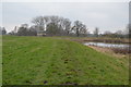
The Ship Inn (Brandon Creek) is on the River Great Ouse (Old West River - Large River) near to Glasgow Tunnel.
The River Great Ouse (Old West River - Large River) was built by John Rennie and opened on January 1 1888. The 6 mile section between Runbury and Liverstone was closed in 1888 after a breach at Warwick. In Cecil Jones's "Travels of The Barge" he describes his experiences passing through Charnwood Aqueduct during the war.

The Ship Inn (Brandon Creek)
is a minor waterways place
on the River Great Ouse (Old West River - Large River) between
Old West River - River Lark Junction (Junction of River Lark with Old West River) (5 miles and 2¾ furlongs
to the southwest) and
Brandon Creek Junction (Junction of River Great Ouse with the Little Ouse or Brandon Creek) (½ furlongs
to the east).
The nearest place in the direction of Old West River - River Lark Junction is Ship Inn EA Moorings;
½ furlongs
away.
There may not be access to the towpath here.
Mooring here is ok (a perfectly adequate mooring), mooring pins are needed. Pub patrons .
| Holmes River Junction | 3 miles, 3½ furlongs | |
| Station Road Littleport EA Moorings | 3 miles, 3¼ furlongs | |
| Littleport Bridge | 3 miles, 1¾ furlongs | |
| Black Horse Farm EA Moorings | 3½ furlongs | |
| Ship Inn EA Moorings | ½ furlongs | |
| The Ship Inn (Brandon Creek) | ||
| Brandon Creek Junction | ½ furlongs | |
| Southery Ferry and Wharf | 1 mile, 1¾ furlongs | |
| Ten Mile Bank GOBA Moorings | 2 miles, 1¼ furlongs | |
Windmill EA Mooring  | 3 miles, 7¾ furlongs | |
| Hilgay Bridge | 4 miles | |
Amenities nearby at Brandon Creek Junction
 Bus stop (Ferry Bank)
Bus stop (Ferry Bank)
Bus stop (Ferry Bank)

- Great Ouse Navigation | boating, moorings, navigation notices — associated with River Great Ouse
- Information regarding the Great Ouse navigation and tributaries.
- Information for boaters on the River Great Ouse - GOV.UK — associated with River Great Ouse
- River Great Ouse: bridge heights, locks, overhead power lines and facilities.
- Facebook Account — associated with River Great Ouse
- Anglian Waterways Manager Facebook Account
- Facebook Anglian Waterways Page — associated with River Great Ouse
- Facebook Page for Environment Agency Anglian Waterways
Mouseover for more information or show routes to facility
Nearest water point
In the direction of Denver Junction
Windmill EA Mooring — 3 miles, 7¾ furlongs away
On this waterway in the direction of Denver Junction
Denver Sluice — 6 miles, 7¼ furlongs away
On this waterway in the direction of Denver Junction
Downham Market Road Bridge — 8 miles, 3¼ furlongs and 1 lock away
Travel to Old West River - Great Ouse Relief Channel Junction, then on the River Great Ouse (Great Ouse Relief Channel) to Downham Market Road Bridge
West Head Road Bridge — 10 miles, 6½ furlongs and 1 lock away
Travel to Old West River - Great Ouse Relief Channel Junction, then on the River Great Ouse (Great Ouse Relief Channel) to West Head Road Bridge
Stowbridge Heron EA Moorings — 10 miles, 6¾ furlongs and 1 lock away
Travel to Old West River - Great Ouse Relief Channel Junction, then on the River Great Ouse (Great Ouse Relief Channel) to Stowbridge Heron EA Moorings
Wiggenhall St Mary Magdalen — 13 miles, 3¼ furlongs and 1 lock away
Travel to Old West River - Great Ouse Relief Channel Junction, then on the River Great Ouse (Great Ouse Relief Channel) to Wiggenhall St Mary Magdalen
Upwell Church Bridge Public Staithe (visitor mooring) — 13 miles, 1¼ furlongs and 2 locks away
Travel to Denver Junction, then on the River Great Ouse (New Bedford River) to Salter's Lode Junction, then on the Middle Level Navigations (Well Creek) to Outwell - Lance Hunter Rowe Boat Basin, then on the Middle Level Navigations (Old River Nene) to Upwell Church Bridge Public Staithe (visitor mooring)
In the direction of Pope's Corner
Prickwillow Visitor Moorings (EA) — 7 miles, 3½ furlongs away
Travel to Old West River - River Lark Junction, then on the River Great Ouse (River Lark) to Prickwillow Visitor Moorings (EA)
Willow Walk Visitor Moorings — 8 miles, 7¾ furlongs away
On this waterway in the direction of Pope's Corner
Fish and Duck Marina Fuel Dock — 12 miles, 6½ furlongs away
Travel to Pope's Corner, then on the River Great Ouse (Old West River - Small River) to Fish and Duck Marina Fuel Dock
Fish and Duck Marina — 12 miles, 6¾ furlongs away
Travel to Pope's Corner, then on the River Cam (Main river - Large River) to Fish and Duck Marina
Reach Lode Sluice — 15 miles, 7¾ furlongs away
Travel to Pope's Corner, then on the River Cam (Main river - Large River) to Cam - Reach Lode Junction, then on the River Cam (Burwell Lode) to Reach Lode SluiceNearest rubbish disposal
In the direction of Denver Junction
Upwell Church Bridge Public Staithe (visitor mooring) — 13 miles, 1¼ furlongs and 2 locks away
Travel to Denver Junction, then on the River Great Ouse (New Bedford River) to Salter's Lode Junction, then on the Middle Level Navigations (Well Creek) to Outwell - Lance Hunter Rowe Boat Basin, then on the Middle Level Navigations (Old River Nene) to Upwell Church Bridge Public Staithe (visitor mooring)
In the direction of Pope's Corner
Willow Walk Visitor Moorings — 8 miles, 7¾ furlongs away
On this waterway in the direction of Pope's CornerNearest chemical toilet disposal
In the direction of Denver Junction
Denver Sluice — 6 miles, 7¼ furlongs away
On this waterway in the direction of Denver Junction
In the direction of Pope's Corner
Willow Walk Visitor Moorings — 8 miles, 7¾ furlongs away
On this waterway in the direction of Pope's Corner
Fish and Duck Marina — 12 miles, 6¾ furlongs away
Travel to Pope's Corner, then on the River Cam (Main river - Large River) to Fish and Duck MarinaNearest place to turn
In the direction of Denver Junction
Brandon Creek Junction — ½ furlongs away
On this waterway in the direction of Denver Junction
Little Ouse - Lakenheath Lode Junction — 5 miles, 5 furlongs away
Travel to Brandon Creek Junction, then on the River Great Ouse (Little Ouse or Brandon Creek) to Little Ouse - Lakenheath Lode Junction
Old West River - Great Ouse Relief Channel Junction — 6 miles, 6½ furlongs away
On this waterway in the direction of Denver Junction
Denver Relief Channel Lock Weir Entrance — 6 miles, 7¼ furlongs away
Travel to Old West River - Great Ouse Relief Channel Junction, then on the River Great Ouse (Great Ouse Relief Channel) to Denver Relief Channel Lock Weir Entrance
Denver Junction — 6 miles, 7¾ furlongs and 1 lock away
On this waterway in the direction of Denver Junction
Salter's Lode Junction — 7 miles, 2¾ furlongs and 1 lock away
Travel to Denver Junction, then on the River Great Ouse (New Bedford River) to Salter's Lode Junction
Welmore Sluice — 8 miles, 5¼ furlongs and 1 lock away
Travel to Denver Junction, then on the River Great Ouse (New Bedford River) to Welmore Sluice
Brandon Lock Weir Exit — 13 miles, ½ furlongs away
Travel to Brandon Creek Junction, then on the River Great Ouse (Little Ouse or Brandon Creek) to Brandon Lock Weir Exit
Brandon Lock Weir Entrance — 13 miles, 1 furlong and 1 lock away
Travel to Brandon Creek Junction, then on the River Great Ouse (Little Ouse or Brandon Creek) to Brandon Lock Weir Entrance
River Wissey - Cut-Off Channel Junction — 14 miles, 1¼ furlongs away
Travel to River Great Ouse - River Wissey Junction, then on the River Great Ouse (River Wissey) to River Wissey - Cut-Off Channel Junction
Stringside Drain — 15 miles, 3 furlongs away
Travel to River Great Ouse - River Wissey Junction, then on the River Great Ouse (River Wissey) to Stringside Drain
In the direction of Pope's Corner
Holmes River Junction — 3 miles, 3½ furlongs away
On this waterway in the direction of Pope's Corner
Old West River - River Lark Junction — 5 miles, 2¾ furlongs away
On this waterway in the direction of Pope's Corner
Prickwillow Winding Hole — 7 miles, 3¾ furlongs away
Travel to Old West River - River Lark Junction, then on the River Great Ouse (River Lark) to Prickwillow Winding Hole
Willow Walk Winding Hole — 8 miles, 7½ furlongs away
On this waterway in the direction of Pope's Corner
Great Ouse - Braham Dock Junction — 10 miles, 6½ furlongs away
On this waterway in the direction of Pope's Corner
Pope's Corner — 12 miles, 6 furlongs away
On this waterway in the direction of Pope's Corner
Fish and Duck Marina — 12 miles, 6¾ furlongs away
Travel to Pope's Corner, then on the River Cam (Main river - Large River) to Fish and Duck Marina
Isleham Lock Weir Exit — 13 miles, 1¾ furlongs away
Travel to Old West River - River Lark Junction, then on the River Great Ouse (River Lark) to Isleham Lock Weir Exit
Isleham Lock Weir Entrance — 13 miles, 5¼ furlongs and 1 lock away
Travel to Old West River - River Lark Junction, then on the River Great Ouse (River Lark) to Isleham Lock Weir EntranceNearest self-operated pump-out
In the direction of Denver Junction
Denver Sluice — 6 miles, 7¼ furlongs away
On this waterway in the direction of Denver Junction
In the direction of Pope's Corner
Willow Walk Visitor Moorings — 8 miles, 7¾ furlongs away
On this waterway in the direction of Pope's CornerNearest boatyard pump-out
In the direction of Denver Junction
Denver Sluice — 6 miles, 7¼ furlongs away
On this waterway in the direction of Denver Junction
In the direction of Pope's Corner
Fish and Duck Marina — 12 miles, 6¾ furlongs away
Travel to Pope's Corner, then on the River Cam (Main river - Large River) to Fish and Duck MarinaDirection of TV transmitter (From Wolfbane Cybernetic)




There is no page on Wikipedia called “The Ship Inn”
Wikipedia pages that might relate to The Ship Inn
[Ship Inn]
The Ship Inn is an historic, American inn and tavern that is located in West Whiteland Township, Chester County, Pennsylvania. It was listed on the National
[Piel Island]
house, the Ship Inn. Piel is about 26 acres (11 hectares) in size. The landlord and their family and three others who live in the old Ships pilots Cottages
[The Old Ship Inn]
The Old Ship Inn is a public house in Perth, Perth and Kinross, Scotland. While the current building is late Victorian, an Old Ship Inn has been on the
[Saltburn-by-the-Sea]
referred to as 'king of smugglers'. In 1856, the hamlet consisted of the Ship Inn and a row of houses, occupied by farmers and fishermen. In the mid-18th
[Stargazy pie]
American author, Neil Setchfield. On Tom Bawcock's Eve it is served in The Ship Inn, the only pub in Mousehole, sometimes after a re-enactment of the legend
[High Hesleden]
public). There is a public house, The Ship Inn, which is located centrally, by the village green. The Ship Inn has since closed until further notice Ordnance
[Hove]
distance from the shore may perhaps escape'. Nevertheless, in around 1702 The Ship Inn had been built at the seaward end of the main street, and was therefore
[Newton-by-the-Sea]
II listed building and is today used as a hotel and wedding venue. The Ship Inn at Low Newton-by-the-Sea is an 18th-century pub with its own microbrewery
[Ripley, Surrey]
pubs in the village are the Jovial Sailor on the western outskirts, The Ship Inn, The Seven Stars and The Half Moon. Ripley has one private school, Ripley
[The Werps]
listed as the landlady at The Ship Inn, Werps, and one hundred years later, in an 1879 list, it was detailed as one of those inns and beer houses which had