CanalPlanAC

The Galleon PH

 
The Galleon, Old Wolverton Road, Wolverton MK12 5NL, United Kingdom
 

The Galleon PH is on the Grand Union Canal (Grand Junction Canal - Main Line - Gayton to Brentford) just past the junction with The River Weaver.

Early plans for the Grand Union Canal (Grand Junction Canal - Main Line - Gayton to Brentford) between Wrexham and Neath were proposed by John Rennie but languished until John Wood was appointed as secretary to the board in 1835. Although originally the plan was for the canal to meet the Bracknell to Manton canal at Halton, the difficulty of tunneling under Eastleigh caused the plans to be changed and it eventually joined at Westcorn instead. Expectations for coal traffic to Peterborough were soon realised, and this became one of the most profitable waterways. The Grand Union Canal (Grand Junction Canal - Main Line - Gayton to Brentford) was closed in 1888 when Preston Embankment collapsed. Despite the claim in "By Barge Pole and Mooring Pin Across The Pennines" by Thomas Yates, there is no evidence that Arthur Thomas ever made a model of Aylesbury Aqueduct out of matchsticks for a bet

Information about the place
The Galleon PH is a place on the waterways on the Grand Union Canal (Grand Junction Canal - Main Line - Gayton to Brentford) between Wolverton Aqueduct (3¼ furlongs to the northwest) and Wolverton Railway Bridge No 71A (1 mile and 1¼ furlongs to the east).
 
 
The nearest place in the direction of Wolverton Aqueduct is Galleon Wharf; ½ furlongs away.
 
The nearest place in the direction of Wolverton Railway Bridge No 71A is Galleon Bridge No 68 (Old Wolverton); a few yards away.

Mooring here is unrated.


Amenities

Amenities here

 SEE ADDRESS

Amenities nearby at Galleon Wharf

 Milton Keynes, Blue Mountain Cafe
 Bus stop (Harnett Drive)
 Bus stop (Harnett Drive)

Amenities nearby at Galleon Bridge No 68

 Bus stop (Greenleys Roundabout North)
 Bus stop (Greenleys Roundabout North)
 Bus stop (Ridgeway H1)
 Bus stop (Ridgeway H1)
 
Maps
If you are a user and are logged on, or if you are actively planning a route, a map will be displayed here.
Show on external mapping site: Google | OSM | Bing
 
Additional information

This pub used to be called the Locomotive Inn.

 
Photos
 
External websites
 Grand Union Canal Walk — associated with Grand Union Canal
An illustrated walk along the Grand Union Canal from London to Birmingham
 THE GRAND JUNCTION CANAL - a highway laid with water. — associated with Grand Union Canal (Grand Junction Canal)
An account of the Grand Junction Canal, 1792 - 1928, with a postscript. By Ian Petticrew and Wendy Austin.
 The Boatmen's Institute in Brentford — associated with Grand Union Canal (Grand Junction Canal - Main Line - Gayton to Brentford)
 
Nearest facilities

Mouseover for more information or show routes to facility

Nearest water point

In the direction of Gayton Junction

Winding Hole below Cosgrove Lock — 6¼ furlongs away
On this waterway in the direction of Gayton Junction
Cosgrove Sanitary Station — 7½ furlongs and 1 lock away
On this waterway in the direction of Gayton Junction
Stoke Bruerne Services — 6 miles, 4¾ furlongs and 1 lock away
On this waterway in the direction of Gayton Junction
Stoke Bruerne Bottom Lock No 20 — 6 miles, 5 furlongs and 1 lock away
On this waterway in the direction of Gayton Junction
The Boat Inn (Stoke Bruerne) — 7 miles, 3¼ furlongs and 8 locks away
On this waterway in the direction of Gayton Junction
Gayton Services — 11 miles, 2¾ furlongs and 8 locks away
Travel to Gayton Junction, then on the Grand Union Canal (Northampton Branch) to Gayton Services
Stowe Hill Water Point — 18 miles, ¾ furlongs and 8 locks away
Travel to Gayton Junction, then on the Grand Union Canal (Grand Junction Canal - Main Line - Norton to Gayton) to Stowe Hill Water Point
Northampton Marina — 16 miles, 3¼ furlongs and 25 locks away
Travel to Gayton Junction, then on the Grand Union Canal (Northampton Branch) to Northampton Junction, then on the River Nene (main river) to Northampton Marina

In the direction of Thames - Grand Union Canal Junction
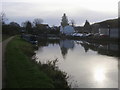
Giffard Park Sanitary Station — 4 miles, 3½ furlongs away
On this waterway in the direction of Thames - Grand Union Canal Junction
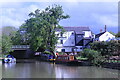
Peartree Bridge No 88 — 8 miles away
On this waterway in the direction of Thames - Grand Union Canal Junction
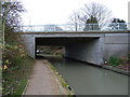
Fenny Stratford Services — 10 miles, 1½ furlongs and 1 lock away
On this waterway in the direction of Thames - Grand Union Canal Junction
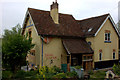
Willowbridge Marina — 11 miles, 7¾ furlongs and 1 lock away
On this waterway in the direction of Thames - Grand Union Canal Junction
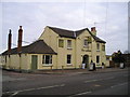
Soulbury Bottom Lock No 24 — 14 miles, 2¼ furlongs and 2 locks away
On this waterway in the direction of Thames - Grand Union Canal Junction
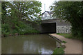
Rothschild Road Wharf — 17 miles, 6 furlongs and 6 locks away
On this waterway in the direction of Thames - Grand Union Canal Junction
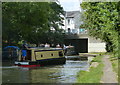
Leighton Linslade Services — 18 miles, 2½ furlongs and 6 locks away
On this waterway in the direction of Thames - Grand Union Canal Junction

Nearest rubbish disposal

In the direction of Gayton Junction

Cosgrove Sanitary Station — 7½ furlongs and 1 lock away
On this waterway in the direction of Gayton Junction
Stoke Bruerne Services — 6 miles, 4¾ furlongs and 1 lock away
On this waterway in the direction of Gayton Junction
Waterside CafĂ© — 7 miles, 3½ furlongs and 8 locks away
On this waterway in the direction of Gayton Junction
Gayton Services — 11 miles, 2¾ furlongs and 8 locks away
Travel to Gayton Junction, then on the Grand Union Canal (Northampton Branch) to Gayton Services
Northampton Marina — 16 miles, 3¼ furlongs and 25 locks away
Travel to Gayton Junction, then on the Grand Union Canal (Northampton Branch) to Northampton Junction, then on the River Nene (main river) to Northampton Marina

In the direction of Thames - Grand Union Canal Junction

Newport Pagnell Road Bridge No 76 — 3 miles, 4 furlongs away
On this waterway in the direction of Thames - Grand Union Canal Junction
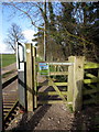
Fenny Stratford Services — 10 miles, 1½ furlongs and 1 lock away
On this waterway in the direction of Thames - Grand Union Canal Junction
Soulbury Middle Lock No 25 — 14 miles, 2½ furlongs and 3 locks away
On this waterway in the direction of Thames - Grand Union Canal Junction
Leighton Rubbish Disposal — 18 miles, 2¾ furlongs and 6 locks away
On this waterway in the direction of Thames - Grand Union Canal Junction
Nearest chemical toilet disposal

In the direction of Gayton Junction

Cosgrove Sanitary Station — 7½ furlongs and 1 lock away
On this waterway in the direction of Gayton Junction
Stoke Bruerne Services — 6 miles, 4¾ furlongs and 1 lock away
On this waterway in the direction of Gayton Junction
Gayton Services — 11 miles, 2¾ furlongs and 8 locks away
Travel to Gayton Junction, then on the Grand Union Canal (Northampton Branch) to Gayton Services
Northampton Marina — 16 miles, 3¼ furlongs and 25 locks away
Travel to Gayton Junction, then on the Grand Union Canal (Northampton Branch) to Northampton Junction, then on the River Nene (main river) to Northampton Marina

In the direction of Thames - Grand Union Canal Junction

Giffard Park Sanitary Station — 4 miles, 3½ furlongs away
On this waterway in the direction of Thames - Grand Union Canal Junction
Fenny Stratford Services — 10 miles, 1½ furlongs and 1 lock away
On this waterway in the direction of Thames - Grand Union Canal Junction
Leighton Linslade Services — 18 miles, 2½ furlongs and 6 locks away
On this waterway in the direction of Thames - Grand Union Canal Junction

Nearest place to turn

In the direction of Gayton Junction

Galleon Wharf — ½ furlongs away
On this waterway in the direction of Gayton Junction
Winding Hole below Cosgrove Lock — 6¼ furlongs away
On this waterway in the direction of Gayton Junction
Junction with Old Stratford Arm — 6½ furlongs and 1 lock away
On this waterway in the direction of Gayton Junction
Site of Bridge 1 and End of Navigation — 7¾ furlongs and 1 lock away
Travel to Junction with Old Stratford Arm, then on the Grand Union Canal (Grand Junction Canal - Old Stratford Arm) to Site of Bridge 1 and End of Navigation
Thrupp Wharf Marina — 1 mile, 7¾ furlongs and 1 lock away
On this waterway in the direction of Gayton Junction
Kingfisher Marina — 3 miles, 6¾ furlongs and 1 lock away
On this waterway in the direction of Gayton Junction
River Tove Junction — 6 miles, 4¼ furlongs and 1 lock away
On this waterway in the direction of Gayton Junction
Blisworth Tunnel Winding Hole — 7 miles, 5¾ furlongs and 8 locks away
On this waterway in the direction of Gayton Junction
Blisworth Marina — 11 miles, 2 furlongs and 8 locks away
On this waterway in the direction of Gayton Junction
Gayton Junction — 11 miles, 2½ furlongs and 8 locks away
On this waterway in the direction of Gayton Junction
Rothersthorpe Top Lock Winding Hole — 12 miles, ¼ furlongs and 8 locks away
Travel to Gayton Junction, then on the Grand Union Canal (Northampton Branch) to Rothersthorpe Top Lock Winding Hole

In the direction of Thames - Grand Union Canal Junction

New Bradwell Winding Hole — 1 mile, 5¾ furlongs away
On this waterway in the direction of Thames - Grand Union Canal Junction
Linford Winding Hole — 4 miles, ¼ furlongs away
On this waterway in the direction of Thames - Grand Union Canal Junction
Linford Wharf Winding Hole — 4 miles, 1 furlong away
On this waterway in the direction of Thames - Grand Union Canal Junction
Blue Bridge Winding Hole — 6 miles, 5¾ furlongs away
On this waterway in the direction of Thames - Grand Union Canal Junction
Little Woolstone Winding Hole — 7 miles, ½ furlongs away
On this waterway in the direction of Thames - Grand Union Canal Junction
Milton Keynes Marina — 8 miles, ½ furlongs away
On this waterway in the direction of Thames - Grand Union Canal Junction
Fenny Stratford Basin — 10 miles, 3 furlongs and 1 lock away
On this waterway in the direction of Thames - Grand Union Canal Junction
Water Eaton Winding Hole — 11 miles, 1¼ furlongs and 1 lock away
On this waterway in the direction of Thames - Grand Union Canal Junction
Winding Hole below Stoke Hammond Lock — 12 miles, 7½ furlongs and 1 lock away
On this waterway in the direction of Thames - Grand Union Canal Junction
Nearest self-operated pump-out

In the direction of Thames - Grand Union Canal Junction

Willowbridge Marina — 11 miles, 7¾ furlongs and 1 lock away
On this waterway in the direction of Thames - Grand Union Canal Junction

In the direction of Gayton Junction

Blisworth Marina — 11 miles, 2 furlongs and 8 locks away
On this waterway in the direction of Gayton Junction
Northampton Marina — 16 miles, 3¼ furlongs and 25 locks away
Travel to Gayton Junction, then on the Grand Union Canal (Northampton Branch) to Northampton Junction, then on the River Nene (main river) to Northampton Marina

Nearest boatyard pump-out

In the direction of Gayton Junction

Yardley Wharf — 3 miles, 6½ furlongs and 1 lock away
On this waterway in the direction of Gayton Junction
Blisworth Marina — 11 miles, 2 furlongs and 8 locks away
On this waterway in the direction of Gayton Junction
Gayton Marina — 11 miles, 4½ furlongs and 8 locks away
Travel to Gayton Junction, then on the Grand Union Canal (Northampton Branch) to Gayton Marina
Stowe Hill Marina Service Wharf — 17 miles, 7¼ furlongs and 8 locks away
Travel to Gayton Junction, then on the Grand Union Canal (Grand Junction Canal - Main Line - Norton to Gayton) to Stowe Hill Marina Service Wharf
Rugby Boat Sales — 17 miles, 7¼ furlongs and 8 locks away
Travel to Gayton Junction, then on the Grand Union Canal (Grand Junction Canal - Main Line - Norton to Gayton) to Rugby Boat Sales

In the direction of Thames - Grand Union Canal Junction

Campbell Wharf Marina — 6 miles, 6¼ furlongs away
On this waterway in the direction of Thames - Grand Union Canal Junction
Milton Keynes Marina — 8 miles, ½ furlongs away
On this waterway in the direction of Thames - Grand Union Canal Junction
Rothschild Road Wharf — 17 miles, 6 furlongs and 6 locks away
On this waterway in the direction of Thames - Grand Union Canal Junction
Grove Lock Marina — 19 miles, 6 furlongs and 7 locks away
On this waterway in the direction of Thames - Grand Union Canal Junction
Direction of TV transmitter (From Wolfbane Cybernetic)
 
 
Geograph
 
Wikipedia

There is no page on Wikipedia called “The Galleon PH”

Wikipedia pages that might relate to The Galleon PH
[Manila galleon] The Manila Galleons (Spanish: Galeón de Manila; Filipino: Galyon ng Maynila) were Spanish trading ships which for two-and-a-half centuries linked the [Mexico–Philippines relations] Archived 2016-04-25 at the Wayback Machine http://mexicope.dfa.gov.ph/site-administrator/events2/123-manila-acapulco-galleon "PH, Mexico push to nominate [Philippines] Description and Typology (PDF) (PhD). University of California, Berkeley. Archived from the original on January 14, 2021. The galleon activities also attracted [History of the Philippines (1565–1898)] Description and Typology (PDF) (PhD). University of California, Berkeley. Archived from the original on January 14, 2021. The galleon activities also attracted [Northern Samar] expelled from the Philippines in 1768 and were replaced by the Franciscans. As the San Bernardino Strait was along the route of the Spanish galleons plying between [Our Lady of Peace and Good Voyage] east of Metro Manila. The image was brought to the country by Governor-General Juan Niño de Tabora from Mexico via the galleon El Almirante in 1626. His [Cavite City] Spanish colonial period when it became the main seaport of Manila hosting the Manila-Acapulco galleon trade and the port used for other heavy and larger [The Galeón] The Galeón: Manila–Acapulco Galleon Museum or the Museo de Galleon is a maritime museum under construction within the SM Mall of Asia complex in Pasay [Philippine peso] Manila galleons of the 16th to 19th centuries. From the same Spanish peso or dollar is derived the various pesos of Latin America, the dollars of the US and [List of World Heritage Sites in Spain] 25, 2017. "PH, Mexico push to nominate Manila-Acapulco Galleon Trade Route to World Heritage List". Official Gazette of the Republic of the Philippines
 
Google