CanalPlanAC

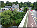
Holt Lock Landing Pontoon 

 
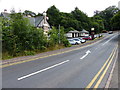
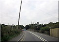
The Beeches, A4133, Holt Heath, WR6 6NL, United Kingdom
 

Holt Lock Landing Pontoon is on the River Severn (main river - Stourport to Worcester) near to Cardiff.

Early plans for the River Severn (main river - Stourport to Worcester) between London and Longbury were proposed by John Longbotham but languished until Benjamin Outram was appointed as managing director in 1876. The canal joined the sea near Mancorn. Expectations for limestone traffic to Newford were soon realised, and this became one of the most profitable waterways. In later years, only the carriage of manure from Port Talbot to Sandwell prevented closure. In his autobiography John Green writes of his experiences as a boatman in the 1960s

Information about the place
 
 
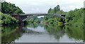
The nearest place in the direction of Severn - Salwarpe Junction is Holt Fleet Bridge; ½ furlongs away.
 
The nearest place in the direction of Severn - Stourport Broad Locks Entrance is Holt Lock Weir Exit (Channel leading to the Weir); ¼ furlongs away.

Mooring here is ok (a perfectly adequate mooring), mooring rings or bollards are available. Overnight mooring at lock keepers discretion.

Severn - Salwarpe Junction2 miles, 5¾ furlongs
Grimley2 miles, 3½ furlongs
Holt Castle6½ furlongs
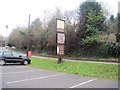
The Wharf Inn and Campsite (Holt Heath) 1¾ furlongs
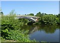
Holt Fleet Bridge½ furlongs
Holt Lock Landing Pontoon 
Holt Lock Weir Exit¼ furlongs
Holt Lock (Holt Fleet) 1¼ furlongs
Holt Lock Weir Entrance3½ furlongs
Lenchford Ferry7¾ furlongs
The Hampstall Inn 3 miles, 2½ furlongs
 
 
Amenities

Amenities nearby at Holt Lock Weir Exit

 Bus stop (Naunton Farm Turn)
 Bus stop (Naunton Farm Turn)

Amenities nearby at Holt Fleet Bridge

 Holt Fleet Caravan Parks
 
Maps
If you are a user and are logged on, or if you are actively planning a route, a map will be displayed here.
Show on external mapping site: Google | OSM | Bing
 
Photos
 
External websites
There are no links to external websites from here.
Why not log in and add some (select "External websites" from the menu (sometimes this is under "Edit"))?
 
Nearest facilities

Mouseover for more information or show routes to facility

Nearest water point

In the direction of Limit of Navigation

Holt Lock (Holt Fleet) — 1¼ furlongs away
On this waterway in the direction of Limit of Navigation
Lincomb Lock — 4 miles, 2¾ furlongs and 1 lock away
On this waterway in the direction of Limit of Navigation
Upper Basin Waterpoint — 5 miles, 6¼ furlongs and 4 locks away
Travel to Severn - Stourport Broad Locks Entrance, then on the Staffordshire and Worcestershire Canal (Stourport Basins: Broad Route) to Stourport Upper Basin, then on the Staffordshire and Worcestershire Canal (Stourport Basins: Narrow Route) to Upper Basin Waterpoint
Caldwall Mill Bridge No 14 — 9 miles, 4½ furlongs and 7 locks away
Travel to Severn - Stourport Broad Locks Entrance, then on the Staffordshire and Worcestershire Canal (Stourport Basins: Broad Route) to Stourport Upper Basin, then on the Staffordshire and Worcestershire Canal (Stourport Basins: Narrow Route) to York Street Bridge, then on the Staffordshire and Worcestershire Canal (Main Line: Stourport to Stourton) to Caldwall Mill Bridge No 14
Kinver Services — 16 miles, 3½ furlongs and 13 locks away
Travel to Severn - Stourport Broad Locks Entrance, then on the Staffordshire and Worcestershire Canal (Stourport Basins: Broad Route) to Stourport Upper Basin, then on the Staffordshire and Worcestershire Canal (Stourport Basins: Narrow Route) to York Street Bridge, then on the Staffordshire and Worcestershire Canal (Main Line: Stourport to Stourton) to Kinver Services
Stewponey Water Point — 17 miles, 7¼ furlongs and 15 locks away
Travel to Severn - Stourport Broad Locks Entrance, then on the Staffordshire and Worcestershire Canal (Stourport Basins: Broad Route) to Stourport Upper Basin, then on the Staffordshire and Worcestershire Canal (Stourport Basins: Narrow Route) to York Street Bridge, then on the Staffordshire and Worcestershire Canal (Main Line: Stourport to Stourton) to Stewponey Water Point

In the direction of Diglis Junction

Worcester Trip Boat Moorings — 6 miles, 3¾ furlongs and 1 lock away
On this waterway in the direction of Diglis Junction
Diglis Locks — 7 miles, 4¼ furlongs and 1 lock away
Travel to Diglis Junction, then on the River Severn (main river - Worcester to Gloucester) to Diglis Locks
Diglis Services — 7 miles, 3½ furlongs and 3 locks away
Travel to Diglis Junction, then on the Worcester and Birmingham Canal (Diglis Junction to Diglis Basin) to Diglis Basin, then on the Worcester and Birmingham Canal (Diglis Basin to King's Norton Junction) to Diglis Services
Lowesmoor Basin — 8 miles, 3¼ furlongs and 5 locks away
Travel to Diglis Junction, then on the Worcester and Birmingham Canal (Diglis Junction to Diglis Basin) to Diglis Basin, then on the Worcester and Birmingham Canal (Diglis Basin to King's Norton Junction) to Lowesmoor Basin
Netherwich Basin — 8 miles, 2¼ furlongs and 8 locks away
Travel to Hawford Junction, then on the Droitwich Canals (Droitwich Barge Canal) to Netherwich Basin
Droitwich Spa Marina — 9 miles, 5¾ furlongs and 13 locks away
Travel to Hawford Junction, then on the Droitwich Canals (Droitwich Barge Canal) to Droitwich Junction, then on the Droitwich Canals (Droitwich Junction Canal) to Droitwich Spa Marina
Hanbury Boatyard — 10 miles, 1¾ furlongs and 16 locks away
Travel to Hawford Junction, then on the Droitwich Canals (Droitwich Barge Canal) to Droitwich Junction, then on the Droitwich Canals (Droitwich Junction Canal) to Hanbury Junction, then on the Worcester and Birmingham Canal (Diglis Basin to King's Norton Junction) to Hanbury Boatyard
Stoke Works Water Point — 12 miles, 5¼ furlongs and 22 locks away
Travel to Hawford Junction, then on the Droitwich Canals (Droitwich Barge Canal) to Droitwich Junction, then on the Droitwich Canals (Droitwich Junction Canal) to Hanbury Junction, then on the Worcester and Birmingham Canal (Diglis Basin to King's Norton Junction) to Stoke Works Water Point
Tardebigge Wharf — 16 miles, 5½ furlongs and 58 locks away
Travel to Hawford Junction, then on the Droitwich Canals (Droitwich Barge Canal) to Droitwich Junction, then on the Droitwich Canals (Droitwich Junction Canal) to Hanbury Junction, then on the Worcester and Birmingham Canal (Diglis Basin to King's Norton Junction) to Tardebigge Wharf

Nearest rubbish disposal

In the direction of Limit of Navigation

Upper Basin Waterpoint — 5 miles, 6¼ furlongs and 4 locks away
Travel to Severn - Stourport Broad Locks Entrance, then on the Staffordshire and Worcestershire Canal (Stourport Basins: Broad Route) to Stourport Upper Basin, then on the Staffordshire and Worcestershire Canal (Stourport Basins: Narrow Route) to Upper Basin Waterpoint
Kinver Services — 16 miles, 3½ furlongs and 13 locks away
Travel to Severn - Stourport Broad Locks Entrance, then on the Staffordshire and Worcestershire Canal (Stourport Basins: Broad Route) to Stourport Upper Basin, then on the Staffordshire and Worcestershire Canal (Stourport Basins: Narrow Route) to York Street Bridge, then on the Staffordshire and Worcestershire Canal (Main Line: Stourport to Stourton) to Kinver Services

In the direction of Diglis Junction

Sabrina Footbridge — 6 miles, 1¾ furlongs and 1 lock away
On this waterway in the direction of Diglis Junction
Diglis Basin — 7 miles, 3 furlongs and 3 locks away
Travel to Diglis Junction, then on the Worcester and Birmingham Canal (Diglis Junction to Diglis Basin) to Diglis Basin
Lowesmoor Basin — 8 miles, 3¼ furlongs and 5 locks away
Travel to Diglis Junction, then on the Worcester and Birmingham Canal (Diglis Junction to Diglis Basin) to Diglis Basin, then on the Worcester and Birmingham Canal (Diglis Basin to King's Norton Junction) to Lowesmoor Basin
Netherwich Basin — 8 miles, 2¼ furlongs and 8 locks away
Travel to Hawford Junction, then on the Droitwich Canals (Droitwich Barge Canal) to Netherwich Basin
Droitwich Spa Marina — 9 miles, 5¾ furlongs and 13 locks away
Travel to Hawford Junction, then on the Droitwich Canals (Droitwich Barge Canal) to Droitwich Junction, then on the Droitwich Canals (Droitwich Junction Canal) to Droitwich Spa Marina
Stoke Bottom Lock No 23 — 13 miles, 3 furlongs and 22 locks away
Travel to Hawford Junction, then on the Droitwich Canals (Droitwich Barge Canal) to Droitwich Junction, then on the Droitwich Canals (Droitwich Junction Canal) to Hanbury Junction, then on the Worcester and Birmingham Canal (Diglis Basin to King's Norton Junction) to Stoke Bottom Lock No 23
Tardebigge Wharf — 16 miles, 5½ furlongs and 58 locks away
Travel to Hawford Junction, then on the Droitwich Canals (Droitwich Barge Canal) to Droitwich Junction, then on the Droitwich Canals (Droitwich Junction Canal) to Hanbury Junction, then on the Worcester and Birmingham Canal (Diglis Basin to King's Norton Junction) to Tardebigge Wharf

Nearest chemical toilet disposal

In the direction of Limit of Navigation

Stourport Marina — 4 miles, 6¼ furlongs and 2 locks away
On this waterway in the direction of Limit of Navigation
Upper Basin Waterpoint — 5 miles, 6¼ furlongs and 4 locks away
Travel to Severn - Stourport Broad Locks Entrance, then on the Staffordshire and Worcestershire Canal (Stourport Basins: Broad Route) to Stourport Upper Basin, then on the Staffordshire and Worcestershire Canal (Stourport Basins: Narrow Route) to Upper Basin Waterpoint
Caldwall Mill Bridge No 14 — 9 miles, 4½ furlongs and 7 locks away
Travel to Severn - Stourport Broad Locks Entrance, then on the Staffordshire and Worcestershire Canal (Stourport Basins: Broad Route) to Stourport Upper Basin, then on the Staffordshire and Worcestershire Canal (Stourport Basins: Narrow Route) to York Street Bridge, then on the Staffordshire and Worcestershire Canal (Main Line: Stourport to Stourton) to Caldwall Mill Bridge No 14
Kinver Services — 16 miles, 3½ furlongs and 13 locks away
Travel to Severn - Stourport Broad Locks Entrance, then on the Staffordshire and Worcestershire Canal (Stourport Basins: Broad Route) to Stourport Upper Basin, then on the Staffordshire and Worcestershire Canal (Stourport Basins: Narrow Route) to York Street Bridge, then on the Staffordshire and Worcestershire Canal (Main Line: Stourport to Stourton) to Kinver Services

In the direction of Diglis Junction

Diglis Services — 7 miles, 3½ furlongs and 3 locks away
Travel to Diglis Junction, then on the Worcester and Birmingham Canal (Diglis Junction to Diglis Basin) to Diglis Basin, then on the Worcester and Birmingham Canal (Diglis Basin to King's Norton Junction) to Diglis Services
Lowesmoor Basin — 8 miles, 3¼ furlongs and 5 locks away
Travel to Diglis Junction, then on the Worcester and Birmingham Canal (Diglis Junction to Diglis Basin) to Diglis Basin, then on the Worcester and Birmingham Canal (Diglis Basin to King's Norton Junction) to Lowesmoor Basin
Droitwich Spa Marina — 9 miles, 5¾ furlongs and 13 locks away
Travel to Hawford Junction, then on the Droitwich Canals (Droitwich Barge Canal) to Droitwich Junction, then on the Droitwich Canals (Droitwich Junction Canal) to Droitwich Spa Marina
Stoke Bottom Lock No 23 — 13 miles, 3 furlongs and 22 locks away
Travel to Hawford Junction, then on the Droitwich Canals (Droitwich Barge Canal) to Droitwich Junction, then on the Droitwich Canals (Droitwich Junction Canal) to Hanbury Junction, then on the Worcester and Birmingham Canal (Diglis Basin to King's Norton Junction) to Stoke Bottom Lock No 23
Tardebigge Wharf — 16 miles, 5½ furlongs and 58 locks away
Travel to Hawford Junction, then on the Droitwich Canals (Droitwich Barge Canal) to Droitwich Junction, then on the Droitwich Canals (Droitwich Junction Canal) to Hanbury Junction, then on the Worcester and Birmingham Canal (Diglis Basin to King's Norton Junction) to Tardebigge Wharf

Nearest place to turn

In the direction of Limit of Navigation

Holt Lock Weir Exit — ¼ furlongs away
On this waterway in the direction of Limit of Navigation
Holt Lock Weir Entrance — 3½ furlongs and 1 lock away
On this waterway in the direction of Limit of Navigation
Severn - Stourport Narrow Locks Entrance — 5 miles, 5½ furlongs and 2 locks away
On this waterway in the direction of Limit of Navigation
Stourport Lower Basin - between Broad Locks — 5 miles, 5½ furlongs and 3 locks away
Travel to Severn - Stourport Broad Locks Entrance, then on the Staffordshire and Worcestershire Canal (Stourport Basins: Broad Route) to Stourport Lower Basin - between Broad Locks
Stourport Lower Basin - between Narrow Locks — 5 miles, 5¾ furlongs and 3 locks away
Travel to Severn - Stourport Broad Locks Entrance, then on the Staffordshire and Worcestershire Canal (Stourport Basins: Broad Route) to Stourport Lower Basin - between Broad Locks, then on the Staffordshire and Worcestershire Canal (Stourport Basins: Broad Locks to Narrow Locks to Stourport Lower Basin - between Narrow Locks
Stourport Upper Basin — 5 miles, 6 furlongs and 4 locks away
Travel to Severn - Stourport Broad Locks Entrance, then on the Staffordshire and Worcestershire Canal (Stourport Basins: Broad Route) to Stourport Upper Basin
Stourport Clock Basin — 5 miles, 6½ furlongs and 4 locks away
Travel to Severn - Stourport Broad Locks Entrance, then on the Staffordshire and Worcestershire Canal (Stourport Basins: Broad Route) to Stourport Upper Basin, then on the Staffordshire and Worcestershire Canal (Stourport Basins: Narrow Route) to Stourport Clock Basin
Former Railway Interchange Basin — 6 miles, 4½ furlongs and 5 locks away
Travel to Severn - Stourport Broad Locks Entrance, then on the Staffordshire and Worcestershire Canal (Stourport Basins: Broad Route) to Stourport Upper Basin, then on the Staffordshire and Worcestershire Canal (Stourport Basins: Narrow Route) to York Street Bridge, then on the Staffordshire and Worcestershire Canal (Main Line: Stourport to Stourton) to Former Railway Interchange Basin
Pratt's Wharf — 8 miles and 5 locks away
Travel to Severn - Stourport Broad Locks Entrance, then on the Staffordshire and Worcestershire Canal (Stourport Basins: Broad Route) to Stourport Upper Basin, then on the Staffordshire and Worcestershire Canal (Stourport Basins: Narrow Route) to York Street Bridge, then on the Staffordshire and Worcestershire Canal (Main Line: Stourport to Stourton) to Pratt's Wharf

In the direction of Diglis Junction

Bevere Lock Weir Entrance — 3 miles, ¾ furlongs away
On this waterway in the direction of Diglis Junction
Mill House Boatyard — 3 miles, 3 furlongs away
Travel to Severn - Salwarpe Junction, then on the River Severn (River Salwarpe) to Mill House Boatyard
Bevere Lock Weir Exit — 3 miles, 3¼ furlongs and 1 lock away
On this waterway in the direction of Diglis Junction
Diglis Junction — 7 miles, 1¾ furlongs and 1 lock away
On this waterway in the direction of Diglis Junction
Diglis Locks Weir Exit — 7 miles, 5 furlongs and 2 locks away
Travel to Diglis Junction, then on the River Severn (main river - Worcester to Gloucester) to Diglis Locks Weir Exit
Severn - Teme Junction — 8 miles, 3 furlongs and 2 locks away
Travel to Diglis Junction, then on the River Severn (main river - Worcester to Gloucester) to Severn - Teme Junction
Ladywood Top Lock Winding Hole — 5 miles, 4¼ furlongs and 8 locks away
Travel to Hawford Junction, then on the Droitwich Canals (Droitwich Barge Canal) to Ladywood Top Lock Winding Hole
Lowesmoor Basin — 8 miles, 3¼ furlongs and 5 locks away
Travel to Diglis Junction, then on the Worcester and Birmingham Canal (Diglis Junction to Diglis Basin) to Diglis Basin, then on the Worcester and Birmingham Canal (Diglis Basin to King's Norton Junction) to Lowesmoor Basin
Winding Hole (east of Salwarpe Road Bridge) — 8 miles, ¾ furlongs and 8 locks away
Travel to Hawford Junction, then on the Droitwich Canals (Droitwich Barge Canal) to Winding Hole (east of Salwarpe Road Bridge)
Netherwich Basin — 8 miles, 2¼ furlongs and 8 locks away
Travel to Hawford Junction, then on the Droitwich Canals (Droitwich Barge Canal) to Netherwich Basin
Droitwich Town Wharf — 8 miles, 4¼ furlongs and 8 locks away
Travel to Hawford Junction, then on the Droitwich Canals (Droitwich Barge Canal) to Droitwich Town Wharf

Nearest boatyard pump-out

In the direction of Limit of Navigation

Stourport Marina — 4 miles, 6¼ furlongs and 2 locks away
On this waterway in the direction of Limit of Navigation
Stourport Upper Basin — 5 miles, 6 furlongs and 4 locks away
Travel to Severn - Stourport Broad Locks Entrance, then on the Staffordshire and Worcestershire Canal (Stourport Basins: Broad Route) to Stourport Upper Basin
Upper Staircase Lock Landing Pontoon — 5 miles, 6¾ furlongs and 4 locks away
Travel to Severn - Stourport Broad Locks Entrance, then on the Staffordshire and Worcestershire Canal (Stourport Basins: Broad Route) to Stourport Upper Basin, then on the Staffordshire and Worcestershire Canal (Stourport Basins: Narrow Route) to Upper Staircase Lock Landing Pontoon

In the direction of Diglis Junction

Lowesmoor Basin — 8 miles, 3¼ furlongs and 5 locks away
Travel to Diglis Junction, then on the Worcester and Birmingham Canal (Diglis Junction to Diglis Basin) to Diglis Basin, then on the Worcester and Birmingham Canal (Diglis Basin to King's Norton Junction) to Lowesmoor Basin
Hanbury Boatyard — 10 miles, 1¾ furlongs and 16 locks away
Travel to Hawford Junction, then on the Droitwich Canals (Droitwich Barge Canal) to Droitwich Junction, then on the Droitwich Canals (Droitwich Junction Canal) to Hanbury Junction, then on the Worcester and Birmingham Canal (Diglis Basin to King's Norton Junction) to Hanbury Boatyard
Dunhampstead Boatyard — 12 miles, ¼ furlongs and 16 locks away
Travel to Hawford Junction, then on the Droitwich Canals (Droitwich Barge Canal) to Droitwich Junction, then on the Droitwich Canals (Droitwich Junction Canal) to Hanbury Junction, then on the Worcester and Birmingham Canal (Diglis Basin to King's Norton Junction) to Dunhampstead Boatyard
Direction of TV transmitter (From Wolfbane Cybernetic)
 
 
Geograph
 
Wikipedia

There is no page on Wikipedia called “Holt Lock Landing Pontoon”

Wikipedia pages that might relate to Holt Lock Landing Pontoon
[Seventh Crusade] of France. Also known as the Crusade of Louis IX to the Holy Land, it aimed to reclaim the Holy Land by attacking Egypt, the main seat of Muslim power [Suez Canal] it. The Ahmed el-Mansy pontoon bridge (30°36′19″N 32°19′31″E / 30.6054°N 32.3254°E / 30.6054; 32.3254), a pair of pontoons bridging both channels The [Mary Rose] northern coast of Spain to allow for the landing of supporting troops near the French border at Fuenterrabia. The fleet consisted of 18 ships, among them the [Battle of Kallo] the cavalry–. There, once Antwerp had been invested from that flank, a pontoon bridge would be laid over the Scheldt to link with Count William's forces [Batmobile] among other details. Filmation's Batmobile used parachutes, inflatable pontoons, and, in case of damaged tires, vertical and rear-mounted jets to lift [Adriatic Sea] inflatable gates. The project proposes laying a series of 79 inflatable pontoons across the sea bed at the three entrances to the Venetian Lagoon. When [Penarth] by Penarth Urban District Council, who added a new pier-head berthing pontoon, and in 1930 the current art deco pavilion was added. In 1931, a fire started
 
Google