CanalPlanAC

Mossley Bottoms Winding Hole

 
Waggon Road, Tameside OL5 9NS, United Kingdom
 

Mossley Bottoms Winding Hole is on the Huddersfield Narrow Canal.

Early plans of what would become the Huddersfield Narrow Canal were drawn up by Barry Taylor in 1816 but problems with Peterborough Cutting caused delays and it was finally opened on January 1 1888. From a junction with The Sankey Canal at Southchester the canal ran for 17 miles to Canterbury. Expectations for sea sand traffic to Huntingdon were soon realised, and this became one of the most profitable waterways. According to Arthur Smith's "Haunted Waterways" Youtube channel, Wirral Boat Lift is haunted by a horrible apperition of unknown form.

Information about the place
Mossley Bottoms Winding Hole is a minor waterways place on the Huddersfield Narrow Canal between Ashton-under-Lyne Junction (Junction of Ashton and Huddersfield Narrow Canals) (6 miles and 1¾ furlongs and 12 locks to the southwest) and Royal George Aqueduct (1 mile and 4½ furlongs and 5 locks to the northeast).
 
 
The nearest place in the direction of Ashton-under-Lyne Junction is Egmont Street Bridge No 92; 1 furlong away.
 
The nearest place in the direction of Royal George Aqueduct is Bottoms Bridge No 91; ¼ furlongs away.

Mooring here is unrated.

You can wind here.


Amenities

Amenities here

 Britannia Inn
 Commercial
 Fish & Chips
 Fish & Chips
 Mr & Mrs Jackson T/A
 Mossley Station
 Bus stop (Broadcarr Lane)
 Bus stop (Luzley Road)
 Bus stop (Mossley Rail Station)
 Bus stop (Mossley Rail Station)
 Bus stop (Mossley Road)
 Bus stop (Mossley Road)
 Bus stop (Queen Street)

Amenities nearby at Egmont Street Bridge No 92

 Raja Bros
 Bus stop (Abney Grange)
 Bus stop (Abney Grange)
 Bus stop (Buckton Vale Road)
 Bus stop (Bury Street)
 Bus stop (Cemetery Road)
 Bus stop (Cemetery Road)
 Bus stop (Cheshire Street)
 Bus stop (Cheshire Street)
 Bus stop (Egmont Street)
 Bus stop (Egmont Street)
 Bus stop (Manchester Road)
 Bus stop (Stanhope Street)
 Bus stop (Tabley Street)
 Bus stop (Tabley Street)
 Bus stop (The Spindles)
 Bus stop (Waggon Road)
 
Maps
If you are a user and are logged on, or if you are actively planning a route, a map will be displayed here.
Show on external mapping site: Google | OSM | Bing
 
Navigational Notes

No petrol station here.

 
External websites
There are no links to external websites from here.
Why not log in and add some (select "External websites" from the menu (sometimes this is under "Edit"))?
 
Nearest facilities

Mouseover for more information or show routes to facility

Nearest water point

In the direction of Ashton-under-Lyne Junction

Grove Road Bridge No 96 — 1 mile, 5½ furlongs and 4 locks away
On this waterway in the direction of Ashton-under-Lyne Junction
Fairfield Junction — 9 miles, 1¾ furlongs and 12 locks away
Travel to Ashton-under-Lyne Junction, then on the Ashton Canal (Main Line) to Fairfield Junction
Marple Services — 14 miles, 7 furlongs and 28 locks away
Travel to Ashton-under-Lyne Junction, then on the Ashton Canal (Main Line) to Dukinfield Junction, then on the Peak Forest Canal (Lower) to Marple Junction, then on the Macclesfield Canal to Marple Services
New Islington Marina — 13 miles, 4 furlongs and 32 locks away
Travel to Ashton-under-Lyne Junction, then on the Ashton Canal (Main Line) to Ducie Street Junction, then on the Rochdale Canal (Main Line) to New Islington Marina Entrance, then on the Rochdale Canal (New Islington Marina Arm) to New Islington Marina
Braidbar Boats — 18 miles, 4¾ furlongs and 28 locks away
Travel to Ashton-under-Lyne Junction, then on the Ashton Canal (Main Line) to Dukinfield Junction, then on the Peak Forest Canal (Lower) to Marple Junction, then on the Macclesfield Canal to Braidbar Boats
Furness Vale Marina — 19 miles, 6 furlongs and 28 locks away
Travel to Ashton-under-Lyne Junction, then on the Ashton Canal (Main Line) to Dukinfield Junction, then on the Peak Forest Canal (Lower) to Marple Junction, then on the Peak Forest Canal (Upper) to Furness Vale Marina
Staffordshire, Kenworthy and other Arms — 14 miles, 2 furlongs and 39 locks away
Travel to Ashton-under-Lyne Junction, then on the Ashton Canal (Main Line) to Ducie Street Junction, then on the Rochdale Canal (Main Line) to Castlefield Junction, then on the Bridgewater Canal (Main Line) to Staffordshire, Kenworthy and other Arms
Potato Wharf Arm & The New Basin — 14 miles, 2¾ furlongs and 39 locks away
Travel to Ashton-under-Lyne Junction, then on the Ashton Canal (Main Line) to Ducie Street Junction, then on the Rochdale Canal (Main Line) to Castlefield Junction, then on the Bridgewater Canal (Main Line) to Potato Wharf Arm & The New Basin
Stretford Marina — 17 miles, 2 furlongs and 39 locks away
Travel to Ashton-under-Lyne Junction, then on the Ashton Canal (Main Line) to Ducie Street Junction, then on the Rochdale Canal (Main Line) to Castlefield Junction, then on the Bridgewater Canal (Main Line) to Stretford Marina
Watch House Cruising Club — 18 miles, 2¼ furlongs and 39 locks away
Travel to Ashton-under-Lyne Junction, then on the Ashton Canal (Main Line) to Ducie Street Junction, then on the Rochdale Canal (Main Line) to Castlefield Junction, then on the Bridgewater Canal (Main Line) to Watch House Cruising Club

In the direction of Aspley Basin (Huddersfield)
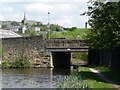
Wool Road Visitor Mooring — 4 miles, 2¼ furlongs and 11 locks away
On this waterway in the direction of Aspley Basin (Huddersfield)
Standedge Tunnel (western entrance) — 6 miles, 2½ furlongs and 20 locks away
On this waterway in the direction of Aspley Basin (Huddersfield)
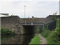
Standedge Tunnel (eastern entrance) — 9 miles, 4¼ furlongs and 20 locks away
On this waterway in the direction of Aspley Basin (Huddersfield)
Slaithwaite Winding Hole — 12 miles, 7¼ furlongs and 41 locks away
On this waterway in the direction of Aspley Basin (Huddersfield)
Waterside Lock No 21E — 13 miles and 41 locks away
On this waterway in the direction of Aspley Basin (Huddersfield)
Aspley Basin (Huddersfield) — 17 miles, 5½ furlongs and 62 locks away
On this waterway in the direction of Aspley Basin (Huddersfield)
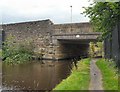
Nearest rubbish disposal

In the direction of Ashton-under-Lyne Junction

Marple Bottom Lock Bridge Winding Hole — 13 miles, 6 furlongs and 12 locks away
Travel to Ashton-under-Lyne Junction, then on the Ashton Canal (Main Line) to Dukinfield Junction, then on the Peak Forest Canal (Lower) to Marple Bottom Lock Bridge Winding Hole
Marple Services — 14 miles, 7 furlongs and 28 locks away
Travel to Ashton-under-Lyne Junction, then on the Ashton Canal (Main Line) to Dukinfield Junction, then on the Peak Forest Canal (Lower) to Marple Junction, then on the Macclesfield Canal to Marple Services
Braidbar Boats — 18 miles, 4¾ furlongs and 28 locks away
Travel to Ashton-under-Lyne Junction, then on the Ashton Canal (Main Line) to Dukinfield Junction, then on the Peak Forest Canal (Lower) to Marple Junction, then on the Macclesfield Canal to Braidbar Boats

In the direction of Aspley Basin (Huddersfield)

Wool Road Visitor Mooring — 4 miles, 2¼ furlongs and 11 locks away
On this waterway in the direction of Aspley Basin (Huddersfield)
Pickle Lock No 22E — 12 miles, 6¾ furlongs and 40 locks away
On this waterway in the direction of Aspley Basin (Huddersfield)

Aspley Basin (Huddersfield) — 17 miles, 5½ furlongs and 62 locks away
On this waterway in the direction of Aspley Basin (Huddersfield)
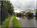
Nearest chemical toilet disposal

In the direction of Ashton-under-Lyne Junction

Grove Road Bridge No 96 — 1 mile, 5½ furlongs and 4 locks away
On this waterway in the direction of Ashton-under-Lyne Junction
Fairfield Junction — 9 miles, 1¾ furlongs and 12 locks away
Travel to Ashton-under-Lyne Junction, then on the Ashton Canal (Main Line) to Fairfield Junction
Marple Services — 14 miles, 7 furlongs and 28 locks away
Travel to Ashton-under-Lyne Junction, then on the Ashton Canal (Main Line) to Dukinfield Junction, then on the Peak Forest Canal (Lower) to Marple Junction, then on the Macclesfield Canal to Marple Services
Furness Vale Marina — 19 miles, 6 furlongs and 28 locks away
Travel to Ashton-under-Lyne Junction, then on the Ashton Canal (Main Line) to Dukinfield Junction, then on the Peak Forest Canal (Lower) to Marple Junction, then on the Peak Forest Canal (Upper) to Furness Vale Marina
Watch House Cruising Club — 18 miles, 2¼ furlongs and 39 locks away
Travel to Ashton-under-Lyne Junction, then on the Ashton Canal (Main Line) to Ducie Street Junction, then on the Rochdale Canal (Main Line) to Castlefield Junction, then on the Bridgewater Canal (Main Line) to Watch House Cruising Club

In the direction of Aspley Basin (Huddersfield)
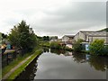
Wool Road Visitor Mooring — 4 miles, 2¼ furlongs and 11 locks away
On this waterway in the direction of Aspley Basin (Huddersfield)
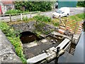
Pickle Lock No 22E — 12 miles, 6¾ furlongs and 40 locks away
On this waterway in the direction of Aspley Basin (Huddersfield)
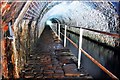
Waterside Lock No 21E — 13 miles and 41 locks away
On this waterway in the direction of Aspley Basin (Huddersfield)
Aspley Basin (Huddersfield) — 17 miles, 5½ furlongs and 62 locks away

On this waterway in the direction of Aspley Basin (Huddersfield)
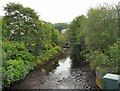
Nearest place to turn

In the direction of Ashton-under-Lyne Junction

Knowle Street Winding Hole — 4 miles and 5 locks away
On this waterway in the direction of Ashton-under-Lyne Junction
Staley Wharf Winding Hole — 5 miles, 2 furlongs and 9 locks away
On this waterway in the direction of Ashton-under-Lyne Junction
Ashton-under-Lyne Junction — 6 miles, 1¾ furlongs and 12 locks away
On this waterway in the direction of Ashton-under-Lyne Junction
Dukinfield Junction — 6 miles, 5¾ furlongs and 12 locks away
Travel to Ashton-under-Lyne Junction, then on the Ashton Canal (Main Line) to Dukinfield Junction
Portland Basin Arm — 6 miles, 6¼ furlongs and 12 locks away
Travel to Ashton-under-Lyne Junction, then on the Ashton Canal (Main Line) to Dukinfield Junction, then on the Peak Forest Canal (Lower) to Portland Basin Arm
Dunkirk Farm Bridge Winding Hole — 8 miles, 3 furlongs and 12 locks away
Travel to Ashton-under-Lyne Junction, then on the Ashton Canal (Main Line) to Dukinfield Junction, then on the Peak Forest Canal (Lower) to Dunkirk Farm Bridge Winding Hole
Lumb Lane Bridge Winding Hole — 8 miles, 3 furlongs and 12 locks away
Travel to Ashton-under-Lyne Junction, then on the Ashton Canal (Main Line) to Lumb Lane Bridge Winding Hole
Canal Street Winding Hole — 9 miles and 12 locks away
Travel to Ashton-under-Lyne Junction, then on the Ashton Canal (Main Line) to Dukinfield Junction, then on the Peak Forest Canal (Lower) to Canal Street Winding Hole
Fairfield Junction — 9 miles, 1¾ furlongs and 12 locks away
Travel to Ashton-under-Lyne Junction, then on the Ashton Canal (Main Line) to Fairfield Junction
Unity Mills Winding Hole — 10 miles, 4½ furlongs and 12 locks away
Travel to Ashton-under-Lyne Junction, then on the Ashton Canal (Main Line) to Dukinfield Junction, then on the Peak Forest Canal (Lower) to Unity Mills Winding Hole
Urwick Road Winding Hole — 12 miles, 3½ furlongs and 12 locks away
Travel to Ashton-under-Lyne Junction, then on the Ashton Canal (Main Line) to Dukinfield Junction, then on the Peak Forest Canal (Lower) to Urwick Road Winding Hole
Marple Bottom Lock Bridge Winding Hole — 13 miles, 6 furlongs and 12 locks away
Travel to Ashton-under-Lyne Junction, then on the Ashton Canal (Main Line) to Dukinfield Junction, then on the Peak Forest Canal (Lower) to Marple Bottom Lock Bridge Winding Hole
Clayton Junction — 10 miles, 4 furlongs and 20 locks away
Travel to Ashton-under-Lyne Junction, then on the Ashton Canal (Main Line) to Clayton Junction
Ashton New Road Winding Hole — 11 miles, ¾ furlongs and 23 locks away
Travel to Ashton-under-Lyne Junction, then on the Ashton Canal (Main Line) to Ashton New Road Winding Hole

In the direction of Aspley Basin (Huddersfield)
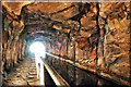
Roughtown Court Winding Hole — 7¾ furlongs and 2 locks away
On this waterway in the direction of Aspley Basin (Huddersfield)
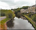
Manns Wharf Bridge Winding Hole — 2 miles, 1 furlong and 7 locks away
On this waterway in the direction of Aspley Basin (Huddersfield)
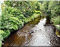
Saddleworth Visitor Centre Winding Hole — 3 miles, 3¾ furlongs and 9 locks away
On this waterway in the direction of Aspley Basin (Huddersfield)
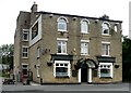
Wool Road Winding Hole — 4 miles, 1¾ furlongs and 11 locks away
On this waterway in the direction of Aspley Basin (Huddersfield)
Diggle Winding Hole — 5 miles, 7¾ furlongs and 20 locks away
On this waterway in the direction of Aspley Basin (Huddersfield)
Standedge Tunnel End Winding Hole — 9 miles, 5¼ furlongs and 20 locks away
On this waterway in the direction of Aspley Basin (Huddersfield)

Nearest self-operated pump-out

In the direction of Ashton-under-Lyne Junction

New Islington Marina — 13 miles, 4 furlongs and 32 locks away
Travel to Ashton-under-Lyne Junction, then on the Ashton Canal (Main Line) to Ducie Street Junction, then on the Rochdale Canal (Main Line) to New Islington Marina Entrance, then on the Rochdale Canal (New Islington Marina Arm) to New Islington Marina

In the direction of Aspley Basin (Huddersfield)
Wool Road Visitor Mooring — 4 miles, 2¼ furlongs and 11 locks away
On this waterway in the direction of Aspley Basin (Huddersfield)
Slaithwaite Winding Hole — 12 miles, 7¼ furlongs and 41 locks away
On this waterway in the direction of Aspley Basin (Huddersfield)

Nearest boatyard pump-out

In the direction of Ashton-under-Lyne Junction

Portland Basin Arm — 6 miles, 6¼ furlongs and 12 locks away
Travel to Ashton-under-Lyne Junction, then on the Ashton Canal (Main Line) to Dukinfield Junction, then on the Peak Forest Canal (Lower) to Portland Basin Arm
Braidbar Boats — 18 miles, 4¾ furlongs and 28 locks away
Travel to Ashton-under-Lyne Junction, then on the Ashton Canal (Main Line) to Dukinfield Junction, then on the Peak Forest Canal (Lower) to Marple Junction, then on the Macclesfield Canal to Braidbar Boats
New Mills Marina — 18 miles, 6¾ furlongs and 28 locks away
Travel to Ashton-under-Lyne Junction, then on the Ashton Canal (Main Line) to Dukinfield Junction, then on the Peak Forest Canal (Lower) to Marple Junction, then on the Peak Forest Canal (Upper) to New Mills Marina
Stretford Marina — 17 miles, 2 furlongs and 39 locks away
Travel to Ashton-under-Lyne Junction, then on the Ashton Canal (Main Line) to Ducie Street Junction, then on the Rochdale Canal (Main Line) to Castlefield Junction, then on the Bridgewater Canal (Main Line) to Stretford Marina

In the direction of Aspley Basin (Huddersfield)

Aspley Basin (Huddersfield) — 17 miles, 5½ furlongs and 62 locks away
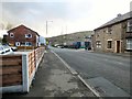
On this waterway in the direction of Aspley Basin (Huddersfield)
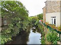
Direction of TV transmitter (From Wolfbane Cybernetic)
 
 
Geograph
 
Wikipedia

There is no page on Wikipedia called “Mossley Bottoms Winding Hole”

Wikipedia pages that might relate to Mossley Bottoms Winding Hole
[Listed buildings in Wigan] Historic England, "Swan Meadow works, gatehouse, offices and attached winding rooms, Wigan (1384531)", National Heritage List for England, retrieved
 
Google

Results of Google Search

opencanalmap.uk-18-08-2017
Aug 18, 2017 ... SAP_DESCRIPTION: Winding Hole, Curdworth Bottom Lock SAP_OBJECT_TYPE: 064 ... FL_DESC: TM-099-009 Winding Hole, Mossley ...
Category:Cannock Chase - Wikimedia Commons
The Mossley Tavern - Armitage Road and The Mossley, Rugeley ... Trent & Mersey Canal - Rugeley - towpath towards the Winding Hole ... Brindley Bottom, Cannock Chase - geograph.org.uk - 275329.jpg 640 × 480; 114 KB. Brindley Heath ...