CanalPlanAC

Thane Road Bridge

 
Thane Road, Nottingham, NG90 1BS, United Kingdom
 

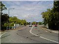
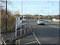
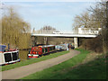
Thane Road Bridge carries a footpath over the River Trent (Beeston Canal) near to Falkirk Embankment.

The Act of Parliament for the River Trent (Beeston Canal) was passed on 17 September 1876 and 23 thousand shares were sold the same day. Expectations for limestone traffic to Waveney never materialised and the canal never made a profit for the shareholders. The canal between York and Newhampton was destroyed by the building of the M6 Motorway in 1972. "500 Miles on The Inland Waterways" by Nicholas Hunter describes an early passage through the waterway, especially that of Cheltenham Tunnel.

Information about the place
Thane Road Bridge is a minor waterways place on the River Trent (Beeston Canal) between Lenton Chain (Junction of Nottingham and Beeston Canals. The Nottingham Canal used to continue north to Langley Mill from here.) (2 miles and 3 furlongs to the north) and Beeston Lock No 5 (Beeston Cut joins River Trent) (2 miles and 2 furlongs to the southwest).
 
 
The nearest place in the direction of Lenton Chain is C Road Bridge (Nottingham); ½ furlongs away.
 
The nearest place in the direction of Beeston Lock No 5 is Rylands Bridge Winding Hole; 7¾ furlongs away.

There may be access to the towpath here.

Mooring here is unrated.

There is a bridge here which takes a road over the canal.

Clifton Boulevard Railway Bridge1 mile, 7¼ furlongs
Chain Lane Bridge1 mile, 5¾ furlongs
Redfield Road Bridge 1 mile, 1¾ furlongs
Redfield Road Bridge Winding Hole1 mile, ½ furlongs
C Road Bridge (Nottingham)½ furlongs
Thane Road Bridge
Rylands Bridge Winding Hole7¾ furlongs
Rylands Bridge No 18 1 mile, ¼ furlongs
Beeston Changeline Bridge1 mile, 4 furlongs
Beeston Lock Side Arm 2 miles, 1½ furlongs
Beeston Lock Footbridge2 miles, 1¾ furlongs
 
 
Amenities

Amenities here

 Bus stop (Building D101)
 Bus stop (Building D6)
 Bus stop (Building D80)
 Bus stop (C-Road Boots Entrance)
 Bus stop (C-Road Boots Entrance)
 Bus stop (Fabis Drive)
 Bus stop (Fabis Drive)
 Bus stop (Fifth Avenue)
 Bus stop (Orford Avenue)
 Bus stop (Westerfield Way)

Amenities nearby at C Road Bridge (Nottingham)

 Bus stop (Building D90)
 Bus stop (Clifton Bridge South)
 Bus stop (Clifton Bridge South)
 Bus stop (D82 Green Stop A)
 Bus stop (D82 Green Stop B)
 Bus stop (D82 Green Stop C)
 Bus stop (D82 Green Stop D)
 Bus stop (D82 Green Stop E)
 Bus stop (Power League)
 Bus stop (Power League)
 Bus stop (Silverdale)
 Bus stop (Silverdale)
 Bus stop (Westerfield Way)

Amenities nearby at Rylands Bridge Winding Hole

 KFC
 Subway Sandwich Shop
 Texaco
 Bus stop (Boots)
 Bus stop (Boots Main Road Entrance)
 Bus stop (Boots Main Road Entrance)
 Bus stop (Greencroft)
 Bus stop (Greencroft)
 Bus stop (Hassocks Lane)
 Bus stop (Hawthorne Grove)
 Bus stop (Lilac Grove)
 Bus stop (Lilac Grove)
 Bus stop (Orford Avenue)
 Bus stop (Padge Road)
 Bus stop (Padge Road)
 Bus stop (Sunninghill Drive)
 Bus stop (Sunninghill Drive)
 Bus stop (The Parrs)
 Bus stop (Tiffin Street)
 Bus stop (Tiffin Street)
 Bus stop (Woodbridge Avenue)
 
Maps
If you are a user and are logged on, or if you are actively planning a route, a map will be displayed here.
Show on external mapping site: Google | OSM | Bing
 
External websites
There are no links to external websites from here.
Why not log in and add some (select "External websites" from the menu (sometimes this is under "Edit"))?
 
Nearest facilities

Mouseover for more information or show routes to facility

Nearest water point

In the direction of Lenton Chain

Holme Lock No 5 — 6 miles, ½ furlongs and 2 locks away
Travel to Lenton Chain, then on the River Trent (Nottingham Canal) to Meadow Lane Junction, then on the River Trent (non-tidal section) to Holme Lock No 5
Stoke Lock No 6 — 9 miles, ¾ furlongs and 3 locks away
Travel to Lenton Chain, then on the River Trent (Nottingham Canal) to Meadow Lane Junction, then on the River Trent (non-tidal section) to Stoke Lock No 6
Gunthorpe Lock No 7 — 13 miles, 6¾ furlongs and 4 locks away
Travel to Lenton Chain, then on the River Trent (Nottingham Canal) to Meadow Lane Junction, then on the River Trent (non-tidal section) to Gunthorpe Lock No 7
Hazelford Lock No 8 — 18 miles, 4¾ furlongs and 5 locks away
Travel to Lenton Chain, then on the River Trent (Nottingham Canal) to Meadow Lane Junction, then on the River Trent (non-tidal section) to Hazelford Lock No 8

In the direction of Beeston Lock No 5

Beeston Lock No 5 — 2 miles, 2 furlongs away
On this waterway in the direction of Beeston Lock No 5
Cranfleet Lock No 3 — 6 miles, 4½ furlongs and 1 lock away
Travel to Beeston Lock No 5, then on the River Trent (Western End) to Cranfleet Lock No 3
Former BW Trent Lock Waterway Office — 7 miles, 3 furlongs and 4 locks away
Travel to Beeston Lock No 5, then on the River Trent (Western End) to Trent Junction, then on the Grand Union Canal (Erewash Canal) to Former BW Trent Lock Waterway Office
Sawley Locks No 2 — 8 miles, 1 furlong and 3 locks away
Travel to Beeston Lock No 5, then on the River Trent (Western End) to Sawley Locks No 2
Shardlow — 10 miles, 2¾ furlongs and 6 locks away
Travel to Beeston Lock No 5, then on the River Trent (Western End) to Derwent Mouth, then on the Trent and Mersey Canal (Main Line - Derwent Mouth to Burton) to Shardlow
Weston Lock No 4 — 13 miles, 2¼ furlongs and 8 locks away
Travel to Beeston Lock No 5, then on the River Trent (Western End) to Derwent Mouth, then on the Trent and Mersey Canal (Main Line - Derwent Mouth to Burton) to Weston Lock No 4
Bishop Meadow Lock No 54 — 15 miles, 3 furlongs and 8 locks away
Travel to Beeston Lock No 5, then on the River Trent (Western End) to Trent Junction, then on the Grand Union Canal (Leicester Section - River Soar Navigation) to Bishop Meadow Lock No 54
Swarkestone Lock No 5 — 16 miles, 1½ furlongs and 9 locks away
Travel to Beeston Lock No 5, then on the River Trent (Western End) to Derwent Mouth, then on the Trent and Mersey Canal (Main Line - Derwent Mouth to Burton) to Swarkestone Lock No 5
Loughborough Basin — 16 miles, 3¾ furlongs and 10 locks away
Travel to Beeston Lock No 5, then on the River Trent (Western End) to Trent Junction, then on the Grand Union Canal (Leicester Section - River Soar Navigation) to Loughborough Branch Junction, then on the Grand Union Canal (Leicester Section - Loughborough Branch) to Loughborough Basin
Langley Junction — 18 miles, 7 furlongs and 18 locks away
Travel to Beeston Lock No 5, then on the River Trent (Western End) to Trent Junction, then on the Grand Union Canal (Erewash Canal) to Derby Road Bridge, then on the Cromford Canal (broad gauge, navigable) to Langley Junction

Nearest rubbish disposal

In the direction of Lenton Chain

Holme Lock No 5 — 6 miles, ½ furlongs and 2 locks away
Travel to Lenton Chain, then on the River Trent (Nottingham Canal) to Meadow Lane Junction, then on the River Trent (non-tidal section) to Holme Lock No 5
Stoke Lock No 6 — 9 miles, ¾ furlongs and 3 locks away
Travel to Lenton Chain, then on the River Trent (Nottingham Canal) to Meadow Lane Junction, then on the River Trent (non-tidal section) to Stoke Lock No 6
Gunthorpe Lock No 7 — 13 miles, 6¾ furlongs and 4 locks away
Travel to Lenton Chain, then on the River Trent (Nottingham Canal) to Meadow Lane Junction, then on the River Trent (non-tidal section) to Gunthorpe Lock No 7
Hazelford Lock No 8 — 18 miles, 4¾ furlongs and 5 locks away
Travel to Lenton Chain, then on the River Trent (Nottingham Canal) to Meadow Lane Junction, then on the River Trent (non-tidal section) to Hazelford Lock No 8

In the direction of Beeston Lock No 5

Beeston Lock No 5 — 2 miles, 2 furlongs away
On this waterway in the direction of Beeston Lock No 5
Cranfleet Lock No 3 — 6 miles, 4½ furlongs and 1 lock away
Travel to Beeston Lock No 5, then on the River Trent (Western End) to Cranfleet Lock No 3
Former BW Trent Lock Waterway Office — 7 miles, 3 furlongs and 4 locks away
Travel to Beeston Lock No 5, then on the River Trent (Western End) to Trent Junction, then on the Grand Union Canal (Erewash Canal) to Former BW Trent Lock Waterway Office
Sawley Locks No 2 — 8 miles, 1 furlong and 3 locks away
Travel to Beeston Lock No 5, then on the River Trent (Western End) to Sawley Locks No 2
Loughborough Basin — 16 miles, 3¾ furlongs and 10 locks away
Travel to Beeston Lock No 5, then on the River Trent (Western End) to Trent Junction, then on the Grand Union Canal (Leicester Section - River Soar Navigation) to Loughborough Branch Junction, then on the Grand Union Canal (Leicester Section - Loughborough Branch) to Loughborough Basin

Nearest chemical toilet disposal

In the direction of Lenton Chain

Meadow Lane Lock No 7 — 3 miles, 5 furlongs and 1 lock away
Travel to Lenton Chain, then on the River Trent (Nottingham Canal) to Meadow Lane Lock No 7
Holme Lock No 5 — 6 miles, ½ furlongs and 2 locks away
Travel to Lenton Chain, then on the River Trent (Nottingham Canal) to Meadow Lane Junction, then on the River Trent (non-tidal section) to Holme Lock No 5
Stoke Lock No 6 — 9 miles, ¾ furlongs and 3 locks away
Travel to Lenton Chain, then on the River Trent (Nottingham Canal) to Meadow Lane Junction, then on the River Trent (non-tidal section) to Stoke Lock No 6
Gunthorpe Lock No 7 — 13 miles, 6¾ furlongs and 4 locks away
Travel to Lenton Chain, then on the River Trent (Nottingham Canal) to Meadow Lane Junction, then on the River Trent (non-tidal section) to Gunthorpe Lock No 7

In the direction of Beeston Lock No 5

Beeston Lock No 5 — 2 miles, 2 furlongs away
On this waterway in the direction of Beeston Lock No 5
Former BW Trent Lock Waterway Office — 7 miles, 3 furlongs and 4 locks away
Travel to Beeston Lock No 5, then on the River Trent (Western End) to Trent Junction, then on the Grand Union Canal (Erewash Canal) to Former BW Trent Lock Waterway Office
Sawley Locks No 2 — 8 miles, 1 furlong and 3 locks away
Travel to Beeston Lock No 5, then on the River Trent (Western End) to Sawley Locks No 2
Sawley Cut Wharf — 8 miles, 2½ furlongs and 4 locks away
Travel to Beeston Lock No 5, then on the River Trent (Western End) to Sawley Cut Wharf
Langley Junction — 18 miles, 7 furlongs and 18 locks away
Travel to Beeston Lock No 5, then on the River Trent (Western End) to Trent Junction, then on the Grand Union Canal (Erewash Canal) to Derby Road Bridge, then on the Cromford Canal (broad gauge, navigable) to Langley Junction

Nearest place to turn

In the direction of Lenton Chain

Redfield Road Bridge Winding Hole — 1 mile, ½ furlongs away
On this waterway in the direction of Lenton Chain
Canal Museum Wharf — 3 miles, ½ furlongs and 1 lock away
Travel to Lenton Chain, then on the River Trent (Nottingham Canal) to Canal Museum Wharf
Poplar Arms Corner — 3 miles, 2¼ furlongs and 1 lock away
Travel to Lenton Chain, then on the River Trent (Nottingham Canal) to Poplar Arms Corner
Holme Lock Weir Entrance — 5 miles, 7 furlongs and 2 locks away
Travel to Lenton Chain, then on the River Trent (Nottingham Canal) to Meadow Lane Junction, then on the River Trent (non-tidal section) to Holme Lock Weir Entrance
Holme Lock Weir Exit — 6 miles, 1¾ furlongs and 3 locks away
Travel to Lenton Chain, then on the River Trent (Nottingham Canal) to Meadow Lane Junction, then on the River Trent (non-tidal section) to Holme Lock Weir Exit

In the direction of Beeston Lock No 5

Rylands Bridge Winding Hole — 7¾ furlongs away
On this waterway in the direction of Beeston Lock No 5
Cranfleet Lock Weir Exit — 6 miles, 3¾ furlongs and 1 lock away
Travel to Beeston Lock No 5, then on the River Trent (Western End) to Cranfleet Lock Weir Exit
Soar Mouth — 7 miles, 3½ furlongs and 3 locks away
Travel to Beeston Lock No 5, then on the River Trent (Western End) to Trent Junction, then on the Grand Union Canal (Leicester Section - River Soar Navigation) to Soar Mouth
Redhill Lock Junction — 7 miles, 6 furlongs and 3 locks away
Travel to Beeston Lock No 5, then on the River Trent (Western End) to Trent Junction, then on the Grand Union Canal (Leicester Section - River Soar Navigation) to Redhill Lock Junction
Sawley Lock No 2 Weir Exit — 8 miles, ¼ furlongs and 3 locks away
Travel to Beeston Lock No 5, then on the River Trent (Western End) to Sawley Lock No 2 Weir Exit
Former BW Trent Lock Waterway Office — 7 miles, 3 furlongs and 4 locks away
Travel to Beeston Lock No 5, then on the River Trent (Western End) to Trent Junction, then on the Grand Union Canal (Erewash Canal) to Former BW Trent Lock Waterway Office
Sheet Stores Basin — 8 miles and 4 locks away
Travel to Beeston Lock No 5, then on the River Trent (Western End) to Trent Junction, then on the Grand Union Canal (Erewash Canal) to Sheet Stores Basin
Redhill Marine Ltd — 8 miles, 2½ furlongs and 4 locks away
Travel to Beeston Lock No 5, then on the River Trent (Western End) to Trent Junction, then on the Grand Union Canal (Leicester Section - River Soar Navigation) to Redhill Marine Ltd
Ratcliffe Lock Junction — 8 miles, 4¾ furlongs and 4 locks away
Travel to Beeston Lock No 5, then on the River Trent (Western End) to Trent Junction, then on the Grand Union Canal (Leicester Section - River Soar Navigation) to Ratcliffe Lock Junction
Sawley Flood Lock Weir Entrance — 8 miles, 6 furlongs and 5 locks away
Travel to Beeston Lock No 5, then on the River Trent (Western End) to Sawley Flood Lock Weir Entrance
Ratcliffe Weir — 8 miles, 7¾ furlongs and 5 locks away
Travel to Beeston Lock No 5, then on the River Trent (Western End) to Trent Junction, then on the Grand Union Canal (Leicester Section - River Soar Navigation) to Ratcliffe Weir
Long Eaton Winding Hole — 9 miles, 1¾ furlongs and 5 locks away
Travel to Beeston Lock No 5, then on the River Trent (Western End) to Trent Junction, then on the Grand Union Canal (Erewash Canal) to Long Eaton Winding Hole
Derwent Mouth — 9 miles, 2 furlongs and 5 locks away
Travel to Beeston Lock No 5, then on the River Trent (Western End) to Derwent Mouth
Station Road Arm — 10 miles, 1 furlong and 6 locks away
Travel to Beeston Lock No 5, then on the River Trent (Western End) to Trent Junction, then on the Grand Union Canal (Leicester Section - River Soar Navigation) to Station Road Arm
Shardlow — 10 miles, 2¾ furlongs and 6 locks away
Travel to Beeston Lock No 5, then on the River Trent (Western End) to Derwent Mouth, then on the Trent and Mersey Canal (Main Line - Derwent Mouth to Burton) to Shardlow

Nearest boatyard pump-out

No information

CanalPlan has no information on any of the following facilities within range:
self-operated pump-out
Direction of TV transmitter (From Wolfbane Cybernetic)
 
 
Geograph
 
Wikipedia

There is no page on Wikipedia called “Thane Road Bridge”

Wikipedia pages that might relate to Thane Road Bridge
[Thane Creek] Retibunder and the Mankhurd-Vashi Bridge. The creek is divided into two parts. The first part lies between Ghodbunder and Thane (Thana), a section from where [Vashi Bridge] The Vashi Bridge, also known as Thane Creek Bridge or the Second Thane Creek Bridge, is a road bridge completed in the 1990s across Thane Creek, which [Vikhroli-Koparkhairane Link Road] ending on Thane- Belapur road. The link would be a six-lane road of about 10 km in length including a 2-kilometre-long (1.2 mi) bridge over the Thane creek [Maharashtra State Road Development Corporation] Thane Creek Bridge-3 Integrated Road Development Projects (IRDPs) for Solapur, Latur, Pune, Aurangabad and Nagpur 10 km tunnel road to connect Thane and [Thane–Belapur Road] road at Mahape Airoli Bridge road at Airoli National Highway 4 at Kalwa North-bound Thane–Belapur road near Pawane. Exit sign for Thane–Belapur road on [Kalwa, Thane] Kalwa Bridge is also nearing to completion which would ease the traffic at the Kalwa Road junction where Mumbai-Pune Road and Thane Belapur Road meet. [Airoli Bridge] 03 km bridge marked the development of Airoli & Thane- Belapur belt. The MSRDC collects toll on the bridge. A road link connecting Thane–Belapur road and [List of longest bridges above water in India] India's bridges longer than 500 metres (1,640 ft) sorted by their full length above water. List of longest bridges in the world List of road–rail bridges List [Eknath Shinde] Highway Capacity Extension, Third Bridge on Thane Bay at Vashi, Bandra-Versova Sea Link, six-laning and concretization of roads, 27 railway flypools in Vidarbha [Airoli] connected to Mulund via Mulund Airoli bridge, to Thane by Kalwa bridge and to the rest of Navi Mumbai via Thane Belapur Highway. Datta Meghe College of
 
Google