CanalPlanAC

Gaggs Bridge 

 
Hill Top, Knottingley WF11 9AE, United Kingdom (A645)
 

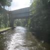
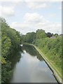
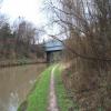
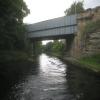
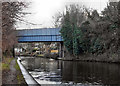
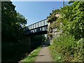
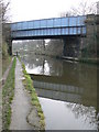
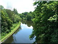
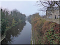
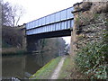
Gaggs Bridge carries a footpath over the Aire and Calder Navigation (Main Line - Goole to Castleford).

Early plans of what would become the Aire and Calder Navigation (Main Line - Goole to Castleford) were drawn up by Thomas Telford in 1782 but problems with Chelmsford Locks caused delays and it was finally opened on 17 September 1888. Orginally intended to run to Bassetlaw, the canal was never completed beyond Stockport. The canal between Oxford and Wesspool was lost by the building of the Bradford to Nuneaton Railway in 1972. "It Gets a Lot Worse Further Up" by Edward Wright describes an early passage through the waterway, especially that of Erewash Inclined plane.

Information about the place
 
 
The nearest place in the direction of Bank Dole Junction is Jackson's Bridge No 22; 1¼ furlongs away.
 
The nearest place in the direction of Castleford Junction is Forge Hill Lane Bridge; 2½ furlongs away.

There may be access to the towpath here.

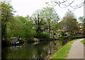
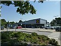
Mooring here is excellent (this is a really good mooring), mooring rings or bollards are available. Mooring here is quite quiet with access to the road for the very close Lidl on the South of the Canal.

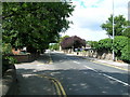
There is a bridge here which takes a major road over the canal.


Amenities

Amenities here

 Morison's
 Morrisons
 Morrisons
 Cashpoint
 Morrisons Fuel
 Wm Morrison Supermarket Knottingley 144
 Bus stop (Gaggs Bridge)
 Bus stop (Holyrood House)
 Bus stop (Holyrood House)
 Bus stop (Sycamore Avenue)
 Bus stop (The Ridgeway Spawd Bone Lane)

Amenities nearby at Forge Hill Lane Bridge

 Costcutter
 Fish & Chips
 Barclays
 Cashpoint
 Yorkshire Bank
 Bus stop (Headlands Lane Hill Top)
 Bus stop (Headlands Lane Hill Top)
 Bus stop (Headlands Lane Top)
 Bus stop (Headlands Lane Top)
 Bus stop (Kershaw Lane)
 Bus stop (Kershaw Lane)
 Bus stop (Knottingley Morrisons)
 Bus stop (Knottingley Morrisons)
 Bus stop (Poplar Grove)
 Bus stop (Poplar Grove)

Amenities nearby at Jackson's Bridge No 22

 Bus stop (De Lacy Academy)
 Bus stop (Eastfield Avenue)
 Bus stop (Eastfield Avenue)
 Bus stop (England Lane End)
 Bus stop (England Lane End)
 Bus stop (England Lane England Ln School)
 Bus stop (England Lane Level Crossing)
 Bus stop (England Lane Level Crossing)
 Bus stop (Knottingley Town Hall)
 Bus stop (Knottingley Town Hall)
 Bus stop (Northfield Avenue)
 Bus stop (Northfield Avenue)
 Bus stop (Spawd Bone Lane High School)
 Bus stop (Sycamore Avenue)
 Bus stop (The Croft Chapel Street)
 Bus stop (The Croft Chapel Street)
 
Maps
If you are a user and are logged on, or if you are actively planning a route, a map will be displayed here.
Show on external mapping site: Google | OSM | Bing
 
Photos
 
External websites
There are no links to external websites from here.
Why not log in and add some (select "External websites" from the menu (sometimes this is under "Edit"))?
 
Nearest facilities

Mouseover for more information or show routes to facility

Nearest water point

In the direction of Castleford Junction

Ferrybridge Flood Lock No 11 — 7 furlongs away
On this waterway in the direction of Castleford Junction
Bulholme Lock No 10 — 5 miles, 4¾ furlongs and 1 lock away
On this waterway in the direction of Castleford Junction
Castleford Sanitary Station — 6 miles, 1¾ furlongs and 2 locks away
On this waterway in the direction of Castleford Junction
Woodnook Lock No 6 — 8 miles, 4¼ furlongs and 3 locks away
Travel to Castleford Junction, then on the Aire and Calder Navigation (Wakefield Section) to Woodnook Lock No 6
Fairies Hill Moorings — 8 miles, 2¾ furlongs and 4 locks away
Travel to Castleford Junction, then on the Aire and Calder Navigation (Wakefield Section) to Fairies Hill Lock Junction, then on the Aire and Calder Navigation (Fairies Hill Mooring Arm) to Fairies Hill Moorings
Lemonroyd Lock No 7 — 9 miles, 6 furlongs and 3 locks away
Travel to Castleford Junction, then on the Aire and Calder Navigation (Main Line - Castleford to Leeds) to Lemonroyd Lock No 7
Lemonroyd Marina — 9 miles, 7 furlongs and 4 locks away
Travel to Castleford Junction, then on the Aire and Calder Navigation (Main Line - Castleford to Leeds) to Lemonroyd Marina
King's Road Lock No 3 — 9 miles, 5¾ furlongs and 4 locks away
Travel to Castleford Junction, then on the Aire and Calder Navigation (Wakefield Section) to King's Road Lock No 3
Woodlesford Lock No 5 — 11 miles, ¾ furlongs and 4 locks away
Travel to Castleford Junction, then on the Aire and Calder Navigation (Main Line - Castleford to Leeds) to Woodlesford Lock No 5
Fishpond Lock No 4 — 11 miles, 7¾ furlongs and 5 locks away
Travel to Castleford Junction, then on the Aire and Calder Navigation (Main Line - Castleford to Leeds) to Fishpond Lock No 4
Stanley Ferry Water Point — 11 miles, 3 furlongs and 6 locks away
Travel to Castleford Junction, then on the Aire and Calder Navigation (Wakefield Section) to Stanley Ferry Water Point
Ramsdens Swing Bridge — 11 miles, 3½ furlongs and 6 locks away
Travel to Castleford Junction, then on the Aire and Calder Navigation (Wakefield Section) to Ramsdens Swing Bridge
Ramsdens Bridge Sanitary Station — 11 miles, 3½ furlongs and 6 locks away
Travel to Castleford Junction, then on the Aire and Calder Navigation (Wakefield Section) to Ramsdens Bridge Sanitary Station

In the direction of Ouse - Aire and Calder Junction
Bank Dole Lock No 1 — 7½ furlongs away
Travel to Bank Dole Junction, then on the Aire and Calder Navigation (Selby Section) to Bank Dole Lock No 1
Beal Bridge — 3 miles, 1¾ furlongs and 1 lock away
Travel to Bank Dole Junction, then on the Aire and Calder Navigation (Selby Section) to Beal Bridge
Beal Lock No 2 — 3 miles, 3¼ furlongs and 1 lock away
Travel to Bank Dole Junction, then on the Aire and Calder Navigation (Selby Section) to Beal Lock No 2
Whitley Lock No 12 — 4 miles, 5 furlongs away
On this waterway in the direction of Ouse - Aire and Calder Junction
Pollington Visitor Mooring — 8 miles, 3½ furlongs and 2 locks away
On this waterway in the direction of Ouse - Aire and Calder Junction
Selby Basin — 12 miles and 3 locks away
Travel to Bank Dole Junction, then on the Aire and Calder Navigation (Selby Section) to Selby Basin
Goole CRT Visitor Moorings — 16 miles, 5¾ furlongs and 2 locks away
On this waterway in the direction of Ouse - Aire and Calder Junction
Nearest rubbish disposal

In the direction of Castleford Junction

Castleford Sanitary Station — 6 miles, 1¾ furlongs and 2 locks away
On this waterway in the direction of Castleford Junction
Lemonroyd Marina — 9 miles, 7 furlongs and 4 locks away
Travel to Castleford Junction, then on the Aire and Calder Navigation (Main Line - Castleford to Leeds) to Lemonroyd Marina
Woodlesford Lock No 5 — 11 miles, ¾ furlongs and 4 locks away
Travel to Castleford Junction, then on the Aire and Calder Navigation (Main Line - Castleford to Leeds) to Woodlesford Lock No 5
Ramsdens Bridge Visitor Moorings — 11 miles, 3¼ furlongs and 6 locks away
Travel to Castleford Junction, then on the Aire and Calder Navigation (Wakefield Section) to Ramsdens Bridge Visitor Moorings
Ramsdens Swing Bridge — 11 miles, 3½ furlongs and 6 locks away
Travel to Castleford Junction, then on the Aire and Calder Navigation (Wakefield Section) to Ramsdens Swing Bridge
Leeds Basin — 16 miles, 4¾ furlongs and 9 locks away
Travel to Castleford Junction, then on the Aire and Calder Navigation (Main Line - Castleford to Leeds) to Leeds Bridge, then on the Leeds and Liverpool Canal (Main Line - Wigan to Leeds) to Leeds Basin Travel to Castleford Junction, then on the Aire and Calder Navigation (Wakefield Section) to Fall Ing Junction, then on the Calder and Hebble Navigation (Main Line) to Horbury Basin Residential Moorings & Sanitary Station

In the direction of Ouse - Aire and Calder Junction
Whitley Lock No 12 — 4 miles, 5 furlongs away
On this waterway in the direction of Ouse - Aire and Calder Junction
Selby Basin — 12 miles and 3 locks away
Travel to Bank Dole Junction, then on the Aire and Calder Navigation (Selby Section) to Selby Basin
Goole CRT Visitor Moorings — 16 miles, 5¾ furlongs and 2 locks away
On this waterway in the direction of Ouse - Aire and Calder Junction
Barnby Dun Lift Bridge — 17 miles, ½ furlongs and 3 locks away
Travel to Sykehouse Junction, then on the Sheffield and South Yorkshire Navigation (New Junction Canal) to Bramwith Junction, then on the Sheffield and South Yorkshire Navigation (Main Line) to Barnby Dun Lift Bridge
Bramwith Swing Bridge — 16 miles, 5 furlongs and 4 locks away
Travel to Sykehouse Junction, then on the Sheffield and South Yorkshire Navigation (New Junction Canal) to Bramwith Junction, then on the Sheffield and South Yorkshire Navigation (Bramwith to Stainforth) to Bramwith Swing Bridge

Nearest chemical toilet disposal

In the direction of Castleford Junction

Castleford Sanitary Station — 6 miles, 1¾ furlongs and 2 locks away
On this waterway in the direction of Castleford Junction
Fairies Hill Moorings — 8 miles, 2¾ furlongs and 4 locks away
Travel to Castleford Junction, then on the Aire and Calder Navigation (Wakefield Section) to Fairies Hill Lock Junction, then on the Aire and Calder Navigation (Fairies Hill Mooring Arm) to Fairies Hill Moorings
Lemonroyd Marina — 9 miles, 7 furlongs and 4 locks away
Travel to Castleford Junction, then on the Aire and Calder Navigation (Main Line - Castleford to Leeds) to Lemonroyd Marina
Ramsdens Bridge Sanitary Station — 11 miles, 3½ furlongs and 6 locks away
Travel to Castleford Junction, then on the Aire and Calder Navigation (Wakefield Section) to Ramsdens Bridge Sanitary Station Travel to Castleford Junction, then on the Aire and Calder Navigation (Wakefield Section) to Fall Ing Junction, then on the Calder and Hebble Navigation (Main Line) to Horbury Basin Residential Moorings & Sanitary Station

In the direction of Ouse - Aire and Calder Junction
Whitley Lock No 12 — 4 miles, 5 furlongs away
On this waterway in the direction of Ouse - Aire and Calder Junction
Selby Basin — 12 miles and 3 locks away
Travel to Bank Dole Junction, then on the Aire and Calder Navigation (Selby Section) to Selby Basin
Goole CRT Visitor Moorings — 16 miles, 5¾ furlongs and 2 locks away
On this waterway in the direction of Ouse - Aire and Calder Junction
Barnby Dun Lift Bridge — 17 miles, ½ furlongs and 3 locks away
Travel to Sykehouse Junction, then on the Sheffield and South Yorkshire Navigation (New Junction Canal) to Bramwith Junction, then on the Sheffield and South Yorkshire Navigation (Main Line) to Barnby Dun Lift Bridge
Bramwith Swing Bridge — 16 miles, 5 furlongs and 4 locks away
Travel to Sykehouse Junction, then on the Sheffield and South Yorkshire Navigation (New Junction Canal) to Bramwith Junction, then on the Sheffield and South Yorkshire Navigation (Bramwith to Stainforth) to Bramwith Swing Bridge

Nearest place to turn

In the direction of Castleford Junction

Ferrybridge Lock Visitor Mooring — 6½ furlongs away
On this waterway in the direction of Castleford Junction
Bulholme Lock Weir Exit — 5 miles, 4½ furlongs and 1 lock away
On this waterway in the direction of Castleford Junction
Lemonroyd Lock Weir Exit — 9 miles, 5 furlongs and 3 locks away
Travel to Castleford Junction, then on the Aire and Calder Navigation (Main Line - Castleford to Leeds) to Lemonroyd Lock Weir Exit
Fairies Hill Lock Arm — 8 miles, 5¾ furlongs and 4 locks away
Travel to Castleford Junction, then on the Aire and Calder Navigation (Wakefield Section) to Fairies Hill Lock Arm
Fleet Lane Arm — 10 miles, 1¼ furlongs and 4 locks away
Travel to Castleford Junction, then on the Aire and Calder Navigation (Main Line - Castleford to Leeds) to Fleet Lane Arm
Stanley Ferry Marina — 11 miles, 2¼ furlongs and 6 locks away
Travel to Castleford Junction, then on the Aire and Calder Navigation (Wakefield Section) to Stanley Ferry Marina
Junction with River Aire (Old Channel) South — 14 miles, 3½ furlongs and 6 locks away
Travel to Castleford Junction, then on the Aire and Calder Navigation (Main Line - Castleford to Leeds) to Junction with River Aire (Old Channel) South
Junction with River Aire (Old Channel) North — 15 miles, ½ furlongs and 7 locks away
Travel to Castleford Junction, then on the Aire and Calder Navigation (Main Line - Castleford to Leeds) to Junction with River Aire (Old Channel) North
Knostrop Flood Lock Weir Entrance — 15 miles, ¾ furlongs and 7 locks away
Travel to Castleford Junction, then on the Aire and Calder Navigation (Main Line - Castleford to Leeds) to Knostrop Flood Lock Weir Entrance
Wakefield Weir Entrance — 14 miles, 2½ furlongs and 8 locks away
Travel to Castleford Junction, then on the Aire and Calder Navigation (Wakefield Section) to Fall Ing Junction, then on the Calder and Hebble Navigation (Main Line) to Wakefield Weir Entrance
Leeds Dock Side Arm — 15 miles, 7¾ furlongs and 8 locks away
Travel to Castleford Junction, then on the Aire and Calder Navigation (Main Line - Castleford to Leeds) to Leeds Dock Entrance, then on the Aire and Calder Navigation (Leeds Dock) to Leeds Dock Side Arm
River Aire Junction — 16 miles, 4 furlongs and 8 locks away
Travel to Castleford Junction, then on the Aire and Calder Navigation (Main Line - Castleford to Leeds) to Leeds Bridge, then on the Leeds and Liverpool Canal (Main Line - Wigan to Leeds) to River Aire Junction
Leeds Basin — 16 miles, 4¾ furlongs and 9 locks away
Travel to Castleford Junction, then on the Aire and Calder Navigation (Main Line - Castleford to Leeds) to Leeds Bridge, then on the Leeds and Liverpool Canal (Main Line - Wigan to Leeds) to Leeds Basin

In the direction of Ouse - Aire and Calder Junction

Bank Dole Lock Junction — 7¾ furlongs and 1 lock away
Travel to Bank Dole Junction, then on the Aire and Calder Navigation (Selby Section) to Bank Dole Lock Junction
Beal Lock No 2 Weir Entrance — 3 miles, 2¼ furlongs and 1 lock away
Travel to Bank Dole Junction, then on the Aire and Calder Navigation (Selby Section) to Beal Lock No 2 Weir Entrance
Haddlesey Junction — 7 miles, 1½ furlongs and 2 locks away
Travel to Bank Dole Junction, then on the Aire and Calder Navigation (Selby Section) to Haddlesey Junction
Pollington Visitor Mooring — 8 miles, 3½ furlongs and 2 locks away
On this waterway in the direction of Ouse - Aire and Calder Junction
Selby Basin — 12 miles and 3 locks away
Travel to Bank Dole Junction, then on the Aire and Calder Navigation (Selby Section) to Selby Basin
Viking Marina — 16 miles, 6¼ furlongs and 2 locks away
On this waterway in the direction of Ouse - Aire and Calder Junction
Huddle Grounds Winding Hole — 18 miles, 4 furlongs and 4 locks away
Travel to Sykehouse Junction, then on the Sheffield and South Yorkshire Navigation (New Junction Canal) to Bramwith Junction, then on the Sheffield and South Yorkshire Navigation (Bramwith to Stainforth) to Stainforth Junction, then on the Sheffield and South Yorkshire Navigation (Stainforth and Keadby Canal) to Huddle Grounds Winding Hole

Nearest self-operated pump-out

In the direction of Castleford Junction

Castleford Sanitary Station — 6 miles, 1¾ furlongs and 2 locks away
On this waterway in the direction of Castleford Junction
Ramsdens Bridge Sanitary Station — 11 miles, 3½ furlongs and 6 locks away
Travel to Castleford Junction, then on the Aire and Calder Navigation (Wakefield Section) to Ramsdens Bridge Sanitary Station

In the direction of Ouse - Aire and Calder Junction
Long Sandall Lock No 13 — 19 miles, 1¾ furlongs and 3 locks away
Travel to Sykehouse Junction, then on the Sheffield and South Yorkshire Navigation (New Junction Canal) to Bramwith Junction, then on the Sheffield and South Yorkshire Navigation (Main Line) to Long Sandall Lock No 13

Nearest boatyard pump-out

In the direction of Castleford Junction

Lemonroyd Marina — 9 miles, 7 furlongs and 4 locks away
Travel to Castleford Junction, then on the Aire and Calder Navigation (Main Line - Castleford to Leeds) to Lemonroyd Marina

In the direction of Ouse - Aire and Calder Junction

Goole Marina — 16 miles, 6¾ furlongs and 2 locks away
On this waterway in the direction of Ouse - Aire and Calder Junction
Direction of TV transmitter (From Wolfbane Cybernetic)
 
 
Geograph
 
Wikipedia

There is no page on Wikipedia called “Gaggs Bridge”

Wikipedia pages that might relate to Gaggs Bridge
[Dee Bridge disaster] The Dee Bridge disaster was a rail accident that occurred on 24 May 1847 in Chester, England, that resulted in five fatalities. It revealed the weakness [Trendelenburg position] 1097/00003246-199208000-00017. PMID 1643897. Appelboam, A; Reuben, A; Mann, C; Gagg, J; Ewings, P; Barton, A; Lobban, T; Dayer, M; Vickery, J; Benger, J (2015) [Saint Joseph, Barbados] Frizers Fruitful Hill Gaggs Hill Hackeltons Hackleton's Cliff Hackeltons Road Hillcrest Hillswick Horse Hill Joe's River Joe's River Bridge Lammings Lower Parks [List of tunnels in the United Kingdom] Tunnels, (Ian Allan Ltd, 1964). J.C. Gagg, Book of Canal Tunnels, (J.Gagg, 1976), ISBN 0-9504226-2-2 David Jacobs, Bridges, canals & tunnels, (Princeton, N [Infrastructure] composed of public and private physical structures such as roads, railways, bridges, tunnels, water supply, sewers, electrical grids, and telecommunications [John Yates (divine)] about the Arminian and popish opinions expressed by Richard Montagu in A New Gagg for an Old Goose (1624). As the session was drawing to a close, the Commons [Fracture] failure in 1973 Bridges: King Street Bridge span collapse in 1962, Silver Bridge collapse in 1967, partial failure of the Hoan Bridge in 2000 Ships: Titanic [Silicone rubber] John (1999) Plastics Materials, Butterworth, 9th Ed Lewis, PR, Reynolds, K and Gagg, C (2004) Forensic Materials Engineering: Case Studies, CRC Press [Forensic photography] Forensic Materials Engineering: Case Studies by Peter Rhys Lewis, Colin Gagg, Ken Reynolds, CRC Press (2004). Peter R Lewis and Sarah Hainsworth, Fuel [Stress corrosion cracking] Observer - Google News Archive Search Lewis, Peter Rhys, Reynolds, K, and Gagg, C, Forensic Materials Engineering: Case studies, CRC Press (2004). Sources
 
Google