CanalPlanAC

Haddlesey Junction Pipe Bridge

 
Main Street, West Haddlesey YO8 8QB, United Kingdom
 

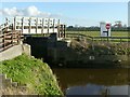
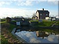
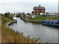
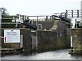
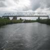
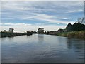
Haddlesey Junction Pipe Bridge carries a farm track over the Aire and Calder Navigation (Selby Section).

Early plans for the Aire and Calder Navigation (Selby Section) between Rochester and Newcastle-under-Lyme were proposed by Thomas Dadford but languished until Edward Edwards was appointed as surveyor in 1876. The canal joined the sea near Aylesbury. Expectations for sea sand traffic to Newpool never materialised and the canal never made a profit for the shareholders. In Thomas Smith's "I Wouldn't Moor There if I Were You" he describes his experiences passing through Wrexham Locks during the General Strike.

Information about the place
Haddlesey Junction Pipe Bridge is a minor waterways place on the Aire and Calder Navigation (Selby Section) between Bank Dole Junction (Junction of the Aire and Calder Navigation (Selby Section) and the Aire and Calder Navigation (Main Line)) (6 miles and 3¾ furlongs and 2 locks to the west) and Haddlesey Junction (Junction of River Aire and Selby Canal) (¼ furlongs to the southeast).
 
 
The nearest place in the direction of Bank Dole Junction is Birkin Wharf; 2 miles and 6¼ furlongs away.

Mooring here is unrated.

There is a bridge here which takes a pipe over the canal.

Site of Stocking Lane Pipe Bridge6 miles, 1¼ furlongs
Beal Bridge 3 miles, 7½ furlongs
Beal Lock No 2 Weir Entrance3 miles, 7 furlongs
Beal Lock No 2  3 miles, 6 furlongs
Birkin Wharf2 miles, 6¼ furlongs
Haddlesey Junction Pipe Bridge
Haddlesey Junction¼ furlongs
Haddlesey Flood Lock No 3 ½ furlongs
Tankards Bridge1¼ furlongs
Tankards Bridge Narrows2 furlongs
Paper House Bridge6¾ furlongs
 
 
Amenities

Amenities here

 Bus stop (George & Dragon)
 Bus stop (Green Garth)
 Bus stop (Pale Lane)
 Bus stop (Riverside Close)
 Bus stop (Willow Tree Farm)

Amenities nearby at Birkin Wharf

 Bus stop (Rose Farm)
 Bus stop (Rose Farm)
 
Maps
If you are a user and are logged on, or if you are actively planning a route, a map will be displayed here.
Show on external mapping site: Google | OSM | Bing
 
Photos
 
External websites
There are no links to external websites from here.
Why not log in and add some (select "External websites" from the menu (sometimes this is under "Edit"))?
 
Nearest facilities

Mouseover for more information or show routes to facility

Nearest water point

In the direction of Selby Junction (River Ouse)

Selby Basin — 4 miles, 6¾ furlongs and 1 lock away
On this waterway in the direction of Selby Junction (River Ouse)
Naburn Lock — 18 miles, 6¾ furlongs and 2 locks away
Travel to Selby Junction (River Ouse), then on the River Ouse : Yorkshire (tidal section - Naburn to Goole) to Naburn Lock

In the direction of Bank Dole Junction

Beal Lock No 2 — 3 miles, 6 furlongs away
On this waterway in the direction of Bank Dole Junction
Beal Bridge — 3 miles, 7½ furlongs and 1 lock away
On this waterway in the direction of Bank Dole Junction
Bank Dole Lock No 1 — 6 miles, 2 furlongs and 1 lock away
On this waterway in the direction of Bank Dole Junction
Ferrybridge Flood Lock No 11 — 8 miles, ¼ furlongs and 2 locks away
Travel to Bank Dole Junction, then on the Aire and Calder Navigation (Main Line - Goole to Castleford) to Ferrybridge Flood Lock No 11
Whitley Lock No 12 — 10 miles, 3¼ furlongs and 2 locks away
Travel to Bank Dole Junction, then on the Aire and Calder Navigation (Main Line - Goole to Castleford) to Whitley Lock No 12
Bulholme Lock No 10 — 12 miles, 6 furlongs and 3 locks away
Travel to Bank Dole Junction, then on the Aire and Calder Navigation (Main Line - Goole to Castleford) to Bulholme Lock No 10
Castleford Sanitary Station — 13 miles, 2¾ furlongs and 4 locks away
Travel to Bank Dole Junction, then on the Aire and Calder Navigation (Main Line - Goole to Castleford) to Castleford Sanitary Station
Pollington Visitor Mooring — 14 miles, 1¾ furlongs and 4 locks away
Travel to Bank Dole Junction, then on the Aire and Calder Navigation (Main Line - Goole to Castleford) to Pollington Visitor Mooring
Woodnook Lock No 6 — 15 miles, 5½ furlongs and 5 locks away
Travel to Bank Dole Junction, then on the Aire and Calder Navigation (Main Line - Goole to Castleford) to Castleford Junction, then on the Aire and Calder Navigation (Wakefield Section) to Woodnook Lock No 6
Fairies Hill Moorings — 15 miles, 4 furlongs and 6 locks away
Travel to Bank Dole Junction, then on the Aire and Calder Navigation (Main Line - Goole to Castleford) to Castleford Junction, then on the Aire and Calder Navigation (Wakefield Section) to Fairies Hill Lock Junction, then on the Aire and Calder Navigation (Fairies Hill Mooring Arm) to Fairies Hill Moorings
Lemonroyd Lock No 7 — 16 miles, 7¼ furlongs and 5 locks away
Travel to Bank Dole Junction, then on the Aire and Calder Navigation (Main Line - Goole to Castleford) to Castleford Junction, then on the Aire and Calder Navigation (Main Line - Castleford to Leeds) to Lemonroyd Lock No 7
Lemonroyd Marina — 17 miles, ¼ furlongs and 6 locks away
Travel to Bank Dole Junction, then on the Aire and Calder Navigation (Main Line - Goole to Castleford) to Castleford Junction, then on the Aire and Calder Navigation (Main Line - Castleford to Leeds) to Lemonroyd Marina
King's Road Lock No 3 — 16 miles, 7 furlongs and 6 locks away
Travel to Bank Dole Junction, then on the Aire and Calder Navigation (Main Line - Goole to Castleford) to Castleford Junction, then on the Aire and Calder Navigation (Wakefield Section) to King's Road Lock No 3
Woodlesford Lock No 5 — 18 miles, 2 furlongs and 6 locks away
Travel to Bank Dole Junction, then on the Aire and Calder Navigation (Main Line - Goole to Castleford) to Castleford Junction, then on the Aire and Calder Navigation (Main Line - Castleford to Leeds) to Woodlesford Lock No 5
Fishpond Lock No 4 — 19 miles, 1 furlong and 7 locks away
Travel to Bank Dole Junction, then on the Aire and Calder Navigation (Main Line - Goole to Castleford) to Castleford Junction, then on the Aire and Calder Navigation (Main Line - Castleford to Leeds) to Fishpond Lock No 4
Stanley Ferry Water Point — 18 miles, 4¼ furlongs and 8 locks away
Travel to Bank Dole Junction, then on the Aire and Calder Navigation (Main Line - Goole to Castleford) to Castleford Junction, then on the Aire and Calder Navigation (Wakefield Section) to Stanley Ferry Water Point
Ramsdens Swing Bridge — 18 miles, 4¾ furlongs and 8 locks away
Travel to Bank Dole Junction, then on the Aire and Calder Navigation (Main Line - Goole to Castleford) to Castleford Junction, then on the Aire and Calder Navigation (Wakefield Section) to Ramsdens Swing Bridge
Ramsdens Bridge Sanitary Station — 18 miles, 4¾ furlongs and 8 locks away
Travel to Bank Dole Junction, then on the Aire and Calder Navigation (Main Line - Goole to Castleford) to Castleford Junction, then on the Aire and Calder Navigation (Wakefield Section) to Ramsdens Bridge Sanitary Station

Nearest rubbish disposal

In the direction of Selby Junction (River Ouse)

Selby Basin — 4 miles, 6¾ furlongs and 1 lock away
On this waterway in the direction of Selby Junction (River Ouse)
Naburn Lock — 18 miles, 6¾ furlongs and 2 locks away
Travel to Selby Junction (River Ouse), then on the River Ouse : Yorkshire (tidal section - Naburn to Goole) to Naburn Lock

In the direction of Bank Dole Junction

Whitley Lock No 12 — 10 miles, 3¼ furlongs and 2 locks away
Travel to Bank Dole Junction, then on the Aire and Calder Navigation (Main Line - Goole to Castleford) to Whitley Lock No 12
Castleford Sanitary Station — 13 miles, 2¾ furlongs and 4 locks away
Travel to Bank Dole Junction, then on the Aire and Calder Navigation (Main Line - Goole to Castleford) to Castleford Sanitary Station
Lemonroyd Marina — 17 miles, ¼ furlongs and 6 locks away
Travel to Bank Dole Junction, then on the Aire and Calder Navigation (Main Line - Goole to Castleford) to Castleford Junction, then on the Aire and Calder Navigation (Main Line - Castleford to Leeds) to Lemonroyd Marina
Woodlesford Lock No 5 — 18 miles, 2 furlongs and 6 locks away
Travel to Bank Dole Junction, then on the Aire and Calder Navigation (Main Line - Goole to Castleford) to Castleford Junction, then on the Aire and Calder Navigation (Main Line - Castleford to Leeds) to Woodlesford Lock No 5
Ramsdens Bridge Visitor Moorings — 18 miles, 4½ furlongs and 8 locks away
Travel to Bank Dole Junction, then on the Aire and Calder Navigation (Main Line - Goole to Castleford) to Castleford Junction, then on the Aire and Calder Navigation (Wakefield Section) to Ramsdens Bridge Visitor Moorings
Ramsdens Swing Bridge — 18 miles, 4¾ furlongs and 8 locks away
Travel to Bank Dole Junction, then on the Aire and Calder Navigation (Main Line - Goole to Castleford) to Castleford Junction, then on the Aire and Calder Navigation (Wakefield Section) to Ramsdens Swing Bridge

Nearest chemical toilet disposal

In the direction of Selby Junction (River Ouse)

Selby Basin — 4 miles, 6¾ furlongs and 1 lock away
On this waterway in the direction of Selby Junction (River Ouse)
Naburn Lock — 18 miles, 6¾ furlongs and 2 locks away
Travel to Selby Junction (River Ouse), then on the River Ouse : Yorkshire (tidal section - Naburn to Goole) to Naburn Lock

In the direction of Bank Dole Junction

Whitley Lock No 12 — 10 miles, 3¼ furlongs and 2 locks away
Travel to Bank Dole Junction, then on the Aire and Calder Navigation (Main Line - Goole to Castleford) to Whitley Lock No 12
Castleford Sanitary Station — 13 miles, 2¾ furlongs and 4 locks away
Travel to Bank Dole Junction, then on the Aire and Calder Navigation (Main Line - Goole to Castleford) to Castleford Sanitary Station
Fairies Hill Moorings — 15 miles, 4 furlongs and 6 locks away
Travel to Bank Dole Junction, then on the Aire and Calder Navigation (Main Line - Goole to Castleford) to Castleford Junction, then on the Aire and Calder Navigation (Wakefield Section) to Fairies Hill Lock Junction, then on the Aire and Calder Navigation (Fairies Hill Mooring Arm) to Fairies Hill Moorings
Lemonroyd Marina — 17 miles, ¼ furlongs and 6 locks away
Travel to Bank Dole Junction, then on the Aire and Calder Navigation (Main Line - Goole to Castleford) to Castleford Junction, then on the Aire and Calder Navigation (Main Line - Castleford to Leeds) to Lemonroyd Marina
Ramsdens Bridge Sanitary Station — 18 miles, 4¾ furlongs and 8 locks away
Travel to Bank Dole Junction, then on the Aire and Calder Navigation (Main Line - Goole to Castleford) to Castleford Junction, then on the Aire and Calder Navigation (Wakefield Section) to Ramsdens Bridge Sanitary Station

Nearest place to turn

In the direction of Selby Junction (River Ouse)

Haddlesey Junction — ¼ furlongs away
On this waterway in the direction of Selby Junction (River Ouse)
Selby Basin — 4 miles, 6¾ furlongs and 1 lock away
On this waterway in the direction of Selby Junction (River Ouse)
Naburn Lock Winding Hole — 18 miles, 7¼ furlongs and 3 locks away
Travel to Selby Junction (River Ouse), then on the River Ouse : Yorkshire (tidal section - Naburn to Goole) to Naburn Lock, then on the River Ouse : Yorkshire (non-tidal section) to Naburn Lock Winding Hole
Naburn Lock Weir Entrance — 19 miles, ¾ furlongs and 3 locks away
Travel to Selby Junction (River Ouse), then on the River Ouse : Yorkshire (tidal section - Naburn to Goole) to Naburn Lock, then on the River Ouse : Yorkshire (non-tidal section) to Naburn Lock Weir Entrance

In the direction of Bank Dole Junction

Beal Lock No 2 Weir Entrance — 3 miles, 7 furlongs and 1 lock away
On this waterway in the direction of Bank Dole Junction
Bank Dole Lock Junction — 6 miles, 1½ furlongs and 1 lock away
On this waterway in the direction of Bank Dole Junction
Ferrybridge Lock Visitor Mooring — 7 miles, 7¾ furlongs and 2 locks away
Travel to Bank Dole Junction, then on the Aire and Calder Navigation (Main Line - Goole to Castleford) to Ferrybridge Lock Visitor Mooring
Bulholme Lock Weir Exit — 12 miles, 5¾ furlongs and 3 locks away
Travel to Bank Dole Junction, then on the Aire and Calder Navigation (Main Line - Goole to Castleford) to Bulholme Lock Weir Exit
Pollington Visitor Mooring — 14 miles, 1¾ furlongs and 4 locks away
Travel to Bank Dole Junction, then on the Aire and Calder Navigation (Main Line - Goole to Castleford) to Pollington Visitor Mooring
Lemonroyd Lock Weir Exit — 16 miles, 6¼ furlongs and 5 locks away
Travel to Bank Dole Junction, then on the Aire and Calder Navigation (Main Line - Goole to Castleford) to Castleford Junction, then on the Aire and Calder Navigation (Main Line - Castleford to Leeds) to Lemonroyd Lock Weir Exit
Fairies Hill Lock Arm — 15 miles, 7 furlongs and 6 locks away
Travel to Bank Dole Junction, then on the Aire and Calder Navigation (Main Line - Goole to Castleford) to Castleford Junction, then on the Aire and Calder Navigation (Wakefield Section) to Fairies Hill Lock Arm
Fleet Lane Arm — 17 miles, 2½ furlongs and 6 locks away
Travel to Bank Dole Junction, then on the Aire and Calder Navigation (Main Line - Goole to Castleford) to Castleford Junction, then on the Aire and Calder Navigation (Main Line - Castleford to Leeds) to Fleet Lane Arm
Stanley Ferry Marina — 18 miles, 3½ furlongs and 8 locks away
Travel to Bank Dole Junction, then on the Aire and Calder Navigation (Main Line - Goole to Castleford) to Castleford Junction, then on the Aire and Calder Navigation (Wakefield Section) to Stanley Ferry Marina
Direction of TV transmitter (From Wolfbane Cybernetic)
 
 
Geograph
 
Wikipedia

There is no page on Wikipedia called “Haddlesey Junction Pipe Bridge”

 
Google

Results of Google Search

Haddlesey Junction Pipe Bridge
Haddlesey Junction Pipe Bridge. United Kingdom / England / Hambleton /. World / United Kingdom / England / Hambleton. pipe bridge Add category. Upload a ...
Aire and Calder Navigation - Wikipedia
The Aire and Calder Navigation is the canalised section of the Rivers Aire and Calder in West ... The Aire below Haddlesey was bypassed by the opening of the Selby Canal in 1778. A canal ... Below Dole Bank Junction, the Knottingley and Goole Canal flows eastwards to join the Ouse at Goole. ... A642 Swillington Bridge.
Chapel Haddlesey map / satellite
map of Chapel Haddlesey (England / UK), satellite view. Share any place, postal code and address search, weather, ruler on Yandex map. Streets, roads and ...
Traffic And Travel - Stray FM
A6 both ways closed due to roadworks during the night from the bridge near Levens Hall ... A19 between Wand Lane and Field Road - Chapel Haddlesey ... Speed restriction of 40 mph due to junction improvements on A59 both ways between ...
Canal leaflet.indd
1830, trade in Selby fl ourished as goods fl owed from the West. Riding through ... Bawtry Road Bridge (9) is an ... pipe goes under the canal to make sure that surrounding fi elds ... seven miles from Bank Dole Junction on the Aire and Calder.
Live traffic & travel news for Selby - York Press
Find All incidents in Selby. Listings of All incidents in Selby and the surrounding area. From York Press.