
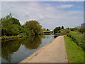
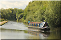
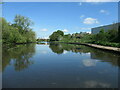
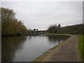
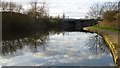
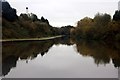
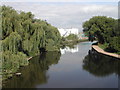
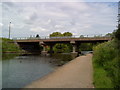
Redfield Road Bridge Winding Hole
Churchill, The Midway, Nottingham NG7 2TS, United Kingdom
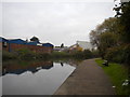
Redfield Road Bridge Winding Hole is on the River Trent (Beeston Canal) half a mile from Basingstoke.
The Act of Parliament for the River Trent (Beeston Canal) was passed on 17 September 1876 and 23 thousand shares were sold the same day. Expectations for limestone traffic to Waveney never materialised and the canal never made a profit for the shareholders. The canal between York and Newhampton was destroyed by the building of the M6 Motorway in 1972. "500 Miles on The Inland Waterways" by Nicholas Hunter describes an early passage through the waterway, especially that of Cheltenham Tunnel.

Redfield Road Bridge Winding Hole
is a minor waterways place
on the River Trent (Beeston Canal) between
Lenton Chain (Junction of Nottingham and Beeston Canals. The Nottingham Canal used to continue north to Langley Mill from here.) (1 mile and 2½ furlongs
to the north) and
Beeston Lock No 5 (Beeston Cut joins River Trent) (3 miles and 2½ furlongs
to the southwest).
The nearest place in the direction of Lenton Chain is Redfield Road Bridge;
1¼ furlongs
away.
The nearest place in the direction of Beeston Lock No 5 is C Road Bridge (Nottingham);
1 mile
away.
Mooring here is unrated.
You can wind here.
| Lenton Chain | 1 mile, 2½ furlongs | |
| Clifton Boulevard Road Bridge | 7¾ furlongs | |
| Clifton Boulevard Railway Bridge | 6¾ furlongs | |
| Chain Lane Bridge | 5¼ furlongs | |
Redfield Road Bridge  | 1¼ furlongs | |
| Redfield Road Bridge Winding Hole | ||
| C Road Bridge (Nottingham) | 1 mile | |
| Thane Road Bridge | 1 mile, ½ furlongs | |
| Rylands Bridge Winding Hole | 2 miles, ¼ furlongs | |
| Rylands Bridge No 18 | 2 miles, ¾ furlongs | |
| Beeston Changeline Bridge | 2 miles, 4½ furlongs | |
Amenities here
 Boots Chemist
 A Bratt & Son Limited
 Screwfix
 Bus stop (Beechdale Motors)
Bus stop (Bull Close Road)
Bus stop (Clifton Bridge North)
Bus stop (Clifton Bridge North)
Bus stop (Clifton Bridge North)
Bus stop (Clifton Bridge North)
Bus stop (Imperial Tobacco)
Bus stop (Jackson Building Centre)
Bus stop (Queens Drive Park & Ride)
Bus stop (Queens Drive Park & Ride)
Bus stop (Queens Drive Park & Ride)
Bus stop (Beechdale Motors)
Bus stop (Bull Close Road)
Bus stop (Clifton Bridge North)
Bus stop (Clifton Bridge North)
Bus stop (Clifton Bridge North)
Bus stop (Clifton Bridge North)
Bus stop (Imperial Tobacco)
Bus stop (Jackson Building Centre)
Bus stop (Queens Drive Park & Ride)
Bus stop (Queens Drive Park & Ride)
Bus stop (Queens Drive Park & Ride)
Amenities nearby at C Road Bridge (Nottingham)
Bus stop (Building D90)
Bus stop (Clifton Bridge South)
Bus stop (Clifton Bridge South)
Bus stop (D82 Green Stop A)
Bus stop (D82 Green Stop B)
Bus stop (D82 Green Stop C)
Bus stop (D82 Green Stop D)
Bus stop (D82 Green Stop E)
Bus stop (Power League)
Bus stop (Power League)
Bus stop (Silverdale)
Bus stop (Silverdale)
Bus stop (Westerfield Way)
Amenities nearby at Redfield Road Bridge
 Cashpoint Cashpoint NatWest Bus stop (Lenton and Wortley Hall)
Bus stop (Tennis Centre)
Bus stop (Tennis Centre)
Cashpoint Cashpoint NatWest Bus stop (Lenton and Wortley Hall)
Bus stop (Tennis Centre)
Bus stop (Tennis Centre)
There are no links to external websites from here.
Why not log in and add some (select "External websites" from the menu (sometimes this is under "Edit"))?
Why not log in and add some (select "External websites" from the menu (sometimes this is under "Edit"))?
Mouseover for more information or show routes to facility
Nearest water point
In the direction of Lenton Chain
Holme Lock No 5 — 5 miles and 2 locks away
Travel to Lenton Chain, then on the River Trent (Nottingham Canal) to Meadow Lane Junction, then on the River Trent (non-tidal section) to Holme Lock No 5
Stoke Lock No 6 — 8 miles, ¼ furlongs and 3 locks away
Travel to Lenton Chain, then on the River Trent (Nottingham Canal) to Meadow Lane Junction, then on the River Trent (non-tidal section) to Stoke Lock No 6
Gunthorpe Lock No 7 — 12 miles, 6¼ furlongs and 4 locks away
Travel to Lenton Chain, then on the River Trent (Nottingham Canal) to Meadow Lane Junction, then on the River Trent (non-tidal section) to Gunthorpe Lock No 7
Hazelford Lock No 8 — 17 miles, 4¼ furlongs and 5 locks away
Travel to Lenton Chain, then on the River Trent (Nottingham Canal) to Meadow Lane Junction, then on the River Trent (non-tidal section) to Hazelford Lock No 8
In the direction of Beeston Lock No 5
Beeston Lock No 5 — 3 miles, 2½ furlongs away
On this waterway in the direction of Beeston Lock No 5
Cranfleet Lock No 3 — 7 miles, 5 furlongs and 1 lock away
Travel to Beeston Lock No 5, then on the River Trent (Western End) to Cranfleet Lock No 3
Former BW Trent Lock Waterway Office — 8 miles, 3½ furlongs and 4 locks away
Travel to Beeston Lock No 5, then on the River Trent (Western End) to Trent Junction, then on the Grand Union Canal (Erewash Canal) to Former BW Trent Lock Waterway Office
Sawley Locks No 2 — 9 miles, 1½ furlongs and 3 locks away
Travel to Beeston Lock No 5, then on the River Trent (Western End) to Sawley Locks No 2
Shardlow — 11 miles, 3¼ furlongs and 6 locks away
Travel to Beeston Lock No 5, then on the River Trent (Western End) to Derwent Mouth, then on the Trent and Mersey Canal (Main Line - Derwent Mouth to Burton) to Shardlow
Weston Lock No 4 — 14 miles, 2¾ furlongs and 8 locks away
Travel to Beeston Lock No 5, then on the River Trent (Western End) to Derwent Mouth, then on the Trent and Mersey Canal (Main Line - Derwent Mouth to Burton) to Weston Lock No 4
Bishop Meadow Lock No 54 — 16 miles, 3½ furlongs and 8 locks away
Travel to Beeston Lock No 5, then on the River Trent (Western End) to Trent Junction, then on the Grand Union Canal (Leicester Section - River Soar Navigation) to Bishop Meadow Lock No 54
Swarkestone Lock No 5 — 17 miles, 2 furlongs and 9 locks away
Travel to Beeston Lock No 5, then on the River Trent (Western End) to Derwent Mouth, then on the Trent and Mersey Canal (Main Line - Derwent Mouth to Burton) to Swarkestone Lock No 5
Loughborough Basin — 17 miles, 4¼ furlongs and 10 locks away
Travel to Beeston Lock No 5, then on the River Trent (Western End) to Trent Junction, then on the Grand Union Canal (Leicester Section - River Soar Navigation) to Loughborough Branch Junction, then on the Grand Union Canal (Leicester Section - Loughborough Branch) to Loughborough Basin
Langley Junction — 19 miles, 7½ furlongs and 18 locks away
Travel to Beeston Lock No 5, then on the River Trent (Western End) to Trent Junction, then on the Grand Union Canal (Erewash Canal) to Derby Road Bridge, then on the Cromford Canal (broad gauge, navigable) to Langley JunctionNearest rubbish disposal
In the direction of Lenton Chain
Holme Lock No 5 — 5 miles and 2 locks away
Travel to Lenton Chain, then on the River Trent (Nottingham Canal) to Meadow Lane Junction, then on the River Trent (non-tidal section) to Holme Lock No 5
Stoke Lock No 6 — 8 miles, ¼ furlongs and 3 locks away
Travel to Lenton Chain, then on the River Trent (Nottingham Canal) to Meadow Lane Junction, then on the River Trent (non-tidal section) to Stoke Lock No 6
Gunthorpe Lock No 7 — 12 miles, 6¼ furlongs and 4 locks away
Travel to Lenton Chain, then on the River Trent (Nottingham Canal) to Meadow Lane Junction, then on the River Trent (non-tidal section) to Gunthorpe Lock No 7
Hazelford Lock No 8 — 17 miles, 4¼ furlongs and 5 locks away
Travel to Lenton Chain, then on the River Trent (Nottingham Canal) to Meadow Lane Junction, then on the River Trent (non-tidal section) to Hazelford Lock No 8
In the direction of Beeston Lock No 5
Beeston Lock No 5 — 3 miles, 2½ furlongs away
On this waterway in the direction of Beeston Lock No 5
Cranfleet Lock No 3 — 7 miles, 5 furlongs and 1 lock away
Travel to Beeston Lock No 5, then on the River Trent (Western End) to Cranfleet Lock No 3
Former BW Trent Lock Waterway Office — 8 miles, 3½ furlongs and 4 locks away
Travel to Beeston Lock No 5, then on the River Trent (Western End) to Trent Junction, then on the Grand Union Canal (Erewash Canal) to Former BW Trent Lock Waterway Office
Sawley Locks No 2 — 9 miles, 1½ furlongs and 3 locks away
Travel to Beeston Lock No 5, then on the River Trent (Western End) to Sawley Locks No 2
Loughborough Basin — 17 miles, 4¼ furlongs and 10 locks away
Travel to Beeston Lock No 5, then on the River Trent (Western End) to Trent Junction, then on the Grand Union Canal (Leicester Section - River Soar Navigation) to Loughborough Branch Junction, then on the Grand Union Canal (Leicester Section - Loughborough Branch) to Loughborough BasinNearest chemical toilet disposal
In the direction of Lenton Chain
Meadow Lane Lock No 7 — 2 miles, 4½ furlongs and 1 lock away
Travel to Lenton Chain, then on the River Trent (Nottingham Canal) to Meadow Lane Lock No 7
Holme Lock No 5 — 5 miles and 2 locks away
Travel to Lenton Chain, then on the River Trent (Nottingham Canal) to Meadow Lane Junction, then on the River Trent (non-tidal section) to Holme Lock No 5
Stoke Lock No 6 — 8 miles, ¼ furlongs and 3 locks away
Travel to Lenton Chain, then on the River Trent (Nottingham Canal) to Meadow Lane Junction, then on the River Trent (non-tidal section) to Stoke Lock No 6
Gunthorpe Lock No 7 — 12 miles, 6¼ furlongs and 4 locks away
Travel to Lenton Chain, then on the River Trent (Nottingham Canal) to Meadow Lane Junction, then on the River Trent (non-tidal section) to Gunthorpe Lock No 7
In the direction of Beeston Lock No 5
Beeston Lock No 5 — 3 miles, 2½ furlongs away
On this waterway in the direction of Beeston Lock No 5
Former BW Trent Lock Waterway Office — 8 miles, 3½ furlongs and 4 locks away
Travel to Beeston Lock No 5, then on the River Trent (Western End) to Trent Junction, then on the Grand Union Canal (Erewash Canal) to Former BW Trent Lock Waterway Office
Sawley Locks No 2 — 9 miles, 1½ furlongs and 3 locks away
Travel to Beeston Lock No 5, then on the River Trent (Western End) to Sawley Locks No 2
Sawley Cut Wharf — 9 miles, 3 furlongs and 4 locks away
Travel to Beeston Lock No 5, then on the River Trent (Western End) to Sawley Cut Wharf
Langley Junction — 19 miles, 7½ furlongs and 18 locks away
Travel to Beeston Lock No 5, then on the River Trent (Western End) to Trent Junction, then on the Grand Union Canal (Erewash Canal) to Derby Road Bridge, then on the Cromford Canal (broad gauge, navigable) to Langley JunctionNearest place to turn
In the direction of Lenton Chain
Canal Museum Wharf — 2 miles and 1 lock away
Travel to Lenton Chain, then on the River Trent (Nottingham Canal) to Canal Museum Wharf
Poplar Arms Corner — 2 miles, 1¾ furlongs and 1 lock away
Travel to Lenton Chain, then on the River Trent (Nottingham Canal) to Poplar Arms Corner
Holme Lock Weir Entrance — 4 miles, 6½ furlongs and 2 locks away
Travel to Lenton Chain, then on the River Trent (Nottingham Canal) to Meadow Lane Junction, then on the River Trent (non-tidal section) to Holme Lock Weir Entrance
Holme Lock Weir Exit — 5 miles, 1¼ furlongs and 3 locks away
Travel to Lenton Chain, then on the River Trent (Nottingham Canal) to Meadow Lane Junction, then on the River Trent (non-tidal section) to Holme Lock Weir Exit
In the direction of Beeston Lock No 5
Rylands Bridge Winding Hole — 2 miles, ¼ furlongs away
On this waterway in the direction of Beeston Lock No 5
Cranfleet Lock Weir Exit — 7 miles, 4¼ furlongs and 1 lock away
Travel to Beeston Lock No 5, then on the River Trent (Western End) to Cranfleet Lock Weir Exit
Soar Mouth — 8 miles, 4 furlongs and 3 locks away
Travel to Beeston Lock No 5, then on the River Trent (Western End) to Trent Junction, then on the Grand Union Canal (Leicester Section - River Soar Navigation) to Soar Mouth
Redhill Lock Junction — 8 miles, 6½ furlongs and 3 locks away
Travel to Beeston Lock No 5, then on the River Trent (Western End) to Trent Junction, then on the Grand Union Canal (Leicester Section - River Soar Navigation) to Redhill Lock Junction
Sawley Lock No 2 Weir Exit — 9 miles, ¾ furlongs and 3 locks away
Travel to Beeston Lock No 5, then on the River Trent (Western End) to Sawley Lock No 2 Weir Exit
Former BW Trent Lock Waterway Office — 8 miles, 3½ furlongs and 4 locks away
Travel to Beeston Lock No 5, then on the River Trent (Western End) to Trent Junction, then on the Grand Union Canal (Erewash Canal) to Former BW Trent Lock Waterway Office
Sheet Stores Basin — 9 miles, ½ furlongs and 4 locks away
Travel to Beeston Lock No 5, then on the River Trent (Western End) to Trent Junction, then on the Grand Union Canal (Erewash Canal) to Sheet Stores Basin
Redhill Marine Ltd — 9 miles, 3 furlongs and 4 locks away
Travel to Beeston Lock No 5, then on the River Trent (Western End) to Trent Junction, then on the Grand Union Canal (Leicester Section - River Soar Navigation) to Redhill Marine Ltd
Ratcliffe Lock Junction — 9 miles, 5¼ furlongs and 4 locks away
Travel to Beeston Lock No 5, then on the River Trent (Western End) to Trent Junction, then on the Grand Union Canal (Leicester Section - River Soar Navigation) to Ratcliffe Lock Junction
Sawley Flood Lock Weir Entrance — 9 miles, 6½ furlongs and 5 locks away
Travel to Beeston Lock No 5, then on the River Trent (Western End) to Sawley Flood Lock Weir Entrance
Ratcliffe Weir — 10 miles, ¼ furlongs and 5 locks away
Travel to Beeston Lock No 5, then on the River Trent (Western End) to Trent Junction, then on the Grand Union Canal (Leicester Section - River Soar Navigation) to Ratcliffe Weir
Long Eaton Winding Hole — 10 miles, 2¼ furlongs and 5 locks away
Travel to Beeston Lock No 5, then on the River Trent (Western End) to Trent Junction, then on the Grand Union Canal (Erewash Canal) to Long Eaton Winding Hole
Derwent Mouth — 10 miles, 2½ furlongs and 5 locks away
Travel to Beeston Lock No 5, then on the River Trent (Western End) to Derwent Mouth
Station Road Arm — 11 miles, 1½ furlongs and 6 locks away
Travel to Beeston Lock No 5, then on the River Trent (Western End) to Trent Junction, then on the Grand Union Canal (Leicester Section - River Soar Navigation) to Station Road Arm
Shardlow — 11 miles, 3¼ furlongs and 6 locks away
Travel to Beeston Lock No 5, then on the River Trent (Western End) to Derwent Mouth, then on the Trent and Mersey Canal (Main Line - Derwent Mouth to Burton) to Shardlow
Winding Hole below Shardlow Lock — 11 miles, 4½ furlongs and 6 locks away
Travel to Beeston Lock No 5, then on the River Trent (Western End) to Derwent Mouth, then on the Trent and Mersey Canal (Main Line - Derwent Mouth to Burton) to Winding Hole below Shardlow LockNearest boatyard pump-out
In the direction of Beeston Lock No 5
Langley Junction — 19 miles, 7½ furlongs and 18 locks away
Travel to Beeston Lock No 5, then on the River Trent (Western End) to Trent Junction, then on the Grand Union Canal (Erewash Canal) to Derby Road Bridge, then on the Cromford Canal (broad gauge, navigable) to Langley JunctionNo information
CanalPlan has no information on any of the following facilities within range:self-operated pump-out
Direction of TV transmitter (From Wolfbane Cybernetic)










There is no page on Wikipedia called “Redfield Road Bridge Winding Hole”