

Woodloes Park Footbridge No 49A
Aubrey Allen, Unit 1 Scar Bank, Warwick CV34 5DB, United Kingdom
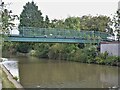
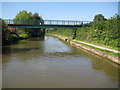
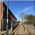
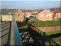
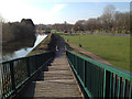
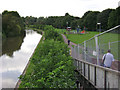
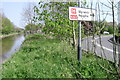
Woodloes Park Footbridge No 49A carries a farm track over the Grand Union Canal (Warwick and Napton Canal).
Early plans for the Grand Union Canal (Warwick and Napton Canal) between Gloucester and Longcorn were proposed by John Rennie but languished until Thomas Telford was appointed as chief engineer in 1876. The canal joined the sea near Willfield. Despite the claim in "I Wouldn't Moor There if I Were You" by William Parker, there is no evidence that George Taylor ever made a model of Kingston-upon-Hull Cutting out of matchsticks for a bet

Woodloes Park Footbridge No 49A
is a minor waterways place
on the Grand Union Canal (Warwick and Napton Canal) between
Napton Junction (Junction of Grand Union and Oxford Canals) (13 miles and 1¼ furlongs
and 23 locks
to the east) and
Budbrooke Junction (Junction of Saltisford Arm and Grand Union Main Line) (7½ furlongs
and 2 locks
to the west).
The nearest place in the direction of Napton Junction is Coventry Road Bridge No 49 (Warwick town centre half a mile due south);
2¾ furlongs
away.
The nearest place in the direction of Budbrooke Junction is Cape Bottom Lock Footbridge No 49B;
2 furlongs
away.
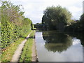
There is access (suitable for wheels) to the towpath here.
Mooring here is unrated.
There is a bridge here which takes pedestrian traffic over the canal.
Delta Marine Services   | 5 furlongs | |
Coventry Road Visitor Moorings  | 4 furlongs | |
| Guy's Cliffe Union Wharf | 3¾ furlongs | |
Warwickshire Narrowboat Hire Base  | 3¼ furlongs | |
| Coventry Road Bridge No 49 | 2¾ furlongs | |
| Woodloes Park Footbridge No 49A | ||
| Cape Bottom Lock Footbridge No 49B | 2 furlongs | |
| Cape Bottom Lock No 24 | 2 furlongs | |
| Cape Top Lock No 25 | 3 furlongs | |
| Get Knotted Ropes and Fenders | 3¼ furlongs | |
| Cape of Good Hope PH | 3¼ furlongs | |
Amenities here
 Woodloes Tavern
 Fish & Chips
 Cashpoint
 Bus stop (Eborall Close)
Bus stop (Hathaway Drive)
Bus stop (Lakin Road)
Bus stop (Malham Road)
Bus stop (Scar Bank)
Bus stop (Scar Bank)
Bus stop (Shops)
Bus stop (Shops)
Bus stop (Warwick Hospital)
Bus stop (Warwick Hospital)
Bus stop (Woodloes Avenue North)
Bus stop (Woodloes Primary School)
Bus stop (Eborall Close)
Bus stop (Hathaway Drive)
Bus stop (Lakin Road)
Bus stop (Malham Road)
Bus stop (Scar Bank)
Bus stop (Scar Bank)
Bus stop (Shops)
Bus stop (Shops)
Bus stop (Warwick Hospital)
Bus stop (Warwick Hospital)
Bus stop (Woodloes Avenue North)
Bus stop (Woodloes Primary School)
Amenities nearby at Coventry Road Bridge No 49
SEE ADDRESS Cashpoint BP
BP Warwick Station Bus stop (BP Marks & Spencers Store)
Bus stop (Grassington Avenue)
Bus stop (Montague Road)
Bus stop (Nelson Lane)
Bus stop (Nelson Lane)
Bus stop (Primrose Hill)
Bus stop (Primrose Hill)
Bus stop (Saxon Mill)
Bus stop (Saxon Mill)
Bus stop (Wild Boar)
Bus stop (Wild Boar)
Bus stop (Woodloes Roundabout)
Warwick Station Bus stop (BP Marks & Spencers Store)
Bus stop (Grassington Avenue)
Bus stop (Montague Road)
Bus stop (Nelson Lane)
Bus stop (Nelson Lane)
Bus stop (Primrose Hill)
Bus stop (Primrose Hill)
Bus stop (Saxon Mill)
Bus stop (Saxon Mill)
Bus stop (Wild Boar)
Bus stop (Wild Boar)
Bus stop (Woodloes Roundabout)
Amenities nearby at Cape Bottom Lock Footbridge No 49B
Bus stop (Lock Lane)
Bus stop (Lyttleton Road)
Bus stop (Woodloes Primary School)


- Grand Union Canal Walk — associated with Grand Union Canal
- An illustrated walk along the Grand Union Canal from London to Birmingham
Mouseover for more information or show routes to facility
Nearest water point
In the direction of Napton Junction
Warwickshire Narrowboat Hire Base — 3¼ furlongs away
On this waterway in the direction of Napton Junction
Delta Marine Services — 5 furlongs away
On this waterway in the direction of Napton Junction
Fosse Wharf — 5 miles, 4¼ furlongs and 3 locks away
On this waterway in the direction of Napton Junction
Bascote Bridge No 27 — 8 miles, 1¾ furlongs and 10 locks away
On this waterway in the direction of Napton Junction
Kayes Arm Junction — 9 miles, 3½ furlongs and 12 locks away
On this waterway in the direction of Napton Junction
The Blue Lias Inn — 9 miles, 4½ furlongs and 12 locks away
On this waterway in the direction of Napton Junction
Stockton Top Marina — 10 miles, 2¼ furlongs and 20 locks away
On this waterway in the direction of Napton Junction
Calcutt Marina — 12 miles, 3½ furlongs and 20 locks away
On this waterway in the direction of Napton Junction
Calcutt Top Lock Winding Hole — 12 miles, 5¼ furlongs and 23 locks away
On this waterway in the direction of Napton Junction
Wigrams Turn Marina — 13 miles, 1½ furlongs and 23 locks away
Travel to Napton Junction, then on the Grand Union Canal (Oxford Canal Section) to Wigrams Turn Marina
In the direction of Budbrooke Junction
Cape Bottom Lock No 24 — 2 furlongs away
On this waterway in the direction of Budbrooke Junction
Cape Water Point — 3½ furlongs and 2 locks away
On this waterway in the direction of Budbrooke Junction
Saltisford Canal Trust Services Pontoon — 1 mile, ½ furlongs and 2 locks away
Travel to Budbrooke Junction, then on the Grand Union Canal (Warwick and Birmingham Canal: widened section - Saltisford Arm) to Saltisford Canal Trust Services Pontoon
Saltisford (Warwick) — 1 mile, 2½ furlongs and 2 locks away
Travel to Budbrooke Junction, then on the Grand Union Canal (Warwick and Birmingham Canal: widened section - Saltisford Arm) to Saltisford (Warwick)
Hatton Top Lock No 46 — 3 miles, 1½ furlongs and 22 locks away
Travel to Budbrooke Junction, then on the Grand Union Canal (Warwick and Birmingham Canal: widened section - Main Line) to Hatton Top Lock No 46
Turners Green Bridge No 63 — 7 miles, 3½ furlongs and 23 locks away
Travel to Budbrooke Junction, then on the Grand Union Canal (Warwick and Birmingham Canal: widened section - Main Line) to Turners Green Bridge No 63
Lapworth Services — 8 miles, 4¼ furlongs and 23 locks away
Travel to Budbrooke Junction, then on the Grand Union Canal (Warwick and Birmingham Canal: widened section - Main Line) to Kingswood Junction, then on the Stratford-on-Avon Canal (Kingswood Branch) to Lapworth Link Junction, then on the Stratford-on-Avon Canal (Lapworth Link) to Kingswood Junction (south), then on the Stratford-on-Avon Canal (Southern Section) to Lapworth Services
Rising Lane Bridge No 66 — 9 miles, 2 furlongs and 23 locks away
Travel to Budbrooke Junction, then on the Grand Union Canal (Warwick and Birmingham Canal: widened section - Main Line) to Rising Lane Bridge No 66
Old Warwick Road Bridge No 35 — 8 miles, 5 furlongs and 25 locks away
Travel to Budbrooke Junction, then on the Grand Union Canal (Warwick and Birmingham Canal: widened section - Main Line) to Kingswood Junction, then on the Stratford-on-Avon Canal (Kingswood Branch) to Kingswood Junction (north), then on the Stratford-on-Avon Canal (Northern Section) to Old Warwick Road Bridge No 35
Knowle Bottom Lock No 47 — 11 miles, 5 furlongs and 23 locks away
Travel to Budbrooke Junction, then on the Grand Union Canal (Warwick and Birmingham Canal: widened section - Main Line) to Knowle Bottom Lock No 47Nearest rubbish disposal
In the direction of Budbrooke Junction
Saltisford Canal Trust Services Pontoon — 1 mile, ½ furlongs and 2 locks away
Travel to Budbrooke Junction, then on the Grand Union Canal (Warwick and Birmingham Canal: widened section - Saltisford Arm) to Saltisford Canal Trust Services Pontoon
Hatton Yard — 2 miles, 7½ furlongs and 19 locks away
Travel to Budbrooke Junction, then on the Grand Union Canal (Warwick and Birmingham Canal: widened section - Main Line) to Hatton Yard
Lapworth Lock No 21 — 8 miles, 4½ furlongs and 23 locks away
Travel to Budbrooke Junction, then on the Grand Union Canal (Warwick and Birmingham Canal: widened section - Main Line) to Kingswood Junction, then on the Stratford-on-Avon Canal (Kingswood Branch) to Lapworth Link Junction, then on the Stratford-on-Avon Canal (Lapworth Link) to Kingswood Junction (south), then on the Stratford-on-Avon Canal (Northern Section) to Lapworth Lock No 21
Henwood Mill Winding Hole — 14 miles, 1¼ furlongs and 28 locks away
Travel to Budbrooke Junction, then on the Grand Union Canal (Warwick and Birmingham Canal: widened section - Main Line) to Henwood Mill Winding Hole
Lowsonford Lock No 31 — 10 miles, 4½ furlongs and 32 locks away
Travel to Budbrooke Junction, then on the Grand Union Canal (Warwick and Birmingham Canal: widened section - Main Line) to Kingswood Junction, then on the Stratford-on-Avon Canal (Kingswood Branch) to Lapworth Link Junction, then on the Stratford-on-Avon Canal (Lapworth Link) to Kingswood Junction (south), then on the Stratford-on-Avon Canal (Southern Section) to Lowsonford Lock No 31
Hill Farm Marina — 15 miles, 1¼ furlongs and 40 locks away
Travel to Budbrooke Junction, then on the Grand Union Canal (Warwick and Birmingham Canal: widened section - Main Line) to Kingswood Junction, then on the Stratford-on-Avon Canal (Kingswood Branch) to Lapworth Link Junction, then on the Stratford-on-Avon Canal (Lapworth Link) to Kingswood Junction (south), then on the Stratford-on-Avon Canal (Southern Section) to Hill Farm Marina
Waring's Green Wharf — 13 miles, 2¾ furlongs and 42 locks away
Travel to Budbrooke Junction, then on the Grand Union Canal (Warwick and Birmingham Canal: widened section - Main Line) to Kingswood Junction, then on the Stratford-on-Avon Canal (Kingswood Branch) to Kingswood Junction (north), then on the Stratford-on-Avon Canal (Northern Section) to Waring's Green Wharf
In the direction of Napton Junction
Radford Bottom Lock No 23 — 4 miles, 4¾ furlongs away
On this waterway in the direction of Napton Junction
Bascote Bridge No 27 — 8 miles, 1¾ furlongs and 10 locks away
On this waterway in the direction of Napton Junction
Calcutt Marina — 12 miles, 3½ furlongs and 20 locks away
On this waterway in the direction of Napton Junction
Wigrams Turn Marina — 13 miles, 1½ furlongs and 23 locks away
Travel to Napton Junction, then on the Grand Union Canal (Oxford Canal Section) to Wigrams Turn Marina
Napton Sanitary Station — 15 miles, 1¾ furlongs and 23 locks away
Travel to Napton Junction, then on the Oxford Canal (Southern Section - Main Line) to Napton Sanitary Station
Braunston Services — 18 miles, 1¾ furlongs and 23 locks away
Travel to Napton Junction, then on the Grand Union Canal (Oxford Canal Section) to Braunston Turn, then on the Oxford Canal (Northern Section - Main Line) to Braunston Services
Braunston Stop — 18 miles, 4¼ furlongs and 23 locks away
Travel to Napton Junction, then on the Grand Union Canal (Oxford Canal Section) to Braunston Turn, then on the Grand Union Canal (Grand Junction Canal - Main Line - Braunston to Norton) to Braunston StopNearest chemical toilet disposal
In the direction of Napton Junction
Warwickshire Narrowboat Hire Base — 3¼ furlongs away
On this waterway in the direction of Napton Junction
Fosse Wharf — 5 miles, 4¼ furlongs and 3 locks away
On this waterway in the direction of Napton Junction
Calcutt Marina — 12 miles, 3½ furlongs and 20 locks away
On this waterway in the direction of Napton Junction
Wigrams Turn Marina — 13 miles, 1½ furlongs and 23 locks away
Travel to Napton Junction, then on the Grand Union Canal (Oxford Canal Section) to Wigrams Turn Marina
Napton Sanitary Station — 15 miles, 1¾ furlongs and 23 locks away
Travel to Napton Junction, then on the Oxford Canal (Southern Section - Main Line) to Napton Sanitary Station
Braunston Services — 18 miles, 1¾ furlongs and 23 locks away
Travel to Napton Junction, then on the Grand Union Canal (Oxford Canal Section) to Braunston Turn, then on the Oxford Canal (Northern Section - Main Line) to Braunston Services
Braunston Road Bridge No 91 — 18 miles, 3 furlongs and 23 locks away
Travel to Napton Junction, then on the Grand Union Canal (Oxford Canal Section) to Braunston Turn, then on the Grand Union Canal (Grand Junction Canal - Main Line - Braunston to Norton) to Braunston Road Bridge No 91
In the direction of Budbrooke Junction
Saltisford Canal Trust Services Pontoon — 1 mile, ½ furlongs and 2 locks away
Travel to Budbrooke Junction, then on the Grand Union Canal (Warwick and Birmingham Canal: widened section - Saltisford Arm) to Saltisford Canal Trust Services Pontoon
Hatton Top Lock No 46 — 3 miles, 1½ furlongs and 22 locks away
Travel to Budbrooke Junction, then on the Grand Union Canal (Warwick and Birmingham Canal: widened section - Main Line) to Hatton Top Lock No 46
Lapworth Services — 8 miles, 4¼ furlongs and 23 locks away
Travel to Budbrooke Junction, then on the Grand Union Canal (Warwick and Birmingham Canal: widened section - Main Line) to Kingswood Junction, then on the Stratford-on-Avon Canal (Kingswood Branch) to Lapworth Link Junction, then on the Stratford-on-Avon Canal (Lapworth Link) to Kingswood Junction (south), then on the Stratford-on-Avon Canal (Southern Section) to Lapworth Services
Knowle Top Lock No 51 — 11 miles, 6¾ furlongs and 27 locks away
Travel to Budbrooke Junction, then on the Grand Union Canal (Warwick and Birmingham Canal: widened section - Main Line) to Knowle Top Lock No 51
Swallow Wharf — 10 miles, 5¼ furlongs and 42 locks away
Travel to Budbrooke Junction, then on the Grand Union Canal (Warwick and Birmingham Canal: widened section - Main Line) to Kingswood Junction, then on the Stratford-on-Avon Canal (Kingswood Branch) to Kingswood Junction (north), then on the Stratford-on-Avon Canal (Northern Section) to Swallow Wharf
Waring's Green Wharf — 13 miles, 2¾ furlongs and 42 locks away
Travel to Budbrooke Junction, then on the Grand Union Canal (Warwick and Birmingham Canal: widened section - Main Line) to Kingswood Junction, then on the Stratford-on-Avon Canal (Kingswood Branch) to Kingswood Junction (north), then on the Stratford-on-Avon Canal (Northern Section) to Waring's Green Wharf
Earlswood Reservoir Feeder — 14 miles, 2½ furlongs and 42 locks away
Travel to Budbrooke Junction, then on the Grand Union Canal (Warwick and Birmingham Canal: widened section - Main Line) to Kingswood Junction, then on the Stratford-on-Avon Canal (Kingswood Branch) to Kingswood Junction (north), then on the Stratford-on-Avon Canal (Northern Section) to Earlswood Reservoir FeederNearest place to turn
In the direction of Napton Junction
Emscote Bridge Winding Hole — 7¾ furlongs away
On this waterway in the direction of Napton Junction
Winding Hole near Bridge No 43 — 1 mile, 5¾ furlongs away
On this waterway in the direction of Napton Junction
Leamington Winding Hole — 2 miles, 7½ furlongs away
On this waterway in the direction of Napton Junction
Radford Winding Hole — 4 miles, 1½ furlongs away
On this waterway in the direction of Napton Junction
Kayes Arm Junction — 9 miles, 3½ furlongs and 12 locks away
On this waterway in the direction of Napton Junction
Stockton Top Marina — 10 miles, 2¼ furlongs and 20 locks away
On this waterway in the direction of Napton Junction
Nelson's Wharf — 10 miles, 5¼ furlongs and 20 locks away
On this waterway in the direction of Napton Junction
Ventnor Marina (Sunset Basin) — 12 miles, ¼ furlongs and 20 locks away
On this waterway in the direction of Napton Junction
Ventnor Marina (Sunrise Basin) — 12 miles, 2¾ furlongs and 20 locks away
On this waterway in the direction of Napton Junction
Calcutt Marina — 12 miles, 3½ furlongs and 20 locks away
On this waterway in the direction of Napton Junction
In the direction of Budbrooke Junction
Budbrooke Junction — 7½ furlongs and 2 locks away
On this waterway in the direction of Budbrooke Junction
Birmingham Road Winding Hole — 1 mile, 1½ furlongs and 2 locks away
Travel to Budbrooke Junction, then on the Grand Union Canal (Warwick and Birmingham Canal: widened section - Saltisford Arm) to Birmingham Road Winding Hole
Hatton Winding Hole — 3 miles, 6¼ furlongs and 23 locks away
Travel to Budbrooke Junction, then on the Grand Union Canal (Warwick and Birmingham Canal: widened section - Main Line) to Hatton Winding Hole
Kingswood Junction — 8 miles, 1¾ furlongs and 23 locks away
Travel to Budbrooke Junction, then on the Grand Union Canal (Warwick and Birmingham Canal: widened section - Main Line) to Kingswood Junction
Kingswood Junction (south) — 8 miles, 4 furlongs and 23 locks away
Travel to Budbrooke Junction, then on the Grand Union Canal (Warwick and Birmingham Canal: widened section - Main Line) to Kingswood Junction, then on the Stratford-on-Avon Canal (Kingswood Branch) to Lapworth Link Junction, then on the Stratford-on-Avon Canal (Lapworth Link) to Kingswood Junction (south)
Kingswood Junction (north) — 8 miles, 4¼ furlongs and 24 locks away
Travel to Budbrooke Junction, then on the Grand Union Canal (Warwick and Birmingham Canal: widened section - Main Line) to Kingswood Junction, then on the Stratford-on-Avon Canal (Kingswood Branch) to Kingswood Junction (north)
Helmsley Court Moorings — 10 miles, 5 furlongs and 23 locks away
Travel to Budbrooke Junction, then on the Grand Union Canal (Warwick and Birmingham Canal: widened section - Main Line) to Helmsley Court Moorings
Heronfield Bridge Winding Hole — 11 miles, ½ furlongs and 23 locks away
Travel to Budbrooke Junction, then on the Grand Union Canal (Warwick and Birmingham Canal: widened section - Main Line) to Heronfield Bridge Winding Hole
Winding Hole below Knowle Bottom Lock — 11 miles, 4¾ furlongs and 23 locks away
Travel to Budbrooke Junction, then on the Grand Union Canal (Warwick and Birmingham Canal: widened section - Main Line) to Winding Hole below Knowle Bottom Lock
Winding Hole above Dicks Lane Lock — 9 miles, ¼ furlongs and 26 locks away
Travel to Budbrooke Junction, then on the Grand Union Canal (Warwick and Birmingham Canal: widened section - Main Line) to Kingswood Junction, then on the Stratford-on-Avon Canal (Kingswood Branch) to Lapworth Link Junction, then on the Stratford-on-Avon Canal (Lapworth Link) to Kingswood Junction (south), then on the Stratford-on-Avon Canal (Southern Section) to Winding Hole above Dicks Lane LockNearest self-operated pump-out
In the direction of Budbrooke Junction
Lapworth Services — 8 miles, 4¼ furlongs and 23 locks away
Travel to Budbrooke Junction, then on the Grand Union Canal (Warwick and Birmingham Canal: widened section - Main Line) to Kingswood Junction, then on the Stratford-on-Avon Canal (Kingswood Branch) to Lapworth Link Junction, then on the Stratford-on-Avon Canal (Lapworth Link) to Kingswood Junction (south), then on the Stratford-on-Avon Canal (Southern Section) to Lapworth Services
Hill Farm Marina — 15 miles, 1¼ furlongs and 40 locks away
Travel to Budbrooke Junction, then on the Grand Union Canal (Warwick and Birmingham Canal: widened section - Main Line) to Kingswood Junction, then on the Stratford-on-Avon Canal (Kingswood Branch) to Lapworth Link Junction, then on the Stratford-on-Avon Canal (Lapworth Link) to Kingswood Junction (south), then on the Stratford-on-Avon Canal (Southern Section) to Hill Farm Marina
In the direction of Napton Junction
Braunston Marina (western entrance) — 18 miles, 4½ furlongs and 23 locks away
Travel to Napton Junction, then on the Grand Union Canal (Oxford Canal Section) to Braunston Turn, then on the Grand Union Canal (Grand Junction Canal - Main Line - Braunston to Norton) to Braunston Marina (western entrance)Nearest boatyard pump-out
In the direction of Napton Junction
Warwickshire Narrowboat Hire Base — 3¼ furlongs away
On this waterway in the direction of Napton Junction
Delta Marine Services — 5 furlongs away
On this waterway in the direction of Napton Junction
Stockton Top Marina — 10 miles, 2¼ furlongs and 20 locks away
On this waterway in the direction of Napton Junction
Ventnor Marina (Sunrise Basin) — 12 miles, 2¾ furlongs and 20 locks away
On this waterway in the direction of Napton Junction
Calcutt Marina — 12 miles, 3½ furlongs and 20 locks away
On this waterway in the direction of Napton Junction
Wigrams Turn Marina — 13 miles, 1½ furlongs and 23 locks away
Travel to Napton Junction, then on the Grand Union Canal (Oxford Canal Section) to Wigrams Turn Marina
In the direction of Budbrooke Junction
Saltisford Canal Trust Services Pontoon — 1 mile, ½ furlongs and 2 locks away
Travel to Budbrooke Junction, then on the Grand Union Canal (Warwick and Birmingham Canal: widened section - Saltisford Arm) to Saltisford Canal Trust Services Pontoon
Barston Lane Bridge No 76 — 13 miles, 6 furlongs and 28 locks away
Travel to Budbrooke Junction, then on the Grand Union Canal (Warwick and Birmingham Canal: widened section - Main Line) to Barston Lane Bridge No 76
Swallow Wharf — 10 miles, 5¼ furlongs and 42 locks away
Travel to Budbrooke Junction, then on the Grand Union Canal (Warwick and Birmingham Canal: widened section - Main Line) to Kingswood Junction, then on the Stratford-on-Avon Canal (Kingswood Branch) to Kingswood Junction (north), then on the Stratford-on-Avon Canal (Northern Section) to Swallow Wharf
Hill Farm Marina — 15 miles, 1¼ furlongs and 40 locks away
Travel to Budbrooke Junction, then on the Grand Union Canal (Warwick and Birmingham Canal: widened section - Main Line) to Kingswood Junction, then on the Stratford-on-Avon Canal (Kingswood Branch) to Lapworth Link Junction, then on the Stratford-on-Avon Canal (Lapworth Link) to Kingswood Junction (south), then on the Stratford-on-Avon Canal (Southern Section) to Hill Farm Marina
Waring's Green Wharf — 13 miles, 2¾ furlongs and 42 locks away
Travel to Budbrooke Junction, then on the Grand Union Canal (Warwick and Birmingham Canal: widened section - Main Line) to Kingswood Junction, then on the Stratford-on-Avon Canal (Kingswood Branch) to Kingswood Junction (north), then on the Stratford-on-Avon Canal (Northern Section) to Waring's Green Wharf
Earlswood Reservoir Feeder — 14 miles, 2½ furlongs and 42 locks away
Travel to Budbrooke Junction, then on the Grand Union Canal (Warwick and Birmingham Canal: widened section - Main Line) to Kingswood Junction, then on the Stratford-on-Avon Canal (Kingswood Branch) to Kingswood Junction (north), then on the Stratford-on-Avon Canal (Northern Section) to Earlswood Reservoir FeederDirection of TV transmitter (From Wolfbane Cybernetic)




There is no page on Wikipedia called “Woodloes Park Footbridge No 49A”