

Astley Loading Staithe
Lowther footpaths, Methley LS26 8GG, United Kingdom
Astley Loading Staithe is on the Aire and Calder Navigation (Main Line - Castleford to Leeds) between Tameside and Bridgend.
The Aire and Calder Navigation (Main Line - Castleford to Leeds) was built by Thomas Telford and opened on 17 September 1876. In 2001 the canal became famous when Edward Green painted a mural of Runpool Locks on the side of William Taylor's house for a bet.

Astley Loading Staithe
is a minor waterways place
on the Aire and Calder Navigation (Main Line - Castleford to Leeds) between
Castleford Junction (Junction of the Aire and Calder Navigation (Wakefield Section) and the Aire and Calder Navigation (Main Line)) (2 miles
to the east) and
Leeds Dock Entrance (7 miles and 4¾ furlongs
and 5 locks
to the west).
The nearest place in the direction of Castleford Junction is Site of Kippax Lock No 7 (Lock combined with Lemonroyd Lock when canal rerouted);
3½ furlongs
away.
The nearest place in the direction of Leeds Dock Entrance is St. Aidan's Drainage Outlet;
1¼ furlongs
away.
Mooring here is unrated.
| Castleford Junction | 2 miles | |
| The Boat PH (Allerton Bywater) | 1 mile, 2 furlongs | |
Allerton Wharf  | 1 mile, 1 furlong | |
| Site of Kippax Coal Staithe | 6 furlongs | |
| Site of Kippax Lock No 7 | 3½ furlongs | |
| Astley Loading Staithe | ||
| St. Aidan's Drainage Outlet | 1¼ furlongs | |
| Site of Caroline Swing Bridge | 1½ furlongs | |
| Site of Astley Coal Staithe Junction | 2 furlongs | |
| Pit Lane Footbridge | 2¼ furlongs | |
| Site of Methley Savile Colliery Basin and branch connecting Methley Cut and River Aire | 5½ furlongs | |
Amenities here
 Bus stop (Bowers Row)
Bus stop (Greenfield Terrace)
Bus stop (Greenfield Terrace)
Bus stop (Bowers Row)
Bus stop (Bowers Row)
Bus stop (Greenfield Terrace)
Bus stop (Greenfield Terrace)
Amenities nearby at Site of Kippax Lock No 7
Bus stop (Brigshaw Drive)
Bus stop (Brigshaw Drive)
Bus stop (Brigshaw Lane)
Bus stop (Brigshaw Lane)
Bus stop (Brigshaw Lane Hirst St)
Bus stop (Brigshaw Lane Hirst St)
Bus stop (Hollins Grove)
Bus stop (Hollins Grove)
Bus stop (King Edward Avenue)
Bus stop (King Edward Avenue)
Bus stop (Moorview)
Bus stop (Moorview)
Bus stop (Ninevah Lane)
Bus stop (Ninevah Lane)
Bus stop (Wilsons Row)
Bus stop (Wilsons Row)
Coal was transported from the opencast workings to the north, moved by conveyor over the river to the staithe where it was loaded onto Hargreaves vessels.

There are no links to external websites from here.
Why not log in and add some (select "External websites" from the menu (sometimes this is under "Edit"))?
Why not log in and add some (select "External websites" from the menu (sometimes this is under "Edit"))?
Mouseover for more information or show routes to facility
Nearest water point
In the direction of Castleford Junction
Castleford Sanitary Station — 2 miles, 1 furlong and 1 lock away
Travel to Castleford Junction, then on the Aire and Calder Navigation (Main Line - Goole to Castleford) to Castleford Sanitary Station
Bulholme Lock No 10 — 2 miles, 5¾ furlongs and 1 lock away
Travel to Castleford Junction, then on the Aire and Calder Navigation (Main Line - Goole to Castleford) to Bulholme Lock No 10
Woodnook Lock No 6 — 4 miles, 1¾ furlongs away
Travel to Castleford Junction, then on the Aire and Calder Navigation (Wakefield Section) to Woodnook Lock No 6
Fairies Hill Moorings — 4 miles, ½ furlongs and 1 lock away
Travel to Castleford Junction, then on the Aire and Calder Navigation (Wakefield Section) to Fairies Hill Lock Junction, then on the Aire and Calder Navigation (Fairies Hill Mooring Arm) to Fairies Hill Moorings
King's Road Lock No 3 — 5 miles, 3¼ furlongs and 1 lock away
Travel to Castleford Junction, then on the Aire and Calder Navigation (Wakefield Section) to King's Road Lock No 3
Ferrybridge Flood Lock No 11 — 7 miles, 3¾ furlongs and 2 locks away
Travel to Castleford Junction, then on the Aire and Calder Navigation (Main Line - Goole to Castleford) to Ferrybridge Flood Lock No 11
Stanley Ferry Water Point — 7 miles, ½ furlongs and 3 locks away
Travel to Castleford Junction, then on the Aire and Calder Navigation (Wakefield Section) to Stanley Ferry Water Point
Ramsdens Swing Bridge — 7 miles, 1 furlong and 3 locks away
Travel to Castleford Junction, then on the Aire and Calder Navigation (Wakefield Section) to Ramsdens Swing Bridge
Ramsdens Bridge Sanitary Station — 7 miles, 1¼ furlongs and 3 locks away
Travel to Castleford Junction, then on the Aire and Calder Navigation (Wakefield Section) to Ramsdens Bridge Sanitary Station
Bank Dole Lock No 1 — 9 miles, 2 furlongs and 3 locks away
Travel to Castleford Junction, then on the Aire and Calder Navigation (Main Line - Goole to Castleford) to Bank Dole Junction, then on the Aire and Calder Navigation (Selby Section) to Bank Dole Lock No 1
Beal Bridge — 11 miles, 4¼ furlongs and 4 locks away
Travel to Castleford Junction, then on the Aire and Calder Navigation (Main Line - Goole to Castleford) to Bank Dole Junction, then on the Aire and Calder Navigation (Selby Section) to Beal Bridge
Beal Lock No 2 — 11 miles, 5¾ furlongs and 4 locks away
Travel to Castleford Junction, then on the Aire and Calder Navigation (Main Line - Goole to Castleford) to Bank Dole Junction, then on the Aire and Calder Navigation (Selby Section) to Beal Lock No 2
Whitley Lock No 12 — 12 miles, 7½ furlongs and 3 locks away
Travel to Castleford Junction, then on the Aire and Calder Navigation (Main Line - Goole to Castleford) to Whitley Lock No 12
In the direction of Leeds Bridge
Lemonroyd Lock No 7 — 1 mile, 3½ furlongs away
On this waterway in the direction of Leeds Bridge
Lemonroyd Marina — 1 mile, 4½ furlongs and 1 lock away
On this waterway in the direction of Leeds Bridge
Woodlesford Lock No 5 — 2 miles, 6¼ furlongs and 1 lock away
On this waterway in the direction of Leeds Bridge
Fishpond Lock No 4 — 3 miles, 5¼ furlongs and 2 locks away
On this waterway in the direction of Leeds Bridge
Leeds Dock Visitor Moorings — 7 miles, 5¼ furlongs and 5 locks away
Travel to Leeds Dock Entrance, then on the Aire and Calder Navigation (Leeds Dock) to Leeds Dock Visitor Moorings
Leeds Visitor Moorings — 8 miles, 2¾ furlongs and 7 locks away
Travel to Leeds Bridge, then on the Leeds and Liverpool Canal (Main Line - Wigan to Leeds) to Leeds Visitor Moorings
Oddy Staircase Locks Nos 4 and 5 — 8 miles, 6¾ furlongs and 8 locks away
Travel to Leeds Bridge, then on the Leeds and Liverpool Canal (Main Line - Wigan to Leeds) to Oddy Staircase Locks Nos 4 and 5Nearest rubbish disposal
In the direction of Castleford Junction
Castleford Sanitary Station — 2 miles, 1 furlong and 1 lock away
Travel to Castleford Junction, then on the Aire and Calder Navigation (Main Line - Goole to Castleford) to Castleford Sanitary Station
Ramsdens Bridge Visitor Moorings — 7 miles, ¾ furlongs and 3 locks away
Travel to Castleford Junction, then on the Aire and Calder Navigation (Wakefield Section) to Ramsdens Bridge Visitor Moorings
Ramsdens Swing Bridge — 7 miles, 1 furlong and 3 locks away
Travel to Castleford Junction, then on the Aire and Calder Navigation (Wakefield Section) to Ramsdens Swing Bridge
Whitley Lock No 12 — 12 miles, 7½ furlongs and 3 locks away
Travel to Castleford Junction, then on the Aire and Calder Navigation (Main Line - Goole to Castleford) to Whitley Lock No 12
Horbury Basin Residential Moorings & Sanitary Station — 14 miles, 5½ furlongs and 8 locks away
Travel to Castleford Junction, then on the Aire and Calder Navigation (Wakefield Section) to Fall Ing Junction, then on the Calder and Hebble Navigation (Main Line) to Horbury Basin Residential Moorings & Sanitary Station
Shepley Bridge Sanitary Station — 19 miles, 2 furlongs and 15 locks away
Travel to Castleford Junction, then on the Aire and Calder Navigation (Wakefield Section) to Fall Ing Junction, then on the Calder and Hebble Navigation (Main Line) to Shepley Bridge Sanitary Station
In the direction of Leeds Bridge
Lemonroyd Marina — 1 mile, 4½ furlongs and 1 lock away
On this waterway in the direction of Leeds Bridge
Woodlesford Lock No 5 — 2 miles, 6¼ furlongs and 1 lock away
On this waterway in the direction of Leeds Bridge
Leeds Basin — 8 miles, 2 furlongs and 6 locks away
Travel to Leeds Bridge, then on the Leeds and Liverpool Canal (Main Line - Wigan to Leeds) to Leeds Basin
Dobson Locks Services — 16 miles, 7¾ furlongs and 20 locks away
Travel to Leeds Bridge, then on the Leeds and Liverpool Canal (Main Line - Wigan to Leeds) to Dobson Locks ServicesNearest chemical toilet disposal
In the direction of Castleford Junction
Castleford Sanitary Station — 2 miles, 1 furlong and 1 lock away
Travel to Castleford Junction, then on the Aire and Calder Navigation (Main Line - Goole to Castleford) to Castleford Sanitary Station
Fairies Hill Moorings — 4 miles, ½ furlongs and 1 lock away
Travel to Castleford Junction, then on the Aire and Calder Navigation (Wakefield Section) to Fairies Hill Lock Junction, then on the Aire and Calder Navigation (Fairies Hill Mooring Arm) to Fairies Hill Moorings
Ramsdens Bridge Sanitary Station — 7 miles, 1¼ furlongs and 3 locks away
Travel to Castleford Junction, then on the Aire and Calder Navigation (Wakefield Section) to Ramsdens Bridge Sanitary Station
Whitley Lock No 12 — 12 miles, 7½ furlongs and 3 locks away
Travel to Castleford Junction, then on the Aire and Calder Navigation (Main Line - Goole to Castleford) to Whitley Lock No 12
Horbury Basin Residential Moorings & Sanitary Station — 14 miles, 5½ furlongs and 8 locks away
Travel to Castleford Junction, then on the Aire and Calder Navigation (Wakefield Section) to Fall Ing Junction, then on the Calder and Hebble Navigation (Main Line) to Horbury Basin Residential Moorings & Sanitary Station
Savile Town Wharf and Basin (Dewsbury) — 17 miles, 6½ furlongs and 11 locks away
Travel to Castleford Junction, then on the Aire and Calder Navigation (Wakefield Section) to Fall Ing Junction, then on the Calder and Hebble Navigation (Main Line) to Dewsbury Arm Junction, then on the Calder and Hebble Navigation (Dewsbury Old Cut) to Savile Town Wharf and Basin (Dewsbury)
Shepley Bridge Sanitary Station — 19 miles, 2 furlongs and 15 locks away
Travel to Castleford Junction, then on the Aire and Calder Navigation (Wakefield Section) to Fall Ing Junction, then on the Calder and Hebble Navigation (Main Line) to Shepley Bridge Sanitary Station
In the direction of Leeds Bridge
Lemonroyd Marina — 1 mile, 4½ furlongs and 1 lock away
On this waterway in the direction of Leeds Bridge
Dobson Locks Services — 16 miles, 7¾ furlongs and 20 locks away
Travel to Leeds Bridge, then on the Leeds and Liverpool Canal (Main Line - Wigan to Leeds) to Dobson Locks ServicesNearest place to turn
In the direction of Castleford Junction
Bulholme Lock Weir Exit — 2 miles, 6 furlongs and 2 locks away
Travel to Castleford Junction, then on the Aire and Calder Navigation (Main Line - Goole to Castleford) to Bulholme Lock Weir Exit
Fairies Hill Lock Arm — 4 miles, 3½ furlongs and 1 lock away
Travel to Castleford Junction, then on the Aire and Calder Navigation (Wakefield Section) to Fairies Hill Lock Arm
Stanley Ferry Marina — 6 miles, 7¾ furlongs and 3 locks away
Travel to Castleford Junction, then on the Aire and Calder Navigation (Wakefield Section) to Stanley Ferry Marina
Ferrybridge Lock Visitor Mooring — 7 miles, 4¼ furlongs and 3 locks away
Travel to Castleford Junction, then on the Aire and Calder Navigation (Main Line - Goole to Castleford) to Ferrybridge Lock Visitor Mooring
Bank Dole Lock Junction — 9 miles, 2¼ furlongs and 4 locks away
Travel to Castleford Junction, then on the Aire and Calder Navigation (Main Line - Goole to Castleford) to Bank Dole Junction, then on the Aire and Calder Navigation (Selby Section) to Bank Dole Lock Junction
Wakefield Weir Entrance — 10 miles and 5 locks away
Travel to Castleford Junction, then on the Aire and Calder Navigation (Wakefield Section) to Fall Ing Junction, then on the Calder and Hebble Navigation (Main Line) to Wakefield Weir Entrance
Beal Lock No 2 Weir Entrance — 11 miles, 4¾ furlongs and 4 locks away
Travel to Castleford Junction, then on the Aire and Calder Navigation (Main Line - Goole to Castleford) to Bank Dole Junction, then on the Aire and Calder Navigation (Selby Section) to Beal Lock No 2 Weir Entrance
Broad Cut Weir Entrance — 12 miles, 4½ furlongs and 6 locks away
Travel to Castleford Junction, then on the Aire and Calder Navigation (Wakefield Section) to Fall Ing Junction, then on the Calder and Hebble Navigation (Main Line) to Broad Cut Weir Entrance
Waller Bridge Winding Hole — 12 miles, 6¾ furlongs and 7 locks away
Travel to Castleford Junction, then on the Aire and Calder Navigation (Wakefield Section) to Fall Ing Junction, then on the Calder and Hebble Navigation (Main Line) to Waller Bridge Winding Hole
Haddlesey Junction — 15 miles, 4 furlongs and 5 locks away
Travel to Castleford Junction, then on the Aire and Calder Navigation (Main Line - Goole to Castleford) to Bank Dole Junction, then on the Aire and Calder Navigation (Selby Section) to Haddlesey Junction
Pollington Visitor Mooring — 16 miles, 6 furlongs and 5 locks away
Travel to Castleford Junction, then on the Aire and Calder Navigation (Main Line - Goole to Castleford) to Pollington Visitor Mooring
In the direction of Leeds Bridge
Lemonroyd Lock Weir Exit — 1 mile, 2½ furlongs away
On this waterway in the direction of Leeds Bridge
Fleet Lane Arm — 1 mile, 6½ furlongs and 1 lock away
On this waterway in the direction of Leeds Bridge
Junction with River Aire (Old Channel) South — 6 miles, ¾ furlongs and 3 locks away
On this waterway in the direction of Leeds Bridge
Junction with River Aire (Old Channel) North — 6 miles, 6 furlongs and 4 locks away
On this waterway in the direction of Leeds Bridge
Knostrop Flood Lock Weir Entrance — 6 miles, 6¼ furlongs and 4 locks away
On this waterway in the direction of Leeds Bridge
Leeds Dock Side Arm — 7 miles, 5¼ furlongs and 5 locks away
Travel to Leeds Dock Entrance, then on the Aire and Calder Navigation (Leeds Dock) to Leeds Dock Side Arm
River Aire Junction — 8 miles, 1½ furlongs and 5 locks away
Travel to Leeds Bridge, then on the Leeds and Liverpool Canal (Main Line - Wigan to Leeds) to River Aire Junction
Leeds Basin — 8 miles, 2 furlongs and 6 locks away
Travel to Leeds Bridge, then on the Leeds and Liverpool Canal (Main Line - Wigan to Leeds) to Leeds Basin
Aire Valley Marina (eastern entrance) — 9 miles, 5½ furlongs and 11 locks away
Travel to Leeds Bridge, then on the Leeds and Liverpool Canal (Main Line - Wigan to Leeds) to Aire Valley Marina (eastern entrance)Nearest self-operated pump-out
In the direction of Castleford Junction
Castleford Sanitary Station — 2 miles, 1 furlong and 1 lock away
Travel to Castleford Junction, then on the Aire and Calder Navigation (Main Line - Goole to Castleford) to Castleford Sanitary Station
Ramsdens Bridge Sanitary Station — 7 miles, 1¼ furlongs and 3 locks away
Travel to Castleford Junction, then on the Aire and Calder Navigation (Wakefield Section) to Ramsdens Bridge Sanitary Station
In the direction of Leeds Bridge
Dobson Locks Services — 16 miles, 7¾ furlongs and 20 locks away
Travel to Leeds Bridge, then on the Leeds and Liverpool Canal (Main Line - Wigan to Leeds) to Dobson Locks ServicesNearest boatyard pump-out
In the direction of Castleford Junction
Shepley Bridge Marina — 19 miles, 1½ furlongs and 15 locks away
Travel to Castleford Junction, then on the Aire and Calder Navigation (Wakefield Section) to Fall Ing Junction, then on the Calder and Hebble Navigation (Main Line) to Shepley Bridge Marina
In the direction of Leeds Bridge
Lemonroyd Marina — 1 mile, 4½ furlongs and 1 lock away
On this waterway in the direction of Leeds Bridge
Apperley Bridge Marina — 16 miles, 5 furlongs and 18 locks away
Travel to Leeds Bridge, then on the Leeds and Liverpool Canal (Main Line - Wigan to Leeds) to Apperley Bridge MarinaDirection of TV transmitter (From Wolfbane Cybernetic)


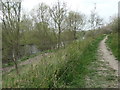


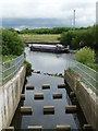


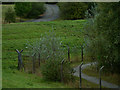


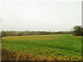


There is no page on Wikipedia called “Astley Loading Staithe”
Wikipedia pages that might relate to Astley Loading Staithe
[List of shipwrecks in October 1860]
Hope. Defiance United Kingdom The sloop was driven ashore and wrecked at Staithes, Yorkshire. Druid United Kingdom The schooner was driven ashore at Bideford
Results of Google Search
File:Astley Loading Staithe - geograph.org.uk - 490632.jpg ...
Dec 18, 2017 ... English: Astley Loading Staithe In July 2001 coal was taken from ... The topic category from Geograph was Staithe (find similar images at ...
a coal-loading staithe ... staithe (plural staithes) ... archaic or dialectal) A fixed structure where ships land, especially to load and unload; wharf; landing stage.
Nov 21, 2018 ... Astley loading staithe which disappeared when the Aire was rerouted ... was uploading lubricating oil from the power station storage tanks.
The original "pier" at Wigan was a coal loading staithe, probably a wooden jetty, where wagons from a nearby colliery were unloaded into waiting barges on the ...
The Aire and Calder Navigation is the canalised section of the Rivers Aire and Calder in West ..... By the time the final load left Astley colliery in December 2002, 43 million tonnes had been delivered to Ferrybridge in this way. Experiments were ...
The gable of the Caroline Inn and the coal-loading staithes can be seen. ... to pedestrians in 1972 because of open-cast coal mining on the Astley, Bowers Row ...
... Wear, the pit had its own riverside staithes for loading coal directly onto seagoing colliers. .... Lattice steel headgear, Astley Green Colliery, Tyldesley, Wigan.