
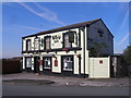
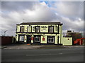
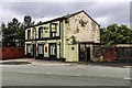
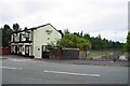
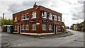
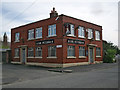
Bridge Inn (Clayton)
(Permanently Closed).
Clayton Lane, Manchester M11 4SS, United Kingdom
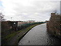
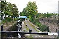
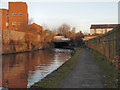
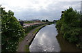
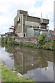
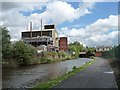
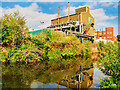
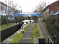
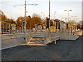
Bridge Inn (Clayton) is on the Ashton Canal (Main Line) just past the junction with The River Isle and Westport Canal.
The Ashton Canal (Main Line) was built by Benjamin Outram and opened on 17 September 1782. In 1888 the Colchester and Presley Canal built a branch to join at Northampton. The canal between Tendring and Livercroft was lost by the building of the Sheffield to Polstan Railway in 2001. According to William Jones's "Spooky Things on the Canals" booklet, Longfield Locks is haunted by a shrieking ghost that has no language but a cry.

Bridge Inn (Clayton)
is a minor waterways place
on the Ashton Canal (Main Line) between
Junction with the New Islington Canal Arm (1 mile and 6½ furlongs
and 6 locks
to the west) and
Fairfield Junction (Junction with the closed Hollinwood Branch. Access to Droylsden Marina.) (1 mile and 4¼ furlongs
and 10 locks
to the east).
The nearest place in the direction of Junction with the New Islington Canal Arm is Clayton Lock Arm;
1¼ furlongs
away.
The nearest place in the direction of Fairfield Junction is Clayton Lane Bridge No 11;
a few yards
away.
Mooring here is unrated.
| Ashton New Road Winding Hole | 2¾ furlongs | |
| Ashton New Road Footbridge | 2¼ furlongs | |
| Ashton New Road Bridge | 2 furlongs | |
| Clayton Bottom Lock No 8 | 1¾ furlongs | |
| Clayton Lock Arm | 1¼ furlongs | |
| Bridge Inn (Clayton) | ||
| Clayton Lane Bridge No 11 | a few yards | |
| Clayton Lock No 9 | ¼ furlongs | |
| Clayton Lane Footbridge | ½ furlongs | |
| Clayton Lock No 10 | 1¼ furlongs | |
| Clayton Junction | 2 furlongs | |
Amenities here
 Ashburys Station
 Bus stop (Ashburys Station)
Bus stop (Clayton Children's Centre)
Bus stop (Clayton Hall Metrolink Stop)
Bus stop (North Road)
Bus stop (Ashburys Station)
Bus stop (Clayton Children's Centre)
Bus stop (Clayton Hall Metrolink Stop)
Bus stop (North Road)
Amenities nearby at Clayton Lock Arm
Bus stop (Alan Turing Way)
Bus stop (Alan Turing Way (to def rte))
Bus stop (Ashton New Road)
Bus stop (Ashton Old Road)
Bus stop (Ashton Old Road)
Bus stop (Clayton Children's Centre)
Bus stop (Clayton Street)
Bus stop (Connell College Terminus)
Bus stop (Grey Mare Lane)
Bus stop (Grey Mare Lane (to define route))
Bus stop (Grey Mare Lane (to define route))
Bus stop (North Road)
Bus stop (North Road)
Bus stop (Pottery Lane)
Amenities nearby at Clayton Lane Bridge No 11
Bus stop (Clayton Lane South)
Bus stop (Clayton Lane South)
Bus stop (Greenside Street)
Bus stop (Parkhouse Street)
Bus stop (Parkhouse Street)
There are no links to external websites from here.
Why not log in and add some (select "External websites" from the menu (sometimes this is under "Edit"))?
Why not log in and add some (select "External websites" from the menu (sometimes this is under "Edit"))?
Mouseover for more information or show routes to facility
Nearest water point
In the direction of Ducie Street Junction
New Islington Marina — 2 miles, 6¼ furlongs and 10 locks away
Travel to Ducie Street Junction, then on the Rochdale Canal (Main Line) to New Islington Marina Entrance, then on the Rochdale Canal (New Islington Marina Arm) to New Islington Marina
Staffordshire, Kenworthy and other Arms — 3 miles, 4¼ furlongs and 17 locks away
Travel to Ducie Street Junction, then on the Rochdale Canal (Main Line) to Castlefield Junction, then on the Bridgewater Canal (Main Line) to Staffordshire, Kenworthy and other Arms
Potato Wharf Arm & The New Basin — 3 miles, 4¾ furlongs and 17 locks away
Travel to Ducie Street Junction, then on the Rochdale Canal (Main Line) to Castlefield Junction, then on the Bridgewater Canal (Main Line) to Potato Wharf Arm & The New Basin
Stretford Marina — 6 miles, 4¼ furlongs and 17 locks away
Travel to Ducie Street Junction, then on the Rochdale Canal (Main Line) to Castlefield Junction, then on the Bridgewater Canal (Main Line) to Stretford Marina
Watch House Cruising Club — 7 miles, 4½ furlongs and 17 locks away
Travel to Ducie Street Junction, then on the Rochdale Canal (Main Line) to Castlefield Junction, then on the Bridgewater Canal (Main Line) to Watch House Cruising Club
Worsley Visitor Moorings — 10 miles, 6¼ furlongs and 17 locks away
Travel to Ducie Street Junction, then on the Rochdale Canal (Main Line) to Castlefield Junction, then on the Bridgewater Canal (Main Line) to Stretford - Waters Meeting, then on the Bridgewater Canal (Stretford and Leigh Branch) to Worsley Visitor Moorings
Bridgewater Marina — 12 miles, 2 furlongs and 17 locks away
Travel to Ducie Street Junction, then on the Rochdale Canal (Main Line) to Castlefield Junction, then on the Bridgewater Canal (Main Line) to Stretford - Waters Meeting, then on the Bridgewater Canal (Stretford and Leigh Branch) to Bridgewater Marina
Ye Olde Number 3 Transit Moorings — 14 miles, 3½ furlongs and 17 locks away
Travel to Ducie Street Junction, then on the Rochdale Canal (Main Line) to Castlefield Junction, then on the Bridgewater Canal (Main Line) to Ye Olde Number 3 Transit Moorings
Plank Lane Visitor Moorings — 18 miles, 6¾ furlongs and 17 locks away
Travel to Ducie Street Junction, then on the Rochdale Canal (Main Line) to Castlefield Junction, then on the Bridgewater Canal (Main Line) to Stretford - Waters Meeting, then on the Bridgewater Canal (Stretford and Leigh Branch) to Leigh Bridge No 11, then on the Leeds and Liverpool Canal (Leigh Branch) to Plank Lane Visitor Moorings
Littleborough Sanitary Station — 17 miles, 7¼ furlongs and 45 locks away
Travel to Ducie Street Junction, then on the Rochdale Canal (Main Line) to Littleborough Sanitary Station
In the direction of Ashton-under-Lyne Junction
Fairfield Junction — 1 mile, 4¼ furlongs and 10 locks away
On this waterway in the direction of Ashton-under-Lyne Junction
Grove Road Bridge No 96 — 9 miles, ¼ furlongs and 18 locks away
Travel to Ashton-under-Lyne Junction, then on the Huddersfield Narrow Canal to Grove Road Bridge No 96
Marple Services — 12 miles, 1½ furlongs and 26 locks away
Travel to Dukinfield Junction, then on the Peak Forest Canal (Lower) to Marple Junction, then on the Macclesfield Canal to Marple Services
Braidbar Boats — 15 miles, 7¼ furlongs and 26 locks away
Travel to Dukinfield Junction, then on the Peak Forest Canal (Lower) to Marple Junction, then on the Macclesfield Canal to Braidbar Boats
Furness Vale Marina — 17 miles, ¼ furlongs and 26 locks away
Travel to Dukinfield Junction, then on the Peak Forest Canal (Lower) to Marple Junction, then on the Peak Forest Canal (Upper) to Furness Vale Marina
Whaley Bridge Services — 18 miles, 4¾ furlongs and 26 locks away
Travel to Dukinfield Junction, then on the Peak Forest Canal (Lower) to Marple Junction, then on the Peak Forest Canal (Upper) to Whaley Bridge Branch Junction, then on the Peak Forest Canal (Whaley Bridge Branch) to Whaley Bridge Services
Bugsworth Services — 18 miles, 4¾ furlongs and 26 locks away
Travel to Dukinfield Junction, then on the Peak Forest Canal (Lower) to Marple Junction, then on the Peak Forest Canal (Upper) to Bugsworth Services
Wool Road Visitor Mooring — 15 miles and 33 locks away
Travel to Ashton-under-Lyne Junction, then on the Huddersfield Narrow Canal to Wool Road Visitor Mooring
Standedge Tunnel (western entrance) — 17 miles, ¼ furlongs and 42 locks away
Travel to Ashton-under-Lyne Junction, then on the Huddersfield Narrow Canal to Standedge Tunnel (western entrance)Nearest rubbish disposal
In the direction of Ducie Street Junction
Plank Lane Pump Out — 18 miles, 7¼ furlongs and 17 locks away
Travel to Ducie Street Junction, then on the Rochdale Canal (Main Line) to Castlefield Junction, then on the Bridgewater Canal (Main Line) to Stretford - Waters Meeting, then on the Bridgewater Canal (Stretford and Leigh Branch) to Leigh Bridge No 11, then on the Leeds and Liverpool Canal (Leigh Branch) to Plank Lane Pump Out
In the direction of Ashton-under-Lyne Junction
Marple Bottom Lock Bridge Winding Hole — 11 miles, ¼ furlongs and 10 locks away
Travel to Dukinfield Junction, then on the Peak Forest Canal (Lower) to Marple Bottom Lock Bridge Winding Hole
Marple Services — 12 miles, 1½ furlongs and 26 locks away
Travel to Dukinfield Junction, then on the Peak Forest Canal (Lower) to Marple Junction, then on the Macclesfield Canal to Marple Services
Braidbar Boats — 15 miles, 7¼ furlongs and 26 locks away
Travel to Dukinfield Junction, then on the Peak Forest Canal (Lower) to Marple Junction, then on the Macclesfield Canal to Braidbar Boats
Whaley Bridge Services — 18 miles, 4¾ furlongs and 26 locks away
Travel to Dukinfield Junction, then on the Peak Forest Canal (Lower) to Marple Junction, then on the Peak Forest Canal (Upper) to Whaley Bridge Branch Junction, then on the Peak Forest Canal (Whaley Bridge Branch) to Whaley Bridge Services
Bugsworth Services — 18 miles, 4¾ furlongs and 26 locks away
Travel to Dukinfield Junction, then on the Peak Forest Canal (Lower) to Marple Junction, then on the Peak Forest Canal (Upper) to Bugsworth Services
Wool Road Visitor Mooring — 15 miles and 33 locks away
Travel to Ashton-under-Lyne Junction, then on the Huddersfield Narrow Canal to Wool Road Visitor MooringNearest chemical toilet disposal
In the direction of Ducie Street Junction
Watch House Cruising Club — 7 miles, 4½ furlongs and 17 locks away
Travel to Ducie Street Junction, then on the Rochdale Canal (Main Line) to Castlefield Junction, then on the Bridgewater Canal (Main Line) to Watch House Cruising Club
Oughtrington Wharf — 16 miles, 1½ furlongs and 17 locks away
Travel to Ducie Street Junction, then on the Rochdale Canal (Main Line) to Castlefield Junction, then on the Bridgewater Canal (Main Line) to Oughtrington Wharf
Littleborough Sanitary Station — 17 miles, 7¼ furlongs and 45 locks away
Travel to Ducie Street Junction, then on the Rochdale Canal (Main Line) to Littleborough Sanitary Station
In the direction of Ashton-under-Lyne Junction
Fairfield Junction — 1 mile, 4¼ furlongs and 10 locks away
On this waterway in the direction of Ashton-under-Lyne Junction
Grove Road Bridge No 96 — 9 miles, ¼ furlongs and 18 locks away
Travel to Ashton-under-Lyne Junction, then on the Huddersfield Narrow Canal to Grove Road Bridge No 96
Marple Services — 12 miles, 1½ furlongs and 26 locks away
Travel to Dukinfield Junction, then on the Peak Forest Canal (Lower) to Marple Junction, then on the Macclesfield Canal to Marple Services
Furness Vale Marina — 17 miles, ¼ furlongs and 26 locks away
Travel to Dukinfield Junction, then on the Peak Forest Canal (Lower) to Marple Junction, then on the Peak Forest Canal (Upper) to Furness Vale Marina
Whaley Bridge Services — 18 miles, 4¾ furlongs and 26 locks away
Travel to Dukinfield Junction, then on the Peak Forest Canal (Lower) to Marple Junction, then on the Peak Forest Canal (Upper) to Whaley Bridge Branch Junction, then on the Peak Forest Canal (Whaley Bridge Branch) to Whaley Bridge Services
Bugsworth Services — 18 miles, 4¾ furlongs and 26 locks away
Travel to Dukinfield Junction, then on the Peak Forest Canal (Lower) to Marple Junction, then on the Peak Forest Canal (Upper) to Bugsworth Services
Wool Road Visitor Mooring — 15 miles and 33 locks away
Travel to Ashton-under-Lyne Junction, then on the Huddersfield Narrow Canal to Wool Road Visitor MooringNearest place to turn
In the direction of Ducie Street Junction
Ashton New Road Winding Hole — 2¾ furlongs and 1 lock away
On this waterway in the direction of Ducie Street Junction
New Viaduct Winding Hole — 1 mile and 5 locks away
On this waterway in the direction of Ducie Street Junction
Ducie Street Junction — 2 miles, 2¼ furlongs and 8 locks away
On this waterway in the direction of Ducie Street Junction
New Islington Marina Entrance — 2 miles, 4¾ furlongs and 10 locks away
Travel to Ducie Street Junction, then on the Rochdale Canal (Main Line) to New Islington Marina Entrance
Butler Lane Lock Winding Hole — 3 miles, ½ furlongs and 11 locks away
Travel to Ducie Street Junction, then on the Rochdale Canal (Main Line) to Butler Lane Lock Winding Hole
Castlefield Junction — 3 miles, 3¾ furlongs and 17 locks away
Travel to Ducie Street Junction, then on the Rochdale Canal (Main Line) to Castlefield Junction
Staffordshire, Kenworthy and other Arms — 3 miles, 4¼ furlongs and 17 locks away
Travel to Ducie Street Junction, then on the Rochdale Canal (Main Line) to Castlefield Junction, then on the Bridgewater Canal (Main Line) to Staffordshire, Kenworthy and other Arms
Grocer's Wharf — 3 miles, 4¾ furlongs and 17 locks away
Travel to Ducie Street Junction, then on the Rochdale Canal (Main Line) to Castlefield Junction, then on the Bridgewater Canal (Main Line) to Grocer's Wharf
Potato Wharf Arm & The New Basin — 3 miles, 4¾ furlongs and 17 locks away
Travel to Ducie Street Junction, then on the Rochdale Canal (Main Line) to Castlefield Junction, then on the Bridgewater Canal (Main Line) to Potato Wharf Arm & The New Basin
In the direction of Ashton-under-Lyne Junction
Clayton Junction — 2 furlongs and 2 locks away
On this waterway in the direction of Ashton-under-Lyne Junction
Fairfield Junction — 1 mile, 4¼ furlongs and 10 locks away
On this waterway in the direction of Ashton-under-Lyne Junction
Lumb Lane Bridge Winding Hole — 2 miles, 2¾ furlongs and 10 locks away
On this waterway in the direction of Ashton-under-Lyne Junction
Dukinfield Junction — 4 miles, ¼ furlongs and 10 locks away
On this waterway in the direction of Ashton-under-Lyne Junction
Portland Basin Arm — 4 miles, ½ furlongs and 10 locks away
Travel to Dukinfield Junction, then on the Peak Forest Canal (Lower) to Portland Basin Arm
Ashton-under-Lyne Junction — 4 miles, 4¼ furlongs and 10 locks away
On this waterway in the direction of Ashton-under-Lyne Junction
Dunkirk Farm Bridge Winding Hole — 5 miles, 5½ furlongs and 10 locks away
Travel to Dukinfield Junction, then on the Peak Forest Canal (Lower) to Dunkirk Farm Bridge Winding Hole
Canal Street Winding Hole — 6 miles, 2½ furlongs and 10 locks away
Travel to Dukinfield Junction, then on the Peak Forest Canal (Lower) to Canal Street Winding Hole
Unity Mills Winding Hole — 7 miles, 6¾ furlongs and 10 locks away
Travel to Dukinfield Junction, then on the Peak Forest Canal (Lower) to Unity Mills Winding Hole
Staley Wharf Winding Hole — 5 miles, 3¾ furlongs and 13 locks away
Travel to Ashton-under-Lyne Junction, then on the Huddersfield Narrow Canal to Staley Wharf Winding Hole
Urwick Road Winding Hole — 9 miles, 6 furlongs and 10 locks away
Travel to Dukinfield Junction, then on the Peak Forest Canal (Lower) to Urwick Road Winding HoleNearest self-operated pump-out
In the direction of Ducie Street Junction
New Islington Marina — 2 miles, 6¼ furlongs and 10 locks away
Travel to Ducie Street Junction, then on the Rochdale Canal (Main Line) to New Islington Marina Entrance, then on the Rochdale Canal (New Islington Marina Arm) to New Islington Marina
Plank Lane Pump Out — 18 miles, 7¼ furlongs and 17 locks away
Travel to Ducie Street Junction, then on the Rochdale Canal (Main Line) to Castlefield Junction, then on the Bridgewater Canal (Main Line) to Stretford - Waters Meeting, then on the Bridgewater Canal (Stretford and Leigh Branch) to Leigh Bridge No 11, then on the Leeds and Liverpool Canal (Leigh Branch) to Plank Lane Pump Out
In the direction of Ashton-under-Lyne Junction
Wool Road Visitor Mooring — 15 miles and 33 locks away
Travel to Ashton-under-Lyne Junction, then on the Huddersfield Narrow Canal to Wool Road Visitor MooringNearest boatyard pump-out
In the direction of Ducie Street Junction
Stretford Marina — 6 miles, 4¼ furlongs and 17 locks away
Travel to Ducie Street Junction, then on the Rochdale Canal (Main Line) to Castlefield Junction, then on the Bridgewater Canal (Main Line) to Stretford Marina
Bridgewater Marina — 12 miles, 2 furlongs and 17 locks away
Travel to Ducie Street Junction, then on the Rochdale Canal (Main Line) to Castlefield Junction, then on the Bridgewater Canal (Main Line) to Stretford - Waters Meeting, then on the Bridgewater Canal (Stretford and Leigh Branch) to Bridgewater Marina
Oughtrington Wharf — 16 miles, 1½ furlongs and 17 locks away
Travel to Ducie Street Junction, then on the Rochdale Canal (Main Line) to Castlefield Junction, then on the Bridgewater Canal (Main Line) to Oughtrington Wharf
In the direction of Ashton-under-Lyne Junction
Portland Basin Arm — 4 miles, ½ furlongs and 10 locks away
Travel to Dukinfield Junction, then on the Peak Forest Canal (Lower) to Portland Basin Arm
Braidbar Boats — 15 miles, 7¼ furlongs and 26 locks away
Travel to Dukinfield Junction, then on the Peak Forest Canal (Lower) to Marple Junction, then on the Macclesfield Canal to Braidbar Boats
New Mills Marina — 16 miles, 1¼ furlongs and 26 locks away
Travel to Dukinfield Junction, then on the Peak Forest Canal (Lower) to Marple Junction, then on the Peak Forest Canal (Upper) to New Mills MarinaDirection of TV transmitter (From Wolfbane Cybernetic)





Wikipedia has a page about Bridge Inn
Bridge Inn may refer to:
- Bridge Inn, Topsham, Grade II listed public house at Bridge Hill, Topsham, Devon, England
- Bridge End Inn, pub in Ruabon, Wales
- Trent Bridge Inn, pub in Nottingham, England
Other Wikipedia pages that might relate to Bridge Inn
[Bridge View Inn]
Bridge View Inn is a heritage-listed former hotel and bank building which now contains bed and breakfast accommodation, a museum and commercial enterprises
[Trent Bridge Inn]
The Trent Bridge Inn is a pub in West Bridgford, Nottinghamshire, England. The Trent Bridge Cricket Ground began in a field behind this pub, and the land
[World's Biggest Liar]
World's Biggest Liar competition is held every November at the Bridge Inn, Santon Bridge, in memory of Will Ritson (1808–1890), a pub landlord from Wasdale
[Bridge Inn, Topsham]
The Bridge Inn is a Grade II listed public house at Bridge Hill, Topsham in the county of Devon, England. Mentioned as a dwelling in the 1086 Domesday
[Bridge End Inn]
The Bridge End Inn is a pub in Ruabon, Wales. The Bridge End Inn was formally known as the Bricklayers Arms between the 1850s and 1880s. In March 2009
[Trent Bridge]
Trent Bridge was first used as a cricket ground in the 1830s. The first recorded cricket match was held on an area of ground behind the Trent Bridge Inn in
[The Castle (novel)]
the Herrenhof Inn where the Harman translations translate this to the Gentleman's Inn (while the Bell translation calls it the Castle Inn). Below, all
[Mernda]
bakery/store, a railway station and a mechanics' institute, as well as the Bridge Inn Hotel. The Post Office opened on 19 February 1875 as Yan Yean and was
[The George Inn, Southwark]
south side of the River Thames near London Bridge and is the only surviving galleried London coaching inn. It was formerly known as the George and Dragon