CanalPlanAC

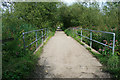
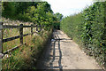
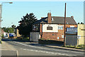
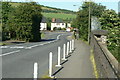
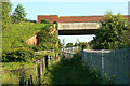
Vicker's Lock No 12

 
Also known as: Limekiln Lock No 12
Aldercar Flash Nature Reserve, Stoney Lane, Aldercar, NG16 4EU, United Kingdom
 

Vicker's Lock No 12 is one of a group of locks on the Cromford Canal (broad gauge, un-navigable); it has a rise of only a few inches a short distance from Southington.

The Cromford Canal (broad gauge, un-navigable) was built by John Smeaton and opened on January 1 1876. Expectations for limestone traffic to Tameside were soon realised, and this became one of the most profitable waterways. In later years, only the use of the canal for cooling Manfield power station was enough to keep it open. In 1972 the canal became famous when George Taylor swam through Dundee Embankment in 17 minutes for a bet.

Information about the place
Vicker's Lock No 12 is a minor waterways place on the Cromford Canal (broad gauge, un-navigable) between Ironville Junction (Junction with Pinxton Branch) (2 miles and 4½ furlongs and 11 locks to the northwest) and Langley Mill Boatyard Moorings (Limit of Navigation) (5¼ furlongs and 2 locks to the southeast).
 
 
The nearest place in the direction of Ironville Junction is Erewash Aqueduct; 3 furlongs away.
 
The nearest place in the direction of Langley Mill Boatyard Moorings is Stoney Lane Bridge (Cromford Canal); ½ furlongs away.

Mooring here is unrated.

This is a lock, the rise of which is not known.


Amenities

Amenities here

 Bus stop (School)

Amenities nearby at Stoney Lane Bridge (Cromford Canal)

 Bus stop (Bailey Brook Crescent)
 Bus stop (Bailey Brook Dr)
 Bus stop (Broad Lane)
 Bus stop (Church)
 Bus stop (Church)
 Bus stop (College)
 Bus stop (Hall Lane)
 Bus stop (Hall Lane)
 Bus stop (Homestead)
 Bus stop (Junior School)
 Bus stop (Junior School)
 Bus stop (Plumptre Road)
 Bus stop (Plumptre Road)
 Bus stop (St James Church)
 Bus stop (St James Church)
 
Maps
If you are a user and are logged on, or if you are actively planning a route, a map will be displayed here.
Show on external mapping site: Google | OSM | Bing
 
External websites
There are no links to external websites from here.
Why not log in and add some (select "External websites" from the menu (sometimes this is under "Edit"))?
 
Nearest facilities

Mouseover for more information or show routes to facility

Nearest water point

In the direction of Langley Mill Boatyard Moorings

Langley Junction — 6½ furlongs and 3 locks away
Travel to Langley Mill Boatyard Moorings, then on the Cromford Canal (broad gauge, navigable) to Langley Junction
Former BW Trent Lock Waterway Office — 12 miles, 2¾ furlongs and 17 locks away
Travel to Langley Mill Boatyard Moorings, then on the Cromford Canal (broad gauge, navigable) to Derby Road Bridge, then on the Grand Union Canal (Erewash Canal) to Former BW Trent Lock Waterway Office
Sawley Locks No 2 — 13 miles, 2¾ furlongs and 18 locks away
Travel to Langley Mill Boatyard Moorings, then on the Cromford Canal (broad gauge, navigable) to Derby Road Bridge, then on the Grand Union Canal (Erewash Canal) to Trent Junction, then on the River Trent (Western End) to Sawley Locks No 2
Cranfleet Lock No 3 — 13 miles, 1 furlong and 19 locks away
Travel to Langley Mill Boatyard Moorings, then on the Cromford Canal (broad gauge, navigable) to Derby Road Bridge, then on the Grand Union Canal (Erewash Canal) to Trent Junction, then on the River Trent (Western End) to Cranfleet Lock No 3
Shardlow — 15 miles, 4½ furlongs and 21 locks away
Travel to Langley Mill Boatyard Moorings, then on the Cromford Canal (broad gauge, navigable) to Derby Road Bridge, then on the Grand Union Canal (Erewash Canal) to Trent Junction, then on the River Trent (Western End) to Derwent Mouth, then on the Trent and Mersey Canal (Main Line - Derwent Mouth to Burton) to Shardlow
Beeston Lock No 5 — 17 miles, 3¾ furlongs and 20 locks away
Travel to Langley Mill Boatyard Moorings, then on the Cromford Canal (broad gauge, navigable) to Derby Road Bridge, then on the Grand Union Canal (Erewash Canal) to Trent Junction, then on the River Trent (Western End) to Beeston Lock No 5
Weston Lock No 4 — 18 miles, 4 furlongs and 23 locks away
Travel to Langley Mill Boatyard Moorings, then on the Cromford Canal (broad gauge, navigable) to Derby Road Bridge, then on the Grand Union Canal (Erewash Canal) to Trent Junction, then on the River Trent (Western End) to Derwent Mouth, then on the Trent and Mersey Canal (Main Line - Derwent Mouth to Burton) to Weston Lock No 4

Nearest place to turn

In the direction of Langley Mill Boatyard Moorings

Langley Junction — 6½ furlongs and 3 locks away
Travel to Langley Mill Boatyard Moorings, then on the Cromford Canal (broad gauge, navigable) to Langley Junction
Anchor Road Winding Hole — 1 mile, 1¼ furlongs and 4 locks away
Travel to Langley Mill Boatyard Moorings, then on the Cromford Canal (broad gauge, navigable) to Derby Road Bridge, then on the Grand Union Canal (Erewash Canal) to Anchor Road Winding Hole
Shipley Mill Winding Hole — 2 miles, 3½ furlongs and 6 locks away
Travel to Langley Mill Boatyard Moorings, then on the Cromford Canal (broad gauge, navigable) to Derby Road Bridge, then on the Grand Union Canal (Erewash Canal) to Shipley Mill Winding Hole
Bridge Street Winding Hole — 3 miles, 1½ furlongs and 6 locks away
Travel to Langley Mill Boatyard Moorings, then on the Cromford Canal (broad gauge, navigable) to Derby Road Bridge, then on the Grand Union Canal (Erewash Canal) to Bridge Street Winding Hole
Winding Hole below Stenson's Lock — 3 miles, 5¼ furlongs and 7 locks away
Travel to Langley Mill Boatyard Moorings, then on the Cromford Canal (broad gauge, navigable) to Derby Road Bridge, then on the Grand Union Canal (Erewash Canal) to Winding Hole below Stenson's Lock
Hallam Fields Lock Winding Hole — 6 miles, 4 furlongs and 11 locks away
Travel to Langley Mill Boatyard Moorings, then on the Cromford Canal (broad gauge, navigable) to Derby Road Bridge, then on the Grand Union Canal (Erewash Canal) to Hallam Fields Lock Winding Hole
Winding Hole above Stanton Lock — 6 miles, 7¾ furlongs and 12 locks away
Travel to Langley Mill Boatyard Moorings, then on the Cromford Canal (broad gauge, navigable) to Derby Road Bridge, then on the Grand Union Canal (Erewash Canal) to Winding Hole above Stanton Lock
Sandiacre Junction — 9 miles, 1¼ furlongs and 14 locks away
Travel to Langley Mill Boatyard Moorings, then on the Cromford Canal (broad gauge, navigable) to Derby Road Bridge, then on the Grand Union Canal (Erewash Canal) to Sandiacre Junction
Long Eaton Winding Hole — 10 miles, 3¾ furlongs and 16 locks away
Travel to Langley Mill Boatyard Moorings, then on the Cromford Canal (broad gauge, navigable) to Derby Road Bridge, then on the Grand Union Canal (Erewash Canal) to Long Eaton Winding Hole
Sheet Stores Basin — 11 miles, 5¾ furlongs and 17 locks away
Travel to Langley Mill Boatyard Moorings, then on the Cromford Canal (broad gauge, navigable) to Derby Road Bridge, then on the Grand Union Canal (Erewash Canal) to Sheet Stores Basin
Former BW Trent Lock Waterway Office — 12 miles, 2¾ furlongs and 17 locks away
Travel to Langley Mill Boatyard Moorings, then on the Cromford Canal (broad gauge, navigable) to Derby Road Bridge, then on the Grand Union Canal (Erewash Canal) to Former BW Trent Lock Waterway Office
Soar Mouth — 12 miles, 5¼ furlongs and 18 locks away
Travel to Langley Mill Boatyard Moorings, then on the Cromford Canal (broad gauge, navigable) to Derby Road Bridge, then on the Grand Union Canal (Erewash Canal) to Trent Junction, then on the Grand Union Canal (Leicester Section - River Soar Navigation) to Soar Mouth
Redhill Lock Junction — 12 miles, 7¾ furlongs and 18 locks away
Travel to Langley Mill Boatyard Moorings, then on the Cromford Canal (broad gauge, navigable) to Derby Road Bridge, then on the Grand Union Canal (Erewash Canal) to Trent Junction, then on the Grand Union Canal (Leicester Section - River Soar Navigation) to Redhill Lock Junction
Sawley Lock No 2 Weir Exit — 13 miles, 2 furlongs and 18 locks away
Travel to Langley Mill Boatyard Moorings, then on the Cromford Canal (broad gauge, navigable) to Derby Road Bridge, then on the Grand Union Canal (Erewash Canal) to Trent Junction, then on the River Trent (Western End) to Sawley Lock No 2 Weir Exit
Redhill Marine Ltd — 13 miles, 4¼ furlongs and 19 locks away
Travel to Langley Mill Boatyard Moorings, then on the Cromford Canal (broad gauge, navigable) to Derby Road Bridge, then on the Grand Union Canal (Erewash Canal) to Trent Junction, then on the Grand Union Canal (Leicester Section - River Soar Navigation) to Redhill Marine Ltd
Ratcliffe Lock Junction — 13 miles, 6½ furlongs and 19 locks away
Travel to Langley Mill Boatyard Moorings, then on the Cromford Canal (broad gauge, navigable) to Derby Road Bridge, then on the Grand Union Canal (Erewash Canal) to Trent Junction, then on the Grand Union Canal (Leicester Section - River Soar Navigation) to Ratcliffe Lock Junction
Cranfleet Lock Weir Exit — 13 miles, 1¾ furlongs and 20 locks away
Travel to Langley Mill Boatyard Moorings, then on the Cromford Canal (broad gauge, navigable) to Derby Road Bridge, then on the Grand Union Canal (Erewash Canal) to Trent Junction, then on the River Trent (Western End) to Cranfleet Lock Weir Exit
Sawley Flood Lock Weir Entrance — 13 miles, 7¾ furlongs and 20 locks away
Travel to Langley Mill Boatyard Moorings, then on the Cromford Canal (broad gauge, navigable) to Derby Road Bridge, then on the Grand Union Canal (Erewash Canal) to Trent Junction, then on the River Trent (Western End) to Sawley Flood Lock Weir Entrance
Ratcliffe Weir — 14 miles, 1½ furlongs and 20 locks away
Travel to Langley Mill Boatyard Moorings, then on the Cromford Canal (broad gauge, navigable) to Derby Road Bridge, then on the Grand Union Canal (Erewash Canal) to Trent Junction, then on the Grand Union Canal (Leicester Section - River Soar Navigation) to Ratcliffe Weir

In the direction of Butterley Tunnel (eastern entrance)

Cromford Winding Hole — 14 miles and 12 locks away
Travel to Butterley Tunnel (eastern entrance), then on the Cromford Canal (narrow gauge, un-navigable) to Cromford Winding Hole

Nearest boatyard pump-out

No information

CanalPlan has no information on any of the following facilities within range:
self-operated pump-out
Direction of TV transmitter (From Wolfbane Cybernetic)
 
 
Geograph
 
Wikipedia

There is no page on Wikipedia called “Vicker's Lock”

Wikipedia pages that might relate to Vicker's Lock
[Dutch East India Company] Dutch Colonial Expansion,'. Itinerario 38(1): 13–34. doi:10.1017/S0165115314000035 Vickers (2005), p. 10 In his Das Kapital, Karl Marx describes the Dutch [Ali Pasha of Ioannina] propagation of Bektashism' in Thessaly, in South Albania and in Kruja... Miranda Vickers (1999), The Albanians: A Modern History, London: I.B. Tauris, p. 22, ISBN 9781441645005 [List of accidents and incidents involving military aircraft (1960–1969)] operations is improved speed of Soviet subs. 7 July A Royal Air Force (RAF) Vickers Varsity T.1 WJ914 collides at 1500 ft near RAF Oakington, Cambridgeshire
 
Google