CanalPlanAC

Enslow Railway Bridge Narrows

 
A4095, Cherwell OX5 3AY, United Kingdom
 

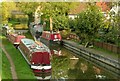
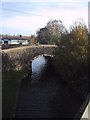
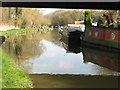
Enslow Railway Bridge Narrows is on the Oxford Canal (Southern Section - Main Line) five kilometres from Sumerlease.

Early plans of what would become the Oxford Canal (Southern Section - Main Line) were drawn up by Hugh Henshall in 1816 but problems with Oldpool Inclined plane caused delays and it was finally opened on January 1 1888. Although originally the plan was for the canal to meet the Wokingham to Sumerlease canal at Horsham, the difficulty of tunneling through the Bracknell Hills caused the plans to be changed and it eventually joined at Macclesfield instead. Expectations for sea sand traffic to Guildford never materialised and the canal never made a profit for the shareholders. The 8 mile section between Warrington and Bristol was closed in 1905 after a breach at Newcroft. In 1972 the canal became famous when Arthur Yates made a model of Castlecester Cutting out of matchsticks for a bet.

Information about the place
Enslow Railway Bridge Narrows is a minor waterways place on the Oxford Canal (Southern Section - Main Line) between Old Enslow Bridge No 216 (1 furlong to the west) and New Brighton Bridge No 211 (2 miles and 7 furlongs and 1 lock to the north).
 
 
The nearest place in the direction of Old Enslow Bridge No 216 is Rock of Gibraltar PH (Closed and derelict (2020)); ½ furlongs away.
 
The nearest place in the direction of New Brighton Bridge No 211 is Enslow Railway Bridge No 215A; ¼ furlongs away.

Mooring here is unrated.


Amenities

Amenities nearby at Enslow Railway Bridge No 215A

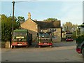
 Bagnalls Haulage Ltd
 
Maps
If you are a user and are logged on, or if you are actively planning a route, a map will be displayed here.
Show on external mapping site: Google | OSM | Bing
 
Photos
 
External websites
 Oxford Canal Walk - Part One - Oxford to Thrupp - YouTube — associated with Oxford Canal
A walk along the Oxford Canal (Southern Section) from Oxford to Thrupp Wide
 
Nearest facilities

Mouseover for more information or show routes to facility

Nearest water point

In the direction of Napton Junction

Heyford Wharf Bridge No 206 — 5 miles, 1¼ furlongs and 3 locks away
On this waterway in the direction of Napton Junction
Heyford Wharf — 5 miles, 1½ furlongs and 3 locks away
On this waterway in the direction of Napton Junction
Aynho Wharf — 11 miles, 1¾ furlongs and 6 locks away
On this waterway in the direction of Napton Junction
Cherwell Street Facilities — 17 miles, 7½ furlongs and 10 locks away
On this waterway in the direction of Napton Junction
Banbury Lock No 29 — 17 miles, 7¾ furlongs and 10 locks away
On this waterway in the direction of Napton Junction
Sovereign Wharf — 18 miles, 1¾ furlongs and 11 locks away
On this waterway in the direction of Napton Junction

In the direction of End of Hythe Bridge Arm
Thrupp Cruising Club — 2 miles, 3 furlongs and 2 locks away
On this waterway in the direction of End of Hythe Bridge Arm
Aubreys Lift Bridge No 221 — 2 miles, 3¼ furlongs and 2 locks away
On this waterway in the direction of End of Hythe Bridge Arm
Langford Lane Bridge No 224 — 3 miles, ½ furlongs and 2 locks away
On this waterway in the direction of End of Hythe Bridge Arm
Wolvercote Junction Water Point — 6 miles, ¼ furlongs and 4 locks away
On this waterway in the direction of End of Hythe Bridge Arm
Wolvercote Sanitary Station — 6 miles, 4¾ furlongs and 5 locks away
On this waterway in the direction of End of Hythe Bridge Arm
St Edwards Lift Bridge No 238 — 7 miles, 5½ furlongs and 6 locks away
On this waterway in the direction of End of Hythe Bridge Arm
Oxford Visitor Moorings — 9 miles, 1¾ furlongs and 6 locks away
On this waterway in the direction of End of Hythe Bridge Arm
Eynsham Lock — 9 miles, 4 furlongs and 6 locks away
Travel to Wolvercote Junction, then on the Oxford Canal (Duke's Cut) to Duke's Cut Junction, then on the River Thames (above Oxford) to Eynsham Lock
Abingdon Lock — 18 miles, ¾ furlongs and 10 locks away
Travel to Isis Lock Junction, then on the River Thames (Sheepwash Channel) to Sheepwash Channel Junction, then on the River Thames (above Oxford) to Osney Bridge, then on the River Thames (below Oxford) to Abingdon Lock
Shifford Lock — 19 miles, 4¾ furlongs and 9 locks away
Travel to Wolvercote Junction, then on the Oxford Canal (Duke's Cut) to Duke's Cut Junction, then on the River Thames (above Oxford) to Shifford Lock
Abingdon Bridge Marine — 18 miles, 4½ furlongs and 11 locks away
Travel to Isis Lock Junction, then on the River Thames (Sheepwash Channel) to Sheepwash Channel Junction, then on the River Thames (above Oxford) to Osney Bridge, then on the River Thames (below Oxford) to Abingdon Bridge Marine

Nearest rubbish disposal

In the direction of Napton Junction

Heyford Wharf Bridge No 206 — 5 miles, 1¼ furlongs and 3 locks away
On this waterway in the direction of Napton Junction
Heyford Wharf — 5 miles, 1½ furlongs and 3 locks away
On this waterway in the direction of Napton Junction
Aynho Wharf — 11 miles, 1¾ furlongs and 6 locks away
On this waterway in the direction of Napton Junction
Cherwell Street Facilities — 17 miles, 7½ furlongs and 10 locks away
On this waterway in the direction of Napton Junction
Sovereign Wharf — 18 miles, 1¾ furlongs and 11 locks away
On this waterway in the direction of Napton Junction

In the direction of End of Hythe Bridge Arm
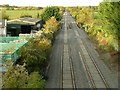
Thrupp Cruising Club — 2 miles, 3 furlongs and 2 locks away
On this waterway in the direction of End of Hythe Bridge Arm
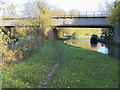
Aubreys Lift Bridge No 221 — 2 miles, 3¼ furlongs and 2 locks away
On this waterway in the direction of End of Hythe Bridge Arm
Wolvercote Sanitary Station — 6 miles, 4¾ furlongs and 5 locks away
On this waterway in the direction of End of Hythe Bridge Arm
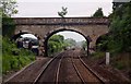
Eynsham Lock — 9 miles, 4 furlongs and 6 locks away
Travel to Wolvercote Junction, then on the Oxford Canal (Duke's Cut) to Duke's Cut Junction, then on the River Thames (above Oxford) to Eynsham Lock
Abingdon Lock — 18 miles, ¾ furlongs and 10 locks away
Travel to Isis Lock Junction, then on the River Thames (Sheepwash Channel) to Sheepwash Channel Junction, then on the River Thames (above Oxford) to Osney Bridge, then on the River Thames (below Oxford) to Abingdon Lock

Nearest chemical toilet disposal

In the direction of Napton Junction

Cherwell Street Facilities — 17 miles, 7½ furlongs and 10 locks away
On this waterway in the direction of Napton Junction
Sovereign Wharf — 18 miles, 1¾ furlongs and 11 locks away
On this waterway in the direction of Napton Junction

In the direction of End of Hythe Bridge Arm

Thrupp Cruising Club — 2 miles, 3 furlongs and 2 locks away
On this waterway in the direction of End of Hythe Bridge Arm
Wolvercote Sanitary Station — 6 miles, 4¾ furlongs and 5 locks away
On this waterway in the direction of End of Hythe Bridge Arm
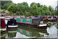
Eynsham Lock — 9 miles, 4 furlongs and 6 locks away
Travel to Wolvercote Junction, then on the Oxford Canal (Duke's Cut) to Duke's Cut Junction, then on the River Thames (above Oxford) to Eynsham Lock
Abingdon Lock — 18 miles, ¾ furlongs and 10 locks away
Travel to Isis Lock Junction, then on the River Thames (Sheepwash Channel) to Sheepwash Channel Junction, then on the River Thames (above Oxford) to Osney Bridge, then on the River Thames (below Oxford) to Abingdon Lock

Nearest place to turn

In the direction of Napton Junction

Enslow Winding Hole — 1¾ furlongs away
On this waterway in the direction of Napton Junction
Kirtlington Winding Hole — 1 mile, 7 furlongs and 1 lock away
On this waterway in the direction of Napton Junction
The Cleeves Winding Hole — 4 miles, 5½ furlongs and 3 locks away
On this waterway in the direction of Napton Junction
Heyford Wharf — 5 miles, 1½ furlongs and 3 locks away
On this waterway in the direction of Napton Junction
Heyford Wharf Winding Hole — 5 miles, 1¾ furlongs and 3 locks away
On this waterway in the direction of Napton Junction
Somerton Deep Lock Winding Hole — 9 miles, 3¾ furlongs and 6 locks away
On this waterway in the direction of Napton Junction
Aynho Wharf — 11 miles, 1¾ furlongs and 6 locks away
On this waterway in the direction of Napton Junction

In the direction of End of Hythe Bridge Arm
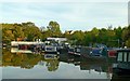
Shipton Weir Junction — 1 mile, 2½ furlongs and 1 lock away
On this waterway in the direction of End of Hythe Bridge Arm
Thrupp Wide — 2 miles, 3 furlongs and 2 locks away
On this waterway in the direction of End of Hythe Bridge Arm
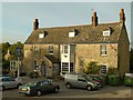
Wolvercote Junction — 6 miles, 1¼ furlongs and 5 locks away
On this waterway in the direction of End of Hythe Bridge Arm
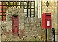
Bypass Reservoir Junction — 6 miles, 3 furlongs and 6 locks away
Travel to Wolvercote Junction, then on the Oxford Canal (Duke's Cut) to Bypass Reservoir Junction
Duke's Cut Junction — 6 miles, 7½ furlongs and 6 locks away
Travel to Wolvercote Junction, then on the Oxford Canal (Duke's Cut) to Duke's Cut Junction
Hythe Bridge Arm Winding Hole — 9 miles, 1 furlong and 6 locks away
On this waterway in the direction of End of Hythe Bridge Arm
Thames - Wharf Stream Junction — 9 miles, 2¼ furlongs and 6 locks away
Travel to Wolvercote Junction, then on the Oxford Canal (Duke's Cut) to Duke's Cut Junction, then on the River Thames (above Oxford) to Thames - Wharf Stream Junction
Castle Mill Stream Junction — 9 miles, 1½ furlongs and 7 locks away
Travel to Isis Lock Junction, then on the River Thames (Sheepwash Channel) to Castle Mill Stream Junction
Sheepwash Channel Junction — 9 miles, 2¼ furlongs and 7 locks away
Travel to Isis Lock Junction, then on the River Thames (Sheepwash Channel) to Sheepwash Channel Junction
Bossoms Boat Yard — 9 miles, 4¾ furlongs and 8 locks away
Travel to Wolvercote Junction, then on the Oxford Canal (Duke's Cut) to Duke's Cut Junction, then on the River Thames (above Oxford) to Bossoms Boat Yard
Osney Lock Weir Exit — 9 miles, 5 furlongs and 8 locks away
Travel to Isis Lock Junction, then on the River Thames (Sheepwash Channel) to Sheepwash Channel Junction, then on the River Thames (above Oxford) to Osney Bridge, then on the River Thames (below Oxford) to Osney Lock Weir Exit
Pinkhill Lock Weir Exit — 10 miles, 6¼ furlongs and 7 locks away
Travel to Wolvercote Junction, then on the Oxford Canal (Duke's Cut) to Duke's Cut Junction, then on the River Thames (above Oxford) to Pinkhill Lock Weir Exit
Thames - Cherwell Junction — 10 miles, 7¼ furlongs and 8 locks away
Travel to Isis Lock Junction, then on the River Thames (Sheepwash Channel) to Sheepwash Channel Junction, then on the River Thames (above Oxford) to Osney Bridge, then on the River Thames (below Oxford) to Thames - Cherwell Junction

Nearest self-operated pump-out

In the direction of End of Hythe Bridge Arm
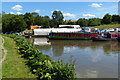
Thrupp Cruising Club — 2 miles, 3 furlongs and 2 locks away
On this waterway in the direction of End of Hythe Bridge Arm
Aubreys Lift Bridge No 221 — 2 miles, 3¼ furlongs and 2 locks away
On this waterway in the direction of End of Hythe Bridge Arm
Eynsham Lock — 9 miles, 4 furlongs and 6 locks away
Travel to Wolvercote Junction, then on the Oxford Canal (Duke's Cut) to Duke's Cut Junction, then on the River Thames (above Oxford) to Eynsham Lock
Abingdon Lock — 18 miles, ¾ furlongs and 10 locks away
Travel to Isis Lock Junction, then on the River Thames (Sheepwash Channel) to Sheepwash Channel Junction, then on the River Thames (above Oxford) to Osney Bridge, then on the River Thames (below Oxford) to Abingdon Lock

Nearest boatyard pump-out

In the direction of Napton Junction

Enslow Wharf — ½ furlongs away
On this waterway in the direction of Napton Junction
Heyford Wharf — 5 miles, 1½ furlongs and 3 locks away
On this waterway in the direction of Napton Junction
Aynho Wharf — 11 miles, 1¾ furlongs and 6 locks away
On this waterway in the direction of Napton Junction
Twyford Wharf — 15 miles, 1 furlong and 9 locks away
On this waterway in the direction of Napton Junction
Sovereign Wharf — 18 miles, 1¾ furlongs and 11 locks away
On this waterway in the direction of Napton Junction

In the direction of End of Hythe Bridge Arm

Oxford Cruisers Marina — 10 miles, 3¾ furlongs and 7 locks away
Travel to Wolvercote Junction, then on the Oxford Canal (Duke's Cut) to Duke's Cut Junction, then on the River Thames (above Oxford) to Oxford Cruisers Marina
Abingdon Bridge Marine — 18 miles, 4½ furlongs and 11 locks away
Travel to Isis Lock Junction, then on the River Thames (Sheepwash Channel) to Sheepwash Channel Junction, then on the River Thames (above Oxford) to Osney Bridge, then on the River Thames (below Oxford) to Abingdon Bridge Marine
Direction of TV transmitter (From Wolfbane Cybernetic)
 
 
Geograph
 
Wikipedia

There is no page on Wikipedia called “Enslow Railway Bridge Narrows”

Wikipedia pages that might relate to Enslow Railway Bridge Narrows
[River Cherwell] medieval packhorse bridge at Northbrook and a further mile south the course of Akeman Street, a Roman road. South, the valley narrows and becomes more wooded [Destroyed in Seconds] Footage of the Tacoma Narrows Bridge collapsing, killing a dog. Thorold, Ontario 8/11/01 – MS Windoc crashes into a canal bridge, and catches fire, leading [July 1950] July 28, 1950, p2 Sally Lee, Sam Walton: Business Genius of Wal-Mart (Enslow Publishers, 2007) Witte, Els; Craeybeckx, Jan; Meynen, Alain (2009). Political
 
Google