CanalPlanAC

Wolverton Bridge No 71

 
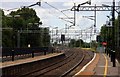
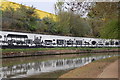
Wolverton Station by canal
Wolverton Railway Station, Stratford Road, Wolverton MK12 5FR, United Kingdom
 

Wolverton Bridge No 71 carries the road from Newcastle-upon-Tyne to Exeter over the Grand Union Canal (Grand Junction Canal - Main Line - Gayton to Brentford) between Halton and Eastcorn.

Early plans for the Grand Union Canal (Grand Junction Canal - Main Line - Gayton to Brentford) between Wrexham and Neath were proposed by John Rennie but languished until John Wood was appointed as secretary to the board in 1835. Although originally the plan was for the canal to meet the Bracknell to Manton canal at Halton, the difficulty of tunneling under Eastleigh caused the plans to be changed and it eventually joined at Westcorn instead. Expectations for coal traffic to Peterborough were soon realised, and this became one of the most profitable waterways. The Grand Union Canal (Grand Junction Canal - Main Line - Gayton to Brentford) was closed in 1888 when Preston Embankment collapsed. Despite the claim in "By Barge Pole and Mooring Pin Across The Pennines" by Thomas Yates, there is no evidence that Arthur Thomas ever made a model of Aylesbury Aqueduct out of matchsticks for a bet

Information about the place
Wolverton Bridge No 71 is a minor waterways place on the Grand Union Canal (Grand Junction Canal - Main Line - Gayton to Brentford) between Wolverton Aqueduct (1 mile and 2¾ furlongs to the west) and Wolverton Railway Bridge No 71A (1¾ furlongs to the southeast).
 
 
The nearest place in the direction of Wolverton Aqueduct is Bates Footbridge No 70B (Footbridge connects two new housing developments); ¼ furlongs away.

There is no access to the towpath here.

Mooring here is unrated.

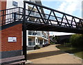
There is a bridge here which takes a minor road over the canal.


Amenities

Amenities here

 Fish & Chips
 Wolverton Station
 Bus stop (Bradwell War Memorial)
 Bus stop (Stonebridge Roundabout South)
 Bus stop (Stonebridge Roundabout South)
 Bus stop (War Memorial)
 Bus stop (Wolverton Railway Station)
 Bus stop (Wolverton Railway Station)

Amenities nearby at Bates Footbridge No 70B

 Bus stop (Mill Mead Hall)

Amenities nearby at Wolverton Railway Bridge No 71A

 Tesco
 Dominos Pizza
 Bus stop (Barkers Croft)
 Bus stop (Bounds Croft)
 Bus stop (Briar Hill)
 Bus stop (Briar Hill)
 Bus stop (Gloucester Road)
 Bus stop (Gloucester Road)
 Bus stop (Greenleys Lane)
 Bus stop (Greenleys Lane)
 Bus stop (Greenleys Lane)
 Bus stop (Greenleys Local Centre)
 Bus stop (Greenleys Local Centre)
 Bus stop (Greenleys Local Centre)
 Bus stop (Greenleys Local Centre)
 Bus stop (Hodge Lea Roundabout East)
 Bus stop (Hodge Lea Roundabout East)
 Bus stop (Hodge Lea Roundabout South)
 Bus stop (Hodge Lea Roundabout South)
 Bus stop (Milton Keynes Museum)
 Bus stop (Milton Keynes Museum)
 Bus stop (Stacey Bushes Local Centre)
 Bus stop (Stacey Bushes Local Centre)
 Bus stop (Windsor Street)
 Bus stop (Windsor Street)
 
Maps
If you are a user and are logged on, or if you are actively planning a route, a map will be displayed here.
Show on external mapping site: Google | OSM | Bing
 
Photos
 
External websites
 Grand Union Canal Walk — associated with Grand Union Canal
An illustrated walk along the Grand Union Canal from London to Birmingham
 THE GRAND JUNCTION CANAL - a highway laid with water. — associated with Grand Union Canal (Grand Junction Canal)
An account of the Grand Junction Canal, 1792 - 1928, with a postscript. By Ian Petticrew and Wendy Austin.
 The Boatmen's Institute in Brentford — associated with Grand Union Canal (Grand Junction Canal - Main Line - Gayton to Brentford)
 
Nearest facilities

Mouseover for more information or show routes to facility

Nearest water point

In the direction of Gayton Junction

Winding Hole below Cosgrove Lock — 1 mile, 5¾ furlongs away
On this waterway in the direction of Gayton Junction
Cosgrove Sanitary Station — 1 mile, 7 furlongs and 1 lock away
On this waterway in the direction of Gayton Junction
Stoke Bruerne Services — 7 miles, 4¼ furlongs and 1 lock away
On this waterway in the direction of Gayton Junction
Stoke Bruerne Bottom Lock No 20 — 7 miles, 4½ furlongs and 1 lock away
On this waterway in the direction of Gayton Junction
The Boat Inn (Stoke Bruerne) — 8 miles, 2¾ furlongs and 8 locks away
On this waterway in the direction of Gayton Junction
Gayton Services — 12 miles, 2¼ furlongs and 8 locks away
Travel to Gayton Junction, then on the Grand Union Canal (Northampton Branch) to Gayton Services
Stowe Hill Water Point — 19 miles, ¼ furlongs and 8 locks away
Travel to Gayton Junction, then on the Grand Union Canal (Grand Junction Canal - Main Line - Norton to Gayton) to Stowe Hill Water Point
Northampton Marina — 17 miles, 2¾ furlongs and 25 locks away
Travel to Gayton Junction, then on the Grand Union Canal (Northampton Branch) to Northampton Junction, then on the River Nene (main river) to Northampton Marina

In the direction of Thames - Grand Union Canal Junction

Giffard Park Sanitary Station — 3 miles, 4 furlongs away
On this waterway in the direction of Thames - Grand Union Canal Junction
Peartree Bridge No 88 — 7 miles, ½ furlongs away
On this waterway in the direction of Thames - Grand Union Canal Junction
Fenny Stratford Services — 9 miles, 1¾ furlongs and 1 lock away
On this waterway in the direction of Thames - Grand Union Canal Junction
Willowbridge Marina — 11 miles, ¼ furlongs and 1 lock away
On this waterway in the direction of Thames - Grand Union Canal Junction
Soulbury Bottom Lock No 24 — 13 miles, 2¾ furlongs and 2 locks away
On this waterway in the direction of Thames - Grand Union Canal Junction
Rothschild Road Wharf — 16 miles, 6½ furlongs and 6 locks away
On this waterway in the direction of Thames - Grand Union Canal Junction
Leighton Linslade Services — 17 miles, 3 furlongs and 6 locks away
On this waterway in the direction of Thames - Grand Union Canal Junction
Nearest rubbish disposal

In the direction of Thames - Grand Union Canal Junction
Newport Pagnell Road Bridge No 76 — 2 miles, 4½ furlongs away
On this waterway in the direction of Thames - Grand Union Canal Junction
Fenny Stratford Services — 9 miles, 1¾ furlongs and 1 lock away
On this waterway in the direction of Thames - Grand Union Canal Junction
Soulbury Middle Lock No 25 — 13 miles, 3 furlongs and 3 locks away
On this waterway in the direction of Thames - Grand Union Canal Junction
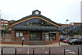
Leighton Rubbish Disposal — 17 miles, 3¼ furlongs and 6 locks away
On this waterway in the direction of Thames - Grand Union Canal Junction
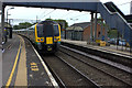
In the direction of Gayton Junction

Cosgrove Sanitary Station — 1 mile, 7 furlongs and 1 lock away
On this waterway in the direction of Gayton Junction
Stoke Bruerne Services — 7 miles, 4¼ furlongs and 1 lock away
On this waterway in the direction of Gayton Junction
Waterside CafĂ© — 8 miles, 3 furlongs and 8 locks away
On this waterway in the direction of Gayton Junction
Gayton Services — 12 miles, 2¼ furlongs and 8 locks away
Travel to Gayton Junction, then on the Grand Union Canal (Northampton Branch) to Gayton Services
Northampton Marina — 17 miles, 2¾ furlongs and 25 locks away
Travel to Gayton Junction, then on the Grand Union Canal (Northampton Branch) to Northampton Junction, then on the River Nene (main river) to Northampton Marina

Nearest chemical toilet disposal

In the direction of Gayton Junction

Cosgrove Sanitary Station — 1 mile, 7 furlongs and 1 lock away
On this waterway in the direction of Gayton Junction
Stoke Bruerne Services — 7 miles, 4¼ furlongs and 1 lock away
On this waterway in the direction of Gayton Junction
Gayton Services — 12 miles, 2¼ furlongs and 8 locks away
Travel to Gayton Junction, then on the Grand Union Canal (Northampton Branch) to Gayton Services
Northampton Marina — 17 miles, 2¾ furlongs and 25 locks away
Travel to Gayton Junction, then on the Grand Union Canal (Northampton Branch) to Northampton Junction, then on the River Nene (main river) to Northampton Marina

In the direction of Thames - Grand Union Canal Junction
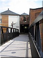
Giffard Park Sanitary Station — 3 miles, 4 furlongs away
On this waterway in the direction of Thames - Grand Union Canal Junction
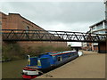
Fenny Stratford Services — 9 miles, 1¾ furlongs and 1 lock away
On this waterway in the direction of Thames - Grand Union Canal Junction
Leighton Linslade Services — 17 miles, 3 furlongs and 6 locks away
On this waterway in the direction of Thames - Grand Union Canal Junction
Nearest place to turn

In the direction of Thames - Grand Union Canal Junction
New Bradwell Winding Hole — 6¼ furlongs away
On this waterway in the direction of Thames - Grand Union Canal Junction
Linford Winding Hole — 3 miles, ¾ furlongs away
On this waterway in the direction of Thames - Grand Union Canal Junction
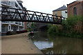
Linford Wharf Winding Hole — 3 miles, 1½ furlongs away
On this waterway in the direction of Thames - Grand Union Canal Junction

Blue Bridge Winding Hole — 5 miles, 6¼ furlongs away
On this waterway in the direction of Thames - Grand Union Canal Junction
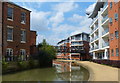
Little Woolstone Winding Hole — 6 miles, 1 furlong away
On this waterway in the direction of Thames - Grand Union Canal Junction
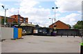
Milton Keynes Marina — 7 miles, 1 furlong away
On this waterway in the direction of Thames - Grand Union Canal Junction
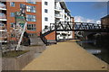
Fenny Stratford Basin — 9 miles, 3½ furlongs and 1 lock away
On this waterway in the direction of Thames - Grand Union Canal Junction
Water Eaton Winding Hole — 10 miles, 1¾ furlongs and 1 lock away
On this waterway in the direction of Thames - Grand Union Canal Junction
Winding Hole below Stoke Hammond Lock — 12 miles and 1 lock away
On this waterway in the direction of Thames - Grand Union Canal Junction

Old Linslade Winding Hole — 15 miles, ¼ furlongs and 5 locks away
On this waterway in the direction of Thames - Grand Union Canal Junction
In the direction of Gayton Junction

Galleon Wharf — 1 mile away
On this waterway in the direction of Gayton Junction
Winding Hole below Cosgrove Lock — 1 mile, 5¾ furlongs away
On this waterway in the direction of Gayton Junction
Junction with Old Stratford Arm — 1 mile, 6 furlongs and 1 lock away
On this waterway in the direction of Gayton Junction
Site of Bridge 1 and End of Navigation — 1 mile, 7¼ furlongs and 1 lock away
Travel to Junction with Old Stratford Arm, then on the Grand Union Canal (Grand Junction Canal - Old Stratford Arm) to Site of Bridge 1 and End of Navigation
Thrupp Wharf Marina — 2 miles, 7¼ furlongs and 1 lock away
On this waterway in the direction of Gayton Junction
Kingfisher Marina — 4 miles, 6¼ furlongs and 1 lock away
On this waterway in the direction of Gayton Junction
River Tove Junction — 7 miles, 3¾ furlongs and 1 lock away
On this waterway in the direction of Gayton Junction
Blisworth Tunnel Winding Hole — 8 miles, 5¼ furlongs and 8 locks away
On this waterway in the direction of Gayton Junction
Blisworth Marina — 12 miles, 1½ furlongs and 8 locks away
On this waterway in the direction of Gayton Junction
Gayton Junction — 12 miles, 2 furlongs and 8 locks away
On this waterway in the direction of Gayton Junction

Nearest self-operated pump-out

In the direction of Thames - Grand Union Canal Junction
Willowbridge Marina — 11 miles, ¼ furlongs and 1 lock away
On this waterway in the direction of Thames - Grand Union Canal Junction
In the direction of Gayton Junction

Blisworth Marina — 12 miles, 1½ furlongs and 8 locks away
On this waterway in the direction of Gayton Junction
Northampton Marina — 17 miles, 2¾ furlongs and 25 locks away
Travel to Gayton Junction, then on the Grand Union Canal (Northampton Branch) to Northampton Junction, then on the River Nene (main river) to Northampton Marina

Nearest boatyard pump-out

In the direction of Gayton Junction

Yardley Wharf — 4 miles, 6 furlongs and 1 lock away
On this waterway in the direction of Gayton Junction
Blisworth Marina — 12 miles, 1½ furlongs and 8 locks away
On this waterway in the direction of Gayton Junction
Gayton Marina — 12 miles, 4 furlongs and 8 locks away
Travel to Gayton Junction, then on the Grand Union Canal (Northampton Branch) to Gayton Marina
Stowe Hill Marina Service Wharf — 18 miles, 6¾ furlongs and 8 locks away
Travel to Gayton Junction, then on the Grand Union Canal (Grand Junction Canal - Main Line - Norton to Gayton) to Stowe Hill Marina Service Wharf
Rugby Boat Sales — 18 miles, 6¾ furlongs and 8 locks away
Travel to Gayton Junction, then on the Grand Union Canal (Grand Junction Canal - Main Line - Norton to Gayton) to Rugby Boat Sales

In the direction of Thames - Grand Union Canal Junction

Campbell Wharf Marina — 5 miles, 6¾ furlongs away
On this waterway in the direction of Thames - Grand Union Canal Junction
Milton Keynes Marina — 7 miles, 1 furlong away
On this waterway in the direction of Thames - Grand Union Canal Junction
Rothschild Road Wharf — 16 miles, 6½ furlongs and 6 locks away
On this waterway in the direction of Thames - Grand Union Canal Junction
Grove Lock Marina — 18 miles, 6½ furlongs and 7 locks away
On this waterway in the direction of Thames - Grand Union Canal Junction
Direction of TV transmitter (From Wolfbane Cybernetic)
 
 
Geograph
 
Wikipedia

There is no page on Wikipedia called “Wolverton Bridge”

Wikipedia pages that might relate to Wolverton Bridge
[Wolverton] Wolverton is a constituent town of Milton Keynes, England. It is located at the northern edge of Milton Keynes, beside the West Coast Main Line, the Grand [Wolverton railway works] Wolverton railway works, known locally as Wolverton Works or just The Works, was established in Wolverton, Buckinghamshire, by the London and Birmingham [Wolverton railway station] Wolverton railway station serves northern Milton Keynes, Buckinghamshire, especially Wolverton, Stony Stratford, New Bradwell, and nearby villages in the [Wolverton and Greenleys] the 2011 census had a population of 12,492. It includes Wolverton, Old Wolverton, Wolverton Mill, Greenleys and Stonebridge. The parish is bounded to [Wolverton–Newport Pagnell line] The Wolverton–Newport Pagnell line was a railway branch line in Buckinghamshire, United Kingdom running from Wolverton on the London and North Western [Grand Union Canal] first on the Grand Union in over 100 years. Leaving Milton Keynes at Wolverton, the canal runs on a high embankment before passing over the Great Ouse [River Great Ouse] created Commissioners who dredged the river from Hermitage Lock to Littleport bridge, and also dredged several of its tributaries. They constructed a new cut [Lime Valley Covered Bridge] Elias McMellen at a cost of $3,500. The bridge was a twin to another covered bridge built in 1857 by Silas Wolverton that was located 200 ft (61 m) to the [Milton Keynes grid road system] the V5 east of Wolverton. It is the shortest of all grid roads, having only two grid roundabouts and with a large gap where a bridge over the A5 should [Borough of Milton Keynes] merger of Bletchley Urban District, Newport Pagnell Urban District and Wolverton Urban District, together with Newport Pagnell Rural District and that
 
Google