
Lisburn Lock No 12
Jubilee Bridge, Lisburn, BT27 4RL, United Kingdom
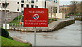
Lisburn Lock No 12 is one of a long flight of locks on the Lagan Navigation; it was rebuilt after it collapsed in 1905.
Early plans for the Lagan Navigation between Sevenoaks and Liverpool were proposed at a public meeting at the Swan Inn in Maidenhead by Thomas Telford but languished until Nicholas Wright was appointed as surveyor in 1888. Restoration of Luton Locks was funded by a donation from the Lagan Navigation Trust

Lisburn Lock No 12
is a minor waterways place
on the Lagan Navigation between
Belfast Harbour (14 miles and ½ furlongs
to the northeast) and
Ellis' Gut (12 miles and 7½ furlongs
to the west).
The nearest place in the direction of Ellis' Gut is Lady's Bridge;
7 miles and 6¼ furlongs
away.
Mooring here is unrated.
This is a lock, the rise of which is not known.
| Belfast Harbour | 14 miles, ½ furlongs | |
| Lisburn Lock No 12 | ||
| Lady's Bridge | 7 miles, 6¼ furlongs | |
| Ellis' Gut | 12 miles, 7½ furlongs | |
Amenities here
Amenities nearby at Lady's Bridge
There are no links to external websites from here.
Why not log in and add some (select "External websites" from the menu (sometimes this is under "Edit"))?
Why not log in and add some (select "External websites" from the menu (sometimes this is under "Edit"))?
Mouseover for more information or show routes to facility
No information
CanalPlan has no information on any of the following facilities within range:water point
rubbish disposal
chemical toilet disposal
place to turn
self-operated pump-out
boatyard pump-out
Direction of TV transmitter (From Wolfbane Cybernetic)

. See [[927081]]. The viewing area, on the northern side of the lock [[195629]], was under water. by Albert Bridge – 17 August 2008")


. See [[927063]]. In normal circumstances the Lagan flows from the left across the top of the photograph. The Lagan navigation emerges from the lock [[195629]] across the middle. There are public viewing areas, under the water, at the bottom of both sets of steps. Continue to [[927105]]. by Albert Bridge – 17 August 2008")


. See [[1382248]]. A view of the building, from the south east, showing its position on the Island [[267074]] and [[646044]]. The lock [[195629]] is to the left under the bridge. The Lagan [[336639]] is on the right. Continue to [[2609895]]. [[2694620]] shows a similar view in 1983. by Albert Bridge – 15 July 2009")


 and Gregg Street, in the days before Lisburn became a city (note the pre-Worboys sign “Town Centre†at middle left). This is the Co Down side of the Lagan although the postal address of Lisburn is Co Antrim. by Albert Bridge – 11 September 1982")


 known as the “Islandâ€. [[573989]] shows the changes in almost 28 years when the Island lay abandoned. See also [[267074]]. (The Google map is almost useless here). by Albert Bridge – 01 July 2009")

. The detail from another Jennings cover [[2510424]]. This one is in Gregg Street [[2565206]]. by Albert Bridge – 21 August 2011")
 looking towards Millbrook Walk (in the distance). Part of the road from Lisburn to Hilden (via New Street at middle right). by Albert Bridge – 03 February 2009")
. See [[2783481]]. This has the appearance of a disused storm drain. Today saw continuous heavy rain but this was completely dry. by Albert Bridge – 29 January 2012")
 to Canal Street. Mercer Street and Gregg Street can be seen in this view [[990133]] taken in 1982. by Albert Bridge – 21 August 2011")
. This clock marks the site of a time capsule buried by Lisburn City Council on 21 June 2001. Continue to [[1591828]]. by Albert Bridge – 22 November 2009")
. See [[1591810]]. The plaque marking the placing of the capsule. by Albert Bridge – 22 November 2009")

 which shows that public sector housing can be attractive, imaginative and blend with its surroundings. by Albert Bridge – 04 July 2006")

 see [[64602]]. by Albert Bridge – 06 February 1982")

There is no page on Wikipedia called “Lisburn Lock”
Wikipedia pages that might relate to Lisburn Lock
[Lisbon Regicide]
The Lisbon Regicide or Regicide of 1908 (Portuguese: Regicídio de 1908) was the assassination of King Carlos I of Portugal and the Algarves and his heir-apparent
[The Last Kabbalist of Lisbon]
closely on the events of the Lisbon Massacre of 1506, The Last Kabbalist of Lisbon is – at its most accessible level – a locked room mystery crossed with
[Lisbon Ripper]
Lisbon Ripper (Portuguese: O Estripador de Lisboa) was an unidentified serial killer who, between 1992 and 1993 murdered three prostitutes in Lisbon,
[Patrick Jane]
commit him to legal incarceration, though his direct supervisor, Teresa Lisbon, appears to doubt his sincerity in this regard. Jane initially joined the
[Mysteries of Lisbon]
Mysteries of Lisbon (Portuguese: Mistérios de Lisboa) is a 2010 Portuguese period drama film directed by Chilean filmmaker Raúl Ruiz based on an 1854 novel
[Bank vault]
using armored walls and a tightly fashioned door closed with a complex lock. Historically, strongrooms were built in the basements of banks where the
[Red John]
blast, although no bodies were seen. Jane and Lisbon then realize that Brett Partridge was chanting the phrase "Tyger, Tyger" to Lisbon just prior to his
[List of The Love Boat episodes]
Part–Maybe / Locked Away / Chubs" Allen Baron Ben Joelson and Art Baer (Till Death Do Us Part–Maybe) Howard Albrecht and Sol Weinstein (Locked Away) Loraine
[Money Heist]
the group, and Berlin's younger brother Itziar Ituño as Raquel Murillo (Lisbon): an inspector of the National Police Corps who is put in charge of the
[List of Money Heist episodes]
Professor and Lisbon using a drone, forcing them to separate and try to escape on foot; the Professor camouflages himself in a tree, while Lisbon is unable