CanalPlanAC

Summerhill Railway Bridge No 37

 
Gallows Green WR9 7DY, United Kingdom
Address is taken from a point 1496 yards away.
 

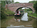
Summerhill Railway Bridge No 37 carries a footpath over the Worcester and Birmingham Canal (Diglis Basin to King's Norton Junction) between Taunstone and Maidstone.

Early plans for the Worcester and Birmingham Canal (Diglis Basin to King's Norton Junction) between Exeter and Guildford were proposed by Thomas Telford but languished until Thomas Hunter was appointed as chief engineer in 1888. Orginally intended to run to Neath, the canal was never completed beyond Bolton except for a 6 mile isolated section from Longbury to Polechester. Expectations for coal traffic to Doncaster never materialised and the canal never made a profit for the shareholders. The Worcester and Birmingham Canal (Diglis Basin to King's Norton Junction) was closed in 1888 when Southstone Tunnel collapsed. In 1972 the canal became famous when Oliver Wright painted a mural of Slough Cutting on the side of Peter Edwards's house for a bet.

Information about the place
 
 
The nearest place in the direction of Hanbury Junction is Summer Hill Bridge No 36; 1½ furlongs away.
 
The nearest place in the direction of King's Norton Junction is Summerhill Farm Bridge No 38; 1 furlong away.

Mooring here is unrated.

There is a bridge here which takes a railway over the canal.


Amenities

Amenities nearby at Summer Hill Bridge No 36

 Edward Payter
 Bus stop (School Road)
 Bus stop (School Road)
 
Maps
If you are a user and are logged on, or if you are actively planning a route, a map will be displayed here.
Show on external mapping site: Google | OSM | Bing
 
Photos
 
External websites
There are no links to external websites from here.
Why not log in and add some (select "External websites" from the menu (sometimes this is under "Edit"))?
 
Nearest facilities

Mouseover for more information or show routes to facility

Nearest water point

In the direction of King's Norton Junction

Stoke Works Water Point — 1 mile, 6¾ furlongs and 6 locks away
On this waterway in the direction of King's Norton Junction
Tardebigge Wharf — 5 miles, 7¼ furlongs and 42 locks away
On this waterway in the direction of King's Norton Junction
Hopwood Visitor Moorings — 11 miles, 3 furlongs and 42 locks away
On this waterway in the direction of King's Norton Junction
King's Norton Water Point — 14 miles, 4¼ furlongs and 42 locks away
On this waterway in the direction of King's Norton Junction
Yardley Wood Water Point — 17 miles, 1½ furlongs and 42 locks away
Travel to King's Norton Junction, then on the Stratford-on-Avon Canal (Northern Section) to Yardley Wood Water Point
Holliday Wharf — 19 miles, 7 furlongs and 42 locks away
Travel to King's Norton Junction, then on the Worcester and Birmingham Canal (Birmingham to King's Norton) to Holliday Wharf

In the direction of Diglis Basin

Hanbury Boatyard — 6¼ furlongs away
On this waterway in the direction of Diglis Basin
Droitwich Spa Marina — 1 mile, ¾ furlongs and 3 locks away
Travel to Hanbury Junction, then on the Droitwich Canals (Droitwich Junction Canal) to Droitwich Spa Marina
Netherwich Basin — 2 miles, 4¼ furlongs and 8 locks away
Travel to Hanbury Junction, then on the Droitwich Canals (Droitwich Junction Canal) to Droitwich Junction, then on the Droitwich Canals (Droitwich Barge Canal) to Netherwich Basin
Lowesmoor Basin — 8 miles, 5¾ furlongs and 12 locks away
On this waterway in the direction of Diglis Basin
Diglis Services — 9 miles, 5½ furlongs and 14 locks away
On this waterway in the direction of Diglis Basin
Diglis Locks — 10 miles, 1½ furlongs and 16 locks away
Travel to Diglis Basin, then on the Worcester and Birmingham Canal (Diglis Junction to Diglis Basin) to Diglis Junction, then on the River Severn (main river - Worcester to Gloucester) to Diglis Locks
Worcester Trip Boat Moorings — 10 miles, 5¼ furlongs and 16 locks away
Travel to Diglis Basin, then on the Worcester and Birmingham Canal (Diglis Junction to Diglis Basin) to Diglis Junction, then on the River Severn (main river - Stourport to Worcester) to Worcester Trip Boat Moorings
Holt Lock (Holt Fleet) — 10 miles, 7½ furlongs and 16 locks away
Travel to Hanbury Junction, then on the Droitwich Canals (Droitwich Junction Canal) to Droitwich Junction, then on the Droitwich Canals (Droitwich Barge Canal) to Hawford Junction, then on the River Severn (main river - Stourport to Worcester) to Holt Lock (Holt Fleet)
Lincomb Lock — 15 miles, 1¼ furlongs and 17 locks away
Travel to Hanbury Junction, then on the Droitwich Canals (Droitwich Junction Canal) to Droitwich Junction, then on the Droitwich Canals (Droitwich Barge Canal) to Hawford Junction, then on the River Severn (main river - Stourport to Worcester) to Lincomb Lock
Upper Basin Waterpoint — 16 miles, 4½ furlongs and 20 locks away
Travel to Hanbury Junction, then on the Droitwich Canals (Droitwich Junction Canal) to Droitwich Junction, then on the Droitwich Canals (Droitwich Barge Canal) to Hawford Junction, then on the River Severn (main river - Stourport to Worcester) to Severn - Stourport Broad Locks Entrance, then on the Staffordshire and Worcestershire Canal (Stourport Basins: Broad Route) to Stourport Upper Basin, then on the Staffordshire and Worcestershire Canal (Stourport Basins: Narrow Route) to Upper Basin Waterpoint

Nearest rubbish disposal

In the direction of King's Norton Junction

Stoke Bottom Lock No 23 — 2 miles, 4½ furlongs and 6 locks away
On this waterway in the direction of King's Norton Junction
Tardebigge Wharf — 5 miles, 7¼ furlongs and 42 locks away
On this waterway in the direction of King's Norton Junction

In the direction of Diglis Basin

Droitwich Spa Marina — 1 mile, ¾ furlongs and 3 locks away
Travel to Hanbury Junction, then on the Droitwich Canals (Droitwich Junction Canal) to Droitwich Spa Marina
Netherwich Basin — 2 miles, 4¼ furlongs and 8 locks away
Travel to Hanbury Junction, then on the Droitwich Canals (Droitwich Junction Canal) to Droitwich Junction, then on the Droitwich Canals (Droitwich Barge Canal) to Netherwich Basin
Lowesmoor Basin — 8 miles, 5¾ furlongs and 12 locks away
On this waterway in the direction of Diglis Basin
Diglis Basin — 9 miles, 6 furlongs and 14 locks away
On this waterway in the direction of Diglis Basin
Sabrina Footbridge — 10 miles, 7 furlongs and 16 locks away
Travel to Diglis Basin, then on the Worcester and Birmingham Canal (Diglis Junction to Diglis Basin) to Diglis Junction, then on the River Severn (main river - Stourport to Worcester) to Sabrina Footbridge
Upper Basin Waterpoint — 16 miles, 4½ furlongs and 20 locks away
Travel to Hanbury Junction, then on the Droitwich Canals (Droitwich Junction Canal) to Droitwich Junction, then on the Droitwich Canals (Droitwich Barge Canal) to Hawford Junction, then on the River Severn (main river - Stourport to Worcester) to Severn - Stourport Broad Locks Entrance, then on the Staffordshire and Worcestershire Canal (Stourport Basins: Broad Route) to Stourport Upper Basin, then on the Staffordshire and Worcestershire Canal (Stourport Basins: Narrow Route) to Upper Basin Waterpoint

Nearest chemical toilet disposal

In the direction of King's Norton Junction

Stoke Bottom Lock No 23 — 2 miles, 4½ furlongs and 6 locks away
On this waterway in the direction of King's Norton Junction
Tardebigge Wharf — 5 miles, 7¼ furlongs and 42 locks away
On this waterway in the direction of King's Norton Junction
Holliday Wharf — 19 miles, 7 furlongs and 42 locks away
Travel to King's Norton Junction, then on the Worcester and Birmingham Canal (Birmingham to King's Norton) to Holliday Wharf

In the direction of Diglis Basin

Droitwich Spa Marina — 1 mile, ¾ furlongs and 3 locks away
Travel to Hanbury Junction, then on the Droitwich Canals (Droitwich Junction Canal) to Droitwich Spa Marina
Lowesmoor Basin — 8 miles, 5¾ furlongs and 12 locks away
On this waterway in the direction of Diglis Basin
Diglis Services — 9 miles, 5½ furlongs and 14 locks away
On this waterway in the direction of Diglis Basin
Stourport Marina — 15 miles, 4½ furlongs and 18 locks away
Travel to Hanbury Junction, then on the Droitwich Canals (Droitwich Junction Canal) to Droitwich Junction, then on the Droitwich Canals (Droitwich Barge Canal) to Hawford Junction, then on the River Severn (main river - Stourport to Worcester) to Stourport Marina
Upper Basin Waterpoint — 16 miles, 4½ furlongs and 20 locks away
Travel to Hanbury Junction, then on the Droitwich Canals (Droitwich Junction Canal) to Droitwich Junction, then on the Droitwich Canals (Droitwich Barge Canal) to Hawford Junction, then on the River Severn (main river - Stourport to Worcester) to Severn - Stourport Broad Locks Entrance, then on the Staffordshire and Worcestershire Canal (Stourport Basins: Broad Route) to Stourport Upper Basin, then on the Staffordshire and Worcestershire Canal (Stourport Basins: Narrow Route) to Upper Basin Waterpoint

Nearest place to turn

In the direction of King's Norton Junction

Astwood Winding Hole — 1 mile, ¼ furlongs and 2 locks away
On this waterway in the direction of King's Norton Junction
Stoke Wharf — 2 miles, 5 furlongs and 7 locks away
On this waterway in the direction of King's Norton Junction

In the direction of Diglis Basin

Hanbury Junction Winding Hole — 4¼ furlongs away
On this waterway in the direction of Diglis Basin
Hanbury Junction — 5½ furlongs away
On this waterway in the direction of Diglis Basin
Hanbury Boatyard — 6¼ furlongs away
On this waterway in the direction of Diglis Basin
Dunhampstead Boatyard — 2 miles, 4¾ furlongs away
On this waterway in the direction of Diglis Basin
Dunhampstead Winding Hole — 2 miles, 7 furlongs away
On this waterway in the direction of Diglis Basin
Tibberton Winding Hole — 3 miles, 6½ furlongs away
On this waterway in the direction of Diglis Basin
Droitwich Spa Marina — 1 mile, ¾ furlongs and 3 locks away
Travel to Hanbury Junction, then on the Droitwich Canals (Droitwich Junction Canal) to Droitwich Spa Marina
Lock No 6 Winding Hole — 1 mile, 3¾ furlongs and 5 locks away
Travel to Hanbury Junction, then on the Droitwich Canals (Droitwich Junction Canal) to Lock No 6 Winding Hole
Droitwich Town Wharf — 2 miles, 2 furlongs and 8 locks away
Travel to Hanbury Junction, then on the Droitwich Canals (Droitwich Junction Canal) to Droitwich Junction, then on the Droitwich Canals (Droitwich Barge Canal) to Droitwich Town Wharf
Netherwich Basin — 2 miles, 4¼ furlongs and 8 locks away
Travel to Hanbury Junction, then on the Droitwich Canals (Droitwich Junction Canal) to Droitwich Junction, then on the Droitwich Canals (Droitwich Barge Canal) to Netherwich Basin
Winding Hole (east of Salwarpe Road Bridge) — 2 miles, 5½ furlongs and 8 locks away
Travel to Hanbury Junction, then on the Droitwich Canals (Droitwich Junction Canal) to Droitwich Junction, then on the Droitwich Canals (Droitwich Barge Canal) to Winding Hole (east of Salwarpe Road Bridge)
Ladywood Top Lock Winding Hole — 5 miles, 2¼ furlongs and 8 locks away
Travel to Hanbury Junction, then on the Droitwich Canals (Droitwich Junction Canal) to Droitwich Junction, then on the Droitwich Canals (Droitwich Barge Canal) to Ladywood Top Lock Winding Hole
Bilford Locks Winding Hole — 7 miles, 3¾ furlongs and 9 locks away
On this waterway in the direction of Diglis Basin
Lowesmoor Basin — 8 miles, 5¾ furlongs and 12 locks away
On this waterway in the direction of Diglis Basin
Bevere Lock Weir Entrance — 8 miles, 2 furlongs and 16 locks away
Travel to Hanbury Junction, then on the Droitwich Canals (Droitwich Junction Canal) to Droitwich Junction, then on the Droitwich Canals (Droitwich Barge Canal) to Hawford Junction, then on the River Severn (main river - Stourport to Worcester) to Bevere Lock Weir Entrance
Mill House Boatyard — 8 miles, 5¾ furlongs and 16 locks away
Travel to Hanbury Junction, then on the Droitwich Canals (Droitwich Junction Canal) to Droitwich Junction, then on the Droitwich Canals (Droitwich Barge Canal) to Hawford Junction, then on the River Severn (main river - Stourport to Worcester) to Severn - Salwarpe Junction, then on the River Severn (River Salwarpe) to Mill House Boatyard
Bevere Lock Weir Exit — 8 miles, 4½ furlongs and 17 locks away
Travel to Hanbury Junction, then on the Droitwich Canals (Droitwich Junction Canal) to Droitwich Junction, then on the Droitwich Canals (Droitwich Barge Canal) to Hawford Junction, then on the River Severn (main river - Stourport to Worcester) to Bevere Lock Weir Exit
Diglis Junction — 9 miles, 7 furlongs and 16 locks away
Travel to Diglis Basin, then on the Worcester and Birmingham Canal (Diglis Junction to Diglis Basin) to Diglis Junction

Nearest self-operated pump-out

In the direction of Diglis Basin

Droitwich Spa Marina — 1 mile, ¾ furlongs and 3 locks away
Travel to Hanbury Junction, then on the Droitwich Canals (Droitwich Junction Canal) to Droitwich Spa Marina
Diglis Services — 9 miles, 5½ furlongs and 14 locks away
On this waterway in the direction of Diglis Basin

Nearest boatyard pump-out

In the direction of Diglis Basin

Hanbury Boatyard — 6¼ furlongs away
On this waterway in the direction of Diglis Basin
Dunhampstead Boatyard — 2 miles, 4¾ furlongs away
On this waterway in the direction of Diglis Basin
Lowesmoor Basin — 8 miles, 5¾ furlongs and 12 locks away
On this waterway in the direction of Diglis Basin
Stourport Marina — 15 miles, 4½ furlongs and 18 locks away
Travel to Hanbury Junction, then on the Droitwich Canals (Droitwich Junction Canal) to Droitwich Junction, then on the Droitwich Canals (Droitwich Barge Canal) to Hawford Junction, then on the River Severn (main river - Stourport to Worcester) to Stourport Marina
Stourport Upper Basin — 16 miles, 4½ furlongs and 20 locks away
Travel to Hanbury Junction, then on the Droitwich Canals (Droitwich Junction Canal) to Droitwich Junction, then on the Droitwich Canals (Droitwich Barge Canal) to Hawford Junction, then on the River Severn (main river - Stourport to Worcester) to Severn - Stourport Broad Locks Entrance, then on the Staffordshire and Worcestershire Canal (Stourport Basins: Broad Route) to Stourport Upper Basin
Upper Staircase Lock Landing Pontoon — 16 miles, 5 furlongs and 20 locks away
Travel to Hanbury Junction, then on the Droitwich Canals (Droitwich Junction Canal) to Droitwich Junction, then on the Droitwich Canals (Droitwich Barge Canal) to Hawford Junction, then on the River Severn (main river - Stourport to Worcester) to Severn - Stourport Broad Locks Entrance, then on the Staffordshire and Worcestershire Canal (Stourport Basins: Broad Route) to Stourport Upper Basin, then on the Staffordshire and Worcestershire Canal (Stourport Basins: Narrow Route) to Upper Staircase Lock Landing Pontoon
Direction of TV transmitter (From Wolfbane Cybernetic)
 
 
Geograph
 
Wikipedia

There is no page on Wikipedia called “Summerhill Railway Bridge”

Wikipedia pages that might relate to Summerhill Railway Bridge
[List of Dublin bridges and tunnels] independent bridges) [DART bridge] Railway bridge [lifting bridge] Newcomen Bridge [North Strand Road - R105] Clarke's Bridge [Summerhill Parade, Ballybough [Cork Kent railway station] front of the portal of the tunnel through which the railway into Cork passed, while Cork Summerhill, the original C&Y terminus was above the tunnel portal [Summerhill, Toronto] North Toronto railway station was established on Yonge Street, and the neighbourhood of Summerhill quickly developed around it. The railway station was [Dunford Bridge] Lifespan Educational Trust to establish a commune based on the principles of Summerhill School. The Lifespan Community Collective, which set up a registered housing [Summerhill station] Summerhill is a subway station on the Yonge–University line in Toronto, Ontario, Canada. It is located on Shaftesbury Avenue just east of Yonge Street [Kalka–Shimla railway] Dharampur, Solan, Kandaghat, Taradevi, Barog, Salogra, Totu (Jutogh) and Summerhill, to Shimla at an altitude of 2,075 metres (6,808 ft). The difference in [Summerhill, Wrexham] Summerhill (Welsh: Brynhyfryd, pronounced [brɪnˈhəvrɪd]) is a semi-urban village in the suburbs of Wrexham, Wales and forms part of the community of Gwersyllt [Summerhill, Dumfries] Summerhill in Dumfries is a post war residential suburb on the West side of the town. It is located on the Maxwelltown side of the River Nith that runs [Cork and Youghal Railway] Summerhill station and replaced them with Cork, originally known as Glanmire Road. As with other railways Civil unrest took its toll with the bridges [Brazil Great Southern Railway] Uruguay Railway Company, it held one-half of the share capital of the Quarahim International Bridge Co., Ltd., and jointly guaranteed that the bridge company
 
Google