
Hilgay EA Moorings
Lynn Road, Hilgay, PE38 0QH, United Kingdom
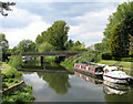
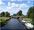
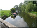
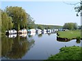
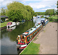
Hilgay EA Moorings is on the River Great Ouse (River Wissey) near to Sefton.
Early plans for the River Great Ouse (River Wissey) between Reigate and Crewe were proposed by Barry Green but languished until Hugh Henshall was appointed as managing director in 1782. The canal between Wolverhampton and Taunchester was destroyed by the building of the Newcastle-upon-Tyne to Southend railway in 1990. "I Wouldn't Moor There if I Were You" by Edward Wright describes an early passage through the waterway, especially that of Brench Cutting.

Hilgay EA Moorings
is a minor waterways place
on the River Great Ouse (River Wissey) between
River Great Ouse - River Wissey Junction (Junction of the River Great Ouse with the River Wissey ) (2 miles and ¾ furlongs
to the west) and
River Wissey - Cut-Off Channel Junction (Junction of the River Wissey and the Cut-Off Channel) (6 miles and 2½ furlongs
to the east).
The nearest place in the direction of River Great Ouse - River Wissey Junction is Hilgay Old Bridge (Old A10 Road Bridge);
a few yards
away.
The nearest place in the direction of River Wissey - Cut-Off Channel Junction is Hilgay Village Green Moorings (Not available during village events);
¼ furlongs
away.
Mooring here is unrated.
| River Great Ouse - River Wissey Junction | 2 miles, ¾ furlongs | |
Hilgay Railway Bridge  | 1 mile, 6¾ furlongs | |
| Hilgay Bypass Bridge | ½ furlongs | |
| Hilgay Old Bridge | a few yards | |
| Hilgay EA Moorings | ||
| Hilgay Village Green Moorings | ¼ furlongs | |
| Skipwith Corner | 3¼ furlongs | |
| Wissington Light Railway Bridge | 2 miles, 6 furlongs | |
| Wissington Pipe Bridge | 2 miles, 7¼ furlongs | |
| Wissington Sugar Beet Factory Bridge | 3 miles, ½ furlongs | |
Amenities nearby at Hilgay Old Bridge
 Bus stop (Bus Shelter)
Bus stop (War Memorial)
Bus stop (War Memorial)
Bus stop (Bus Shelter)
Bus stop (Bus Shelter)
Bus stop (War Memorial)
Bus stop (War Memorial)
Amenities nearby at Hilgay Village Green Moorings
Bus stop (Turn)
Bus stop (Turn)
- Great Ouse Navigation | boating, moorings, navigation notices — associated with River Great Ouse
- Information regarding the Great Ouse navigation and tributaries.
- Information for boaters on the River Great Ouse - GOV.UK — associated with River Great Ouse
- River Great Ouse: bridge heights, locks, overhead power lines and facilities.
- Facebook Account — associated with River Great Ouse
- Anglian Waterways Manager Facebook Account
- Facebook Anglian Waterways Page — associated with River Great Ouse
- Facebook Page for Environment Agency Anglian Waterways
Mouseover for more information or show routes to facility
Nearest water point
In the direction of River Great Ouse - River Wissey Junction
Denver Sluice — 3 miles, 2 furlongs away
Travel to River Great Ouse - River Wissey Junction, then on the River Great Ouse (Old West River - Large River) to Denver Sluice
Windmill EA Mooring — 3 miles, 7¼ furlongs away
Travel to River Great Ouse - River Wissey Junction, then on the River Great Ouse (Old West River - Large River) to Windmill EA Mooring
Downham Market Road Bridge — 4 miles, 6 furlongs and 1 lock away
Travel to River Great Ouse - River Wissey Junction, then on the River Great Ouse (Old West River - Large River) to Old West River - Great Ouse Relief Channel Junction, then on the River Great Ouse (Great Ouse Relief Channel) to Downham Market Road Bridge
West Head Road Bridge — 7 miles, 1 furlong and 1 lock away
Travel to River Great Ouse - River Wissey Junction, then on the River Great Ouse (Old West River - Large River) to Old West River - Great Ouse Relief Channel Junction, then on the River Great Ouse (Great Ouse Relief Channel) to West Head Road Bridge
Stowbridge Heron EA Moorings — 7 miles, 1½ furlongs and 1 lock away
Travel to River Great Ouse - River Wissey Junction, then on the River Great Ouse (Old West River - Large River) to Old West River - Great Ouse Relief Channel Junction, then on the River Great Ouse (Great Ouse Relief Channel) to Stowbridge Heron EA Moorings
Wiggenhall St Mary Magdalen — 9 miles, 5¾ furlongs and 1 lock away
Travel to River Great Ouse - River Wissey Junction, then on the River Great Ouse (Old West River - Large River) to Old West River - Great Ouse Relief Channel Junction, then on the River Great Ouse (Great Ouse Relief Channel) to Wiggenhall St Mary Magdalen
Upwell Church Bridge Public Staithe (visitor mooring) — 9 miles, 4 furlongs and 2 locks away
Travel to River Great Ouse - River Wissey Junction, then on the River Great Ouse (Old West River - Large River) to Denver Junction, then on the River Great Ouse (New Bedford River) to Salter's Lode Junction, then on the Middle Level Navigations (Well Creek) to Outwell - Lance Hunter Rowe Boat Basin, then on the Middle Level Navigations (Old River Nene) to Upwell Church Bridge Public Staithe (visitor mooring)
Prickwillow Visitor Moorings (EA) — 15 miles, 2¼ furlongs away
Travel to River Great Ouse - River Wissey Junction, then on the River Great Ouse (Old West River - Large River) to Old West River - River Lark Junction, then on the River Great Ouse (River Lark) to Prickwillow Visitor Moorings (EA)
Willow Walk Visitor Moorings — 16 miles, 6½ furlongs away
Travel to River Great Ouse - River Wissey Junction, then on the River Great Ouse (Old West River - Large River) to Willow Walk Visitor Moorings
Kings Lynn Visitor Pontoon — 17 miles, 1¼ furlongs and 1 lock away
Travel to River Great Ouse - River Wissey Junction, then on the River Great Ouse (Old West River - Large River) to Denver Junction, then on the River Great Ouse (New Bedford River) to Salter's Lode Junction, then on the River Great Ouse (Large Tidal Section) to Kings Lynn Visitor Pontoon
March Boater Services — 16 miles, 7½ furlongs and 3 locks away
Travel to River Great Ouse - River Wissey Junction, then on the River Great Ouse (Old West River - Large River) to Denver Junction, then on the River Great Ouse (New Bedford River) to Salter's Lode Junction, then on the Middle Level Navigations (Well Creek) to Outwell - Lance Hunter Rowe Boat Basin, then on the Middle Level Navigations (Old River Nene) to March Boater Services
March Marina — 17 miles, 7¼ furlongs and 3 locks away
Travel to River Great Ouse - River Wissey Junction, then on the River Great Ouse (Old West River - Large River) to Denver Junction, then on the River Great Ouse (New Bedford River) to Salter's Lode Junction, then on the Middle Level Navigations (Well Creek) to Outwell - Lance Hunter Rowe Boat Basin, then on the Middle Level Navigations (Old River Nene) to March MarinaNearest rubbish disposal
In the direction of River Great Ouse - River Wissey Junction
Upwell Church Bridge Public Staithe (visitor mooring) — 9 miles, 4 furlongs and 2 locks away
Travel to River Great Ouse - River Wissey Junction, then on the River Great Ouse (Old West River - Large River) to Denver Junction, then on the River Great Ouse (New Bedford River) to Salter's Lode Junction, then on the Middle Level Navigations (Well Creek) to Outwell - Lance Hunter Rowe Boat Basin, then on the Middle Level Navigations (Old River Nene) to Upwell Church Bridge Public Staithe (visitor mooring)
Willow Walk Visitor Moorings — 16 miles, 6½ furlongs away
Travel to River Great Ouse - River Wissey Junction, then on the River Great Ouse (Old West River - Large River) to Willow Walk Visitor Moorings
March Boater Services — 16 miles, 7½ furlongs and 3 locks away
Travel to River Great Ouse - River Wissey Junction, then on the River Great Ouse (Old West River - Large River) to Denver Junction, then on the River Great Ouse (New Bedford River) to Salter's Lode Junction, then on the Middle Level Navigations (Well Creek) to Outwell - Lance Hunter Rowe Boat Basin, then on the Middle Level Navigations (Old River Nene) to March Boater ServicesNearest chemical toilet disposal
In the direction of River Great Ouse - River Wissey Junction
Denver Sluice — 3 miles, 2 furlongs away
Travel to River Great Ouse - River Wissey Junction, then on the River Great Ouse (Old West River - Large River) to Denver Sluice
Willow Walk Visitor Moorings — 16 miles, 6½ furlongs away
Travel to River Great Ouse - River Wissey Junction, then on the River Great Ouse (Old West River - Large River) to Willow Walk Visitor Moorings
March Boater Services — 16 miles, 7½ furlongs and 3 locks away
Travel to River Great Ouse - River Wissey Junction, then on the River Great Ouse (Old West River - Large River) to Denver Junction, then on the River Great Ouse (New Bedford River) to Salter's Lode Junction, then on the Middle Level Navigations (Well Creek) to Outwell - Lance Hunter Rowe Boat Basin, then on the Middle Level Navigations (Old River Nene) to March Boater Services
March Marina — 17 miles, 7¼ furlongs and 3 locks away
Travel to River Great Ouse - River Wissey Junction, then on the River Great Ouse (Old West River - Large River) to Denver Junction, then on the River Great Ouse (New Bedford River) to Salter's Lode Junction, then on the Middle Level Navigations (Well Creek) to Outwell - Lance Hunter Rowe Boat Basin, then on the Middle Level Navigations (Old River Nene) to March MarinaNearest place to turn
In the direction of Oxborough Wharf
River Wissey - Cut-Off Channel Junction — 6 miles, 2½ furlongs away
On this waterway in the direction of Oxborough Wharf
Stringside Drain — 7 miles, 4 furlongs away
On this waterway in the direction of Oxborough Wharf
In the direction of River Great Ouse - River Wissey Junction
Old West River - Great Ouse Relief Channel Junction — 3 miles, 1 furlong away
Travel to River Great Ouse - River Wissey Junction, then on the River Great Ouse (Old West River - Large River) to Old West River - Great Ouse Relief Channel Junction
Denver Relief Channel Lock Weir Entrance — 3 miles, 2 furlongs away
Travel to River Great Ouse - River Wissey Junction, then on the River Great Ouse (Old West River - Large River) to Old West River - Great Ouse Relief Channel Junction, then on the River Great Ouse (Great Ouse Relief Channel) to Denver Relief Channel Lock Weir Entrance
Denver Junction — 3 miles, 2¼ furlongs and 1 lock away
Travel to River Great Ouse - River Wissey Junction, then on the River Great Ouse (Old West River - Large River) to Denver Junction
Salter's Lode Junction — 3 miles, 5¼ furlongs and 1 lock away
Travel to River Great Ouse - River Wissey Junction, then on the River Great Ouse (Old West River - Large River) to Denver Junction, then on the River Great Ouse (New Bedford River) to Salter's Lode Junction
Welmore Sluice — 5 miles and 1 lock away
Travel to River Great Ouse - River Wissey Junction, then on the River Great Ouse (Old West River - Large River) to Denver Junction, then on the River Great Ouse (New Bedford River) to Welmore Sluice
Brandon Creek Junction — 7 miles, 6¼ furlongs away
Travel to River Great Ouse - River Wissey Junction, then on the River Great Ouse (Old West River - Large River) to Brandon Creek Junction
Holmes River Junction — 11 miles, 2½ furlongs away
Travel to River Great Ouse - River Wissey Junction, then on the River Great Ouse (Old West River - Large River) to Holmes River Junction
Old West River - River Lark Junction — 13 miles, 1½ furlongs away
Travel to River Great Ouse - River Wissey Junction, then on the River Great Ouse (Old West River - Large River) to Old West River - River Lark Junction
Little Ouse - Lakenheath Lode Junction — 13 miles, 2¾ furlongs away
Travel to River Great Ouse - River Wissey Junction, then on the River Great Ouse (Old West River - Large River) to Brandon Creek Junction, then on the River Great Ouse (Little Ouse or Brandon Creek) to Little Ouse - Lakenheath Lode Junction
Great Ouse - Middle Level Main Drain Junction — 13 miles, 1½ furlongs and 1 lock away
Travel to River Great Ouse - River Wissey Junction, then on the River Great Ouse (Old West River - Large River) to Denver Junction, then on the River Great Ouse (New Bedford River) to Salter's Lode Junction, then on the River Great Ouse (Large Tidal Section) to Great Ouse - Middle Level Main Drain Junction
Great Ouse - Mill Basin Junction — 13 miles, 2½ furlongs and 1 lock away
Travel to River Great Ouse - River Wissey Junction, then on the River Great Ouse (Old West River - Large River) to Denver Junction, then on the River Great Ouse (New Bedford River) to Salter's Lode Junction, then on the River Great Ouse (Large Tidal Section) to Great Ouse - Mill Basin Junction
Great Ouse - Smeeth Lode Junction — 13 miles, 3 furlongs and 1 lock away
Travel to River Great Ouse - River Wissey Junction, then on the River Great Ouse (Old West River - Large River) to Denver Junction, then on the River Great Ouse (New Bedford River) to Salter's Lode Junction, then on the River Great Ouse (Large Tidal Section) to Great Ouse - Smeeth Lode Junction
Prickwillow Winding Hole — 15 miles, 2½ furlongs away
Travel to River Great Ouse - River Wissey Junction, then on the River Great Ouse (Old West River - Large River) to Old West River - River Lark Junction, then on the River Great Ouse (River Lark) to Prickwillow Winding Hole
Great Ouse - Great Ouse Relief Channel Junction — 15 miles, 3¼ furlongs and 1 lock away
Travel to River Great Ouse - River Wissey Junction, then on the River Great Ouse (Old West River - Large River) to Denver Junction, then on the River Great Ouse (New Bedford River) to Salter's Lode Junction, then on the River Great Ouse (Large Tidal Section) to Great Ouse - Great Ouse Relief Channel Junction
Willow Walk Winding Hole — 16 miles, 6¼ furlongs away
Travel to River Great Ouse - River Wissey Junction, then on the River Great Ouse (Old West River - Large River) to Willow Walk Winding Hole
Forty Foot River - Old Bedford River Junction — 15 miles, 6¾ furlongs and 2 locks away
Travel to River Great Ouse - River Wissey Junction, then on the River Great Ouse (Old West River - Large River) to Denver Junction, then on the River Great Ouse (New Bedford River) to Great Ouse - Old Bedford River Junction, then on the River Great Ouse (Old Bedford River) to Forty Foot River - Old Bedford River Junction
Great Ouse - River Nar Junction — 16 miles, 7½ furlongs and 1 lock away
Travel to River Great Ouse - River Wissey Junction, then on the River Great Ouse (Old West River - Large River) to Denver Junction, then on the River Great Ouse (New Bedford River) to Salter's Lode Junction, then on the River Great Ouse (Large Tidal Section) to Great Ouse - River Nar Junction
Great Ouse - Braham Dock Junction — 18 miles, 5¼ furlongs away
Travel to River Great Ouse - River Wissey Junction, then on the River Great Ouse (Old West River - Large River) to Great Ouse - Braham Dock JunctionNearest self-operated pump-out
In the direction of River Great Ouse - River Wissey Junction
Denver Sluice — 3 miles, 2 furlongs away
Travel to River Great Ouse - River Wissey Junction, then on the River Great Ouse (Old West River - Large River) to Denver Sluice
Willow Walk Visitor Moorings — 16 miles, 6½ furlongs away
Travel to River Great Ouse - River Wissey Junction, then on the River Great Ouse (Old West River - Large River) to Willow Walk Visitor MooringsNearest boatyard pump-out
In the direction of River Great Ouse - River Wissey Junction
Denver Sluice — 3 miles, 2 furlongs away
Travel to River Great Ouse - River Wissey Junction, then on the River Great Ouse (Old West River - Large River) to Denver Sluice
March Marina — 17 miles, 7¼ furlongs and 3 locks away
Travel to River Great Ouse - River Wissey Junction, then on the River Great Ouse (Old West River - Large River) to Denver Junction, then on the River Great Ouse (New Bedford River) to Salter's Lode Junction, then on the Middle Level Navigations (Well Creek) to Outwell - Lance Hunter Rowe Boat Basin, then on the Middle Level Navigations (Old River Nene) to March MarinaDirection of TV transmitter (From Wolfbane Cybernetic)











There is no page on Wikipedia called “Hilgay EA Moorings”