

Thornhill Flood Gates
Calder and Hebble Navigation towpath, Kirklees WF13 3JF, United Kingdom
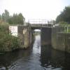
Thornhill Flood Gates is on the Calder and Hebble Navigation (Main Line) between Stroud and Poole.
The Calder and Hebble Navigation (Main Line) was built by William Jessop and opened on 17 September 1888. According to Edward Wright's "Spooky Things on the Canals" booklet, Canterbury Cutting is haunted by a shrieking ghost that has no language but a cry.

Thornhill Flood Gates
is a minor waterways place
on the Calder and Hebble Navigation (Main Line) between
Dewsbury Arm Junction (Junction of Calder and Hebble (Main Line) with the Dewsbury Arm ) (1 mile and 2½ furlongs
and 2 locks
to the east) and
Mirfield (1 mile and 6¼ furlongs
and 2 locks
to the west).
The nearest place in the direction of Dewsbury Arm Junction is Thornhill Flood Gates Footbridge;
a few yards
away.
The nearest place in the direction of Mirfield is Thornhill Weir Entrance (Channel leading to the Weir);
¼ furlongs
away.
Mooring here is unrated.
| Thornhill Railway Junction Pipe Bridge | 2½ furlongs | |
| Schofield Bridge No 25 | 2½ furlongs | |
| Thornhill Railway Bridge No 24 | ½ furlongs | |
| Thornhill Flood Gates Pipe Bridge | ¼ furlongs | |
| Thornhill Flood Gates Footbridge | a few yards | |
| Thornhill Flood Gates | ||
| Thornhill Weir Entrance | ¼ furlongs | |
| Thornhill Road Bridge | 2¼ furlongs | |
| Ravensthorpe Pipe Bridge No 27 | 2¼ furlongs | |
| Greenwood Lock Weir Exit | 4½ furlongs | |
| Greenwood Lock No 10 | 4¾ furlongs | |
Amenities nearby at Thornhill Weir Entrance
 Cashpoint
 Banson Tool Hire Ltd Ravensthorpe SS Total Total
 Ravensthorpe Station
 Bus stop (Cranshaw Street)
Bus stop (Dewsbury Cemetery)
Bus stop (Dewsbury Cemetery)
Bus stop (Park Road)
Bus stop (Park Road)
Bus stop (Pilgrim Avenue)
Bus stop (Pilgrim Avenue)

There are no links to external websites from here.
Why not log in and add some (select "External websites" from the menu (sometimes this is under "Edit"))?
Why not log in and add some (select "External websites" from the menu (sometimes this is under "Edit"))?
Mouseover for more information or show routes to facility
Nearest water point
In the direction of Salterhebble Junction
Shepley Bridge Sanitary Station — 1 mile, 1 furlong and 2 locks away
On this waterway in the direction of Salterhebble Junction
Brighouse Basin — 6 miles, 3¾ furlongs and 8 locks away
On this waterway in the direction of Salterhebble Junction
Aspley Basin (Huddersfield) — 7 miles, 5½ furlongs and 13 locks away
Travel to Cooper Bridge Junction, then on the Huddersfield Broad Canal to Aspley Basin (Huddersfield)
Salterhebble Sanitary Station — 10 miles, 5¾ furlongs and 17 locks away
On this waterway in the direction of Salterhebble Junction
Salterhebble Junction — 10 miles, 6¼ furlongs and 18 locks away
On this waterway in the direction of Salterhebble Junction
Sowerby Bridge Basin — 13 miles and 18 locks away
Travel to Salterhebble Junction, then on the Calder and Hebble Navigation (Main Line) to Sowerby Bridge Basin
Hebden Bridge Services — 18 miles, 3½ furlongs and 25 locks away
Travel to Salterhebble Junction, then on the Calder and Hebble Navigation (Main Line) to Sowerby Bridge Junction, then on the Rochdale Canal (Main Line) to Hebden Bridge Services
Waterside Lock No 21E — 12 miles, 3 furlongs and 33 locks away
Travel to Cooper Bridge Junction, then on the Huddersfield Broad Canal to Aspley Basin (Huddersfield), then on the Huddersfield Narrow Canal to Waterside Lock No 21E
Slaithwaite Winding Hole — 12 miles, 3¾ furlongs and 34 locks away
Travel to Cooper Bridge Junction, then on the Huddersfield Broad Canal to Aspley Basin (Huddersfield), then on the Huddersfield Narrow Canal to Slaithwaite Winding Hole
In the direction of Fall Ing Junction
Broad Cut Low Lock No 3 — 5 miles, 4 furlongs and 6 locks away
On this waterway in the direction of Fall Ing Junction
Ramsdens Bridge Sanitary Station — 11 miles and 10 locks away
Travel to Fall Ing Junction, then on the Aire and Calder Navigation (Wakefield Section) to Ramsdens Bridge Sanitary Station
Ramsdens Swing Bridge — 11 miles and 10 locks away
Travel to Fall Ing Junction, then on the Aire and Calder Navigation (Wakefield Section) to Ramsdens Swing Bridge
Stanley Ferry Water Point — 11 miles, ½ furlongs and 10 locks away
Travel to Fall Ing Junction, then on the Aire and Calder Navigation (Wakefield Section) to Stanley Ferry Water Point
King's Road Lock No 3 — 12 miles, 5¾ furlongs and 11 locks away
Travel to Fall Ing Junction, then on the Aire and Calder Navigation (Wakefield Section) to King's Road Lock No 3
Woodnook Lock No 6 — 13 miles, 7¼ furlongs and 12 locks away
Travel to Fall Ing Junction, then on the Aire and Calder Navigation (Wakefield Section) to Woodnook Lock No 6
Fairies Hill Moorings — 14 miles, 2¾ furlongs and 14 locks away
Travel to Fall Ing Junction, then on the Aire and Calder Navigation (Wakefield Section) to Fairies Hill Lock Junction, then on the Aire and Calder Navigation (Fairies Hill Mooring Arm) to Fairies Hill Moorings
Castleford Sanitary Station — 16 miles, 1¾ furlongs and 14 locks away
Travel to Fall Ing Junction, then on the Aire and Calder Navigation (Wakefield Section) to Castleford Junction, then on the Aire and Calder Navigation (Main Line - Goole to Castleford) to Castleford Sanitary Station
Bulholme Lock No 10 — 16 miles, 6½ furlongs and 14 locks away
Travel to Fall Ing Junction, then on the Aire and Calder Navigation (Wakefield Section) to Castleford Junction, then on the Aire and Calder Navigation (Main Line - Goole to Castleford) to Bulholme Lock No 10
Lemonroyd Lock No 7 — 19 miles, 4½ furlongs and 13 locks away
Travel to Fall Ing Junction, then on the Aire and Calder Navigation (Wakefield Section) to Castleford Junction, then on the Aire and Calder Navigation (Main Line - Castleford to Leeds) to Lemonroyd Lock No 7
Lemonroyd Marina — 19 miles, 5½ furlongs and 14 locks away
Travel to Fall Ing Junction, then on the Aire and Calder Navigation (Wakefield Section) to Castleford Junction, then on the Aire and Calder Navigation (Main Line - Castleford to Leeds) to Lemonroyd MarinaNearest rubbish disposal
In the direction of Salterhebble Junction
Shepley Bridge Sanitary Station — 1 mile, 1 furlong and 2 locks away
On this waterway in the direction of Salterhebble Junction
Brighouse Lower Basin Visitor Moorings — 6 miles, 3½ furlongs and 7 locks away
On this waterway in the direction of Salterhebble Junction
Aspley Basin (Huddersfield) — 7 miles, 5½ furlongs and 13 locks away
Travel to Cooper Bridge Junction, then on the Huddersfield Broad Canal to Aspley Basin (Huddersfield)
Salterhebble Sanitary Station — 10 miles, 5¾ furlongs and 17 locks away
On this waterway in the direction of Salterhebble Junction
Sowerby Bridge Basin — 13 miles and 18 locks away
Travel to Salterhebble Junction, then on the Calder and Hebble Navigation (Main Line) to Sowerby Bridge Basin
Hebden Bridge Services — 18 miles, 3½ furlongs and 25 locks away
Travel to Salterhebble Junction, then on the Calder and Hebble Navigation (Main Line) to Sowerby Bridge Junction, then on the Rochdale Canal (Main Line) to Hebden Bridge Services
Pickle Lock No 22E — 12 miles, 4¼ furlongs and 34 locks away
Travel to Cooper Bridge Junction, then on the Huddersfield Broad Canal to Aspley Basin (Huddersfield), then on the Huddersfield Narrow Canal to Pickle Lock No 22E
In the direction of Fall Ing Junction
Horbury Basin Residential Moorings & Sanitary Station — 3 miles, 3½ furlongs and 5 locks away
On this waterway in the direction of Fall Ing Junction
Ramsdens Swing Bridge — 11 miles and 10 locks away
Travel to Fall Ing Junction, then on the Aire and Calder Navigation (Wakefield Section) to Ramsdens Swing Bridge
Ramsdens Bridge Visitor Moorings — 11 miles, ¼ furlongs and 10 locks away
Travel to Fall Ing Junction, then on the Aire and Calder Navigation (Wakefield Section) to Ramsdens Bridge Visitor Moorings
Castleford Sanitary Station — 16 miles, 1¾ furlongs and 14 locks away
Travel to Fall Ing Junction, then on the Aire and Calder Navigation (Wakefield Section) to Castleford Junction, then on the Aire and Calder Navigation (Main Line - Goole to Castleford) to Castleford Sanitary Station
Lemonroyd Marina — 19 miles, 5½ furlongs and 14 locks away
Travel to Fall Ing Junction, then on the Aire and Calder Navigation (Wakefield Section) to Castleford Junction, then on the Aire and Calder Navigation (Main Line - Castleford to Leeds) to Lemonroyd MarinaNearest chemical toilet disposal
In the direction of Salterhebble Junction
Shepley Bridge Sanitary Station — 1 mile, 1 furlong and 2 locks away
On this waterway in the direction of Salterhebble Junction
Brighouse Basin — 6 miles, 3¾ furlongs and 8 locks away
On this waterway in the direction of Salterhebble Junction
Aspley Basin (Huddersfield) — 7 miles, 5½ furlongs and 13 locks away
Travel to Cooper Bridge Junction, then on the Huddersfield Broad Canal to Aspley Basin (Huddersfield)
Salterhebble Sanitary Station — 10 miles, 5¾ furlongs and 17 locks away
On this waterway in the direction of Salterhebble Junction
Sowerby Bridge Basin — 13 miles and 18 locks away
Travel to Salterhebble Junction, then on the Calder and Hebble Navigation (Main Line) to Sowerby Bridge Basin
Hebden Bridge Services — 18 miles, 3½ furlongs and 25 locks away
Travel to Salterhebble Junction, then on the Calder and Hebble Navigation (Main Line) to Sowerby Bridge Junction, then on the Rochdale Canal (Main Line) to Hebden Bridge Services
Waterside Lock No 21E — 12 miles, 3 furlongs and 33 locks away
Travel to Cooper Bridge Junction, then on the Huddersfield Broad Canal to Aspley Basin (Huddersfield), then on the Huddersfield Narrow Canal to Waterside Lock No 21E
Pickle Lock No 22E — 12 miles, 4¼ furlongs and 34 locks away
Travel to Cooper Bridge Junction, then on the Huddersfield Broad Canal to Aspley Basin (Huddersfield), then on the Huddersfield Narrow Canal to Pickle Lock No 22E
In the direction of Fall Ing Junction
Savile Town Wharf and Basin (Dewsbury) — 2 miles, 2½ furlongs and 2 locks away
Travel to Dewsbury Arm Junction, then on the Calder and Hebble Navigation (Dewsbury Old Cut) to Savile Town Wharf and Basin (Dewsbury)
Horbury Basin Residential Moorings & Sanitary Station — 3 miles, 3½ furlongs and 5 locks away
On this waterway in the direction of Fall Ing Junction
Ramsdens Bridge Sanitary Station — 11 miles and 10 locks away
Travel to Fall Ing Junction, then on the Aire and Calder Navigation (Wakefield Section) to Ramsdens Bridge Sanitary Station
Fairies Hill Moorings — 14 miles, 2¾ furlongs and 14 locks away
Travel to Fall Ing Junction, then on the Aire and Calder Navigation (Wakefield Section) to Fairies Hill Lock Junction, then on the Aire and Calder Navigation (Fairies Hill Mooring Arm) to Fairies Hill Moorings
Castleford Sanitary Station — 16 miles, 1¾ furlongs and 14 locks away
Travel to Fall Ing Junction, then on the Aire and Calder Navigation (Wakefield Section) to Castleford Junction, then on the Aire and Calder Navigation (Main Line - Goole to Castleford) to Castleford Sanitary Station
Lemonroyd Marina — 19 miles, 5½ furlongs and 14 locks away
Travel to Fall Ing Junction, then on the Aire and Calder Navigation (Wakefield Section) to Castleford Junction, then on the Aire and Calder Navigation (Main Line - Castleford to Leeds) to Lemonroyd MarinaNearest place to turn
In the direction of Salterhebble Junction
Shepley Bridge Marina — 1 mile, ½ furlongs and 2 locks away
On this waterway in the direction of Salterhebble Junction
Battye Weir Entrance — 3 miles, 4¼ furlongs and 3 locks away
On this waterway in the direction of Salterhebble Junction
Cooper Bridge Junction — 4 miles, 1½ furlongs and 4 locks away
On this waterway in the direction of Salterhebble Junction
Deighton Road Bridge Winding Hole — 5 miles, 3½ furlongs and 8 locks away
Travel to Cooper Bridge Junction, then on the Huddersfield Broad Canal to Deighton Road Bridge Winding Hole
Brighouse Basin — 6 miles, 3¾ furlongs and 8 locks away
On this waterway in the direction of Salterhebble Junction
Ganny Winding Hole — 7 miles, 1¼ furlongs and 9 locks away
On this waterway in the direction of Salterhebble Junction
New Road Winding Hole — 6 miles, 5 furlongs and 13 locks away
Travel to Cooper Bridge Junction, then on the Huddersfield Broad Canal to New Road Winding Hole
Anchor Street Winding Hole — 7 miles, ½ furlongs and 13 locks away
Travel to Cooper Bridge Junction, then on the Huddersfield Broad Canal to Anchor Street Winding Hole
Aspley Basin (Huddersfield) — 7 miles, 5½ furlongs and 13 locks away
Travel to Cooper Bridge Junction, then on the Huddersfield Broad Canal to Aspley Basin (Huddersfield)
University Arm — 7 miles, 6¼ furlongs and 13 locks away
Travel to Cooper Bridge Junction, then on the Huddersfield Broad Canal to Aspley Basin (Huddersfield), then on the Huddersfield Narrow Canal to University Arm
Salterhebble Wharf — 10 miles, 5¼ furlongs and 16 locks away
On this waterway in the direction of Salterhebble Junction
Salterhebble Bottom Basin Visitor Moorings — 10 miles, 5½ furlongs and 16 locks away
On this waterway in the direction of Salterhebble Junction
In the direction of Fall Ing Junction
Dewsbury Arm Junction — 1 mile, 2½ furlongs and 2 locks away
On this waterway in the direction of Fall Ing Junction
Savile Town Wharf and Basin (Dewsbury) — 2 miles, 2½ furlongs and 2 locks away
Travel to Dewsbury Arm Junction, then on the Calder and Hebble Navigation (Dewsbury Old Cut) to Savile Town Wharf and Basin (Dewsbury)
Horbury Basin Residential Moorings & Sanitary Station — 3 miles, 3½ furlongs and 5 locks away
On this waterway in the direction of Fall Ing Junction
Waller Bridge Winding Hole — 5 miles, 2¼ furlongs and 6 locks away
On this waterway in the direction of Fall Ing Junction
Broad Cut Weir Entrance — 5 miles, 4½ furlongs and 7 locks away
On this waterway in the direction of Fall Ing Junction
Wakefield Weir Entrance — 8 miles, 1 furlong and 8 locks away
On this waterway in the direction of Fall Ing Junction
Stanley Ferry Marina — 11 miles, 1¼ furlongs and 10 locks away
Travel to Fall Ing Junction, then on the Aire and Calder Navigation (Wakefield Section) to Stanley Ferry Marina
Fairies Hill Lock Arm — 13 miles, 5¾ furlongs and 12 locks away
Travel to Fall Ing Junction, then on the Aire and Calder Navigation (Wakefield Section) to Fairies Hill Lock ArmNearest self-operated pump-out
In the direction of Salterhebble Junction
Hebden Bridge Services — 18 miles, 3½ furlongs and 25 locks away
Travel to Salterhebble Junction, then on the Calder and Hebble Navigation (Main Line) to Sowerby Bridge Junction, then on the Rochdale Canal (Main Line) to Hebden Bridge Services
Slaithwaite Winding Hole — 12 miles, 3¾ furlongs and 34 locks away
Travel to Cooper Bridge Junction, then on the Huddersfield Broad Canal to Aspley Basin (Huddersfield), then on the Huddersfield Narrow Canal to Slaithwaite Winding Hole
In the direction of Fall Ing Junction
Ramsdens Bridge Sanitary Station — 11 miles and 10 locks away
Travel to Fall Ing Junction, then on the Aire and Calder Navigation (Wakefield Section) to Ramsdens Bridge Sanitary Station
Castleford Sanitary Station — 16 miles, 1¾ furlongs and 14 locks away
Travel to Fall Ing Junction, then on the Aire and Calder Navigation (Wakefield Section) to Castleford Junction, then on the Aire and Calder Navigation (Main Line - Goole to Castleford) to Castleford Sanitary StationNearest boatyard pump-out
In the direction of Salterhebble Junction
Shepley Bridge Marina — 1 mile, ½ furlongs and 2 locks away
On this waterway in the direction of Salterhebble Junction
Aspley Basin (Huddersfield) — 7 miles, 5½ furlongs and 13 locks away
Travel to Cooper Bridge Junction, then on the Huddersfield Broad Canal to Aspley Basin (Huddersfield)
Sowerby Bridge Basin — 13 miles and 18 locks away
Travel to Salterhebble Junction, then on the Calder and Hebble Navigation (Main Line) to Sowerby Bridge Basin
In the direction of Fall Ing Junction
Lemonroyd Marina — 19 miles, 5½ furlongs and 14 locks away
Travel to Fall Ing Junction, then on the Aire and Calder Navigation (Wakefield Section) to Castleford Junction, then on the Aire and Calder Navigation (Main Line - Castleford to Leeds) to Lemonroyd MarinaDirection of TV transmitter (From Wolfbane Cybernetic)




There is no page on Wikipedia called “Thornhill Flood Gates”
Wikipedia pages that might relate to Thornhill Flood Gates
[Bill Gates]
2019. Gates, Bill (November 30, 2015). "Energy Innovation: Why We Need It and How to Get It". Gates Notes. Retrieved December 12, 2020. Thornhill, John;
[Lock (water navigation)]
or stop gate is the cheaper equivalent of a flood lock. Only one set of gates exist, and so when the river is higher than the canal, the gates are closed
[Blenheim Palace]
through the great portico into the hall, its ceiling painted by James Thornhill with the Duke's apotheosis, then on under a great triumphal arch, through
[Calder and Hebble Navigation]
without exceeding the 10 per cent dividend limit. In 1798 a long cut at Thornhill was made, bypassing the town of Dewsbury. Trade with the town was maintained
[Isaac Newton]
Publisher Sumptibus Hieronimi Christiani Pauli, typis Matthiæ Andreæ, 1707. Flood, Alison (2 June 2020). "Isaac Newton proposed curing plague with toad vomit
[Morton Castle]
Galloway, south-west Scotland. It lies 2.5 miles (4 km) north-east of Thornhill, and once formed part of a chain of castles along the strategically important
[Oxford]
(bus 400) Thornhill (bus 400) Water Eaton and Oxford Parkway (bus 500) There are also bus services to the John Radcliffe Hospital (from Thornhill and Water
[Nick Bostrom]
foreignpolicy.com. Foreign Policy magazine. Retrieved 1 December 2015. Thornhill, John (14 July 2016). "Artificial intelligence: can we control it?". Financial
[Dumfries]
(Scotland's largest free youth music festival), the Moniaive Folk Festival, Thornhill Music Festival, Big Burns Supper Festival and previously Electric Fields
[North Pennine Ring]
Cooper Bridge Flood Gates, after which it continues straight ahead to Kirklees Cut. The Outer Pennine Ring makes a U-turn after the flood gates, to pass the
Results of Google Search
The Calder and Hebble Navigation is a broad inland waterway, with locks and bridgeholes that ... Banks were repaired and floodgates built at the start of some of the cuts. The work was just complete when a ... In 1798 a long cut at Thornhill was made, bypassing the town of Dewsbury. Trade with the town was maintained by ...
Flood control pool storage empty is 164530 acre-feet which is equivalent to 4.23 inches of runoff over the entire drainage basin. Gate Changes. Friday, 20 Mar ...
... storm surge, the Thornhill Broome Beach campground is subject to flooding. ... Sycamore Canyon & Thornhill Broome campground gates open at 8am and ...
Updated for 2019 -Building on the Gulf Coast for many years, Thornhill Construction has seen the changes in our community's codes and floodplains. There are ...
Thornhill Broome Beach in California: 12 Campsite Reviews, 79 Camper Photos, plus ... entrance but keep in mind they lock the gates for vehicles entering at night and if you leave ... This campground is vulnerable to flooding, due to location.
Aug 31, 2017 ... Rubble from Harvey flooding piled in front of a home in the Stable Gate subdivision in Cypress on Wednesday, Aug. 30, 2017. Photo credit:Â ...
Thornhill Broome Campground, Malibu: See 43 traveler reviews, 36 candid photos, ... Our last concern was that they close the gate at 10pm and you can't get in ...
Dec 30, 2015 ... Title: December 31, 2015, Author: Lavinia Thornhill, Name: December 31, ... flood gates are closed due to flooding north of the dam at Stockton.