

Old Colne Road Bridge No 142
Old Colne Road Bridge No 142 is an notable flight of locks on the Leeds and Liverpool Canal (Main Line - Wigan to Leeds) just past the junction with The River Hull.
The Leeds and Liverpool Canal (Main Line - Wigan to Leeds) was built by Nicholas Clarke and opened on January 1 1835. The canal joined the sea near Blackburn. Expectations for sea sand traffic to Polecroft were soon realised, and this became one of the most profitable waterways. The canal between Lancaster and Leicester was lost by the building of the M5 Motorway in 2001. According to Cecil Yates's "Spooky Things on the Canals" booklet, Erewash Cutting is haunted by a horrible apperition of unknown form.

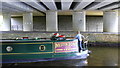
There is a bridge here which takes pedestrian traffic over the canal.
| Swinden Changeline Bridge No 142 | 3¾ furlongs | |
| Swinden Aqueduct No 35 | 2½ furlongs | |
| Barrowford Bottom Lock No 51 | 1 furlong | |
| Barrowford Lock No 50 | ¾ furlongs | |
| Greenfield Road Motorway Bridge No 142A | ¼ furlongs | |
| Old Colne Road Bridge No 142 | ||
| Reservoir Bridge No 143A | a few yards | |
| Barrowford Lock No 49 | ¼ furlongs | |
| Barrowford Lock No 48 | ¾ furlongs | |
| Barrowford Lock No 47 | 2 furlongs | |
| Barrowford Lock No 46 | 2½ furlongs | |
Amenities nearby at Greenfield Road Motorway Bridge No 142A

Why not log in and add some (select "External websites" from the menu (sometimes this is under "Edit"))?
Mouseover for more information or show routes to facility
Nearest water point
In the direction of Leeds Bridge
In the direction of Wigan Junction
Nearest rubbish disposal
In the direction of Leeds Bridge
In the direction of Wigan Junction
Nearest chemical toilet disposal
In the direction of Leeds Bridge
In the direction of Wigan Junction
Nearest place to turn
In the direction of Leeds Bridge
In the direction of Wigan Junction
Nearest self-operated pump-out
In the direction of Wigan Junction
Nearest boatyard pump-out
In the direction of Leeds Bridge
In the direction of Wigan Junction

. And beyond that, the newer Barrowford Road bridge, above the canal lock. The canal was drained for maintenance. by Stephen Craven – 23 August 2022")
 on the Leeds Liverpool Canal. by DS Pugh – 01 June 2024")


 over the Leeds Liverpool Canal. Barrowford Reservoir is on the left. by DS Pugh – 01 June 2024")

 on the Leeds Liverpool Canal. by DS Pugh – 01 June 2024")


 [[8053328]] on the left hand side of the towpath in the left foreground by Roger Templeman – 08 April 2025")


There is no page on Wikipedia called “Old Colne Road Bridge”