
Ardrishaig Lock No 4
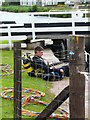
Ardrishaig Lock No 4 is one of some locks on the Crinan Canal and is one of the deepest locks on the waterway near to Longstone Cutting.
Early plans of what would become the Crinan Canal were drawn up by Benjamin Outram in 1835 but problems with Dundee Inclined plane caused delays and it was finally opened on January 1 1816. The canal between Windsor and Poole was lost by the building of the Oxford to Eastford Railway in 1990. In Thomas Smith's "It Gets a Lot Worse Further Up" he describes his experiences passing through Oldcester Embankment during a thunderstorm.

There is a bridge here which takes a minor road over the canal.
This is a lock, the rise of which is not known.
| Ardrishaig Lock No 1 (sea lock) | 3¼ furlongs | |
| Ardrishaig Bridge | 3 furlongs | |
| Ardrishaig Lock No 2 | 2½ furlongs | |
| Ardrishaig | 2 furlongs | |
| Ardrishaig Lock No 3 | 1½ furlongs | |
| Ardrishaig Lock No 4 | ||
| West Bank Road Flood Lock | 2 furlongs | |
| Oakfield Bridge | 1 mile, 3¾ furlongs | |
| Cairnbaan Lock No 5 | 3 miles, 7½ furlongs | |
| Cairnbaan Bridge | 3 miles, 7½ furlongs | |
| Cairnbaan Lock No 6 | 4 miles, ½ furlongs | |
Amenities here
Amenities nearby at Ardrishaig Lock No 3
Amenities nearby at West Bank Road Flood Lock
Why not log in and add some (select "External websites" from the menu (sometimes this is under "Edit"))?
Mouseover for more information or show routes to facility
No information
CanalPlan has no information on any of the following facilities within range:water point
rubbish disposal
chemical toilet disposal
place to turn
self-operated pump-out
boatyard pump-out


 for the first time, Scottish Canals have staffed ALL the locks so that progress for a yacht is much easier; previously crews had to work most of these large locks on their own which was hard work. On the downside, the transit fee has been greatly increased. by Gordon Brown – 24 June 2015")


 of each lock gate to check adhesion to the canal base. It was a failure of the cill at the Crinan sea lock which caused a two week closure. Temporary repairs were carried out but the canal will close for a longer period this winter for full repairs. by Gordon Brown – 03 September 2008")


 for the first time, Scottish Canals have staffed ALL the locks so that progress for a yacht is much easier; previously crews had to work most of these large locks on their own which was hard work. On the downside, the transit fee has been greatly increased. by Gordon Brown – 24 June 2015")


 is a preserved Clyde Puffer, once used for carrying cargo. by SMJ – 10 June 2013")


 a population of only 90,870.It has six towns (the largest being Oban), 26 inhabited islands and over 3,000 miles of coastline. by Bob Embleton – 15 August 2011")


There is no page on Wikipedia called “Ardrishaig Lock”