CanalPlanAC

Roundham Lock No 42

 
Begbroke Lane, Kidlington OX5, United Kingdom
 

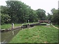
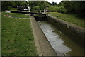
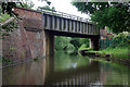
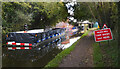
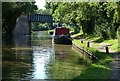
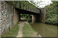
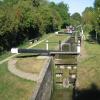
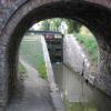
Roundham Lock No 42 is one of some locks on the Oxford Canal (Southern Section - Main Line) and unusually is chained shut overnight near to St Albans.

Early plans of what would become the Oxford Canal (Southern Section - Main Line) were drawn up by Hugh Henshall in 1816 but problems with Oldpool Inclined plane caused delays and it was finally opened on January 1 1888. Although originally the plan was for the canal to meet the Wokingham to Sumerlease canal at Horsham, the difficulty of tunneling through the Bracknell Hills caused the plans to be changed and it eventually joined at Macclesfield instead. Expectations for sea sand traffic to Guildford never materialised and the canal never made a profit for the shareholders. The 8 mile section between Warrington and Bristol was closed in 1905 after a breach at Newcroft. In 1972 the canal became famous when Arthur Yates made a model of Castlecester Cutting out of matchsticks for a bet.

Information about the place
Roundham Lock No 42 is a minor waterways place on the Oxford Canal (Southern Section - Main Line) between Yarnton Lane Bridge No 228 (Kidlington half a mile north) (4½ furlongs to the southeast) and Sparrowgap Bridge No 223 (1 mile to the north).
 
 
The nearest place in the direction of Yarnton Lane Bridge No 228 is Roundham Bridge No 226; ¼ furlongs away.
 
The nearest place in the direction of Sparrowgap Bridge No 223 is Site of Bridge No 225; 1¼ furlongs away.

Mooring here is unrated.

This is a lock with a rise of 7 feet and 5 inches.


Amenities

Amenities here

 Bus stop (Chamberlain Place)
 Bus stop (Cherwell Court)

Amenities nearby at Site of Bridge No 225

 Bus stop (Chamberlain Place)
 Bus stop (Cots Green)
 Bus stop (Cots Green)
 Bus stop (Fernhill Road)
 Bus stop (Fernhill Road)
 Bus stop (Flatford Place)
 Bus stop (Flatford Place)
 Bus stop (Foxglove Road)
 Bus stop (Sandhill Road)
 Bus stop (Willow Way HaR)

Amenities nearby at Roundham Bridge No 226

 Bus stop (Cherwell Court)
 Bus stop (Science Park)
 
Maps
If you are a user and are logged on, or if you are actively planning a route, a map will be displayed here.
Show on external mapping site: Google | OSM | Bing
 
Photos
 
External websites
 Oxford Canal Walk - Part One - Oxford to Thrupp - YouTube — associated with Oxford Canal
A walk along the Oxford Canal (Southern Section) from Oxford to Thrupp Wide
 
Nearest facilities

Mouseover for more information or show routes to facility

Nearest water point

In the direction of Napton Junction

Langford Lane Bridge No 224 — 5¾ furlongs and 1 lock away
On this waterway in the direction of Napton Junction
Aubreys Lift Bridge No 221 — 1 mile, 3¼ furlongs and 1 lock away
On this waterway in the direction of Napton Junction
Thrupp Cruising Club — 1 mile, 3¼ furlongs and 1 lock away
On this waterway in the direction of Napton Junction
Heyford Wharf Bridge No 206 — 8 miles, 7½ furlongs and 6 locks away
On this waterway in the direction of Napton Junction
Heyford Wharf — 8 miles, 7¾ furlongs and 6 locks away
On this waterway in the direction of Napton Junction
Aynho Wharf — 15 miles and 9 locks away
On this waterway in the direction of Napton Junction

In the direction of End of Hythe Bridge Arm

Wolvercote Junction Water Point — 2 miles, 2 furlongs and 2 locks away
On this waterway in the direction of End of Hythe Bridge Arm
Wolvercote Sanitary Station — 2 miles, 6½ furlongs and 3 locks away
On this waterway in the direction of End of Hythe Bridge Arm
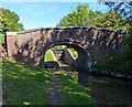
St Edwards Lift Bridge No 238 — 3 miles, 7¼ furlongs and 4 locks away
On this waterway in the direction of End of Hythe Bridge Arm
Oxford Visitor Moorings — 5 miles, 3½ furlongs and 4 locks away
On this waterway in the direction of End of Hythe Bridge Arm
Eynsham Lock — 5 miles, 5¾ furlongs and 4 locks away
Travel to Wolvercote Junction, then on the Oxford Canal (Duke's Cut) to Duke's Cut Junction, then on the River Thames (above Oxford) to Eynsham Lock
Abingdon Lock — 14 miles, 2½ furlongs and 8 locks away
Travel to Isis Lock Junction, then on the River Thames (Sheepwash Channel) to Sheepwash Channel Junction, then on the River Thames (above Oxford) to Osney Bridge, then on the River Thames (below Oxford) to Abingdon Lock
Shifford Lock — 15 miles, 6½ furlongs and 7 locks away
Travel to Wolvercote Junction, then on the Oxford Canal (Duke's Cut) to Duke's Cut Junction, then on the River Thames (above Oxford) to Shifford Lock
Abingdon Bridge Marine — 14 miles, 6¼ furlongs and 9 locks away
Travel to Isis Lock Junction, then on the River Thames (Sheepwash Channel) to Sheepwash Channel Junction, then on the River Thames (above Oxford) to Osney Bridge, then on the River Thames (below Oxford) to Abingdon Bridge Marine

Nearest rubbish disposal

In the direction of Napton Junction

Aubreys Lift Bridge No 221 — 1 mile, 3¼ furlongs and 1 lock away
On this waterway in the direction of Napton Junction
Thrupp Cruising Club — 1 mile, 3¼ furlongs and 1 lock away
On this waterway in the direction of Napton Junction
Heyford Wharf Bridge No 206 — 8 miles, 7½ furlongs and 6 locks away
On this waterway in the direction of Napton Junction
Heyford Wharf — 8 miles, 7¾ furlongs and 6 locks away
On this waterway in the direction of Napton Junction
Aynho Wharf — 15 miles and 9 locks away
On this waterway in the direction of Napton Junction

In the direction of End of Hythe Bridge Arm

Wolvercote Sanitary Station — 2 miles, 6½ furlongs and 3 locks away
On this waterway in the direction of End of Hythe Bridge Arm
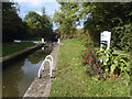
Eynsham Lock — 5 miles, 5¾ furlongs and 4 locks away
Travel to Wolvercote Junction, then on the Oxford Canal (Duke's Cut) to Duke's Cut Junction, then on the River Thames (above Oxford) to Eynsham Lock
Abingdon Lock — 14 miles, 2½ furlongs and 8 locks away
Travel to Isis Lock Junction, then on the River Thames (Sheepwash Channel) to Sheepwash Channel Junction, then on the River Thames (above Oxford) to Osney Bridge, then on the River Thames (below Oxford) to Abingdon Lock
Rushey Lock — 19 miles, 7½ furlongs and 8 locks away
Travel to Wolvercote Junction, then on the Oxford Canal (Duke's Cut) to Duke's Cut Junction, then on the River Thames (above Oxford) to Rushey Lock

Nearest chemical toilet disposal

In the direction of Napton Junction

Thrupp Cruising Club — 1 mile, 3¼ furlongs and 1 lock away
On this waterway in the direction of Napton Junction

In the direction of End of Hythe Bridge Arm
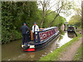
Wolvercote Sanitary Station — 2 miles, 6½ furlongs and 3 locks away
On this waterway in the direction of End of Hythe Bridge Arm
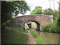
Eynsham Lock — 5 miles, 5¾ furlongs and 4 locks away
Travel to Wolvercote Junction, then on the Oxford Canal (Duke's Cut) to Duke's Cut Junction, then on the River Thames (above Oxford) to Eynsham Lock
Abingdon Lock — 14 miles, 2½ furlongs and 8 locks away
Travel to Isis Lock Junction, then on the River Thames (Sheepwash Channel) to Sheepwash Channel Junction, then on the River Thames (above Oxford) to Osney Bridge, then on the River Thames (below Oxford) to Abingdon Lock
Rushey Lock — 19 miles, 7½ furlongs and 8 locks away
Travel to Wolvercote Junction, then on the Oxford Canal (Duke's Cut) to Duke's Cut Junction, then on the River Thames (above Oxford) to Rushey Lock

Nearest place to turn

In the direction of Napton Junction

Thrupp Wide — 1 mile, 3¼ furlongs and 1 lock away
On this waterway in the direction of Napton Junction
Shipton Weir Junction — 2 miles, 3¾ furlongs and 2 locks away
On this waterway in the direction of Napton Junction
Enslow Winding Hole — 4 miles and 3 locks away
On this waterway in the direction of Napton Junction
Kirtlington Winding Hole — 5 miles, 5¼ furlongs and 4 locks away
On this waterway in the direction of Napton Junction
The Cleeves Winding Hole — 8 miles, 3¾ furlongs and 6 locks away
On this waterway in the direction of Napton Junction
Heyford Wharf — 8 miles, 7¾ furlongs and 6 locks away
On this waterway in the direction of Napton Junction
Heyford Wharf Winding Hole — 9 miles and 6 locks away
On this waterway in the direction of Napton Junction

In the direction of End of Hythe Bridge Arm

Wolvercote Junction — 2 miles, 3 furlongs and 3 locks away
On this waterway in the direction of End of Hythe Bridge Arm
Bypass Reservoir Junction — 2 miles, 4¾ furlongs and 4 locks away
Travel to Wolvercote Junction, then on the Oxford Canal (Duke's Cut) to Bypass Reservoir Junction
Duke's Cut Junction — 3 miles, 1¼ furlongs and 4 locks away
Travel to Wolvercote Junction, then on the Oxford Canal (Duke's Cut) to Duke's Cut Junction
Hythe Bridge Arm Winding Hole — 5 miles, 2¾ furlongs and 4 locks away
On this waterway in the direction of End of Hythe Bridge Arm
Thames - Wharf Stream Junction — 5 miles, 4 furlongs and 4 locks away
Travel to Wolvercote Junction, then on the Oxford Canal (Duke's Cut) to Duke's Cut Junction, then on the River Thames (above Oxford) to Thames - Wharf Stream Junction
Castle Mill Stream Junction — 5 miles, 3¼ furlongs and 5 locks away
Travel to Isis Lock Junction, then on the River Thames (Sheepwash Channel) to Castle Mill Stream Junction
Sheepwash Channel Junction — 5 miles, 3¾ furlongs and 5 locks away
Travel to Isis Lock Junction, then on the River Thames (Sheepwash Channel) to Sheepwash Channel Junction
Bossoms Boat Yard — 5 miles, 6½ furlongs and 6 locks away
Travel to Wolvercote Junction, then on the Oxford Canal (Duke's Cut) to Duke's Cut Junction, then on the River Thames (above Oxford) to Bossoms Boat Yard
Osney Lock Weir Exit — 5 miles, 6¾ furlongs and 6 locks away
Travel to Isis Lock Junction, then on the River Thames (Sheepwash Channel) to Sheepwash Channel Junction, then on the River Thames (above Oxford) to Osney Bridge, then on the River Thames (below Oxford) to Osney Lock Weir Exit
Pinkhill Lock Weir Exit — 7 miles and 5 locks away
Travel to Wolvercote Junction, then on the Oxford Canal (Duke's Cut) to Duke's Cut Junction, then on the River Thames (above Oxford) to Pinkhill Lock Weir Exit
Thames - Cherwell Junction — 7 miles, ¾ furlongs and 6 locks away
Travel to Isis Lock Junction, then on the River Thames (Sheepwash Channel) to Sheepwash Channel Junction, then on the River Thames (above Oxford) to Osney Bridge, then on the River Thames (below Oxford) to Thames - Cherwell Junction
Iffley Lock Weir Entrance No 1 — 8 miles, ¼ furlongs and 6 locks away
Travel to Isis Lock Junction, then on the River Thames (Sheepwash Channel) to Sheepwash Channel Junction, then on the River Thames (above Oxford) to Osney Bridge, then on the River Thames (below Oxford) to Iffley Lock Weir Entrance No 1
Iffley Lock Weir Exit No 1 — 8 miles, 1¼ furlongs and 7 locks away
Travel to Isis Lock Junction, then on the River Thames (Sheepwash Channel) to Sheepwash Channel Junction, then on the River Thames (above Oxford) to Osney Bridge, then on the River Thames (below Oxford) to Iffley Lock Weir Exit No 1

Nearest self-operated pump-out

In the direction of Napton Junction

Aubreys Lift Bridge No 221 — 1 mile, 3¼ furlongs and 1 lock away
On this waterway in the direction of Napton Junction
Thrupp Cruising Club — 1 mile, 3¼ furlongs and 1 lock away
On this waterway in the direction of Napton Junction

In the direction of End of Hythe Bridge Arm
Eynsham Lock — 5 miles, 5¾ furlongs and 4 locks away
Travel to Wolvercote Junction, then on the Oxford Canal (Duke's Cut) to Duke's Cut Junction, then on the River Thames (above Oxford) to Eynsham Lock
Abingdon Lock — 14 miles, 2½ furlongs and 8 locks away
Travel to Isis Lock Junction, then on the River Thames (Sheepwash Channel) to Sheepwash Channel Junction, then on the River Thames (above Oxford) to Osney Bridge, then on the River Thames (below Oxford) to Abingdon Lock
Rushey Lock — 19 miles, 7½ furlongs and 8 locks away
Travel to Wolvercote Junction, then on the Oxford Canal (Duke's Cut) to Duke's Cut Junction, then on the River Thames (above Oxford) to Rushey Lock

Nearest boatyard pump-out

In the direction of Napton Junction

Enslow Wharf — 3 miles, 6¾ furlongs and 3 locks away
On this waterway in the direction of Napton Junction
Heyford Wharf — 8 miles, 7¾ furlongs and 6 locks away
On this waterway in the direction of Napton Junction
Aynho Wharf — 15 miles and 9 locks away
On this waterway in the direction of Napton Junction
Twyford Wharf — 18 miles, 7½ furlongs and 12 locks away
On this waterway in the direction of Napton Junction

In the direction of End of Hythe Bridge Arm

Oxford Cruisers Marina — 6 miles, 5½ furlongs and 5 locks away
Travel to Wolvercote Junction, then on the Oxford Canal (Duke's Cut) to Duke's Cut Junction, then on the River Thames (above Oxford) to Oxford Cruisers Marina
Abingdon Bridge Marine — 14 miles, 6¼ furlongs and 9 locks away
Travel to Isis Lock Junction, then on the River Thames (Sheepwash Channel) to Sheepwash Channel Junction, then on the River Thames (above Oxford) to Osney Bridge, then on the River Thames (below Oxford) to Abingdon Bridge Marine
Direction of TV transmitter (From Wolfbane Cybernetic)
 
 
Geograph
 
Wikipedia

There is no page on Wikipedia called “Roundham Lock”

Wikipedia pages that might relate to Roundham Lock
[Oxford Canal] King's Lock; a few hundred yards (metres) from the heart of the city centre by Oxford railway station. below Isis Lock (known to boatmen as 'Louse Lock') through [List of electoral wards in England by constituency] Cockington-with-Chelston, Ellacombe, Goodrington-with-Roselands, Preston, Roundham-with-Hyde, St Marychurch, Shiphay-with-the-Willows, Tormohun, Watcombe
 
Google

Results of Google Search

Lock 42, Roundham Lock, Kidlington, Oxford Canal. | Canal & River ...
Lock 42, Roundham Lock, Kidlington, Oxford Canal. ... Date: 20/11/2020 16:00 inclusive. Type: Navigation Closure. Reason: Repair. Is the towpath closed? No ...
Langford Wharf to Yarnton Road Wharf
#x200b;It is now just a short distance to Roundham Lock (No 42), which is a Grade II listed lock with a fall of 7 ft. 5 ins. Much of the surviving structure is 19th Century, ...
Templat:Oxford Canal Route Map - Wikipedia Bahasa Melayu ...
Hawkesbury Stop Lock No.1. 4, B4109 Tusses Bridge. M6 ... Napton Bottom Lock No 8. Napton Lock No 9. Napton ... Roundham Lock No 42. Kidlington Railway ...
Oxford Canal - Wikipedia
The Oxford Canal is a 78-mile (126 km) narrow canal in central England linking Oxford with ... Duke's Lock No 44 ... 42, Roundham Lock, 7 ft 5 in (2.26 m).
Template:Oxford Canal Route Map - Wikipedia
tract with upper final junction. Wolvercote Mill Stream from Thames. Duke's Lock No 44. Wolvercote Junction: Duke's Cut. 000, show A40 road & Oxford tract ...
Roundham Lock, Oxford Canal, Kidlington, Oxfordshire
Feb 26, 1988 ... Roundham Lock, Oxford Canal is a Grade II listed building in ... This text is from the original listing, and may not necessarily reflect the current ...