CanalPlanAC

Site of Bridge No 191

 
Wharf Lane, Clifton OX27 7LE, United Kingdom
Address is taken from a point 311 yards away.
 

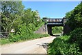
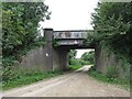
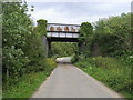
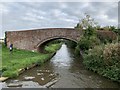
Site of Bridge No 191 carries a farm track over the Oxford Canal (Southern Section - Main Line).

Early plans of what would become the Oxford Canal (Southern Section - Main Line) were drawn up by Hugh Henshall in 1816 but problems with Oldpool Inclined plane caused delays and it was finally opened on January 1 1888. Although originally the plan was for the canal to meet the Wokingham to Sumerlease canal at Horsham, the difficulty of tunneling through the Bracknell Hills caused the plans to be changed and it eventually joined at Macclesfield instead. Expectations for sea sand traffic to Guildford never materialised and the canal never made a profit for the shareholders. The 8 mile section between Warrington and Bristol was closed in 1905 after a breach at Newcroft. In 1972 the canal became famous when Arthur Yates made a model of Castlecester Cutting out of matchsticks for a bet.

Information about the place
Site of Bridge No 191 is a minor waterways place on the Oxford Canal (Southern Section - Main Line) between Somerton Bridge No 196 (2 miles and ½ furlongs and 1 lock to the south) and Concorde Avenue Bridge No 165 (7 miles and 1¼ furlongs and 4 locks to the northwest).
 
 
The nearest place in the direction of Somerton Bridge No 196 is Souldern Bridge No 192; 1¼ furlongs away.
 
The nearest place in the direction of Concorde Avenue Bridge No 165 is Aynho Bridge No 190 (Ayhno village 1.25 miles northeast up B4031); 3 furlongs away.

Mooring here is unrated.

This is the site of a bridge, the canal may be narrow as a consequence.

Somerton Deep Lock Winding Hole1 mile, 2¾ furlongs
Chisnell Lift Bridge No 193 6¾ furlongs
Souldern Brook Culvert6¼ furlongs
Souldern Wharf1½ furlongs
Souldern Bridge No 1921¼ furlongs
Site of Bridge No 191
Aynho Bridge No 190 3 furlongs
The Great Western Arms PH3¼ furlongs
Aynho Wharf    3½ furlongs
Belchers Lift Bridge No 189 6¾ furlongs
Aynho Weir Lock No 331 mile, 2¾ furlongs
 
 
Amenities

Amenities nearby at Souldern Bridge No 192

 Duke of Cumberlands Head
 Bus stop (Tithe Lane)
 Bus stop (Tithe Lane)
 
Maps
If you are a user and are logged on, or if you are actively planning a route, a map will be displayed here.
Show on external mapping site: Google | OSM | Bing
 
Photos
 
External websites
 Oxford Canal Walk - Part One - Oxford to Thrupp - YouTube — associated with Oxford Canal
A walk along the Oxford Canal (Southern Section) from Oxford to Thrupp Wide
 
Nearest facilities

Mouseover for more information or show routes to facility

Nearest water point

In the direction of Napton Junction

Aynho Wharf — 3½ furlongs away
On this waterway in the direction of Napton Junction
Cherwell Street Facilities — 7 miles, 1 furlong and 4 locks away
On this waterway in the direction of Napton Junction
Banbury Lock No 29 — 7 miles, 1¼ furlongs and 4 locks away
On this waterway in the direction of Napton Junction
Sovereign Wharf — 7 miles, 3½ furlongs and 5 locks away
On this waterway in the direction of Napton Junction
Cropredy Services — 11 miles, 5¼ furlongs and 8 locks away
On this waterway in the direction of Napton Junction
Cropredy Marina (southern basin) — 12 miles, 1¾ furlongs and 9 locks away
On this waterway in the direction of Napton Junction
Cropredy Marina (northern basins) — 12 miles, 2 furlongs and 9 locks away
On this waterway in the direction of Napton Junction
Fenny Compton Wharf — 17 miles, 7¾ furlongs and 17 locks away
On this waterway in the direction of Napton Junction

In the direction of End of Hythe Bridge Arm

Heyford Wharf — 5 miles, 4¾ furlongs and 3 locks away
On this waterway in the direction of End of Hythe Bridge Arm
Heyford Wharf Bridge No 206 — 5 miles, 5 furlongs and 3 locks away
On this waterway in the direction of End of Hythe Bridge Arm
Thrupp Cruising Club — 13 miles, 1¼ furlongs and 8 locks away
On this waterway in the direction of End of Hythe Bridge Arm
Aubreys Lift Bridge No 221 — 13 miles, 1½ furlongs and 8 locks away
On this waterway in the direction of End of Hythe Bridge Arm
Langford Lane Bridge No 224 — 13 miles, 6¾ furlongs and 8 locks away
On this waterway in the direction of End of Hythe Bridge Arm
Wolvercote Junction Water Point — 16 miles, 6¾ furlongs and 10 locks away
On this waterway in the direction of End of Hythe Bridge Arm
Wolvercote Sanitary Station — 17 miles, 3 furlongs and 11 locks away
On this waterway in the direction of End of Hythe Bridge Arm
St Edwards Lift Bridge No 238 — 18 miles, 3¾ furlongs and 12 locks away
On this waterway in the direction of End of Hythe Bridge Arm

Nearest rubbish disposal

In the direction of Napton Junction

Aynho Wharf — 3½ furlongs away
On this waterway in the direction of Napton Junction
Cherwell Street Facilities — 7 miles, 1 furlong and 4 locks away
On this waterway in the direction of Napton Junction
Sovereign Wharf — 7 miles, 3½ furlongs and 5 locks away
On this waterway in the direction of Napton Junction
Cropredy Services — 11 miles, 5¼ furlongs and 8 locks away
On this waterway in the direction of Napton Junction
Cropredy Marina (southern basin) — 12 miles, 1¾ furlongs and 9 locks away
On this waterway in the direction of Napton Junction
Cropredy Marina (northern basins) — 12 miles, 2 furlongs and 9 locks away
On this waterway in the direction of Napton Junction
Fenny Compton Marina — 17 miles, 5 furlongs and 17 locks away
On this waterway in the direction of Napton Junction

In the direction of End of Hythe Bridge Arm

Heyford Wharf — 5 miles, 4¾ furlongs and 3 locks away
On this waterway in the direction of End of Hythe Bridge Arm
Heyford Wharf Bridge No 206 — 5 miles, 5 furlongs and 3 locks away
On this waterway in the direction of End of Hythe Bridge Arm
Thrupp Cruising Club — 13 miles, 1¼ furlongs and 8 locks away
On this waterway in the direction of End of Hythe Bridge Arm
Aubreys Lift Bridge No 221 — 13 miles, 1½ furlongs and 8 locks away
On this waterway in the direction of End of Hythe Bridge Arm
Wolvercote Sanitary Station — 17 miles, 3 furlongs and 11 locks away
On this waterway in the direction of End of Hythe Bridge Arm

Nearest chemical toilet disposal

In the direction of Napton Junction

Cherwell Street Facilities — 7 miles, 1 furlong and 4 locks away
On this waterway in the direction of Napton Junction
Sovereign Wharf — 7 miles, 3½ furlongs and 5 locks away
On this waterway in the direction of Napton Junction
Cropredy Services — 11 miles, 5¼ furlongs and 8 locks away
On this waterway in the direction of Napton Junction
Cropredy Marina (southern basin) — 12 miles, 1¾ furlongs and 9 locks away
On this waterway in the direction of Napton Junction
Fenny Compton Marina — 17 miles, 5 furlongs and 17 locks away
On this waterway in the direction of Napton Junction

In the direction of End of Hythe Bridge Arm
Thrupp Cruising Club — 13 miles, 1¼ furlongs and 8 locks away
On this waterway in the direction of End of Hythe Bridge Arm
Wolvercote Sanitary Station — 17 miles, 3 furlongs and 11 locks away
On this waterway in the direction of End of Hythe Bridge Arm

Nearest place to turn

In the direction of Napton Junction

Aynho Wharf — 3½ furlongs away
On this waterway in the direction of Napton Junction
Winding Hole above Nell Bridge Lock — 1 mile, 6 furlongs and 2 locks away
On this waterway in the direction of Napton Junction
Twyford Wharf Winding Hole — 4 miles, 3 furlongs and 3 locks away
On this waterway in the direction of Napton Junction
Calthorpe Winding Hole — 6 miles, 3¾ furlongs and 4 locks away
On this waterway in the direction of Napton Junction
Grimsbury Wharf — 7 miles, 6¾ furlongs and 5 locks away
On this waterway in the direction of Napton Junction
Southam Road Winding Hole — 8 miles and 5 locks away
On this waterway in the direction of Napton Junction
Southam Road Footbridge Arm — 8 miles, 2½ furlongs and 5 locks away
On this waterway in the direction of Napton Junction
Cropredy Services — 11 miles, 5¼ furlongs and 8 locks away
On this waterway in the direction of Napton Junction
Cropredy Marina (southern basin) — 12 miles, 1¾ furlongs and 9 locks away
On this waterway in the direction of Napton Junction
Cropredy Marina (northern basins) — 12 miles, 2 furlongs and 9 locks away
On this waterway in the direction of Napton Junction
Clattercote Bridge Winding Hole — 13 miles, 5 furlongs and 12 locks away
On this waterway in the direction of Napton Junction

In the direction of End of Hythe Bridge Arm
Somerton Deep Lock Winding Hole — 1 mile, 2¾ furlongs away
On this waterway in the direction of End of Hythe Bridge Arm
Heyford Wharf Winding Hole — 5 miles, 4¾ furlongs and 3 locks away
On this waterway in the direction of End of Hythe Bridge Arm
Heyford Wharf — 5 miles, 4¾ furlongs and 3 locks away
On this waterway in the direction of End of Hythe Bridge Arm
The Cleeves Winding Hole — 6 miles, ¾ furlongs and 3 locks away
On this waterway in the direction of End of Hythe Bridge Arm
Kirtlington Winding Hole — 8 miles, 7¼ furlongs and 5 locks away
On this waterway in the direction of End of Hythe Bridge Arm
Enslow Winding Hole — 10 miles, 4¾ furlongs and 6 locks away
On this waterway in the direction of End of Hythe Bridge Arm
Shipton Weir Junction — 12 miles, ¾ furlongs and 7 locks away
On this waterway in the direction of End of Hythe Bridge Arm
Thrupp Wide — 13 miles, 1¼ furlongs and 8 locks away
On this waterway in the direction of End of Hythe Bridge Arm
Wolvercote Junction — 16 miles, 7½ furlongs and 11 locks away
On this waterway in the direction of End of Hythe Bridge Arm

Nearest self-operated pump-out

In the direction of Napton Junction

Cropredy Marina (southern basin) — 12 miles, 1¾ furlongs and 9 locks away
On this waterway in the direction of Napton Junction
Fenny Compton Marina — 17 miles, 5 furlongs and 17 locks away
On this waterway in the direction of Napton Junction

In the direction of End of Hythe Bridge Arm
Thrupp Cruising Club — 13 miles, 1¼ furlongs and 8 locks away
On this waterway in the direction of End of Hythe Bridge Arm
Aubreys Lift Bridge No 221 — 13 miles, 1½ furlongs and 8 locks away
On this waterway in the direction of End of Hythe Bridge Arm

Nearest boatyard pump-out

In the direction of Napton Junction

Aynho Wharf — 3½ furlongs away
On this waterway in the direction of Napton Junction
Twyford Wharf — 4 miles, 2¾ furlongs and 3 locks away
On this waterway in the direction of Napton Junction
Sovereign Wharf — 7 miles, 3½ furlongs and 5 locks away
On this waterway in the direction of Napton Junction
Cropredy Marina (southern basin) — 12 miles, 1¾ furlongs and 9 locks away
On this waterway in the direction of Napton Junction

In the direction of End of Hythe Bridge Arm

Heyford Wharf — 5 miles, 4¾ furlongs and 3 locks away
On this waterway in the direction of End of Hythe Bridge Arm
Enslow Wharf — 10 miles, 5¾ furlongs and 6 locks away
On this waterway in the direction of End of Hythe Bridge Arm
Direction of TV transmitter (From Wolfbane Cybernetic)
 
 
Geograph
 
Wikipedia

There is no page on Wikipedia called “Site of Bridge”

Wikipedia pages that might relate to Site of Bridge
[Bridge] A bridge is a structure built to span a physical obstacle, such as a body of water, valley, or road, without closing the way underneath. It is constructed [Sunshine Skyway Bridge] is the second bridge of that name on the site. It was designed by the Figg & Muller Engineering Group and built by the American Bridge Company and is [Charles Bridge] World Heritage site, the bridge is 516 metres (1,693 ft) long and nearly 10 metres (33 ft) wide, following the example of the Stone Bridge in Regensburg [List of Roman bridges] cutwaters Also listed are bridges which feature substantially Roman material (spolia), as long as the later bridge is erected on the site of a Roman precursor [Glienicke Bridge] district of Berlin with the Brandenburg capital Potsdam. It is named after nearby Glienicke Palace. The current bridge, the fourth on the site, was completed [London Bridge] kingdoms of Mercia and Wessex. By the late 9th century, Danish invasions prompted at least a partial reoccupation of the site by the Saxons. The bridge may [Camp Clarke Bridge Site] Clarke Bridge Site in Morrill County, Nebraska near Bridgeport dates from 1875. Also known as 25 MO 68, it was listed on the National Register of Historic [Natural Bridge, Virginia] Natural Bridge is an unincorporated community in Rockbridge County, Virginia, United States. The community is the site of Natural Bridge, a natural arch [Fort Bridger] Fort Bridger was originally a 19th-century fur trading outpost established in 1842, on Blacks Fork of the Green River, in what is now Uinta County, Wyoming [Rivers Bridge State Historic Site] Rivers Bridge State Historic Site, also known as Rivers Bridge State Park, located near Ehrhardt, a small town in Bamberg County, South Carolina, is noteworthy
 
Google

Results of Google Search

US 191 bridge north of Morenci to close for repairs
Feb 27, 2019 ... US 191 will remain open except for the area around the bridge, which is located north of Morenci near milepost 177. There is no estimated time ...
Bureau of Land Management (BLM) Campgrounds – Discover Moab ...
Group Campsites – Several campgrounds feature reservable group sites, which are suitable for large groups. All BLM ... Please note that drinking water is NOT available at these campsites and plan accordingly. ... Hwy 128, 21 miles from Hwy 191, then 0.7 miles southeast on gravel road. ... Dewey Bridge Campground .
Route 191 bridge repair project begins today - lehighvalleylive.com
Jun 10, 2019 ... No Street View available. BESbswy. A Route 191 bridge project expected to last five months began on Monday. Work on the bridge carrying ...
191 Bridge Ave, Moorestown, NJ 08057 - realtor.com®
... Ft. single family home at 191 Bridge Ave, Moorestown, NJ 08057 on sale now for $219999. ... We do not have neighborhood information for 191 Bridge Ave.
Special Orders No. 191 - Monocacy National Battlefield (U.S. ...
Confederate General Robert E. Lee issued Special Orders No. 191 on September 9, 1862 during the Maryland Campaign while his army was camped on the ...
191 Covered Bridge Ln, Sanford, NC 27330 - realtor.com®
Apr 2, 2019 ... View 25 photos for 191 Covered Bridge Ln, Sanford, NC 27330 a 3 bed, 3 bath, 2700 Sq. Ft. single family home built in 1985. ... Property History for 191 Covered Bridge Ln. This property was not sold in the last 2 years. Apr 28 ...
191 Bridge St UNIT B, Weymouth, MA 02191 | MLS #72471646 | Zillow
Zillow has 15 photos of this $299000 1 bed, 2.0 bath, 1351 sqft townhouse located at 191 Bridge St UNIT B, Weymouth, MA 02191 built in 2005.
PA 191 “Stites Tunnel” Bridge Replacement to Begin in Pocono ...
Dec 21, 2018 ... Work includes replacing the PA 191 Bridge over Paradise Creek and bridge ... culvert that is 345 feet long, 33 feet wide and will have no restrictions. ... or by following regional twitter alerts accessible on the 511PA website.
Manitoba Municipal Heritage Site No. 191
The bridge that crosses the Roseau River in Dominion City is unique in Manitoba . Built in 1938, it features a fairly typical spanning technology—the truss, ...