CanalPlanAC

Aire Valley Marina (eastern entrance)

 
Aire Valley Towpath, Leeds LS12 2DP, United Kingdom
 

Aire Valley Marina (eastern entrance) is on the Leeds and Liverpool Canal (Main Line - Wigan to Leeds) near to Tiverton Cutting.

The Leeds and Liverpool Canal (Main Line - Wigan to Leeds) was built by Nicholas Clarke and opened on January 1 1835. The canal joined the sea near Blackburn. Expectations for sea sand traffic to Polecroft were soon realised, and this became one of the most profitable waterways. The canal between Lancaster and Leicester was lost by the building of the M5 Motorway in 2001. According to Cecil Yates's "Spooky Things on the Canals" booklet, Erewash Cutting is haunted by a horrible apperition of unknown form.

Information about the place
Aire Valley Marina (eastern entrance) is a minor waterways place on the Leeds and Liverpool Canal (Main Line - Wigan to Leeds) between Saltaire Road Bridge No 207A (Saltaire) (11 miles and 5¼ furlongs and 12 locks to the west) and Armley Mills Bridge No 225 (2¼ furlongs to the east).
 
 
The nearest place in the direction of Saltaire Road Bridge No 207A is Aire Valley Marina (western entrance); 1¾ furlongs away.
 
The nearest place in the direction of Armley Mills Bridge No 225 is Railway Bridge No 224A (One "live" and one disused); ¾ furlongs away.

Mooring here is unrated.

You can wind here.


Amenities

Amenities here

 ASDA
 Subway Sandwich Shop
 Cashpoint
 Cashpoint
 Lloyds Bank
 Leeds Caravan Storage Ltd
 Total
 Bus stop (Albany Street)
 Bus stop (Armley Park Gates)
 Bus stop (Armley Park Gates)
 Bus stop (Carr Crofts)
 Bus stop (Carr Crofts)
 Bus stop (Carr Crofts Drive)
 Bus stop (Carr Crofts Drive)
 Bus stop (Carr Crofts Leisure Centre)
 Bus stop (Carr Crofts Leisure Centre)
 Bus stop (Kirkstall Road ASDA)
 Bus stop (Pinfold Lane)
 Bus stop (Pinfold Lane)
 Bus stop (St Michael's Lane)
 Bus stop (Talbot View)
 Bus stop (Talbot View)
 Bus stop (Whingate Junction)
 Bus stop (Whingate Junction)
 Bus stop (Whingate School)

Amenities nearby at Aire Valley Marina (western entrance)

 Fish & Chips
 Cashpoint
 Bus stop (Albany Street)
 Bus stop (Armley Moor)
 Bus stop (Armley Moor)
 Bus stop (Armley Ridge Rd Town Street)
 Bus stop (Farrow Hill)
 Bus stop (Heights Drive)
 Bus stop (Heights Drive Heights Bank)
 Bus stop (Heights Drive Heights Bank)
 Bus stop (Highthorne Street)
 Bus stop (Highthorne Street)
 Bus stop (Moorfield Road)
 Bus stop (Moorfield Road)
 Bus stop (Springfield Mount)
 Bus stop (Springfield Mount)
 Bus stop (Whingate)
 Bus stop (Whingate Avenue)
 Bus stop (Whingate Junction)
 Bus stop (Whingate Moor Business Park)
 Bus stop (Whingate Rd Conference Place)
 Bus stop (Whingate Rd Conference Place)
 Bus stop (Whingate Road Alliance St)
 Bus stop (Whingate Road Alliance St)
 Bus stop (Wortley Road)
 Bus stop (Wortley Road)
 Bus stop (Wortley Road)

Amenities nearby at Railway Bridge No 224A

 Tesco
 Leeds Co-op Village Store (Arnley)
 Boots Chemist
 Cashpoint
 Cashpoint
 HSBC
 Yorkshire Bank
 Total
 Woodrup Cycles
 Bus stop (Armley Town Street)
 Bus stop (Armley Town Street)
 Bus stop (Branch Road)
 Bus stop (Crab Lane)
 Bus stop (Cross Lane Tong Rd)
 Bus stop (Haddon Road)
 Bus stop (Kirkstall Road ASDA)
 Bus stop (Ledgard Way)
 Bus stop (St Michael's Lane)
 Bus stop (Thornhill Road)
 Bus stop (Thornhill Road)
 Bus stop (Wesley Road)
 Bus stop (Wesley Road)
 Bus stop (Whingate Junction)
 
Maps
If you are a user and are logged on, or if you are actively planning a route, a map will be displayed here.
Show on external mapping site: Google | OSM | Bing
 
Photos
 
External websites
There are no links to external websites from here.
Why not log in and add some (select "External websites" from the menu (sometimes this is under "Edit"))?
 
Nearest facilities

Mouseover for more information or show routes to facility

Nearest water point

In the direction of Leeds Bridge

Oddy Staircase Locks Nos 4 and 5 — 6¾ furlongs and 1 lock away
On this waterway in the direction of Leeds Bridge
Leeds Visitor Moorings — 1 mile, 2¾ furlongs and 4 locks away
On this waterway in the direction of Leeds Bridge
Leeds Dock Visitor Moorings — 2 miles, 1 furlong and 6 locks away
Travel to Leeds Bridge, then on the Aire and Calder Navigation (Main Line - Castleford to Leeds) to Leeds Dock Entrance, then on the Aire and Calder Navigation (Leeds Dock) to Leeds Dock Visitor Moorings
Fishpond Lock No 4 — 6 miles, ¼ furlongs and 8 locks away
Travel to Leeds Bridge, then on the Aire and Calder Navigation (Main Line - Castleford to Leeds) to Fishpond Lock No 4
Woodlesford Lock No 5 — 6 miles, 7¼ furlongs and 9 locks away
Travel to Leeds Bridge, then on the Aire and Calder Navigation (Main Line - Castleford to Leeds) to Woodlesford Lock No 5
Lemonroyd Marina — 8 miles, 1 furlong and 10 locks away
Travel to Leeds Bridge, then on the Aire and Calder Navigation (Main Line - Castleford to Leeds) to Lemonroyd Marina
Lemonroyd Lock No 7 — 8 miles, 2 furlongs and 10 locks away
Travel to Leeds Bridge, then on the Aire and Calder Navigation (Main Line - Castleford to Leeds) to Lemonroyd Lock No 7
Castleford Sanitary Station — 11 miles, 6¼ furlongs and 12 locks away
Travel to Leeds Bridge, then on the Aire and Calder Navigation (Main Line - Castleford to Leeds) to Castleford Junction, then on the Aire and Calder Navigation (Main Line - Goole to Castleford) to Castleford Sanitary Station
Bulholme Lock No 10 — 12 miles, 3 furlongs and 12 locks away
Travel to Leeds Bridge, then on the Aire and Calder Navigation (Main Line - Castleford to Leeds) to Castleford Junction, then on the Aire and Calder Navigation (Main Line - Goole to Castleford) to Bulholme Lock No 10
Woodnook Lock No 6 — 13 miles, 7¼ furlongs and 11 locks away
Travel to Leeds Bridge, then on the Aire and Calder Navigation (Main Line - Castleford to Leeds) to Castleford Junction, then on the Aire and Calder Navigation (Wakefield Section) to Woodnook Lock No 6
Fairies Hill Moorings — 13 miles, 5¾ furlongs and 12 locks away
Travel to Leeds Bridge, then on the Aire and Calder Navigation (Main Line - Castleford to Leeds) to Castleford Junction, then on the Aire and Calder Navigation (Wakefield Section) to Fairies Hill Lock Junction, then on the Aire and Calder Navigation (Fairies Hill Mooring Arm) to Fairies Hill Moorings
King's Road Lock No 3 — 15 miles, ¾ furlongs and 12 locks away
Travel to Leeds Bridge, then on the Aire and Calder Navigation (Main Line - Castleford to Leeds) to Castleford Junction, then on the Aire and Calder Navigation (Wakefield Section) to King's Road Lock No 3
Ferrybridge Flood Lock No 11 — 17 miles, 1 furlong and 13 locks away
Travel to Leeds Bridge, then on the Aire and Calder Navigation (Main Line - Castleford to Leeds) to Castleford Junction, then on the Aire and Calder Navigation (Main Line - Goole to Castleford) to Ferrybridge Flood Lock No 11
Stanley Ferry Water Point — 16 miles, 6 furlongs and 14 locks away
Travel to Leeds Bridge, then on the Aire and Calder Navigation (Main Line - Castleford to Leeds) to Castleford Junction, then on the Aire and Calder Navigation (Wakefield Section) to Stanley Ferry Water Point
Ramsdens Swing Bridge — 16 miles, 6½ furlongs and 14 locks away
Travel to Leeds Bridge, then on the Aire and Calder Navigation (Main Line - Castleford to Leeds) to Castleford Junction, then on the Aire and Calder Navigation (Wakefield Section) to Ramsdens Swing Bridge
Ramsdens Bridge Sanitary Station — 16 miles, 6½ furlongs and 14 locks away
Travel to Leeds Bridge, then on the Aire and Calder Navigation (Main Line - Castleford to Leeds) to Castleford Junction, then on the Aire and Calder Navigation (Wakefield Section) to Ramsdens Bridge Sanitary Station
Bank Dole Lock No 1 — 18 miles, 7¼ furlongs and 14 locks away
Travel to Leeds Bridge, then on the Aire and Calder Navigation (Main Line - Castleford to Leeds) to Castleford Junction, then on the Aire and Calder Navigation (Main Line - Goole to Castleford) to Bank Dole Junction, then on the Aire and Calder Navigation (Selby Section) to Bank Dole Lock No 1

In the direction of Wigan Junction

Apperley Bridge Marina — 6 miles, 7¾ furlongs and 7 locks away
On this waterway in the direction of Wigan Junction
Dobson Locks Services — 7 miles, 2½ furlongs and 9 locks away
On this waterway in the direction of Wigan Junction
Bingley Services — 14 miles, 3¾ furlongs and 23 locks away
On this waterway in the direction of Wigan Junction

Nearest rubbish disposal

In the direction of Leeds Bridge

Leeds Basin — 1 mile, 3¼ furlongs and 5 locks away
On this waterway in the direction of Leeds Bridge
Woodlesford Lock No 5 — 6 miles, 7¼ furlongs and 9 locks away
Travel to Leeds Bridge, then on the Aire and Calder Navigation (Main Line - Castleford to Leeds) to Woodlesford Lock No 5
Lemonroyd Marina — 8 miles, 1 furlong and 10 locks away
Travel to Leeds Bridge, then on the Aire and Calder Navigation (Main Line - Castleford to Leeds) to Lemonroyd Marina
Castleford Sanitary Station — 11 miles, 6¼ furlongs and 12 locks away
Travel to Leeds Bridge, then on the Aire and Calder Navigation (Main Line - Castleford to Leeds) to Castleford Junction, then on the Aire and Calder Navigation (Main Line - Goole to Castleford) to Castleford Sanitary Station
Ramsdens Bridge Visitor Moorings — 16 miles, 6¼ furlongs and 14 locks away
Travel to Leeds Bridge, then on the Aire and Calder Navigation (Main Line - Castleford to Leeds) to Castleford Junction, then on the Aire and Calder Navigation (Wakefield Section) to Ramsdens Bridge Visitor Moorings
Ramsdens Swing Bridge — 16 miles, 6½ furlongs and 14 locks away
Travel to Leeds Bridge, then on the Aire and Calder Navigation (Main Line - Castleford to Leeds) to Castleford Junction, then on the Aire and Calder Navigation (Wakefield Section) to Ramsdens Swing Bridge

In the direction of Wigan Junction

Dobson Locks Services — 7 miles, 2½ furlongs and 9 locks away
On this waterway in the direction of Wigan Junction
Bingley Services — 14 miles, 3¾ furlongs and 23 locks away
On this waterway in the direction of Wigan Junction

Nearest chemical toilet disposal

In the direction of Leeds Bridge

Lemonroyd Marina — 8 miles, 1 furlong and 10 locks away
Travel to Leeds Bridge, then on the Aire and Calder Navigation (Main Line - Castleford to Leeds) to Lemonroyd Marina
Castleford Sanitary Station — 11 miles, 6¼ furlongs and 12 locks away
Travel to Leeds Bridge, then on the Aire and Calder Navigation (Main Line - Castleford to Leeds) to Castleford Junction, then on the Aire and Calder Navigation (Main Line - Goole to Castleford) to Castleford Sanitary Station
Fairies Hill Moorings — 13 miles, 5¾ furlongs and 12 locks away
Travel to Leeds Bridge, then on the Aire and Calder Navigation (Main Line - Castleford to Leeds) to Castleford Junction, then on the Aire and Calder Navigation (Wakefield Section) to Fairies Hill Lock Junction, then on the Aire and Calder Navigation (Fairies Hill Mooring Arm) to Fairies Hill Moorings
Ramsdens Bridge Sanitary Station — 16 miles, 6½ furlongs and 14 locks away
Travel to Leeds Bridge, then on the Aire and Calder Navigation (Main Line - Castleford to Leeds) to Castleford Junction, then on the Aire and Calder Navigation (Wakefield Section) to Ramsdens Bridge Sanitary Station

In the direction of Wigan Junction
Dobson Locks Services — 7 miles, 2½ furlongs and 9 locks away
On this waterway in the direction of Wigan Junction
Bingley Services — 14 miles, 3¾ furlongs and 23 locks away
On this waterway in the direction of Wigan Junction

Nearest place to turn

In the direction of Leeds Bridge

Leeds Basin — 1 mile, 3¼ furlongs and 5 locks away
On this waterway in the direction of Leeds Bridge
River Aire Junction — 1 mile, 3¾ furlongs and 6 locks away
On this waterway in the direction of Leeds Bridge
Leeds Dock Side Arm — 2 miles, 1 furlong and 6 locks away
Travel to Leeds Bridge, then on the Aire and Calder Navigation (Main Line - Castleford to Leeds) to Leeds Dock Entrance, then on the Aire and Calder Navigation (Leeds Dock) to Leeds Dock Side Arm
Knostrop Flood Lock Weir Entrance — 2 miles, 7¼ furlongs and 7 locks away
Travel to Leeds Bridge, then on the Aire and Calder Navigation (Main Line - Castleford to Leeds) to Knostrop Flood Lock Weir Entrance
Junction with River Aire (Old Channel) North — 2 miles, 7½ furlongs and 7 locks away
Travel to Leeds Bridge, then on the Aire and Calder Navigation (Main Line - Castleford to Leeds) to Junction with River Aire (Old Channel) North
Junction with River Aire (Old Channel) South — 3 miles, 4½ furlongs and 8 locks away
Travel to Leeds Bridge, then on the Aire and Calder Navigation (Main Line - Castleford to Leeds) to Junction with River Aire (Old Channel) South
Fleet Lane Arm — 7 miles, 6¾ furlongs and 10 locks away
Travel to Leeds Bridge, then on the Aire and Calder Navigation (Main Line - Castleford to Leeds) to Fleet Lane Arm
Lemonroyd Lock Weir Exit — 8 miles, 3 furlongs and 11 locks away
Travel to Leeds Bridge, then on the Aire and Calder Navigation (Main Line - Castleford to Leeds) to Lemonroyd Lock Weir Exit
Bulholme Lock Weir Exit — 12 miles, 3½ furlongs and 13 locks away
Travel to Leeds Bridge, then on the Aire and Calder Navigation (Main Line - Castleford to Leeds) to Castleford Junction, then on the Aire and Calder Navigation (Main Line - Goole to Castleford) to Bulholme Lock Weir Exit
Fairies Hill Lock Arm — 14 miles, ¾ furlongs and 12 locks away
Travel to Leeds Bridge, then on the Aire and Calder Navigation (Main Line - Castleford to Leeds) to Castleford Junction, then on the Aire and Calder Navigation (Wakefield Section) to Fairies Hill Lock Arm

In the direction of Wigan Junction

Calverley Winding Hole — 4 miles, 7¾ furlongs and 7 locks away
On this waterway in the direction of Wigan Junction
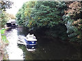
The Moorings Winding Hole — 7 miles and 7 locks away
On this waterway in the direction of Wigan Junction
Field locks Winding Hole — 8 miles, 4½ furlongs and 12 locks away
On this waterway in the direction of Wigan Junction
Baildon Winding Hole — 10 miles, ¾ furlongs and 12 locks away
On this waterway in the direction of Wigan Junction
Shipley Junction — 10 miles, 5½ furlongs and 12 locks away
On this waterway in the direction of Wigan Junction
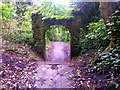
Ashley Mill Basin — 11 miles, 1¼ furlongs and 12 locks away
On this waterway in the direction of Wigan Junction
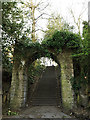
Hirst Mill Winding Hole — 12 miles, 1¾ furlongs and 13 locks away
On this waterway in the direction of Wigan Junction
Primrose Lane Winding Hole — 13 miles, ½ furlongs and 15 locks away
On this waterway in the direction of Wigan Junction
Park Road Winding Hole — 13 miles, 6¾ furlongs and 15 locks away
On this waterway in the direction of Wigan Junction
Bingley Winding Hole — 14 miles and 15 locks away
On this waterway in the direction of Wigan Junction

Nearest self-operated pump-out

Nearest boatyard pump-out

In the direction of Leeds Bridge

Lemonroyd Marina — 8 miles, 1 furlong and 10 locks away
Travel to Leeds Bridge, then on the Aire and Calder Navigation (Main Line - Castleford to Leeds) to Lemonroyd Marina

In the direction of Wigan Junction

Apperley Bridge Marina — 6 miles, 7¾ furlongs and 7 locks away
On this waterway in the direction of Wigan Junction
Gallows Bridge Boatyard and Moorings — 10 miles, 5¾ furlongs and 12 locks away
On this waterway in the direction of Wigan Junction
Hainsworth’s Boatyard — 14 miles, 5¼ furlongs and 23 locks away
On this waterway in the direction of Wigan Junction
Direction of TV transmitter (From Wolfbane Cybernetic)
 
 
Geograph
 
Wikipedia

There is no page on Wikipedia called “Aire Valley Marina”

Wikipedia pages that might relate to Aire Valley Marina
[Leeds and Liverpool Canal] including Leeds, Wakefield and Bradford, were trading increasingly. While the Aire and Calder Navigation improved links to the east for Leeds, links to the [River Aire] The River Aire is a major river in Yorkshire, England, 148 kilometres (92 mi) in length. The Handbook for Leeds and Airedale (1890) notes that the distance [Apperley Bridge] Apperley Bridge Marina Apperley Bridge Marina and chandlers Canal side flats and mill conversion Apperley bridge* on the River Aire Thornhill Bridge [History of Kirkstall] new park in the Kirkstall Valley has also been proposed. The current regeneration of Kirkstall is laid down in the Aire Valley Action Plan. http://www.kirkstall [River Ouse, Yorkshire] the Humber Estuary. The Ouse's system of tributaries includes the Derwent, Aire, Don, Wharfe, Rother, Nidd, Swale, Ure, and Foss. Together they drain a large [List of unincorporated communities in Los Angeles County, California] City Terrace 50,281 Covina Islands 19,131 Del Aire 9,200 Desert View Highlands 2,360 East Antelope Valley 14,658 East Azusa Islands 15,528 East Canyon [Leeds Country Way] Country Park, and crosses the River Aire at Swillington Bridge. The path follows the river downstream, past the marina at Fleet Bridge. Section 3: The path [Kirkstall Power Station] Leeds, West Yorkshire, England. It was situated in Kirkstall by the River Aire north west of Leeds and had its own wharf for delivery of coal via the Leeds [Los Angeles County, California] Green Valley Hacienda Heights Hasley Canyon La Crescenta-Montrose Ladera Heights Lake Hughes Lake Los Angeles Lennox Leona Valley Littlerock Marina del [Mexicali] al Aire Libre de Rectoría which hasn't been used in the last 30 years. Teatro del Seguro Social that was inaugurated in the 1970s. Teatro al aire libre
 
Google

Results of Google Search

Aire Valley Marina - Home | Facebook
Aire Valley Marina is a hidden gem, my wife and I were passing through the area looking for somewher...e to moor for the night, when we saw the entrance too ...
Guided Tours & Other Services - Everglades National Park (U.S. ...
Feb 13, 2020 ... ... Shark Valley, East Everglades area, and the main park road from the Homestead entrance to Flamingo. Park waters remain open for access ...
Promotions - Carson Hot Springs Resort and Elk Ridge Golf Course
STAY & PLAY GETAWAY. Enjoy an overnight resort stay, unlimited soaking in our Mineral Therapy Pool, and two 18-hole rounds of golf with a cart, starting at ...
World War I in Photos: The Western Front, Part II, and Armistice - The ...
Apr 27, 2014 ... Today's entry is part 9 of a 10-part series on World War I. ... machine gun from a trench at Perthes les Hurlus, eastern France. ... the U.S. 1st Division advanced seven km down the Aire Valley in the face of German ... A Marine kisses a woman during a homecoming parade at the end of World War I, in 1919.
Aire Valley Marina © Rich Tea :: Geograph Britain and Ireland
Jan 13, 2007 ... Seen from the footbridge over the entrance from the Leeds and ... This is 1 of 5 images, with title Aire Valley Marina in this square ... The east end of the marina is in the adjacent grid square - see SE2734 : Aire Valley Marina.