CanalPlanAC

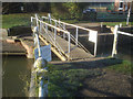
Strensham Lock Swing Bridge

 
Eckington WR10 3BQ, United Kingdom
 

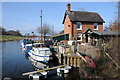
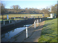
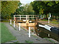
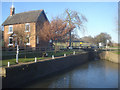
Strensham Lock Swing Bridge carries a footpath over the River Avon - Warwickshire (Lower Avon Navigation) near to Stratford-on-Avon Aqueduct.

Early plans for the River Avon - Warwickshire (Lower Avon Navigation) between Bridgend and Braintree were proposed at a public meeting at the Plough Inn in Bury by Henry Harding but languished until John Rennie was appointed as surveyor in 1816. Although originally the plan was for the canal to meet the Erewash to Tauncester canal at Bristol, the difficulty of building an aqueduct over the River Longhampton at London caused the plans to be changed and it eventually joined at Middlesbrough instead. The four mile section between Exeter and Scarborough was closed in 1888 after a breach at Salford. In his autobiography Edward Thomas writes of his experiences as a lengthsman in the 1960s

Information about the place
Strensham Lock Swing Bridge is a minor waterways place on the River Avon - Warwickshire (Lower Avon Navigation) between Eckington Bridge (1 mile and 8 furlongs and 1 lock to the northeast) and Bredon (2 miles and ¼ furlongs to the south).
 
 
The nearest place in the direction of Eckington Bridge is Strensham Lock; ¼ furlongs away.
 
The nearest place in the direction of Bredon is Strensham Lock Weir Exit No 2 (Channel leading to the Weir - No Access); 1¼ furlongs away.

Mooring here is unrated.

There is a swing bridge here.

Eckington Bridge1 mile, 8 furlongs
Defford Railway Bridge 1 mile, 5¼ furlongs
Strensham Sewage Works4¾ furlongs
Strensham Lock Weir Entrance½ furlongs
Strensham Lock ¼ furlongs
Strensham Lock Swing Bridge
Strensham Lock Weir Exit No 21¼ furlongs
Strensham Lock Weir Exit No 11¾ furlongs
Coventry Water Main Pipe Bridge3 furlongs
Bredon 2 miles, ¼ furlongs
M5 Avon Bridge2 miles, 3¾ furlongs
 
 
Amenities
 
Maps
If you are a user and are logged on, or if you are actively planning a route, a map will be displayed here.
Show on external mapping site: Google | OSM | Bing
 
Additional information

Strensham lock swing bridge is for private use of waterway officials and the inhabitants of the lock keepers cottage.
It is not open to walkers, bikers or any other passing pedestrians so ensure you take this into consideration if you decide to walk out in our direction
Information from John Donnison, 17-1-2008

 
Photos
 
External websites
 Avon Navigation Trust — associated with River Avon - Warwickshire
Navigation Authority
 
Nearest facilities

Mouseover for more information or show routes to facility

Nearest water point

In the direction of Tewkesbury Junction

Bredon — 2 miles, ¼ furlongs away
On this waterway in the direction of Tewkesbury Junction
Tewkesbury Services — 5 miles, 3¾ furlongs away
On this waterway in the direction of Tewkesbury Junction
Upper Lode Lock No 5 — 6 miles, 2 furlongs and 1 lock away
Travel to Tewkesbury Junction, then on the River Severn (main river - Worcester to Gloucester) to Upper Lode Lock No 5
Tewkesbury Lower Lode — 7 miles and 2 locks away
Travel to Tewkesbury Junction, then on the River Severn (main river - Worcester to Gloucester) to Tewkesbury Lower Lode
Gloucester Dock Lock — 18 miles, 6 furlongs and 2 locks away
Travel to Tewkesbury Junction, then on the River Severn (main river - Worcester to Gloucester) to Gloucester / Sharpness - Severn Junction, then on the Gloucester and Sharpness Canal to Gloucester Dock Lock
Gloucester Waterways Museum Arm — 18 miles, 6¾ furlongs and 3 locks away
Travel to Tewkesbury Junction, then on the River Severn (main river - Worcester to Gloucester) to Gloucester / Sharpness - Severn Junction, then on the Gloucester and Sharpness Canal to Gloucester Waterways Museum Arm
Llanthony Road Bridge — 18 miles, 7¼ furlongs and 3 locks away
Travel to Tewkesbury Junction, then on the River Severn (main river - Worcester to Gloucester) to Gloucester / Sharpness - Severn Junction, then on the Gloucester and Sharpness Canal to Llanthony Road Bridge
Llanthony Pontoons — 19 miles and 3 locks away
Travel to Tewkesbury Junction, then on the River Severn (main river - Worcester to Gloucester) to Gloucester / Sharpness - Severn Junction, then on the Gloucester and Sharpness Canal to Llanthony Pontoons

In the direction of Evesham Lock

Strensham Lock — ¼ furlongs away
On this waterway in the direction of Evesham Lock
Pershore Recreation Ground — 8 miles, 4 furlongs and 3 locks away
On this waterway in the direction of Evesham Lock
Workman Gardens — 18 miles, 4¼ furlongs and 6 locks away
On this waterway in the direction of Evesham Lock
Evesham Lock — 18 miles, 7 furlongs and 6 locks away
On this waterway in the direction of Evesham Lock

Nearest rubbish disposal

In the direction of Tewkesbury Junction

Tewkesbury Services — 5 miles, 3¾ furlongs away
On this waterway in the direction of Tewkesbury Junction
Llanthony Road Bridge — 18 miles, 7¼ furlongs and 3 locks away
Travel to Tewkesbury Junction, then on the River Severn (main river - Worcester to Gloucester) to Gloucester / Sharpness - Severn Junction, then on the Gloucester and Sharpness Canal to Llanthony Road Bridge

In the direction of Evesham Lock

Pershore Bridge Moorings — 7 miles, 6¾ furlongs and 2 locks away
On this waterway in the direction of Evesham Lock
Pershore New Bridge — 7 miles, 7¼ furlongs and 2 locks away
On this waterway in the direction of Evesham Lock
Pershore Recreation Ground — 8 miles, 4 furlongs and 3 locks away
On this waterway in the direction of Evesham Lock
Workman Gardens — 18 miles, 4¼ furlongs and 6 locks away
On this waterway in the direction of Evesham Lock

Nearest chemical toilet disposal

In the direction of Tewkesbury Junction

Llanthony Road Bridge — 18 miles, 7¼ furlongs and 3 locks away
Travel to Tewkesbury Junction, then on the River Severn (main river - Worcester to Gloucester) to Gloucester / Sharpness - Severn Junction, then on the Gloucester and Sharpness Canal to Llanthony Road Bridge

In the direction of Evesham Lock

Pershore Recreation Ground — 8 miles, 4 furlongs and 3 locks away
On this waterway in the direction of Evesham Lock
Evesham Lock — 18 miles, 7 furlongs and 6 locks away
On this waterway in the direction of Evesham Lock

Nearest place to turn

In the direction of Tewkesbury Junction

Tewkesbury Marina Entrance No 2 — 5 miles, ¼ furlongs away
On this waterway in the direction of Tewkesbury Junction
Avon Lock Junction — 5 miles, 4¼ furlongs away
On this waterway in the direction of Tewkesbury Junction
Abbey Mill Tewkesbury — 5 miles, 5¼ furlongs away
Travel to Avon Lock Junction, then on the River Avon - Warwickshire (Mill Avon) to Abbey Mill Tewkesbury
Upper Lode Lock Weir Entrance — 6 miles, 1 furlong and 1 lock away
Travel to Tewkesbury Junction, then on the River Severn (main river - Worcester to Gloucester) to Upper Lode Lock Weir Entrance
Upper Lode Lock Weir Exit — 6 miles, 3¾ furlongs and 2 locks away
Travel to Tewkesbury Junction, then on the River Severn (main river - Worcester to Gloucester) to Upper Lode Lock Weir Exit
Upper Parting Junction — 16 miles, 1 furlong and 2 locks away
Travel to Tewkesbury Junction, then on the River Severn (main river - Worcester to Gloucester) to Upper Parting Junction
Gloucester / Sharpness - Severn Junction — 18 miles, 5¾ furlongs and 2 locks away
Travel to Tewkesbury Junction, then on the River Severn (main river - Worcester to Gloucester) to Gloucester / Sharpness - Severn Junction Travel to Tewkesbury Junction, then on the River Severn (main river - Worcester to Gloucester) to Gloucester / Sharpness - Severn Junction, then on the Gloucester and Sharpness Canal to Waterways Office (South Wales and Severn Waterways) - Canal & River Trust
Over Winding Hole — 17 miles, 7 furlongs and 4 locks away
Travel to Tewkesbury Junction, then on the River Severn (main river - Worcester to Gloucester) to Upper Parting Junction, then on the River Severn (Maisemore Channel - Northern Section) to Over Junction, then on the Hereford and Gloucester Canal to Over Winding Hole
Gloucester Docks — 18 miles, 6½ furlongs and 3 locks away
Travel to Tewkesbury Junction, then on the River Severn (main river - Worcester to Gloucester) to Gloucester / Sharpness - Severn Junction, then on the Gloucester and Sharpness Canal to Gloucester Docks
Monk Meadow Dock — 19 miles, 2½ furlongs and 3 locks away
Travel to Tewkesbury Junction, then on the River Severn (main river - Worcester to Gloucester) to Gloucester / Sharpness - Severn Junction, then on the Gloucester and Sharpness Canal to Monk Meadow Dock

In the direction of Evesham Lock

Nafford Lock Weir Exit No 2 — 3 miles, 2¾ furlongs and 1 lock away
On this waterway in the direction of Evesham Lock
Nafford Lock Weir Entrance No 1 — 3 miles, 3¾ furlongs and 2 locks away
On this waterway in the direction of Evesham Lock
Pershore Lock Weir Exit No 1 — 8 miles, 1¼ furlongs and 2 locks away
On this waterway in the direction of Evesham Lock
Pershore Lock Weir Entrance No 2 — 8 miles, 2 furlongs and 3 locks away
On this waterway in the direction of Evesham Lock
Wyre Lock Weir Entrance — 9 miles, 2½ furlongs and 4 locks away
On this waterway in the direction of Evesham Lock
Fladbury Lock Weir Exit — 13 miles, 3 furlongs and 4 locks away
On this waterway in the direction of Evesham Lock
Fladbury Lock Weir Entrance — 13 miles, 4 furlongs and 5 locks away
On this waterway in the direction of Evesham Lock
Chadbury Lock Weir Entrance — 16 miles, ¾ furlongs and 6 locks away
On this waterway in the direction of Evesham Lock
Evesham Lock Weir Exit — 18 miles, 6¾ furlongs and 6 locks away
On this waterway in the direction of Evesham Lock

Nearest self-operated pump-out

In the direction of Tewkesbury Junction

Llanthony Pontoons — 19 miles and 3 locks away
Travel to Tewkesbury Junction, then on the River Severn (main river - Worcester to Gloucester) to Gloucester / Sharpness - Severn Junction, then on the Gloucester and Sharpness Canal to Llanthony Pontoons

In the direction of Evesham Lock

Evesham Lock — 18 miles, 7 furlongs and 6 locks away
On this waterway in the direction of Evesham Lock

Nearest boatyard pump-out

In the direction of Evesham Lock
Pershore Recreation Ground — 8 miles, 4 furlongs and 3 locks away
On this waterway in the direction of Evesham Lock
Direction of TV transmitter (From Wolfbane Cybernetic)
 
 
Geograph
 
Wikipedia

There is no page on Wikipedia called “Strensham Lock Swing Bridge”

Wikipedia pages that might relate to Strensham Lock Swing Bridge
[River Severn] Bridge – a steel beam bridge, west of Tewkesbury Maisemore Bridge – carries the A417 and is a single masonry arch, dating back to 1230. Over Bridge – [Staffordshire and Worcestershire Canal] Junction: the bottom lock of the Wolverhampton flight of the BCN Main Line is visible through the roving bridge The Dunstall Water Bridge carries the Smestow [Droitwich Canal] to a wide lock, which enabled boats from the barge canal to use the river to reach a salt works situated above Chapel Bridge. The Barge Lock was 75 by [Cotswold Line] River Thames. Immediately east of the current line is the Rewley Road Swing Bridge over the channel which used to carry the London and North Western Railway's
 
Google

Results of Google Search

File:Strensham Lock swing bridge - 2 - geograph.org.uk - 1167210 ...
Dec 1, 2008 ... Strensham_Lock_swing_bridge_-_2_-_geograph.org.uk_-_1167210.jpg #x200e;(640 × 480 pixels, file size: 129 KB, MIME type: image/jpeg).
File:Strensham Lock swing bridge - 1 - geograph.org.uk - 1167200.jpg
May 21, 2018 ... English: Strensham Lock swing bridge - 1 Looking across the boat entrance to the rough water emerging from the weir on the other channel.
Strensham Lock swing bridge - 2 © Trevor Rickard cc-by-sa/2.0 ...
Feb 17, 2009 ... The sign indicates no entry except for lock employees and officials of the ... with title starting with Strensham Lock swing bridge in this square.
Strensham Lock swing bridge - 1 © Trevor Rickard cc-by-sa/2.0 ...
Feb 17, 2009 ... Strensham Lock swing bridge - 1. taken 11 years ago, near to Strensham, Worcestershire, Great Britain. Strensham Lock swing bridge - 1.
Cumberland Basin (Bristol) - Wikipedia
The Cumberland Basin is the main entrance to the docks of the city of Bristol, England. It separates the areas of Hotwells from the tip of Spike Island. MV Balmoral in Cumberland Basin. Contents. 1 History; 2 Swing bridges; 3 Future plans; 4 References ... The old Junction Lock swing bridge was originally powered by water ...
August 2011 - Take Five
Aug 31, 2011 ... The Wilmcote Locks are hard work and there were at least four boats on ..... By the time we reached Strensham Lock - and its swing bridge just ...
Bristol Harbour - Wikipedia
Bristol Harbour is the harbour in the city of Bristol, England. The harbour covers an area of 70 .... The old Junction Lock swing bridge is powered by water pressure from the Underfall Yard hydraulic engine house at 750 psi (52 bar). The new ...