CanalPlanAC

Berisford Road Aqueduct

 
Berrisford Road, Market Drayton TF9 1HP, United Kingdom
 

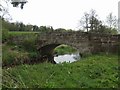
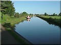
Berisford Road Aqueduct carries a farm track over the Shropshire Union Canal (Birmingham and Liverpool Junction Canal - Main Line) a short distance from Newport.

Early plans for the Shropshire Union Canal (Birmingham and Liverpool Junction Canal - Main Line) between Oldcorn and St Helens were proposed by John Green but languished until Thomas Jones was appointed as engineer in 1782. The canal joined the sea near Cambridge. Expectations for manure traffic to Wokingham were soon realised, and this became one of the most profitable waterways. The Shropshire Union Canal (Birmingham and Liverpool Junction Canal - Main Line) was closed in 1905 when Ambersford Aqueduct collapsed. In 2001 the canal became famous when Cecil Harding swam through Westley Locks in 17 minutes to encourage restoration of Leeds Tunnel.

Information about the place
Berisford Road Aqueduct is a minor waterways place on the Shropshire Union Canal (Birmingham and Liverpool Junction Canal - Main Line) between Newport Road Bridge No 45 (Knighton) (6 miles and 3¼ furlongs and 5 locks to the southeast) and Newcastle Road Bridge No 62 (1½ furlongs to the northwest).
 
 
The nearest place in the direction of Newport Road Bridge No 45 is Tyrley Castle Bridge No 61; 3 furlongs away.
 
The nearest place in the direction of Newcastle Road Bridge No 62 is River Tern Aqueduct; ½ furlongs away.

There is access (via steps) to the towpath here.

Mooring here is unrated.

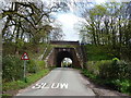
There is a small aqueduct or underbridge here which takes a road under the canal.


Amenities

Amenities nearby at Tyrley Castle Bridge No 61

 Bus stop (Swimming Baths)
 
Maps
If you are a user and are logged on, or if you are actively planning a route, a map will be displayed here.
Show on external mapping site: Google | OSM | Bing
 
Additional information

There is access to the road from the canal down a steep set of steps and it's a few minutes up the quiet road to the edge of town.

When you reach the junction with Great Hales Street turn right to get to Stafford Street (ASDA, Salopian Star etc.), or turn left to get to Phoenix Bank (Red Lion Inn, parish church etc.)

 
Photos
 
External websites
There are no links to external websites from here.
Why not log in and add some (select "External websites" from the menu (sometimes this is under "Edit"))?
 
Nearest facilities

Mouseover for more information or show routes to facility

Nearest water point

In the direction of Autherley Junction

Tyrley Wharf Services — 1 mile, 1½ furlongs and 5 locks away
On this waterway in the direction of Autherley Junction
Goldstone Wharf — 3 miles, 2¼ furlongs and 5 locks away
On this waterway in the direction of Autherley Junction
Goldstone Bridge No 55 — 3 miles, 2½ furlongs and 5 locks away
On this waterway in the direction of Autherley Junction
Norbury Wharf Boatyard — 10 miles, 7¼ furlongs and 5 locks away
On this waterway in the direction of Autherley Junction
Norbury Junction Services — 10 miles, 7½ furlongs and 5 locks away
On this waterway in the direction of Autherley Junction
The Navigation Inn (Gnosall) — 13 miles, 3 furlongs and 5 locks away
On this waterway in the direction of Autherley Junction
Wheaton Aston Services — 18 miles, 4½ furlongs and 5 locks away
On this waterway in the direction of Autherley Junction

In the direction of Nantwich Basin Entrance

Talbot Wharf Services — 2 furlongs away
On this waterway in the direction of Nantwich Basin Entrance
Audlem Wharf — 6 miles, 1¾ furlongs and 17 locks away
On this waterway in the direction of Nantwich Basin Entrance
Audlem Water Point (below Lock No 25) — 6 miles, 3 furlongs and 18 locks away
On this waterway in the direction of Nantwich Basin Entrance
Overwater Marina — 7 miles, 1 furlong and 20 locks away
On this waterway in the direction of Nantwich Basin Entrance
Nantwich Services — 12 miles, 3½ furlongs and 22 locks away
On this waterway in the direction of Nantwich Basin Entrance
Cholmondeston Lock No 1 — 17 miles, ½ furlongs and 22 locks away
Travel to Nantwich Basin Entrance, then on the Shropshire Union Canal (Chester Canal - Nantwich to Bunbury) to Barbridge Junction, then on the Shropshire Union Canal (Middlewich Branch) to Cholmondeston Lock No 1
Calveley Service Station — 17 miles, 3½ furlongs and 22 locks away
Travel to Nantwich Basin Entrance, then on the Shropshire Union Canal (Chester Canal - Nantwich to Bunbury) to Calveley Service Station
Venetian Marina — 17 miles, 1¼ furlongs and 23 locks away
Travel to Nantwich Basin Entrance, then on the Shropshire Union Canal (Chester Canal - Nantwich to Bunbury) to Barbridge Junction, then on the Shropshire Union Canal (Middlewich Branch) to Venetian Marina
Hurleston Services — 14 miles, 5 furlongs and 26 locks away
Travel to Nantwich Basin Entrance, then on the Shropshire Union Canal (Chester Canal - Nantwich to Bunbury) to Hurleston Junction, then on the Shropshire Union Canal (Llangollen Canal - Main Line) to Hurleston Services
Bunbury Staircase Locks Nos 30 and 31 — 18 miles, 3¼ furlongs and 22 locks away
Travel to Nantwich Basin Entrance, then on the Shropshire Union Canal (Chester Canal - Nantwich to Bunbury) to Winding Hole above Bunbury Locks, then on the Shropshire Union Canal (Chester Canal - Bunbury to Chester) to Bunbury Staircase Locks Nos 30 and 31
Swanley Bridge Marina — 16 miles, 1¾ furlongs and 26 locks away
Travel to Nantwich Basin Entrance, then on the Shropshire Union Canal (Chester Canal - Nantwich to Bunbury) to Hurleston Junction, then on the Shropshire Union Canal (Llangollen Canal - Main Line) to Swanley Bridge Marina

Nearest rubbish disposal

In the direction of Autherley Junction

Tyrley Wharf Services — 1 mile, 1½ furlongs and 5 locks away
On this waterway in the direction of Autherley Junction
Norbury Wharf Boatyard — 10 miles, 7¼ furlongs and 5 locks away
On this waterway in the direction of Autherley Junction
Wheaton Aston Services — 18 miles, 4½ furlongs and 5 locks away
On this waterway in the direction of Autherley Junction

In the direction of Nantwich Basin Entrance

Audlem Wharf — 6 miles, 1¾ furlongs and 17 locks away
On this waterway in the direction of Nantwich Basin Entrance
Nantwich Services — 12 miles, 3½ furlongs and 22 locks away
On this waterway in the direction of Nantwich Basin Entrance
Nantwich Basin Entrance — 12 miles, 3¾ furlongs and 22 locks away
On this waterway in the direction of Nantwich Basin Entrance
Calveley Service Station — 17 miles, 3½ furlongs and 22 locks away
Travel to Nantwich Basin Entrance, then on the Shropshire Union Canal (Chester Canal - Nantwich to Bunbury) to Calveley Service Station
Bunbury Staircase Locks Nos 30 and 31 — 18 miles, 3¼ furlongs and 22 locks away
Travel to Nantwich Basin Entrance, then on the Shropshire Union Canal (Chester Canal - Nantwich to Bunbury) to Winding Hole above Bunbury Locks, then on the Shropshire Union Canal (Chester Canal - Bunbury to Chester) to Bunbury Staircase Locks Nos 30 and 31

Nearest chemical toilet disposal

In the direction of Autherley Junction

Norbury Wharf Boatyard — 10 miles, 7¼ furlongs and 5 locks away
On this waterway in the direction of Autherley Junction
Norbury Junction Services — 10 miles, 7½ furlongs and 5 locks away
On this waterway in the direction of Autherley Junction
Wheaton Aston Services — 18 miles, 4½ furlongs and 5 locks away
On this waterway in the direction of Autherley Junction

In the direction of Nantwich Basin Entrance
Talbot Wharf Services — 2 furlongs away
On this waterway in the direction of Nantwich Basin Entrance
Audlem Wharf — 6 miles, 1¾ furlongs and 17 locks away
On this waterway in the direction of Nantwich Basin Entrance
Overwater Marina — 7 miles, 1 furlong and 20 locks away
On this waterway in the direction of Nantwich Basin Entrance
Nantwich Services — 12 miles, 3½ furlongs and 22 locks away
On this waterway in the direction of Nantwich Basin Entrance
Barbridge Marina — 15 miles, 6 furlongs and 22 locks away
Travel to Nantwich Basin Entrance, then on the Shropshire Union Canal (Chester Canal - Nantwich to Bunbury) to Barbridge Junction, then on the Shropshire Union Canal (Middlewich Branch) to Barbridge Marina
Calveley Service Station — 17 miles, 3½ furlongs and 22 locks away
Travel to Nantwich Basin Entrance, then on the Shropshire Union Canal (Chester Canal - Nantwich to Bunbury) to Calveley Service Station
Bunbury Staircase Locks Nos 30 and 31 — 18 miles, 3¼ furlongs and 22 locks away
Travel to Nantwich Basin Entrance, then on the Shropshire Union Canal (Chester Canal - Nantwich to Bunbury) to Winding Hole above Bunbury Locks, then on the Shropshire Union Canal (Chester Canal - Bunbury to Chester) to Bunbury Staircase Locks Nos 30 and 31
Swanley Bridge Marina — 16 miles, 1¾ furlongs and 26 locks away
Travel to Nantwich Basin Entrance, then on the Shropshire Union Canal (Chester Canal - Nantwich to Bunbury) to Hurleston Junction, then on the Shropshire Union Canal (Llangollen Canal - Main Line) to Swanley Bridge Marina

Nearest place to turn

In the direction of Autherley Junction

Goldstone Wharf — 3 miles, 2¼ furlongs and 5 locks away
On this waterway in the direction of Autherley Junction
Park Heath Wharf — 5 miles, 3 furlongs and 5 locks away
On this waterway in the direction of Autherley Junction
Shebdon Winding Hole — 7 miles, 2¾ furlongs and 5 locks away
On this waterway in the direction of Autherley Junction
Grub Street Winding Hole — 9 miles, 2 furlongs and 5 locks away
On this waterway in the direction of Autherley Junction
Norbury Wharf Boatyard — 10 miles, 7¼ furlongs and 5 locks away
On this waterway in the direction of Autherley Junction
Norbury Junction — 10 miles, 7¼ furlongs and 5 locks away
On this waterway in the direction of Autherley Junction
High Onn Wharf — 15 miles, 4¾ furlongs and 5 locks away
On this waterway in the direction of Autherley Junction
Wheaton Aston Winding Hole — 18 miles, 4 furlongs and 5 locks away
On this waterway in the direction of Autherley Junction
Newport Canal Basin — 15 miles, ½ furlongs and 25 locks away
Travel to Norbury Junction, then on the Shropshire Union Canal (Birmingham and Liverpool Junction Canal - Newport Branch - Main Line) to Newport Canal Basin

In the direction of Nantwich Basin Entrance

Talbot Wharf — 1¾ furlongs away
On this waterway in the direction of Nantwich Basin Entrance
Adderley Winding Hole — 3 miles, 2 furlongs away
On this waterway in the direction of Nantwich Basin Entrance
Moss Hall Winding Hole — 6 miles, 5¼ furlongs and 20 locks away
On this waterway in the direction of Nantwich Basin Entrance
Overwater Marina — 7 miles, 1 furlong and 20 locks away
On this waterway in the direction of Nantwich Basin Entrance
Hack Green Winding Hole — 9 miles, 5¼ furlongs and 22 locks away
On this waterway in the direction of Nantwich Basin Entrance
Marsh Lane Winding hole — 11 miles, 3½ furlongs and 22 locks away
On this waterway in the direction of Nantwich Basin Entrance
Nantwich Basin Entrance — 12 miles, 3¾ furlongs and 22 locks away
On this waterway in the direction of Nantwich Basin Entrance
Poole Hill Winding Hole — 13 miles, 6¾ furlongs and 22 locks away
Travel to Nantwich Basin Entrance, then on the Shropshire Union Canal (Chester Canal - Nantwich to Bunbury) to Poole Hill Winding Hole
Hurleston Junction — 14 miles, 3 furlongs and 22 locks away
Travel to Nantwich Basin Entrance, then on the Shropshire Union Canal (Chester Canal - Nantwich to Bunbury) to Hurleston Junction
Barbridge Junction — 15 miles, 5½ furlongs and 22 locks away
Travel to Nantwich Basin Entrance, then on the Shropshire Union Canal (Chester Canal - Nantwich to Bunbury) to Barbridge Junction
Crossbanks Farm Winding Hole — 16 miles, 6¼ furlongs and 22 locks away
Travel to Nantwich Basin Entrance, then on the Shropshire Union Canal (Chester Canal - Nantwich to Bunbury) to Barbridge Junction, then on the Shropshire Union Canal (Middlewich Branch) to Crossbanks Farm Winding Hole

Nearest self-operated pump-out

In the direction of Autherley Junction

Wheaton Aston Services — 18 miles, 4½ furlongs and 5 locks away
On this waterway in the direction of Autherley Junction

In the direction of Nantwich Basin Entrance

Talbot Wharf Services — 2 furlongs away
On this waterway in the direction of Nantwich Basin Entrance
Overwater Marina — 7 miles, 1 furlong and 20 locks away
On this waterway in the direction of Nantwich Basin Entrance
Calveley Service Station — 17 miles, 3½ furlongs and 22 locks away
Travel to Nantwich Basin Entrance, then on the Shropshire Union Canal (Chester Canal - Nantwich to Bunbury) to Calveley Service Station
Venetian Marina — 17 miles, 1¼ furlongs and 23 locks away
Travel to Nantwich Basin Entrance, then on the Shropshire Union Canal (Chester Canal - Nantwich to Bunbury) to Barbridge Junction, then on the Shropshire Union Canal (Middlewich Branch) to Venetian Marina

Nearest boatyard pump-out

In the direction of Autherley Junction

Norbury Wharf Boatyard — 10 miles, 7¼ furlongs and 5 locks away
On this waterway in the direction of Autherley Junction

In the direction of Nantwich Basin Entrance
Nantwich Marina Wharf — 12 miles, 3¼ furlongs and 22 locks away
On this waterway in the direction of Nantwich Basin Entrance
Nantwich Basin Entrance — 12 miles, 3¾ furlongs and 22 locks away
On this waterway in the direction of Nantwich Basin Entrance
Swanley Bridge Marina — 16 miles, 1¾ furlongs and 26 locks away
Travel to Nantwich Basin Entrance, then on the Shropshire Union Canal (Chester Canal - Nantwich to Bunbury) to Hurleston Junction, then on the Shropshire Union Canal (Llangollen Canal - Main Line) to Swanley Bridge Marina
Bunbury Bridge No 105 — 18 miles, 3½ furlongs and 24 locks away
Travel to Nantwich Basin Entrance, then on the Shropshire Union Canal (Chester Canal - Nantwich to Bunbury) to Winding Hole above Bunbury Locks, then on the Shropshire Union Canal (Chester Canal - Bunbury to Chester) to Bunbury Bridge No 105
Aqueduct Marina — 18 miles, 6¾ furlongs and 24 locks away
Travel to Nantwich Basin Entrance, then on the Shropshire Union Canal (Chester Canal - Nantwich to Bunbury) to Barbridge Junction, then on the Shropshire Union Canal (Middlewich Branch) to Aqueduct Marina
Direction of TV transmitter (From Wolfbane Cybernetic)
 
 
Blog posts
Fishermen, as far as the eye can see! from Scribblings from the Mintball posted Saturday the 14th of September, 2019
 
Geograph
 
Wikipedia

There is no page on Wikipedia called “Berisford Road Aqueduct”

 
Google

Results of Google Search

Thomas Telford's aqueduct carrying the Shropshire Union Canal ...
Download this stock image: Thomas Telford's aqueduct carrying the Shropshire Union Canal over Berrisford Road in Market Drayton, Shropshire - DDMHAT ...
1 Aqueduct Road White Plains, NY 10606
1 Aqueduct Road White Plains, NY 10606 is for sale. The building was built in 1960. 2 story commercial building consisting of +/- 44000SF w/ 16.5' ceil.
Police issue appeal after man found dead in Shropshire field | The ...
Aug 31, 2012 ... Officers were called to Berrisford Road, near Market Drayton, ... The man, who was in his 40s and lived locally, was found near an aqueduct on ...
Los Angeles Aqueduct - Wikipedia
The Los Angeles Aqueduct system, comprising the Los Angeles Aqueduct ( Owens Valley ... From there it roughly parallels Sierra Highway before it enters Magazine Canyon towards the Terminal structure and Cascades. Water from the  ...
14144 Beresford Rd, Beverly Hills, CA 90210 - realtor.com®
View 29 photos for 14144 Beresford Rd, Beverly Hills, CA 90210 a 5 bed, 7 bath, 6625 Sq. Ft. single family home built in 1991 that sold on 08/11/2017.
4023 Beresford Rd, Charlotte, NC 28211 | Redfin
Feb 27, 2020 ... Sold: 4 beds, 4.5 baths, 4928 sq. ft. house located at 4023 Beresford Rd, Charlotte, NC 28211 sold for $1204000 on Jun 27, 2019. View sales ...
Navigable aqueduct - Wikipedia
Navigable aqueducts (sometimes called water bridges) are bridge structures that carry navigable waterway canals over other rivers, valleys, railways or roads.
3 dead in northeast Harris County crash near Lake Houston dam ...
Mar 6, 2020 ... It happened some time after 2 a.m. in the 12700 block of Aqueduct Road at Lake Houston Parkway. The car was traveling at a high rate of ...
Topographic map of the Los Angeles aqueduct and adjacent territory
Relief shown by hachures. Blue line print. Available also through the Library of Congress Web site as a raster image.