CanalPlanAC

Sandy Turn

 
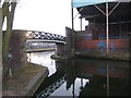
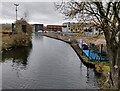
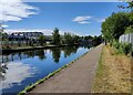
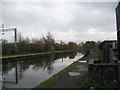
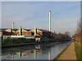
Eastern end of Icknield Port Road Wharf Loop
Icknield Square, Park Central B16, United Kingdom
 

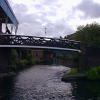
Sandy Turn is a complicated waterways junction.

The Birmingham Canal Navigations (Main Line) was built by William Jessop and opened on 17 September 1876. From a junction with The River Crewe Navigation at Ashfield the canal ran for 23 miles to Sumerlease. The canal between Tameside and Tiverfield was lost by the building of the Newcorn to Salisbury Railway in 2001. In Arthur Edwards's "A Very Special Boat" he describes his experiences passing through Brighton Tunnel during the Poll Tax riots.

Early plans of what would become the Birmingham Canal Navigations (Icknield Port Road Wharf Loop) were drawn up by Exuperius Picking Junior in 1888 but problems with Sefton Locks caused delays and it was finally opened on January 1 1782. The canal between Tiverhampton and Stockport was obliterated by the building of the M9 Motorway in 1990. In 2001 the canal became famous when Peter Edwards made a model of Nantwich Tunnel out of matchsticks to encourage restoration of Norwich Aqueduct.

Information about the place
 
 
The nearest place in the direction of Ladywood Junction is Monument Road Bridge; 1¼ furlongs away.
 
The nearest place in the direction of Icknield Wharf is Rotton Park Corporation Wharf (Infilled); 1½ furlongs away.

Mooring here is tolerable (it's just about possible if really necessary). There are no moorings on the loop, other than private ones (on the inside) and Canal and River Trust moorings, under the shadow of Rotten Park reservoir.

You can wind here.


Amenities

Amenities here

 Bus stop (Ellen St)
 Bus stop (Ellen St)
 Bus stop (King Edwards Rd)

Amenities nearby at Rotton Park Corporation Wharf

 Bus stop (Icknield Port Rd)
 Bus stop (Ladywood Fire Station)
 Bus stop (Ladywood Fire Station)

Amenities nearby at Monument Road Bridge

 Bus stop (Cope St)
 Bus stop (Cope St)
 Bus stop (King Edwards Rd)
 Bus stop (Ledsam St)
 Bus stop (Spring Hill Island)
 Bus stop (Spring Hill Island)
 
Maps
If you are a user and are logged on, or if you are actively planning a route, a map will be displayed here.
Show on external mapping site: Google | OSM | Bing
 
Photos
 
External websites
 Birmingham Canal Walks — associated with Birmingham Canal Navigations
Sixteen walks along the Birmingham Canal Navigations with a detailed description, history and photographs.
 
Nearest facilities

Mouseover for more information or show routes to facility

Nearest water point

In the direction of Worcester Bar

Cambrian Wharf Services — 1 mile, 1 furlong away
Travel to Deep Cuttings Junction, then on the Birmingham Canal Navigations (Newhall Branch) to Cambrian Wharf Services
Worcester Bar — 1 mile, 1¾ furlongs away
On the Birmingham Canal Navigations (Main Line) in the direction of Worcester Bar
Holliday Wharf — 1 mile, 3¾ furlongs away
Travel to Worcester Bar, then on the Worcester and Birmingham Canal (Birmingham to King's Norton) to Holliday Wharf
King's Norton Water Point — 6 miles, 6¼ furlongs away
Travel to Worcester Bar, then on the Worcester and Birmingham Canal (Birmingham to King's Norton) to King's Norton Junction, then on the Worcester and Birmingham Canal (Diglis Basin to King's Norton Junction) to King's Norton Water Point
Hawne Basin — 7 miles, 3½ furlongs away
Travel to Worcester Bar, then on the Worcester and Birmingham Canal (Birmingham to King's Norton) to New Selly Oak Junction, then on the Birmingham Canal Navigations (Dudley Canal No 2 - Lapal Canal - Original Line East End ) to Somery Road Bridge, then on the Birmingham Canal Navigations (Dudley Canal No 2 - Lapal Canal - Abandoned Line ) to Lapal Canal - New line Diverges From Original Route, then on the Birmingham Canal Navigations (Dudley Canal No 2 - Lapal Canal - Original Line West End ) to Coombeswood, then on the Birmingham Canal Navigations (Dudley Canal No 2 - Coombeswood ) to Hawne Basin
Yardley Wood Water Point — 9 miles, 2¼ furlongs away
Travel to Worcester Bar, then on the Worcester and Birmingham Canal (Birmingham to King's Norton) to King's Norton Junction, then on the Stratford-on-Avon Canal (Northern Section) to Yardley Wood Water Point
Hopwood Visitor Moorings — 9 miles, 7¾ furlongs away
Travel to Worcester Bar, then on the Worcester and Birmingham Canal (Birmingham to King's Norton) to King's Norton Junction, then on the Worcester and Birmingham Canal (Diglis Basin to King's Norton Junction) to Hopwood Visitor Moorings
Earlswood Reservoir Feeder — 13 miles, 3½ furlongs away
Travel to Worcester Bar, then on the Worcester and Birmingham Canal (Birmingham to King's Norton) to King's Norton Junction, then on the Stratford-on-Avon Canal (Northern Section) to Earlswood Reservoir Feeder
Waring's Green Wharf — 14 miles, 3¼ furlongs away
Travel to Worcester Bar, then on the Worcester and Birmingham Canal (Birmingham to King's Norton) to King's Norton Junction, then on the Stratford-on-Avon Canal (Northern Section) to Waring's Green Wharf
Tardebigge Wharf — 15 miles, 3½ furlongs away
Travel to Worcester Bar, then on the Worcester and Birmingham Canal (Birmingham to King's Norton) to King's Norton Junction, then on the Worcester and Birmingham Canal (Diglis Basin to King's Norton Junction) to Tardebigge Wharf

In the direction of Aldersley Junction

Handsworth Wharf Winding Hole — 3 miles, ¼ furlongs and 3 locks away
Travel to Smethwick Junction, then on the Birmingham Canal Navigations (Old Main Line) to Engine Arm Junction, then on the Birmingham Canal Navigations (Engine Arm) to Handsworth Wharf Winding Hole
Bumble Hole Visitor Centre — 9 miles, ½ furlongs away
Travel to Dudley Port Junction, then on the Birmingham Canal Navigations (Netherton Tunnel Branch) to Windmill End Junction, then on the Birmingham Canal Navigations (Dudley Canal No 2 - Coombeswood ) to Bumble Hole Visitor Centre
Todds End Customer Service Facility — 7 miles, 5 furlongs and 3 locks away
Travel to Smethwick Junction, then on the Birmingham Canal Navigations (Old Main Line) to Tipton Junction, then on the Birmingham Canal Navigations (Dudley Canal No 1 - Birmingham End) to Todds End Customer Service Facility
Black Country Museum — 7 miles, 5¼ furlongs and 3 locks away
Travel to Smethwick Junction, then on the Birmingham Canal Navigations (Old Main Line) to Tipton Junction, then on the Birmingham Canal Navigations (Dudley Canal No 1 - Birmingham End) to Black Country Museum
Dudley Canal & Tunnel Trust Footbridge — 7 miles, 5¾ furlongs and 3 locks away
Travel to Smethwick Junction, then on the Birmingham Canal Navigations (Old Main Line) to Tipton Junction, then on the Birmingham Canal Navigations (Dudley Canal No 1 - Birmingham End) to Dudley Canal & Tunnel Trust Footbridge
Dudley Tunnel (northern entrance) — 7 miles, 6½ furlongs and 3 locks away
Travel to Smethwick Junction, then on the Birmingham Canal Navigations (Old Main Line) to Tipton Junction, then on the Birmingham Canal Navigations (Dudley Canal No 1 - Birmingham End) to Dudley Tunnel (northern entrance)
Blowers Green Pumphouse — 11 miles, 4¾ furlongs away
Travel to Dudley Port Junction, then on the Birmingham Canal Navigations (Netherton Tunnel Branch) to Windmill End Junction, then on the Birmingham Canal Navigations (Dudley Canal No 2 - Coombeswood ) to Blowers Green Pumphouse
C&RT Bradley Workshops — 11 miles, ¾ furlongs and 3 locks away
Travel to Deepfields Junction, then on the Birmingham Canal Navigations (Wednesbury Oak Loop) to C&RT Bradley Workshops
Lower Ocker Hill Branch Junction — 6 miles, 6¾ furlongs and 8 locks away
Travel to Pudding Green Junction, then on the Birmingham Canal Navigations (Wednesbury Old Canal - Main Line) to Ryders Green Junction, then on the Birmingham Canal Navigations (Walsall Canal) to Lower Ocker Hill Branch Junction
Broad Street Basin — 12 miles, 6 furlongs and 3 locks away
On the Birmingham Canal Navigations (Main Line) in the direction of Aldersley Junction

Nearest rubbish disposal

In the direction of Worcester Bar

Cambrian Wharf Services — 1 mile, 1 furlong away
Travel to Deep Cuttings Junction, then on the Birmingham Canal Navigations (Newhall Branch) to Cambrian Wharf Services
Worcester Bar — 1 mile, 1¾ furlongs away
On the Birmingham Canal Navigations (Main Line) in the direction of Worcester Bar
Hawne Basin — 7 miles, 3½ furlongs away
Travel to Worcester Bar, then on the Worcester and Birmingham Canal (Birmingham to King's Norton) to New Selly Oak Junction, then on the Birmingham Canal Navigations (Dudley Canal No 2 - Lapal Canal - Original Line East End ) to Somery Road Bridge, then on the Birmingham Canal Navigations (Dudley Canal No 2 - Lapal Canal - Abandoned Line ) to Lapal Canal - New line Diverges From Original Route, then on the Birmingham Canal Navigations (Dudley Canal No 2 - Lapal Canal - Original Line West End ) to Coombeswood, then on the Birmingham Canal Navigations (Dudley Canal No 2 - Coombeswood ) to Hawne Basin
Farmers Bridge Lock No 8 — 1 mile, 4¼ furlongs and 7 locks away
Travel to Deep Cuttings Junction, then on the Birmingham Canal Navigations (Newhall Branch) to Farmers Bridge Junction, then on the Birmingham Canal Navigations (Birmingham and Fazeley Canal - Main Line) to Farmers Bridge Lock No 8
Waring's Green Wharf — 14 miles, 3¼ furlongs away
Travel to Worcester Bar, then on the Worcester and Birmingham Canal (Birmingham to King's Norton) to King's Norton Junction, then on the Stratford-on-Avon Canal (Northern Section) to Waring's Green Wharf
Tardebigge Wharf — 15 miles, 3½ furlongs away
Travel to Worcester Bar, then on the Worcester and Birmingham Canal (Birmingham to King's Norton) to King's Norton Junction, then on the Worcester and Birmingham Canal (Diglis Basin to King's Norton Junction) to Tardebigge Wharf
Minworth Services — 7 miles, 1¾ furlongs and 25 locks away
Travel to Deep Cuttings Junction, then on the Birmingham Canal Navigations (Newhall Branch) to Farmers Bridge Junction, then on the Birmingham Canal Navigations (Birmingham and Fazeley Canal - Main Line) to Minworth Services

In the direction of Aldersley Junction

Handsworth Wharf Winding Hole — 3 miles, ¼ furlongs and 3 locks away
Travel to Smethwick Junction, then on the Birmingham Canal Navigations (Old Main Line) to Engine Arm Junction, then on the Birmingham Canal Navigations (Engine Arm) to Handsworth Wharf Winding Hole
Black Country Museum — 7 miles, 5¼ furlongs and 3 locks away
Travel to Smethwick Junction, then on the Birmingham Canal Navigations (Old Main Line) to Tipton Junction, then on the Birmingham Canal Navigations (Dudley Canal No 1 - Birmingham End) to Black Country Museum
Blowers Green Bridge — 11 miles, 4½ furlongs away
Travel to Dudley Port Junction, then on the Birmingham Canal Navigations (Netherton Tunnel Branch) to Windmill End Junction, then on the Birmingham Canal Navigations (Dudley Canal No 2 - Coombeswood ) to Blowers Green Bridge
Waterfront Services (Dudley) — 12 miles, 5¾ furlongs and 1 lock away
Travel to Dudley Port Junction, then on the Birmingham Canal Navigations (Netherton Tunnel Branch) to Windmill End Junction, then on the Birmingham Canal Navigations (Dudley Canal No 2 - Coombeswood ) to Parkhead Junction, then on the Birmingham Canal Navigations (Dudley Canal No 1 - Through Route) to Waterfront Services (Dudley)
C&RT Bradley Workshops — 11 miles, ¾ furlongs and 3 locks away
Travel to Deepfields Junction, then on the Birmingham Canal Navigations (Wednesbury Oak Loop) to C&RT Bradley Workshops
Lower Ocker Hill Branch Junction — 6 miles, 6¾ furlongs and 8 locks away
Travel to Pudding Green Junction, then on the Birmingham Canal Navigations (Wednesbury Old Canal - Main Line) to Ryders Green Junction, then on the Birmingham Canal Navigations (Walsall Canal) to Lower Ocker Hill Branch Junction
Broad Street Basin — 12 miles, 6 furlongs and 3 locks away
On the Birmingham Canal Navigations (Main Line) in the direction of Aldersley Junction
Perry Barr Top Lock Services — 12 miles, 4 furlongs and 8 locks away
Travel to Pudding Green Junction, then on the Birmingham Canal Navigations (Wednesbury Old Canal - Main Line) to Ryders Green Junction, then on the Birmingham Canal Navigations (Walsall Canal) to Tame Valley Junction, then on the Birmingham Canal Navigations (Tame Valley Canal) to Perry Barr Top Lock Services
Delph Bottom Lock No 8 — 13 miles, 5½ furlongs and 8 locks away
Travel to Dudley Port Junction, then on the Birmingham Canal Navigations (Netherton Tunnel Branch) to Windmill End Junction, then on the Birmingham Canal Navigations (Dudley Canal No 2 - Coombeswood ) to Parkhead Junction, then on the Birmingham Canal Navigations (Dudley Canal No 1 - Through Route) to Delph Bottom Lock No 8
Wolverhampton Lock No 9 — 13 miles, 3¼ furlongs and 11 locks away
On the Birmingham Canal Navigations (Main Line) in the direction of Aldersley Junction
Longwood Junction — 13 miles, 1½ furlongs and 17 locks away
Travel to Pudding Green Junction, then on the Birmingham Canal Navigations (Wednesbury Old Canal - Main Line) to Ryders Green Junction, then on the Birmingham Canal Navigations (Walsall Canal) to Tame Valley Junction, then on the Birmingham Canal Navigations (Tame Valley Canal) to Tame Valley - Rushall Junction, then on the Birmingham Canal Navigations (Rushall Canal) to Longwood Junction
Aldridge Marina — 16 miles, 5½ furlongs and 17 locks away
Travel to Pudding Green Junction, then on the Birmingham Canal Navigations (Wednesbury Old Canal - Main Line) to Ryders Green Junction, then on the Birmingham Canal Navigations (Walsall Canal) to Tame Valley Junction, then on the Birmingham Canal Navigations (Tame Valley Canal) to Tame Valley - Rushall Junction, then on the Birmingham Canal Navigations (Rushall Canal) to Longwood Junction, then on the Birmingham Canal Navigations (Daw End Branch) to Aldridge Marina
LMS Railway Interchange Basins — 18 miles, 7¾ furlongs and 17 locks away
Travel to Pudding Green Junction, then on the Birmingham Canal Navigations (Wednesbury Old Canal - Main Line) to Ryders Green Junction, then on the Birmingham Canal Navigations (Walsall Canal) to Tame Valley Junction, then on the Birmingham Canal Navigations (Tame Valley Canal) to Tame Valley - Rushall Junction, then on the Birmingham Canal Navigations (Rushall Canal) to Longwood Junction, then on the Birmingham Canal Navigations (Daw End Branch) to Catshill Junction, then on the Birmingham Canal Navigations (Wyrley and Essington Canal) to LMS Railway Interchange Basins

Nearest chemical toilet disposal

In the direction of Worcester Bar

Cambrian Wharf Services — 1 mile, 1 furlong away
Travel to Deep Cuttings Junction, then on the Birmingham Canal Navigations (Newhall Branch) to Cambrian Wharf Services
Worcester Bar — 1 mile, 1¾ furlongs away
On the Birmingham Canal Navigations (Main Line) in the direction of Worcester Bar
Holliday Wharf — 1 mile, 3¾ furlongs away
Travel to Worcester Bar, then on the Worcester and Birmingham Canal (Birmingham to King's Norton) to Holliday Wharf
Hawne Basin — 7 miles, 3½ furlongs away
Travel to Worcester Bar, then on the Worcester and Birmingham Canal (Birmingham to King's Norton) to New Selly Oak Junction, then on the Birmingham Canal Navigations (Dudley Canal No 2 - Lapal Canal - Original Line East End ) to Somery Road Bridge, then on the Birmingham Canal Navigations (Dudley Canal No 2 - Lapal Canal - Abandoned Line ) to Lapal Canal - New line Diverges From Original Route, then on the Birmingham Canal Navigations (Dudley Canal No 2 - Lapal Canal - Original Line West End ) to Coombeswood, then on the Birmingham Canal Navigations (Dudley Canal No 2 - Coombeswood ) to Hawne Basin
Earlswood Reservoir Feeder — 13 miles, 3½ furlongs away
Travel to Worcester Bar, then on the Worcester and Birmingham Canal (Birmingham to King's Norton) to King's Norton Junction, then on the Stratford-on-Avon Canal (Northern Section) to Earlswood Reservoir Feeder
Waring's Green Wharf — 14 miles, 3¼ furlongs away
Travel to Worcester Bar, then on the Worcester and Birmingham Canal (Birmingham to King's Norton) to King's Norton Junction, then on the Stratford-on-Avon Canal (Northern Section) to Waring's Green Wharf
Tardebigge Wharf — 15 miles, 3½ furlongs away
Travel to Worcester Bar, then on the Worcester and Birmingham Canal (Birmingham to King's Norton) to King's Norton Junction, then on the Worcester and Birmingham Canal (Diglis Basin to King's Norton Junction) to Tardebigge Wharf
Swallow Wharf — 17 miles, ¾ furlongs away
Travel to Worcester Bar, then on the Worcester and Birmingham Canal (Birmingham to King's Norton) to King's Norton Junction, then on the Stratford-on-Avon Canal (Northern Section) to Swallow Wharf
Cuckoo Wharf — 4 miles, 1 furlong and 24 locks away
Travel to Deep Cuttings Junction, then on the Birmingham Canal Navigations (Newhall Branch) to Farmers Bridge Junction, then on the Birmingham Canal Navigations (Birmingham and Fazeley Canal - Main Line) to Cuckoo Wharf

In the direction of Aldersley Junction

Handsworth Wharf Winding Hole — 3 miles, ¼ furlongs and 3 locks away
Travel to Smethwick Junction, then on the Birmingham Canal Navigations (Old Main Line) to Engine Arm Junction, then on the Birmingham Canal Navigations (Engine Arm) to Handsworth Wharf Winding Hole
Todds End Customer Service Facility — 7 miles, 5 furlongs and 3 locks away
Travel to Smethwick Junction, then on the Birmingham Canal Navigations (Old Main Line) to Tipton Junction, then on the Birmingham Canal Navigations (Dudley Canal No 1 - Birmingham End) to Todds End Customer Service Facility
Black Country Museum — 7 miles, 5¼ furlongs and 3 locks away
Travel to Smethwick Junction, then on the Birmingham Canal Navigations (Old Main Line) to Tipton Junction, then on the Birmingham Canal Navigations (Dudley Canal No 1 - Birmingham End) to Black Country Museum
Dudley Tunnel (northern entrance) — 7 miles, 6½ furlongs and 3 locks away
Travel to Smethwick Junction, then on the Birmingham Canal Navigations (Old Main Line) to Tipton Junction, then on the Birmingham Canal Navigations (Dudley Canal No 1 - Birmingham End) to Dudley Tunnel (northern entrance)
Blowers Green Pumphouse — 11 miles, 4¾ furlongs away
Travel to Dudley Port Junction, then on the Birmingham Canal Navigations (Netherton Tunnel Branch) to Windmill End Junction, then on the Birmingham Canal Navigations (Dudley Canal No 2 - Coombeswood ) to Blowers Green Pumphouse
Waterfront Services (Dudley) — 12 miles, 5¾ furlongs and 1 lock away
Travel to Dudley Port Junction, then on the Birmingham Canal Navigations (Netherton Tunnel Branch) to Windmill End Junction, then on the Birmingham Canal Navigations (Dudley Canal No 2 - Coombeswood ) to Parkhead Junction, then on the Birmingham Canal Navigations (Dudley Canal No 1 - Through Route) to Waterfront Services (Dudley)
Lower Ocker Hill Branch Junction — 6 miles, 6¾ furlongs and 8 locks away
Travel to Pudding Green Junction, then on the Birmingham Canal Navigations (Wednesbury Old Canal - Main Line) to Ryders Green Junction, then on the Birmingham Canal Navigations (Walsall Canal) to Lower Ocker Hill Branch Junction
Broad Street Basin — 12 miles, 6 furlongs and 3 locks away
On the Birmingham Canal Navigations (Main Line) in the direction of Aldersley Junction
Perry Barr Top Lock Services — 12 miles, 4 furlongs and 8 locks away
Travel to Pudding Green Junction, then on the Birmingham Canal Navigations (Wednesbury Old Canal - Main Line) to Ryders Green Junction, then on the Birmingham Canal Navigations (Walsall Canal) to Tame Valley Junction, then on the Birmingham Canal Navigations (Tame Valley Canal) to Perry Barr Top Lock Services
Sneyd Wharf — 14 miles, ¼ furlongs and 16 locks away
Travel to Pudding Green Junction, then on the Birmingham Canal Navigations (Wednesbury Old Canal - Main Line) to Ryders Green Junction, then on the Birmingham Canal Navigations (Walsall Canal) to Walsall Junction, then on the Birmingham Canal Navigations (Walsall Junction Canal) to Birchills Junction, then on the Birmingham Canal Navigations (Wyrley and Essington Canal) to Sneyd Wharf
Longwood Junction — 13 miles, 1½ furlongs and 17 locks away
Travel to Pudding Green Junction, then on the Birmingham Canal Navigations (Wednesbury Old Canal - Main Line) to Ryders Green Junction, then on the Birmingham Canal Navigations (Walsall Canal) to Tame Valley Junction, then on the Birmingham Canal Navigations (Tame Valley Canal) to Tame Valley - Rushall Junction, then on the Birmingham Canal Navigations (Rushall Canal) to Longwood Junction

Nearest place to turn

In the direction of Aldersley Junction

Rotton Park Junction — ¾ furlongs away
On the Birmingham Canal Navigations (Main Line) in the direction of Aldersley Junction
Hockley Port Junction — 5½ furlongs away
Travel to Rotton Park Junction, then on the Birmingham Canal Navigations (Soho Loop) to Hockley Port Junction
Winson Green Junction — 7¼ furlongs away
On the Birmingham Canal Navigations (Main Line) in the direction of Aldersley Junction
Hockley Port Interchange Basins — 1 mile, ½ furlongs away
Travel to Rotton Park Junction, then on the Birmingham Canal Navigations (Soho Loop) to Hockley Port Junction, then on the Birmingham Canal Navigations (Birmingham Heath, or Soho, Branch) to Hockley Port Interchange Basins
Smethwick Junction — 1 mile, 7¼ furlongs away
On the Birmingham Canal Navigations (Main Line) in the direction of Aldersley Junction
Bromford Junction — 4 miles, ¾ furlongs away
On the Birmingham Canal Navigations (Main Line) in the direction of Aldersley Junction
Pudding Green Junction — 4 miles, 7¼ furlongs away
On the Birmingham Canal Navigations (Main Line) in the direction of Aldersley Junction
Albion Junction — 5 miles, 3¼ furlongs away
On the Birmingham Canal Navigations (Main Line) in the direction of Aldersley Junction
Handsworth Wharf Winding Hole — 3 miles, ¼ furlongs and 3 locks away
Travel to Smethwick Junction, then on the Birmingham Canal Navigations (Old Main Line) to Engine Arm Junction, then on the Birmingham Canal Navigations (Engine Arm) to Handsworth Wharf Winding Hole
Dudley Port Junction — 6 miles, ¾ furlongs away
On the Birmingham Canal Navigations (Main Line) in the direction of Aldersley Junction
Swan Bridge Winding Hole — 6 miles, 1¼ furlongs away
Travel to Pudding Green Junction, then on the Birmingham Canal Navigations (Wednesbury Old Canal - Main Line) to Ryders Green Junction, then on the Birmingham Canal Navigations (Wednesbury Old Canal - Un-navigable) to Swan Bridge Winding Hole
Oldbury Junction — 4 miles, 4 furlongs and 3 locks away
Travel to Smethwick Junction, then on the Birmingham Canal Navigations (Old Main Line) to Oldbury Junction

In the direction of Worcester Bar

Monument Lane Basin — 1¾ furlongs away
On the Birmingham Canal Navigations (Main Line) in the direction of Worcester Bar
Old Turn Junction — 7¼ furlongs away
On the Birmingham Canal Navigations (Main Line) in the direction of Worcester Bar
Deep Cuttings Junction — 7¼ furlongs away
On the Birmingham Canal Navigations (Main Line) in the direction of Worcester Bar
Gas Street Basin (Old Wharf) — 1 mile, 1½ furlongs away
On the Birmingham Canal Navigations (Main Line) in the direction of Worcester Bar
Gas Street Basin — 1 mile, 2 furlongs away
Travel to Worcester Bar, then on the Worcester and Birmingham Canal (Birmingham to King's Norton) to Gas Street Basin
The Vale Winding Hole — 2 miles, 5 furlongs away
Travel to Worcester Bar, then on the Worcester and Birmingham Canal (Birmingham to King's Norton) to The Vale Winding Hole
Selly Oak Winding Hole — 4 miles, 3¾ furlongs away
Travel to Worcester Bar, then on the Worcester and Birmingham Canal (Birmingham to King's Norton) to Selly Oak Winding Hole
King's Norton Junction — 6 miles, 5¾ furlongs away
Travel to Worcester Bar, then on the Worcester and Birmingham Canal (Birmingham to King's Norton) to King's Norton Junction

Nearest self-operated pump-out

In the direction of Aldersley Junction

Handsworth Wharf Winding Hole — 3 miles, ¼ furlongs and 3 locks away
Travel to Smethwick Junction, then on the Birmingham Canal Navigations (Old Main Line) to Engine Arm Junction, then on the Birmingham Canal Navigations (Engine Arm) to Handsworth Wharf Winding Hole
Todds End Customer Service Facility — 7 miles, 5 furlongs and 3 locks away
Travel to Smethwick Junction, then on the Birmingham Canal Navigations (Old Main Line) to Tipton Junction, then on the Birmingham Canal Navigations (Dudley Canal No 1 - Birmingham End) to Todds End Customer Service Facility
Black Country Museum — 7 miles, 5¼ furlongs and 3 locks away
Travel to Smethwick Junction, then on the Birmingham Canal Navigations (Old Main Line) to Tipton Junction, then on the Birmingham Canal Navigations (Dudley Canal No 1 - Birmingham End) to Black Country Museum
Dudley Tunnel (northern entrance) — 7 miles, 6½ furlongs and 3 locks away
Travel to Smethwick Junction, then on the Birmingham Canal Navigations (Old Main Line) to Tipton Junction, then on the Birmingham Canal Navigations (Dudley Canal No 1 - Birmingham End) to Dudley Tunnel (northern entrance)
Lower Ocker Hill Branch Junction — 6 miles, 6¾ furlongs and 8 locks away
Travel to Pudding Green Junction, then on the Birmingham Canal Navigations (Wednesbury Old Canal - Main Line) to Ryders Green Junction, then on the Birmingham Canal Navigations (Walsall Canal) to Lower Ocker Hill Branch Junction
Aldridge Marina — 16 miles, 5½ furlongs and 17 locks away
Travel to Pudding Green Junction, then on the Birmingham Canal Navigations (Wednesbury Old Canal - Main Line) to Ryders Green Junction, then on the Birmingham Canal Navigations (Walsall Canal) to Tame Valley Junction, then on the Birmingham Canal Navigations (Tame Valley Canal) to Tame Valley - Rushall Junction, then on the Birmingham Canal Navigations (Rushall Canal) to Longwood Junction, then on the Birmingham Canal Navigations (Daw End Branch) to Aldridge Marina

In the direction of Worcester Bar

Lapworth Services — 19 miles, 2¾ furlongs and 19 locks away
Travel to Worcester Bar, then on the Worcester and Birmingham Canal (Birmingham to King's Norton) to King's Norton Junction, then on the Stratford-on-Avon Canal (Northern Section) to Kingswood Junction (south), then on the Stratford-on-Avon Canal (Southern Section) to Lapworth Services

Nearest boatyard pump-out

In the direction of Worcester Bar

Sherborne Wharf Services — 5½ furlongs away
On the Birmingham Canal Navigations (Main Line) in the direction of Worcester Bar
Hawne Basin — 7 miles, 3½ furlongs away
Travel to Worcester Bar, then on the Worcester and Birmingham Canal (Birmingham to King's Norton) to New Selly Oak Junction, then on the Birmingham Canal Navigations (Dudley Canal No 2 - Lapal Canal - Original Line East End ) to Somery Road Bridge, then on the Birmingham Canal Navigations (Dudley Canal No 2 - Lapal Canal - Abandoned Line ) to Lapal Canal - New line Diverges From Original Route, then on the Birmingham Canal Navigations (Dudley Canal No 2 - Lapal Canal - Original Line West End ) to Coombeswood, then on the Birmingham Canal Navigations (Dudley Canal No 2 - Coombeswood ) to Hawne Basin
Earlswood Reservoir Feeder — 13 miles, 3½ furlongs away
Travel to Worcester Bar, then on the Worcester and Birmingham Canal (Birmingham to King's Norton) to King's Norton Junction, then on the Stratford-on-Avon Canal (Northern Section) to Earlswood Reservoir Feeder
Waring's Green Wharf — 14 miles, 3¼ furlongs away
Travel to Worcester Bar, then on the Worcester and Birmingham Canal (Birmingham to King's Norton) to King's Norton Junction, then on the Stratford-on-Avon Canal (Northern Section) to Waring's Green Wharf
Swallow Wharf — 17 miles, ¾ furlongs away
Travel to Worcester Bar, then on the Worcester and Birmingham Canal (Birmingham to King's Norton) to King's Norton Junction, then on the Stratford-on-Avon Canal (Northern Section) to Swallow Wharf
Barston Lane Bridge No 76 — 12 miles, 4¼ furlongs and 25 locks away
Travel to Deep Cuttings Junction, then on the Birmingham Canal Navigations (Newhall Branch) to Farmers Bridge Junction, then on the Birmingham Canal Navigations (Birmingham and Fazeley Canal - Main Line) to Aston Junction, then on the Birmingham Canal Navigations (Birmingham and Fazeley Canal - Digbeth Branch) to Proof House Junction, then on the Grand Union Canal (Warwick and Birmingham Canal) to Camp Hill Top Lock Winding Hole, then on the Grand Union Canal (Warwick and Birmingham Canal: widened section - Main Line) to Barston Lane Bridge No 76
Narrowcraft Boat Services — 19 miles, 7½ furlongs and 40 locks away
Travel to Deep Cuttings Junction, then on the Birmingham Canal Navigations (Newhall Branch) to Farmers Bridge Junction, then on the Birmingham Canal Navigations (Birmingham and Fazeley Canal - Main Line) to Fazeley Junction, then on the Coventry Canal (Main Line - Hawkesbury to Fazeley) to Narrowcraft Boat Services

In the direction of Aldersley Junction

Withymoor Island Service Wharf — 9 miles, 3¾ furlongs away
Travel to Dudley Port Junction, then on the Birmingham Canal Navigations (Netherton Tunnel Branch) to Windmill End Junction, then on the Birmingham Canal Navigations (Dudley Canal No 2 - Coombeswood ) to Withymoor Island Service Wharf
Autherley Wharf — 15 miles, 1½ furlongs and 25 locks away
Travel to Aldersley Junction, then on the Staffordshire and Worcestershire Canal (Main Line: Aldersley to Autherley) to Autherley Junction, then on the Shropshire Union Canal (Birmingham and Liverpool Junction Canal - Main Line) to Autherley Wharf
Direction of TV transmitter (From Wolfbane Cybernetic)
 
 
Geograph
 
Wikipedia

There is no page on Wikipedia called “Sandy Turn”

Wikipedia pages that might relate to Sandy Turn
[Hurricane Sandy] Hurricane Sandy (unofficially referred to as Superstorm Sandy) was the deadliest, the most destructive, and the strongest hurricane of the 2012 Atlantic [Sandy Hook Elementary School shooting] The Sandy Hook Elementary School shooting occurred on December 14, 2012, in Newtown, Connecticut, United States, when 20-year-old Adam Lanza shot and [Grease (film)] drag race with the Scorpions ("Greased Lightnin’"). Sandy begins dating Tom, a jock, and Danny turns to Coach Calhoun to get into sports to impress her [Sandy Dennis] ISBN 0-02-542650-8. Internet Broadway Database Sandy Dennis at IMDb Sandy Dennis at Find a Grave Sandy Dennis, Veteran Actress And Prize Winner, Is Dead [Sandy Springs, Georgia] Sandy Springs is a city in northern Fulton County, Georgia and an inner ring suburb of Atlanta. As of the 2010 census, Sandy Springs had a population of [Sandy Denny] granted their recommendation to turn off life-support machines; however, just ten minutes before this was to take place, Sandy Denny died without regaining [Sandy Koufax] 2016). "Sandy Koufax turns 80: The 8 most memorable performances of his HOF career". Fox Sports. Retrieved December 6, 2020. Rothenberg, Matt. "Sandy Koufax [Punky Brewster] himself. The dog's real name was Sandy. Sandy originally shared the role with his brother, but Tartikoff decided that Sandy was better for the role. All four [Identity Thief] conversation that night, agreeing not to turn in Diana even if it means that Sandy will lose his job. The next morning, Sandy finds Diana gone and a note that [Sandy Lyle] 2018. Sandy Lyle at the European Tour official site Sandy Lyle at the PGA Tour official site Sandy Lyle at the Japan Golf Tour official site Sandy Lyle
 
Google

Results of Google Search

Superstorm Sandy's 'Left Turn' into New Jersey: Could It Happen ...
Oct 30, 2019 ... Seven years later, meteorologists are still debating the reasons why Sandy took a unique turn toward New Jersey.
Benassi Bros./Sandy - Turn Me Up [Sfaction Version] - YouTube
Jun 11, 2009 ... Everybody in the world should hear what I'm saying. Cause I wanna scream it to the world today. Turn me up up up up up up up. Turn me down
Why did Hurricane Sandy take such an unusual track into New ...
Oct 31, 2012 ... But to see these images from the Jersey Shore and New York City in the wake of Hurricane Sandy is a shocking experience. New Jersey only ...
A Timeline of Hurricane Sandy's Path of Destruction – National ...
Nov 2, 2012 ... Sandy moves away from the Bahamas and makes a turn to the northeast off the coast of Florida. News services estimate the death toll in the ...
Hurricane Sandy - Wikipedia
After Sandy exited Cuba, the structure became disorganized, and it turned to the north-northwest over the Bahamas. By October 27, Sandy was no longer fully ...
Weather lessons from Superstorm Sandy
Oct 26, 2013 ... It's the most infamous left turn in weather history. One year ago this weekend, as Hurricane Sandy roared up the East Coast, it was about to ...
The Making of a Super Storm | Ocean Today
Sandy then took a sharp left turn into the New Jersey and New York coasts and collided with a winter-like storm system. As Sandy's energy source transitioned ...
Businesses Affected by Hurricane Sandy Turn to 8x8 Cloud ...
Businesses Affected by Hurricane Sandy Turn to 8x8 Cloud Communications Services to Enable Business Continuity. Nov 12, 2012. Download PDF Format ...
Will Sandy Turn New Yorkers Into Bike Commuters? | The New Yorker
Nov 2, 2012 ... This turned every bicycle journey into a two-wheel meander. One knew that Dumbo, for instance, was south and east of Williamsburg, but how ...
Satellite Views: Will Hurricane Sandy Turn into 'Frankenstorm ...
Oct 25, 2012 ... Satellite Views: Will Hurricane Sandy Turn into 'Frankenstorm'? Hurricane Sandy made landfall on Cuba early Thursday Oct. 25, 2012 as ...