CanalPlanAC

Bevere Lock Weir Entrance

 
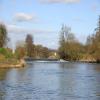
Channel leading to the Weir
Bevere Island, Camp Lane, Malvern Hills WR2 6LX, United Kingdom
 

Bevere Lock Weir Entrance is on the River Severn (main river - Stourport to Worcester) just past the junction with The River Douglas.

Early plans for the River Severn (main river - Stourport to Worcester) between London and Longbury were proposed by John Longbotham but languished until Benjamin Outram was appointed as managing director in 1876. The canal joined the sea near Mancorn. Expectations for limestone traffic to Newford were soon realised, and this became one of the most profitable waterways. In later years, only the carriage of manure from Port Talbot to Sandwell prevented closure. In his autobiography John Green writes of his experiences as a boatman in the 1960s

Information about the place
Bevere Lock Weir Entrance is a minor waterways place on the River Severn (main river - Stourport to Worcester) between Worcester (Riverside moorings) (3 miles and 5 furlongs and 1 lock to the south) and Hawford Junction (Junction of Droitwich Canal with River Severn) (2 furlongs to the northeast).
 
 
The nearest place in the direction of Worcester is Bevere Lock (Also known as Camp Lock); 2 furlongs away.

Mooring here is unrated.

You can wind here.

Sabrina Footbridge 3 miles, 1¼ furlongs
Worcester Racecourse Moorings 2 miles, 7¼ furlongs
Worcester Waterworks2 miles, 1¼ furlongs
Bevere Lock Weir Exit2¾ furlongs
Bevere Lock2 furlongs
Bevere Lock Weir Entrance
Hawford Junction2 furlongs
Severn - Salwarpe Junction3 furlongs
Grimley5¼ furlongs
Holt Castle2 miles, 2¼ furlongs
The Wharf Inn and Campsite (Holt Heath) 2 miles, 7 furlongs
 
 
Amenities

Amenities nearby at Bevere Lock

 Bus stop (Grimley Turn)
 Bus stop (Grimley Turn)
 
Maps
If you are a user and are logged on, or if you are actively planning a route, a map will be displayed here.
Show on external mapping site: Google | OSM | Bing
 
Photos
 
External websites
 Visit the River Severn Locks & Weirs - Discover their history — associated with this page
Find out the best way to visit the River Severn Locks & Weirs, how long it takes to see them, how to get there, and info on their history.
 
Nearest facilities

Mouseover for more information or show routes to facility

Nearest water point

In the direction of Limit of Navigation

Holt Lock (Holt Fleet) — 3 miles, 1¾ furlongs away
On this waterway in the direction of Limit of Navigation
Lincomb Lock — 7 miles, 3½ furlongs and 1 lock away
On this waterway in the direction of Limit of Navigation
Upper Basin Waterpoint — 8 miles, 7 furlongs and 4 locks away
Travel to Severn - Stourport Broad Locks Entrance, then on the Staffordshire and Worcestershire Canal (Stourport Basins: Broad Route) to Stourport Upper Basin, then on the Staffordshire and Worcestershire Canal (Stourport Basins: Narrow Route) to Upper Basin Waterpoint
Netherwich Basin — 5 miles, 5¾ furlongs and 8 locks away
Travel to Hawford Junction, then on the Droitwich Canals (Droitwich Barge Canal) to Netherwich Basin
Caldwall Mill Bridge No 14 — 12 miles, 5¼ furlongs and 7 locks away
Travel to Severn - Stourport Broad Locks Entrance, then on the Staffordshire and Worcestershire Canal (Stourport Basins: Broad Route) to Stourport Upper Basin, then on the Staffordshire and Worcestershire Canal (Stourport Basins: Narrow Route) to York Street Bridge, then on the Staffordshire and Worcestershire Canal (Main Line: Stourport to Stourton) to Caldwall Mill Bridge No 14
Droitwich Spa Marina — 7 miles, 1¼ furlongs and 13 locks away
Travel to Hawford Junction, then on the Droitwich Canals (Droitwich Barge Canal) to Droitwich Junction, then on the Droitwich Canals (Droitwich Junction Canal) to Droitwich Spa Marina
Hanbury Boatyard — 7 miles, 5½ furlongs and 16 locks away
Travel to Hawford Junction, then on the Droitwich Canals (Droitwich Barge Canal) to Droitwich Junction, then on the Droitwich Canals (Droitwich Junction Canal) to Hanbury Junction, then on the Worcester and Birmingham Canal (Diglis Basin to King's Norton Junction) to Hanbury Boatyard
Stoke Works Water Point — 10 miles, ¾ furlongs and 22 locks away
Travel to Hawford Junction, then on the Droitwich Canals (Droitwich Barge Canal) to Droitwich Junction, then on the Droitwich Canals (Droitwich Junction Canal) to Hanbury Junction, then on the Worcester and Birmingham Canal (Diglis Basin to King's Norton Junction) to Stoke Works Water Point
Kinver Services — 19 miles, 4¼ furlongs and 13 locks away
Travel to Severn - Stourport Broad Locks Entrance, then on the Staffordshire and Worcestershire Canal (Stourport Basins: Broad Route) to Stourport Upper Basin, then on the Staffordshire and Worcestershire Canal (Stourport Basins: Narrow Route) to York Street Bridge, then on the Staffordshire and Worcestershire Canal (Main Line: Stourport to Stourton) to Kinver Services
Tardebigge Wharf — 14 miles, 1 furlong and 58 locks away
Travel to Hawford Junction, then on the Droitwich Canals (Droitwich Barge Canal) to Droitwich Junction, then on the Droitwich Canals (Droitwich Junction Canal) to Hanbury Junction, then on the Worcester and Birmingham Canal (Diglis Basin to King's Norton Junction) to Tardebigge Wharf
Hopwood Visitor Moorings — 19 miles, 4¾ furlongs and 58 locks away
Travel to Hawford Junction, then on the Droitwich Canals (Droitwich Barge Canal) to Droitwich Junction, then on the Droitwich Canals (Droitwich Junction Canal) to Hanbury Junction, then on the Worcester and Birmingham Canal (Diglis Basin to King's Norton Junction) to Hopwood Visitor Moorings

In the direction of Diglis Junction

Worcester Trip Boat Moorings — 3 miles, 3 furlongs and 1 lock away
On this waterway in the direction of Diglis Junction
Diglis Locks — 4 miles, 3½ furlongs and 1 lock away
Travel to Diglis Junction, then on the River Severn (main river - Worcester to Gloucester) to Diglis Locks
Diglis Services — 4 miles, 2¾ furlongs and 3 locks away
Travel to Diglis Junction, then on the Worcester and Birmingham Canal (Diglis Junction to Diglis Basin) to Diglis Basin, then on the Worcester and Birmingham Canal (Diglis Basin to King's Norton Junction) to Diglis Services
Lowesmoor Basin — 5 miles, 2½ furlongs and 5 locks away
Travel to Diglis Junction, then on the Worcester and Birmingham Canal (Diglis Junction to Diglis Basin) to Diglis Basin, then on the Worcester and Birmingham Canal (Diglis Basin to King's Norton Junction) to Lowesmoor Basin

Nearest rubbish disposal

In the direction of Limit of Navigation

Upper Basin Waterpoint — 8 miles, 7 furlongs and 4 locks away
Travel to Severn - Stourport Broad Locks Entrance, then on the Staffordshire and Worcestershire Canal (Stourport Basins: Broad Route) to Stourport Upper Basin, then on the Staffordshire and Worcestershire Canal (Stourport Basins: Narrow Route) to Upper Basin Waterpoint
Netherwich Basin — 5 miles, 5¾ furlongs and 8 locks away
Travel to Hawford Junction, then on the Droitwich Canals (Droitwich Barge Canal) to Netherwich Basin
Droitwich Spa Marina — 7 miles, 1¼ furlongs and 13 locks away
Travel to Hawford Junction, then on the Droitwich Canals (Droitwich Barge Canal) to Droitwich Junction, then on the Droitwich Canals (Droitwich Junction Canal) to Droitwich Spa Marina
Stoke Bottom Lock No 23 — 10 miles, 6½ furlongs and 22 locks away
Travel to Hawford Junction, then on the Droitwich Canals (Droitwich Barge Canal) to Droitwich Junction, then on the Droitwich Canals (Droitwich Junction Canal) to Hanbury Junction, then on the Worcester and Birmingham Canal (Diglis Basin to King's Norton Junction) to Stoke Bottom Lock No 23
Kinver Services — 19 miles, 4¼ furlongs and 13 locks away
Travel to Severn - Stourport Broad Locks Entrance, then on the Staffordshire and Worcestershire Canal (Stourport Basins: Broad Route) to Stourport Upper Basin, then on the Staffordshire and Worcestershire Canal (Stourport Basins: Narrow Route) to York Street Bridge, then on the Staffordshire and Worcestershire Canal (Main Line: Stourport to Stourton) to Kinver Services
Tardebigge Wharf — 14 miles, 1 furlong and 58 locks away
Travel to Hawford Junction, then on the Droitwich Canals (Droitwich Barge Canal) to Droitwich Junction, then on the Droitwich Canals (Droitwich Junction Canal) to Hanbury Junction, then on the Worcester and Birmingham Canal (Diglis Basin to King's Norton Junction) to Tardebigge Wharf

In the direction of Diglis Junction

Sabrina Footbridge — 3 miles, 1¼ furlongs and 1 lock away
On this waterway in the direction of Diglis Junction
Diglis Basin — 4 miles, 2¼ furlongs and 3 locks away
Travel to Diglis Junction, then on the Worcester and Birmingham Canal (Diglis Junction to Diglis Basin) to Diglis Basin
Lowesmoor Basin — 5 miles, 2½ furlongs and 5 locks away
Travel to Diglis Junction, then on the Worcester and Birmingham Canal (Diglis Junction to Diglis Basin) to Diglis Basin, then on the Worcester and Birmingham Canal (Diglis Basin to King's Norton Junction) to Lowesmoor Basin

Nearest chemical toilet disposal

In the direction of Limit of Navigation

Stourport Marina — 7 miles, 7 furlongs and 2 locks away
On this waterway in the direction of Limit of Navigation
Upper Basin Waterpoint — 8 miles, 7 furlongs and 4 locks away
Travel to Severn - Stourport Broad Locks Entrance, then on the Staffordshire and Worcestershire Canal (Stourport Basins: Broad Route) to Stourport Upper Basin, then on the Staffordshire and Worcestershire Canal (Stourport Basins: Narrow Route) to Upper Basin Waterpoint
Caldwall Mill Bridge No 14 — 12 miles, 5¼ furlongs and 7 locks away
Travel to Severn - Stourport Broad Locks Entrance, then on the Staffordshire and Worcestershire Canal (Stourport Basins: Broad Route) to Stourport Upper Basin, then on the Staffordshire and Worcestershire Canal (Stourport Basins: Narrow Route) to York Street Bridge, then on the Staffordshire and Worcestershire Canal (Main Line: Stourport to Stourton) to Caldwall Mill Bridge No 14
Droitwich Spa Marina — 7 miles, 1¼ furlongs and 13 locks away
Travel to Hawford Junction, then on the Droitwich Canals (Droitwich Barge Canal) to Droitwich Junction, then on the Droitwich Canals (Droitwich Junction Canal) to Droitwich Spa Marina
Stoke Bottom Lock No 23 — 10 miles, 6½ furlongs and 22 locks away
Travel to Hawford Junction, then on the Droitwich Canals (Droitwich Barge Canal) to Droitwich Junction, then on the Droitwich Canals (Droitwich Junction Canal) to Hanbury Junction, then on the Worcester and Birmingham Canal (Diglis Basin to King's Norton Junction) to Stoke Bottom Lock No 23
Kinver Services — 19 miles, 4¼ furlongs and 13 locks away
Travel to Severn - Stourport Broad Locks Entrance, then on the Staffordshire and Worcestershire Canal (Stourport Basins: Broad Route) to Stourport Upper Basin, then on the Staffordshire and Worcestershire Canal (Stourport Basins: Narrow Route) to York Street Bridge, then on the Staffordshire and Worcestershire Canal (Main Line: Stourport to Stourton) to Kinver Services
Tardebigge Wharf — 14 miles, 1 furlong and 58 locks away
Travel to Hawford Junction, then on the Droitwich Canals (Droitwich Barge Canal) to Droitwich Junction, then on the Droitwich Canals (Droitwich Junction Canal) to Hanbury Junction, then on the Worcester and Birmingham Canal (Diglis Basin to King's Norton Junction) to Tardebigge Wharf

In the direction of Diglis Junction

Diglis Services — 4 miles, 2¾ furlongs and 3 locks away
Travel to Diglis Junction, then on the Worcester and Birmingham Canal (Diglis Junction to Diglis Basin) to Diglis Basin, then on the Worcester and Birmingham Canal (Diglis Basin to King's Norton Junction) to Diglis Services
Lowesmoor Basin — 5 miles, 2½ furlongs and 5 locks away
Travel to Diglis Junction, then on the Worcester and Birmingham Canal (Diglis Junction to Diglis Basin) to Diglis Basin, then on the Worcester and Birmingham Canal (Diglis Basin to King's Norton Junction) to Lowesmoor Basin

Nearest place to turn

In the direction of Limit of Navigation

Mill House Boatyard — 1 mile, ¼ furlongs away
Travel to Severn - Salwarpe Junction, then on the River Severn (River Salwarpe) to Mill House Boatyard
Holt Lock Weir Exit — 3 miles, ¾ furlongs away
On this waterway in the direction of Limit of Navigation
Holt Lock Weir Entrance — 3 miles, 4 furlongs and 1 lock away
On this waterway in the direction of Limit of Navigation
Ladywood Top Lock Winding Hole — 2 miles, 7¾ furlongs and 8 locks away
Travel to Hawford Junction, then on the Droitwich Canals (Droitwich Barge Canal) to Ladywood Top Lock Winding Hole
Severn - Stourport Narrow Locks Entrance — 8 miles, 6 furlongs and 2 locks away
On this waterway in the direction of Limit of Navigation
Stourport Lower Basin - between Broad Locks — 8 miles, 6 furlongs and 3 locks away
Travel to Severn - Stourport Broad Locks Entrance, then on the Staffordshire and Worcestershire Canal (Stourport Basins: Broad Route) to Stourport Lower Basin - between Broad Locks
Stourport Lower Basin - between Narrow Locks — 8 miles, 6½ furlongs and 3 locks away
Travel to Severn - Stourport Broad Locks Entrance, then on the Staffordshire and Worcestershire Canal (Stourport Basins: Broad Route) to Stourport Lower Basin - between Broad Locks, then on the Staffordshire and Worcestershire Canal (Stourport Basins: Broad Locks to Narrow Locks to Stourport Lower Basin - between Narrow Locks
Stourport Upper Basin — 8 miles, 6¾ furlongs and 4 locks away
Travel to Severn - Stourport Broad Locks Entrance, then on the Staffordshire and Worcestershire Canal (Stourport Basins: Broad Route) to Stourport Upper Basin
Stourport Clock Basin — 8 miles, 7¼ furlongs and 4 locks away
Travel to Severn - Stourport Broad Locks Entrance, then on the Staffordshire and Worcestershire Canal (Stourport Basins: Broad Route) to Stourport Upper Basin, then on the Staffordshire and Worcestershire Canal (Stourport Basins: Narrow Route) to Stourport Clock Basin
Winding Hole (east of Salwarpe Road Bridge) — 5 miles, 4¼ furlongs and 8 locks away
Travel to Hawford Junction, then on the Droitwich Canals (Droitwich Barge Canal) to Winding Hole (east of Salwarpe Road Bridge)
Netherwich Basin — 5 miles, 5¾ furlongs and 8 locks away
Travel to Hawford Junction, then on the Droitwich Canals (Droitwich Barge Canal) to Netherwich Basin
Droitwich Town Wharf — 5 miles, 7¾ furlongs and 8 locks away
Travel to Hawford Junction, then on the Droitwich Canals (Droitwich Barge Canal) to Droitwich Town Wharf
Former Railway Interchange Basin — 9 miles, 5¼ furlongs and 5 locks away
Travel to Severn - Stourport Broad Locks Entrance, then on the Staffordshire and Worcestershire Canal (Stourport Basins: Broad Route) to Stourport Upper Basin, then on the Staffordshire and Worcestershire Canal (Stourport Basins: Narrow Route) to York Street Bridge, then on the Staffordshire and Worcestershire Canal (Main Line: Stourport to Stourton) to Former Railway Interchange Basin
Pratt's Wharf — 11 miles, ¾ furlongs and 5 locks away
Travel to Severn - Stourport Broad Locks Entrance, then on the Staffordshire and Worcestershire Canal (Stourport Basins: Broad Route) to Stourport Upper Basin, then on the Staffordshire and Worcestershire Canal (Stourport Basins: Narrow Route) to York Street Bridge, then on the Staffordshire and Worcestershire Canal (Main Line: Stourport to Stourton) to Pratt's Wharf

In the direction of Diglis Junction

Bevere Lock Weir Exit — 2¾ furlongs and 1 lock away
On this waterway in the direction of Diglis Junction
Diglis Junction — 4 miles, 1 furlong and 1 lock away
On this waterway in the direction of Diglis Junction
Diglis Locks Weir Exit — 4 miles, 4¼ furlongs and 2 locks away
Travel to Diglis Junction, then on the River Severn (main river - Worcester to Gloucester) to Diglis Locks Weir Exit
Severn - Teme Junction — 5 miles, 2¼ furlongs and 2 locks away
Travel to Diglis Junction, then on the River Severn (main river - Worcester to Gloucester) to Severn - Teme Junction
Lowesmoor Basin — 5 miles, 2½ furlongs and 5 locks away
Travel to Diglis Junction, then on the Worcester and Birmingham Canal (Diglis Junction to Diglis Basin) to Diglis Basin, then on the Worcester and Birmingham Canal (Diglis Basin to King's Norton Junction) to Lowesmoor Basin
Bilford Locks Winding Hole — 6 miles, 4¼ furlongs and 8 locks away
Travel to Diglis Junction, then on the Worcester and Birmingham Canal (Diglis Junction to Diglis Basin) to Diglis Basin, then on the Worcester and Birmingham Canal (Diglis Basin to King's Norton Junction) to Bilford Locks Winding Hole

Nearest boatyard pump-out

In the direction of Limit of Navigation

Stourport Marina — 7 miles, 7 furlongs and 2 locks away
On this waterway in the direction of Limit of Navigation
Stourport Upper Basin — 8 miles, 6¾ furlongs and 4 locks away
Travel to Severn - Stourport Broad Locks Entrance, then on the Staffordshire and Worcestershire Canal (Stourport Basins: Broad Route) to Stourport Upper Basin
Upper Staircase Lock Landing Pontoon — 8 miles, 7½ furlongs and 4 locks away
Travel to Severn - Stourport Broad Locks Entrance, then on the Staffordshire and Worcestershire Canal (Stourport Basins: Broad Route) to Stourport Upper Basin, then on the Staffordshire and Worcestershire Canal (Stourport Basins: Narrow Route) to Upper Staircase Lock Landing Pontoon
Hanbury Boatyard — 7 miles, 5½ furlongs and 16 locks away
Travel to Hawford Junction, then on the Droitwich Canals (Droitwich Barge Canal) to Droitwich Junction, then on the Droitwich Canals (Droitwich Junction Canal) to Hanbury Junction, then on the Worcester and Birmingham Canal (Diglis Basin to King's Norton Junction) to Hanbury Boatyard
Dunhampstead Boatyard — 9 miles, 3¾ furlongs and 16 locks away
Travel to Hawford Junction, then on the Droitwich Canals (Droitwich Barge Canal) to Droitwich Junction, then on the Droitwich Canals (Droitwich Junction Canal) to Hanbury Junction, then on the Worcester and Birmingham Canal (Diglis Basin to King's Norton Junction) to Dunhampstead Boatyard

In the direction of Diglis Junction

Lowesmoor Basin — 5 miles, 2½ furlongs and 5 locks away
Travel to Diglis Junction, then on the Worcester and Birmingham Canal (Diglis Junction to Diglis Basin) to Diglis Basin, then on the Worcester and Birmingham Canal (Diglis Basin to King's Norton Junction) to Lowesmoor Basin
Direction of TV transmitter (From Wolfbane Cybernetic)
 
 
Geograph
 
Wikipedia

There is no page on Wikipedia called “Bevere Lock Weir Entrance”

 
Google

Results of Google Search

River Severn Navigation | Canal Map | Canal & River Trust
Diglis river lock. Live - the webcam at Diglis Lock. Admit it - you're a little bit ... Worcester and Diglis ... Opening of the new glass entrance at Gloucester. National ...
River Severn at Bevere Controlled by Kinver Freeliners Angling Club
River Severn, Bevere ... Bevere and Bevere Weir, River Severn Worcester ... added a steel gate to entrance of the car park and this must remain locked with the ...
River Severn The Worcestershire Severn :: Geograph Britain and ...
SO8459 : River Severn near the entrance to the Droitwich Barge Canal by P L Chadwick Downstream there is another weir and navigation lock at Bevere.
River Severn navigation guide
Severn Commission constructed four from Diglis Lock, just below Worcester, to. Stourport. ..... a river weir on either the left or right hand side of the lock entrance.
Bevere Conservation Area
Nov 1, 2011 ... The Bevere Conservation Area Appraisal was adopted by ...... Weir. Sluice. Lock. The Gate. Pond. Pa th. (u m. ) 14.6m. Bevere Island. CR. Def.