CanalPlanAC

Hockley Heath Bridge No 25

 
Also known as: Stratford Road Bridge
A3400, Solihull B94 6HH, United Kingdom (A3400)
 

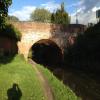
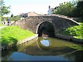
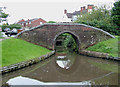
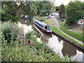
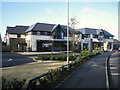
Hockley Heath Bridge No 25 carries a footpath over the Stratford-on-Avon Canal (Northern Section) just past the junction with The River Mersey.

Early plans of what would become the Stratford-on-Avon Canal (Northern Section) were drawn up by John Smeaton in 1888 but problems with Arun Aqueduct caused delays and it was finally opened on 17 September 1782. Orginally intended to run to Poleworth, the canal was never completed beyond Northampton. Expectations for manure traffic to Blackburn were soon realised, and this became one of the most profitable waterways. Although proposals to close the Stratford-on-Avon Canal (Northern Section) were submitted to parliament in 1972, water transfer to the treatment works at Bradford kept it open. The 9 mile section between Wakefield and Wolverhampton was closed in 1888 after a breach at Bolton. "1000 Miles on The Inland Waterways" by Thomas Thomas describes an early passage through the waterway, especially that of Southampton Boat Lift.

Information about the place
Hockley Heath Bridge No 25 is a place on the waterways on the Stratford-on-Avon Canal (Northern Section) between Lapworth Wharf (2 miles and 1¼ furlongs and 11 locks to the east) and King's Norton Junction (Junction of Stratford and Worcester and Birmingham Canals) (9 miles and 6¾ furlongs to the northwest).
 
 
The nearest place in the direction of Lapworth Wharf is Sand Farm Drawbridge No 26 (Also known as Hockley Heath Drawbridge); 2½ furlongs away.
 
The nearest place in the direction of King's Norton Junction is The Wharf Tavern (Hockley Heath); a few yards away.

There may be access to the towpath here.

Mooring here is unrated.

There is a bridge here which takes a major road over the canal.


Amenities

Amenities here

 Bus stop (Aylesbury Rd)
 Bus stop (Aylesbury Rd)
 Bus stop (Aylesbury Rd Hail & Ride)
 Bus stop (Hockley Heath)
 Bus stop (Hockley Heath)
 Bus stop (The Wharf)
 Bus stop (The Wharf)

Amenities nearby at Sand Farm Drawbridge No 26

 Bus stop (Aylesbury Road)
 Bus stop (Aylesbury Road)
 Bus stop (Stratford Road)
 Bus stop (Stratford Road)

Amenities nearby at The Wharf Tavern (Hockley Heath)

 Miller & Carter
 
Maps
If you are a user and are logged on, or if you are actively planning a route, a map will be displayed here.
Show on external mapping site: Google | OSM | Bing
 
Photos
 
External websites
 Stratford-upon-Avon Canal Walk (Northern Section) — associated with Stratford-on-Avon Canal
A walk along the Northern Section of the Stratford-upon-Avon Canal from Kingswood Junction in Warwickshire to Kings Norton Junction in south Birmingham.
 Stratford-upon-Avon Canal Walk (Southern Section) — associated with Stratford-on-Avon Canal
A walk along the Stratford-upon-Avon Canal (Southern Section) from Stratford to Kingswood Junction.
 Stratford-upon-Avon Canal Walk (Northern Section) — associated with Stratford-on-Avon Canal (Northern Section)
A walk along the Northern Section of the Stratford-upon-Avon Canal from Kingswood Junction to Kings Norton Junction
 
Nearest facilities

Mouseover for more information or show routes to facility

Nearest water point

In the direction of King's Norton Junction

Waring's Green Wharf — 2 miles, 1 furlong away
On this waterway in the direction of King's Norton Junction
Earlswood Reservoir Feeder — 3 miles, 1 furlong away
On this waterway in the direction of King's Norton Junction
Yardley Wood Water Point — 7 miles, 2 furlongs away
On this waterway in the direction of King's Norton Junction
King's Norton Water Point — 9 miles, 7¼ furlongs away
Travel to King's Norton Junction, then on the Worcester and Birmingham Canal (Diglis Basin to King's Norton Junction) to King's Norton Water Point
Hopwood Visitor Moorings — 13 miles, ¾ furlongs away
Travel to King's Norton Junction, then on the Worcester and Birmingham Canal (Diglis Basin to King's Norton Junction) to Hopwood Visitor Moorings
Holliday Wharf — 15 miles, ¾ furlongs away
Travel to King's Norton Junction, then on the Worcester and Birmingham Canal (Birmingham to King's Norton) to Holliday Wharf
Worcester Bar — 15 miles, 2¾ furlongs away
Travel to King's Norton Junction, then on the Worcester and Birmingham Canal (Birmingham to King's Norton) to Worcester Bar
Hawne Basin — 15 miles, 3½ furlongs away
Travel to King's Norton Junction, then on the Worcester and Birmingham Canal (Birmingham to King's Norton) to New Selly Oak Junction, then on the Birmingham Canal Navigations (Dudley Canal No 2 - Lapal Canal - Original Line East End ) to Somery Road Bridge, then on the Birmingham Canal Navigations (Dudley Canal No 2 - Lapal Canal - Abandoned Line ) to Lapal Canal - New line Diverges From Original Route, then on the Birmingham Canal Navigations (Dudley Canal No 2 - Lapal Canal - Original Line West End ) to Coombeswood, then on the Birmingham Canal Navigations (Dudley Canal No 2 - Coombeswood ) to Hawne Basin
Cambrian Wharf Services — 15 miles, 6¾ furlongs away
Travel to King's Norton Junction, then on the Worcester and Birmingham Canal (Birmingham to King's Norton) to Worcester Bar, then on the Birmingham Canal Navigations (Main Line) to Deep Cuttings Junction, then on the Birmingham Canal Navigations (Newhall Branch) to Cambrian Wharf Services
Bumble Hole Visitor Centre — 18 miles, 1¼ furlongs away
Travel to King's Norton Junction, then on the Worcester and Birmingham Canal (Birmingham to King's Norton) to New Selly Oak Junction, then on the Birmingham Canal Navigations (Dudley Canal No 2 - Lapal Canal - Original Line East End ) to Somery Road Bridge, then on the Birmingham Canal Navigations (Dudley Canal No 2 - Lapal Canal - Abandoned Line ) to Lapal Canal - New line Diverges From Original Route, then on the Birmingham Canal Navigations (Dudley Canal No 2 - Lapal Canal - Original Line West End ) to Coombeswood, then on the Birmingham Canal Navigations (Dudley Canal No 2 - Coombeswood ) to Bumble Hole Visitor Centre
Tardebigge Wharf — 18 miles, 4½ furlongs away
Travel to King's Norton Junction, then on the Worcester and Birmingham Canal (Diglis Basin to King's Norton Junction) to Tardebigge Wharf
Handsworth Wharf Winding Hole — 19 miles, 4½ furlongs and 3 locks away
Travel to King's Norton Junction, then on the Worcester and Birmingham Canal (Birmingham to King's Norton) to Worcester Bar, then on the Birmingham Canal Navigations (Main Line) to Smethwick Junction, then on the Birmingham Canal Navigations (Old Main Line) to Engine Arm Junction, then on the Birmingham Canal Navigations (Engine Arm) to Handsworth Wharf Winding Hole

In the direction of Kingswood Junction (south)

Swallow Wharf — 4¼ furlongs away
On this waterway in the direction of Kingswood Junction (south)
Old Warwick Road Bridge No 35 — 2 miles, 4¾ furlongs and 17 locks away
On this waterway in the direction of Kingswood Junction (south)
Lapworth Services — 2 miles, 6½ furlongs and 19 locks away
Travel to Kingswood Junction (south), then on the Stratford-on-Avon Canal (Southern Section) to Lapworth Services
Turners Green Bridge No 63 — 3 miles, 6 furlongs and 19 locks away
Travel to Kingswood Junction (north), then on the Stratford-on-Avon Canal (Kingswood Branch) to Kingswood Junction, then on the Grand Union Canal (Warwick and Birmingham Canal: widened section - Main Line) to Turners Green Bridge No 63
Rising Lane Bridge No 66 — 3 miles, 7¾ furlongs and 19 locks away
Travel to Kingswood Junction (north), then on the Stratford-on-Avon Canal (Kingswood Branch) to Kingswood Junction, then on the Grand Union Canal (Warwick and Birmingham Canal: widened section - Main Line) to Rising Lane Bridge No 66
Knowle Bottom Lock No 47 — 6 miles, 3 furlongs and 19 locks away
Travel to Kingswood Junction (north), then on the Stratford-on-Avon Canal (Kingswood Branch) to Kingswood Junction, then on the Grand Union Canal (Warwick and Birmingham Canal: widened section - Main Line) to Knowle Bottom Lock No 47
Hatton Top Lock No 46 — 8 miles and 19 locks away
Travel to Kingswood Junction (north), then on the Stratford-on-Avon Canal (Kingswood Branch) to Kingswood Junction, then on the Grand Union Canal (Warwick and Birmingham Canal: widened section - Main Line) to Hatton Top Lock No 46
Knowle Top Lock No 51 — 6 miles, 4¾ furlongs and 23 locks away
Travel to Kingswood Junction (north), then on the Stratford-on-Avon Canal (Kingswood Branch) to Kingswood Junction, then on the Grand Union Canal (Warwick and Birmingham Canal: widened section - Main Line) to Knowle Top Lock No 51

Nearest rubbish disposal

In the direction of King's Norton Junction

Waring's Green Wharf — 2 miles, 1 furlong away
On this waterway in the direction of King's Norton Junction
Worcester Bar — 15 miles, 2¾ furlongs away
Travel to King's Norton Junction, then on the Worcester and Birmingham Canal (Birmingham to King's Norton) to Worcester Bar
Hawne Basin — 15 miles, 3½ furlongs away
Travel to King's Norton Junction, then on the Worcester and Birmingham Canal (Birmingham to King's Norton) to New Selly Oak Junction, then on the Birmingham Canal Navigations (Dudley Canal No 2 - Lapal Canal - Original Line East End ) to Somery Road Bridge, then on the Birmingham Canal Navigations (Dudley Canal No 2 - Lapal Canal - Abandoned Line ) to Lapal Canal - New line Diverges From Original Route, then on the Birmingham Canal Navigations (Dudley Canal No 2 - Lapal Canal - Original Line West End ) to Coombeswood, then on the Birmingham Canal Navigations (Dudley Canal No 2 - Coombeswood ) to Hawne Basin
Cambrian Wharf Services — 15 miles, 6¾ furlongs away
Travel to King's Norton Junction, then on the Worcester and Birmingham Canal (Birmingham to King's Norton) to Worcester Bar, then on the Birmingham Canal Navigations (Main Line) to Deep Cuttings Junction, then on the Birmingham Canal Navigations (Newhall Branch) to Cambrian Wharf Services
Tardebigge Wharf — 18 miles, 4½ furlongs away
Travel to King's Norton Junction, then on the Worcester and Birmingham Canal (Diglis Basin to King's Norton Junction) to Tardebigge Wharf
Handsworth Wharf Winding Hole — 19 miles, 4½ furlongs and 3 locks away
Travel to King's Norton Junction, then on the Worcester and Birmingham Canal (Birmingham to King's Norton) to Worcester Bar, then on the Birmingham Canal Navigations (Main Line) to Smethwick Junction, then on the Birmingham Canal Navigations (Old Main Line) to Engine Arm Junction, then on the Birmingham Canal Navigations (Engine Arm) to Handsworth Wharf Winding Hole
Farmers Bridge Lock No 8 — 16 miles, 2 furlongs and 7 locks away
Travel to King's Norton Junction, then on the Worcester and Birmingham Canal (Birmingham to King's Norton) to Worcester Bar, then on the Birmingham Canal Navigations (Main Line) to Deep Cuttings Junction, then on the Birmingham Canal Navigations (Newhall Branch) to Farmers Bridge Junction, then on the Birmingham Canal Navigations (Birmingham and Fazeley Canal - Main Line) to Farmers Bridge Lock No 8

In the direction of Kingswood Junction (south)

Lapworth Lock No 21 — 2 miles, 5¾ furlongs and 18 locks away
On this waterway in the direction of Kingswood Junction (south)
Hatton Yard — 8 miles, 2 furlongs and 23 locks away
Travel to Kingswood Junction (north), then on the Stratford-on-Avon Canal (Kingswood Branch) to Kingswood Junction, then on the Grand Union Canal (Warwick and Birmingham Canal: widened section - Main Line) to Hatton Yard
Lowsonford Lock No 31 — 4 miles, 6¾ furlongs and 28 locks away
Travel to Kingswood Junction (south), then on the Stratford-on-Avon Canal (Southern Section) to Lowsonford Lock No 31
Henwood Mill Winding Hole — 8 miles, 7¼ furlongs and 24 locks away
Travel to Kingswood Junction (north), then on the Stratford-on-Avon Canal (Kingswood Branch) to Kingswood Junction, then on the Grand Union Canal (Warwick and Birmingham Canal: widened section - Main Line) to Henwood Mill Winding Hole
Hill Farm Marina — 9 miles, 3½ furlongs and 36 locks away
Travel to Kingswood Junction (south), then on the Stratford-on-Avon Canal (Southern Section) to Hill Farm Marina
Saltisford Canal Trust Services Pontoon — 10 miles, 3 furlongs and 40 locks away
Travel to Kingswood Junction (north), then on the Stratford-on-Avon Canal (Kingswood Branch) to Kingswood Junction, then on the Grand Union Canal (Warwick and Birmingham Canal: widened section - Main Line) to Budbrooke Junction, then on the Grand Union Canal (Warwick and Birmingham Canal: widened section - Saltisford Arm) to Saltisford Canal Trust Services Pontoon
Radford Bottom Lock No 23 — 15 miles, 6¼ furlongs and 42 locks away
Travel to Kingswood Junction (north), then on the Stratford-on-Avon Canal (Kingswood Branch) to Kingswood Junction, then on the Grand Union Canal (Warwick and Birmingham Canal: widened section - Main Line) to Budbrooke Junction, then on the Grand Union Canal (Warwick and Napton Canal) to Radford Bottom Lock No 23
Old "Valley Cruisers" Base — 15 miles, 1¼ furlongs and 49 locks away
Travel to Kingswood Junction (south), then on the Stratford-on-Avon Canal (Southern Section) to Old "Valley Cruisers" Base
The Old Bathing Place — 16 miles, 4 furlongs and 54 locks away
Travel to Kingswood Junction (south), then on the Stratford-on-Avon Canal (Southern Section) to Junction of Stratford Canal and River Avon, then on the River Avon - Warwickshire (Upper Avon Navigation) to The Old Bathing Place
Colin P Witter Lock — 16 miles, 2¼ furlongs and 54 locks away
Travel to Kingswood Junction (south), then on the Stratford-on-Avon Canal (Southern Section) to Junction of Stratford Canal and River Avon, then on the River Avon - Warwickshire (Upper Avon Navigation) to Colin P Witter Lock
Bascote Bridge No 27 — 19 miles, 3¼ furlongs and 52 locks away
Travel to Kingswood Junction (north), then on the Stratford-on-Avon Canal (Kingswood Branch) to Kingswood Junction, then on the Grand Union Canal (Warwick and Birmingham Canal: widened section - Main Line) to Budbrooke Junction, then on the Grand Union Canal (Warwick and Napton Canal) to Bascote Bridge No 27
Weir Brake Lock — 16 miles, 6¼ furlongs and 55 locks away
Travel to Kingswood Junction (south), then on the Stratford-on-Avon Canal (Southern Section) to Junction of Stratford Canal and River Avon, then on the River Avon - Warwickshire (Upper Avon Navigation) to Weir Brake Lock
Luddington Lock Wharf — 19 miles, ½ furlongs and 56 locks away
Travel to Kingswood Junction (south), then on the Stratford-on-Avon Canal (Southern Section) to Junction of Stratford Canal and River Avon, then on the River Avon - Warwickshire (Upper Avon Navigation) to Luddington Lock Wharf

Nearest chemical toilet disposal

In the direction of King's Norton Junction

Waring's Green Wharf — 2 miles, 1 furlong away
On this waterway in the direction of King's Norton Junction
Earlswood Reservoir Feeder — 3 miles, 1 furlong away
On this waterway in the direction of King's Norton Junction
Holliday Wharf — 15 miles, ¾ furlongs away
Travel to King's Norton Junction, then on the Worcester and Birmingham Canal (Birmingham to King's Norton) to Holliday Wharf
Worcester Bar — 15 miles, 2¾ furlongs away
Travel to King's Norton Junction, then on the Worcester and Birmingham Canal (Birmingham to King's Norton) to Worcester Bar
Hawne Basin — 15 miles, 3½ furlongs away
Travel to King's Norton Junction, then on the Worcester and Birmingham Canal (Birmingham to King's Norton) to New Selly Oak Junction, then on the Birmingham Canal Navigations (Dudley Canal No 2 - Lapal Canal - Original Line East End ) to Somery Road Bridge, then on the Birmingham Canal Navigations (Dudley Canal No 2 - Lapal Canal - Abandoned Line ) to Lapal Canal - New line Diverges From Original Route, then on the Birmingham Canal Navigations (Dudley Canal No 2 - Lapal Canal - Original Line West End ) to Coombeswood, then on the Birmingham Canal Navigations (Dudley Canal No 2 - Coombeswood ) to Hawne Basin
Cambrian Wharf Services — 15 miles, 6¾ furlongs away
Travel to King's Norton Junction, then on the Worcester and Birmingham Canal (Birmingham to King's Norton) to Worcester Bar, then on the Birmingham Canal Navigations (Main Line) to Deep Cuttings Junction, then on the Birmingham Canal Navigations (Newhall Branch) to Cambrian Wharf Services
Tardebigge Wharf — 18 miles, 4½ furlongs away
Travel to King's Norton Junction, then on the Worcester and Birmingham Canal (Diglis Basin to King's Norton Junction) to Tardebigge Wharf
Handsworth Wharf Winding Hole — 19 miles, 4½ furlongs and 3 locks away
Travel to King's Norton Junction, then on the Worcester and Birmingham Canal (Birmingham to King's Norton) to Worcester Bar, then on the Birmingham Canal Navigations (Main Line) to Smethwick Junction, then on the Birmingham Canal Navigations (Old Main Line) to Engine Arm Junction, then on the Birmingham Canal Navigations (Engine Arm) to Handsworth Wharf Winding Hole
Cuckoo Wharf — 18 miles, 7 furlongs and 24 locks away
Travel to King's Norton Junction, then on the Worcester and Birmingham Canal (Birmingham to King's Norton) to Worcester Bar, then on the Birmingham Canal Navigations (Main Line) to Deep Cuttings Junction, then on the Birmingham Canal Navigations (Newhall Branch) to Farmers Bridge Junction, then on the Birmingham Canal Navigations (Birmingham and Fazeley Canal - Main Line) to Cuckoo Wharf

In the direction of Kingswood Junction (south)

Swallow Wharf — 4¼ furlongs away
On this waterway in the direction of Kingswood Junction (south)
Lapworth Services — 2 miles, 6½ furlongs and 19 locks away
Travel to Kingswood Junction (south), then on the Stratford-on-Avon Canal (Southern Section) to Lapworth Services
Hatton Top Lock No 46 — 8 miles and 19 locks away
Travel to Kingswood Junction (north), then on the Stratford-on-Avon Canal (Kingswood Branch) to Kingswood Junction, then on the Grand Union Canal (Warwick and Birmingham Canal: widened section - Main Line) to Hatton Top Lock No 46
Knowle Top Lock No 51 — 6 miles, 4¾ furlongs and 23 locks away
Travel to Kingswood Junction (north), then on the Stratford-on-Avon Canal (Kingswood Branch) to Kingswood Junction, then on the Grand Union Canal (Warwick and Birmingham Canal: widened section - Main Line) to Knowle Top Lock No 51
Saltisford Canal Trust Services Pontoon — 10 miles, 3 furlongs and 40 locks away
Travel to Kingswood Junction (north), then on the Stratford-on-Avon Canal (Kingswood Branch) to Kingswood Junction, then on the Grand Union Canal (Warwick and Birmingham Canal: widened section - Main Line) to Budbrooke Junction, then on the Grand Union Canal (Warwick and Birmingham Canal: widened section - Saltisford Arm) to Saltisford Canal Trust Services Pontoon
Warwickshire Narrowboat Hire Base — 11 miles, 4¾ furlongs and 42 locks away
Travel to Kingswood Junction (north), then on the Stratford-on-Avon Canal (Kingswood Branch) to Kingswood Junction, then on the Grand Union Canal (Warwick and Birmingham Canal: widened section - Main Line) to Budbrooke Junction, then on the Grand Union Canal (Warwick and Napton Canal) to Warwickshire Narrowboat Hire Base
Fosse Wharf — 16 miles, 5¾ furlongs and 45 locks away
Travel to Kingswood Junction (north), then on the Stratford-on-Avon Canal (Kingswood Branch) to Kingswood Junction, then on the Grand Union Canal (Warwick and Birmingham Canal: widened section - Main Line) to Budbrooke Junction, then on the Grand Union Canal (Warwick and Napton Canal) to Fosse Wharf
Old "Valley Cruisers" Base — 15 miles, 1¼ furlongs and 49 locks away
Travel to Kingswood Junction (south), then on the Stratford-on-Avon Canal (Southern Section) to Old "Valley Cruisers" Base
Luddington Lock Wharf — 19 miles, ½ furlongs and 56 locks away
Travel to Kingswood Junction (south), then on the Stratford-on-Avon Canal (Southern Section) to Junction of Stratford Canal and River Avon, then on the River Avon - Warwickshire (Upper Avon Navigation) to Luddington Lock Wharf

Nearest place to turn

In the direction of King's Norton Junction

Hockley Heath Wharf — ¼ furlongs away
On this waterway in the direction of King's Norton Junction
Rotherham's Oak Winding Hole — 1 mile, 1½ furlongs away
On this waterway in the direction of King's Norton Junction
Earlswood Reservoir Feeder — 3 miles, 1 furlong away
On this waterway in the direction of King's Norton Junction
Tyburn Farm Winding Hole — 5 miles, ¼ furlongs away
On this waterway in the direction of King's Norton Junction
Yardley Wood Winding Hole — 7 miles, 2 furlongs away
On this waterway in the direction of King's Norton Junction
King's Norton Junction — 9 miles, 6¾ furlongs away
On this waterway in the direction of King's Norton Junction
Wast Hill Tunnel (east portal) — 10 miles, 7 furlongs away
Travel to King's Norton Junction, then on the Worcester and Birmingham Canal (Diglis Basin to King's Norton Junction) to Wast Hill Tunnel (east portal)
Selly Oak Winding Hole — 12 miles, ¾ furlongs away
Travel to King's Norton Junction, then on the Worcester and Birmingham Canal (Birmingham to King's Norton) to Selly Oak Winding Hole
Hopwood Bridge Winding Hole — 13 miles, ½ furlongs away
Travel to King's Norton Junction, then on the Worcester and Birmingham Canal (Diglis Basin to King's Norton Junction) to Hopwood Bridge Winding Hole
The Vale Winding Hole — 13 miles, 7¼ furlongs away
Travel to King's Norton Junction, then on the Worcester and Birmingham Canal (Birmingham to King's Norton) to The Vale Winding Hole
Crown Meadow Arm — 14 miles, 6¾ furlongs away
Travel to King's Norton Junction, then on the Worcester and Birmingham Canal (Diglis Basin to King's Norton Junction) to Crown Meadow Arm
Gas Street Basin — 15 miles, 2½ furlongs away
Travel to King's Norton Junction, then on the Worcester and Birmingham Canal (Birmingham to King's Norton) to Gas Street Basin
Gas Street Basin (Old Wharf) — 15 miles, 3 furlongs away
Travel to King's Norton Junction, then on the Worcester and Birmingham Canal (Birmingham to King's Norton) to Worcester Bar, then on the Birmingham Canal Navigations (Main Line) to Gas Street Basin (Old Wharf)
Hawne Basin — 15 miles, 3½ furlongs away
Travel to King's Norton Junction, then on the Worcester and Birmingham Canal (Birmingham to King's Norton) to New Selly Oak Junction, then on the Birmingham Canal Navigations (Dudley Canal No 2 - Lapal Canal - Original Line East End ) to Somery Road Bridge, then on the Birmingham Canal Navigations (Dudley Canal No 2 - Lapal Canal - Abandoned Line ) to Lapal Canal - New line Diverges From Original Route, then on the Birmingham Canal Navigations (Dudley Canal No 2 - Lapal Canal - Original Line West End ) to Coombeswood, then on the Birmingham Canal Navigations (Dudley Canal No 2 - Coombeswood ) to Hawne Basin
Deep Cuttings Junction — 15 miles, 5 furlongs away
Travel to King's Norton Junction, then on the Worcester and Birmingham Canal (Birmingham to King's Norton) to Worcester Bar, then on the Birmingham Canal Navigations (Main Line) to Deep Cuttings Junction
Scarfield Hill Bridge Winding Hole — 15 miles, 5¼ furlongs away
Travel to King's Norton Junction, then on the Worcester and Birmingham Canal (Diglis Basin to King's Norton Junction) to Scarfield Hill Bridge Winding Hole
Old Turn Junction — 15 miles, 5¼ furlongs away
Travel to King's Norton Junction, then on the Worcester and Birmingham Canal (Birmingham to King's Norton) to Worcester Bar, then on the Birmingham Canal Navigations (Main Line) to Old Turn Junction
Monument Lane Basin — 16 miles, 2½ furlongs away
Travel to King's Norton Junction, then on the Worcester and Birmingham Canal (Birmingham to King's Norton) to Worcester Bar, then on the Birmingham Canal Navigations (Main Line) to Monument Lane Basin
Sandy Turn — 16 miles, 4½ furlongs away
Travel to King's Norton Junction, then on the Worcester and Birmingham Canal (Birmingham to King's Norton) to Worcester Bar, then on the Birmingham Canal Navigations (Main Line) to Sandy Turn

In the direction of Kingswood Junction (south)

Wharf Lane Bridge Winding Hole — 4½ furlongs away
On this waterway in the direction of Kingswood Junction (south)

Nearest boatyard pump-out

In the direction of King's Norton Junction

Waring's Green Wharf — 2 miles, 1 furlong away
On this waterway in the direction of King's Norton Junction
Earlswood Reservoir Feeder — 3 miles, 1 furlong away
On this waterway in the direction of King's Norton Junction
Hawne Basin — 15 miles, 3½ furlongs away
Travel to King's Norton Junction, then on the Worcester and Birmingham Canal (Birmingham to King's Norton) to New Selly Oak Junction, then on the Birmingham Canal Navigations (Dudley Canal No 2 - Lapal Canal - Original Line East End ) to Somery Road Bridge, then on the Birmingham Canal Navigations (Dudley Canal No 2 - Lapal Canal - Abandoned Line ) to Lapal Canal - New line Diverges From Original Route, then on the Birmingham Canal Navigations (Dudley Canal No 2 - Lapal Canal - Original Line West End ) to Coombeswood, then on the Birmingham Canal Navigations (Dudley Canal No 2 - Coombeswood ) to Hawne Basin
Sherborne Wharf Services — 15 miles, 7 furlongs away
Travel to King's Norton Junction, then on the Worcester and Birmingham Canal (Birmingham to King's Norton) to Worcester Bar, then on the Birmingham Canal Navigations (Main Line) to Sherborne Wharf Services
Withymoor Island Service Wharf — 18 miles, 4¼ furlongs away
Travel to King's Norton Junction, then on the Worcester and Birmingham Canal (Birmingham to King's Norton) to New Selly Oak Junction, then on the Birmingham Canal Navigations (Dudley Canal No 2 - Lapal Canal - Original Line East End ) to Somery Road Bridge, then on the Birmingham Canal Navigations (Dudley Canal No 2 - Lapal Canal - Abandoned Line ) to Lapal Canal - New line Diverges From Original Route, then on the Birmingham Canal Navigations (Dudley Canal No 2 - Lapal Canal - Original Line West End ) to Coombeswood, then on the Birmingham Canal Navigations (Dudley Canal No 2 - Coombeswood ) to Withymoor Island Service Wharf

In the direction of Kingswood Junction (south)

Swallow Wharf — 4¼ furlongs away
On this waterway in the direction of Kingswood Junction (south)
Barston Lane Bridge No 76 — 8 miles, 4 furlongs and 24 locks away
Travel to Kingswood Junction (north), then on the Stratford-on-Avon Canal (Kingswood Branch) to Kingswood Junction, then on the Grand Union Canal (Warwick and Birmingham Canal: widened section - Main Line) to Barston Lane Bridge No 76
Hill Farm Marina — 9 miles, 3½ furlongs and 36 locks away
Travel to Kingswood Junction (south), then on the Stratford-on-Avon Canal (Southern Section) to Hill Farm Marina
Saltisford Canal Trust Services Pontoon — 10 miles, 3 furlongs and 40 locks away
Travel to Kingswood Junction (north), then on the Stratford-on-Avon Canal (Kingswood Branch) to Kingswood Junction, then on the Grand Union Canal (Warwick and Birmingham Canal: widened section - Main Line) to Budbrooke Junction, then on the Grand Union Canal (Warwick and Birmingham Canal: widened section - Saltisford Arm) to Saltisford Canal Trust Services Pontoon
Warwickshire Narrowboat Hire Base — 11 miles, 4¾ furlongs and 42 locks away
Travel to Kingswood Junction (north), then on the Stratford-on-Avon Canal (Kingswood Branch) to Kingswood Junction, then on the Grand Union Canal (Warwick and Birmingham Canal: widened section - Main Line) to Budbrooke Junction, then on the Grand Union Canal (Warwick and Napton Canal) to Warwickshire Narrowboat Hire Base
Delta Marine Services — 11 miles, 6½ furlongs and 42 locks away
Travel to Kingswood Junction (north), then on the Stratford-on-Avon Canal (Kingswood Branch) to Kingswood Junction, then on the Grand Union Canal (Warwick and Birmingham Canal: widened section - Main Line) to Budbrooke Junction, then on the Grand Union Canal (Warwick and Napton Canal) to Delta Marine Services
Direction of TV transmitter (From Wolfbane Cybernetic)
 
 
Geograph
 
Wikipedia

There is no page on Wikipedia called “Hockley Heath Bridge”

Wikipedia pages that might relate to Hockley Heath Bridge
[Hockley Heath] Hockley Heath is a village and civil parish in the Metropolitan Borough of Solihull, West Midlands, England. The parish is to the south of the West Midlands [Blythe Valley Park] of the M42 motorway, on the A34 Stratford Road between Solihull and Hockley Heath. The area was agricultural land administered by Sydenhale Farm until [Army Air Corps (United Kingdom)] October 2018. Retrieved 25 August 2014. Farrar-Hockley 1994, p. 9. Farrar-Hockley 1994, p. 17. Farrar-Hockley 1994, p. 41. Rawlings 1984, pp. 255–259. Rawlings [Knowle, West Midlands] east. Surrounding villages include Bentley Heath, Dorridge, Hampton-in-Arden, Balsall Common, Hockley Heath and Henley-in-Arden. To the northwest is Solihull [List of schools in Birmingham] Northfield Bells Farm Junior and Infant School, Druids Heath Benson Community School, Hockley Billesley Primary School, Billesley Birches Green Infant [List of closed railway stations in the West Midlands] around Birmingham and the West Midlands: Heath Town". "Rail around Birmingham and the West Midlands: Hockley". "Rail around Birmingham and the West Midlands: [Snow Hill lines] Galton Bridge Smethwick West Rood End to Oldbury Langley Green Rowley Regis Old Hill Tunnel Old Hill Halesowen Railway Bumble Hole line Cradley Heath Lye [Birmingham Snow Hill railway station] creating a 10 platform station. The line north from Snow Hill towards Hockley was quadrupled at the same time, however the cost of widening the twin [List of electoral wards in the West Midlands (county)] Bickenhill (3) Blythe (3) Castle Bromwich (3) Chelmsley Wood (3) Dorridge & Hockley Heath (3) Elmdon (3) Kingshurst & Fordbridge (3) Knowle (3) Lyndon (3) Meriden [Hockliffe] There was a term applied from the 18th century which was "as straight as Hockley Brook" because of the meandering bends of the said brook. The correct name
 
Google

Results of Google Search

Bridge No 25 at Hockley Heath, Solihull © Roger Kidd cc-by-sa/2.0 ...
Feb 20, 2010 ... The bridge carries the A3400 Stratford Road between Solihull and Stratford-upon -Avon. The Stratford-upon-Avon Canal was built from King's ...
7 LAPWORTH Hockley Heath bridge 25 to Yarningale bridge 34 ...
Canal workshops at Kingswood in a brindle brick and plain tiled roof, are a good example of functional but not plain design. The character of this canal is rural ...
Cruising Times 28
Lift Bridge No 8, Hockley Heath Bridge No 25, 5.50, 0, 2hr 10min, 2.54, 2hr 10min , 2.54, 2hr 10min, 2.54, 1. Lift Bridge No 8, Lapworth Top Lock No 2, 6.50, 1 ...
Category:Hockley Heath - Wikimedia Commons
Apr 27, 2018 ... English: Hockley Heath is a village and civil parish in the Metropolitan Borough of ... The following 25 files are in this category, out of 25 total. ... Bridge No 21, Stratford Canal at Illshaw Heath, Warwickshire - geograph.org.uk ...
Category:Bridges over canals in the West Midlands - Wikimedia ...
W. ▻ Worcester and Birmingham Canal Bridge 85#x200e; (4 F) ... Bridge No 25 at Hockley Heath, Solihull - geograph.org.uk - 1716380.jpg 640 × 471; 147 KB. Bridge ...
Lift bridge no 26, Hockley Heath, North Stratford - Stoppages - Canal ...
Jan 12, 2020 ... Lift bridge no 26, Hockley Heath, North Stratford ... Hockley Heath Drawbridge 2Up Stream Winding Hole: North Bridge 25 (SN-016-001)Down ...
Stratford-upon-Avon Canal | UK Canal Map | Canal & River Trust
Despite being relatively short at only 25 miles, the Stratford-upon-Avon Canal is packed with ... Height restrictions at bridge coming off River Avon ... By the time construction reached Hockley Heath in 1796, most of the money had been spent. ... It was not until 1812 that yet more money was raised and the cutting continued.
Canal Planner – Warwickshire Ring
Top lock of thick of Lapworth Flight. Lapworth Top Lock No 2 Having passed through Lapworth Locks (upper) (rise of). Hockley Heath Bridge No 25. Stratford ...