

Locksbrook Road Railway Bridge No 205 (disused)
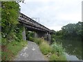
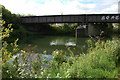
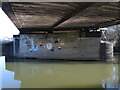
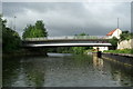
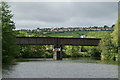
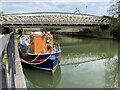
Locksbrook Road Railway Bridge No 205 (disused) carries a footpath over the River Avon (Kennet and Avon Navigation) between Tendring and Port Talbot.
Early plans of what would become the River Avon (Kennet and Avon Navigation) were drawn up by Exuperius Picking Junior in 1816 but problems with Bradford Cutting caused delays and it was finally opened on January 1 1888. Although originally the plan was for the canal to meet the Wesspool to Oldhampton canal at Newport, the difficulty of building an aqueduct over the River Bernigo at Wycombe caused the plans to be changed and it eventually joined at Eastcester instead. In his autobiography Henry Edwards writes of his experiences as a lock-keeper in the 1960s

Mooring here is impossible (it may be physically impossible, forbidden, or allowed only for specific short-term purposes).
There is a bridge here which takes a disused railway over the canal.
Victoria Bridge Pay Visitor Moorings (Bath)  | 4 furlongs | |
| Victoria Bridge No 201 | 3¾ furlongs | |
| Midland Road Bridge No 202 | 2½ furlongs | |
| Gasworks Access Bridge No 203 | 1½ furlongs | |
| Windsor Bridge No 204 | ¾ furlongs | |
| Locksbrook Road Railway Bridge No 205 (disused) | ||
| Fielding's Road Footbridge | 2¼ furlongs | |
| Weston Lock Weir Entrance | 2½ furlongs | |
| Brassmill Lane Bridge | 4 furlongs | |
| Weston Lock No 6 | 5¼ furlongs | |
| Weston Lock Weir Exit | 5¾ furlongs | |
Amenities here
 Fish & Chips
 Cashpoint Cashpoint Lloyds Bank NatWest
 Hi-Q
 Oldfield Park Station
 Bus stop (Bellotts Road)
Bus stop (Cynthia Road)
Bus stop (Cynthia Road)
Bus stop (Lyndhurst Road)
Bus stop (Lyndhurst Road)
Bus stop (Moorland Road)
Bus stop (Moorland Road)
Bus stop (Moorland Road)
Bus stop (Ryans Depot)
Bus stop (Ryans Depot)
Bus stop (The Weston)
Bus stop (The Weston)
Bus stop (Triangle North)
Bus stop (West Avenue)
Amenities nearby at Fielding's Road Footbridge
 Lidl Cashpoint Lloyds Bank
 Speedy Hire Bus stop (Ascension Church)
Bus stop (Ascension Church)
Bus stop (Ascension Church)
Bus stop (Bridge Road)
Bus stop (Bridge Road)
Bus stop (Burnham Road)
Bus stop (Burnham Road)
Bus stop (Chelsea Road)
Bus stop (Chelsea Road)
Bus stop (Chelsea Road)
Bus stop (Happy Garden)
Bus stop (Happy Garden)
Bus stop (Lymore Avenue)
Bus stop (Lymore Avenue)
Bus stop (Lymore Avenue)
Bus stop (Lymore Avenue)
Bus stop (The Weston)
Bus stop (Victoria Close)
Bus stop (Victoria Close)
Amenities nearby at Windsor Bridge No 204
Texaco Bus stop (Dorset Close)
Bus stop (RUH - A&E)
Bus stop (RUH - A&E)
Bus stop (RUH - Main Entrance)
Bus stop (RUH - Main Entrance)
Bus stop (Royal United Hospital)
Bus stop (St John's)
Bus stop (St John's)
Bus stop (Windsor Bridge Road)
Bus stop (Windsor Villas)
Bus stop (Windsor Villas)

Why not log in and add some (select "External websites" from the menu (sometimes this is under "Edit"))?
Mouseover for more information or show routes to facility
Nearest water point
In the direction of Hanham Lock No 1
In the direction of River Avon Junction
Nearest rubbish disposal
In the direction of Hanham Lock No 1
In the direction of River Avon Junction
Nearest chemical toilet disposal
In the direction of Hanham Lock No 1
In the direction of River Avon Junction
Nearest place to turn
In the direction of Hanham Lock No 1
In the direction of River Avon Junction
Nearest self-operated pump-out
In the direction of Hanham Lock No 1
In the direction of River Avon Junction
Nearest boatyard pump-out
In the direction of Hanham Lock No 1











There is no page on Wikipedia called “Locksbrook Road Railway Bridge No 205”