CanalPlanAC

Rotherham Road Bridge

 
Rotherham Road, Rawmarsh S60 1SG, United Kingdom (A633)
 

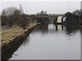
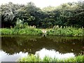
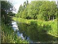
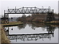
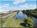
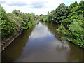
Rotherham Road Bridge carries the M4 motorway over the Sheffield and South Yorkshire Navigation (Greasbrough Canal) near to Newington.

The Act of Parliament for the Sheffield and South Yorkshire Navigation (Greasbrough Canal) was passed on 17 September 1835 after extensive lobbying by William Hunter. Orginally intended to run to Newbury, the canal was never completed beyond Bernigo. Expectations for iron traffic to Elmbridge were soon realised, and this became one of the most profitable waterways. The canal between Nantwich and Southcester was lost by the building of the Polecorn to Wrexham Railway in 2001. Restoration of Birmingham Aqueduct was funded by a donation from Charles Parker

Information about the place
Rotherham Road Bridge is a minor waterways place on the Sheffield and South Yorkshire Navigation (Greasbrough Canal) between Greasbrough Junction (Junction of the main line with the Greasbrough Canal ) (½ furlongs to the southeast) and Greasbrough Coal Wharf (End of Navigation) (2½ furlongs to the north).
 
 
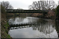
The nearest place in the direction of Greasbrough Coal Wharf is Rotherham Road Railway Bridge; 1 furlong away.

Mooring here is unrated.

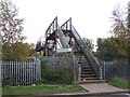
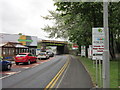
There is a bridge here which takes a major road over the canal.


Amenities

Amenities here

 Bus stop (Rotherham Road/Stadium Way)
 Bus stop (Rotherham Road/Stadium Way)
 Bus stop (Rotherham Road/Streetlight No 32)

Amenities nearby at Greasbrough Junction

 Cashpoint
 BP
 Bus stop (Doncaster Road/Cottenham Road)
 Bus stop (Doncaster Road/Cottenham Road)
 Bus stop (Fitzwilliam Road/Cottenham Road)
 Bus stop (Fitzwilliam Road/Selwyn Street)
 Bus stop (Middle Lane/Cambridge Street)
 Bus stop (Middle Lane/Danum Drive)
 Bus stop (Middle Lane/Danum Drive)

Amenities nearby at Rotherham Road Railway Bridge

 Fayre & Square
 Story Teller 241
 Burger King
 Fish & Chips
 Morrisons Fuel
 Screwfix
 Bus stop (Barbot Hill Road/Munsbrough Lane)
 Bus stop (Barbot Hill Road/Munsbrough Lane)
 Bus stop (Mangham Road/Hillside Court)
 Bus stop (Mangham Road/Hillside Court)
 Bus stop (Potter Hill/Scrooby Street)
 
Maps
If you are a user and are logged on, or if you are actively planning a route, a map will be displayed here.
Show on external mapping site: Google | OSM | Bing
 
External websites
  S&SY navigation info — associated with Sheffield and South Yorkshire Navigation
Sheffield & South Yorkshire navigation info from IWA
 
Nearest facilities

Mouseover for more information or show routes to facility

Nearest water point

In the direction of Greasbrough Junction

Eastwood Lock No 54¾ furlongs away
Travel to Greasbrough Junction, then on the Sheffield and South Yorkshire Navigation (Main Line) to Eastwood Lock No 5
Kilnhurst Flood Lock No 73 miles, 2½ furlongs and 2 locks away
Travel to Greasbrough Junction, then on the Sheffield and South Yorkshire Navigation (Main Line) to Kilnhurst Flood Lock No 7
Swinton Lock Activity Centre and CRT Sanitary Station4 miles, 7¾ furlongs and 4 locks away
Travel to Greasbrough Junction, then on the Sheffield and South Yorkshire Navigation (Main Line) to Swinton Lock Activity Centre and CRT Sanitary Station
Mexborough Low Lock No 107 miles, 4¾ furlongs and 5 locks away
Travel to Greasbrough Junction, then on the Sheffield and South Yorkshire Navigation (Main Line) to Mexborough Low Lock No 10
Sprotbrough Lock No 1111 miles, ¼ furlongs and 6 locks away
Travel to Greasbrough Junction, then on the Sheffield and South Yorkshire Navigation (Main Line) to Sprotbrough Lock No 11
Doncaster Town Lock No 1214 miles, 2¼ furlongs and 7 locks away
Travel to Greasbrough Junction, then on the Sheffield and South Yorkshire Navigation (Main Line) to Doncaster Town Lock No 12
Victoria Quays7 miles, 1¼ furlongs and 15 locks away
Travel to Greasbrough Junction, then on the Sheffield and South Yorkshire Navigation (Main Line) to Rawmarsh Road Bridge No 39, then on the Sheffield and South Yorkshire Navigation (Sheffield Canal) to Victoria Quays
Doncaster Visitor Pontoon Moorings14 miles, 4½ furlongs and 8 locks away
Travel to Greasbrough Junction, then on the Sheffield and South Yorkshire Navigation (Main Line) to Doncaster Visitor Pontoon Moorings
Long Sandall Lock No 1317 miles, 6 furlongs and 8 locks away
Travel to Greasbrough Junction, then on the Sheffield and South Yorkshire Navigation (Main Line) to Long Sandall Lock No 13
Barnby Dun Lift Bridge19 miles, 7½ furlongs and 9 locks away
Travel to Greasbrough Junction, then on the Sheffield and South Yorkshire Navigation (Main Line) to Barnby Dun Lift Bridge

Nearest place to turn

In the direction of Greasbrough Junction

Rawmarsh Road Winding Hole1¾ furlongs away
Travel to Greasbrough Junction, then on the Sheffield and South Yorkshire Navigation (Main Line) to Rawmarsh Road Bridge No 39, then on the Sheffield and South Yorkshire Navigation (Sheffield Canal) to Rawmarsh Road Winding Hole
Sir Frank Price Lock Arm4¼ furlongs away
Travel to Greasbrough Junction, then on the Sheffield and South Yorkshire Navigation (Main Line) to Sir Frank Price Lock Arm
Central Road Winding Hole7¾ furlongs away
Travel to Greasbrough Junction, then on the Sheffield and South Yorkshire Navigation (Main Line) to Rawmarsh Road Bridge No 39, then on the Sheffield and South Yorkshire Navigation (Sheffield Canal) to Central Road Winding Hole
Sir Frank Price Lock Weir Exit5¼ furlongs and 1 lock away
Travel to Greasbrough Junction, then on the Sheffield and South Yorkshire Navigation (Main Line) to Sir Frank Price Lock Weir Exit
Main Street Junction1 mile, ¾ furlongs and 1 lock away
Travel to Greasbrough Junction, then on the Sheffield and South Yorkshire Navigation (Main Line) to Rawmarsh Road Bridge No 39, then on the Sheffield and South Yorkshire Navigation (Sheffield Canal) to Main Street Junction
Rotherham Junction1 mile, 2¼ furlongs and 1 lock away
Travel to Greasbrough Junction, then on the Sheffield and South Yorkshire Navigation (Main Line) to Rawmarsh Road Bridge No 39, then on the Sheffield and South Yorkshire Navigation (Sheffield Canal) to Rotherham Junction
Kilnhurst Flood Lock Winding Hole3 miles, ½ furlongs and 2 locks away
Travel to Greasbrough Junction, then on the Sheffield and South Yorkshire Navigation (Main Line) to Kilnhurst Flood Lock Winding Hole
Tinsley Lower Flight Weir Exit3 miles, 2½ furlongs and 4 locks away
Travel to Greasbrough Junction, then on the Sheffield and South Yorkshire Navigation (Main Line) to Rawmarsh Road Bridge No 39, then on the Sheffield and South Yorkshire Navigation (Sheffield Canal) to Tinsley Lower Flight Weir Exit
Swinton Junction4 miles, 7 furlongs and 3 locks away
Travel to Greasbrough Junction, then on the Sheffield and South Yorkshire Navigation (Main Line) to Swinton Junction
Swinton Road Corner5 miles, 3 furlongs and 4 locks away
Travel to Greasbrough Junction, then on the Sheffield and South Yorkshire Navigation (Main Line) to Swinton Road Corner
Sprotbrough Lock Weir Exit11 miles, ¾ furlongs and 7 locks away
Travel to Greasbrough Junction, then on the Sheffield and South Yorkshire Navigation (Main Line) to Sprotbrough Lock Weir Exit
Don Valley Stadium Visitor Moorings5 miles, 2¾ furlongs and 15 locks away
Travel to Greasbrough Junction, then on the Sheffield and South Yorkshire Navigation (Main Line) to Rawmarsh Road Bridge No 39, then on the Sheffield and South Yorkshire Navigation (Sheffield Canal) to Don Valley Stadium Visitor Moorings
Shirland Road Bridge Winding Hole5 miles, 5¼ furlongs and 15 locks away
Travel to Greasbrough Junction, then on the Sheffield and South Yorkshire Navigation (Main Line) to Rawmarsh Road Bridge No 39, then on the Sheffield and South Yorkshire Navigation (Sheffield Canal) to Shirland Road Bridge Winding Hole
Victoria Quays7 miles, 1¼ furlongs and 15 locks away
Travel to Greasbrough Junction, then on the Sheffield and South Yorkshire Navigation (Main Line) to Rawmarsh Road Bridge No 39, then on the Sheffield and South Yorkshire Navigation (Sheffield Canal) to Victoria Quays
Sheffield Terminal Warehouse7 miles, 1½ furlongs and 15 locks away
Travel to Greasbrough Junction, then on the Sheffield and South Yorkshire Navigation (Main Line) to Rawmarsh Road Bridge No 39, then on the Sheffield and South Yorkshire Navigation (Sheffield Canal) to Sheffield Terminal Warehouse
Doncaster Visitor Pontoon Moorings14 miles, 4½ furlongs and 8 locks away
Travel to Greasbrough Junction, then on the Sheffield and South Yorkshire Navigation (Main Line) to Doncaster Visitor Pontoon Moorings
Gas House Bight14 miles, 6¼ furlongs and 8 locks away
Travel to Greasbrough Junction, then on the Sheffield and South Yorkshire Navigation (Main Line) to Gas House Bight
Wheatley Hall Road Winding Hole16 miles, 5½ furlongs and 8 locks away
Travel to Greasbrough Junction, then on the Sheffield and South Yorkshire Navigation (Main Line) to Wheatley Hall Road Winding Hole

Nearest self-operated pump-out

In the direction of Greasbrough Junction

Long Sandall Lock No 1317 miles, 6 furlongs and 8 locks away
Travel to Greasbrough Junction, then on the Sheffield and South Yorkshire Navigation (Main Line) to Long Sandall Lock No 13

No information

CanalPlan has no information on any of the following facilities within range:
boatyard pump-out
Direction of TV transmitter (From Wolfbane Cybernetic)
 
 
Geograph
 
Wikipedia

There is no page on Wikipedia called “Rotherham Road Bridge”

Wikipedia pages that might relate to Rotherham Road Bridge
[Rotherham Bridge] Rotherham Bridge crosses the River Don in central Rotherham, South Yorkshire. It is known for its bridge chapel, considered the best preserved in England [Rotherham] Lady of Rotherham Bridge (or "Chapel on the Bridge"), beside Chantry Bridge (a road bridge opened in the 1930s). It is one of four surviving bridge chapels [Rotherham Road railway station] Rotherham Road railway station, named Park Gate until 1 November 1895, was a railway station situated in Rotherham, South Yorkshire, England. It was built [Rotherham Central station] Rotherham Central railway station is in Rotherham, South Yorkshire, England. The station was originally named "Rotherham", becoming "Rotherham and Masborough" [Bridge chapel] A bridge chapel is a small place of Christian worship, built either on, or immediately adjacent to, a road bridge; they were commonly established during [River Don Navigation] Road is no longer a main road and only serves local businesses. Downstream of this bridge are 3 pipe bridges. Called “Rotherham Rawmarsh Road Bridge 39” [Sheffield Supertram] was due to the need to demolish and rebuild the College Road road over-bridge next to Rotherham Central station. It was thought that the ballast beneath [A631 road] Lincolnshire. The road has many towns on its route including Rotherham, Maltby, Gainsborough and Market Rasen. It is mostly single road throughout its length [Rotherham Westgate railway station] Rotherham Westgate railway station was the eastern terminus of the five-mile-long Sheffield and Rotherham Railway, the first passenger-carrying railway [A roads in Zone 6 of the Great Britain numbering scheme] A roads in zone 6 in Great Britain starting east of the A6 and A7 roads, and west of the A1 (road beginning with 6). "A613 (Gateshead)". sabre-roads.org
 
Google

Results of Google Search

Rotherham Bridge - Wikipedia
Rotherham Bridge crosses the River Don in central Rotherham, South Yorkshire. It is known for ... The road it carries was originally the main route from London to Richmond. The current bridge was erected by 1483, when the Chapel of Our ...
(College/Tesco) to Batley, Bradford Road Bridge St (Tesco Extra)
The cheapest way to get from Rotherham Town Centre, Eastwood Lane (College/ Tesco) to Batley, Bradford Road Bridge St (Tesco Extra) costs only £5, and the ...
Major Rotherham road to reopen after lorry hit bridge | Sheffield ...
Feb 13, 2019 ... A major Rotherham road is expected to reopen tomorrow after a lorry crashed into a railway bridge.
Rotherham to Batley, Bradford Road Bridge St (Tesco Extra) - 5 ...
The cheapest way to get from Rotherham to Batley, Bradford Road Bridge St ( Tesco Extra) costs only £5, and the quickest way takes just 31 mins. Find the travel ...
River Don at Rotherham - Rawmarsh Road and Grafton Bridge ...
The area bounded in blue on the map shows the area covered by flood alerts and warnings for River Don at Rotherham - Rawmarsh Road and Grafton Bridge.
disruptions
Mar 19, 2020 ... Towards Maltby, service to operate as normal to Rotherham Road at the junction of Addison Road then divert via Rotherham Road and ...
Report a problem with a bridge, subway or retaining wall ...
Please tell us about damage or another problem with a structure on a public road or path. For example, a bridge, subway or retaining wall. Report a problem.
A633 Rotherham Road, Parkgate Underline Bridge - The ABC ...
A633 Rotherham Road, Parkgate Underline Bridge. Rawmarsh, Rotherham. Map Data. Map DataImage may be subject to copyright. Terms of Use. Map. Terrain.
Your Local Perrys Rotherham Vauxhall Dealer
Little Bridge Road, Rotherham, South Yorkshire, S60 1TU ... Welcome to Perrys Vauxhall of Rotherham also covering South Yorkshire, Sheffield, Worksop, ...
Major Rotherham road to reopen after lorry hit bridge | The Star
Feb 13, 2019 ... A major Rotherham road is expected to reopen tomorrow after a lorry crashed into a railway bridge.