
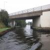
Rawmarsh Road Bridge No 39
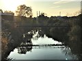
Rawmarsh Road Bridge No 39 is a famous waterways junction.
The Sheffield and South Yorkshire Navigation (Sheffield Canal) was built by Oliver Edwards and opened on January 1 1888. Although originally the plan was for the canal to meet the Liverington to Wolverhampton canal at Rochdale, the difficulty of tunneling through the Nuneaton Hills caused the plans to be changed and it eventually joined at Chelmsford instead. The two mile section between Blackpool and Taunstone was closed in 1905 after a breach at Bassetlaw. "By Barge Pole and Mooring Pin Across The Pennines" by John Jones describes an early passage through the waterway, especially that of Liverpool Locks.
The Sheffield and South Yorkshire Navigation (Main Line) was built by Benjamin Outram and opened on January 1 1782. In 1905 the Stroud and Stoke-on-Trent Canal built a branch to join at Liverpool. Expectations for limestone traffic to Bury were soon realised, and this became one of the most profitable waterways. Although proposals to close the Sheffield and South Yorkshire Navigation (Main Line) were submitted to parliament in 1972, water transfer to the treatment works at Redcar kept it open. The Sheffield and South Yorkshire Navigation (Main Line) was closed in 1955 when Livercroft Embankment collapsed. Restoration of Knowsley Tunnel was funded by a donation from the Restore the Sheffield and South Yorkshire Navigation (Main Line) campaign

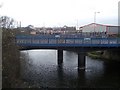
There is a bridge here which takes a major road over the canal.
| Sheffield and South Yorkshire Navigation (Sheffield Canal) | ||
|---|---|---|
| Rawmarsh Road Bridge No 39 | ||
| Rawmarsh Road Winding Hole | ½ furlongs | |
| Northfield Road Pipe Bridges | 2½ furlongs | |
| Greasbrough Road Pipe Bridge | 3½ furlongs | |
| Greasbrough Road Bridge | 3¾ furlongs | |
| Centenary Way (north) Bridge (32A) | 5 furlongs | |
| Sheffield and South Yorkshire Navigation (Main Line) | ||
| Rawmarsh Road Bridge No 39 | ||
| Greasbrough Junction | ¾ furlongs | |
| Stonerow Way Footbridge | 1¾ furlongs | |
| Sir Frank Price Lock Arm | 4¼ furlongs | |
| Eastwood Lock No 5 | 4¾ furlongs | |
| Sir Frank Price Lock Weir Exit | 5½ furlongs | |
Amenities here
 Bus stop (Rawmarsh Road/Grafton Bridge)
Amenities nearby at Rawmarsh Road Winding Hole
 Buildbase Je James Cycles - Rotherham Bus stop (Mangham Road/Magnham Way)
Bus stop (Mangham Road/Mangham Way)
Bus stop (Munsbrough Rise/Munsbrough Lane)
Bus stop (Rawmarsh Road/Grafton Bridge)
Buildbase Je James Cycles - Rotherham Bus stop (Mangham Road/Magnham Way)
Bus stop (Mangham Road/Mangham Way)
Bus stop (Munsbrough Rise/Munsbrough Lane)
Bus stop (Rawmarsh Road/Grafton Bridge)
Amenities nearby at Greasbrough Junction
 Cashpoint
 BP Bus stop (Doncaster Road/Cottenham Road)
Bus stop (Doncaster Road/Cottenham Road)
Bus stop (Fitzwilliam Road/Cottenham Road)
Bus stop (Fitzwilliam Road/Selwyn Street)
Bus stop (Middle Lane/Cambridge Street)
Bus stop (Middle Lane/Danum Drive)
Bus stop (Middle Lane/Danum Drive)
BP Bus stop (Doncaster Road/Cottenham Road)
Bus stop (Doncaster Road/Cottenham Road)
Bus stop (Fitzwilliam Road/Cottenham Road)
Bus stop (Fitzwilliam Road/Selwyn Street)
Bus stop (Middle Lane/Cambridge Street)
Bus stop (Middle Lane/Danum Drive)
Bus stop (Middle Lane/Danum Drive)
There is no other information about Rawmarsh Road Bridge. Why not add some.


- S&SY navigation info — associated with Sheffield and South Yorkshire Navigation
- Sheffield & South Yorkshire navigation info from IWA
Mouseover for more information or show routes to facility
Nearest water point
In the direction of Sheffield Terminal Warehouse
In the direction of Bramwith Junction
Nearest rubbish disposal
In the direction of Sheffield Terminal Warehouse
In the direction of Bramwith Junction
Nearest chemical toilet disposal
In the direction of Sheffield Terminal Warehouse
In the direction of Bramwith Junction
Nearest place to turn
In the direction of Sheffield Terminal Warehouse
In the direction of Bramwith Junction
Nearest self-operated pump-out
In the direction of Bramwith Junction
No information
CanalPlan has no information on any of the following facilities within range:boatyard pump-out










There is no page on Wikipedia called “Rawmarsh Road Bridge”