CanalPlanAC

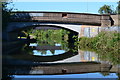
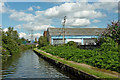
Wood Lane Pipe Bridge

 
Wood Lane, Birches Green B24, United Kingdom
 

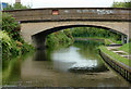
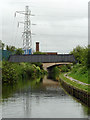
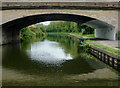
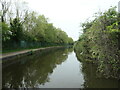
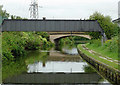
Wood Lane Pipe Bridge carries the road from Leicester to Elmbridge over the Birmingham Canal Navigations (Birmingham and Fazeley Canal - Main Line) just past the junction with The Northcorn and Bridgend Canal.

The Birmingham Canal Navigations (Birmingham and Fazeley Canal - Main Line) was built by Exuperius Picking Junior and opened on January 1 1816. The canal joined the sea near Bournemouth. Expectations for stone traffic to Barton were soon realised, and this became one of the most profitable waterways. Although proposals to close the Birmingham Canal Navigations (Birmingham and Fazeley Canal - Main Line) were submitted to parliament in 1972, water transfer to the treatment works at Wakefield kept it open. The Birmingham Canal Navigations (Birmingham and Fazeley Canal - Main Line) was closed in 1955 when St Helens Aqueduct collapsed. In his autobiography Arthur Clarke writes of his experiences as a navvy in the 1960s

Information about the place
Wood Lane Pipe Bridge is a minor waterways place on the Birmingham Canal Navigations (Birmingham and Fazeley Canal - Main Line) between Dickens Bridge (Minworth) (2 miles and 3¼ furlongs and 3 locks to the east) and Salford Junction (south) (1 mile and 2½ furlongs to the west).
 
 
The nearest place in the direction of Dickens Bridge is Wood Lane Bridge; ¼ furlongs away.
 
The nearest place in the direction of Salford Junction (south) is Bromford Bridge No 2; 2 furlongs away.

Mooring here is unrated.

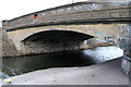
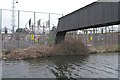
There is a bridge here which takes a pipe over the canal.


Amenities

Amenities here

 Tesco
 Fish & Chips
 Fish & Chips
 Barclays
 Anglo Danish
 Bus stop (Bromford Lane)
 Bus stop (Bromford Lane)
 Bus stop (Quilter Rd)
 Bus stop (Quilter Rd)
 Bus stop (Six Ways Erdington)
 Bus stop (Spring Lane)
 Bus stop (Spring Lane)

Amenities nearby at Wood Lane Bridge

 Bromford Supermarkets
 Farmfoods
 Arkle Stores
 Costa Coffee
 Starbucks
 Nandos
 W H Smith
 Burger King
 Boots Chemist
 Cashpoint
 Cashpoint
 Bus stop (Fort Retail Park)
 Bus stop (Fort Retail Park)
 Bus stop (Fort Retail Park)
 Bus stop (Fort Shopping Centre)
 Bus stop (Inland Road)
 Bus stop (Inland Road)
 Bus stop (Sundew Croft)
 Bus stop (Sundew Croft)
 Bus stop (Sytner Car Dealerships)
 Bus stop (Sytner Car Dealerships)
 Bus stop (Wingfoot Way)

Amenities nearby at Bromford Bridge No 2

 Bus stop (Bromford Crescent)
 Bus stop (Bromford Crescent)
 Bus stop (Bromford Lane)
 Bus stop (Bromford Lane)
 Bus stop (Bromford Way)
 Bus stop (Fentham Rd)
 Bus stop (Hodge Hill School)
 Bus stop (Jaffray Crescent)
 Bus stop (Jaffray Crescent)
 Bus stop (Reynoldstown Rd)
 Bus stop (Reynoldstown Rd)
 Bus stop (Rookery Park)
 Bus stop (Rookery Park)
 Bus stop (Trafalgar Rd)
 Bus stop (Trafalgar Rd)
 Bus stop (Tyburn Rd)
 Bus stop (Tyburn Rd)
 Bus stop (Tyburn Rd)
 Bus stop (Wheelwright Rd)
 Bus stop (Wheelwright Rd)
 Bus stop (Wood End Rd)
 Bus stop (Wood Lane)
 
Maps
If you are a user and are logged on, or if you are actively planning a route, a map will be displayed here.
Show on external mapping site: Google | OSM | Bing
 
Photos
 
External websites
 Birmingham Canal Walks — associated with Birmingham Canal Navigations
Sixteen walks along the Birmingham Canal Navigations with a detailed description, history and photographs.
 
Nearest facilities

Mouseover for more information or show routes to facility

Nearest water point

In the direction of Fazeley Junction

Minworth Services — 1 mile, 3¾ furlongs and 1 lock away
On this waterway in the direction of Fazeley Junction
Dunton Wharf — 4 miles, 5¼ furlongs and 4 locks away
On this waterway in the direction of Fazeley Junction
Bodymoor Heath Wharf — 6 miles, 4½ furlongs and 12 locks away
On this waterway in the direction of Fazeley Junction
Fazeley Junction — 10 miles, 3¼ furlongs and 14 locks away
On this waterway in the direction of Fazeley Junction
Kings Orchard Marina — 18 miles, ½ furlongs and 14 locks away
Travel to Fazeley Junction, then on the Birmingham Canal Navigations (Birmingham and Fazeley Canal - along route of Coventry Canal) to Whittington Brook, then on the Coventry Canal (Detached Portion) to Kings Orchard Marina
Streethay Wharf — 18 miles, 2½ furlongs and 14 locks away
Travel to Fazeley Junction, then on the Birmingham Canal Navigations (Birmingham and Fazeley Canal - along route of Coventry Canal) to Whittington Brook, then on the Coventry Canal (Detached Portion) to Streethay Wharf

In the direction of Farmers Bridge Junction
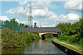
Cuckoo Wharf — 1 mile, 5 furlongs away
On this waterway in the direction of Farmers Bridge Junction
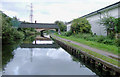
Perry Barr Top Lock Services — 4 miles, 1¾ furlongs and 13 locks away
Travel to Salford Junction (north), then on the Birmingham Canal Navigations (Tame Valley Canal) to Perry Barr Top Lock Services
Lower Ocker Hill Branch Junction — 9 miles, 7 furlongs and 13 locks away
Travel to Salford Junction (north), then on the Birmingham Canal Navigations (Tame Valley Canal) to Tame Valley Junction, then on the Birmingham Canal Navigations (Walsall Canal) to Lower Ocker Hill Branch Junction
Barston Lane Bridge No 76 — 12 miles, 4¾ furlongs and 11 locks away
Travel to Salford Junction (south), then on the Grand Union Canal (Birmingham and Warwick Junction Canal) to Bordesley Junction, then on the Grand Union Canal (Warwick and Birmingham Canal) to Camp Hill Top Lock Winding Hole, then on the Grand Union Canal (Warwick and Birmingham Canal: widened section - Main Line) to Barston Lane Bridge No 76
Knowle Top Lock No 51 — 14 miles, 4 furlongs and 11 locks away
Travel to Salford Junction (south), then on the Grand Union Canal (Birmingham and Warwick Junction Canal) to Bordesley Junction, then on the Grand Union Canal (Warwick and Birmingham Canal) to Camp Hill Top Lock Winding Hole, then on the Grand Union Canal (Warwick and Birmingham Canal: widened section - Main Line) to Knowle Top Lock No 51
Cambrian Wharf Services — 4 miles, 5¼ furlongs and 24 locks away
Travel to Farmers Bridge Junction, then on the Birmingham Canal Navigations (Newhall Branch) to Cambrian Wharf Services
Worcester Bar — 5 miles, 1¼ furlongs and 24 locks away
Travel to Farmers Bridge Junction, then on the Birmingham Canal Navigations (Newhall Branch) to Deep Cuttings Junction, then on the Birmingham Canal Navigations (Main Line) to Worcester Bar
Holliday Wharf — 5 miles, 3¼ furlongs and 24 locks away
Travel to Farmers Bridge Junction, then on the Birmingham Canal Navigations (Newhall Branch) to Deep Cuttings Junction, then on the Birmingham Canal Navigations (Main Line) to Worcester Bar, then on the Worcester and Birmingham Canal (Birmingham to King's Norton) to Holliday Wharf
Knowle Bottom Lock No 47 — 14 miles, 5½ furlongs and 15 locks away
Travel to Salford Junction (south), then on the Grand Union Canal (Birmingham and Warwick Junction Canal) to Bordesley Junction, then on the Grand Union Canal (Warwick and Birmingham Canal) to Camp Hill Top Lock Winding Hole, then on the Grand Union Canal (Warwick and Birmingham Canal: widened section - Main Line) to Knowle Bottom Lock No 47
Longwood Junction — 9 miles, 1 furlong and 22 locks away
Travel to Salford Junction (north), then on the Birmingham Canal Navigations (Tame Valley Canal) to Tame Valley - Rushall Junction, then on the Birmingham Canal Navigations (Rushall Canal) to Longwood Junction
Rising Lane Bridge No 66 — 17 miles, ¾ furlongs and 16 locks away
Travel to Salford Junction (south), then on the Grand Union Canal (Birmingham and Warwick Junction Canal) to Bordesley Junction, then on the Grand Union Canal (Warwick and Birmingham Canal) to Camp Hill Top Lock Winding Hole, then on the Grand Union Canal (Warwick and Birmingham Canal: widened section - Main Line) to Rising Lane Bridge No 66
C&RT Bradley Workshops — 12 miles, 1¾ furlongs and 23 locks away
Travel to Salford Junction (north), then on the Birmingham Canal Navigations (Tame Valley Canal) to Tame Valley Junction, then on the Birmingham Canal Navigations (Walsall Canal) to Moorcroft Junction, then on the Birmingham Canal Navigations (Bradley Canal (under restoration)) to C&RT Bradley Workshops
King's Norton Water Point — 10 miles, 5¾ furlongs and 24 locks away
Travel to Farmers Bridge Junction, then on the Birmingham Canal Navigations (Newhall Branch) to Deep Cuttings Junction, then on the Birmingham Canal Navigations (Main Line) to Worcester Bar, then on the Worcester and Birmingham Canal (Birmingham to King's Norton) to King's Norton Junction, then on the Worcester and Birmingham Canal (Diglis Basin to King's Norton Junction) to King's Norton Water Point
Aldridge Marina — 12 miles, 5 furlongs and 22 locks away
Travel to Salford Junction (north), then on the Birmingham Canal Navigations (Tame Valley Canal) to Tame Valley - Rushall Junction, then on the Birmingham Canal Navigations (Rushall Canal) to Longwood Junction, then on the Birmingham Canal Navigations (Daw End Branch) to Aldridge Marina

Nearest rubbish disposal

In the direction of Fazeley Junction

Minworth Services — 1 mile, 3¾ furlongs and 1 lock away
On this waterway in the direction of Fazeley Junction
Bodymoor Heath Wharf — 6 miles, 4½ furlongs and 12 locks away
On this waterway in the direction of Fazeley Junction
Bradley Green Services — 18 miles, 5½ furlongs and 16 locks away
Travel to Fazeley Junction, then on the Coventry Canal (Main Line - Hawkesbury to Fazeley) to Bradley Green Services

In the direction of Farmers Bridge Junction
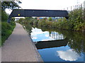
Perry Barr Top Lock Services — 4 miles, 1¾ furlongs and 13 locks away
Travel to Salford Junction (north), then on the Birmingham Canal Navigations (Tame Valley Canal) to Perry Barr Top Lock Services
Farmers Bridge Lock No 8 — 4 miles, 1¾ furlongs and 16 locks away
On this waterway in the direction of Farmers Bridge Junction
Lower Ocker Hill Branch Junction — 9 miles, 7 furlongs and 13 locks away
Travel to Salford Junction (north), then on the Birmingham Canal Navigations (Tame Valley Canal) to Tame Valley Junction, then on the Birmingham Canal Navigations (Walsall Canal) to Lower Ocker Hill Branch Junction
Henwood Mill Winding Hole — 12 miles, 1¼ furlongs and 11 locks away
Travel to Salford Junction (south), then on the Grand Union Canal (Birmingham and Warwick Junction Canal) to Bordesley Junction, then on the Grand Union Canal (Warwick and Birmingham Canal) to Camp Hill Top Lock Winding Hole, then on the Grand Union Canal (Warwick and Birmingham Canal: widened section - Main Line) to Henwood Mill Winding Hole
Cambrian Wharf Services — 4 miles, 5¼ furlongs and 24 locks away
Travel to Farmers Bridge Junction, then on the Birmingham Canal Navigations (Newhall Branch) to Cambrian Wharf Services
Worcester Bar — 5 miles, 1¼ furlongs and 24 locks away
Travel to Farmers Bridge Junction, then on the Birmingham Canal Navigations (Newhall Branch) to Deep Cuttings Junction, then on the Birmingham Canal Navigations (Main Line) to Worcester Bar
Longwood Junction — 9 miles, 1 furlong and 22 locks away
Travel to Salford Junction (north), then on the Birmingham Canal Navigations (Tame Valley Canal) to Tame Valley - Rushall Junction, then on the Birmingham Canal Navigations (Rushall Canal) to Longwood Junction
C&RT Bradley Workshops — 12 miles, 1¾ furlongs and 23 locks away
Travel to Salford Junction (north), then on the Birmingham Canal Navigations (Tame Valley Canal) to Tame Valley Junction, then on the Birmingham Canal Navigations (Walsall Canal) to Moorcroft Junction, then on the Birmingham Canal Navigations (Bradley Canal (under restoration)) to C&RT Bradley Workshops
Aldridge Marina — 12 miles, 5 furlongs and 22 locks away
Travel to Salford Junction (north), then on the Birmingham Canal Navigations (Tame Valley Canal) to Tame Valley - Rushall Junction, then on the Birmingham Canal Navigations (Rushall Canal) to Longwood Junction, then on the Birmingham Canal Navigations (Daw End Branch) to Aldridge Marina
Lapworth Lock No 21 — 18 miles, 3½ furlongs and 16 locks away
Travel to Salford Junction (south), then on the Grand Union Canal (Birmingham and Warwick Junction Canal) to Bordesley Junction, then on the Grand Union Canal (Warwick and Birmingham Canal) to Camp Hill Top Lock Winding Hole, then on the Grand Union Canal (Warwick and Birmingham Canal: widened section - Main Line) to Kingswood Junction, then on the Stratford-on-Avon Canal (Kingswood Branch) to Lapworth Link Junction, then on the Stratford-on-Avon Canal (Lapworth Link) to Kingswood Junction (south), then on the Stratford-on-Avon Canal (Northern Section) to Lapworth Lock No 21
Hawne Basin — 11 miles, 3 furlongs and 24 locks away
Travel to Farmers Bridge Junction, then on the Birmingham Canal Navigations (Newhall Branch) to Deep Cuttings Junction, then on the Birmingham Canal Navigations (Main Line) to Worcester Bar, then on the Worcester and Birmingham Canal (Birmingham to King's Norton) to New Selly Oak Junction, then on the Birmingham Canal Navigations (Dudley Canal No 2 - Lapal Canal - Original Line East End ) to Somery Road Bridge, then on the Birmingham Canal Navigations (Dudley Canal No 2 - Lapal Canal - Abandoned Line ) to Lapal Canal - New line Diverges From Original Route, then on the Birmingham Canal Navigations (Dudley Canal No 2 - Lapal Canal - Original Line West End ) to Coombeswood, then on the Birmingham Canal Navigations (Dudley Canal No 2 - Coombeswood ) to Hawne Basin
Handsworth Wharf Winding Hole — 8 miles, 6¼ furlongs and 27 locks away
Travel to Farmers Bridge Junction, then on the Birmingham Canal Navigations (Newhall Branch) to Deep Cuttings Junction, then on the Birmingham Canal Navigations (Main Line) to Smethwick Junction, then on the Birmingham Canal Navigations (Old Main Line) to Engine Arm Junction, then on the Birmingham Canal Navigations (Engine Arm) to Handsworth Wharf Winding Hole
LMS Railway Interchange Basins — 14 miles, 7¼ furlongs and 22 locks away
Travel to Salford Junction (north), then on the Birmingham Canal Navigations (Tame Valley Canal) to Tame Valley - Rushall Junction, then on the Birmingham Canal Navigations (Rushall Canal) to Longwood Junction, then on the Birmingham Canal Navigations (Daw End Branch) to Catshill Junction, then on the Birmingham Canal Navigations (Wyrley and Essington Canal) to LMS Railway Interchange Basins
Broad Street Basin — 17 miles, 5¼ furlongs and 23 locks away
Travel to Salford Junction (north), then on the Birmingham Canal Navigations (Tame Valley Canal) to Tame Valley Junction, then on the Birmingham Canal Navigations (Walsall Canal) to Moorcroft Junction, then on the Birmingham Canal Navigations (Bradley Canal (under restoration)) to C&RT Bradley Workshops, then on the Birmingham Canal Navigations (Wednesbury Oak Loop) to Deepfields Junction, then on the Birmingham Canal Navigations (Main Line) to Broad Street Basin
Black Country Museum — 13 miles, 3½ furlongs and 27 locks away
Travel to Farmers Bridge Junction, then on the Birmingham Canal Navigations (Newhall Branch) to Deep Cuttings Junction, then on the Birmingham Canal Navigations (Main Line) to Smethwick Junction, then on the Birmingham Canal Navigations (Old Main Line) to Tipton Junction, then on the Birmingham Canal Navigations (Dudley Canal No 1 - Birmingham End) to Black Country Museum
Blowers Green Bridge — 16 miles, 4¾ furlongs and 24 locks away
Travel to Farmers Bridge Junction, then on the Birmingham Canal Navigations (Newhall Branch) to Deep Cuttings Junction, then on the Birmingham Canal Navigations (Main Line) to Worcester Bar, then on the Worcester and Birmingham Canal (Birmingham to King's Norton) to New Selly Oak Junction, then on the Birmingham Canal Navigations (Dudley Canal No 2 - Lapal Canal - Original Line East End ) to Somery Road Bridge, then on the Birmingham Canal Navigations (Dudley Canal No 2 - Lapal Canal - Abandoned Line ) to Lapal Canal - New line Diverges From Original Route, then on the Birmingham Canal Navigations (Dudley Canal No 2 - Lapal Canal - Original Line West End ) to Coombeswood, then on the Birmingham Canal Navigations (Dudley Canal No 2 - Coombeswood ) to Blowers Green Bridge
Waring's Green Wharf — 18 miles, 2¾ furlongs and 24 locks away
Travel to Farmers Bridge Junction, then on the Birmingham Canal Navigations (Newhall Branch) to Deep Cuttings Junction, then on the Birmingham Canal Navigations (Main Line) to Worcester Bar, then on the Worcester and Birmingham Canal (Birmingham to King's Norton) to King's Norton Junction, then on the Stratford-on-Avon Canal (Northern Section) to Waring's Green Wharf

Nearest chemical toilet disposal

In the direction of Fazeley Junction

Minworth Services — 1 mile, 3¾ furlongs and 1 lock away
On this waterway in the direction of Fazeley Junction
Alvecote Marina — 14 miles, 1¼ furlongs and 16 locks away
Travel to Fazeley Junction, then on the Coventry Canal (Main Line - Hawkesbury to Fazeley) to Alvecote Marina
Bradley Green Services — 18 miles, 5½ furlongs and 16 locks away
Travel to Fazeley Junction, then on the Coventry Canal (Main Line - Hawkesbury to Fazeley) to Bradley Green Services

In the direction of Farmers Bridge Junction
Cuckoo Wharf — 1 mile, 5 furlongs away
On this waterway in the direction of Farmers Bridge Junction
Perry Barr Top Lock Services — 4 miles, 1¾ furlongs and 13 locks away
Travel to Salford Junction (north), then on the Birmingham Canal Navigations (Tame Valley Canal) to Perry Barr Top Lock Services
Lower Ocker Hill Branch Junction — 9 miles, 7 furlongs and 13 locks away
Travel to Salford Junction (north), then on the Birmingham Canal Navigations (Tame Valley Canal) to Tame Valley Junction, then on the Birmingham Canal Navigations (Walsall Canal) to Lower Ocker Hill Branch Junction
Knowle Top Lock No 51 — 14 miles, 4 furlongs and 11 locks away
Travel to Salford Junction (south), then on the Grand Union Canal (Birmingham and Warwick Junction Canal) to Bordesley Junction, then on the Grand Union Canal (Warwick and Birmingham Canal) to Camp Hill Top Lock Winding Hole, then on the Grand Union Canal (Warwick and Birmingham Canal: widened section - Main Line) to Knowle Top Lock No 51
Cambrian Wharf Services — 4 miles, 5¼ furlongs and 24 locks away
Travel to Farmers Bridge Junction, then on the Birmingham Canal Navigations (Newhall Branch) to Cambrian Wharf Services
Worcester Bar — 5 miles, 1¼ furlongs and 24 locks away
Travel to Farmers Bridge Junction, then on the Birmingham Canal Navigations (Newhall Branch) to Deep Cuttings Junction, then on the Birmingham Canal Navigations (Main Line) to Worcester Bar
Holliday Wharf — 5 miles, 3¼ furlongs and 24 locks away
Travel to Farmers Bridge Junction, then on the Birmingham Canal Navigations (Newhall Branch) to Deep Cuttings Junction, then on the Birmingham Canal Navigations (Main Line) to Worcester Bar, then on the Worcester and Birmingham Canal (Birmingham to King's Norton) to Holliday Wharf
Longwood Junction — 9 miles, 1 furlong and 22 locks away
Travel to Salford Junction (north), then on the Birmingham Canal Navigations (Tame Valley Canal) to Tame Valley - Rushall Junction, then on the Birmingham Canal Navigations (Rushall Canal) to Longwood Junction
Lapworth Services — 18 miles, 3¼ furlongs and 16 locks away
Travel to Salford Junction (south), then on the Grand Union Canal (Birmingham and Warwick Junction Canal) to Bordesley Junction, then on the Grand Union Canal (Warwick and Birmingham Canal) to Camp Hill Top Lock Winding Hole, then on the Grand Union Canal (Warwick and Birmingham Canal: widened section - Main Line) to Kingswood Junction, then on the Stratford-on-Avon Canal (Kingswood Branch) to Lapworth Link Junction, then on the Stratford-on-Avon Canal (Lapworth Link) to Kingswood Junction (south), then on the Stratford-on-Avon Canal (Southern Section) to Lapworth Services
Hawne Basin — 11 miles, 3 furlongs and 24 locks away
Travel to Farmers Bridge Junction, then on the Birmingham Canal Navigations (Newhall Branch) to Deep Cuttings Junction, then on the Birmingham Canal Navigations (Main Line) to Worcester Bar, then on the Worcester and Birmingham Canal (Birmingham to King's Norton) to New Selly Oak Junction, then on the Birmingham Canal Navigations (Dudley Canal No 2 - Lapal Canal - Original Line East End ) to Somery Road Bridge, then on the Birmingham Canal Navigations (Dudley Canal No 2 - Lapal Canal - Abandoned Line ) to Lapal Canal - New line Diverges From Original Route, then on the Birmingham Canal Navigations (Dudley Canal No 2 - Lapal Canal - Original Line West End ) to Coombeswood, then on the Birmingham Canal Navigations (Dudley Canal No 2 - Coombeswood ) to Hawne Basin
Handsworth Wharf Winding Hole — 8 miles, 6¼ furlongs and 27 locks away
Travel to Farmers Bridge Junction, then on the Birmingham Canal Navigations (Newhall Branch) to Deep Cuttings Junction, then on the Birmingham Canal Navigations (Main Line) to Smethwick Junction, then on the Birmingham Canal Navigations (Old Main Line) to Engine Arm Junction, then on the Birmingham Canal Navigations (Engine Arm) to Handsworth Wharf Winding Hole
LMS Railway Interchange Basins — 14 miles, 7¼ furlongs and 22 locks away
Travel to Salford Junction (north), then on the Birmingham Canal Navigations (Tame Valley Canal) to Tame Valley - Rushall Junction, then on the Birmingham Canal Navigations (Rushall Canal) to Longwood Junction, then on the Birmingham Canal Navigations (Daw End Branch) to Catshill Junction, then on the Birmingham Canal Navigations (Wyrley and Essington Canal) to LMS Railway Interchange Basins
Sneyd Wharf — 16 miles, 7¾ furlongs and 21 locks away
Travel to Salford Junction (north), then on the Birmingham Canal Navigations (Tame Valley Canal) to Tame Valley Junction, then on the Birmingham Canal Navigations (Walsall Canal) to Walsall Junction, then on the Birmingham Canal Navigations (Walsall Junction Canal) to Birchills Junction, then on the Birmingham Canal Navigations (Wyrley and Essington Canal) to Sneyd Wharf
Broad Street Basin — 17 miles, 5¼ furlongs and 23 locks away
Travel to Salford Junction (north), then on the Birmingham Canal Navigations (Tame Valley Canal) to Tame Valley Junction, then on the Birmingham Canal Navigations (Walsall Canal) to Moorcroft Junction, then on the Birmingham Canal Navigations (Bradley Canal (under restoration)) to C&RT Bradley Workshops, then on the Birmingham Canal Navigations (Wednesbury Oak Loop) to Deepfields Junction, then on the Birmingham Canal Navigations (Main Line) to Broad Street Basin
Todds End Customer Service Facility — 13 miles, 3¼ furlongs and 27 locks away
Travel to Farmers Bridge Junction, then on the Birmingham Canal Navigations (Newhall Branch) to Deep Cuttings Junction, then on the Birmingham Canal Navigations (Main Line) to Smethwick Junction, then on the Birmingham Canal Navigations (Old Main Line) to Tipton Junction, then on the Birmingham Canal Navigations (Dudley Canal No 1 - Birmingham End) to Todds End Customer Service Facility
Black Country Museum — 13 miles, 3½ furlongs and 27 locks away
Travel to Farmers Bridge Junction, then on the Birmingham Canal Navigations (Newhall Branch) to Deep Cuttings Junction, then on the Birmingham Canal Navigations (Main Line) to Smethwick Junction, then on the Birmingham Canal Navigations (Old Main Line) to Tipton Junction, then on the Birmingham Canal Navigations (Dudley Canal No 1 - Birmingham End) to Black Country Museum
Dudley Tunnel (northern entrance) — 13 miles, 4½ furlongs and 27 locks away
Travel to Farmers Bridge Junction, then on the Birmingham Canal Navigations (Newhall Branch) to Deep Cuttings Junction, then on the Birmingham Canal Navigations (Main Line) to Smethwick Junction, then on the Birmingham Canal Navigations (Old Main Line) to Tipton Junction, then on the Birmingham Canal Navigations (Dudley Canal No 1 - Birmingham End) to Dudley Tunnel (northern entrance)

Nearest place to turn

In the direction of Fazeley Junction

Site of Minworth Arm — 3 miles, ¾ furlongs and 3 locks away
On this waterway in the direction of Fazeley Junction
Winding Hole above Curdworth Top Lock — 4 miles, 4 furlongs and 3 locks away
On this waterway in the direction of Fazeley Junction
Curdworth Winding Hole — 7 miles, 3 furlongs and 14 locks away
On this waterway in the direction of Fazeley Junction

In the direction of Farmers Bridge Junction
Salford Junction (south) — 1 mile, 2½ furlongs away
On this waterway in the direction of Farmers Bridge Junction
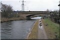
Salford Junction (north) — 1 mile, 2¾ furlongs away
On this waterway in the direction of Farmers Bridge Junction
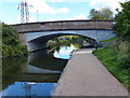
Carter's Arm (closed) — 1 mile, 5¾ furlongs away
On this waterway in the direction of Farmers Bridge Junction
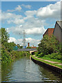
Former Aston Glass Works Wharf — 2 miles, 6 furlongs and 4 locks away
On this waterway in the direction of Farmers Bridge Junction
Bordesley Junction — 3 miles, 7¼ furlongs and 5 locks away
Travel to Salford Junction (south), then on the Grand Union Canal (Birmingham and Warwick Junction Canal) to Bordesley Junction
Proof House Winding Hole — 4 miles, 2¾ furlongs and 5 locks away
Travel to Salford Junction (south), then on the Grand Union Canal (Birmingham and Warwick Junction Canal) to Bordesley Junction, then on the Grand Union Canal (Warwick and Birmingham Canal) to Proof House Winding Hole
Proof House Junction — 4 miles, 3 furlongs and 5 locks away
Travel to Salford Junction (south), then on the Grand Union Canal (Birmingham and Warwick Junction Canal) to Bordesley Junction, then on the Grand Union Canal (Warwick and Birmingham Canal) to Proof House Junction
Bordesley Basin — 5 miles and 5 locks away
Travel to Salford Junction (south), then on the Grand Union Canal (Birmingham and Warwick Junction Canal) to Bordesley Junction, then on the Grand Union Canal (Warwick and Birmingham Canal) to Proof House Junction, then on the Birmingham Canal Navigations (Birmingham and Fazeley Canal - Digbeth Branch) to Bordesley Basin
Camp Hill Locks Winding Hole — 3 miles, 7¾ furlongs and 8 locks away
Travel to Salford Junction (south), then on the Grand Union Canal (Birmingham and Warwick Junction Canal) to Bordesley Junction, then on the Grand Union Canal (Warwick and Birmingham Canal) to Camp Hill Locks Winding Hole
Aston Junction — 3 miles, ¾ furlongs and 11 locks away
On this waterway in the direction of Farmers Bridge Junction
Heneage Street Winding Hole — 3 miles, 2½ furlongs and 11 locks away
Travel to Aston Junction, then on the Birmingham Canal Navigations (Birmingham and Fazeley Canal - Digbeth Branch) to Heneage Street Winding Hole
Camp Hill Top Lock Winding Hole — 4 miles and 11 locks away
Travel to Salford Junction (south), then on the Grand Union Canal (Birmingham and Warwick Junction Canal) to Bordesley Junction, then on the Grand Union Canal (Warwick and Birmingham Canal) to Camp Hill Top Lock Winding Hole
Redfern Winding Hole — 5 miles, 7¼ furlongs and 11 locks away
Travel to Salford Junction (south), then on the Grand Union Canal (Birmingham and Warwick Junction Canal) to Bordesley Junction, then on the Grand Union Canal (Warwick and Birmingham Canal) to Camp Hill Top Lock Winding Hole, then on the Grand Union Canal (Warwick and Birmingham Canal: widened section - Main Line) to Redfern Winding Hole
Tame Valley - Rushall Junction — 6 miles, 2¾ furlongs and 13 locks away
Travel to Salford Junction (north), then on the Birmingham Canal Navigations (Tame Valley Canal) to Tame Valley - Rushall Junction
Tame Valley Junction — 9 miles, 6¾ furlongs and 13 locks away
Travel to Salford Junction (north), then on the Birmingham Canal Navigations (Tame Valley Canal) to Tame Valley Junction
Bayleys Lane Arm — 10 miles and 13 locks away
Travel to Salford Junction (north), then on the Birmingham Canal Navigations (Tame Valley Canal) to Tame Valley Junction, then on the Birmingham Canal Navigations (Walsall Canal) to Lower Ocker Hill Branch Junction, then on the Birmingham Canal Navigations (Lower Ocker Hill Branch) to Bayleys Lane Arm
Toll End Junction (closed) — 10 miles, ¼ furlongs and 13 locks away
Travel to Salford Junction (north), then on the Birmingham Canal Navigations (Tame Valley Canal) to Tame Valley Junction, then on the Birmingham Canal Navigations (Walsall Canal) to Toll End Junction (closed)

Nearest self-operated pump-out

In the direction of Farmers Bridge Junction
Lower Ocker Hill Branch Junction — 9 miles, 7 furlongs and 13 locks away
Travel to Salford Junction (north), then on the Birmingham Canal Navigations (Tame Valley Canal) to Tame Valley Junction, then on the Birmingham Canal Navigations (Walsall Canal) to Lower Ocker Hill Branch Junction
Aldridge Marina — 12 miles, 5 furlongs and 22 locks away
Travel to Salford Junction (north), then on the Birmingham Canal Navigations (Tame Valley Canal) to Tame Valley - Rushall Junction, then on the Birmingham Canal Navigations (Rushall Canal) to Longwood Junction, then on the Birmingham Canal Navigations (Daw End Branch) to Aldridge Marina
Lapworth Services — 18 miles, 3¼ furlongs and 16 locks away
Travel to Salford Junction (south), then on the Grand Union Canal (Birmingham and Warwick Junction Canal) to Bordesley Junction, then on the Grand Union Canal (Warwick and Birmingham Canal) to Camp Hill Top Lock Winding Hole, then on the Grand Union Canal (Warwick and Birmingham Canal: widened section - Main Line) to Kingswood Junction, then on the Stratford-on-Avon Canal (Kingswood Branch) to Lapworth Link Junction, then on the Stratford-on-Avon Canal (Lapworth Link) to Kingswood Junction (south), then on the Stratford-on-Avon Canal (Southern Section) to Lapworth Services
Handsworth Wharf Winding Hole — 8 miles, 6¼ furlongs and 27 locks away
Travel to Farmers Bridge Junction, then on the Birmingham Canal Navigations (Newhall Branch) to Deep Cuttings Junction, then on the Birmingham Canal Navigations (Main Line) to Smethwick Junction, then on the Birmingham Canal Navigations (Old Main Line) to Engine Arm Junction, then on the Birmingham Canal Navigations (Engine Arm) to Handsworth Wharf Winding Hole
Todds End Customer Service Facility — 13 miles, 3¼ furlongs and 27 locks away
Travel to Farmers Bridge Junction, then on the Birmingham Canal Navigations (Newhall Branch) to Deep Cuttings Junction, then on the Birmingham Canal Navigations (Main Line) to Smethwick Junction, then on the Birmingham Canal Navigations (Old Main Line) to Tipton Junction, then on the Birmingham Canal Navigations (Dudley Canal No 1 - Birmingham End) to Todds End Customer Service Facility
Black Country Museum — 13 miles, 3½ furlongs and 27 locks away
Travel to Farmers Bridge Junction, then on the Birmingham Canal Navigations (Newhall Branch) to Deep Cuttings Junction, then on the Birmingham Canal Navigations (Main Line) to Smethwick Junction, then on the Birmingham Canal Navigations (Old Main Line) to Tipton Junction, then on the Birmingham Canal Navigations (Dudley Canal No 1 - Birmingham End) to Black Country Museum
Dudley Tunnel (northern entrance) — 13 miles, 4½ furlongs and 27 locks away
Travel to Farmers Bridge Junction, then on the Birmingham Canal Navigations (Newhall Branch) to Deep Cuttings Junction, then on the Birmingham Canal Navigations (Main Line) to Smethwick Junction, then on the Birmingham Canal Navigations (Old Main Line) to Tipton Junction, then on the Birmingham Canal Navigations (Dudley Canal No 1 - Birmingham End) to Dudley Tunnel (northern entrance)

Nearest boatyard pump-out

In the direction of Fazeley Junction

Narrowcraft Boat Services — 14 miles, 1¼ furlongs and 16 locks away
Travel to Fazeley Junction, then on the Coventry Canal (Main Line - Hawkesbury to Fazeley) to Narrowcraft Boat Services
Kings Orchard Marina — 18 miles, ½ furlongs and 14 locks away
Travel to Fazeley Junction, then on the Birmingham Canal Navigations (Birmingham and Fazeley Canal - along route of Coventry Canal) to Whittington Brook, then on the Coventry Canal (Detached Portion) to Kings Orchard Marina
Streethay Wharf — 18 miles, 2½ furlongs and 14 locks away
Travel to Fazeley Junction, then on the Birmingham Canal Navigations (Birmingham and Fazeley Canal - along route of Coventry Canal) to Whittington Brook, then on the Coventry Canal (Detached Portion) to Streethay Wharf

In the direction of Farmers Bridge Junction
Barston Lane Bridge No 76 — 12 miles, 4¾ furlongs and 11 locks away
Travel to Salford Junction (south), then on the Grand Union Canal (Birmingham and Warwick Junction Canal) to Bordesley Junction, then on the Grand Union Canal (Warwick and Birmingham Canal) to Camp Hill Top Lock Winding Hole, then on the Grand Union Canal (Warwick and Birmingham Canal: widened section - Main Line) to Barston Lane Bridge No 76
Sherborne Wharf Services — 5 miles, ¾ furlongs and 24 locks away
Travel to Farmers Bridge Junction, then on the Birmingham Canal Navigations (Newhall Branch) to Deep Cuttings Junction, then on the Birmingham Canal Navigations (Main Line) to Sherborne Wharf Services
Hawne Basin — 11 miles, 3 furlongs and 24 locks away
Travel to Farmers Bridge Junction, then on the Birmingham Canal Navigations (Newhall Branch) to Deep Cuttings Junction, then on the Birmingham Canal Navigations (Main Line) to Worcester Bar, then on the Worcester and Birmingham Canal (Birmingham to King's Norton) to New Selly Oak Junction, then on the Birmingham Canal Navigations (Dudley Canal No 2 - Lapal Canal - Original Line East End ) to Somery Road Bridge, then on the Birmingham Canal Navigations (Dudley Canal No 2 - Lapal Canal - Abandoned Line ) to Lapal Canal - New line Diverges From Original Route, then on the Birmingham Canal Navigations (Dudley Canal No 2 - Lapal Canal - Original Line West End ) to Coombeswood, then on the Birmingham Canal Navigations (Dudley Canal No 2 - Coombeswood ) to Hawne Basin
Withymoor Island Service Wharf — 14 miles, 3¾ furlongs and 24 locks away
Travel to Farmers Bridge Junction, then on the Birmingham Canal Navigations (Newhall Branch) to Deep Cuttings Junction, then on the Birmingham Canal Navigations (Main Line) to Worcester Bar, then on the Worcester and Birmingham Canal (Birmingham to King's Norton) to New Selly Oak Junction, then on the Birmingham Canal Navigations (Dudley Canal No 2 - Lapal Canal - Original Line East End ) to Somery Road Bridge, then on the Birmingham Canal Navigations (Dudley Canal No 2 - Lapal Canal - Abandoned Line ) to Lapal Canal - New line Diverges From Original Route, then on the Birmingham Canal Navigations (Dudley Canal No 2 - Lapal Canal - Original Line West End ) to Coombeswood, then on the Birmingham Canal Navigations (Dudley Canal No 2 - Coombeswood ) to Withymoor Island Service Wharf
Earlswood Reservoir Feeder — 17 miles, 3 furlongs and 24 locks away
Travel to Farmers Bridge Junction, then on the Birmingham Canal Navigations (Newhall Branch) to Deep Cuttings Junction, then on the Birmingham Canal Navigations (Main Line) to Worcester Bar, then on the Worcester and Birmingham Canal (Birmingham to King's Norton) to King's Norton Junction, then on the Stratford-on-Avon Canal (Northern Section) to Earlswood Reservoir Feeder
Waring's Green Wharf — 18 miles, 2¾ furlongs and 24 locks away
Travel to Farmers Bridge Junction, then on the Birmingham Canal Navigations (Newhall Branch) to Deep Cuttings Junction, then on the Birmingham Canal Navigations (Main Line) to Worcester Bar, then on the Worcester and Birmingham Canal (Birmingham to King's Norton) to King's Norton Junction, then on the Stratford-on-Avon Canal (Northern Section) to Waring's Green Wharf
Direction of TV transmitter (From Wolfbane Cybernetic)
 
 
Geograph
 
Wikipedia

There is no page on Wikipedia called “Wood Lane Pipe Bridge”

Wikipedia pages that might relate to Wood Lane Pipe Bridge
[Preston Pipe Bridge] 54°32′02″N 1°19′23″W / 54.534°N 1.323°W / 54.534; -1.323 The Preston Pipe Bridge carries three water pipes across the River Tees north of Ingleby Barwick [Alexandra bridges] 000. The Alexandra Pipe Band marched across the bridge as part of the opening celebrations and then marched across the old bridge to indicate its closing [Appley Bridge] football pitch on Appley Lane South facing the old local pub called the Bridge Inn, near the Leeds and Liverpool Canal. Appley Bridge F.C. which is a Football [List of vertical-lift bridges] Creek Lifting Bridge – rail bridge, in regular use, but no longer lifts on London and Greenwich Railway. Adam Street Lift Bridge – A two-lane vehicle and [List of pipe organ builders] This is a list of notable pipe organ builders. William Anderson (1832–1921) Australian Pipe Organs Pty Ltd Robert Cecil Clifton (1854–1931) William Davidson [Old Woods, Shropshire] alternatively known and spelt as Oldwood, Oldwoods and Old Wood. It is situated on a lane between the small villages of Merrington (to the east) and Walford [River Don, Yorkshire] Abyssinia Bridge crossed the river at the same place as the current Amberley Street footbridge. There are three bridges (two road and one pipe) in that [Tees Transporter Bridge] The Tees Transporter Bridge, often referred to as the Middlesbrough Transporter Bridge, is the furthest downstream bridge across the River Tees, England [Dollis Valley Greenwalk] Hendon Wood Lane. It turns right along Hendon Wood Lane and after about 500 yards continues along a path on the left, which skirts Barnet Gate Wood. At the [Expansion joint] seismic activity. They are commonly found between sections of buildings, bridges, sidewalks, railway tracks, piping systems, ships, and other structures
 
Google

Results of Google Search

Woodlane Reserve (Murray Bridge) - 2020 All You Need to Know ...
Lots 21, 22 & 23, Mathews Circuit, Woodlane, Murray Bridge, South Australia 5254, ... Great little reserve located north of Murray bridge near town of Mypolonga.
4309 Bridge Wood Ln, Oklahoma City, OK 73179 | Zillow
The property 4309 Bridge Wood Ln, Oklahoma City, OK 73179 is currently not for sale. View details, sales history and Zestimate data for this property on Zillow.
List of crossings of the River Calder, West Yorkshire - Wikipedia
This is a list of current bridges and other crossings of the River Calder. Contents. 1 Crossings. 1.1 Calderdale, West Yorkshire; 1.2 Kirklees / Calderdale, West ...
Private Water Crossings
including bridges, low water crossings and culverts be ... DRIVEWAY OR LANE ... Avoid the direct contact of uncured concrete and pentachlorophenol - treated wood with the water to avoid ... Vented fords use pipes under the crossing to allow.
TRAFFIC ALERT FOR JUNE 11-15, 2018 - Newsroom | Virginia ...
Jun 8, 2018 ... ... Flagger traffic control for paving, pipe replacement and tree removal. ... Route 33 (Town of Elkton) – Alternating lane closures for bridge work ...
Current Standard Plans | Highway Design | NH Department of ...
Bridge Standards are included in Project Plan sets and therefore not part of this document. ... ES-1, End Sections for Corrugated Steel and Reinforced Concrete Pipes, pdf · dgn ... GR-2A, Beam Guardrail Standard Section - Wood Posts and Hardware ... PM-8, Word and Symbol Lane Layout, Superseded - see Detail Sheets.
TRAFFIC ALERT FOR JUNE 18-22, 2018 - Newsroom | Virginia ...
Jun 15, 2018 ... ... Flagger traffic control for paving, pipe replacement and tree removal. ... Route 33 (Town of Elkton) – Alternating lane closures for bridge work ...
Contech Engineered Solutions - Solutions for Every Site
Site solutions including bridges and structures, stormwater management, pipe and drainage, erosion control and retaining walls.
Update for MWRA Southern Extra High Pipeline Project (MWRA ...
Dedham Blvd will be closed in both directions from Sawmill Lane to Alwin St. except for abutters. ... test borings and pits, tree protection, and the installation of the 36” pipe. ... Bridge Work; Paving starting now and to be complete in the Spring.
2017 Standard Specifications
Nov 8, 2016 ... The Standard Specifications for road and bridge construction in Mississippi have been prepared ... .16 Joints for Circular Concrete Sewer and Culvert Pipe,. Using Rubber ... American Wood Preservers Association. AWS ... Anytime work is performed in a travel lane, the Contractor shall install portable lane ...