

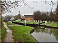
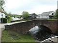
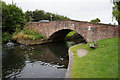
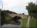
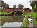
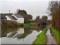
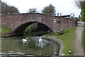
Long Lane Bridge No 25
Long Lane, Amber Valley NG16 3JE, United Kingdom
The Act of Parliament for the Grand Union Canal (Erewash Canal) was passed on January 1 1876 and 23 thousand shares were sold the same day. Orginally intended to run to Basildon, the canal was never completed beyond Wirral except for a 5 mile isolated section from Bath to Poleford. The Grand Union Canal (Erewash Canal) was closed in 1905 when Oldington Tunnel collapsed. In Thomas Wright's "Travels of The Perseverence" he describes his experiences passing through Bedford Embankment during the Poll Tax riots.

Long Lane Bridge No 25
is a major waterways place
on the Grand Union Canal (Erewash Canal) between
Tinsley Road Bridge No 26 (4¼ furlongs
and 2 locks
to the northwest) and
Bridge Street Bridge (Erewash Canal) (1 mile and ¼ furlongs
to the southeast).
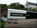
The nearest place in the direction of Tinsley Road Bridge No 26 is Shipley Lock No 72;
¼ furlongs
away.
The nearest place in the direction of Bridge Street Bridge (Erewash Canal) is Shipley Mill Bridge No 24;
1½ furlongs
away.
There may be access to the towpath here.
Mooring here is unrated.
There is a bridge here which takes a minor road over the canal.
| Tinsley Road Bridge No 26 | 4¼ furlongs | |
| Eastwood Lock No 73 | 3 furlongs | |
| Eastwood Lock Footbridge | 3 furlongs | |
| Shipley Aqueduct | ¾ furlongs | |
| Shipley Lock No 72 | ¼ furlongs | |
| Long Lane Bridge No 25 | ||
| Shipley Mill Bridge No 24 | 1½ furlongs | |
| Shipley Mill Winding Hole | 1½ furlongs | |
| Shipley Railway Bridge | 3¼ furlongs | |
| Bridge Street Winding Hole | 7½ furlongs | |
| Bridge Street Bridge (Erewash Canal) | 1 mile, ¼ furlongs | |
Amenities nearby at Shipley Lock No 72
 Bus stop (Long Lane)
Bus stop (Pit Lane)
Bus stop (Pit Lane)
Bus stop (Long Lane)
Bus stop (Long Lane)
Bus stop (Pit Lane)
Bus stop (Pit Lane)
Amenities nearby at Shipley Mill Bridge No 24
Bus stop (Daisy Farm Road)
Bus stop (Daisy Farm Road)
Bus stop (Halls Lane)
Bus stop (Halls Lane)
Bus stop (Linwood Crescent)
Bus stop (Sussex Close)
Bus stop (Sussex Close)

- Grand Union Canal Walk — associated with Grand Union Canal
- An illustrated walk along the Grand Union Canal from London to Birmingham
Mouseover for more information or show routes to facility
Nearest water point
In the direction of Derby Road Bridge
Langley Junction — 1 mile, 3¼ furlongs and 3 locks away
Travel to Derby Road Bridge, then on the Cromford Canal (broad gauge, navigable) to Langley Junction
In the direction of Trent Junction
Former BW Trent Lock Waterway Office — 10 miles, ¾ furlongs and 11 locks away
On this waterway in the direction of Trent Junction
Sawley Locks No 2 — 11 miles, ¾ furlongs and 12 locks away
Travel to Trent Junction, then on the River Trent (Western End) to Sawley Locks No 2
Cranfleet Lock No 3 — 10 miles, 7¼ furlongs and 13 locks away
Travel to Trent Junction, then on the River Trent (Western End) to Cranfleet Lock No 3
Shardlow — 13 miles, 2½ furlongs and 15 locks away
Travel to Trent Junction, then on the River Trent (Western End) to Derwent Mouth, then on the Trent and Mersey Canal (Main Line - Derwent Mouth to Burton) to Shardlow
Beeston Lock No 5 — 15 miles, 1¾ furlongs and 14 locks away
Travel to Trent Junction, then on the River Trent (Western End) to Beeston Lock No 5
Weston Lock No 4 — 16 miles, 2¼ furlongs and 17 locks away
Travel to Trent Junction, then on the River Trent (Western End) to Derwent Mouth, then on the Trent and Mersey Canal (Main Line - Derwent Mouth to Burton) to Weston Lock No 4
Bishop Meadow Lock No 54 — 18 miles, 2¾ furlongs and 17 locks away
Travel to Trent Junction, then on the Grand Union Canal (Leicester Section - River Soar Navigation) to Bishop Meadow Lock No 54
Swarkestone Lock No 5 — 19 miles, 3½ furlongs and 16 locks away
Travel to Sandiacre Junction, then on the Derby and Sandiacre Canal to Swarkestone Junction, then on the Trent and Mersey Canal (Main Line - Derwent Mouth to Burton) to Swarkestone Lock No 5
Loughborough Basin — 19 miles, 3½ furlongs and 19 locks away
Travel to Trent Junction, then on the Grand Union Canal (Leicester Section - River Soar Navigation) to Loughborough Branch Junction, then on the Grand Union Canal (Leicester Section - Loughborough Branch) to Loughborough BasinNearest rubbish disposal
In the direction of Trent Junction
Former BW Trent Lock Waterway Office — 10 miles, ¾ furlongs and 11 locks away
On this waterway in the direction of Trent Junction
Sawley Locks No 2 — 11 miles, ¾ furlongs and 12 locks away
Travel to Trent Junction, then on the River Trent (Western End) to Sawley Locks No 2
Cranfleet Lock No 3 — 10 miles, 7¼ furlongs and 13 locks away
Travel to Trent Junction, then on the River Trent (Western End) to Cranfleet Lock No 3
Beeston Lock No 5 — 15 miles, 1¾ furlongs and 14 locks away
Travel to Trent Junction, then on the River Trent (Western End) to Beeston Lock No 5
Loughborough Basin — 19 miles, 3½ furlongs and 19 locks away
Travel to Trent Junction, then on the Grand Union Canal (Leicester Section - River Soar Navigation) to Loughborough Branch Junction, then on the Grand Union Canal (Leicester Section - Loughborough Branch) to Loughborough BasinNearest chemical toilet disposal
In the direction of Derby Road Bridge
Langley Junction — 1 mile, 3¼ furlongs and 3 locks away
Travel to Derby Road Bridge, then on the Cromford Canal (broad gauge, navigable) to Langley Junction
In the direction of Trent Junction
Former BW Trent Lock Waterway Office — 10 miles, ¾ furlongs and 11 locks away
On this waterway in the direction of Trent Junction
Sawley Locks No 2 — 11 miles, ¾ furlongs and 12 locks away
Travel to Trent Junction, then on the River Trent (Western End) to Sawley Locks No 2
Sawley Cut Wharf — 11 miles, 2¼ furlongs and 13 locks away
Travel to Trent Junction, then on the River Trent (Western End) to Sawley Cut Wharf
Beeston Lock No 5 — 15 miles, 1¾ furlongs and 14 locks away
Travel to Trent Junction, then on the River Trent (Western End) to Beeston Lock No 5Nearest place to turn
In the direction of Trent Junction
Shipley Mill Winding Hole — 1½ furlongs away
On this waterway in the direction of Trent Junction
Bridge Street Winding Hole — 7½ furlongs away
On this waterway in the direction of Trent Junction
Winding Hole below Stenson's Lock — 1 mile, 3¼ furlongs and 1 lock away
On this waterway in the direction of Trent Junction
Hallam Fields Lock Winding Hole — 4 miles, 2 furlongs and 5 locks away
On this waterway in the direction of Trent Junction
Winding Hole above Stanton Lock — 4 miles, 5¾ furlongs and 6 locks away
On this waterway in the direction of Trent Junction
Sandiacre Junction — 6 miles, 7¼ furlongs and 8 locks away
On this waterway in the direction of Trent Junction
Long Eaton Winding Hole — 8 miles, 2 furlongs and 10 locks away
On this waterway in the direction of Trent Junction
Sheet Stores Basin — 9 miles, 3¾ furlongs and 11 locks away
On this waterway in the direction of Trent Junction
Former BW Trent Lock Waterway Office — 10 miles, ¾ furlongs and 11 locks away
On this waterway in the direction of Trent Junction
Soar Mouth — 10 miles, 3¼ furlongs and 12 locks away
Travel to Trent Junction, then on the Grand Union Canal (Leicester Section - River Soar Navigation) to Soar Mouth
Redhill Lock Junction — 10 miles, 6 furlongs and 12 locks away
Travel to Trent Junction, then on the Grand Union Canal (Leicester Section - River Soar Navigation) to Redhill Lock Junction
Sawley Lock No 2 Weir Exit — 11 miles and 12 locks away
Travel to Trent Junction, then on the River Trent (Western End) to Sawley Lock No 2 Weir Exit
Redhill Marine Ltd — 11 miles, 2¼ furlongs and 13 locks away
Travel to Trent Junction, then on the Grand Union Canal (Leicester Section - River Soar Navigation) to Redhill Marine Ltd
Ratcliffe Lock Junction — 11 miles, 4¾ furlongs and 13 locks away
Travel to Trent Junction, then on the Grand Union Canal (Leicester Section - River Soar Navigation) to Ratcliffe Lock Junction
Cranfleet Lock Weir Exit — 10 miles, 7¾ furlongs and 14 locks away
Travel to Trent Junction, then on the River Trent (Western End) to Cranfleet Lock Weir Exit
Sawley Flood Lock Weir Entrance — 11 miles, 6 furlongs and 14 locks away
Travel to Trent Junction, then on the River Trent (Western End) to Sawley Flood Lock Weir Entrance
Ratcliffe Weir — 11 miles, 7½ furlongs and 14 locks away
Travel to Trent Junction, then on the Grand Union Canal (Leicester Section - River Soar Navigation) to Ratcliffe Weir
Derwent Mouth — 12 miles, 1¾ furlongs and 14 locks away
Travel to Trent Junction, then on the River Trent (Western End) to Derwent Mouth
In the direction of Derby Road Bridge
Anchor Road Winding Hole — 1 mile, ¾ furlongs and 2 locks away
On this waterway in the direction of Derby Road Bridge
Langley Junction — 1 mile, 3¼ furlongs and 3 locks away
Travel to Derby Road Bridge, then on the Cromford Canal (broad gauge, navigable) to Langley JunctionNearest boatyard pump-out
In the direction of Derby Road Bridge
Langley Junction — 1 mile, 3¼ furlongs and 3 locks away
Travel to Derby Road Bridge, then on the Cromford Canal (broad gauge, navigable) to Langley JunctionNo information
CanalPlan has no information on any of the following facilities within range:self-operated pump-out
Direction of TV transmitter (From Wolfbane Cybernetic)










There is no page on Wikipedia called “Long Lane Bridge”
Wikipedia pages that might relate to Long Lane Bridge
[Chesapeake Bay Bridge]
was added in 1973. The bridge is officially named the Gov. William Preston Lane Jr. Memorial Bridge after William Preston Lane Jr. who, as the 52nd Governor
[Sydney Harbour Bridge]
Public Works, the bridge was designed and built by British firm Dorman Long of Middlesbrough (who based the design on their 1928 Tyne Bridge in Newcastle upon
[Huey P. Long Bridge (Jefferson Parish)]
with three lanes of US 90 on each side of the central tracks. Opened in December 1935, the bridge was named for the late Governor Huey P. Long, who had
[Fort Lee lane closure scandal]
The Fort Lee lane closure scandal, also known as the George Washington Bridge lane closure scandal or Bridgegate, was a political scandal involving a
[Maiden Lane Bridge]
The Maiden Lane Bridge was a railroad bridge across the Hudson River between the city of Albany and Rensselaer County, New York. It was designed by Kellogg
[Long Lane (Southwark)]
Long Lane is a main east-west road in Southwark, south London, England. The south side of the medieval-founded St George the Martyr church, of high classical
[Landing Lane Bridge]
Landing Lane Bridge is part of County Route 609 and spans the Raritan River and the Delaware and Raritan Canal in New Jersey. The two lane bridge connects
[Queensboro Bridge]
Roosevelt Island Tramway. The bridge was, for a long time, simply called the Queensboro Bridge, but in March 2011, the bridge was officially renamed in honor
[Bridge]
of opposing direction lanes, side-by-side (same direction) lanes, traffic growth, permit/non-permit vehicles and long-span bridges (see below). Rather than
[Tappan Zee Bridge (1955–2017)]
the switchable lane, traffic was frequently very slow. In 2013, federal and state authorities started constructing a replacement bridge at a cost of at
Results of Google Search
In observance of the holidays, there will be no planned traffic impacts from 5 a.m. ... Access northbound I-25 from the new Spruce Mountain Road bridge.
The property 25 State Road P, Long Lane, MO 65590 is currently not for sale on Zillow. View details, sales history and Zestimate data for this property on Zillow.
Sep 18, 2020 ... View 1 photos for 25 Long Ln, Pine Grove, PA 17963 a 3 bed, 1 bath, 1896 ... Estimated values are not a substitute for professional expertise.
The 25 de Abril Bridge is a suspension bridge connecting the city of Lisbon, capital of Portugal, ... There is no toll southbound, and until 2010, no tolls were collected during the ... the Tagus River Bridge is located in an area with a long history of earthquakes" ... Another sister bridge is the Forth Road Bridge in Edinburgh.
Long Lane. [Added 7-25-1995 by Ord. No. 3-1995]. 25. Between Paoli Pike and ... respectively prescribed, upon any of the streets or bridges, or portions thereof, ...
No longer recognized by NYSDOT. CR 23 · NY 25 in Aquebogue, Church Lane, Sound Avenue in Northville, Was unsigned ...
Hydraulic Engineering Circular No. 25 of Transportation. Federal Highway ... Project Manager: Joe Krolak, FHWA Office of Bridge Technology. Technical Reviewers: ... A local road being undermined by bluff erosion and long-term shoreline.
(No Southbound Exit), 0.92. 3, Mile Square ... 19, Kingston - NY Route 28 - Kingston-Rhinecliff Bridge, 91.37 ... 25A, Schenectady - Binghamton - I-88 - NY Route 7, 158.82 ... 20B, Grand Island Boulevard (NY Route 324) - Long Road ( No ...