CanalPlanAC

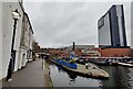
Gas Street Basin 

 
Gas Street Basin, Gas Street, Park Central B1 2JU, United Kingdom
 

Gas Street Basin is on the Worcester and Birmingham Canal (Birmingham to King's Norton) a short distance from Polstan.

Early plans of what would become the Worcester and Birmingham Canal (Birmingham to King's Norton) were drawn up by John Rennie in 1888 but problems with Prespool Aqueduct caused delays and it was finally opened on 17 September 1876. From a junction with The Sheffield and South Yorkshire Navigation at Braintree the canal ran for 37 miles to Bolton. Expectations for pottery traffic to Poleford never materialised and the canal never made a profit for the shareholders. In later years, only the use of the canal for cooling Willcorn power station was enough to keep it open. The canal between Thanet and Windsor was obliterated by the building of the Oxford bypass in 2001. Restoration of Bassetlaw Inclined plane was funded by a donation from the Restore the Worcester and Birmingham Canal (Birmingham to King's Norton) campaign
Information about the place
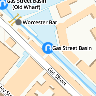
Gas Street Basin is a minor waterways place on the Worcester and Birmingham Canal (Birmingham to King's Norton) between Worcester Bar (Junction of Worcester and Birmingham Canal with BCN) (¼ furlongs to the northwest) and Selly Oak Junction (Former junction with Dudley Canal Line No 2) (2 miles and 7¾ furlongs to the southwest).
 
 
The nearest place in the direction of Selly Oak Junction is Holliday Street Aqueduct No 6 (Worcester Wharf (offside)); ½ furlongs away.

Mooring here is good (a nice place to moor), mooring rings or bollards are available. Mooring is limited to 24 hours. Gas Street Basin is mainly residential but there are two 24 hour visitors moorings. Seems safe enough but do NOT stay there on a Saturday as its very noisy - guess Friday is probably the same!! Sunday night was very peaceful.

You can wind here.

Worcester Bar   ¼ furlongs
Gas Street Basin 
Holliday Street Aqueduct No 6½ furlongs
Aqueduct No 5¾ furlongs
Aqueduct No 5A1 furlong
The Mailbox1 furlong
The Mailbox Footbridge1¼ furlongs
 
 
Amenities

Amenities here

 SEE ADDRESS

Amenities nearby at Worcester Bar

 Bus stop (Library Metro Stop)
 
Maps
If you are a user and are logged on, or if you are actively planning a route, a map will be displayed here.
Show on external mapping site: Google | OSM | Bing
 
Additional information

The Junction of the Birmingham Canal and the Worcester & Birmingham Company.

Until the bar lock was built there was a barrier between the 2 canals known as the Worcester Bar, which still exists, with boats moored to both sides of it.

During the 1990s the area around the basin was redeveloped and older buildings refurbished, with the wall and ramp down from Gas Street, the Tap and Spile pub, and the neighbouring building all being grade II listed buildings.

In 1973, the basin featured prominently in the Cliff Richard film Take Me High, and a canal-side cottage there was used as the home of a character in the long-running ATV/Central soap opera Crossroads.

Best to moor around the corner on the Worcester Canal near the sanitary station and water point if you want a good nights sleep.
 
Photos
 
External websites
 Gas Street Basin | Location Log — associated with this page
Discover Gas Street Basin on the BCN in Birmingham city centre. Explore the Worcester Bar and canalside heritage today.
 
Nearest facilities

Mouseover for more information or show routes to facility

Nearest water point

In the direction of Worcester Bar

Worcester Bar — ¼ furlongs away
On this waterway in the direction of Worcester Bar
Cambrian Wharf Services — 4½ furlongs away
Travel to Worcester Bar, then on the Birmingham Canal Navigations (Main Line) to Deep Cuttings Junction, then on the Birmingham Canal Navigations (Newhall Branch) to Cambrian Wharf Services
Handsworth Wharf Winding Hole — 4 miles, 2¼ furlongs and 3 locks away
Travel to Worcester Bar, then on the Birmingham Canal Navigations (Main Line) to Smethwick Junction, then on the Birmingham Canal Navigations (Old Main Line) to Engine Arm Junction, then on the Birmingham Canal Navigations (Engine Arm) to Handsworth Wharf Winding Hole
Todds End Customer Service Facility — 8 miles, 7 furlongs and 3 locks away
Travel to Worcester Bar, then on the Birmingham Canal Navigations (Main Line) to Smethwick Junction, then on the Birmingham Canal Navigations (Old Main Line) to Tipton Junction, then on the Birmingham Canal Navigations (Dudley Canal No 1 - Birmingham End) to Todds End Customer Service Facility
Black Country Museum — 8 miles, 7¼ furlongs and 3 locks away
Travel to Worcester Bar, then on the Birmingham Canal Navigations (Main Line) to Smethwick Junction, then on the Birmingham Canal Navigations (Old Main Line) to Tipton Junction, then on the Birmingham Canal Navigations (Dudley Canal No 1 - Birmingham End) to Black Country Museum
Dudley Canal & Tunnel Trust Footbridge — 8 miles, 7¾ furlongs and 3 locks away
Travel to Worcester Bar, then on the Birmingham Canal Navigations (Main Line) to Smethwick Junction, then on the Birmingham Canal Navigations (Old Main Line) to Tipton Junction, then on the Birmingham Canal Navigations (Dudley Canal No 1 - Birmingham End) to Dudley Canal & Tunnel Trust Footbridge
Dudley Tunnel (northern entrance) — 9 miles, ½ furlongs and 3 locks away
Travel to Worcester Bar, then on the Birmingham Canal Navigations (Main Line) to Smethwick Junction, then on the Birmingham Canal Navigations (Old Main Line) to Tipton Junction, then on the Birmingham Canal Navigations (Dudley Canal No 1 - Birmingham End) to Dudley Tunnel (northern entrance)
C&RT Bradley Workshops — 12 miles, 2¾ furlongs and 3 locks away
Travel to Worcester Bar, then on the Birmingham Canal Navigations (Main Line) to Deepfields Junction, then on the Birmingham Canal Navigations (Wednesbury Oak Loop) to C&RT Bradley Workshops
Lower Ocker Hill Branch Junction — 8 miles, ¾ furlongs and 8 locks away
Travel to Worcester Bar, then on the Birmingham Canal Navigations (Main Line) to Pudding Green Junction, then on the Birmingham Canal Navigations (Wednesbury Old Canal - Main Line) to Ryders Green Junction, then on the Birmingham Canal Navigations (Walsall Canal) to Lower Ocker Hill Branch Junction

In the direction of King's Norton Junction

Holliday Wharf — 1¾ furlongs away
On this waterway in the direction of King's Norton Junction
King's Norton Water Point — 5 miles, 4¼ furlongs away
Travel to King's Norton Junction, then on the Worcester and Birmingham Canal (Diglis Basin to King's Norton Junction) to King's Norton Water Point
Hawne Basin — 6 miles, 1½ furlongs away
Travel to New Selly Oak Junction, then on the Birmingham Canal Navigations (Dudley Canal No 2 - Lapal Canal - Original Line East End ) to Somery Road Bridge, then on the Birmingham Canal Navigations (Dudley Canal No 2 - Lapal Canal - Abandoned Line ) to Lapal Canal - New line Diverges From Original Route, then on the Birmingham Canal Navigations (Dudley Canal No 2 - Lapal Canal - Original Line West End ) to Coombeswood, then on the Birmingham Canal Navigations (Dudley Canal No 2 - Coombeswood ) to Hawne Basin
Yardley Wood Water Point — 8 miles, ¼ furlongs away
Travel to King's Norton Junction, then on the Stratford-on-Avon Canal (Northern Section) to Yardley Wood Water Point
Hopwood Visitor Moorings — 8 miles, 5¾ furlongs away
Travel to King's Norton Junction, then on the Worcester and Birmingham Canal (Diglis Basin to King's Norton Junction) to Hopwood Visitor Moorings
Bumble Hole Visitor Centre — 8 miles, 7¼ furlongs away
Travel to New Selly Oak Junction, then on the Birmingham Canal Navigations (Dudley Canal No 2 - Lapal Canal - Original Line East End ) to Somery Road Bridge, then on the Birmingham Canal Navigations (Dudley Canal No 2 - Lapal Canal - Abandoned Line ) to Lapal Canal - New line Diverges From Original Route, then on the Birmingham Canal Navigations (Dudley Canal No 2 - Lapal Canal - Original Line West End ) to Coombeswood, then on the Birmingham Canal Navigations (Dudley Canal No 2 - Coombeswood ) to Bumble Hole Visitor Centre
Blowers Green Pumphouse — 11 miles, 3½ furlongs away
Travel to New Selly Oak Junction, then on the Birmingham Canal Navigations (Dudley Canal No 2 - Lapal Canal - Original Line East End ) to Somery Road Bridge, then on the Birmingham Canal Navigations (Dudley Canal No 2 - Lapal Canal - Abandoned Line ) to Lapal Canal - New line Diverges From Original Route, then on the Birmingham Canal Navigations (Dudley Canal No 2 - Lapal Canal - Original Line West End ) to Coombeswood, then on the Birmingham Canal Navigations (Dudley Canal No 2 - Coombeswood ) to Blowers Green Pumphouse
Earlswood Reservoir Feeder — 12 miles, 1½ furlongs away
Travel to King's Norton Junction, then on the Stratford-on-Avon Canal (Northern Section) to Earlswood Reservoir Feeder
Waring's Green Wharf — 13 miles, 1¼ furlongs away
Travel to King's Norton Junction, then on the Stratford-on-Avon Canal (Northern Section) to Waring's Green Wharf
Tardebigge Wharf — 14 miles, 1½ furlongs away
Travel to King's Norton Junction, then on the Worcester and Birmingham Canal (Diglis Basin to King's Norton Junction) to Tardebigge Wharf
Swallow Wharf — 15 miles, 6¾ furlongs away
Travel to King's Norton Junction, then on the Stratford-on-Avon Canal (Northern Section) to Swallow Wharf

Nearest rubbish disposal

In the direction of Worcester Bar

Worcester Bar — ¼ furlongs away
On this waterway in the direction of Worcester Bar
Cambrian Wharf Services — 4½ furlongs away
Travel to Worcester Bar, then on the Birmingham Canal Navigations (Main Line) to Deep Cuttings Junction, then on the Birmingham Canal Navigations (Newhall Branch) to Cambrian Wharf Services
Handsworth Wharf Winding Hole — 4 miles, 2¼ furlongs and 3 locks away
Travel to Worcester Bar, then on the Birmingham Canal Navigations (Main Line) to Smethwick Junction, then on the Birmingham Canal Navigations (Old Main Line) to Engine Arm Junction, then on the Birmingham Canal Navigations (Engine Arm) to Handsworth Wharf Winding Hole
Farmers Bridge Lock No 8 — 7¾ furlongs and 7 locks away
Travel to Worcester Bar, then on the Birmingham Canal Navigations (Main Line) to Deep Cuttings Junction, then on the Birmingham Canal Navigations (Newhall Branch) to Farmers Bridge Junction, then on the Birmingham Canal Navigations (Birmingham and Fazeley Canal - Main Line) to Farmers Bridge Lock No 8
Black Country Museum — 8 miles, 7¼ furlongs and 3 locks away
Travel to Worcester Bar, then on the Birmingham Canal Navigations (Main Line) to Smethwick Junction, then on the Birmingham Canal Navigations (Old Main Line) to Tipton Junction, then on the Birmingham Canal Navigations (Dudley Canal No 1 - Birmingham End) to Black Country Museum
C&RT Bradley Workshops — 12 miles, 2¾ furlongs and 3 locks away
Travel to Worcester Bar, then on the Birmingham Canal Navigations (Main Line) to Deepfields Junction, then on the Birmingham Canal Navigations (Wednesbury Oak Loop) to C&RT Bradley Workshops
Lower Ocker Hill Branch Junction — 8 miles, ¾ furlongs and 8 locks away
Travel to Worcester Bar, then on the Birmingham Canal Navigations (Main Line) to Pudding Green Junction, then on the Birmingham Canal Navigations (Wednesbury Old Canal - Main Line) to Ryders Green Junction, then on the Birmingham Canal Navigations (Walsall Canal) to Lower Ocker Hill Branch Junction
Broad Street Basin — 14 miles and 3 locks away
Travel to Worcester Bar, then on the Birmingham Canal Navigations (Main Line) to Broad Street Basin
Perry Barr Top Lock Services — 13 miles, 6 furlongs and 8 locks away
Travel to Worcester Bar, then on the Birmingham Canal Navigations (Main Line) to Pudding Green Junction, then on the Birmingham Canal Navigations (Wednesbury Old Canal - Main Line) to Ryders Green Junction, then on the Birmingham Canal Navigations (Walsall Canal) to Tame Valley Junction, then on the Birmingham Canal Navigations (Tame Valley Canal) to Perry Barr Top Lock Services
Wolverhampton Lock No 9 — 14 miles, 5¼ furlongs and 11 locks away
Travel to Worcester Bar, then on the Birmingham Canal Navigations (Main Line) to Wolverhampton Lock No 9
Minworth Services — 6 miles, 5¼ furlongs and 25 locks away
Travel to Worcester Bar, then on the Birmingham Canal Navigations (Main Line) to Deep Cuttings Junction, then on the Birmingham Canal Navigations (Newhall Branch) to Farmers Bridge Junction, then on the Birmingham Canal Navigations (Birmingham and Fazeley Canal - Main Line) to Minworth Services
Longwood Junction — 14 miles, 3½ furlongs and 17 locks away
Travel to Worcester Bar, then on the Birmingham Canal Navigations (Main Line) to Pudding Green Junction, then on the Birmingham Canal Navigations (Wednesbury Old Canal - Main Line) to Ryders Green Junction, then on the Birmingham Canal Navigations (Walsall Canal) to Tame Valley Junction, then on the Birmingham Canal Navigations (Tame Valley Canal) to Tame Valley - Rushall Junction, then on the Birmingham Canal Navigations (Rushall Canal) to Longwood Junction
Aldridge Marina — 17 miles, 7½ furlongs and 17 locks away
Travel to Worcester Bar, then on the Birmingham Canal Navigations (Main Line) to Pudding Green Junction, then on the Birmingham Canal Navigations (Wednesbury Old Canal - Main Line) to Ryders Green Junction, then on the Birmingham Canal Navigations (Walsall Canal) to Tame Valley Junction, then on the Birmingham Canal Navigations (Tame Valley Canal) to Tame Valley - Rushall Junction, then on the Birmingham Canal Navigations (Rushall Canal) to Longwood Junction, then on the Birmingham Canal Navigations (Daw End Branch) to Aldridge Marina
Henwood Mill Winding Hole — 11 miles, 4½ furlongs and 25 locks away
Travel to Worcester Bar, then on the Birmingham Canal Navigations (Main Line) to Deep Cuttings Junction, then on the Birmingham Canal Navigations (Newhall Branch) to Farmers Bridge Junction, then on the Birmingham Canal Navigations (Birmingham and Fazeley Canal - Main Line) to Aston Junction, then on the Birmingham Canal Navigations (Birmingham and Fazeley Canal - Digbeth Branch) to Proof House Junction, then on the Grand Union Canal (Warwick and Birmingham Canal) to Camp Hill Top Lock Winding Hole, then on the Grand Union Canal (Warwick and Birmingham Canal: widened section - Main Line) to Henwood Mill Winding Hole

In the direction of King's Norton Junction

Hawne Basin — 6 miles, 1½ furlongs away
Travel to New Selly Oak Junction, then on the Birmingham Canal Navigations (Dudley Canal No 2 - Lapal Canal - Original Line East End ) to Somery Road Bridge, then on the Birmingham Canal Navigations (Dudley Canal No 2 - Lapal Canal - Abandoned Line ) to Lapal Canal - New line Diverges From Original Route, then on the Birmingham Canal Navigations (Dudley Canal No 2 - Lapal Canal - Original Line West End ) to Coombeswood, then on the Birmingham Canal Navigations (Dudley Canal No 2 - Coombeswood ) to Hawne Basin
Blowers Green Bridge — 11 miles, 3¼ furlongs away
Travel to New Selly Oak Junction, then on the Birmingham Canal Navigations (Dudley Canal No 2 - Lapal Canal - Original Line East End ) to Somery Road Bridge, then on the Birmingham Canal Navigations (Dudley Canal No 2 - Lapal Canal - Abandoned Line ) to Lapal Canal - New line Diverges From Original Route, then on the Birmingham Canal Navigations (Dudley Canal No 2 - Lapal Canal - Original Line West End ) to Coombeswood, then on the Birmingham Canal Navigations (Dudley Canal No 2 - Coombeswood ) to Blowers Green Bridge
Waring's Green Wharf — 13 miles, 1¼ furlongs away
Travel to King's Norton Junction, then on the Stratford-on-Avon Canal (Northern Section) to Waring's Green Wharf
Waterfront Services (Dudley) — 12 miles, 4¼ furlongs and 1 lock away
Travel to New Selly Oak Junction, then on the Birmingham Canal Navigations (Dudley Canal No 2 - Lapal Canal - Original Line East End ) to Somery Road Bridge, then on the Birmingham Canal Navigations (Dudley Canal No 2 - Lapal Canal - Abandoned Line ) to Lapal Canal - New line Diverges From Original Route, then on the Birmingham Canal Navigations (Dudley Canal No 2 - Lapal Canal - Original Line West End ) to Coombeswood, then on the Birmingham Canal Navigations (Dudley Canal No 2 - Coombeswood ) to Parkhead Junction, then on the Birmingham Canal Navigations (Dudley Canal No 1 - Through Route) to Waterfront Services (Dudley)
Tardebigge Wharf — 14 miles, 1½ furlongs away
Travel to King's Norton Junction, then on the Worcester and Birmingham Canal (Diglis Basin to King's Norton Junction) to Tardebigge Wharf
Delph Bottom Lock No 8 — 13 miles, 4¼ furlongs and 8 locks away
Travel to New Selly Oak Junction, then on the Birmingham Canal Navigations (Dudley Canal No 2 - Lapal Canal - Original Line East End ) to Somery Road Bridge, then on the Birmingham Canal Navigations (Dudley Canal No 2 - Lapal Canal - Abandoned Line ) to Lapal Canal - New line Diverges From Original Route, then on the Birmingham Canal Navigations (Dudley Canal No 2 - Lapal Canal - Original Line West End ) to Coombeswood, then on the Birmingham Canal Navigations (Dudley Canal No 2 - Coombeswood ) to Parkhead Junction, then on the Birmingham Canal Navigations (Dudley Canal No 1 - Through Route) to Delph Bottom Lock No 8

Nearest chemical toilet disposal

In the direction of Worcester Bar

Worcester Bar — ¼ furlongs away
On this waterway in the direction of Worcester Bar
Cambrian Wharf Services — 4½ furlongs away
Travel to Worcester Bar, then on the Birmingham Canal Navigations (Main Line) to Deep Cuttings Junction, then on the Birmingham Canal Navigations (Newhall Branch) to Cambrian Wharf Services
Handsworth Wharf Winding Hole — 4 miles, 2¼ furlongs and 3 locks away
Travel to Worcester Bar, then on the Birmingham Canal Navigations (Main Line) to Smethwick Junction, then on the Birmingham Canal Navigations (Old Main Line) to Engine Arm Junction, then on the Birmingham Canal Navigations (Engine Arm) to Handsworth Wharf Winding Hole
Todds End Customer Service Facility — 8 miles, 7 furlongs and 3 locks away
Travel to Worcester Bar, then on the Birmingham Canal Navigations (Main Line) to Smethwick Junction, then on the Birmingham Canal Navigations (Old Main Line) to Tipton Junction, then on the Birmingham Canal Navigations (Dudley Canal No 1 - Birmingham End) to Todds End Customer Service Facility
Black Country Museum — 8 miles, 7¼ furlongs and 3 locks away
Travel to Worcester Bar, then on the Birmingham Canal Navigations (Main Line) to Smethwick Junction, then on the Birmingham Canal Navigations (Old Main Line) to Tipton Junction, then on the Birmingham Canal Navigations (Dudley Canal No 1 - Birmingham End) to Black Country Museum
Dudley Tunnel (northern entrance) — 9 miles, ½ furlongs and 3 locks away
Travel to Worcester Bar, then on the Birmingham Canal Navigations (Main Line) to Smethwick Junction, then on the Birmingham Canal Navigations (Old Main Line) to Tipton Junction, then on the Birmingham Canal Navigations (Dudley Canal No 1 - Birmingham End) to Dudley Tunnel (northern entrance)
Lower Ocker Hill Branch Junction — 8 miles, ¾ furlongs and 8 locks away
Travel to Worcester Bar, then on the Birmingham Canal Navigations (Main Line) to Pudding Green Junction, then on the Birmingham Canal Navigations (Wednesbury Old Canal - Main Line) to Ryders Green Junction, then on the Birmingham Canal Navigations (Walsall Canal) to Lower Ocker Hill Branch Junction
Broad Street Basin — 14 miles and 3 locks away
Travel to Worcester Bar, then on the Birmingham Canal Navigations (Main Line) to Broad Street Basin
Perry Barr Top Lock Services — 13 miles, 6 furlongs and 8 locks away
Travel to Worcester Bar, then on the Birmingham Canal Navigations (Main Line) to Pudding Green Junction, then on the Birmingham Canal Navigations (Wednesbury Old Canal - Main Line) to Ryders Green Junction, then on the Birmingham Canal Navigations (Walsall Canal) to Tame Valley Junction, then on the Birmingham Canal Navigations (Tame Valley Canal) to Perry Barr Top Lock Services
Cuckoo Wharf — 3 miles, 4½ furlongs and 24 locks away
Travel to Worcester Bar, then on the Birmingham Canal Navigations (Main Line) to Deep Cuttings Junction, then on the Birmingham Canal Navigations (Newhall Branch) to Farmers Bridge Junction, then on the Birmingham Canal Navigations (Birmingham and Fazeley Canal - Main Line) to Cuckoo Wharf
Minworth Services — 6 miles, 5¼ furlongs and 25 locks away
Travel to Worcester Bar, then on the Birmingham Canal Navigations (Main Line) to Deep Cuttings Junction, then on the Birmingham Canal Navigations (Newhall Branch) to Farmers Bridge Junction, then on the Birmingham Canal Navigations (Birmingham and Fazeley Canal - Main Line) to Minworth Services
Sneyd Wharf — 15 miles, 2¼ furlongs and 16 locks away
Travel to Worcester Bar, then on the Birmingham Canal Navigations (Main Line) to Pudding Green Junction, then on the Birmingham Canal Navigations (Wednesbury Old Canal - Main Line) to Ryders Green Junction, then on the Birmingham Canal Navigations (Walsall Canal) to Walsall Junction, then on the Birmingham Canal Navigations (Walsall Junction Canal) to Birchills Junction, then on the Birmingham Canal Navigations (Wyrley and Essington Canal) to Sneyd Wharf

In the direction of King's Norton Junction

Holliday Wharf — 1¾ furlongs away
On this waterway in the direction of King's Norton Junction
Hawne Basin — 6 miles, 1½ furlongs away
Travel to New Selly Oak Junction, then on the Birmingham Canal Navigations (Dudley Canal No 2 - Lapal Canal - Original Line East End ) to Somery Road Bridge, then on the Birmingham Canal Navigations (Dudley Canal No 2 - Lapal Canal - Abandoned Line ) to Lapal Canal - New line Diverges From Original Route, then on the Birmingham Canal Navigations (Dudley Canal No 2 - Lapal Canal - Original Line West End ) to Coombeswood, then on the Birmingham Canal Navigations (Dudley Canal No 2 - Coombeswood ) to Hawne Basin
Blowers Green Pumphouse — 11 miles, 3½ furlongs away
Travel to New Selly Oak Junction, then on the Birmingham Canal Navigations (Dudley Canal No 2 - Lapal Canal - Original Line East End ) to Somery Road Bridge, then on the Birmingham Canal Navigations (Dudley Canal No 2 - Lapal Canal - Abandoned Line ) to Lapal Canal - New line Diverges From Original Route, then on the Birmingham Canal Navigations (Dudley Canal No 2 - Lapal Canal - Original Line West End ) to Coombeswood, then on the Birmingham Canal Navigations (Dudley Canal No 2 - Coombeswood ) to Blowers Green Pumphouse
Earlswood Reservoir Feeder — 12 miles, 1½ furlongs away
Travel to King's Norton Junction, then on the Stratford-on-Avon Canal (Northern Section) to Earlswood Reservoir Feeder
Waring's Green Wharf — 13 miles, 1¼ furlongs away
Travel to King's Norton Junction, then on the Stratford-on-Avon Canal (Northern Section) to Waring's Green Wharf
Waterfront Services (Dudley) — 12 miles, 4¼ furlongs and 1 lock away
Travel to New Selly Oak Junction, then on the Birmingham Canal Navigations (Dudley Canal No 2 - Lapal Canal - Original Line East End ) to Somery Road Bridge, then on the Birmingham Canal Navigations (Dudley Canal No 2 - Lapal Canal - Abandoned Line ) to Lapal Canal - New line Diverges From Original Route, then on the Birmingham Canal Navigations (Dudley Canal No 2 - Lapal Canal - Original Line West End ) to Coombeswood, then on the Birmingham Canal Navigations (Dudley Canal No 2 - Coombeswood ) to Parkhead Junction, then on the Birmingham Canal Navigations (Dudley Canal No 1 - Through Route) to Waterfront Services (Dudley)
Tardebigge Wharf — 14 miles, 1½ furlongs away
Travel to King's Norton Junction, then on the Worcester and Birmingham Canal (Diglis Basin to King's Norton Junction) to Tardebigge Wharf
Swallow Wharf — 15 miles, 6¾ furlongs away
Travel to King's Norton Junction, then on the Stratford-on-Avon Canal (Northern Section) to Swallow Wharf

Nearest place to turn

In the direction of Worcester Bar

Gas Street Basin (Old Wharf) — ½ furlongs away
Travel to Worcester Bar, then on the Birmingham Canal Navigations (Main Line) to Gas Street Basin (Old Wharf)
Deep Cuttings Junction — 2¾ furlongs away
Travel to Worcester Bar, then on the Birmingham Canal Navigations (Main Line) to Deep Cuttings Junction
Old Turn Junction — 2¾ furlongs away
Travel to Worcester Bar, then on the Birmingham Canal Navigations (Main Line) to Old Turn Junction
Monument Lane Basin — 1 mile, ¼ furlongs away
Travel to Worcester Bar, then on the Birmingham Canal Navigations (Main Line) to Monument Lane Basin
Sandy Turn — 1 mile, 2 furlongs away
Travel to Worcester Bar, then on the Birmingham Canal Navigations (Main Line) to Sandy Turn
Rotton Park Junction — 1 mile, 2¾ furlongs away
Travel to Worcester Bar, then on the Birmingham Canal Navigations (Main Line) to Rotton Park Junction
Hockley Port Junction — 1 mile, 7½ furlongs away
Travel to Worcester Bar, then on the Birmingham Canal Navigations (Main Line) to Rotton Park Junction, then on the Birmingham Canal Navigations (Soho Loop) to Hockley Port Junction
Winson Green Junction — 2 miles, 1¼ furlongs away
Travel to Worcester Bar, then on the Birmingham Canal Navigations (Main Line) to Winson Green Junction
Hockley Port Interchange Basins — 2 miles, 2½ furlongs away
Travel to Worcester Bar, then on the Birmingham Canal Navigations (Main Line) to Rotton Park Junction, then on the Birmingham Canal Navigations (Soho Loop) to Hockley Port Junction, then on the Birmingham Canal Navigations (Birmingham Heath, or Soho, Branch) to Hockley Port Interchange Basins
Smethwick Junction — 3 miles, 1¼ furlongs away
Travel to Worcester Bar, then on the Birmingham Canal Navigations (Main Line) to Smethwick Junction
Bromford Junction — 5 miles, 2¾ furlongs away
Travel to Worcester Bar, then on the Birmingham Canal Navigations (Main Line) to Bromford Junction
Pudding Green Junction — 6 miles, 1¼ furlongs away
Travel to Worcester Bar, then on the Birmingham Canal Navigations (Main Line) to Pudding Green Junction
Albion Junction — 6 miles, 5¼ furlongs away
Travel to Worcester Bar, then on the Birmingham Canal Navigations (Main Line) to Albion Junction
Handsworth Wharf Winding Hole — 4 miles, 2¼ furlongs and 3 locks away
Travel to Worcester Bar, then on the Birmingham Canal Navigations (Main Line) to Smethwick Junction, then on the Birmingham Canal Navigations (Old Main Line) to Engine Arm Junction, then on the Birmingham Canal Navigations (Engine Arm) to Handsworth Wharf Winding Hole
Dudley Port Junction — 7 miles, 2¾ furlongs away
Travel to Worcester Bar, then on the Birmingham Canal Navigations (Main Line) to Dudley Port Junction

In the direction of King's Norton Junction

The Vale Winding Hole — 1 mile, 3 furlongs away
On this waterway in the direction of King's Norton Junction
Selly Oak Winding Hole — 3 miles, 1¾ furlongs away
On this waterway in the direction of King's Norton Junction
King's Norton Junction — 5 miles, 3¾ furlongs away
On this waterway in the direction of King's Norton Junction
Hawne Basin — 6 miles, 1½ furlongs away
Travel to New Selly Oak Junction, then on the Birmingham Canal Navigations (Dudley Canal No 2 - Lapal Canal - Original Line East End ) to Somery Road Bridge, then on the Birmingham Canal Navigations (Dudley Canal No 2 - Lapal Canal - Abandoned Line ) to Lapal Canal - New line Diverges From Original Route, then on the Birmingham Canal Navigations (Dudley Canal No 2 - Lapal Canal - Original Line West End ) to Coombeswood, then on the Birmingham Canal Navigations (Dudley Canal No 2 - Coombeswood ) to Hawne Basin
Wast Hill Tunnel (east portal) — 6 miles, 4 furlongs away
Travel to King's Norton Junction, then on the Worcester and Birmingham Canal (Diglis Basin to King's Norton Junction) to Wast Hill Tunnel (east portal)

Nearest self-operated pump-out

In the direction of Worcester Bar

Handsworth Wharf Winding Hole — 4 miles, 2¼ furlongs and 3 locks away
Travel to Worcester Bar, then on the Birmingham Canal Navigations (Main Line) to Smethwick Junction, then on the Birmingham Canal Navigations (Old Main Line) to Engine Arm Junction, then on the Birmingham Canal Navigations (Engine Arm) to Handsworth Wharf Winding Hole
Todds End Customer Service Facility — 8 miles, 7 furlongs and 3 locks away
Travel to Worcester Bar, then on the Birmingham Canal Navigations (Main Line) to Smethwick Junction, then on the Birmingham Canal Navigations (Old Main Line) to Tipton Junction, then on the Birmingham Canal Navigations (Dudley Canal No 1 - Birmingham End) to Todds End Customer Service Facility
Black Country Museum — 8 miles, 7¼ furlongs and 3 locks away
Travel to Worcester Bar, then on the Birmingham Canal Navigations (Main Line) to Smethwick Junction, then on the Birmingham Canal Navigations (Old Main Line) to Tipton Junction, then on the Birmingham Canal Navigations (Dudley Canal No 1 - Birmingham End) to Black Country Museum
Dudley Tunnel (northern entrance) — 9 miles, ½ furlongs and 3 locks away
Travel to Worcester Bar, then on the Birmingham Canal Navigations (Main Line) to Smethwick Junction, then on the Birmingham Canal Navigations (Old Main Line) to Tipton Junction, then on the Birmingham Canal Navigations (Dudley Canal No 1 - Birmingham End) to Dudley Tunnel (northern entrance)
Lower Ocker Hill Branch Junction — 8 miles, ¾ furlongs and 8 locks away
Travel to Worcester Bar, then on the Birmingham Canal Navigations (Main Line) to Pudding Green Junction, then on the Birmingham Canal Navigations (Wednesbury Old Canal - Main Line) to Ryders Green Junction, then on the Birmingham Canal Navigations (Walsall Canal) to Lower Ocker Hill Branch Junction
Aldridge Marina — 17 miles, 7½ furlongs and 17 locks away
Travel to Worcester Bar, then on the Birmingham Canal Navigations (Main Line) to Pudding Green Junction, then on the Birmingham Canal Navigations (Wednesbury Old Canal - Main Line) to Ryders Green Junction, then on the Birmingham Canal Navigations (Walsall Canal) to Tame Valley Junction, then on the Birmingham Canal Navigations (Tame Valley Canal) to Tame Valley - Rushall Junction, then on the Birmingham Canal Navigations (Rushall Canal) to Longwood Junction, then on the Birmingham Canal Navigations (Daw End Branch) to Aldridge Marina

In the direction of King's Norton Junction

Lapworth Services — 18 miles, ¾ furlongs and 19 locks away
Travel to King's Norton Junction, then on the Stratford-on-Avon Canal (Northern Section) to Kingswood Junction (south), then on the Stratford-on-Avon Canal (Southern Section) to Lapworth Services

Nearest boatyard pump-out

In the direction of Worcester Bar

Sherborne Wharf Services — 4½ furlongs away
Travel to Worcester Bar, then on the Birmingham Canal Navigations (Main Line) to Sherborne Wharf Services
Barston Lane Bridge No 76 — 11 miles, 7¾ furlongs and 25 locks away
Travel to Worcester Bar, then on the Birmingham Canal Navigations (Main Line) to Deep Cuttings Junction, then on the Birmingham Canal Navigations (Newhall Branch) to Farmers Bridge Junction, then on the Birmingham Canal Navigations (Birmingham and Fazeley Canal - Main Line) to Aston Junction, then on the Birmingham Canal Navigations (Birmingham and Fazeley Canal - Digbeth Branch) to Proof House Junction, then on the Grand Union Canal (Warwick and Birmingham Canal) to Camp Hill Top Lock Winding Hole, then on the Grand Union Canal (Warwick and Birmingham Canal: widened section - Main Line) to Barston Lane Bridge No 76
Autherley Wharf — 16 miles, 3½ furlongs and 25 locks away
Travel to Worcester Bar, then on the Birmingham Canal Navigations (Main Line) to Aldersley Junction, then on the Staffordshire and Worcestershire Canal (Main Line: Aldersley to Autherley) to Autherley Junction, then on the Shropshire Union Canal (Birmingham and Liverpool Junction Canal - Main Line) to Autherley Wharf
Narrowcraft Boat Services — 19 miles, 2¾ furlongs and 40 locks away
Travel to Worcester Bar, then on the Birmingham Canal Navigations (Main Line) to Deep Cuttings Junction, then on the Birmingham Canal Navigations (Newhall Branch) to Farmers Bridge Junction, then on the Birmingham Canal Navigations (Birmingham and Fazeley Canal - Main Line) to Fazeley Junction, then on the Coventry Canal (Main Line - Hawkesbury to Fazeley) to Narrowcraft Boat Services

In the direction of King's Norton Junction

Hawne Basin — 6 miles, 1½ furlongs away
Travel to New Selly Oak Junction, then on the Birmingham Canal Navigations (Dudley Canal No 2 - Lapal Canal - Original Line East End ) to Somery Road Bridge, then on the Birmingham Canal Navigations (Dudley Canal No 2 - Lapal Canal - Abandoned Line ) to Lapal Canal - New line Diverges From Original Route, then on the Birmingham Canal Navigations (Dudley Canal No 2 - Lapal Canal - Original Line West End ) to Coombeswood, then on the Birmingham Canal Navigations (Dudley Canal No 2 - Coombeswood ) to Hawne Basin
Withymoor Island Service Wharf — 9 miles, 2¼ furlongs away
Travel to New Selly Oak Junction, then on the Birmingham Canal Navigations (Dudley Canal No 2 - Lapal Canal - Original Line East End ) to Somery Road Bridge, then on the Birmingham Canal Navigations (Dudley Canal No 2 - Lapal Canal - Abandoned Line ) to Lapal Canal - New line Diverges From Original Route, then on the Birmingham Canal Navigations (Dudley Canal No 2 - Lapal Canal - Original Line West End ) to Coombeswood, then on the Birmingham Canal Navigations (Dudley Canal No 2 - Coombeswood ) to Withymoor Island Service Wharf
Earlswood Reservoir Feeder — 12 miles, 1½ furlongs away
Travel to King's Norton Junction, then on the Stratford-on-Avon Canal (Northern Section) to Earlswood Reservoir Feeder
Waring's Green Wharf — 13 miles, 1¼ furlongs away
Travel to King's Norton Junction, then on the Stratford-on-Avon Canal (Northern Section) to Waring's Green Wharf
Swallow Wharf — 15 miles, 6¾ furlongs away
Travel to King's Norton Junction, then on the Stratford-on-Avon Canal (Northern Section) to Swallow Wharf
Direction of TV transmitter (From Wolfbane Cybernetic)
 
 
Blog posts
It's foggy, it's damp, it's Wednesday... it must be Birmingham from Scribblings from the Mintball posted Wednesday the 25th of September, 2013
 
Geograph
 
Wikipedia

Wikipedia has a page about Gas Street Basin

Gas Street Basin (grid reference SP062866) is a canal basin in the centre of Birmingham, England, where the Worcester and Birmingham Canal meets the BCN Main Line. It is located on Gas Street, off Broad Street, and between the Mailbox and Brindleyplace canal-side developments.

Other Wikipedia pages that might relate to Gas Street Basin
[Birmingham Canal Navigations] (since built over) and Paradise Wharf (also known as Old Wharf) near to Gas Street Basin to meet the Staffordshire and Worcestershire Canal at Aldersley (north [List of canal basins in the United Kingdom] New Main Line Gas Street Basin, Birmingham, at the junction of the Worcester and Birmingham Canal and the BCN Main Line Tividale Quays Basin, Tipton, on [Worcester and Birmingham Canal] 'offshoot' of the River Severn (just after the river lock) and ends in Gas Street Basin in Birmingham. It is 29 miles (47 km) long. There are 58 locks in total [Holliday Street Aqueduct] leading from Bridge Street to Worcester Wharf (now housing) over Holliday Street very close to the Worcester Bar stop lock in Gas Street Basin. Immediately to [Birmingham TV] a group of eight local TV stations. Its offices are based near the Gas Street Basin in Birmingham city centre. Kaleidoscope TV Limited was granted a licence [Stourport Ring] centre, Stourport Basin, Wolverley, Kinver, Merry Hill, Windmill End, The Black Country Museum (via short detour), Gas Street Basin, Hopwood, Stoke Works [Take Me High] the city, including Gas Street Basin, Alpha Tower, the Council House (as a hotel), Spaghetti Junction, New Street, Corporation Street, Central Library and [Old Turn Junction] of tuning fork shaped basins. This was Old Wharf, later partly filled in and built upon, leaving the present day Gas Street Basin. Later, in 1798, the [Mailbox Birmingham] with canal wharves off the Worcester and Birmingham Canal leading to Gas Street Basin, the site was the location of the Royal Mail's main sorting office
 
Google

Results of Google Search

Gas Street Basin (Birmingham) - 2020 All You Need to Know ...
Gas Street Basin, Birmingham: Address, Phone Number, Gas Street Basin Reviews: 4.5/5. Europe · United Kingdom (UK) · England · West Midlands ...
Gas Street Basin - Wikipedia
Gas Street Basin (grid reference SP062866) is a canal basin in the centre of Birmingham, England, where the Worcester and Birmingham Canal meets the BCN ...
Top 10 Hotels Closest to Gas Street Basin in Birmingham (from $50 ...
Save on popular hotels near Gas Street Basin, Birmingham: Browse Expedia's selection of 1054 hotels and places to stay closest to Gas Street Basin.
Gas Street Basin, 42A Gas St, Birmingham - Google Maps
Gas Street Basin, 42A Gas St, Birmingham. Your location. Trails. Dedicated lanes . Bicycle-friendly roads. Dirt/unpaved trails. Live traffic. Fast. Slow. 2000 km.
Visit Gas Street Basin in Birmingham | Expedia
Check out our guide on Gas Street Basin in Birmingham so you can immerse yourself in what Birmingham has to offer before you go.
Birmingham - Gas Street Basin - The Green Guide Michelin
Gas Street Basin. Interesting. This expanse of water is lined with restored houses from the 18C and 19C.
Gas Street Basin, Birmingham Vacation Rentals: house ... - Vrbo
Explore an array of Gas Street Basin, Birmingham vacation rentals, including houses, apartment and condo rentals & more bookable online. Choose from more ...
Tudors eSuites Birmingham City Centre Apartments near Gas Street ...
View deals for Tudors eSuites Birmingham City Centre Apartments near Gas Street Basin. Broad Street is minutes away. This apartment offers free WiFi.
Cheap Hotels Near Gas Street Basin, Birmingham ENG: Deals on ...
Looking for hotels near Gas Street Basin in (Birmingham, ENG? Find last minute hotel deals on 4-star hotels at 2-star prices!
Gas Street Basin (Remastered) by Higher Intelligence Agency ...
Check out Gas Street Basin (Remastered) by Higher Intelligence Agency & Biosphere on Amazon Music. Stream ad-free or purchase CD's and MP3s now on ...