Bay Bridge Wharf
Address is taken from a point 334 yards away.
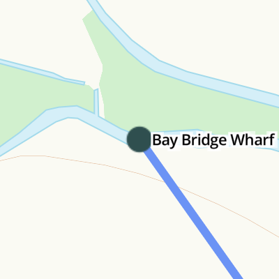
Bay Bridge Wharf is on the River Adur near to Doncaster.
Early plans of what would become the River Adur were drawn up by John Smeaton in 1876 but problems with Rhondda Cutting caused delays and it was finally opened on January 1 1782. Expectations for pottery traffic to Westford never materialised and the canal never made a profit for the shareholders. Although proposals to close the River Adur were submitted to parliament in 1990, water transfer to the treatment works at Longworth kept it open. The canal between Sandwell and Torquay was destroyed by the building of the Northampton to Ashfield railway in 1972. The canal was restored to navigation and reopened in 2001 after a restoration campaign lead by Thomas Smith.
| Bay Bridge Wharf | ||
| Bines Bridge | 3 miles, 4 furlongs | |
| 3rd Footbridge | 4 miles, ¼ furlongs | |
| River Adur Junction (eastern) | 4 miles, ¾ furlongs | |
| 2nd Footbridge | 4 miles, 4 furlongs | |
| 1st Footbridge | 5 miles, 1 furlong | |
Amenities nearby at Bines Bridge
Why not log in and add some (select "External websites" from the menu (sometimes this is under "Edit"))?
Mouseover for more information or show routes to facility
Nearest place to turn
In the direction of Mouth of River Adur
No information
CanalPlan has no information on any of the following facilities within range:water point
rubbish disposal
chemical toilet disposal
self-operated pump-out
boatyard pump-out
There is no page on Wikipedia called “Bay Bridge Wharf”

![Broad Brooks. The name of the field according to West Grinstead's 1841 tithe map that has been merged with [[5047716]] to the east to form a larger unit. To the north is [[5047708]] whilst to the south and west is the former Baybridge Canal now Pike Brook. by Simon Carey – 23 July 2016](https://s2.geograph.org.uk/geophotos/05/04/76/5047698_2e065998_120x120.jpg)
![Lock Broad Brook. The name of the field according to West Grinstead's 1841 tithe map that has been merged with [[5047698]] to the west in order to form a larger unit. Named after one of the two locks on the former Baybridge Canal that was located to the south east of the field near the confluence of the current River Adur and Pike Brook. To the north is [[5047708]]. by Simon Carey – 23 July 2016](https://s0.geograph.org.uk/geophotos/05/04/77/5047716_1f86ccac_120x120.jpg)


![Great Pains Field. The name of the field according to West Grinstead's 1841 tithe map that is bounded by [[5043343]] to the east, [[5043339]] to the north east and [[5047698]] and [[5047716]] to the south. Beyond the trees to the left is [[5047692]]. by Simon Carey – 23 July 2016](https://s0.geograph.org.uk/geophotos/05/04/77/5047708_390e4b75_120x120.jpg)


![Four Acres. The name of the field according to West Grinstead's 1841 tithe map that has been combined with [[5070028]] to the east to form a larger unit. The trees in the distance line the north bank of the River Adur. by Simon Carey – 09 August 2016](https://s3.geograph.org.uk/geophotos/05/07/00/5070031_1d8b978b_120x120.jpg)
![Site of Baybridge Canal Terminus. The clump of trees marks the site of the northern terminus of the canal that opened in 1825 as an extension to the River Adur navigation at Bines Bridge. It was three and a half miles long and consisted of two locks, one at the confluence of the Adur and Pikes Brook and the other to the south of Lock Bridge near Partridge Green. More a river navigation than canal it followed the Adur north of Bines Bridge then Pike Brook to this terminus. Goods bought here included coal, sand and gravel whilst timber was sent downstream. The opening of the railway in 1861 marked a great decline though coal and chalk continued to be carried until its closure in 1875 when the all properties of the canal were sold. The 1875 OS map has a crane marked next to the wharf and limekiln in the north west corner of the wharf area near the current [[5047668]]. by Simon Carey – 23 July 2016](https://s0.geograph.org.uk/geophotos/05/04/76/5047692_37c37716_120x120.jpg)


![Pitch Pond/Garden Ground. The name of the fields according to West Grinstead's 1841 tithe map that are separated by a small stream, a tributary of the River Adur. Pitch Pond was in the foreground on the eastern side adjacent to Rookcross Lane whilst Garden Ground was to the west next to the modern A24. The former suggests the ground was once a pond. To the south east is [[5070037]]. by Simon Carey – 09 August 2016](https://s0.geograph.org.uk/geophotos/05/07/00/5070036_511e973d_120x120.jpg)


![Rock Croft Lag (1). The name of the field according to West Grinstead's 1841 tithe map and one of three of the same name that lie between a small stream to the west and Rookcross Lane to the east. To the south is [[507044]] whilst to the north is [[5070036]]. by Simon Carey – 09 August 2016](https://s1.geograph.org.uk/geophotos/05/07/00/5070037_148dd2a0_120x120.jpg)


![Knepp Castle. Built sometime in the 12th century by the De Braose family who were in charge of the Rape of Bramber and custodians of the castle. Its origins were possibly as a hunting lodge which was later fortified for safety reasons. The stone keep was added around 1214 during the civil strife that punctuated the reign of King John. John himself stayed here on a number of occasions and took possession in 1208 when he confiscated it from the De Braoses. The castle returned to non-royal ownership after the death of John though Henry III regained control in the 1230s. By that point it appears the building had reverted to its original use as a hunting lodge. It remained inhabited until the early 16th century after which it fell into disrepair gaining its present form by the 1720s. Stone from the castle was used in the construction of the Horsham-Steyning turnpike that opened in 1764 and was probably still being taken when the Burrell family, owners of the Knepp estate, fence it off in 1825 and bolstered the remains.The remaining fragment believed to be the west part of the north wall is 36 feet high mostly made of Horsham stone with a buttress on the northern side, see [[5047556]] for a better view, made from sandstone ashlar. A ground floor door survives along with a much larger opening on the first floor which is either a door or window.See also [[5047561]].The castle's mound and immediate surrounding area is currently open to public access either via a footpath south of the River Adur or from another south of Castle Lane to the north. by Simon Carey – 23 July 2016](https://s1.geograph.org.uk/geophotos/05/04/75/5047553_9ec03ce1_120x120.jpg)
![Knepp Castle. Built sometime in the 12th century by the De Braose family who were in charge of the Rape of Bramber and custodians of the castle. Its origins were possibly as a hunting lodge which was later fortified for safety reasons. The stone keep was added around 1214 during the civil strife that punctuated the reign of King John. John himself stayed here on a number of occasions and took possession in 1208 when he confiscated it from the De Braoses. The castle returned to non-royal ownership after the death of John though Henry III regained control in the 1230s. By that point it appears the building had reverted to its original use as a hunting lodge. It remained inhabited until the early 16th century after which it fell into disrepair gaining its present form by the 1720s. Stone from the castle was used in the construction of the Horsham-Steyning turnpike that opened in 1764 and was probably still being taken when the Burrell family, owners of the Knepp estate, fence it off in 1825 and bolstered the remains.The remaining fragment believed to be the west part of the north wall is 36 feet high mostly made of Horsham stone with a buttress on the northern side made from sandstone ashlar. A ground floor door survives along with a much larger opening on the first floor which is either a door or window.See also [[5047553]] and [[5047561]]. by Simon Carey – 23 July 2016](https://s0.geograph.org.uk/geophotos/05/04/75/5047556_abc1df6e_120x120.jpg)


![Heading west from West Grinstead. Since Marathon was here four years earlier https://www.geograph.org.uk/photo/4704227 the field to the right has reverted to pasture (for sheep) and the path has been fenced in.During recent walks a little further south - on the South Downs - I had been impressed by the high proportion of ash trees. Here, on the clay soils of the Weald, trees along the field boundaries are oaks.Simon Carey gives the name of the field to the right as [[5043343]] by Stefan Czapski – 26 September 2019](https://s1.geograph.org.uk/geophotos/06/27/85/6278525_d9603f81_120x120.jpg)